During the 1980s and ’90s, I made a series of photographs of gardens. Mostly the gardens of friends, and a few public gardens. And not photographs, but rather, photographs in series — groups of 10 or 20 meant to be seen as a single unit, much like a music suite: various movements making a single titled presentation.
There was a moment back then when “sequences” were fashionable. Duane Michaels made a living off them. But those were meant to be read like panels of a comic strip, telling a single story. Frames from a film.
But what I was thinking of was a series not a sequence. They were meant to be shifting moods or patterns, understood the way multi-movement music was heard. A suite of images: Allemande, Courante, Sarabande, Minuet, and Gigue, for instance. And intended to be understood as a single thing rather than merely a collection.
Whether I was successful or not, it was what I was thinking.
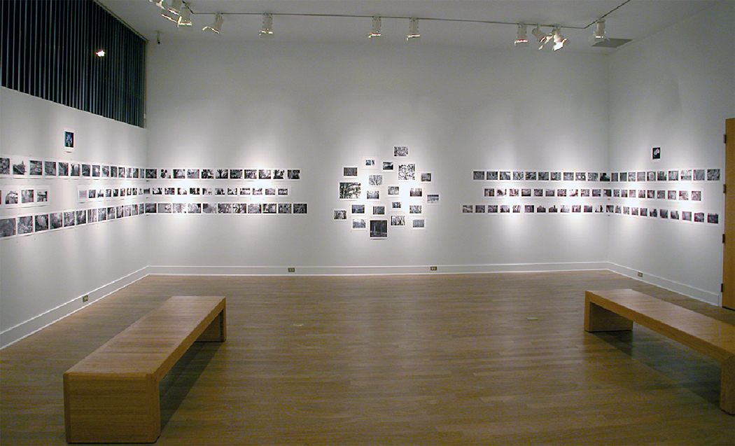
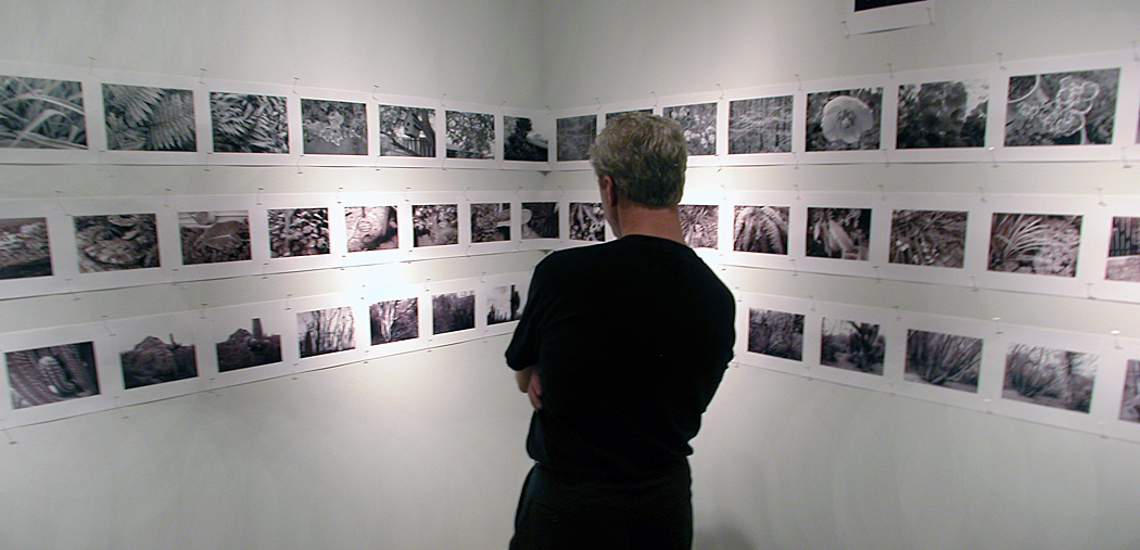
I created perhaps a dozen or so of these series, each boxed up and ordered, with a title card and with individual photographs shown in an order, and all taken during a single day as a single experience. I still work that way, although less formally. I had a show at Tidewater Community College in Virginia Beach, Va., where I had taught in the mid-1980s, and included 12 of these series on the walls. There were more than a hundred prints, lined up and organized by book.
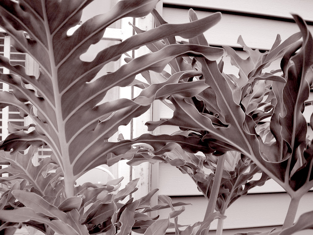
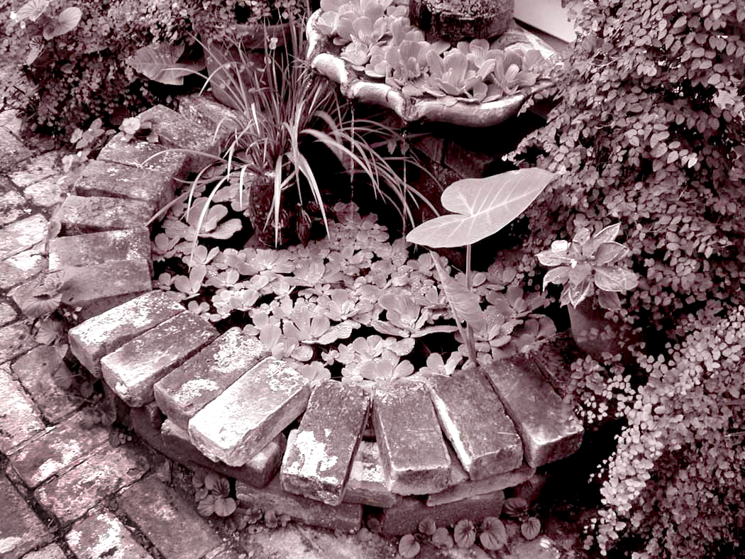
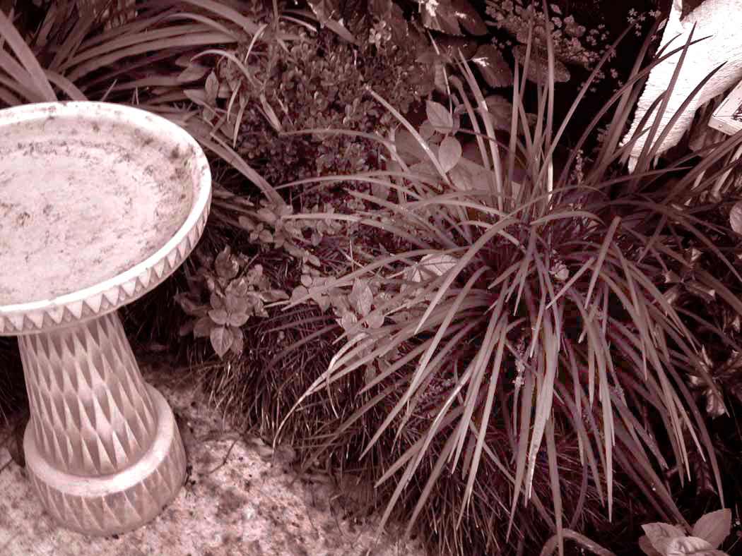
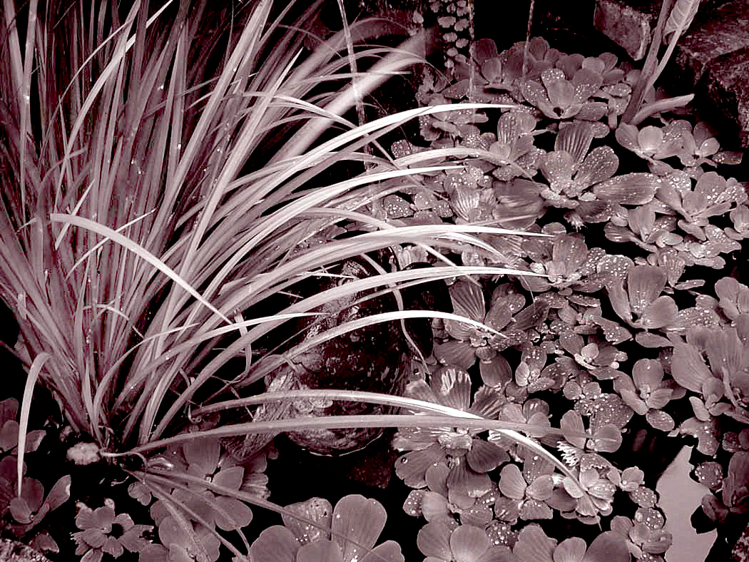
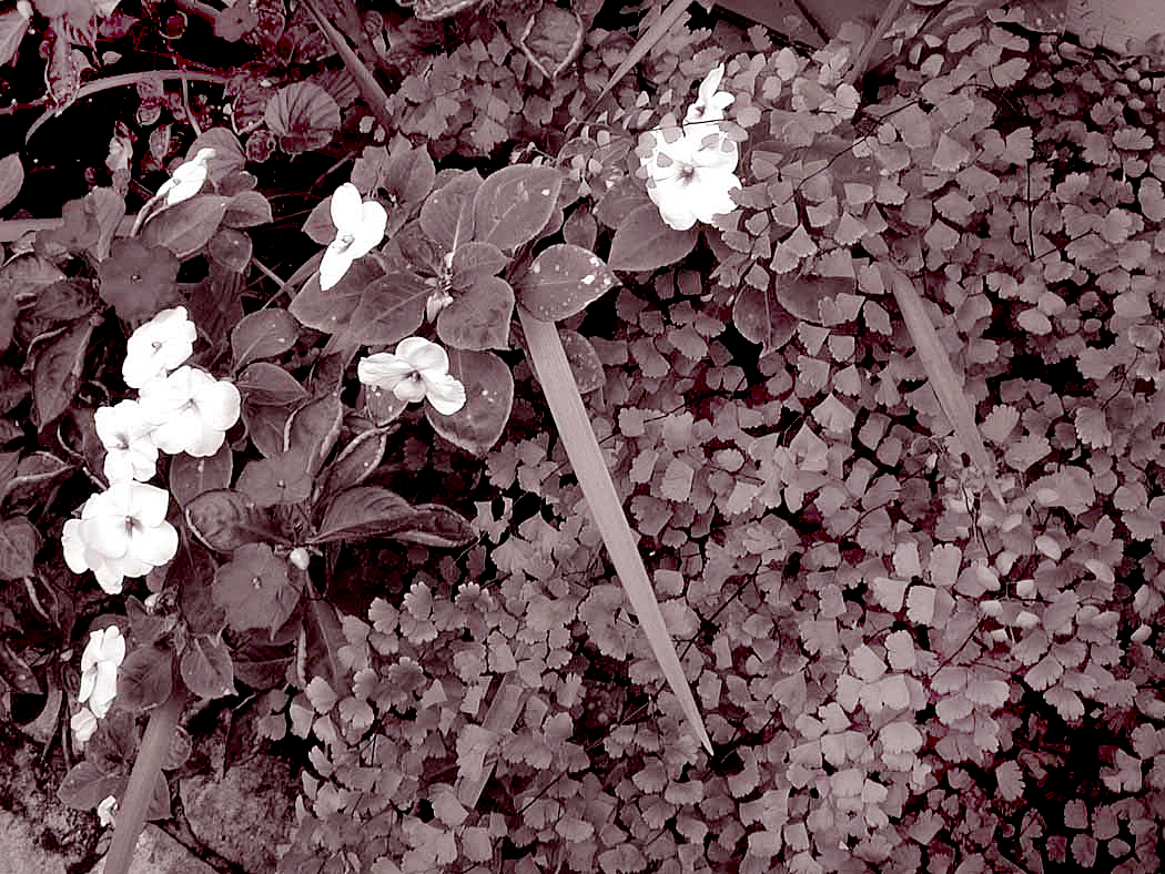
I’ve continued to work in series, but it was gardens I focused on back then. The photos seemed personal without being intrusive. They were metaphors of their creators. I thought I might share a couple of them.
One of the first was made on a visit to New Orleans while staying with friends and former colleagues Judy and Dave Walker. Judy had been the food editor of The Arizona Republic and Dave, aka “Cap’n Dave,” had been our TV writer. They both left Arizona to work for the Times Picayune.
Judy was one of the most gracious and kind people I have ever known. She was one of those people everyone felt comfortable with and at home in any social situation. It was her garden that I thought mirrored her personality.
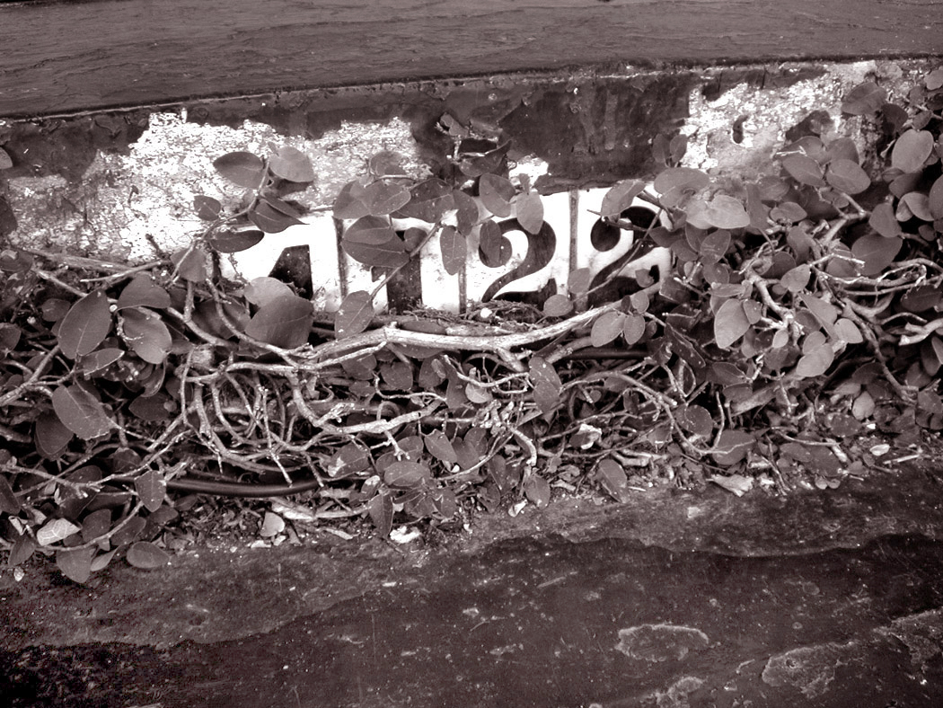
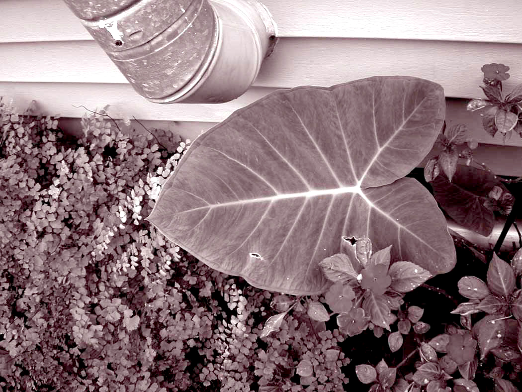
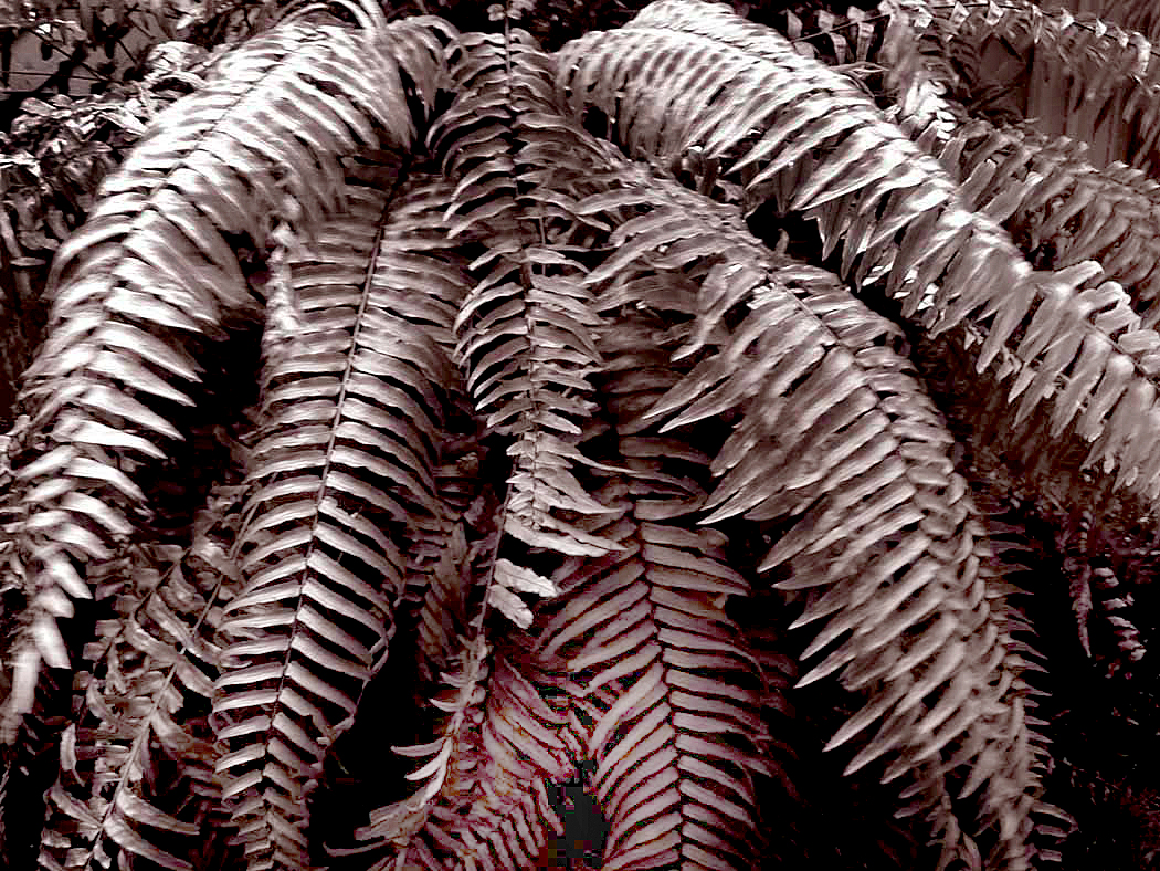
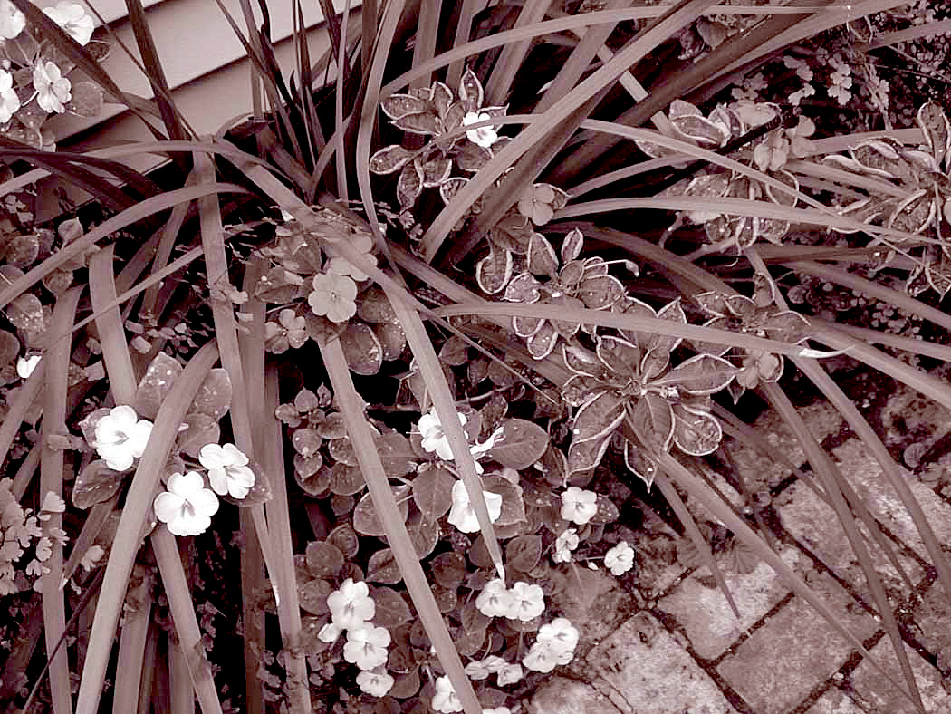
Here is that set, in order:
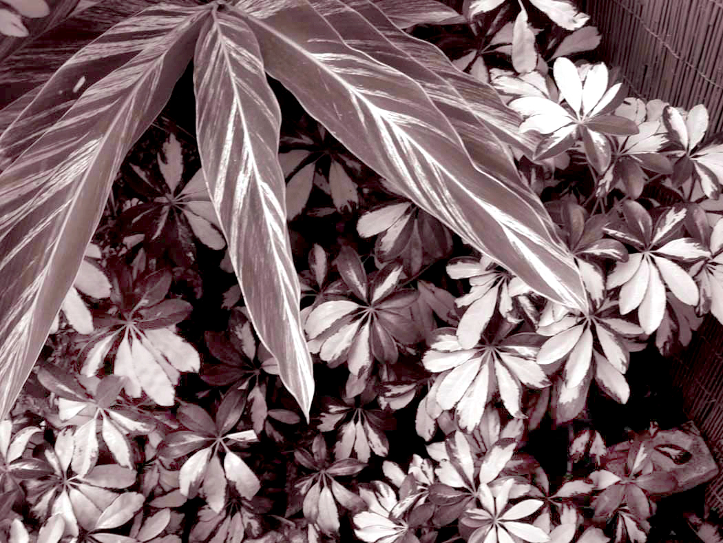
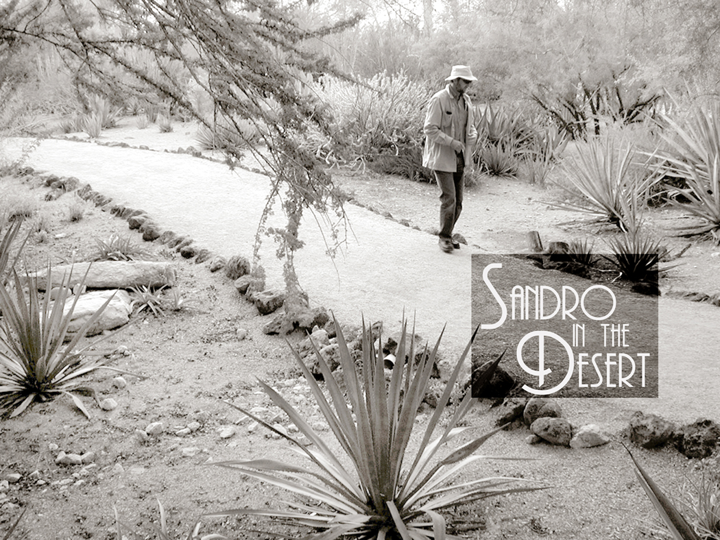
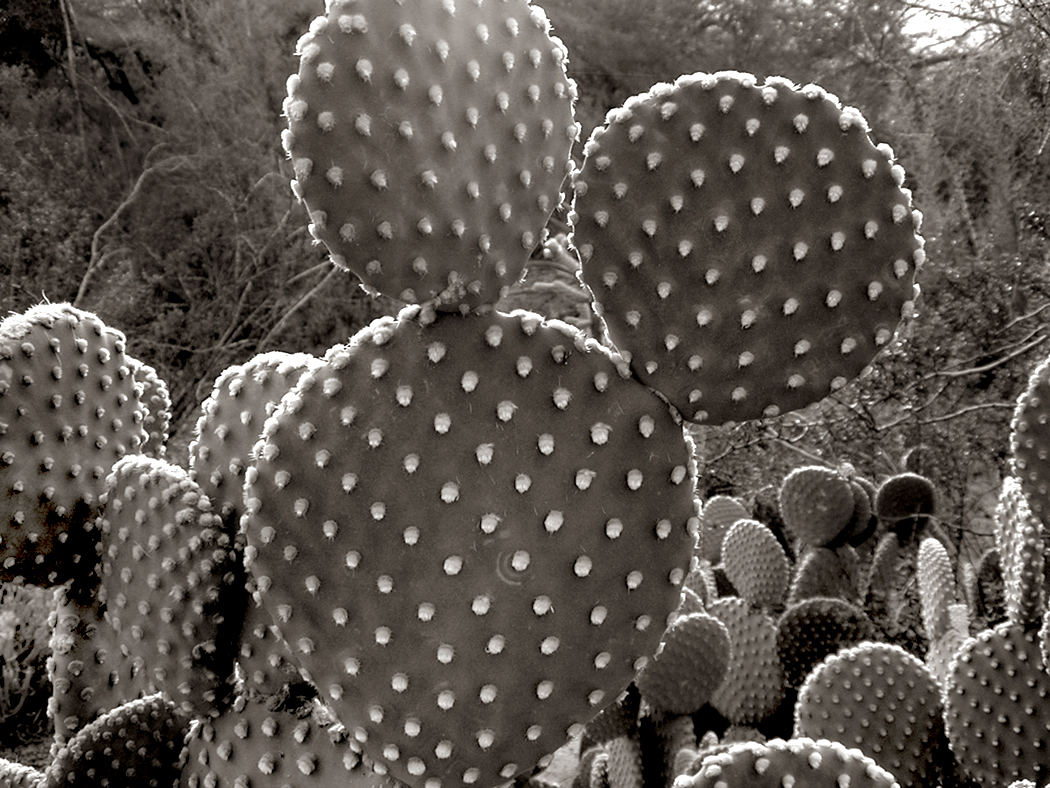
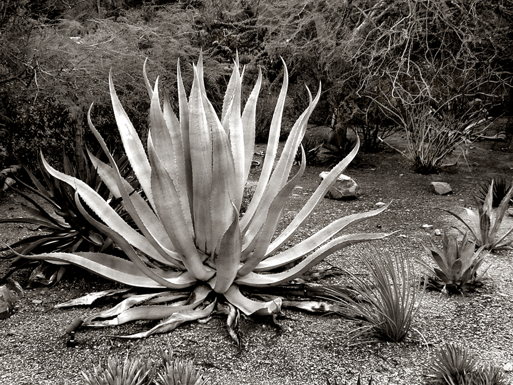
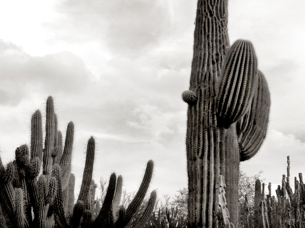
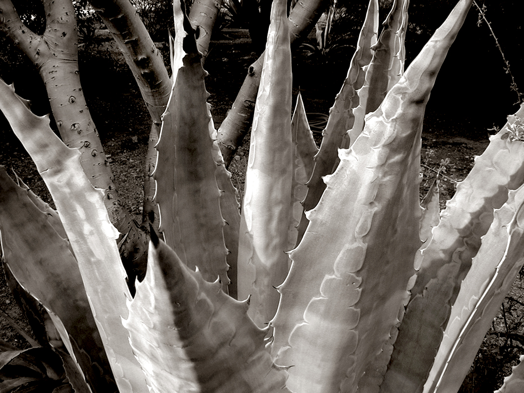
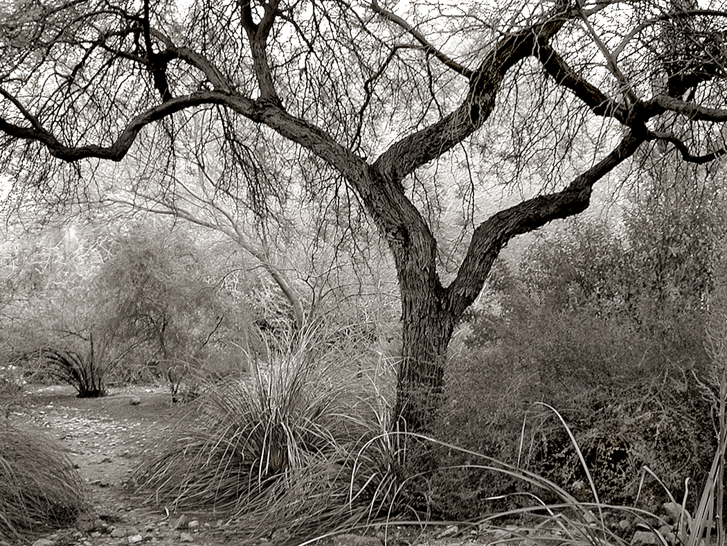
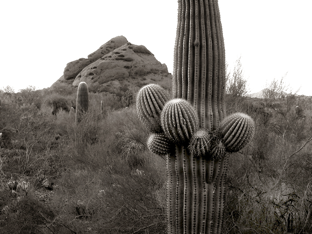
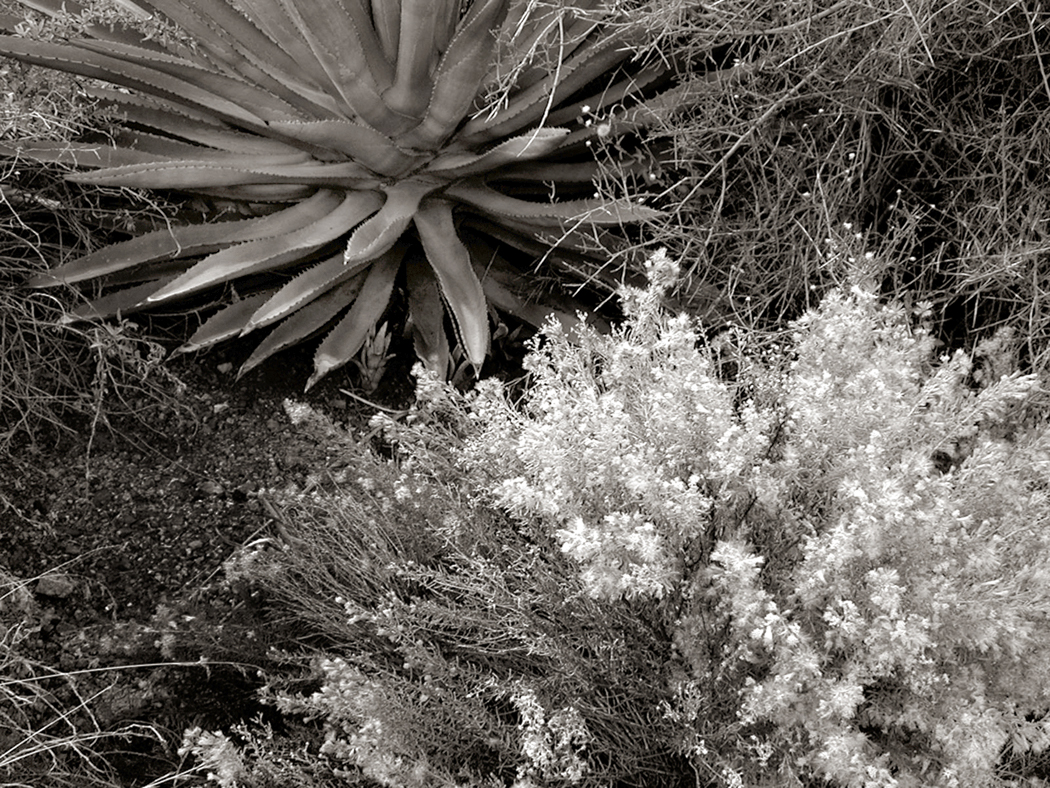
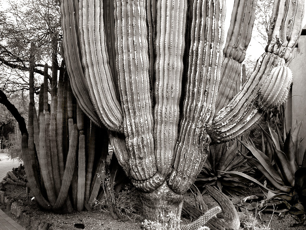
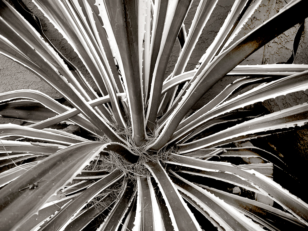
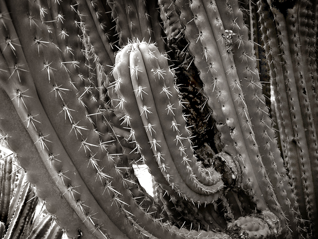
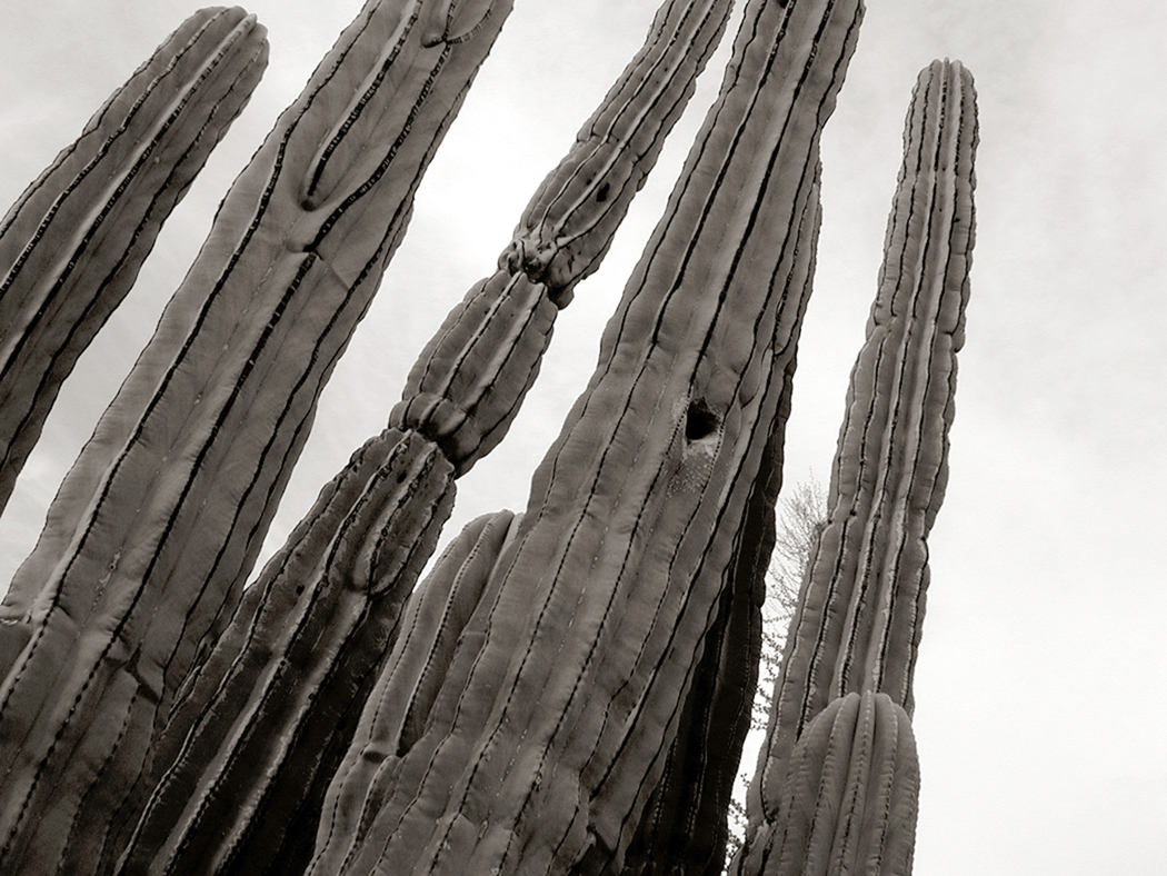
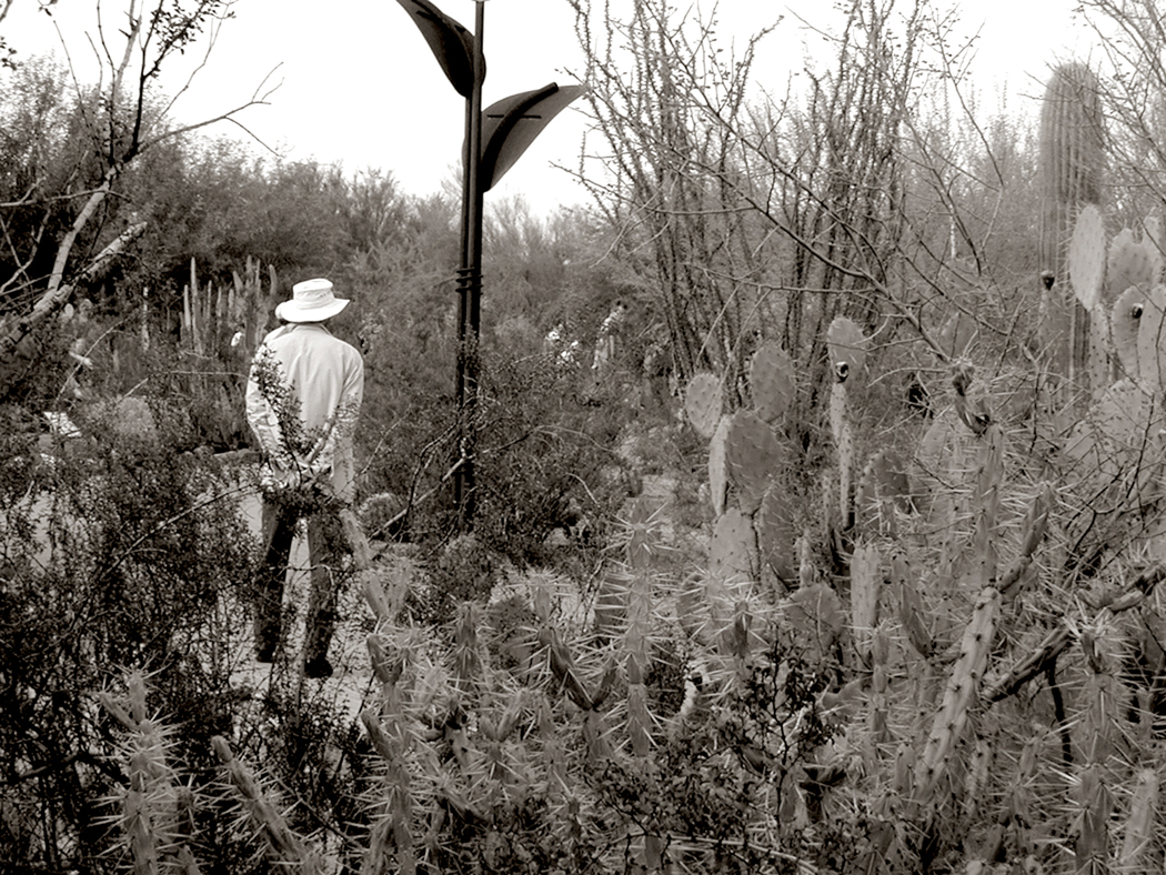
Another kind of series was of the public garden, in this case the Desert Botanical Garden in Phoenix. I had visited many times, walking the sunny paths through cactus, cholla, agave and boojum trees.
One winter, my friend Alexander came to visit us in the desert and I took him to the Botanical Gardens and we walked around all day. It was his first time visiting the West and I got to see it all again for the first time through his eyes.
I first met Sandro — for that is what we call him — my sophomore year at college. He was nuts about classical music and we spent many hours in each others’ dorm rooms spinning vinyl on our portable stereos. We became lifelong friends and spent many camping trips to the Outer Banks. And later, when I was going through a rough patch in life, Sandro and his wife, Mary Lou, took me in and gave me a place to live, fed me and took care of me. I am forever grateful to the two of them.
They later moved to Maine and live in an old farmhouse in Sullivan and I have visited them many times, although it has gotten more difficult now that I am old, and both driving and flying have become a problem.
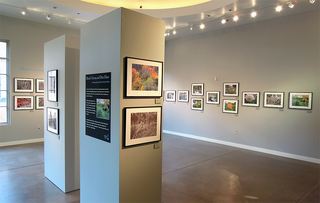
Later, just before I retired, I had a show of my garden photographs at the same Desert Botanical Garden, although this time, it was individual images from the series. The bulk of the images were of Monet’s garden in Giverny, but images from the earlier books were mixed in, in a show titled “Giverny and Other Edens.”
I now photograph my back yard and watch it through its seasons, and my own as well.
The American Southwest is the landscape of John Ford Westerns, Roadrunner cartoons and, of course George Herriman’s Krazy Kat. It is a landscape I know very well, writing about it often for The Arizona Republic when wearing my hat as travel writer. And while I can’t say I miss big-city Phoenix, I do sometimes feel quite homesick for the desert and the canyons. There is a special sense of space there, of horizons bordered not by trees or homes, but by the curve of the earth.
But there was a time before that landscape and I became intimate, when my wife and I were teachers in Virginia and first planned a summer vacation trip to the half of the country on the other side of the Mississippi River. We were unprepared, back in 1981, for what we found, having been conditioned primarily by movies, television and the occasional Arizona Highways magazine Christmas edition.
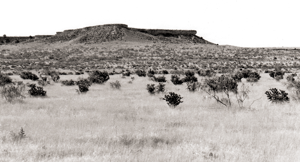
Driving west on I-40 across the Panhandle of Texas, through Amarillo, the earth was as flat as a billiard table, but at the exact border between Texas and New Mexico, the bottom dropped out of the land and the highway sloped down onto a landscape with buttes and mesas. This is the West, we thought. Finally here.
On the border between Texas and New Mexico
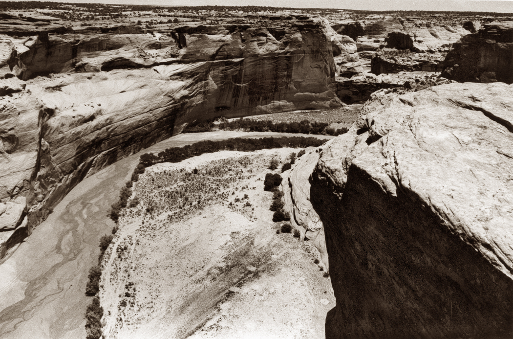
Carole had always been interested in Indians, and one of the goals of the trip was to visit Canyon de Chelly in the Navajo Reservation. In our Eastern ignorance, we pictured the canyon as these steep walls of rock rising up from the land on either side of us. At least, that’s what the photographs looked like.
Canyon de Chelly by Edward S. Curtis, 1904
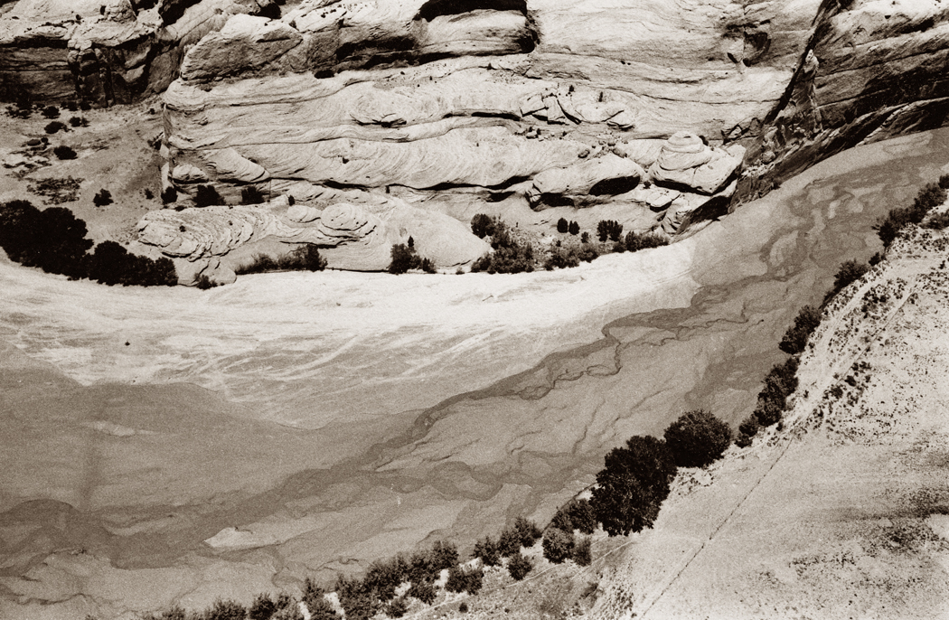
But we had it backwards. Canyons are not cliffs rising up, but great holes dug below the surface.
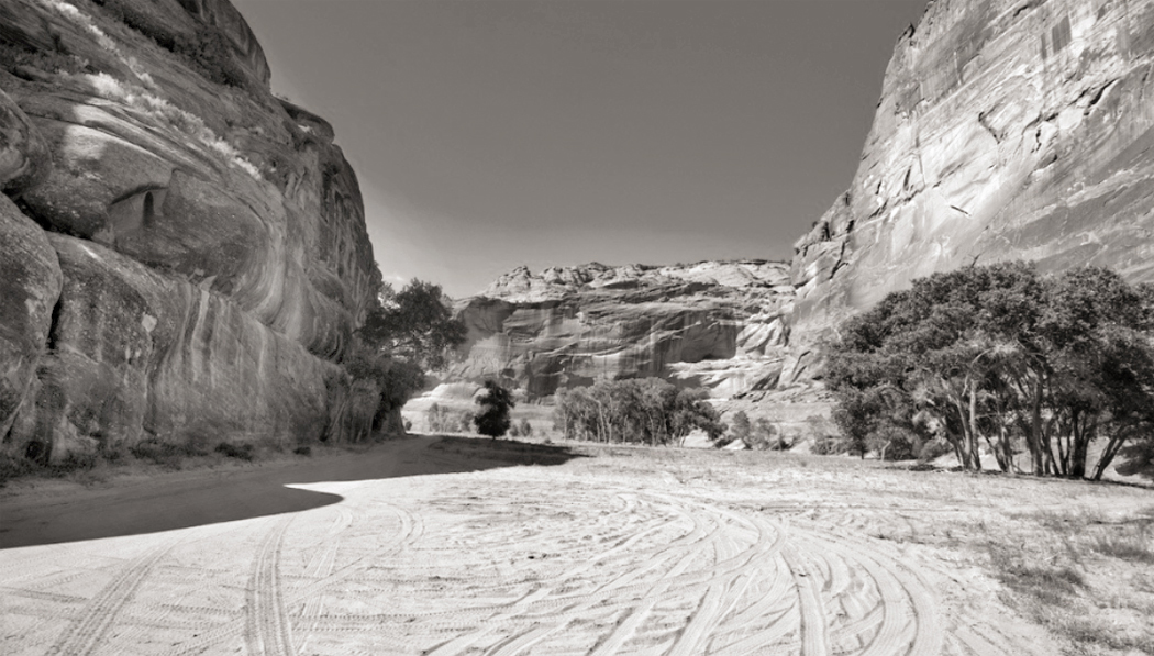
We were lucky, we approached Canyon de Chelly from the east. Most people arrive through the town of Chinle, to the immediate west of the canyon. Chinle is a tourist trap of motels and souvenirs. But coming to it, as we did, there was nothing but pine covered mountains and rocky wilderness. We drove in on an unpaved road — Navajo Route 7 through Sawmill — from New Mexico and coming up to an unmarked fork in the road, we saw a Navajo man sitting next to his pickup truck, which was piled with firewood. We asked him the way to the canyon. He said nothing but turned his head and lifted his chin to point the way. We continued down a wooded hill into a low scrub land, looking across the plain, and I noticed a darker spot in the sun-splashed land. When we pulled over and parked and walked to that spot, it was 400 feet straight down to the bottom of the canyon. It was somewhat like viewing a negative instead of a photograph: It was all backward. It was down, not up. It was Bat Canyon, one of the side shoots of Monument Canyon, one of the many side canyons to the main event.
Of course, we slapped our foreheads (figuratively), because, of course, a canyon is an empty space, not a mountain range. Later as we continued on and found Chinle, and a motel for the night, we realized also how lucky we were to have found the canyon for ourselves, and not through the tourist muck. We had that side canyon all to ourselves. We sat alone on the rim looking down into the abyss for hours, listening to the breeze and the birds, before another car even drove by.
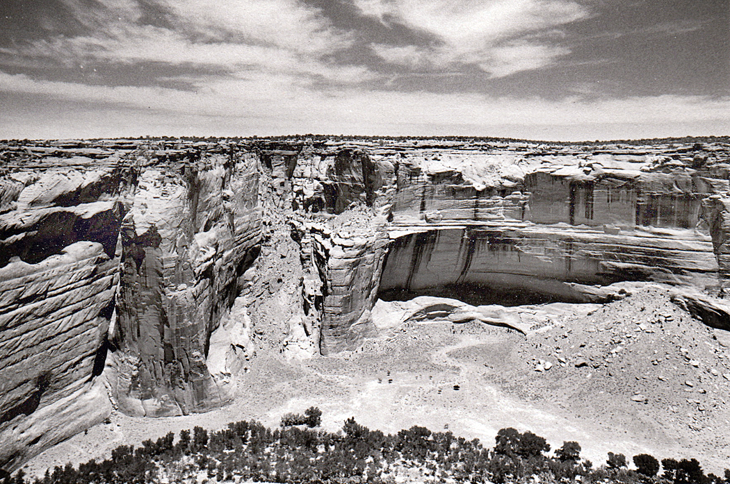
Canyon de Chelly National Monument covers 131 square miles in northeastern Arizona on the Navajo Indian Reservation. Seen from the air or on a map, it is a chicken-foot shape of multiple canyon systems that runs for about 24 miles toward the east and the Chuska Mountains.
Most tourists in Arizona head straight for the Grand Canyon, which is vastly larger and more immediately impressive. “Most famous places are always at least a little disappointing when you finally get there,” my brother once said, “but not the Grand Canyon. You just gawk at it, bigger than you had ever imagined.”
But some of us love the human size of Canyon de Chelly even more than the Grand Canyon. Many days you can pick a corner and have it all to yourself.
We went back many times, after we moved to Arizona, and Canyon de Chelly became a kind of talisman for us. One summer, probably 1998, we decided to hire a Native guide and ride horses into the canyon’s further reaches. We found Dave Wilson, who arranged for us to go up Canyon del Muerto on horses. His teen sons Delbert and Delmar came along, too.
Canyon de Chelly National Monument is divided into two main forks, the southerly one is Canyon de Chelly itself, the more northern is Canyon del Muerto. The national monument’s name is a redundancy, like “Table Mesa” or “Glendale,” since its name derives from the Navajo word for “canyon” — Tsegi — turned by quasi-French transliteration into Chelly, pronounced “Shay.” (There is also a Tsegi Canyon on the Navajo Reservation, near Kayenta, further complicating matters).
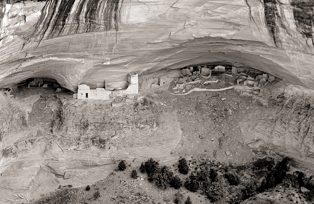
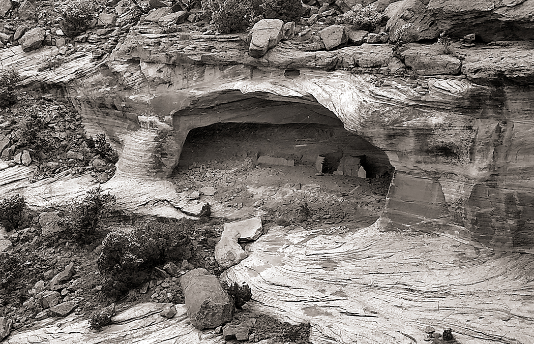
Mummy Cave
Canyon de Muerto, or “Canyon of the Dead” got its name in 1882, when topographical engineer James Stevenson discovered two prehistoric mummified bodies in a rock shelter ruin, now known as Mummy Cave, and then named the north branch of the place Canyon de los Muertos, now shortened to Canyon del Muerto.
It could have been named for other reasons. Humans have lived in Canyon de Chelly for about 5,000 years. Long before the Navajo arrived, the prehistoric Anasazi peoples lived in the area and in Canyon de Chelly had built cliff dwellings to protect them from various warring groups. Those ruins are still to be seen in the canyons. And even after the Athabascan-speaking peoples, now called Navajo, arrived, sometime around 1700, the canyon continued to provide shelter from raids and wars with other tribes. It’s a long history of wars, battles and skirmishes, but two occasions stand out more recently.
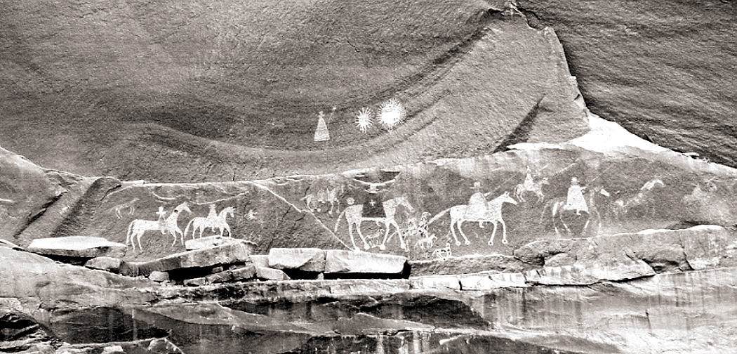
First, in 1805, Spanish forces, under Antonio Narbona trapped about 150 Navajo in a cave high on the walls of the canyon. In his report Narbona stated “They entrenched themselves in an almost inaccessible spot, and fortified beforehand, we succeeded after having battled all day long with the greatest ardor and effort, in taking it the morning after and that our arms had the result of 90 dead warriors, 25 women and children and as prisoners three warriors, eight women and 22 boys and girls.” That cave is now called Massacre Cave.
Massacre Cave
Then, in 1863, the American Army began an attempt to bring the Navajo to a new reservation at Bosque Redondo in New Mexico, and Col. Christopher (“Kit”) Carson was tasked with rounding the Indians up to march them 300 miles to their new home. He had been given orders to destroy their crops and livestock, and the famous peach orchards of Canyon de Chelly. By March of 1864, some 2,400 Navajo had been collected and marched to New Mexico in the “Long Walk.” Thousands followed in later roundups.
And so, there has been plenty of muerto in Canyon del Muertos.
It might be a good place here to discuss Navajo superstitions and taboos. The canyon is filled with Anasazi ruins — good sturdy brick homes that just need a bit of sprucing up and new roofs. But taboos keep the Navajo from using them, or even entering them. Death is a principle taboo. A person’s name who has died should not be uttered. If someone dies in a hogan, traditionally, you move out and no one ever lives in it again.
There are many more — a list of them could make a book. One online posting names more than 200 such superstitions. Do not look at lightning in a mirror or it will strike your hogan. Do not watch clouds moving in the sky or you will become a slow runner. If you see a shooting star, you have to blow at it or you will receive bad luck. Do not put salt on a piñon nut or it will snow. Do not kill grasshoppers or it will give you a nosebleed.
We already encountered one, when the Navajo man with the pickup indicated the road to take by pointing with his chin and pooched lips. Pointing with a finger is considered aggressive.
In 1993, I went to visit famous Navajo painter Jimmy Toddy in his home in Wide Ruins, on the Reservation. Unlike the hogans he had grown up in, or the ranch houses that pass for government housing on the Reservation, in 1947, he built a two-story frame house with a stone foundation. I parked in the dust of his front yard and entered through a front door that was off its hinges. “I never fixed it,” he told me. “There are bees that made a hive there and it would bring bad luck if I didn’t let them fly anywhere inside or outside.”
At the newspaper where I worked, I became friends with Betty Reid, a Navajo reporter. She asked me to help her copy edit a proposal for a book she was planning.
“Yuhzhee is my Navajo name,” she said. “It means ‘short,’ or ‘small’ in English.” She spoke only Navajo until she was seven and her family, who raised sheep, lived near the edge of the Grand Canyon at a place called Bii Daa. “I’m a middle-age journalist who walked away from a traditional life to write for newspapers,” she said. “The two worlds are very different.”
I once asked her about the superstitions. “Yes, we are very superstitious.” “Do you believe in them still?” I asked. “Oh, no. Very few younger Navajos still hold on to such things. They make no sense.”
She paused a beat. “I still do them, though.”
But back to 1998. My wife, Carole, had been fascinated by Indians and Indian culture since she was a little girl and collected arrowheads turned up by North Carolina farmers plowing their fields. She had always wanted to ride horses with Indians, and now she was getting her chance with Dave Wilson.
We drove to his home, on a bluff just above the entrance to the canyons. His wife invited us in as Dave got the horses ready. It seemed like a very ordinary ranch house with modest furnishings, except that it had a dirt floor and just by the front door was a TV console with its tube removed, letting it serve as a home for a few chickens.
I had never ridden a horse before, if you don’t count a pony ride at the state fair when I was a little boy. Dave assured us his horses were used to beginners and it would be easy. Just follow him.
We mounted the horses and followed Dave and his two sons, each on his own horse. He didn’t lead us down a road, but straight down the side of the hill, at a precipitous angle. I had to lean back so far in the saddle, my head rested on my horse’s rump. Luckily, the horse knew what he was doing. I certainly didn’t. Their hooves slid and kicked up gravel the whole way down.
At the bottom of the hill, it flattened out and we rode into the canyon mouth, turning left into Canyon del Muerto. My horse was balking. It lagged behind the rest and they had to stop so I could catch up. At one point the horse, apparently impatient, began to trot after the others and I feared I would fall off. New Jersey boys make poor cowboys.
What can I say? Not only was I a poor equestrian, but my body was not built for the saddle. One sees bow-legged cowpokes in the movies, who have long acclimatized to the barrel-shaped body of a horse, but my straight legs were agonizingly twisted to the stirrups, feeling like my knee cartilage was being torn sideways from my leg bones. It was a form of Medieval torture. Nobody expects the Spanish Inquisition.
Carole, on the other hand, was in horse heaven. I tried to last through the first few miles, but eventually, I had to get off and let my legs assume their normal lines. I limped around my sturdy mount, trying to regain the use of my knee joints.
Dave had, no doubt, come across such greenhorns before and kindly offered to continue our tour of the canyon by car, and sent one of his sons back out of the canyon to bring back his station wagon. About 20 minutes later, it arrived and we all got in and began the tour again. The older son led the horses back home.
But then, the car got a flat tire. Neither Dave, nor his remaining son, Delbert, cussed or fumed, but acted as if this were just a normal course of events. We got out and waited. Dave took out the spare, but it was flat, too. He never expressed any emotion about it all. It’s just normal.
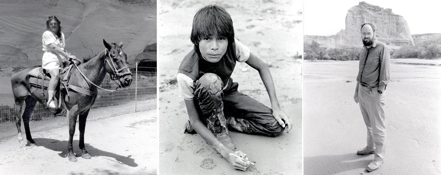
Carole on horseback; Delbert Wilson drawing; me, standing
Other tour cars passed us, other horse tours. But Dave never said a word to any of them, never asked for help. We sat in the sand for perhaps two hours. Delbert began drawing in the wet sand with a stick, to the delight of Carole, who was an art teacher. The sun went behind the canyon walls and it began to darken.
It must have been about 7 p.m. when another car arrived, driven by Dave’s wife. We all got in and drove back out the canyon and up to Dave’s house (taking the road this time), where they apologized for the cock-up. They offered to feed us supper, but Carole wanted to get back to our motel. Dave’s wife gave Carole a gift of a small necklace and we all smiled and thanked one another.
The impassivity that Dave showed with the problems we faced, we came to know as one of the cultural characteristics of the Navajo — which we learned over time with the many other Navajos we came to know and become friends with. I don’t know what Dave was feeling inside, but outwardly, it was all the same to him.
When we got back to Phoenix, we mailed a box of presents up to the Wilsons.
Canyon de Chelly National Monument is situated on land owned by the Navajo nation, and travel in the park is open only to tribal members or those accompanied by authorized Navajo guides, such as Dave Wilson. The only exception to that is a public trail from the cliff edge down to the White House Ruins, about five miles up from the canyon mouth. You walk down a steep path, 600 feet down through switchbacks and tunnels to the canyon floor. The trail is about 2.5 miles long and leaves you at the foot of White House Ruins, an Anasazi cliff dwelling, first built around A.D. 1060.
The pueblo originally had an estimated 80 rooms, on two levels, with some featuring a light plaster, which led to the Navajo name for the site, Kinii’ ni gai — which means “White House.”
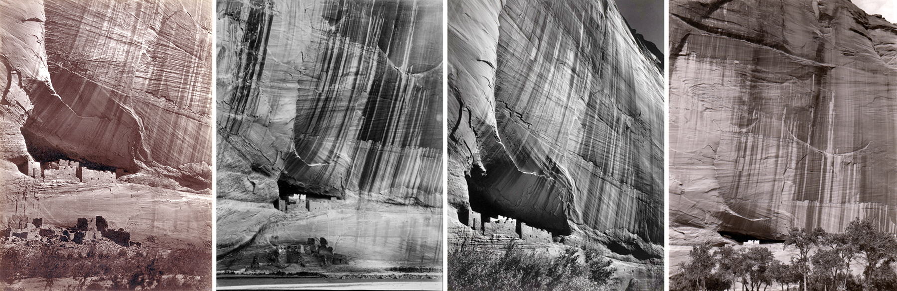
White House ruins by O’Sullivan, Gilpin, Adams, and me
The cliffs above the ruins are streaked with desert varnish, a mix of iron and manganese oxide, that makes a visual scene that is absolute catnip to photographers. The first photo of the ruins and the varnish was made in 1873 by Timothy O’Sullivan, but a parade of others have followed, including Laura Gilpin in 1930, Ansel Adams in 1950 (having made an almost identical photo in 1942), and me in 1981. Gilpin visited and studied the Navajos and the land they occupy and published, in 1968, the classic book, The Enduring Navajo. It is still in print.
The scene absolutely frames itself, which means that hosts of images are basically repeats.
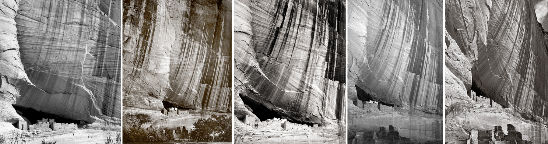
Photos by Tad Nichols, 1931; Jerry Jacka, 1976; Don Whitebread, 2009; Patrick McBride, 2012; Richard Boutwell, 2017
It’s a highly tempting subject and I’m sure that many other tourists have made the same picture, now with their iPhones.
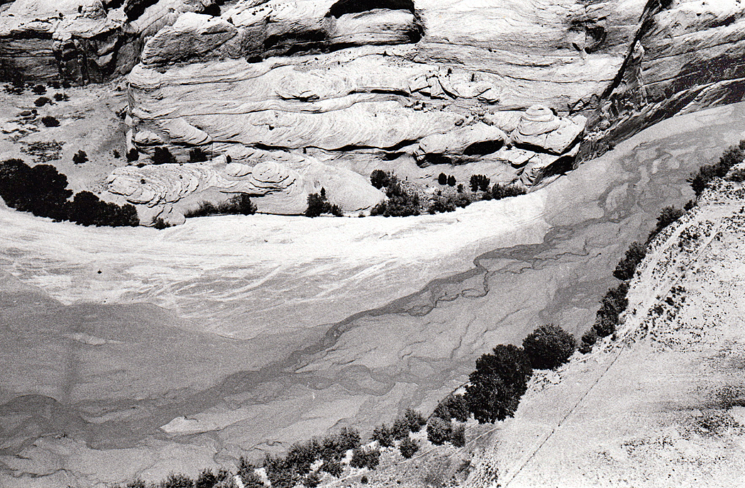
Without getting down into the canyon, you can drive along its rim, both along the south branch and the north, with overlooks at such famous vistas as Spider Rock and Massacre Cave.
You stand at the rim of Canyon de Chelly on the Navajo Reservation and look down to the braided stream at the bottom that scoured this great hole out of the sandstone and wonder how long it must have taken. Then you see the tiny Anasazi relics built into the walls of the rock and realize how long people have been living here, and then you see the sandstone itself an think about how much longer ago — exponentially longer — that ancient river deltas deposited the silt that later became that stone.
We visited Canyon de Chelly many times, and at one point, Carole applied for a teaching job on the Reservation. We drove up for an interview, but the terms of the employment contract would have made it difficult to ever afford to live there — the 10-month contract came with a 10-month lease on a home, meaning we would have to leave with all our belongings during the summer months. It was clear they would rather have a Navajo teacher than a bilagáana. We couldn’t begrudge them that.
Some years ago, there was an unusual installation at the Scottsdale Museum of Contemporary Art. It was a 34-minute video by Mungo Thompson titled The American Desert (for Chuck Jones) and consisted of altered clips from old Warner Brothers Roadrunner cartoons, with the protagonists filtered out, leaving a series of edited backdrops of the American Southwest, with mesas, buttes, canyons and cliffs.
Screen grabs of Mungo Thompson’s “The American Desert (for Chuck Jones)
The video loop (it played continuously) showed me the landscape I knew so well, but translated into cartoon visuals, with all the shapes, colors and weirdness I loved from the Colorado Plateau — Monument Valley, Canyonlands National Park, Capitol Reef NP and Arches NP, the Navajo and Hopi reservations — simplified and turned into theatrical backdrops.
That region has served its term many times over more than a century, as backdrop for drama, from early silent Westerns (The Vanishing American, 1925), through classic John Ford films (beginning with Stagecoach, 1939), and most recently in the Coen Brothers’ Ballad of Buster Scruggs. The Southwest is photogenic, if nothing else.
But the Warner Bros.-Chuck Jones animation presented a stripped-down, diagrammatic version of the landscape that gave us the essentials only — the rocks, cactus, roads and precipices.
Warner Brothers, already famous for its Bugs Bunny and Daffy Duck cartoons, tried something new in 1949, with the first of its series of Roadrunner cartoons, Fast and Furry-ous, with characters created by writer Michael Maltese and drawn by Chuck Jones.
Michael Maltese (l.), Chuck Jones (r.) and their star (c.)
The seven-minute short was a series of attempts by a hungry coyote (originally named “Don Coyote” after Don Quixote) to capture and dine on a roadrunner (given spurious scientific names in the cartoons, such as “Disappearialis Quickius,” although in the natural world, Geococcyx Californianus). The Coyote comes up with an endless series of Rube Goldberg contraptions to catch the bird, who perpetually escapes usually leaving the coyote blown up by dynamite or falling to a sodden crash at the bottom of a canyon.
For 49 animated cartoons, the formula never really changed, each film just a catalog of gags with the same outcome. And after Warner Brothers closed down their animation studio in 1963, Jones took his Roadrunner into various newer permutations, both in theaters and on TV, never varying the formula, but later adding a sheepdog, or Bugs Bunny into the works — even a baby roadrunner and coyote.
The formula never changed, but the desert did. Several background designers worked on the films. The earlier ones, by Robert Gribbroek, were more realistic, but as time went on the landscape, designed by Maurice Noble, became both more abstract and more surreal.
Roadrunner landscape, early (l.) and late (r.)
But, to be honest, how can you really make such a landscape more abstract or more surreal than the actual thing. The Southwest, and particularly the Colorado Plateau of northern Arizona and southern and central Utah, is a wonderland of geoforms, with buttes rising up and canyons dropping down. And in the popular mind, they have become a generic version of the American West, the place setting for countless cavalry-and-Indians movies, and endless TV series.
The idea of a cartoonish Southwest landscape goes back before the Roadrunner. Beginning in 1913 and continuing until his death in 1944, cartoonist George Herriman filled Hearst newspapers with Krazy Kat comic strips, set in a bizarro world Coconino County, the original of which sits in northern Arizona.
Although now famous, the Krazy Kat cartoon strips were not terribly popular when they first ran. They were too weird for popular tastes. Only because the big boss, Hearst himself, loved them, they continued until Herriman’s death. But since then, Krazy has become a cult favorite.
Of course, just like the Roadrunner cartoons, they never changed. Gender-fluid Krazy is in love with Ignatz the mouse, who hurls bricks at the cat and is punished or admonished by Offissa Pup, the doggy policeman of Coconino County. A thousand changes are rung on the formula.
And behind them, the surreal landscape that was a stylized version of the Four Corners region, a landscape Herriman himself came to love through many visits to the Kayenta area just south of Monument Valley.
But, it should be noted that Herriman wasn’t the first cartoonist to fall in love with the Western landscape. It is often stated that the first cartoon strip ever created was The Yellow Kid, by Richard Outcault, which ran in the Pulitzer and later Hearst papers at the end of the 19th century. But the prize for being first has an equal claimant in Jimmy Swinnerton (1875-1974), who began producing the Little Bears strip for the San Francisco Examiner a few years earlier than The Yellow Kid.
Panel from Swinnerton comic strip, with Hopi kachinas
Like Herriman, the California-born Swinnerton loved the American West. When diagnosed with tuberculosis, he moved to Arizona. In 1922, he began a cartoon strip for Good Housekeeping magazine, titled Canyon Kiddies, about Navajo children and life in the Four Corners region. Each was a series of pictures with rhyming verse underneath.
In one, he almost predicts the Roadrunner cartoons, as a coyote eyes a rabbit (instead of a roadrunner) but asks, “It’s simply terrible to have a meal/ That can run much faster than yourself.”
Swinnerton was also a serious painter, and from the 1920s on, made many landscapes of the West. They were more realistic than his comic-strip landscapes, but were still a kind of stripped-down style that borrowed from the popular Art Deco esthetic of the times.
That style has proved durable over the decades. There are artists who prefer a more detailed, more photographic style, but many others seem to have realized that a smoothed-out, simplified version of the landscape was perhaps more expressive. They emphasized tones and colors above detail.
Maynard Dixon
Among the first serious artists who adopted the style was Maynard Dixon (1875-1946). Born in California, he later lived, and died, in Arizona.
Dixon began as an illustrator and painter of a kind of generic California Impressionism, but his career hit its stride with the landscape of the West, and a more Modernist approach.
What was a distinct style with Dixon later became a common vision for painters of the West. Simplified mesas and buttes, huge clouds above a low horizon, and dusty pastel colors.
Maynard Dixon
With Georgia O’Keeffe, geology turns almost to biology, as her many paintings of New Mexico seem almost like bulging muscles and twisting torsos.
Of all the artists working in this style, no one did more to make the style personal. You can spot an O’Keeffe from the other side of the room. Who knew that the most stubbornly cussed Modernist painter of the Southwest could share so much with Roadrunner cartoons?
What all these artists have in common is the reduction of sharp detail and an emphasis on color and general form. The desert Southwest surely demands such.
As the turn-of-the-20th-century art critic John C. Van Dyke wrote in his book, The Desert (1902): “Painters for years have been trying to put it upon canvas — this landscape of color, light, and air, with form almost obliterated, merely suggested, given only as a hint of the mysterious. Men like Corot and Monet have told us, again and again, that in painting, clearly delineated forms of mountains, valleys, trees, and rivers, kill the fine color-sentiment of the picture.”
Van Dyke continues: “The great struggle of the modern landscapist is to get on with the least possible form and to suggest everything by tones of color, shades of light, drifts of air. Why? Because these are the most sensuous qualities in nature and in art. The landscape that is the simplest in form and the finest in color is by all odds the most beautiful.”
Dixon (l.) and O’Keeffe (r.)
In my years as an art critic in Arizona, I knew many artists who found the color more important than the texture. The Art Deco style of Dixon or (more idiosyncratically) O’Keeffe proved to be infinitely malleable for their work.
Many more recent artists have adopted and adapted this style for their landscapes of the Southwest.
Dennis Ziemienski (l.), Martin Sabransky (c.), and David Jonason (r.)
There is a thriving market for Western paintings. (I had to deal with quite a bit of it during my stretch as art critic in Arizona, where a kitschy version, called “Cowboy Art,” was popular in toney art galleries. These artworks, filled with bronco busters and noble Indians, were often painted with considerable technical skill, but very little originality — they were really more merchandise than art).
But among the kitsch are quite a number of landscape artists, including Brett Allen Johnson …
G. Russell Case …
Gary Ernest Smith, who usually paints more Midwestern scenes, but occasionally gives a go at the Southwest …
And Doug West, whose work is often done in silkscreen, or mimics the silkscreen style, which is the simplified color-and-shape taken to extremes.
If you think we have wandered too far from the Roadrunner cartoons, they consider at least this one painting by Carol Bold:
Roadrunner cartoon (l.) and Carol Bold (r.)
But there are two artists I want to mention in particular, both of whom I knew back when I kept track of all the art being made in Arizona.
The first is Ed Mell, who began his career painting fancy cars as a commercial illustrator. Not finding personal satisfaction as a New York advertising artist, he took a job teaching on the Hopi Indian Reservation and rediscovered the landscape of the Colorado Plateau.
His early works tended to be influenced by Maynard Dixon, but as his career progressed, his painting tended to combine the Art Deco with a kind of Cubism, to what one might call “Cubist Deco.” More like the stylized landscape of the cartoons.
That Cubist Deco has made it to other artists, as well, including the above-mentioned David Jonason …
The other artist I want to bring up is Bill Schenck, who has also given us work in the Deco style …
But has also branched out into what can only be called a “paint-by-numbers” esthetic. It gives a hard edge to the otherwise more Impressionistic styles of his contemporaries.
The style has also been mixed with the techniques of Bob Ross, to make a kind of “furniture store” art. One example shows up as a background to MSNBC security analyst Frank Figliuzzi. It is a painting by gallery-owner and artist Diana Madaras.
And I couldn’t end this study without mentioning the Roadrunner esthetic of Wes Anderson’s Asteroid City.
He even has a few appearances of a roadrunner, just to let you know, wink-wink.
I collected more than 200 images for this essay, and I had to leave out so many that I wanted to include. But there is only so much space, and so much attention willing to be subjected to this rabbit hole.
But I did want to end with one final road runner, set in the landscape we’ve been discussing.
In a 1993 interview on the Charlie Rose show on PBS, author David Cornwell (aka John le Carré) talked about his childhood. “We are creatures of our background and environment,” he said. “We are very quickly made in life. The first few years seem to be determining who we are for years and years afterwards. You look for explanations for yourself and you go further and further back and wonder if you ever changed or ever developed.”
When we look at a life as a story, with a single trajectory, and rather like a novel that we tell ourselves about ourselves, one way to organize the narrative is in chapters, and those chapters are the houses we have lived in.
Each house has its particular memories, its particular emotional resonance and its beginning, middle and end, an end leading to the next chapter, the next home. Some chapters are short, some are long. There are even those among us whose lives are told in a single long chapter — a house they were born in, raised in, married in, inherited from parents and eventually died in. Such continuity is rare; most of us have many chapters.
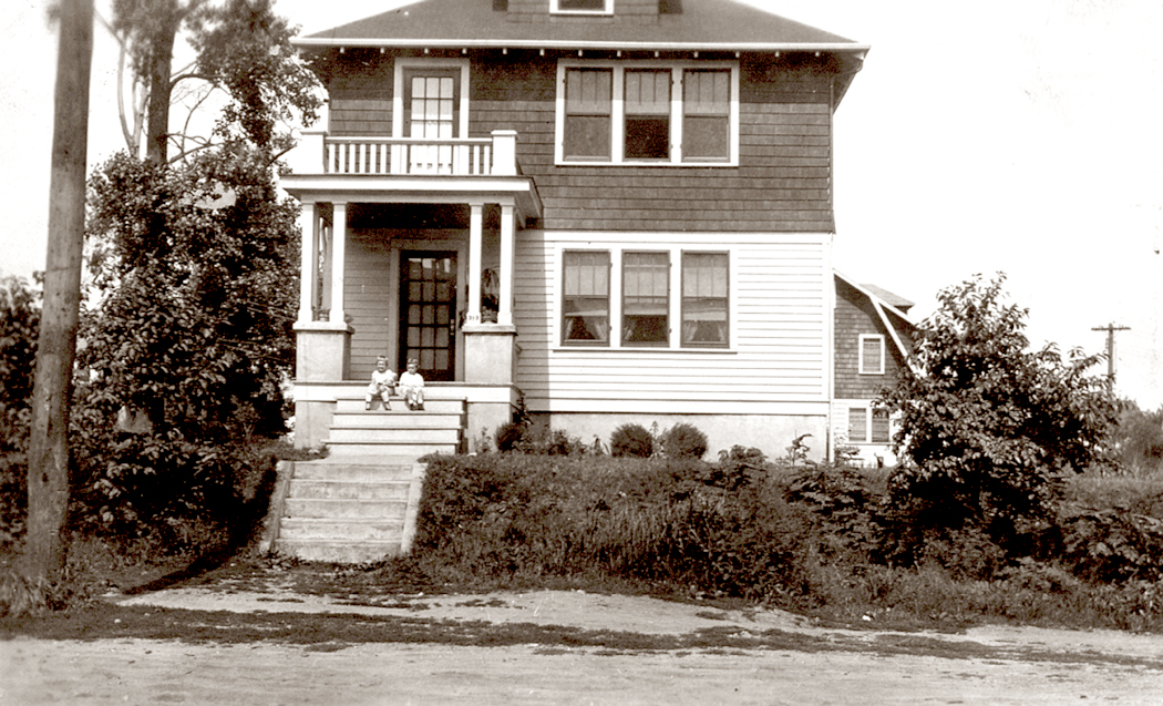
Until I was about three, I lived with my mother and father in a house in Ridgefield Park, New Jersey, about a block from the New York Central rail line. There were six tracks alongside each other back in 1948. The rails are gone now, chewed up by langoliers but left in memory.
The novel I have internalized begins there, with the sight of sunlight striping the walls in the room where I sat in my playpen. I then added to Chapter One the soot and roar of the steam engines that ran on the tracks a block away. Little else remains; I was two when we moved.
We moved then to the house my grandmother owned in Teaneck, N.J., only a few miles away. It was a tall, old house where we shared the lower floor and my grand-aunt and her husband shared the top floor. I have been back to see that house. It is much changed. The vacant lot next door is now an apartment building. The driveway is seeded over with grass. It’s been repainted many times.
It was in that house that I watched my grandmother make applesauce from apples gathered from the tree in the back yard. It was here that my great-grandmother died in my bed, while I had to move temporarily to a bed in my Nana’s room. I remember my great-grandmother only vaguely, as a very shriveled old woman confined to my bed and then, one day, not there anymore. No one spoke about it much. She just wasn’t there anymore.
I can piece out the floorplan of the house, with the living room stretched across the front of it, the dining room at right angles running back toward the kitchen — the kitchen in most houses almost always at the back — with two swinging doors, one on each side of the room, almost like the kitchen doors of a restaurant. Parallel to the dining room ran a hall that connected three bedrooms, and the bathroom, with a great animal-claw bathtub which fascinated me. The front bedroom was for my parents, the middle for my grandmother, and the back for me, and later also for my baby brother.
Behind the kitchen was a pantry with the house’s back door and the stairs that ran down to the basement.
Houses are said — by fantasists and psychologists — to be metaphors of our selves, and the dark basement, with its golem-like furnace and the thick, insulation-coated pipes and duct-work, was the animating presence in the house. I played with my toy rocket ships down there almost as much as I played outside in the vacant lot.
There was another dark place in the house, an under-stairs closet left unfinished with lathe and plaster walls. The public rooms, that is, the living room, dining room and kitchen, were all light and airy, but I was drawn to the shadowy parts of my universe.
I walked a mile to school to kindergarten and first grade, passing a friendly old policeman who stopped traffic on the main street so I could cross.
Not all of the houses I’ve hunkered down in have left a psychological mark. Maybe only three of about twenty, but the Teaneck house was the first and gave me a profound sense of place, of what architecture means emotionally. Thus ends chapter two.
The summer before entering second grade, we got ready to move to a new house my parents had built. It wasn’t quite finished yet, and so we spent the summer living with my mother’s sister and her husband in New Milford. Where Teaneck had an urban feel, this summer had that suburban, tract housing feel. Mostly what I remember from then is that the tap water smelled very strongly of chlorine. It was a brief residence, but I made close friends with the boys who lived next door and went to Catholic school — something that seemed absolutely exotic to me. “Glory, glory hallelujah, Sister hit me with a ruler.”
Chapter Four was a split level in the then-rural township of Old Tappan, on the border with New York’s Rockland County. It was a house my parents had built on a half-acre lot they bought with a stream running through it and woods on three sides. For a kid it was idyllic. In the years I lived there, I saw the town grow into a suburban bedroom community. Busses to New York City stopped by every hour on the street corner. Bits of woods everywhere were turned into housing developments, but the woods around our house remained wild.
The house zigged and zagged from floor to floor, as if cut down the middle and half raised up between floors. On the bottom was a cellar, next up to the other side, the garage and laundry rooms, zag back to the other side and up the stairs and you get the living room, dining room and — at the back of the house — the kitchen. Back the other way and up a flight were the bedrooms and bathroom. By now I had two brothers and we all shared the same room. But up still another set of steps and you had my grandmother’s apartment, with its own living room, bedroom and bath.
It’s a house plan not much favored today, but a split-level was the height of suburbanocity back then. From second grade through high school, I watched the town fill up, tract housing explode and farms and woodlands disappear. All that happened just as I was becoming rebellious and angry at my middle-class life. It was the Holden Caulfield syndrome, and I despised everything middle class, suburban and bourgeois. I couldn’t wait to get away to college.
Next chapter was Cox Hall, a dorm at Guilford College in Greensboro, N.C. My rude introduction to the American South came on my first day, when I faced my dorm and saw a giant banner hanging from the third floor that said, in crude handwritten letters: “Forget? Hell!!” I didn’t know what those words meant, but I quickly came to understand.
Cox Hall was built before World War I, and was quite seedy, with wobbly wooden floors and thick plaster walls. I was dumped into a room with a proudly redneck bully and an ineffectual milksop, neither of whom had any academic interest. Mostly they were after poontang and Everclear. (Everclear, for the uninitiated, is a brand of pure grain alcohol of especial toxicity. Wikipedia tells us that it “is also used as a household ‘food-grade’ cleaning, disinfecting, or stove fuel alcohol.”)
I got moved to a two-person room, but my roommate quickly dropped out of school, and I had the room to myself. It was heaven, just me and my books and my Sears Silvertone phonograph on which to play my pile of classical music LPs.
For my sophomore year, I was moved to the more modern and quite faceless Milner Hall, which might as well have been designed as a prison — all brick and tile and fluorescent lighting. There was a communal bathroom and showers arrangement that echoed like a cavern.
I hated dorm life; it was riotous, noisy, crowded and cramped. I petitioned the dean to let me live off campus and eventually, because I was such a thorn in his side (over many a social issue, like women’s rights and integration), he let me go.
And I moved with my friend, Hank, into the home of a sociology professor and his wife. They had an addition at the back of the house with its own entrance and two bedrooms and a bath, and it was only a block from campus. It became a meeting place for all the other disaffected “hippie” students of 1969, and one night we threw a grand party when about 80 students showed up, most of them not invited, and the party lasted till dawn and left the back yard covered in beer cans. It did not ingratiate us with our landlords.
But by then, I had become engaged to be married, and my new wife and I moved to our own rental house. It was the second floor of a duplex and our entrance came with an outside staircase, which in winter was a treachery of ice. Rent was $50 a month.
There are three times in life when a home becomes mythic. Obviously, first when you are a child and the entire world has that glow and the house is the axis of the universe. Every corner and cornice has meaning.
The second is when you first consider yourself an adult, have gotten married and must make a life for yourself. The world has a lesser glow, but it is renewed, a decent echo of the magic of your childhood home. And this old house, with its tiny kitchen with enameled metal cabinets, became the projection of my inner state.
It was 1969, and I painted the living room burnt orange, with avocado green trim. It was a testament to the zeitgeist, but so was I.
Like so many houses built in the nineteen-teens and -twenties, it had a central hallway with rooms off each side — what architect Frank Lloyd Wright excoriated as “boxes inside boxes.” When you entered the house from the outside steps, you reached the living room. At the back of the house was the kitchen. On the other side of the hall were two bedrooms and the bathroom.
There was a vacant lot behind the house with a felled apple tree that continued to produce fruit, even while horizontal.
The house had no heat except for a kerosene stove in the living room. In the winter, I would have to walk down the icy stairs to get a gallon of kerosene from a 50-gallon drum of fuel in the back yard, carry it up, pour it into the reservoir at the back of the stove, crumple up some paper, let it soak up some kerosene, throw a match in and slowly let the kerosene heat up and vaporize so it could catch fire. Sometimes the heat would be so intense as to turn the stovepipe cherry red and begin shaking violently, and I would have to swivel the damper to discourage the fire. This too, is a metaphor.
We moved to a new house shortly before we broke up. It was about mile away and was another duplex. It would remain my home for the next seven years and the next “permanent” relationship. It was also an old house, and even more of a mythic Eden than the last. This was Chapter Eight.
There was a front door, but we hardly ever used it. We entered the house from the back, through the kitchen and into living room beyond. There was also a back bedroom — a guest room — and the master bedroom at the front of the house. What made the house such an Eden was the grounds; a great black walnut tree in the front yard, a pecan tree in the back. A vacant lot to our side and a patch of woods behind us. All year long, new weeds would blossom — I called them wildflowers. I counted once and found 190 different species of plant in our yard and the lot next door, including a pear tree. We grew a vegetable garden in the front yard and there were a couple of fig trees that gave us fresh figs to eat. This counts as one of the high water marks of my life. I was happy.
At least until my partner told me one day that she was getting married — to someone else. Eden was gone and so was my Eve. I was in shock. I sold most of what I owned and took the train from North Carolina to Seattle, where I moved in with a friend on Phinney Ridge, sharing a house with two lesbian doctors and the world’s most obscene man.
Chapter Nine was a small house and I made a room for myself in the coal bin in the basement. Upstairs, there was a living room, dining room, two bedrooms, bath, and a kitchen at the back, where we took turns cooking, almost always with hot peppers. I got work at the zoo and spent my days in an iron box selling popcorn, hot dogs and cokes. In the chill gray air of Seattle, the hot dog steamer filled the box with a Dante-esque steam-fog which condensed on every surface. The smell of those dogs and the chemical popcorn butter have put me off both for life.
A short but ecstatic relationship came crashing down and I found myself moving back to North Carolina, where my best friends from college offered me a room in their house in Summerfield, just north of Greensboro. I was a mess; I was not over the heartbreak that had shattered my selfhood. I had no job, no money — if they hadn’t given me a place to stay, I would have been homeless. I spent the next year and a half there, doing the cooking and maintenance work and feeling the comfort of a surrogate family.
The house was an old farmhouse, with a barn, or shed in the back. My room was on the ground floor with the kitchen-dining area, which were combined in one space, with the wood stove, which was the only heat in the house. In the winter, the stove was kept going constantly, and we spent almost all our time in that room. When I woke up in the morning, a glass of water would be frozen solid next to my bed. I chopped a lot of wood during that year and a half. If you have never done so — a more modern life being what it is — you will not know the calming power of splitting logs. This is the third time when life became mythic: I was hyper-aware of being the protagonist in an epic that was my own life. The world had an inner glow and throb and I recognize now that I am old, that I was not quite in my right mind.
It was while trying to regain my balance that I began writing. There was an old tree stump in the back under an ancient oak tree. I put my aqua green portable typewrite on the stump and typed away, writing letters to everyone I knew. One was 50 pages long.
I was saved when the woman I would spend the next 35 years with wrote me and asked me to come and visit her in the mountains. I visited but never left.
And so, Chapter 11 ended my psychic bankruptcy and I moved to a house on a bluff overlooking the New River in Ashe County, North Carolina. It was a new house, with a living-dining area, a bedroom and a kitchen at the back, with a basement and another bedroom for the teenage daughter that I acquired. Off the kitchen was a porch that hung out over the bluff looking down at the river, a hundred feet below us. From the kitchen window, I could watch the shifting weather on Mount Jefferson as I washed dishes. Mt. Jefferson was the central mountain in Ashe County and it changed constantly as the sun and weather shifted.
It was a long drive on a snowy winter day to the schools where my new lady was teaching, and so we moved closer to Boone, in Watauga County and found a small house in the community of Meat Camp. The house sat on a creek just below the hill on which one the schools she taught in sat.
The house had two floors, the first with a living room in front and a dining room and kitchen in the back. Upstairs there were two bedrooms, with angled ceilings under the roof. Both were small and the one we didn’t use became just storage. In the summer heat, I could lie in the creek in the icy water and cool down.
Unfortunately, the Watauga school system shut down several programs, including the art program and we needed to find other jobs. I had taught a class part time at Tidewater Community College in Virginia Beach, Va., and Carole found a job teaching art in the Norfolk School system. And so, we moved everything down to an apartment building on a cul-de-sac about a half mile from the ocean. Our apartment was next door to my brother’s. He was a fulltime teacher at the school.
It was a building with 10 apartments, side-by-side, two stories each. In ours, the kitchen was at the front, with a window that looked out on the street. Behind it was the living-dining area. Upstairs were two bedrooms. The art faculty at the school all became great friends and we held great dinner parties together. We lived there for six years.
Then my wife got a job offer from her old boss, who had moved to Phoenix, Ariz. and we decided it might be fun to live in the desert. We imagined a little adobe house with a white picket fence. Never did get that.
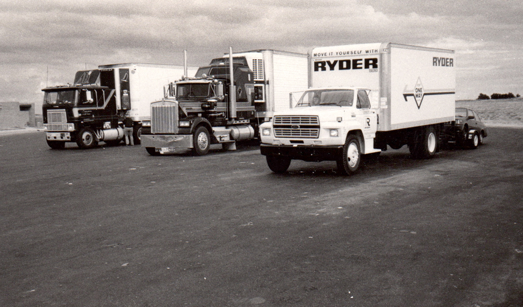
Instead, we had four different houses over a period of 25 years. We had packed everything up into a Ryder truck and drove across the continent, towing our car behind us. We didn’t have a place to move to, but came completely unprepared. We pulled into the street where her new boss lived, and stayed there a few nights. It turned out the house next door was for rent and we moved in.
It was a small place, with its kitchen rightfully in the back again, with two bedrooms and a combined living-dining area. It was on the corner of Seventh Street, which is probably the busiest street in all of Phoenix — probably all of Arizona. It was like living by the ocean, with the constant roar of the surf — i.e., traffic — and, while you sort of get used to it, it also wears on you long term. We had to get out.
We found a flat-roofed faux adobe house on 13th Street, a quiet back street closer to downtown. It was owned by an artist who was covered in tattoos — we called her the “dragon lady,” and who had painted the stucco on the front of the house in a trompe l’oeil imitation of crumbling adobe, revealing its bricks. Across the front of the house was a living room, which led to a hallway kitchen, to another hallway with more than 20 built-in cabinets — more storage than I have ever had or seen in a house — and a glassed-in drop-down family room with a view of a lily pond. At the back of the house was the bedroom and bathroom.
Both of our first homes had no air conditioning. In Phoenix, that is a problem. They had swamp coolers, which work beautifully in the spring and early summer, when the humidity is non-existant, but fail to cool anything in July when the monsoon humidity hits, leaving everything hot and sweaty.
That’s when my wife’s best friend offered us her place. She was moving to Hawaii and needed a tenant for her house, on Cheery Lynn Road (which everyone mistook for “Cherry Lane”). For the first time since living in Greensboro, the yard was an Eden of trees, flowers, plants and roses. Ivy devoured the entire western half of the house and the front was covered by a great tree.
Inside, the living room gave way to a kitchen behind, with a dining room jutting off it, which was actually a converted garage, tutted up with lots of added windows. Three bedrooms under the ivy half of the house, one of which became my office. We lived there for seven years. Then our landlady moved back to Arizona.
And so, we moved into the shadow of Camelback Mountain, the most familiar landmark in the city — a 2700-foot mountain on the border of Phoenix and Scottsdale in the double-hump shape of …
It was the most suburban house I had lived in since my childhood and I felt almost as if I had sold out. It was a sprawling ranch house with a drop-down living room, a huge kitchen with a fireplace and three bedrooms. And there was a swimming pool in the back yard. In Phoenix, the swimming pool usually runs a constant temperature of about 95 degrees in the summer, but feels downright chilly compared with the 110-degree air.
The house was exactly the time of one Haydn symphony to work, and so, I listened to all 104 of them, two a day going and coming, for 52 days. The commute was the highlight of my day.
Ah, but there’s always a worm in the apple and my worm was named Gannett, the newspaper chain that bought The Arizona Republic, where I worked, and everything changed from “our responsibility to our readers” to “our responsibility to our shareholders,” and there were layoffs, management stupidities, a lowering of standards, and a general dumbing down of the paper. Many of the staff were horrified, and when, at age 65, I was offered a buyout, I knew I had to take it. I loved my job, but it was dissolving in front of me. Leaving was the only rational option.
After 25 years in the desert, we moved back to North Carolina, where our daughter was living, in Asheville, up in the Blue Ridge Mountains. Asheville is a blue city in a red state, full of art, music, hippies, restaurants and craft breweries.
We found a house in a quiet neighborhood with the best landlords we’ve ever had. The house sits on a hill, with a kitchen at the back, and three bedrooms, one of which is my office. I have now been here 10 years, which is longer than anywhere else I have lived. My wife of 35 years died five years ago and my daughter moved away.
I am now approaching 75 years old and am writing Chapter 18, and through one of the oddest series of circumstances, I am now reconnected to my first wife, who I had not seen or spoken to in 50 years. She has moved in and we share this house. We are not planning to move anywhere else. Oddly, I am not at all the same person I was, but because through all the chapters, I was me, there is an equally odd continuity.
Cornwell, on that TV show I mentioned at the top of this mountain of words I have written, called life a “dangerous journey of introspection.” I first became aware of that fact as a student in North Carolina. Over the course of that life I have lived in all four corners of this continent and have, in the end, returned to North Carolina. And I wonder at how much I’ve changed and developed.
Cartoonist Reg Manning said you could take in all of Arizona in three great bites. Manning was the Pulitzer-Prize winning political cartoonist for The Arizona Republic from 1948 to 1971. And he wrote a book, What is Arizona Really Like? (1968), a cartoon guide to the state for newcomers (he also wrote a cartoon guide to the prickly vegetation of the state, What Kinda Cactus Izzat? Both required reading for any Arizonan.)
Anyway, his introduction to the state bites off three large chunks: the Colorado Plateau in the north; the mountainous middle; and the desert south. It is a convenient way to swallow up the whole, and works quite well.
I spent a third of my life in Arizona and I traveled through almost every inch of the state, either on my own or for my newspaper, and I never found a better explanation of the state (and state of mind) than Manning’s book. Admittedly, the book can be a bit corny, but its basis is sound.
But my life has been spent in other parts of the country as well, and I came to realize that Manning’s tripartite scheme could work quite as well for almost any state.
I now live in North Carolina, which is traditionally split in three, with the Atlantic Coastal Plain in the east; the Piedmont in the middle; and the mountains in the west. The divisions are quite distinct geologically: The escarpment of the Blue Ridge just up from the Piedmont, and the coastal plain begins with the Fall Line — a series of dams, rapids and waterfalls that long ago provided the power for industry.
But that is hardly the only example. I grew up in New Jersey, which could easily be split into the crowded suburban north, where I grew up; the almost hillbilly south, which is actually below the Mason-Dixon Line, and where the radio is full of Country-Western stations (and who can forget the “Pine Barrens” episode of The Sopranos?); and finally, the Jersey Shore, a whole distinct universe of its own.
And when I lived in Seattle, Washington state was clearly divided into the empty, dry east; the wet, populated coast; divided by the Cascade Mountains. Oregon was the same. It divided up politically the same way: a redneck east, a progressive west, and a mountain barrier between.
So, I began looking at other states I knew fairly well. South Carolina and Georgia follow North Carolina with its mountains (“upcountry” in South Carolina), its Piedmont and its coast. Even Alabama does, although its coastal plain borders the Gulf of Mexico.
Florida has its east coast; its west coast; and its panhandle — all quite distinct in culture. Michigan has its urban east, its rural west and then, hardly part of the state, the UP — Upper Peninsula. There’s lakefront Ohio, riverfront Ohio and farmland Ohio.
Maine has a southern coast that is prosperous and filled with tourists; a northern coast (“Down East”), which is sparsely populated and mostly poor; and a great interior, which is all lakes, forests and potatoes.
Massachusetts has its pastoral western portion, with its hills and mountains; its urban east, centered on Boston; and then there’s Cape Cod, a whole different universe.
Heck, even Delaware, as tiny as it is, has its cities in the north, its farms on the Delmarva Peninsula and its vacationland ocean shores.
Go smaller still. Draw a line down the center of Rhode Island and everything to the west of the line might as well be Connecticut. For the rest, Providence eats up the northern part and south of that, Rhode Island consists of islands in Narraganset Bay.
Colorado has its Rocky Mountains and its eastern farmlands, separated by the sprawling Denver metropolitan area.
But I don’t want to go through every state. I leave that to you. Indiana has its rural south, its urban midlands with Indianapolis, and that funky post-industrial portion that is just outside Chicago. Oy.
Yet, as I looked at that first state, defined by Manning’s cartoons, I realized that each third of Arizona could be subdivided into its own thirds. This was getting to be madness.
The Colorado Plateau is one-third Indian reservation, both Navajo and Hopi; one-third marking the southern edge of northern Arizona in what might be called the I-40 corridor of cities and towns from Holbrook through Flagstaff and on through Williams to Kingman; and a final third that encompasses the Grand Canyon and the remote Arizona Strip.
The mountainous middle third of the state includes the Mogollon Rim and its mountain retreats, such as Payson; another third that is the Verde Valley; and a finishing touch the Fort Apache and San Carlos Indian reservations.
Finally, in the south and west, there is the urban spread from just north of Phoenix and continuing south through Tucson and that nowadays continues almost to Nogales and Mexico; there is the Chihuahuan Desert portions in the southeast, from Douglas through the Wilcox Playa; and in the southwest, the almost empty desert including the Tohono O’odham Indian Reservation, the Barry Goldwater bombing range, and up to the bedraggled haven of trailer parks that is Quartzsite. And no, I’m not forgetting Yuma.
It’s a sort of “rule of thirds” applied to geography. It seems almost any bit of land can be sliced in three. Phoenix itself, as a metro area, has the East Valley, including Mesa, Scottsdale and Tempe; central Phoenix (which itself is divided into north Phoenix, the central Phoenix downtown, and the largely Hispanic south Phoenix), and the West Valley, which nowadays perhaps goes all the way up through Sun City to Surprise.
Here in North Carolina, the Coastal Plain runs through the loblolly pines and farmland of eastern North Carolina; into the swampy lowlands of marshy lakes and tidal rivers; and on to the Outer Banks and the ocean. Another tri-partite division. The Piedmont has its 1) Research Triangle; 2) its Tri-city area of Greensboro, High Point and Winston-Salem (extending out to Statesville and Hickory); and 3) the Charlotte metro area; and the mountains include first the northern parts of the Blue Ridge, around Boone and Linville Falls; second, the Asheville area, which is a blue city in a red state; and finally the southern mountains around the Great Smokies. Thirds, thirds, thirds.
Even Asheville, itself, comes in three varieties: East Asheville (where I live); downtown (where the drum circle is); and West Asheville (where the hippies live). West Asheville is actually south of downtown. Why? I dunno.
You can go too far with this and I’m sure that I have. After all, it’s really rather meaningless and just a game. But you can divide California into thirds in three completely different ways.
First, and too easily, there is Southern California; central California; and northern California. Each has its culture and its political leanings. But you can also look at it as desert California, including Death Valley and Los Angeles; mountain California, with the Sierra Nevada running like a spine down the long banana-shaped state; and populated California north of LA and in the Central Valley.
Finally, you can split California into rural, farming California, that feeds the nation from the Central Valley; wilderness California with deserts and mountains; and entertainment California, from Hollywood and LA up through San Francisco and Skywalker Ranch (and all the wine) that keeps America preoccupied with vino et circenses.
The U.S. as a whole is often looked at as the East, the Midwest and the West. The East then subdivides as the Northeast, the Middle Atlantic States and the South; The Midwest has its Rust Belt, its Corn Belt, and its Wheat Belt. The West has its Rocky Mountain States, its Pacific Coast states and, well, Texas.
And, I suppose if you look at the world in toto, you have the West, including Europe, North America and Australia; you have Asia, or the East, which includes China, Asian Russia, and most of the Muslim nations; and the Third World, which comprises most of the rest. You can quibble over Japan as Asian or a First World Nation; and India seems caught between, with growing prosperity and growing poverty at the same time.
These distinctions are coarse and could well be better defined and refined. And I mean nothing profound — or even very meaningful — with this little set of observations. It is an exercise in a habit of thinking. If anything, I just mean it as a counterbalance to the binary cultural prejudice of splitting everything up into pairs. There is a countervailing cultural pattern that prefers threes to twos. I wrote about this previously in a different context (link here).
We think in patterns, and well-worn templates. But the world doesn’t often present itself in patterns. The world lacks boundary lines and the universe is a great smear of infinite variety. The mental template allows us to organize what is not, in reality, organized. The most pervasive template is the binary one, but we are entering an increasingly non-binary culture. Of course, thirds is only one alternative pattern. Perhaps best is to ignore patterns and look fresh at evidence.
The patterns are roadmaps for thought, and we can too easily take the easy route and fit the evidence to the pattern rather than the reverse.
I have lived in the four corners of the U.S. Born in the Northeast, I went to college in the Southeast, later moved to the Pacific Northwest and for 25 years, lived in the desert Southwest. I found value and pleasure in each region.
But having moved back to North Carolina after so many years in Arizona, I am having lurching pangs from missing the West. I cannot deny that when I lived in Seattle, I had similar pangs about the South — I missed the tremendous variety of plant life when faced with forest consisting of nothing but Douglas fir and western redcedar. Hundreds of miles of Douglas fir and western redcedar. Where were the dogwoods, the sweetgums, the witch hazel, the sassafras, the red maple, canoe birch, beech, elm, oak?
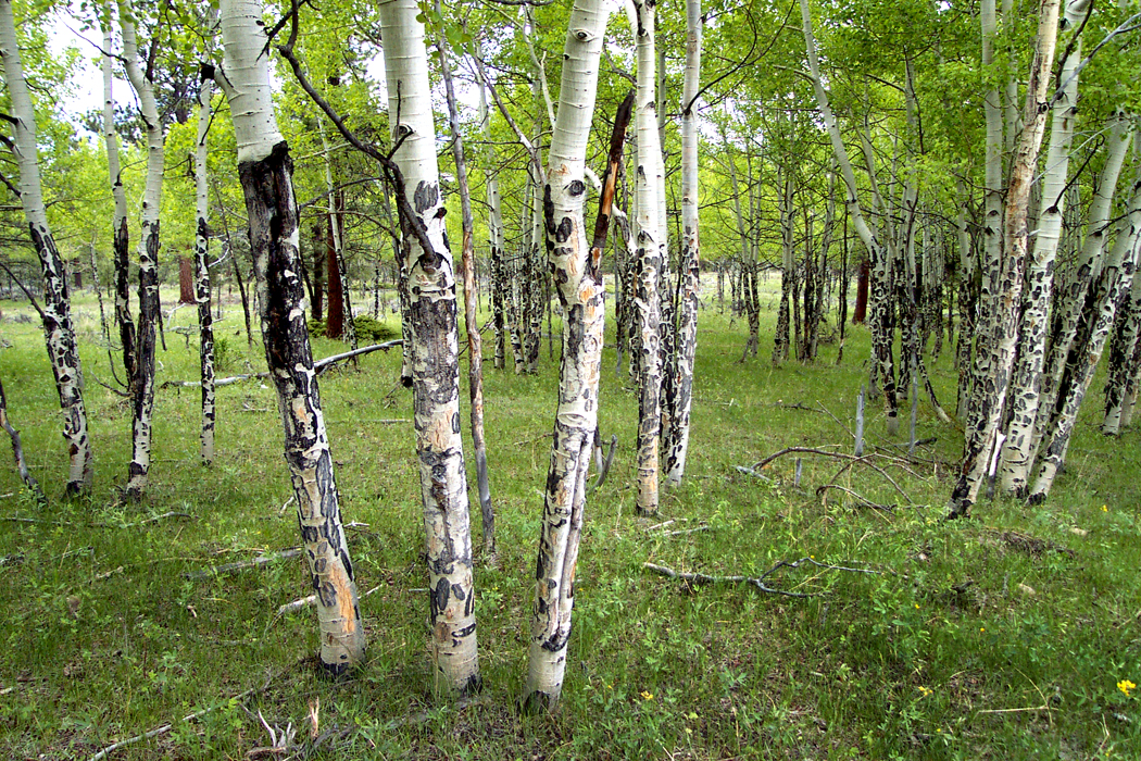
Aspens, Rocky Mountain National Park, Colo.
And so, I moved back to the East and back to North Carolina, where I had by then spent the largest portion of my life. I met my wife there and some years later, we moved to Phoenix, Ariz., where she got a job teaching and I found my life’s work writing for the newspaper. For the paper, I did a lot of traveling, and visited every state west of the Mississippi to write art and/or travel stories. It is always a pleasure to travel on someone else’s dollar.
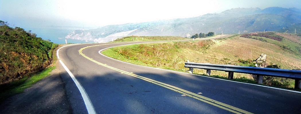
Pacific Coast Highway, Marin County, Calif.
After retirement, we moved back to the mountains of North Carolina, which I love. But I have to admit a nagging desire to spend time again in the desert, on the Colorado Plateau, driving up the coast of California, or revisiting the less glamorous portions of Los Angeles. The American West has wormed itself into my psyche and I feel almost as if some part of it has been amputated and I’m now feeling “phantom pain” or at least pangs in the missing limb.
It is not the idea of the West that I harbor. The idea has been around since before Columbus thought to sail west to find the East. It was there for Leif Erickson; it was there for the Phoenicians; and before that for the Indo-Europeans. It was the idea that grabbed the early American colonists who saw the trans-Appalachian lands and envied their possession.
The West of the mind is a West of infinite possibility, of clean slate and fresh start, of fantastic riches to be had, of prelapsarian goodness. People emigrated to the West for a better life and a quarter-section.
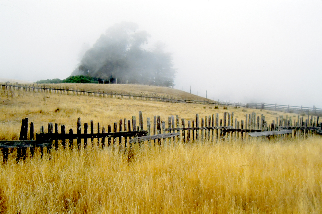
Fort Bragg, Calif.
The reality, of course, is something different: not enough rain for crops, prairie fires and tornadoes, mountain ranges nearly impossible to cross. And an indigenous people we first needed to wipe out and then mythologize into something noble and vanishing — as if the erasure had happened on its own.
The Greeks had the Iliad and the Odyssey; we had our two epics: First, the Civil War, which is our battle epic, and then the wandering to find a new home in our Westward expansion, our odyssey. We made movie stars of our cowboys. The West of the movies is scenic and immaculate. It is a cinemascope landscape.
But that isn’t the West I miss. The West I knew isn’t pristine; it is dusty, dry, spackled with convenience stores and gas stations, and getting hotter every year. It is even boring: If you’ve ever driven across Wyoming, you know what I mean. It has been described as “miles and miles of miles and miles.”
Near Pendleton, Ore.
Gertrude Stein’s description of America is really a description of the West: “In the United States there is more space where nobody is than where anybody is. This is what makes America what it is.”
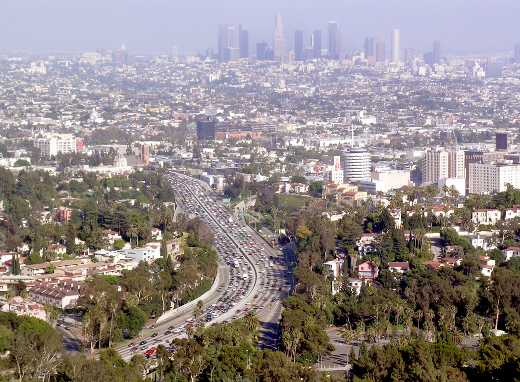
The West I miss in my deep heart’s core is the dusty, windblown vastness, but it is also the crowded, traffic-choked cities. I miss Los Angeles as much as I miss the Rocky Mountains.
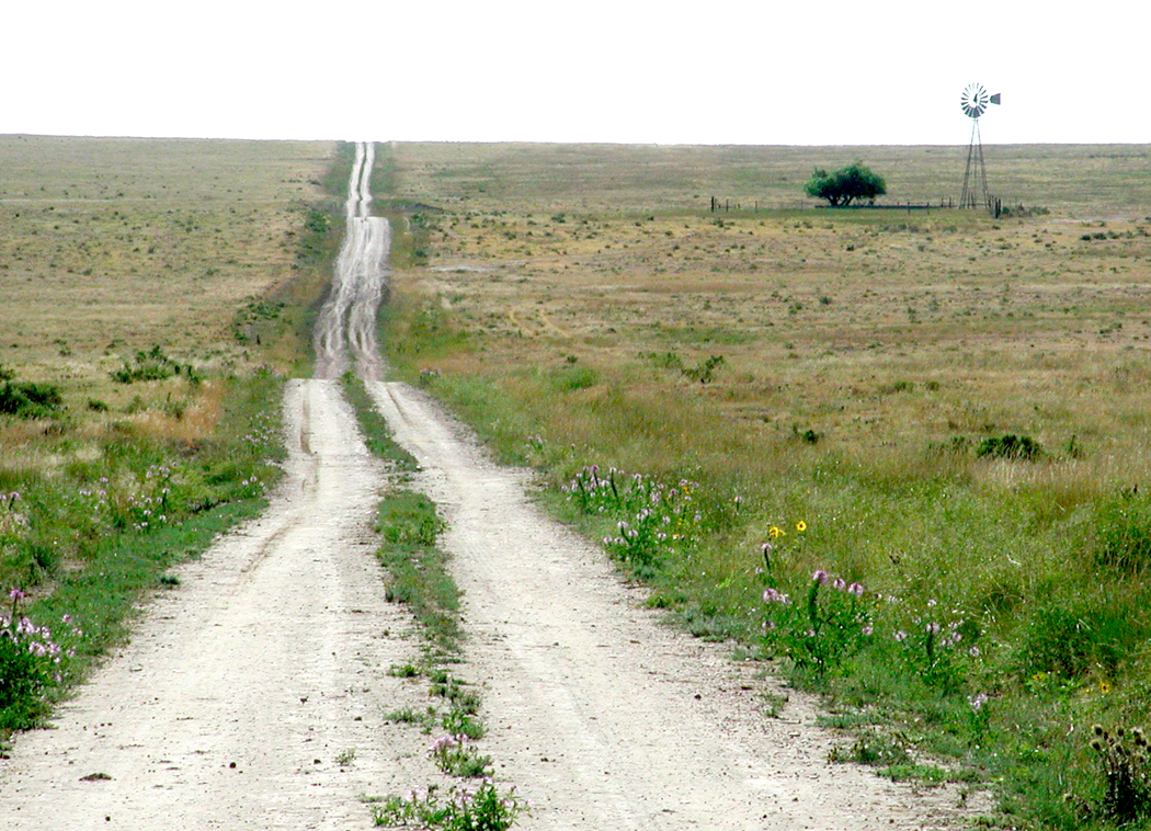
And let’s be clear. There are four very different Wests. There is the Great Plains region;
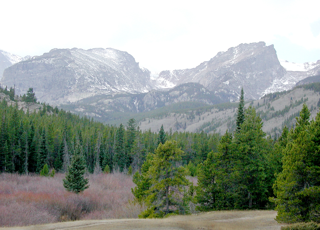
the mountain West;
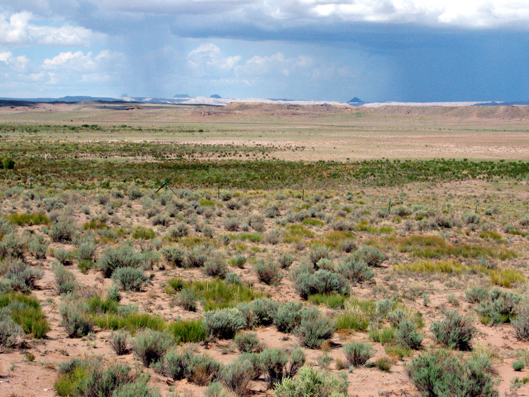
there is the desert West;
and the Pacific West.
Each has its character and its psychic magnetism. I am drawn to each.
Route 66 near Oatman, Ariz.
The flat middle of the country is usually forgotten when we talk of the West. In the movies, Dodge City always seems to have the Sierra Nevadas in the background. The Kansas reality is very different: grassy, flat, and smelling of cattle dung.
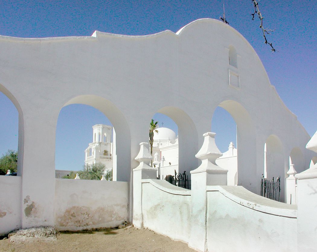
San Xavier del Bac, Tucson, Ariz.
As you drive across the Staked Plains of West Texas, you feel you might as well be out on the high seas with no land in sight. Indeed, that is how Herman Melville describes it in his story/poem, John Marr, about an old salt now living in the center of the continent. “Hooped round by a level rim, the prairie was to John Marr a reminder of ocean.” And the wind in the tall grass makes waves that undulate like the sea.
Friends used to laugh when they asked where I planned to spend my vacation and I said, “Nebraska.” No one, they said, goes to Nebraska. How about the beach? How about Manhattan. But I had in my head a sense of Manhattan, Kansas, instead. I loved seeing grasslands, badlands, farmlands and cowhands.
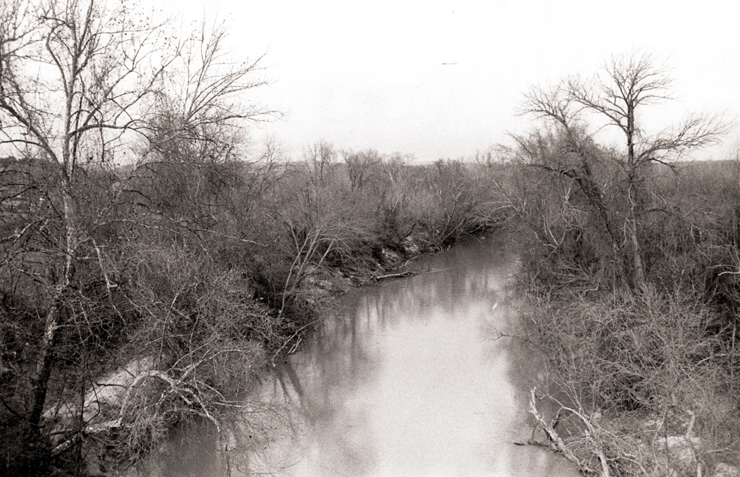
Republican River, Kansas
The mountain West is spread into broad bands. The largest is the Rocky Mountains that were such a barrier to the early pioneers.We drove up and through the Rockies in many of its latitudes, from the Southern Rockies in New Mexico to Glacier National Park in Montana — and further up into Banff and Jasper parks in Alberta.
My wife wanted to see bears. When we camped, she threatened to tie a peanutbutter sandwich to a string and drag it through the campsite, saying, “Here, Mr. Bear. Here, Mr. Bear.” I persuaded her that was a bad idea, but we found several bears on the side of the road as we drove.
Then, there are the Sierra Nevadas of California, some of the most photogenic peaks in the country, and the background to so many cowboy movies of the ’30s and ’40s. The mountains are home to the sequoia forests and Yosemite National Park. The lowest point in the U.S. is Death Valley and the highest peak in the Lower 48 is Mount Whitney of the Sierras and they are only about 80 miles apart. You can practically see one from the other.
The Sierras eventually turn into the Cascade Mountains in Oregon and Washington, and a series of giant volcanoes, such as Mt. Baker, Mt. Hood, and Mt. Rainier. And Mt. St. Helens. I have climbed up portions of Rainier and walked along the Nisqually Glacier on its southwestern face. On a clear day in Seattle, the snowy, ghostlike presence of Mt. Rainier seems like a permanent cloud on the horizon south of the city. It is immense.
Zabriskie Point, Death Valley, Calif.
The desert West is the one I know best. I lived in it for a quarter of a century, in Phoenix. But it is not Phoenix that I miss, except for the friends I left there. No, Phoenix is merely Cleveland in the desert. But outside of the city the desert is beautiful. In a good year — about one in every 15 — the winter rains make the desert floor a paint palette of wildflowers. The January explodes.
To the north of the city, the Colorado Plateau is what I miss the most, those long vistas of grassland and badlands, the Navajo and Hopi reservations, the mesas and canyons, the Colorado River and a half-dozen national parks. The plateau continues north into Utah and into the southern parts of Colorado.
Petroglyphs scar the rocks and cheap souvenir shops, like those called “Chief Yellowhorse” dot the interstate.
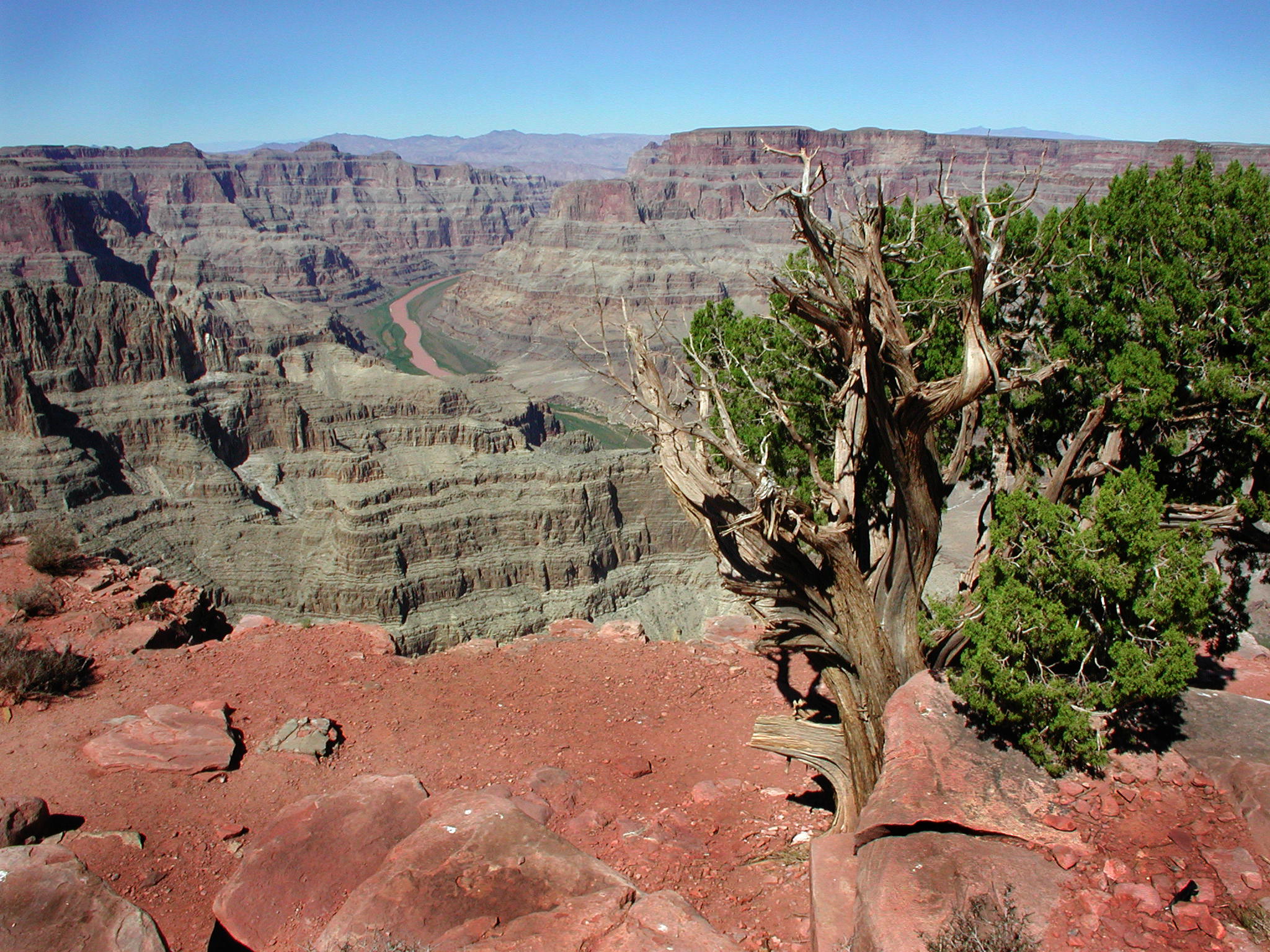
I can no longer count the number of times I have visited the Grand Canyon, both north and south rims, and the forlorn and uninhabited parts of the western stretches of the canyon on what is called the Arizona Strip. Anytime someone visited us in Phoenix, we took them up to see the Canyon. Pictures just don’t suffice; you have to see in to understand the awe. A picture is static, but the canyon changes color minute by minute as the sun slides across the sky and clouds pass over the rock. One of my great experiences was to arrive before dawn and watch the growing light slowly illuminate the stone and see the slim, glowing white ribbon of river a mile below us.
South of Phoenix, there is the Sonoran Desert, with its Saguaro cactus and unending greasewood plains. And rivers with no water in them. The common joke in Arizona was about a long-time desert rat who took a trip to New York City and when he returned, his friend asked him about it. He saw all the sights, including the Empire State Building and the Brooklyn Bridge. “And did you see the Hudson River?” “Yeah, but there weren’t nothing to see; it was covered in water.”
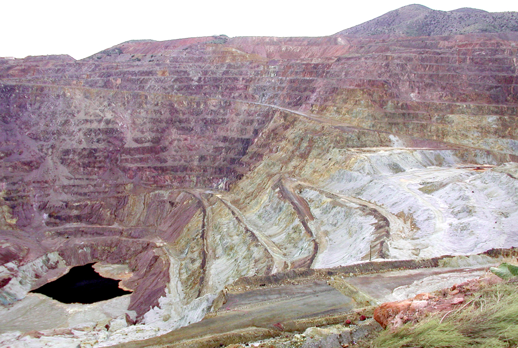
Lavender Pit, Bisbee, Ariz.
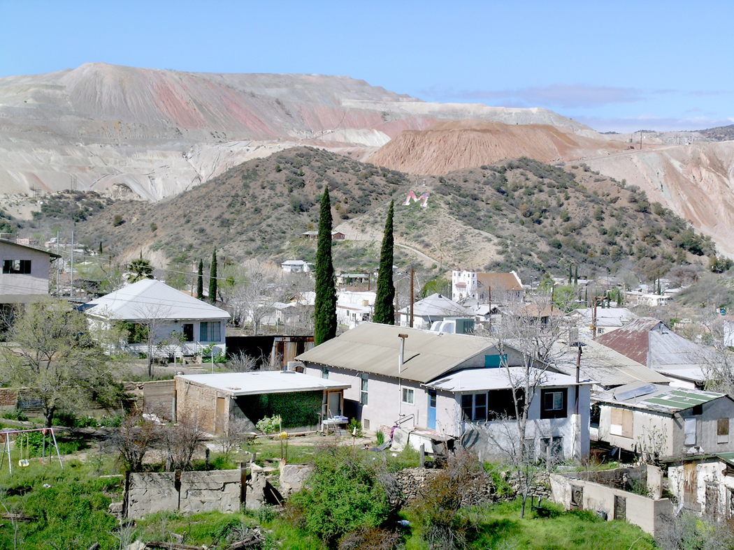
The picturesque parts of the desert are certainly attractive, but what I miss are the unlovely bits. The decrepit mobile home parks of Quartzsite, in the middle of nowhere, with its pyramid monument to Hi Jolly, the camel herder hired by the U.S. Army in a futile experiment. The burned out and abandoned shacks in 29 Palms, Calif.; the stink of dead fish along the shores of the Salton Sea; the shimmering fata morgana over the Wilcox Playa; the city-size holes in the ground where copper is hauled from the pits; and the mountain ranges of slag heaps hanging over the cities of Miami and Claypool.
Miami, Ariz.
In so much of the desert, it is not the unsullied nature that used to be there, but the used-up quality, the peeled paint and weathered wood and broken-out windows, the abandoned and rusting cars, the roads cracked with weeds growing through. These would never be called pretty, but they have an intense kind of beauty about them. There is something very human about the ruins that no bland red sunset can match.
As I said, it is the physicality of the West that speaks to me, not the idea. It is the West as it is, not as it is imagined to have been.
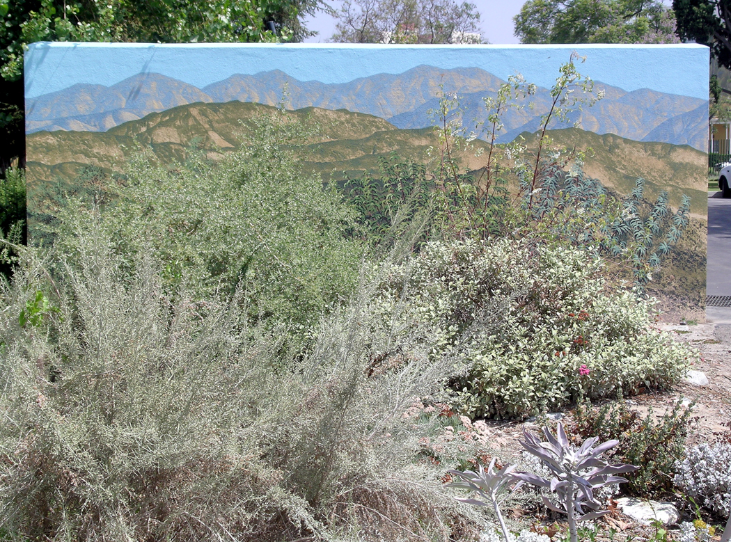
Mural, Los Angeles, Calif.
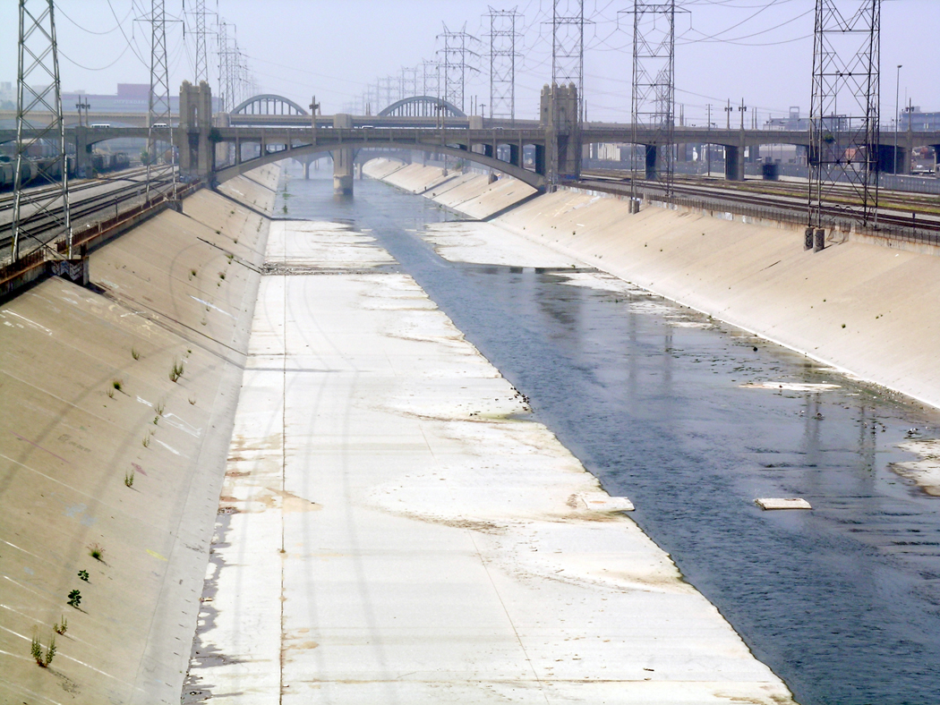
This is true also of the Pacific West. I have written many times about Los Angeles and the parts of the city I love most: the concrete river,
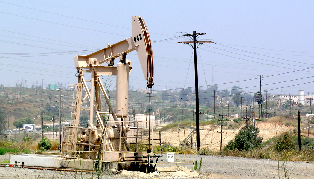
the oil wells on the Baldwin Hills,
the thousands of little strip malls and their ethnic restaurants and food markets. The bungalow houses, the back streets, the Deco architecture.
I have driven from Tijuana to Vancouver along the coast, soaking up cities and redwoods, mountains and rushing rivers; the Samoa Cookhouse of Eureka; the bridges of Conde McCullough; the stonehenge of Maryhill; the Channeled Scablands; the floating bridge over Lake Washington; the Olympic Mountains.
Jupiter Hot Springs, Yellowstone National Park
I have visited every state except Hawaii and every Canadian province except Prince Edward Island and Labrador, and I have absorbed the geography into my tiny head, swallowed whole.
Mexican cemetery, Chandler, Ariz.
We all become the landscape we have lived in. It is what makes a Southerner so darned Southern, the Yankee so taciturn, the desert rat so possessive of his burning sun-broiled gravel. In the past — and still in the American South — people tend to live within a few miles of where they were born, and their regional differences become part of their DNA. In more mobile times, when so many move around the country or even to foreign climes, that conflation of land and psyche may attenuate. But it is still there, defining, in lesser or greater extent, who we are and what we feel and think. It is why red states tend to be rural and blue states urban.
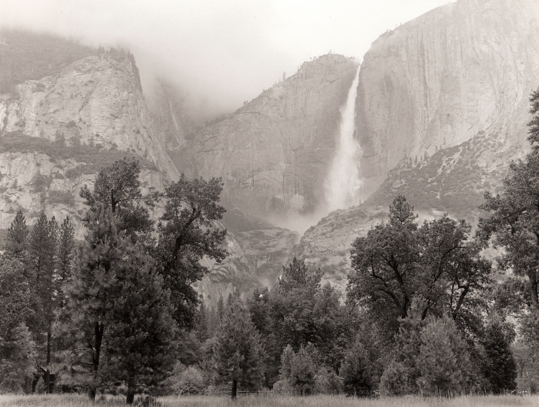
Yosemite Falls
And because I lived in the dry air so long, with the greasewood flats and the arroyos and the roadrunners and javelinas, the West — not the idea, but the real thing — has become a part of my insides. It is why even in the gorgeous Blue Ridge, I miss the desert, mountains, plains and cities of the West. We are in some part, the same thing.
People hate speaking in public; it is often listed as the No. 1 fear — a nightmare of anxiety. It is a fear I never felt. I love speaking to an audience. Whether it is giving a lecture, sitting on a panel discussion or moderating an after-movie discussion, I am in my element. Over the years, I’ve spoken in public hundreds of times. It is exhilarating and leaves me pumped with energy.
Yet, that comfort does not extend to acting. I cannot act my way out of a second-grade pageant (when I had my first onstage experience as a daisy in an Easter program.) The problem is two-fold. First, I have difficulty learning lines. I can’t memorize them. I can paraphrase them, extemporize them, but not repeat them word-for-word. In most plays, that is a problem.
Second, I am so firmly constructed of my own idiosyncratic personality — that ego is so well defined — that I can never leave it behind to assume the mask or persona of a distinct separate character. I am stuck with myself.
Yet, there were two times over the years that I have trodden the boards. There is a theme to the twain.
In high school, I took a speech and drama elective. As part of the class, the final was an assembly program in which we put on a series of one-act plays or skits. We were each required either to act in them or to write the scenes. I did not want to play-act on stage, so, I opted to write a play.
Three of us did that. One student was a natural for the stage, and he wrote a gripping dramatic scene built on the Kitty Genovese story. The second was an incredibly dumb James Bond parody. And mine was unbearably pretentious and literary. I had just read John Updike’s The Centaur and thought I might update, in like fashion, the Seven Against Thebes myth and set it in a modern high school.
We were well into rehearsals when our principal, having been made aware that my play featured a suicide (Oh! The teenage angst!), outright banned the performance, which I was both miffed at and also puffed with pride over — I was banned! Just like Henry Miller or James Joyce. A point of pride.
As a result of my cancellation, I was then coopted into acting in the James Bond parody. I was made an English bobby, shot in the first moments by the lead character, James Bomb. I was to remain motionless on the stage, an inert corpse, for the rest of the play. I had one line and then — bang-bang and then falls bobbie.
The moment I died, James Bomb was supposed to realize his mistake (he shot me thinking I was the villain), and he walked cross-stage to me, grabbed a glass of water from a handy nearby table and splash it in my face to try to revive me. Well, I was wearing this heavy woolen bobby costume and in rehearsal, the wet wool stunk and irritated my skin horribly. I had to lie there for the rest of the play, stewing in the wet clothes.
So, on performance day, just before the curtain rose, as we were all standing on our marks, I reached for the glass and drank the water. I was so clever. And as the scene played on and James Bomb came over to splash me, and finding no water in the glass, he improvised. I had failed to take account of the full pitcher sitting next to the empty glass on the table. Our hero then ignored the glass and poured the entire pitcher of water on me.
As if that were not humiliation enough, imagine me splayed out in my soup on the stage floor, my bladder slowly filling to the uncomfortable water-balloon phase, having to hold it all in till the curtain finally came down, went up again for the curtain call, down again and I could finally run down the hall to the boys’ room and pee “for what seemed like forever, but in reality was only seven minutes.”
(I can’t take credit for that line: It was written my my friend, Doug Nufer of Seattle.)
My next appearance, not an Equity production, came in 2005 in Phoenix, Ariz., as a bit of stunt casting in a play about a notorious local restaurateur.
If you are not from that city, you may not have heard about Jack Durant, who opened the smoky eatery, Durant’s, in 1950. Decorated in whore-house chic, it became the meeting place of politicians, lawyers, and visiting Hollywood celebrities. Everyone who was anyone met at Durant’s. There was an in-the-know air about the place. No one who was a regular ever came in the front door. If you had your wits about you, you came in through the kitchen. Many customers had regular tables. Many a legislative deal was cut in the dark corners of the place.
Durant’s
Durant, himself, was more of a personality than any of his celebrity guests. A former colleague of Bugsy Siegel, reputed to have once bumped off a mob rival, married three or five times — the stories varied — Durant was ringmaster at his restaurant.
Such a colorful character made for many stories, some of them true. Durant died in 1987, leaving his house and an annual allowance of $50,000 to his dog, Humble. The restaurant is still there, running on the ghost of its founder. It is still dark; people still enter through the kitchen, and deals are still negotiated over a great big porterhouse steak.
In 2005, playwright Terry Earp did the inevitable, and created a play about Durant, called In My Humble Opinion, ironically because Durant was never humble — only his dog was.
The play was set in the restaurant after closing, a year after Durant’s death. The man’s ghost sits at a table, recounting his life to a passed-out drunk at the bar. The drunk was played by a different local “celebrity” each night. I was one of them — the local art critic, and rather low down on the celebrity list, but of course, the play went on for a month, so they had to scrape the barrel-bottom at times. Others who played the role included former Phoenix Suns center Alvin Adams, local TV star Bill Thompson and rocker Alice Cooper.
My part had no lines. It also had no motion. I was to sit there, head in my arms flat on the bar for the full hour of the play. Not twitching a muscle.
I don’t know if you have ever had to do that — like you are playing dead during a bear attack — but it is not easy. Muscles begin to scream at you: “Twitch. Twitch, damn you. Shake a leg. stretch your fingers.” But, no, you have to pretend you are carved from marble.
I managed it, but then came the curtain call. I had to unlimber my limbs and stand up from the barstool to acknowledge the acclaim of the audience. My joints had become riveted in their static positions and to stand up required a full course of physical therapy. I wobbled. I nearly fell over. I was half asleep from meditating quietly for the hour. I tried to smile for the crowd, but I’m pretty sure I could only manage a silly grin. I must have looked like the drunk I played.
And thus, my life as a thespian came to its rightful conclusion. Two motionless parts, lying still for the duration. And I never got my Equity card.
Where is home? I don’t mean where is your house, where do you sleep most nights, what is your address. But rather, where do you belong?
For many of us, home is illusive. For most of my adult life, I have not lived in the same house for more than seven years at a time. I have lived in four corners of the nation, splitting my time from the Northeast, where I grew up; to the Southeast, where I went to school, got married and divorced; to the Northwest, where I went to recuperate; back to the South, where I got married again; to the Southwest, where I worked for 25 years; and now, back to the Southeast in retirement. But I cannot say, despite repeatedly returning, that I feel the South is home.
It is where I feel comfortable, where I recognize the landscape on my skin, where I have found family. But there remains something alien about it. Something I can never be fully a part of.
Certainly, part of this is political: The red state conditions are sometimes depressing. There is nativism, clannishness, religion, suspicion of outsiders, lingering racial division. There is a satisfaction of being Southern that can seem provincial.
Yet, there is also a friendliness and helpfulness that I never found in any other corner of the U.S. When my wife, before we were married, was snowed in in the mountains of Ashe County, N.C., a neighbor she barely knew, walked a mile and a half through the knee-high accumulation to knock on her door and check on her, to make sure she had enough firewood to last out the imposed isolation, and to bring her a basket of food. Not in New Jersey. Not in Seattle. Not in Phoenix — although snow in Phoenix would be pretty much out of the question anyway.
North Cascades
When I moved to Seattle, in 1978, before all the Starbucks and California immigration, I was agog over the Olympic Mountains I could see over Puget Sound to the West, and the towering Cascades to the east. When I went out hiking, it was through rain forests of Douglas fir and western red cedar. The ground was spongy underfoot and emerald green moss grew on decaying logs and stumps. Floating on the waters of the sound were goldeneye and cormorant. The air was soft with cool humidity.
I certainly had planned to make Seattle my home, and I mean that —not just a place to sleep at night, but I never felt like more than a traveler spending time in an exotic locale to soak up the ambience along with the rain.
And, compared with the East coast I grew up in, the nature was almost monotonous. When I lived in North Carolina, on the land around my house in Greensboro, I counted a hundred different species of tree and plant. I came to love them all. But there on Phinney Ridge in Seattle, there were two species of tree. Two. They were everywhere and they were prodigious and impressive. But two. I longed to return to the East. And so I did.
Meat Camp, NC
But even then, I moved from Summerfield north of Greensboro, to Obids in the mountains, to Meat Camp just north of Boone — all in the space of two years. And then, to Virginia Beach, Va., to take up a job teaching. After six years there, when my wife was offered a teaching position in Arizona, we packed everything up into a Ryder truck and drove across the continent, without even having a house lined up where to unload the truck. We thought it would be fun to stay in the desert for a couple of years. It turned into a quarter of a century.
I came to love the desert, but truth be told, I did not live in the desert, I lived in Phoenix, which is Cleveland in the desert, a characterless city of endless suburbs and strip malls in the valley of the Salt River — a river with no water in it.
(The famous joke about Arizonans is they go to visit New York City and when they came back they were asked about it. “It was wonderful, huge skyscrapers, millions of people, and traffic like you wouldn’t believe.” “What about the Empire State Building?” “Yep, we went up to the top and you could see for miles around from river to river.” “The Hudson?” “Yep.” “What was the Hudson River like?” “Couldn’t tell, it was covered in water.”)
I loved my job, writing for the newspaper, and I loved my colleagues: I came to respect and value the really hard and dedicated work that journalists do. Over those 25 years, we moved four times. None of the houses was home. They were our quarters, but there were no roots.
North Carolina called back after retirement, and I now live in Asheville, in the Blue Ridge Mountains, a blue city in a red state. And I have gotten old here, but it is not home. It is a residence.
I don’t know if it is my New Jersey birth that has given me this sense of rootlessness. I spent the first 17 years of my life there, but I couldn’t wait to escape. Going off to college was liberation. New Jersey was banal, suburban, bourgeoise, dull, conventional, oppressive. I never felt I belonged.
River Street, Madison, NC, in Rockingham County
I know from my wife and her family, that there is usually a deep sense of belonging that Southerners feel. A genuine love of the patch of ground where they grew up, a love like you feel for a parent. It is a love of where you were born that may not extend beyond the town or county and maybe the state. But for my wife, Rockingham County was where her father and grandfather were buried. That fact alone meant there was an unseverable umbilical connection to that omphalos, that tiny patch of piedmont, those trees, those creeks and rivers, those very weeds that crept over the edges of the crumbling pavement on the back roads. It is the feel of the red clay between your fingers, the blackbirds roosting by the hundreds in the oak tree. Home.
I don’t know how widespread is this feeling I have, how many people share it, whether it is a symptom of the late 20th century, or whether it is confined to just me and my personal makeup. I believe I am not alone.
I suspect many from my generation, growing up with the very real threat of nuclear annihilation and living through an adolescence and young adulthood of assassination, riots and revolutions, felt chucked out of Eden quite unceremoniously.
If you come from Armenia or Poland or Vietnam or Tibet, you have a clear sense of identity, and an unbreakable bond with the land that gave you suckle. Certainly, most Southerners I have come to know have that feeling about their soil of origin. But there are many others, certainly from my generation, who share my sense of rootlessness, the sense that I can never be so comfortable in a place that I would long to be buried there.
Perhaps it is because I have moved so often that I cannot share that sense of home. I have a residence on the earth, but not a home.
I express all of this not so you should feel sorry for me. In fact, this homelessness has its advantages. I have had, in recompense, an ease and comfort anywhere in the world I find myself. I have been to three continents, and 14 countries, three oceans and the Mediterranean Sea, and never have I felt anything but at ease wherever I have gone. Being in a country where English is not spoken is as comfortable as being in a place where people eat mopane worms off the grill.
Travel has felt such a part of my self-identity, that while others might feel distressed having to move to another state or country, torn roots and all from the soil they call home, I, in contrast, feel most myself when seeing some new terrain, hearing new accents or languages, eating new food, driving on different pavements and finding out about the sun-orbiting globe that, more than any single spot, feels like home to me.
I have slighted a good deal of the state in these writings. So much is left out. I have barely mentioned the Navajo Reservation, an area the size of West Virginia. I have loved visiting the Rez, and the Hopi Reservation swallowed Jonah-like inside it. I have left out huge chunks of Arizona that I love and remember well: I scarcely nodded to Tucson, Aravaipa Canyon, Fort Huachuca, the Petrified Forest, Painted Desert, Payson, Showlow, the Mogollon Rim — the list is too long to number here. All of it fascinating either for its geology, its history, its development, its politics, its beauty or its characteristic ugliness. Whatever it is that makes it memorable.
Little Colorado River, Holbrook
I feel bad for not being able to squeeze it all in.
I began in Phoenix, drove south then southeast; then up north and across Interstate 40, making a grand spiral. If I followed that logic, this entry should begin at Hoover Dam and continue on a plumb line south to Yuma, where the excursion should end. But I have left out the middle portion of the state so far. And I should like to be able to mention such prodigies as the pile of rocks at Granite Dells, the prehistoric ruins at Tuzigoot, the Verde River valley and the sliding town of Jerome.
Jerome
This imaginary roadtrip began because I was feeling homesick for the state I left four years ago. I have seen its distances in dreams, when I wake and only half-remember that my eyes now open in the Blue Ridge Mountains of North Carolina. (When I lived in Phoenix, I often had this same homesickness for the Eastern forests and hills). The fact is, I want to engulf it all, sweep it all into my innards and swallow the map whole: I have loved travel more than anything in my six decades and eight years.
Verde River
So, I finally recall the dusty streets of Kingman, the old road through Oatman, and the wastage south, through Spring Break Gomorrah (Lake Havasu City), and on to the remains of the internment camp at Poston, with its memorial (although more moving are the stumps of concrete foundations you can find throughout the area, where the barracks used to be that warehoused Japanese Americans), and Poston’s irrigation and farmland, all on the Indian reservation.
Poston
South of that, you follow the Colorado River to Yuma, where you can walk across the river most times of the year and hardly get your ankles wet. The green farmland along the river, all the way down to San Luis, remind you that so much of Arizona remains agricultural.
I have loved it all, and more: It has become a part of my inner landscape. Drop me anywhere — Burro Creek Canyon, Yarnell, Mormon Lake, Old Oraibi, Gila Bend — and I will know where I am instantly. I have soaked Arizona in like a sponge.
Yuma
But I have lit out for the territories — in my case, that is returning to my past in the Blue Ridge, among the beech and oak and ash and dogwood, where bears scavenge my garbage and a pileated woodpecker knocks the old red maple in my front yard.
Quartzsite
I have lived in the four corners of the continent: born in New Jersey, schooled in North Carolina, taught in Virginia, tested in Seattle and ripened in Arizona; visited every one of the contiguous 48 states at least a half-dozen times, not counting all the Canadian provinces save Prince Edward Island, and I’ve internalized it all. Now that I am old, and driving long distances is torture on my knees, I can revisit the places I know by writing about them. I recommend the maneuver to everyone: Write — or draw, or dance, or sing — and reconnect with the life you have led, with the world you inhabit. Everything written is a new Genesis: the world is created once more, and the world needs to be reborn constantly.
We’ve all had the experience of revisiting some place that meant something to us when we were young, only to find it ruined by the passing years — the blight in tract homes where there had been woods we played in; the proliferation of 7-Elevens or Starbucks; the widening of roads we had ridden our bikes down and the concomitant soot-spewing storm of traffic. The divided-highway bypass and the Walmart near the exit. Time has not been good to the landscape we knew.
But I have always thought, there must be someone of a generation previous who looked at the landscape I bicycled down and thought, how much better it had been when the road was gravel and there were no houses — including the one I grew up in — lining that road.
The fact is, time is furious and eats up the land just as it eats up the remaining years of my life. “Panta Horein” said the Greek philosopher Heraclitus: “Everything changes.” Doubtless, there was someone before my elder who loved the same land when there was nothing but a footpath through the forest and thought it better for all that.
And no doubt there will be some future progeny who will look at the scene some 50 years hence and lament the loss of those same 7-Elevens, replaced by something even crasser and more demoralizing. To them, the land I now lament will have been Eden.
Holbrook, Arizona
Too often we think of the land as something permanent through which plays the impermanence of our comings and goings — a static stage set for our dramas. Its pace may be slower than ours, but the land changes, also; it has its own drama. I particularly love to see the scars of those changes, the evidence of what used to be, the peeping out from under the macadam of the buried eyes of the past.
One of the prizes I have is a Rand-McNally road atlas from the year I was born (1948). The map of Arizona has no interstates on it, and you can see that the very getting from Phoenix to Flagstaff was a detour, driving first through Wickenburg and up to Prescott before either heading north to Ash Fork and then east on U.S. 66 to Flag, or taking the more mountainous route up Alternate 89 over Mingus Mountain, down to the Verde Valley and then up the hill through Sedona and up the face of the Mogollon Rim to your destination.
Of course, there was a more direct route, through Dugas and Camp Verde, but the road was mostly dirt and rutted.
The thing is, that if you look for them, all those ruts are still there. You can, if you wish, and if your car is sturdy enough, drive those roads up through Bumble Bee, through Orme, through Skull Valley, Iron Springs or Happy Jack. Like Schliemann digging down through layers of Troy, the archeology of Arizona is there — or its fossils are.
West of Kingman
All of which brings me to the slice of Arizona across its northern tier, now defined by Interstate 40. The interstate ate up what used to be U.S. 66 — Route 66 of legend — and takes the speediferous driver across the flatter parts of the Colorado Plateau, up through Flagstaff, and down through Williams, Kingman and on to California. “You’ll see Amarillo, Gallup, New Mexico, Flagstaff, Arizona. Don’t forget Winona, Kingman, Barstow, San Bernardino…”
But, if you get off the interstate, right at the state line in Lupton, you can find the ghost road, mostly paralleling the freeway, and you can drive along it, at a steady 45 mph, watching for potholes, and see the scars of the past dug into the dry stony soil. The road is discontinuous — you will have to get back on the interstate for an exit or so, or ride over the tide of traffic to pick up the auxiliary road on the other side, where old 66 will start again. It is a ghost of itself, and along it are a few forgotten towns, many gutted old service stations with their paint peeled, their windows blown out and their driveways split by weeds busting through.
Time is fierce, it eats everything.
I admit to a weakness for these pentimenti, for the palimpsest of time, showing through the later “improvements.” They provide a glimpse of the process, of the metamorphosis — using Ovid’s word — of the constant writhing and seething of the planet and our place as people in the ferment and bubbling.
It comes in the shorter term, such as old Route 66 being devoured by grasses and crucifers, but it also comes in longer terms, such as the Anasazi ruins of Canyon de Chelly and Betatakin, the petroglyphs of Rio Puerco in the Petrified Forest National Park.
There are remaining parts of old Route 66, running through Seligman, and it is mined constantly for nostalgia. But it isn’t that I am feeding on, but the sense of sand sifting through my fingers, of time leaving. It comes out of some chthonic well and runs past us and dissipating in an ocean of we know not where. The old road is still there, and it will be there even when there are no cars — just as the wagon ruts can still be found along the Santa Fe Trail, sunk into the grasses of Kansas.
I relish all the different tickings and tockings of the various clocks running their various races.
Sliding Rock Ruins, Canyon de Chelly
You stand at the rim of Canyon de Chelly on the Navajo Reservation and look down to the braided stream at the bottom that scoured this great hole out of the sandstone and wonder how long it must have taken. Then you see the tiny Anasazi relics built into the walls of the rock and realize how long people have been living here, and then you see the sandstone itself an think about how much longer ago — exponentially longer — that ancient river deltas deposited the silt that later became that stone.
White House Ruins, Canyon de Chelly
How much more do you sense these multiple time scales at this rift’s big brother, the Grand Canyon.
Marble Canyon
If you want to have the planetary feeling without racing around the globe, you can get it standing still in Arizona: with your feet planted at the edge of the Grand Canyon. In that case, you stand stock-still and let the planet do the moving.
North Rim, Grand Canyon
The first time I saw sunrise at the Grand Canyon, my wife and I were camping on the North Rim outside the National Park. We had arrived with the naive assumption we could wander in late in the afternoon and get a room at the lodge. Or failing that, we could get a slot at the campgrounds.
The desk clerk took pity on us and explained that although they were completely booked, lodge and campground, for the foreseeable future, we could find a dirt road just outside the park that would take us to a place in the National Forest where people often camped.
It was dark by the time we got to that road, and when we turned into an open place where two or three other tents were set up, it was already night.
We slept, we dreamed, and we woke before sunrise, when the earliest glow floated in through our tent flap. And when we got out to stretch and start up the camp stove, we gasped: We were about 15 feet from the rim of the canyon. It dropped out of sight below us.
If we had pulled forward just a little farther the night before in the blackness, it would have been Thelma-and-Louise time for us. We were hard on the edge.
But more impressive, the humid late-July weather had left the entire canyon as a gigantic dish of cotton. The clouds filled in the canyon-hollow like apples in a fruit bowl. A 215-mile long fruit bowl.
The mists swirled and wisped below us, over precipices and down canyonlets, in constant motion, rising and subsiding as the new-hatched sun warmed patches of the air the mist rode upon and the breezes wafted the veils.
Grand Canyon West
The Classical writer, Longinus, said that we enjoy the day-to-day things of our lives, but when it comes to awe, we get that only from the sublime. Hearth fires, he said, were nice, but erupting volcanoes make us consider a planet and cosmos larger than we are and well beyond our control. The sublime is beautiful, but it is also scary: It is the source of religious feeling.
You cannot avoid that at the Grand Canyon, with its stony layers of eons piled upon each other. The Canyon is a great wound in the Earth into which we can look and see its organs pulsating at a rate so slow as to make all of human history a mere blip on its EKG.
The Grand Canyon is a clock. It has a big hand and a little hand.
The little hand moves very slowly, telling the time in geologic terms. To see the hand move, you must wait millions of years.
In that time, you would see continental oceans lay down sediments and tectonic forces push those layers upward, only to be eroded by a river, like a sand pile washed by a hose.
One stands at the rim now and looks back into the past, washed away eon by eon, stratum by stratum, until one’s eye stands on the Vishnu schist, the Precambrian footings of the Canyon.
You hardly can take in the vastness of it. It is an earthly reminder of eternity, that time beyond time that turns our lives into flyspecks.
But this geological clock has a fast-moving big hand, too. And it changes all 200 miles of the Canyon second by second. It can seem to the observer like time-lapse photography in real time as the sun jumps from the horizon and changes the shadowed blacks of the deep walls to a burning cherry ruddiness and on much too quickly to the weathered indigo blueness of noon.
Cycles and epicycles, wheels inside wheels, the turning of time on itself in all its speeds.
The first time I saw the Canyon, I got there before dawn. My wife and I had arrived late the previous night and wound up camping in the Kaibab National Forest outside the park. I set our alarm clock for 4 a.m., and when we got up, it was completely dark.
We drove to the overlook at Lipan Point, and I set up my camera in the blackness, out on a rocky ledge beyond the guardrail.
The tripod barely could find purchase on the narrow outcrop, and my wife warned me about taking chances, especially by the glow of a flashlight.
A little after 4, the horizon began to appear. It was July, but it was icy cold before the sun rose. The batteries of my light meter ceased to work in the cold.
Yet it was beginning to be possible, as the far edge of the Canyon contrasted with the blue-gray of the lightening sky, to focus my lens on the ground glass of the camera. And I saw there little more than that dividing line.
But down in the bottom of the Canyon, a mile below us, there was a snaky line of a reflecting light.
It was the river, a white tube of neon cut off here and there by the mesas and buttes below us. At times, the rope of water actually seemed brighter than the sky.
I managed to take a two- or three-minute exposure of the nearly black landscape. The glow in the sky had begun to make some of the rock texture visible, but less so to the eye than to the camera.
Moment by moment, the scene changed, a slow crescendo of light that began where the river disappeared in the northeast until the fire broke the horizon and the first sliver of sun appeared.
What is most surprising is the quickness of the change. If you were to take a photograph once a minute over the course of a day, you hardly would have two alike.
When the sun is on the horizon, you actually can see it move. And as it rose and sank its light deeper into the Canyon, what had been a charcoal mass of rock mazes became lighted at the top ends of the rocks, like the cherry end of a cigarette in the dawn.
You could see probably scores of miles down the Canyon to the west and see the angle of the sun on the edge of the rock.
Nothing is so like the Earth waking up.
Looking toward the sun, the Canyon became a receding stage set of silhouettes, each lighter and grayer as it retreated toward the sunrise. Looking away from the sun, the rock faces became increasingly red, then orange, then brick, with layers of white and green thrown in.
The Grand Canyon is grandest in the dawn. Those willing to awaken early enough stare into the clock of the day playing on the stone and see their lives moving before them. If time is a stream, as Thoreau says, at the Grand Canyon you can see its rapids. The change continues all day. On most summer days, the midday hours are the least interesting. The hazy blueness of the distant rim seems steady from about 10 a.m. to 2 or 3 p.m. But if you stare with enough commitment, you can see the changes even then as the downward angle of the sunlight twists slowly from one side of the cliffs to the other.
Grand Canyon West
Later, when the sun’s angle lowers to day’s end, the changes accelerate once more, taking the rocks back from blue to red and into darkness.
There is no mistaking the Earth as a clock, turning with the sun as the hour marker, moving in orderly procession around the rim of the great circle we live on.
But the two clocks at the Canyon also remind of the conflicting realities of the place. On the one hand, the slow clock tells of the everlastingness of things, their physical endurance. On the other, how can you believe in reality if the same limestone that can be red at 8 a.m. can be blue by 9?
It reinforces your sense of rock-solid reality and undercuts your belief at the same time. To live in two times at once: This is the central message of all the world’s religions.
When people find spiritual meaning in the Canyon, perhaps it is these conflicting clocks more than anything else that create that sense. Certainly, the Canyon’s vast space is inspiring, but it is time that speaks of eternity and our place in it.