Fifty-seven years ago, while on the Apollo 9 mission orbiting Earth, astronaut Rusty Scheickart was floating outside the capsule in his space suit and had a moment to look out through his “fishbowl” helmet at the planet under him.
“And you look down there,” he said, “and you can’t imagine how many borders and boundaries you cross, again and again and again [as you orbit the Earth every 90 minutes]. And you don’t even see them.”
It’s a common refrain from those who have gone to space. Moon astronaut Buzz Aldrin said, “From space there were no observable borders between nations, no observable reasons for the wars we were leaving behind.”
Senator Bill Nelson, who flew on the Space Shuttle Columbia in 1986, said, “In space, you don’t see boundaries or borders. We are all citizens of Earth.”
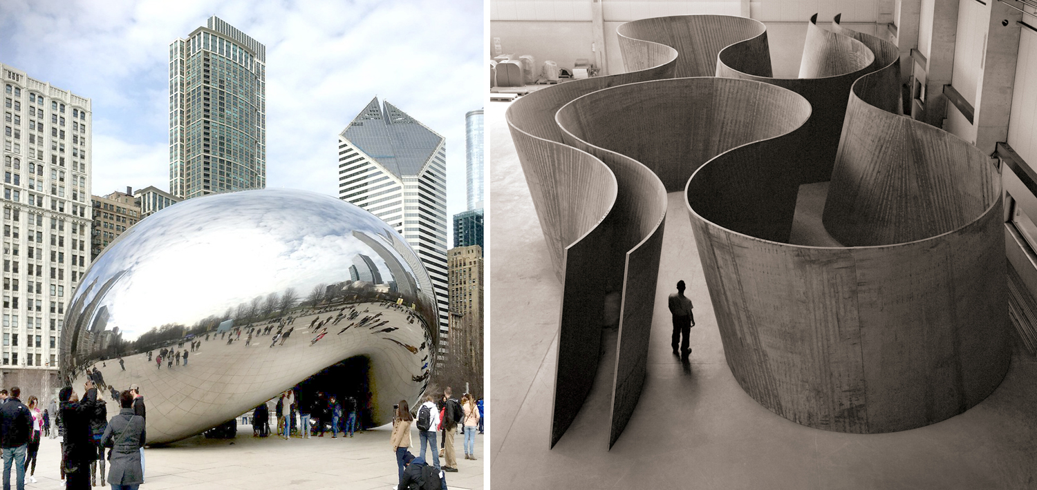
The blue marble
We draw lines where there aren’t any. National borders are just one case. We draw distinct lines between species in biological taxonomy, we name historical eras, invent racial exclusions — we talk about these arbitrary lines as if they build fences between property lines. But they are legal fictions, and continually malleable. Political borders shift; taxonomy rejumbles categories; Red politicians vs blue politicians? Really they are all just grey men in blue suits. Their squabbles are parochial at best.
The issue is that we understand the world in discrete chunks, but nature comes in indistinct swathes. In order to discuss or argue, we pretend there are clear lines. Perhaps we have to; everything all together at once is confusing.
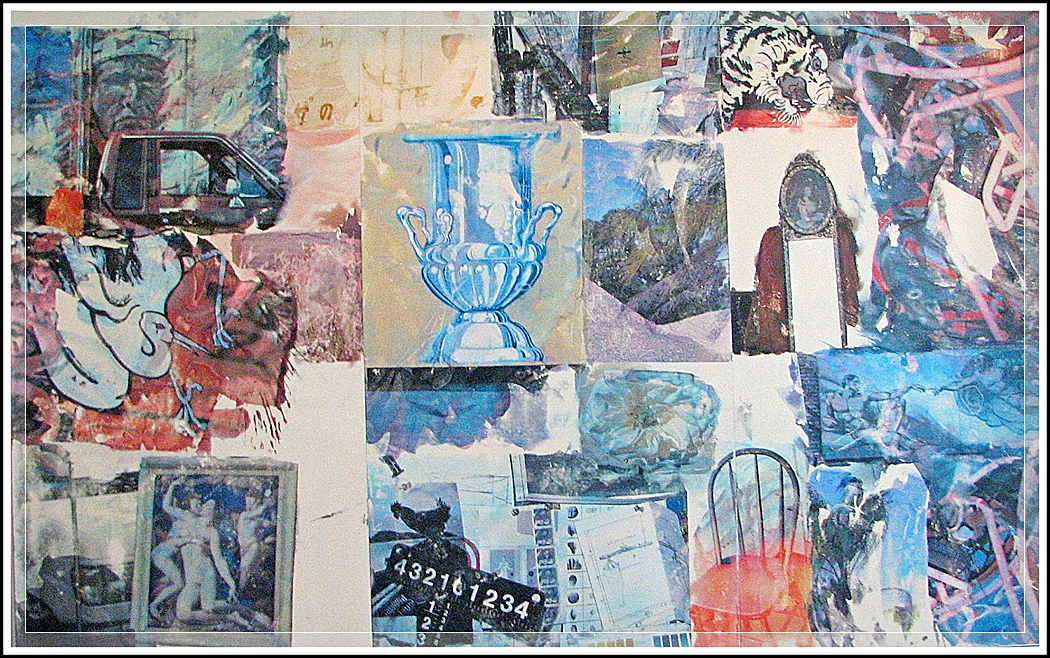
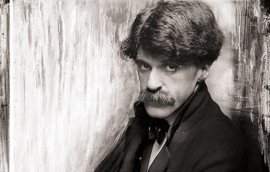
Robert Rauschenberg “Lucky Dream”
Nature, however draws few lines. It spreads and includes. It changes constantly; it is never static. “Everything flows,” as Heraclitus put it. Seed into sprout into flower and into seed into …
I’m not saying there are no differences at all, but rather that the lines we draw tend to be arbitrary or at least, blurry. Are the red people for smaller government or a more powerful presidency? Such issues shift over time and it’s impossible to pin them down.
Take the past, for instance. Historians like to take big chunks of time and give them names: Classical, Postclassical, Late Medieval, Romantic, and so on. Then they argue over it all, because any good academic historian knows that the names we give big chunks of time are misleading. But, as they say, whatcha gonna do? We seem to be stuck with them.
The Middle Ages, for instance. Middle of what? Homo sapiens developed something like — in a common low-end estimate — 300,000 years ago, putting the start of the Middle Ages somewhere approximately in the last 15/3000ths of human history. Not exactly the middle.
And the dates we give the Middle Ages vary widely. Where do you draw the line? It came after the Roman Empire. But when did the Roman Empire fall? Well, you can say that the final collapse came in 1453 with the fall of Constantinople. For some people, that is already the Renaissance, squeezing out the Middle Ages entirely. And no one really believes the Byzantine Empire was genuinely Roman. They spoke Greek, for god’s sake. They were Christian.
Usually, when we talk of the fall of Rome, we mean the Western Roman Empire and the sad reign of Romulus Augustulus, which came to an end in AD 476. But really, the Western Roman empire at the time consisted only of most of Italy, a tiny bit of France, and Dalmatia (later aka Yugoslavia, later still — well, you know).
And you could easily argue that Rome ceased to be Roman after Constantine converted to Christianity and legalized it in AD 313. After that, the slow slide from Roman imperialism into Medieval feudalism began its ambiguous transubstantiation.
It is the great paradox of scholarship: The more you read, the more your ignorance grows: The more you learn about something, the more you discover how little you know.
We think of our current era as modern. But when did that begin? It is a slippery question. I am reminded of the time, some 50 years ago, when I first drove west from North Carolina. I had never seen the great American West and eagerly anticipated finding it. It must be so different, I thought, so distinct.
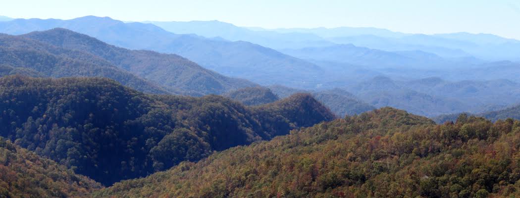
We were living in Boone, N.C., named for Daniel, who trod those mountains in the 1700s, when anything beyond the Blue Ridge was the West. When George Washington surveyed the Northwest Territory in the late 1740s, he was measuring out what became Ohio.
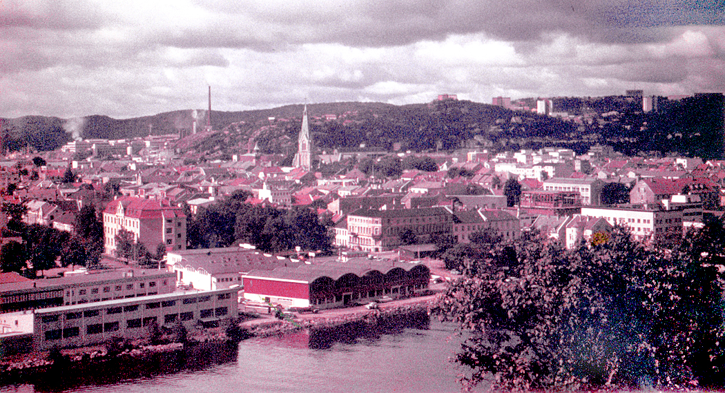
Blue Ridge
So, when I was driving, I knew I had already pushed my own frontier past such things, and knew in my heart that the West began on the other side of the Mississippi River. But, when I crossed the river into Arkansas, it hardly seemed Western. It didn’t look much different from Tennessee, in my rear view mirror. Yet, Arkansas was home to the “Hanging Judge” Isaac Parker and where Jesse James robbed trains.
But surely Texas was the West, but driving through flat, bland Amarillo on I-40 was as exciting as oatmeal. The first time we felt as if we had hit the West was at the New Mexico line, when we first saw a landscape of buttes and mesas. Surely this was the West.
Maybe, but we hadn’t yet crossed the Continental Divide. All the waters of all the rivers we crossed emptied into the Atlantic Ocean. Finally, crossing the Divide near Thoreau, N.M., we felt we had finally made it.
Yet, even when we got to Arizona, we knew that for most of the pioneers who crossed this country a century and a half ago, the desert was just one more obstacle on the way to California. In some sense it still wasn’t the West.
When we got as far as we could in a Chevy, and stared out at the Pacific Ocean, we knew that there was still something farther: Hawaii, Japan, China, India, Africa — and eventually across the Atlantic to Cape Hatteras and back to North Carolina.
So, the West wasn’t a place you could ever really reach, but a destination beyond the horizon: Every point on the planet is the West to somewhere else.
When we look to find the beginnings of Modernity, the horizon recedes from us the same way. Perhaps it began with World War I, when we entered a non-heroic world and faced a more sober reality.
Modern Art began before that, however, perhaps with Stravinsky’s Rite of Spring in 1913, perhaps with Debussy’s Afternoon of a Faun in 1894. Some begin with the first Impressionist exhibition in 1874.
Politically, maybe it begins with Bismarck and the establishment of a new order of nations and the rise of the “balance of power.”
You can make a case that Modernism begins with the Enlightenment in the 18th century, when a rising Middle Class began to fill concert halls and Mozart became an entrepreneur instead of an employee of the aristocracy.
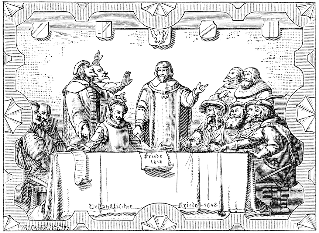
Or before that, in 1648, with the Treaty of Westphalia, and the first recognition of national boundaries as something more than real estate owned by the crown.
You can set your marker down with Luther, with Gutenberg, with Thomas Browne, Montaigne, Caravaggio — or Giotto.
For many, Modernism began with the Renaissance, but when did the Renaissance begin? 15th century? The Trecento? Or did it begin further north with the Gothic around AD 1150, which is really the first sparking of a modern way of thinking.
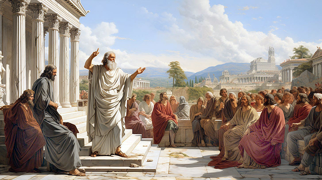
Perhaps, though, it is the Roman republic that divides modern political organization from more tribal eras before. Or you could vote for the democracy and philosophy of ancient Greece. Surely the time before that and the the time after are distinctly different. We recognize the near side of each of these divides as more familiar than the distant side.
You might as well put the starting line with the discovery of agriculture in the steppes of Anatolia and the river plains of Iraq. An argument can be made for any of these points on the timeline — and arguments could be made for many I haven’t room to mention.
Which leaves us the ultimate question: Is Modernism now over? Done with? Have we moved on, or is what we deem Postmodernism really just the next manifestation of the Modern? Perhaps AI is the new line drawn in history.
Perhaps the horizon should be recognized for what it is: an ever-moving phantasm. For those peasants digging in the manorial dirt in the Ninth Century, the times they were living in were modern. The first person recorded to use the term “modern” for his own age was the Roman writer Cassiodorus in the 6th Century. Each moment is the new modern.
Scholars know all this very well, and make their arguments in books and treatises, almost always with the caveat about drawing lines hard and fast. But the convenience of giving names is too seductive, and leaves the popular imagination with images like Monty Python’s “Bring out yer dead” or Elizabeth Taylor’s Cleopatra. Can we talk about the past without the labels we give it?
We need to understand the world is not binary, but a borderless spectrum of experience. Hawaii is now part of North America and Iceland is part of Europe. Electrons are particles and waves. Poland grew immense and shrunk, disappeared completely and reappeared and picked up its skirts and moved 200 miles to the west. And so, I wince every time I hear a red politician tell us with misbegotten certainty what gender roles should be, or that “male” and “female” are hard, definable categories with no subtleties. Or that “Left” and “Right” are hard-and-fast places where we must construct our redouts.
I admit we need words, categories, borders, and definitions to be able to communicate. We need to cut up our steak in order to eat it. But I would wish we could be more humble about their actual reality.
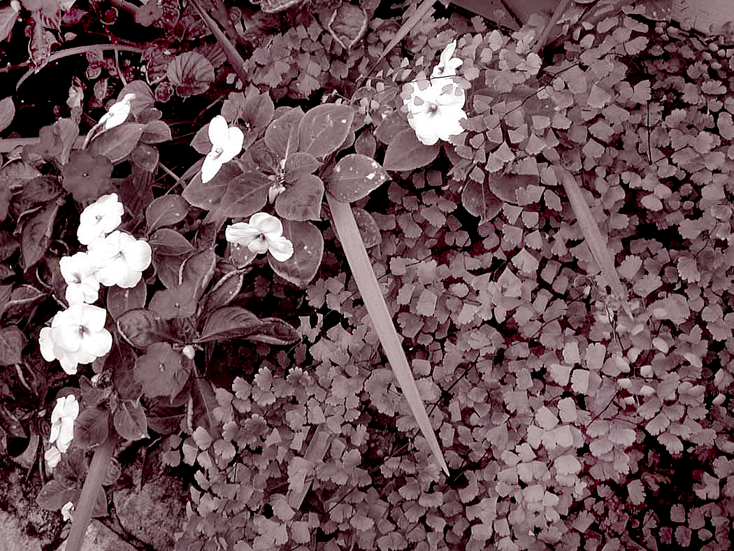
During the 1980s and ’90s, I made a series of photographs of gardens. Mostly the gardens of friends, and a few public gardens. And not photographs, but rather, photographs in series — groups of 10 or 20 meant to be seen as a single unit, much like a music suite: various movements making a single titled presentation.
There was a moment back then when “sequences” were fashionable. Duane Michaels made a living off them. But those were meant to be read like panels of a comic strip, telling a single story. Frames from a film.
But what I was thinking of was a series not a sequence. They were meant to be shifting moods or patterns, understood the way multi-movement music was heard. A suite of images: Allemande, Courante, Sarabande, Minuet, and Gigue, for instance. And intended to be understood as a single thing rather than merely a collection.
Whether I was successful or not, it was what I was thinking.
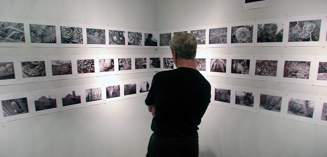
I created perhaps a dozen or so of these series, each boxed up and ordered, with a title card and with individual photographs shown in an order, and all taken during a single day as a single experience. I still work that way, although less formally. I had a show at Tidewater Community College in Virginia Beach, Va., where I had taught in the mid-1980s, and included 12 of these series on the walls. There were more than a hundred prints, lined up and organized by book.
I’ve continued to work in series, but it was gardens I focused on back then. The photos seemed personal without being intrusive. They were metaphors of their creators. I thought I might share a couple of them.
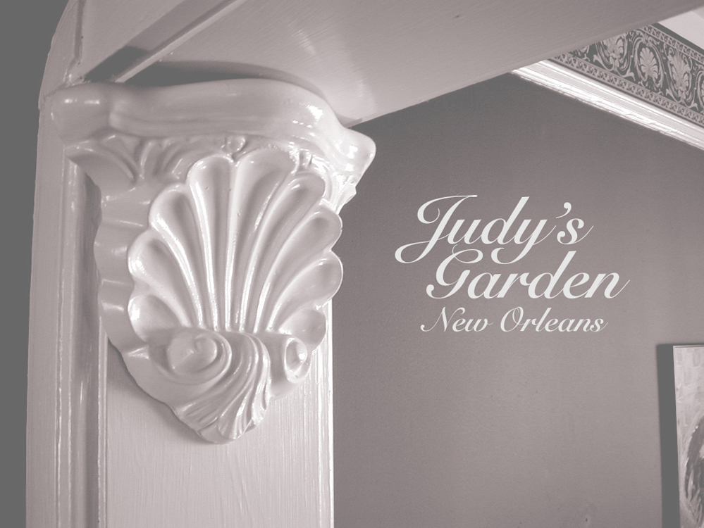
One of the first was made on a visit to New Orleans while staying with friends and former colleagues Judy and Dave Walker. Judy had been the food editor of The Arizona Republic and Dave, aka “Cap’n Dave,” had been our TV writer. They both left Arizona to work for the Times Picayune.
Judy was one of the most gracious and kind people I have ever known. She was one of those people everyone felt comfortable with and at home in any social situation. It was her garden that I thought mirrored her personality.
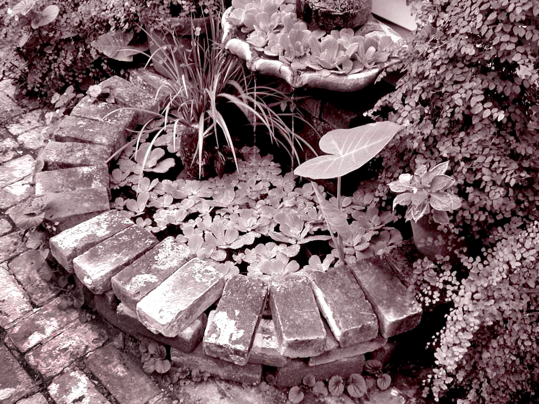
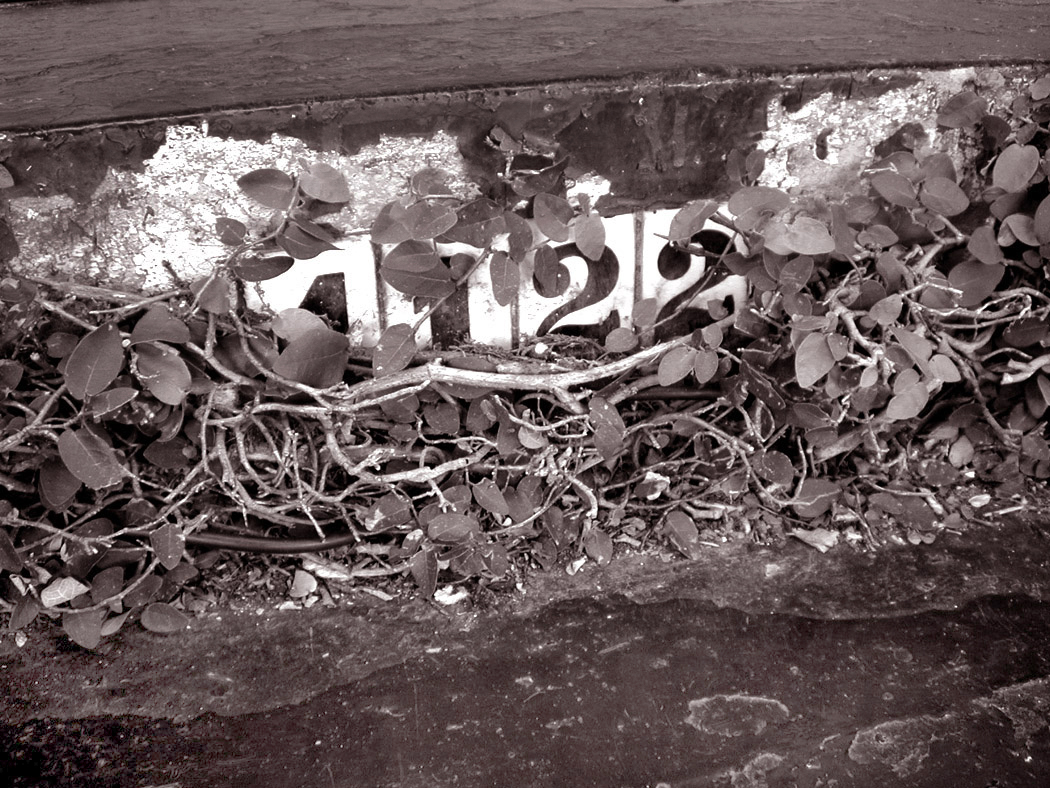
Here is that set, in order:
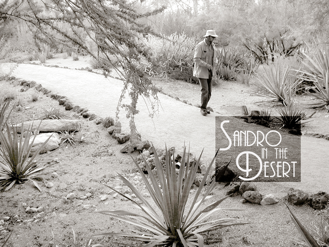
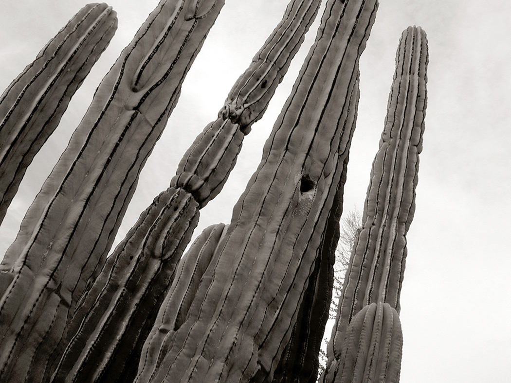
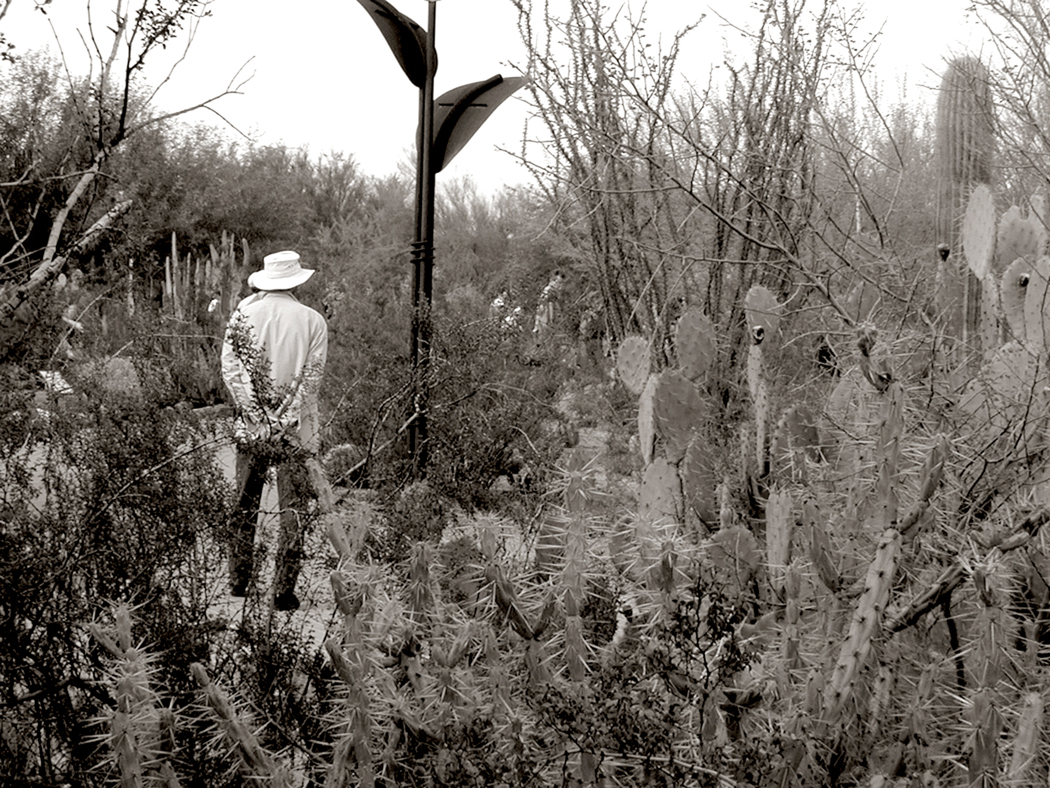
Another kind of series was of the public garden, in this case the Desert Botanical Garden in Phoenix. I had visited many times, walking the sunny paths through cactus, cholla, agave and boojum trees.
One winter, my friend Alexander came to visit us in the desert and I took him to the Botanical Gardens and we walked around all day. It was his first time visiting the West and I got to see it all again for the first time through his eyes.
I first met Sandro — for that is what we call him — my sophomore year at college. He was nuts about classical music and we spent many hours in each others’ dorm rooms spinning vinyl on our portable stereos. We became lifelong friends and spent many camping trips to the Outer Banks. And later, when I was going through a rough patch in life, Sandro and his wife, Mary Lou, took me in and gave me a place to live, fed me and took care of me. I am forever grateful to the two of them.
They later moved to Maine and live in an old farmhouse in Sullivan and I have visited them many times, although it has gotten more difficult now that I am old, and both driving and flying have become a problem.
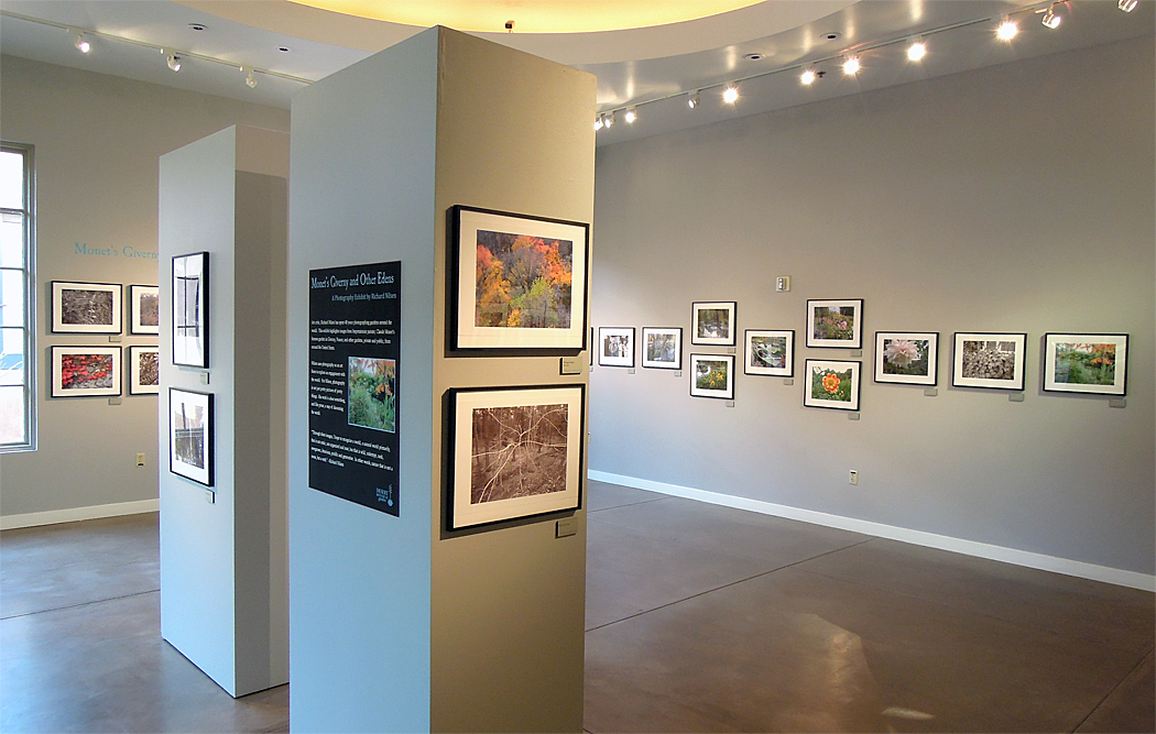
Later, just before I retired, I had a show of my garden photographs at the same Desert Botanical Garden, although this time, it was individual images from the series. The bulk of the images were of Monet’s garden in Giverny, but images from the earlier books were mixed in, in a show titled “Giverny and Other Edens.”
I now photograph my back yard and watch it through its seasons, and my own as well.
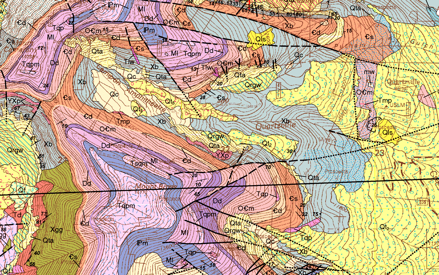
In the TV show, Big Bang Theory, physicist Sheldon Cooper claims that geology “isn’t a real science.” He’s quite a snob about it. But if you unfold any standard geological map — one that outlines the underlying bedrock of any state or county — you will see something so mindbogglingly complex and incomprehensible, that it couldn’t be anything but science.
A geologist is someone who can tell the difference between diorite and andesite, and can measure the schistosity of mica, and explain how seashell fossils came to be found on the top of Mt. Everest. Geologists find petroleum and metals under the earth, and tell us the Earth is 4.6 billion years old. And a good deal of what is written in the field is — much as with quantum physics — well beyond the ken and vocabulary of mere mortals.
They write things such as: “Mass transport deposits (MTDs) occur as intercalations within turbiditic sequences above the ophiolites. They represent syncontractional submarine slides that occurred on frontal accretionary prism slopes during the Late Cretaceous–Paleocene closure of the LPOB.” That, by the way is “Ligurian-Piedmont Ocean Basin,” in case you were confused.
Southern Utah
So, yes, they are scientists. And it’s fun to learn as much as you can, and collect interesting rocks and minerals. But geology is also for poets, artists and cooks. And it is the humanistic aspects of geology that have fascinated me since first studying geology in college.
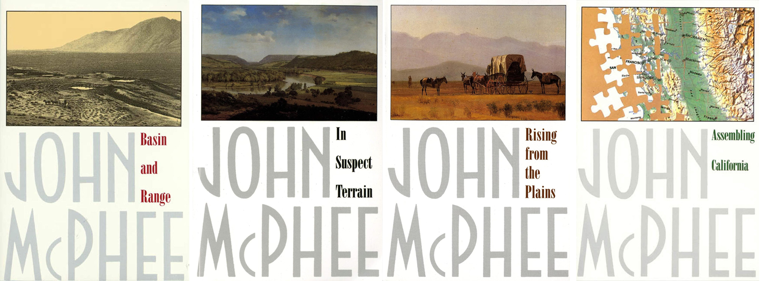
I read a good deal about geology, including the four books written by John McPhee in the 1980s — although they are about geologists as much as about the rocks they study. They are at the comprehensible boundary between general and specialist knowledge. And you’ll never drive through an interstate highway roadcut the same way again.
Along the Colorado River, Utah
Geology is just everywhere and affects all of our lives not only daily, but even hourly. Think of your car. Every bit of it, save only the rubber in its tires and the fabric or leather of its upholstery, came originally out of the ground. Whether it is the steel of its engine, the platinum in its catalytic converter, the glass in its windshield or the plastic of its dashboard — all dug out of the ground before being polished up and installed on your Hyundai.
And even your tires, these days, are only partially rubber. The rest of it was dug up, too.
The skillet in your kitchen is just a rock that has been processed. The knives, too, and the potato peeler. All just carefully refined stones. In many ways, we still live in the Stone Age; we’re just more sophisticated about it than those guys banging rocks together in the Paleolithic caves.
Paleolithic bison carving
Our human prehistory has been divided into the Paleolithic, Mesolithic and Neolithic. I suggest we now live in the Metalithic Age. (Everything now seems to be “meta.”) We do amazing things with the ore we dredge out of the ground and the petroleum we pump, but the foundation of our civilization is still geology.
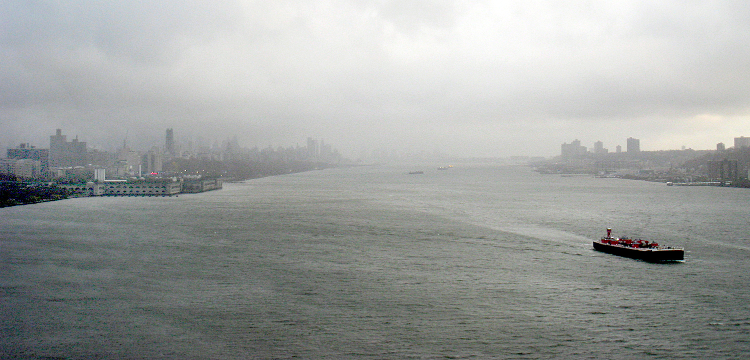
New York on the Hudson River
Cities are the index of civilization and most of the world’s great cities are built on harbors or rivers. The Indus, the Euphrates, the Nile, the Huang Ho. That’s geology. The cities are built with steel and concrete. Geology. Their streets are paved with either concrete or tar and gravel. More geology.
Our food grows in dirt, or grazes on the grasses that sprout from the soil — a soil derived from the bedrock underneath. What are vitamins and minerals but the residue of those same rocks?
Blue Hill, Maine
Geology drives history, too. For instance, because Norway and Greece are so rocky and ungenerous for agriculture, their peoples took to the sea and the Greeks colonized everywhere from Spain to the Black Sea, and the Vikings from Constantinople and Sicily to England and Iceland. Geology kept the Old World and the New from interacting significantly until 1492. It blocked the westward expansion of the British colonies in North America for a century. It is the reason that Afghanistan is the “graveyard of empires.” Plate tectonics — “continental drift” — and the formation of Eurasia as a single east-west landmass has been hypothesized as the cause for European and Asian historical dominance.
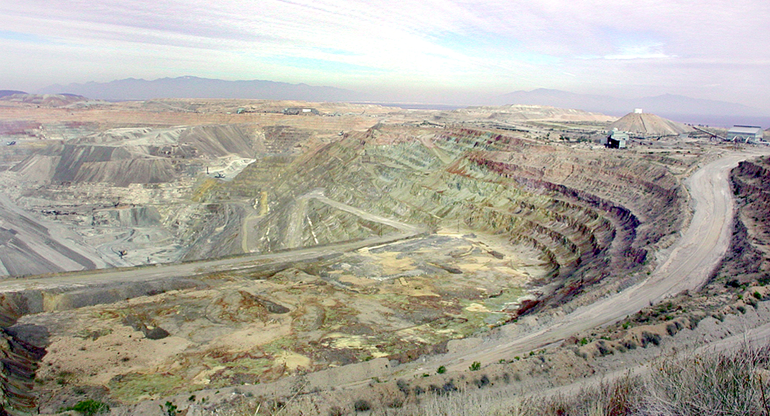
Asarco pit mine, Arizona
And geology, in the form of coal mining and petroleum extraction, is the cause of catastrophic climate change and global warming.
Geologist Donald Beaumont wrote, “Geology will, unfortunately, remain an under-recognized, ‘phantom,’ science in that its role in explaining the foundations for human society may never be fully appreciated.”
I’m not making the case that geology explains everything, nor that it is the only thing that made us what we are, but I am saying that it helps explain it, and that you can see the same forces acting out elsewhere in the world.
Olympic Mountains, Washington
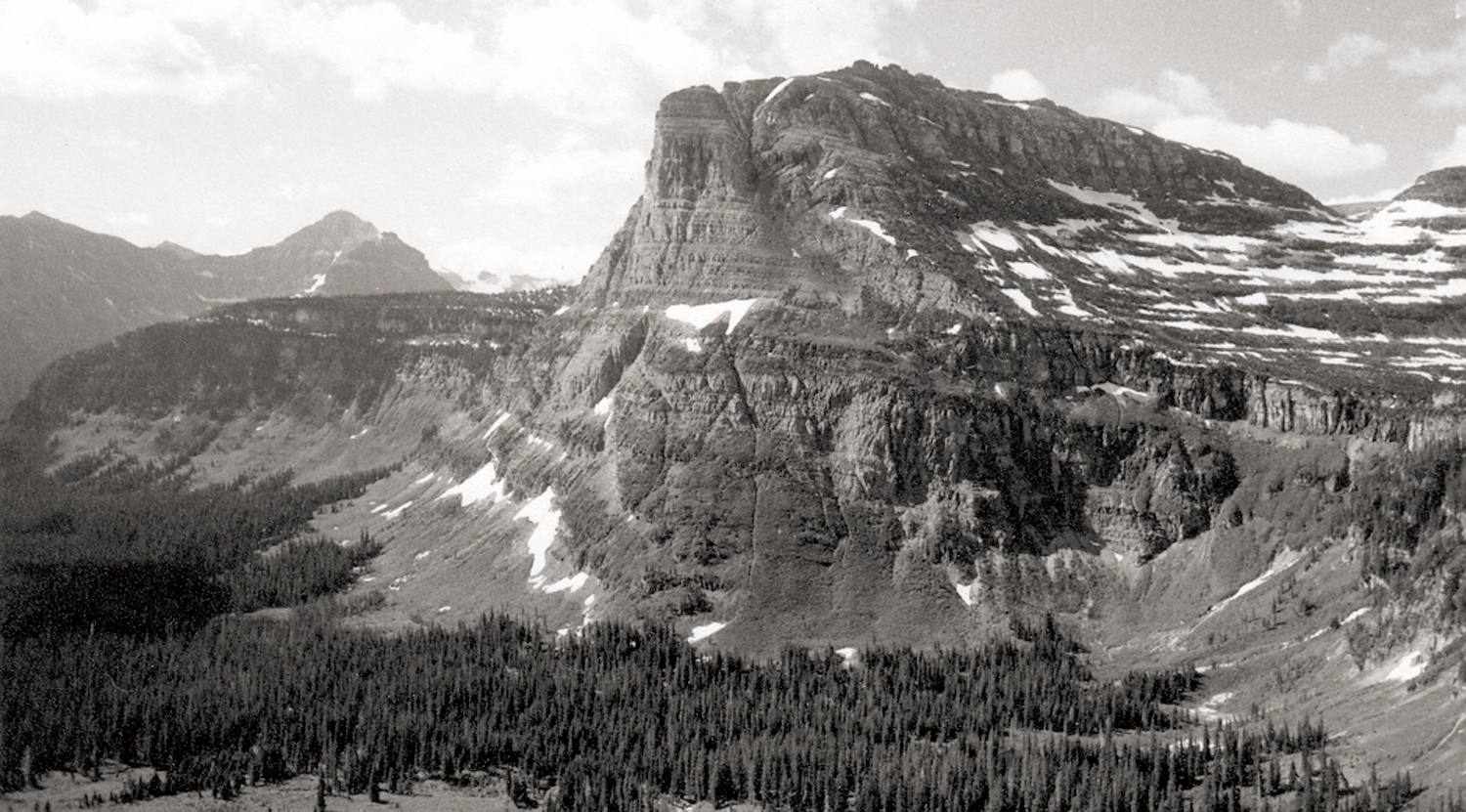
It isn’t only physical, it is psychological also. Geology creates emotions. And so artists and poets have used geology to elicit in their audiences certain emotional states — rocky metaphors.
Pleasant Cove, Chuckanut, Wash.
It is to seek this power that great landscape artists — whether painters or photographers — make their pictures. It is not to make a postcard of a pretty piece of scenery, but to find in the land a metaphor for thought, emotion or state of mind — or even a political philosophy.
Canadian Rockies, Alberta
That mythic force is why we feel the rise in our throats when we sing of “amber waves of grain,” and “purple mountains majesty above the fruited plain.” Rocks and terrain serve as metaphors for internal states.
“The Nymphs of the Luo River,” by Gu Kaizhi
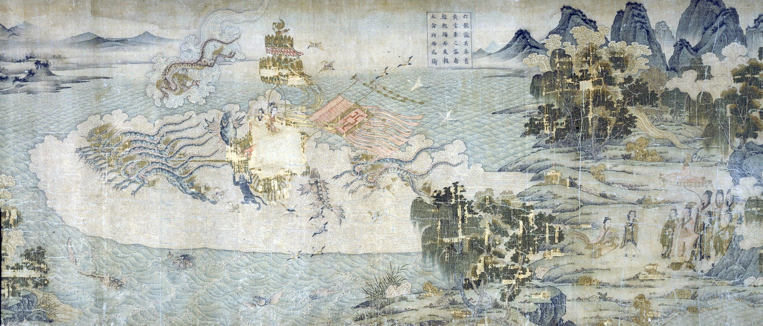
European artists have used that metaphor since the Middle Ages, Asian artists since the Jin Dynasty.
“La Gioconda” detail
Consider the Mona Lisa. Yes, it is a portrait, but behind the smiling lady is a rocky landscape. It is not like anything actually found in Italy, but rather it is a metaphorical landscape — a mountainous desert. Renaissance artists often used such stony views as a reminder that life on earth is a kind of spiritual desert (and the afterlife is where true fulfillment is to be found). As Geoffrey Chaucer wrote: “Here nis noon hoom, here is but wildernesse.”
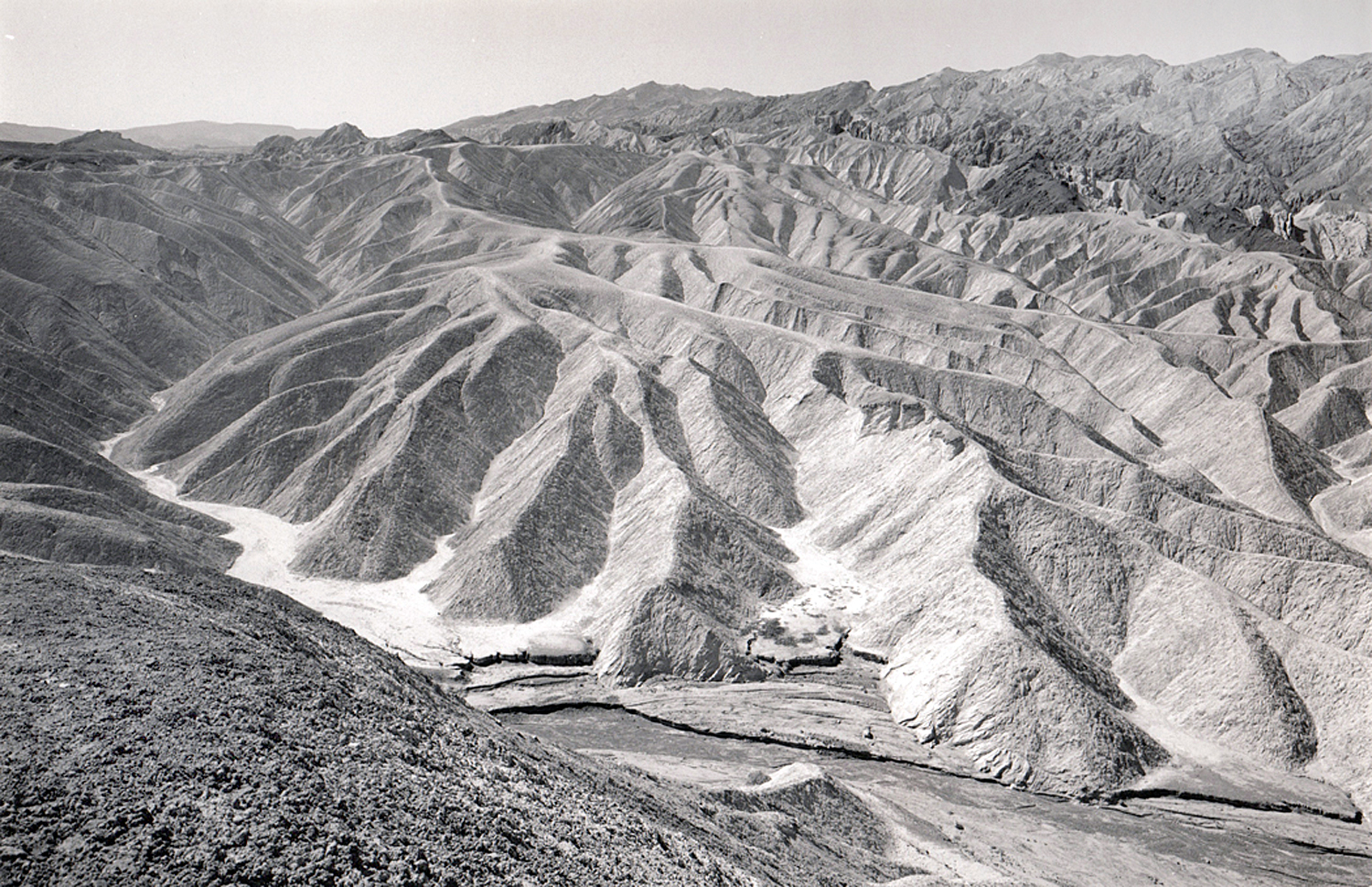
Zabriskie Point, Death Valley, Calif.
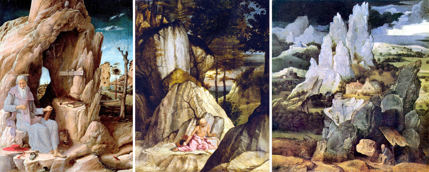
St. Jerome lived in a cave, and painters used the story to show the geology of spiritual isolation. Here are only three of many Renaissance paintings of the saint, by Andrea Mantegna, Lorenzo Lotto, and Joachim Patenier, all from the early 1500s.
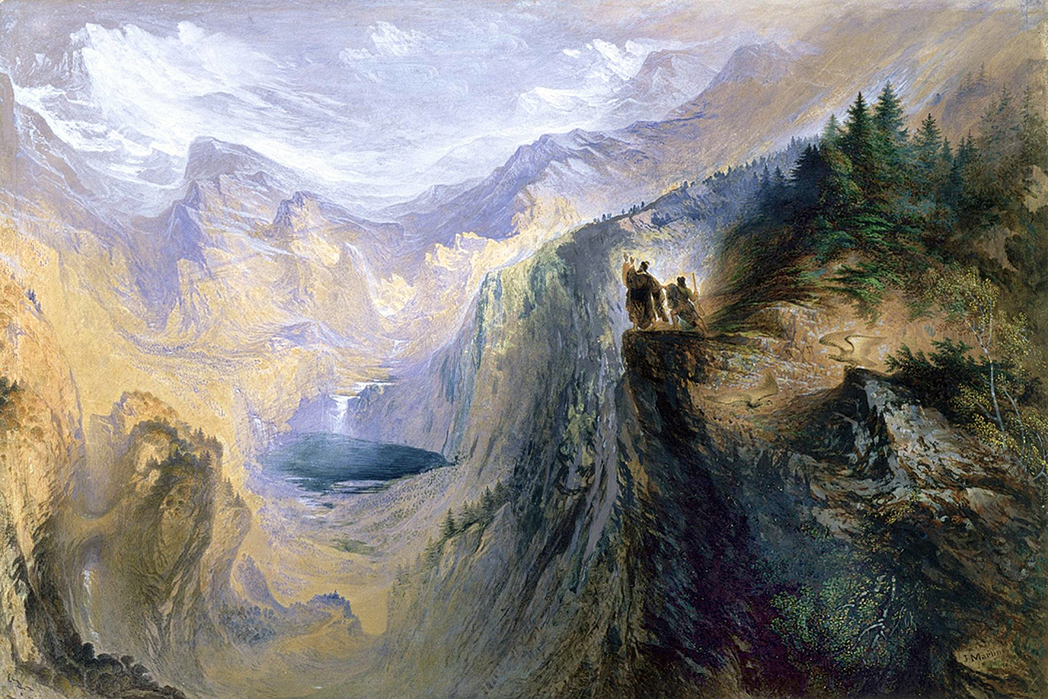
Romantic painters in the 19th century used the vast Alps as a reminder that the cosmos is infinitely larger and more impersonal than we like to believe. Geology becomes an image of The Sublime.
“Manfred on the Jungfrau” by John Martin
Chinese landscape painting features some amazing mountains. I used to believe these scenes were pure fantasy, but no, these mountains actually exist. On porcelain, by Huang Huanwu, a traditional painting — and a photograph, to prove they’re real.
Three paintings and a photo
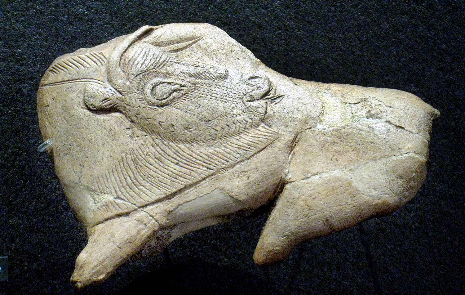
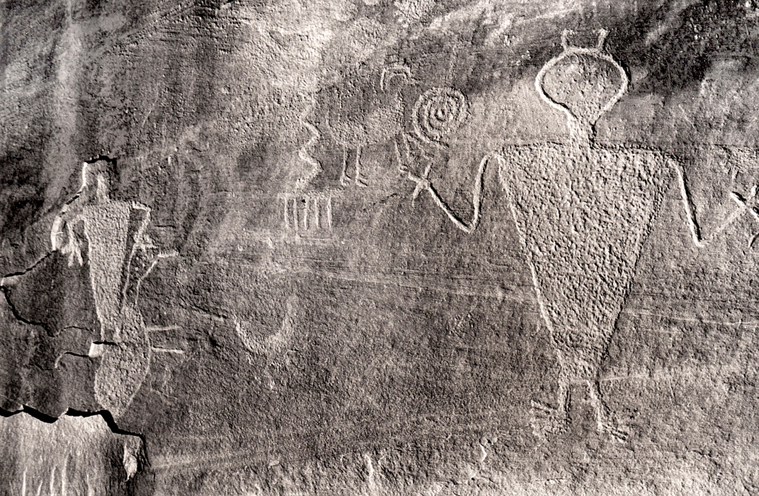
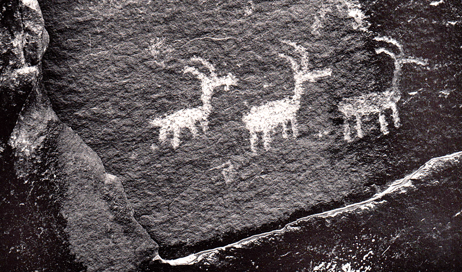
Prehistoric peoples used the rocks for their art, too.
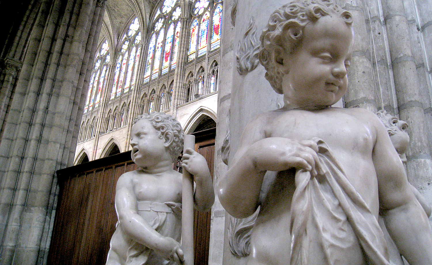
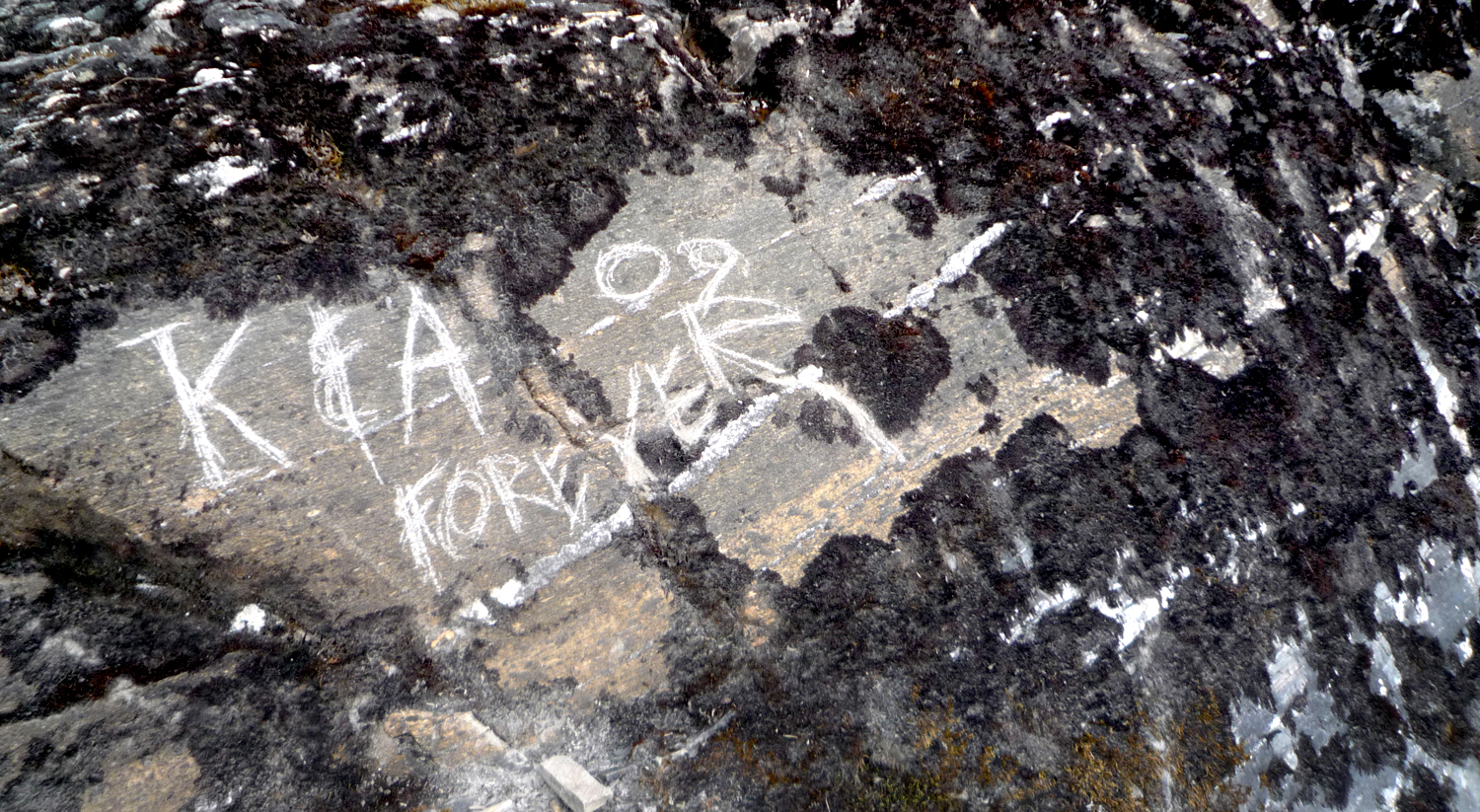
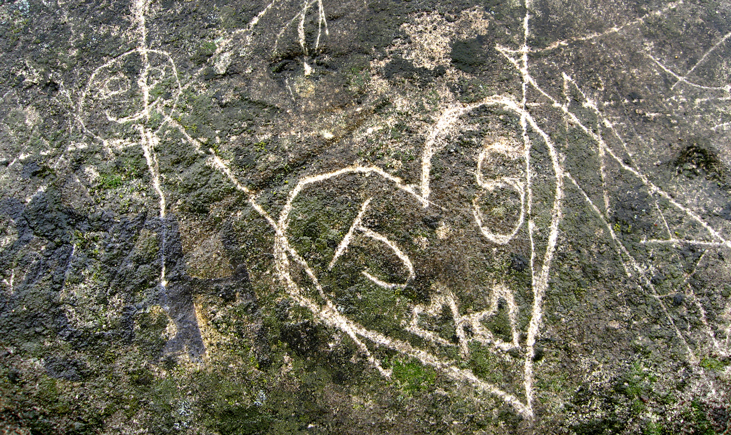
We use stone for permanence. Consider all the marble statuary and granite architecture.
And the way we scrawl our names on rock faces. “K and A Forever.”
The stone is certainly more permanent than the relationship.
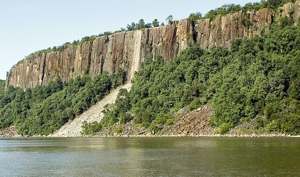
Hudson River Palisades, N.J.
Even the pigments that artists use comes from the ground. In the past, it was actually rocks that were ground up and processed. Now, there are pigments also made from petroleum.
Lapis Lazuli
Different rocks, with their colors and textures, evoke different emotions. Think of a brilliant diamond or ruby; think of a cinder. Different emotions.
Mendenhall Glacier, Alaska
We use geology in our language, although often the words mutually exclusive import.
“You must have been stoned when you thought that up.” “No, I was stone cold sober.” “Well, the theory is either a bit rocky or it is rock-solid.” He answered with a stony silence.
Schoodic Point, Maine
The colors, textures and the grain all impart meaning.
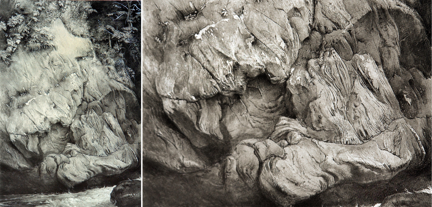
By John Ruskin
I began seriously considering the art elements of geology after seeing a splendid drawing of gneiss by English artist and critic John Ruskin. He made it over several days while visiting Scotland in 1853. The drawing had everything I respond to: texture, detail, close observation and an attention to the world as it is, that is as close to love as is possible to hold for the inanimate world. Ruskin was an astonishing draftsman.
By Mel Steele
It has been one of the lessons of the 20th century and Modernism that meaning in art can transcend anecdote and be more than a story told in a still scene and can impart meaning purely through shape, color, texture, line and scale. Emotions can be evoked by all of them. We have had well more than a hundred years of abstract art.
Even realistic painting depends on the medium it is made from. It isn’t just the face or the scene, but the color and texture of that face and scene.
Craggy Gardens, N.C.
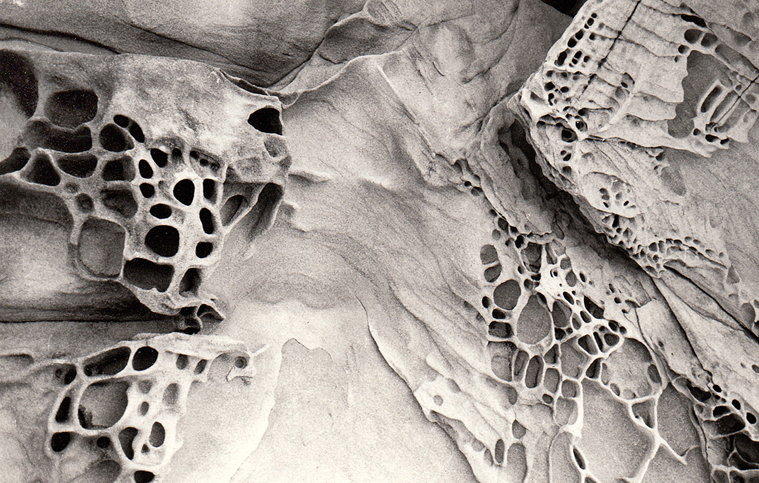
And a camera pointed at the shapes of geology can create meaning in the same manner as the abstract painting we lionize.
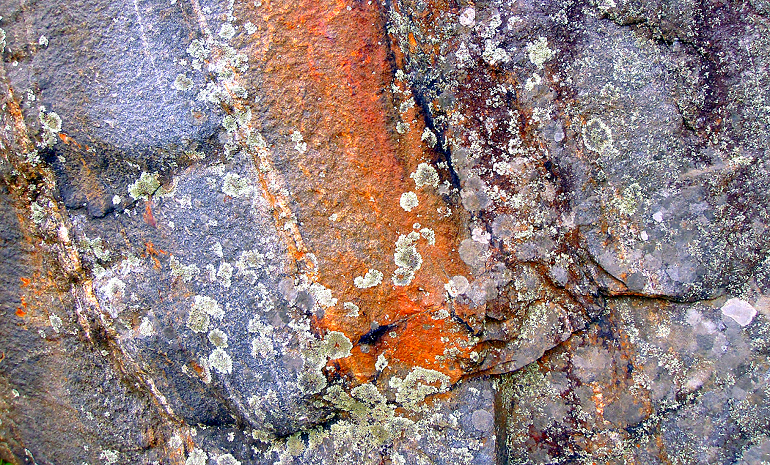
I have since found many rocks, with their esthetic pleasures. There is bright color
Blue Ridge Parkway, N.C.
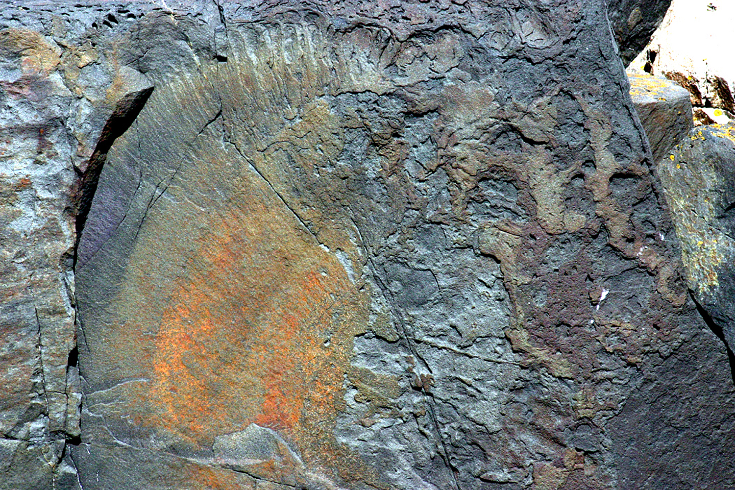
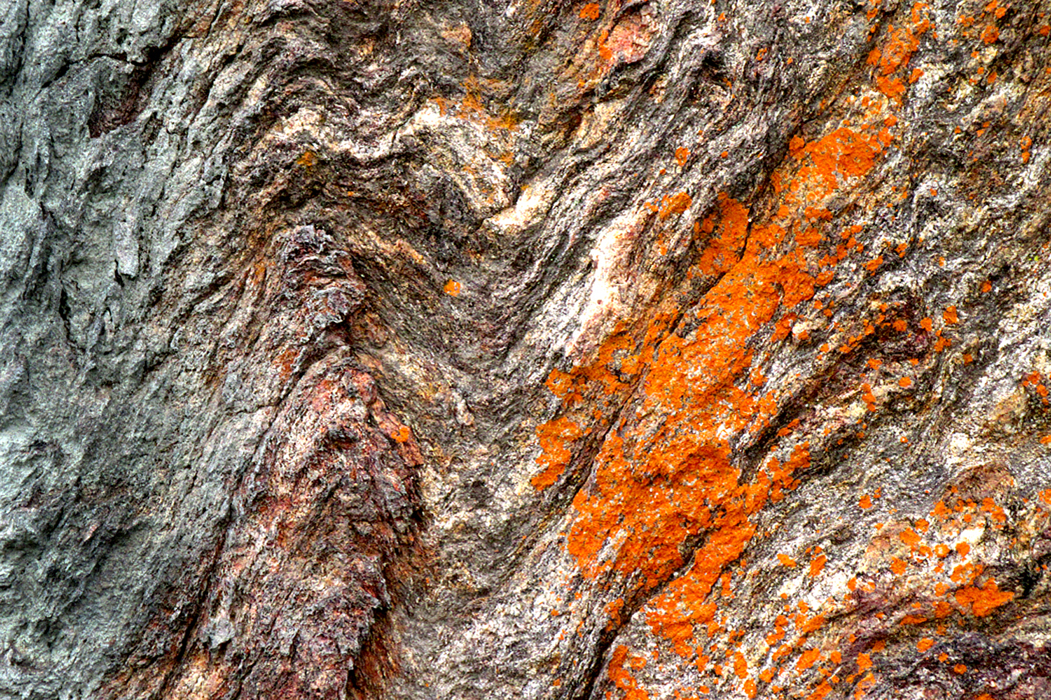
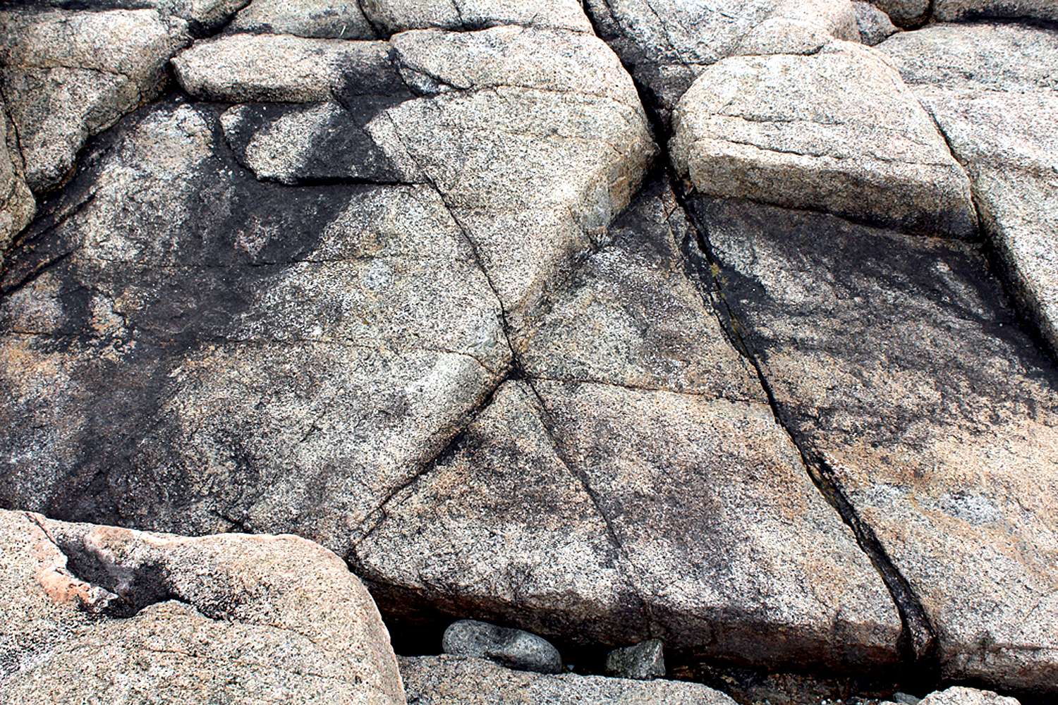
There is gnarly texture
Blue Ridge Parkway, N.C.
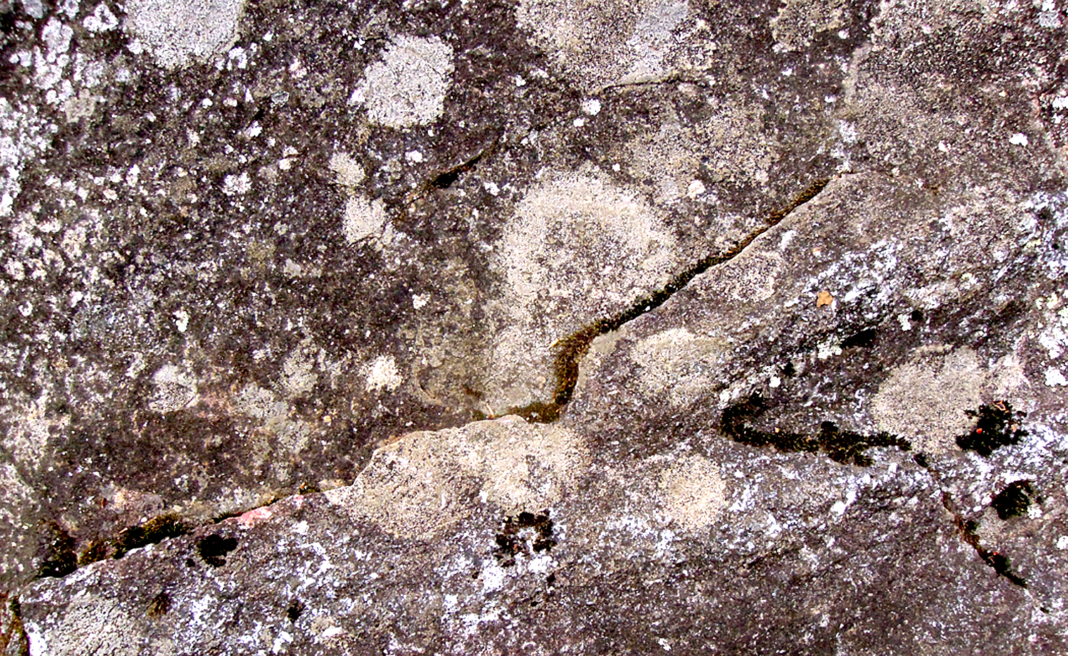
There are planes of surface
Schoodic Point, Maine
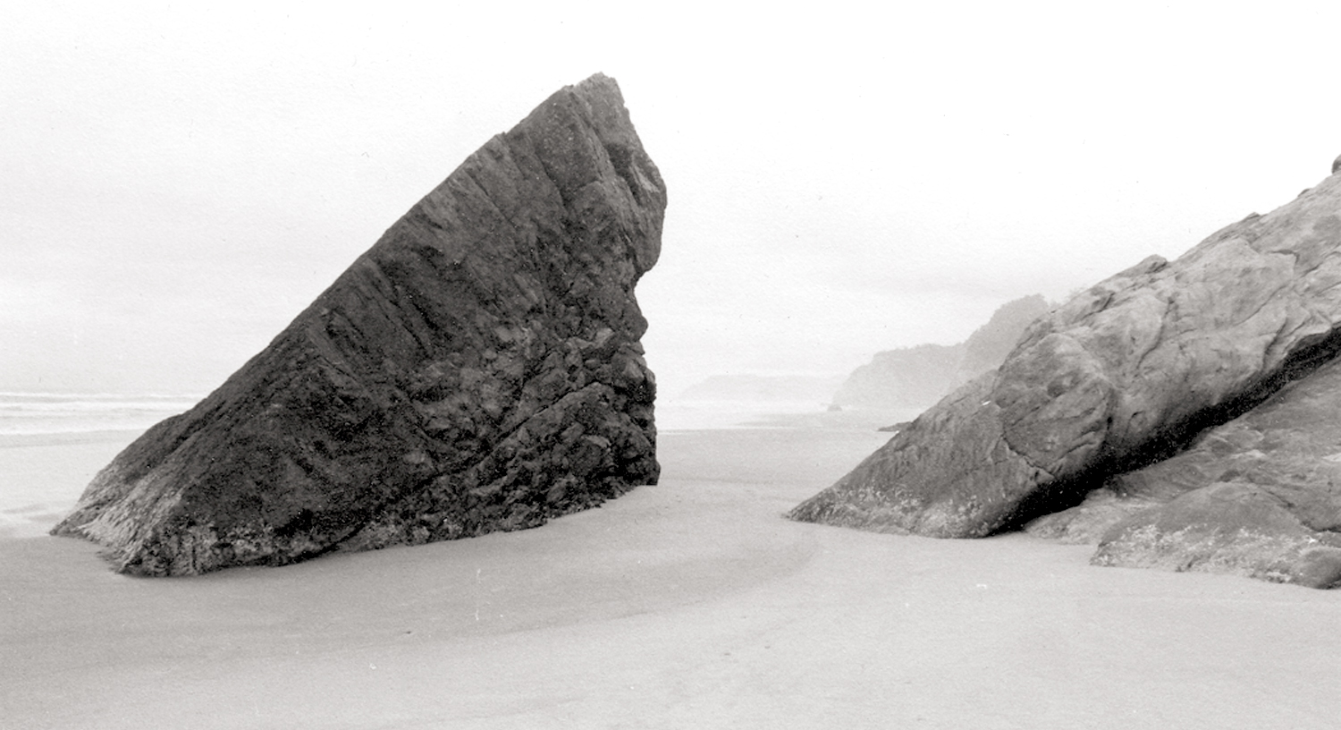
Repetition of shapes
Hug Point, Arch Cape, Ore.
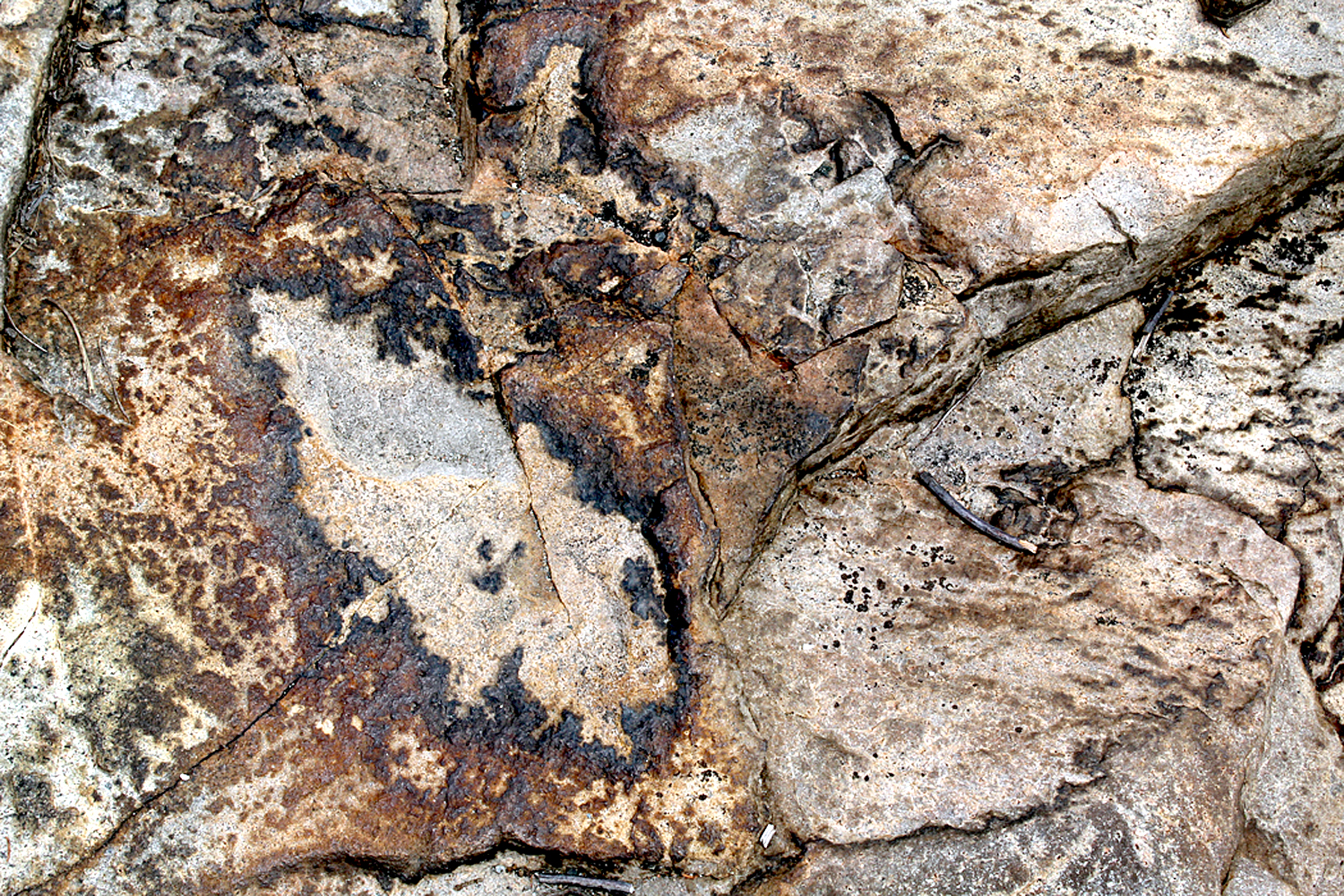
Complexity of image
Schoodic Point, Maine
And a starry night
Pisgah National Forest, NC
Or flying over the continent and looking down at erosion
Over Colorado
One of the primary functions of art is to make us pay attention. It is an interaction with the world and a response to it.
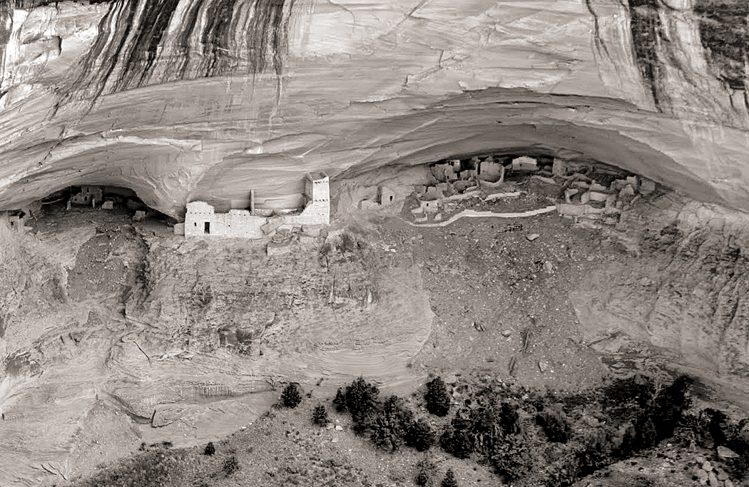
Rio Puerco Ruins, N.M.
The most important lesson I was ever taught was by a college professor who would not accept glib work. Like many bright students, I was adept at giving a teacher what he or she wanted — basically repeating back what was said in class. But when I did that in my English Romantic Poetry class, he gave me a D for a paper that was otherwise correct in every aspect except one. “Don’t give me back what I’ve said,” he told me. “Engage with the material.” Real engagement cannot be faked.
What was real were the words written, not the words written about the words. Dive directly into the poetry. Don’t waste time learning “about” the poetry.
Try to take the material under study seriously and be real about it. If what you find contradicts what the teacher said, all the better. You’ve learned something.
Engage with the material — something you should do with friends, family, society, even the air and the rocks. Engage. Don’t gloss.
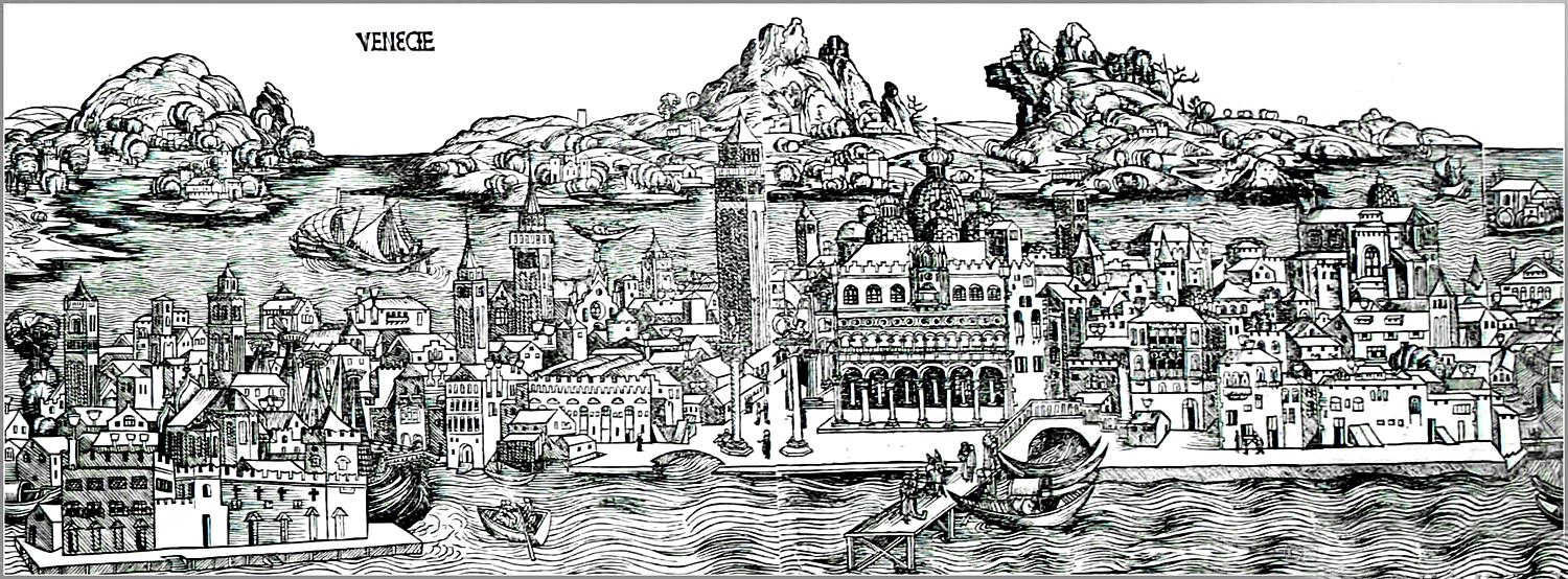
In 1494, at the age of 23, after years of apprenticeship as an artist in Nuremberg, Albrecht Dürer left Germany to visit Venice and Italy and find out what all the Hoohah was about. He was amazed at what he saw and when he returned home to Germany, he brought the Italian Renaissance with him. He went back south for seconds in 1505 and stayed for over a year, soaking up the influences. It was what he had to do if he wanted to see what the Big Boys were doing.
If you wanted to see, you had to travel. There were no full-color coffeetable art books to thumb through. If you wanted to see the work of Bellini, you had to go to Venice; for Raphael, to Rome.
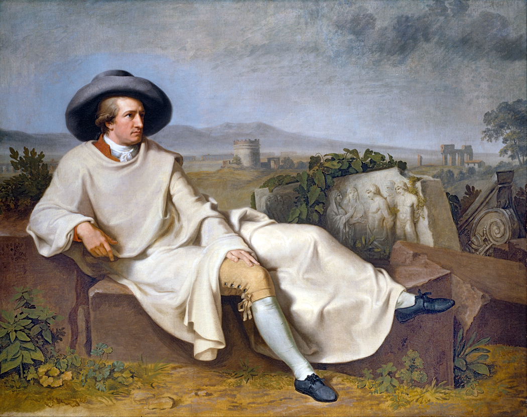
“Goethe in Italy” by Johann Heinrich Wilhelm Tischbein, 1786
In 1786, Johann Wolfgang von Goethe, then age 37, made the trip, this time to see the Roman and Greek sculpture that had been so highly praised in the work of Johann Joachim Winckelmann. He stayed until 1788, studying more than the statues, including many statuesque young women, which he later wrote about in his book of poetry, Roman Elegies.
For most of history — until improvements in color printing in the middle of the 20th century — the only way to see famous art was to leave home and go there. Yes, there were engraved black and white copies published, and later monochrome halftones, but you could not really get a sense of Rembrandt or Titian without traveling.
It gave rise in 17th century to the practice of upper-class families sending their sons on the “Grand Tour” to become educated and cultured. From the 1600s to about the middle of the 19th century, it was common for well-off young men to take a “gap year” — or two — to visit the Continent and see the sights and become men of the world before taking up their roles in government or business. Of course, many of these youths were more attracted to the live demoiselles and regazze than to the canvas madonnas.
“Rose,” Philbert-Louis Debucourt 1788
It wasn’t just visual art. Before recordings, if you wanted to hear a Beethoven symphony, you had to attend a live concert. If you lived outside the city, you had to travel to get to the concert hall. Bach famously walked 280 miles from Arnstadt to Lübeck in order to hear Buxtehude play the organ. Even to hear now-famous symphonies and concertos you likely had to wait years between programmed performances. You might be lucky to have heard Beethoven’s Fifth once or twice in your life. Now, it seems, you can’t get away from it.
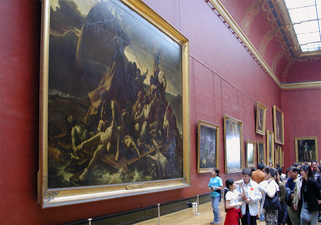
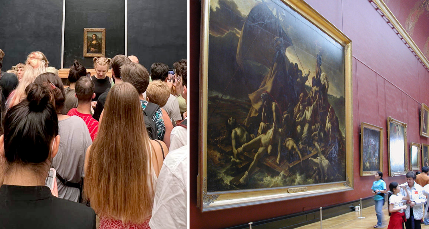
Today, when you can own 30 different CDs of the Beethoven symphonies and have your choice from Furtwangler to Norrington; you can fill your bookshelves with illustrated volumes of any artist you want; and watch endless YouTube videos about the Mona Lisa, it is important to remember that they are not the actual experience of the art in question, but varyingly faithful simulacra. You still need the real thing. A three-inch color plate of Gericault’s Raft of the Medusa cannot replicate the experience of seeing the real thing.
And so, we go to museums and galleries to get to know the art that is our cultural inheritance. Even today people travel across the world to see some of the world’s most famous art. The Grand Tour still exists, if only in ghost form, as a gap year or a summer abroad. My granddaughter had her high school summer in Italy. The traditions continue. Such travel affords an education that books just cannot give.
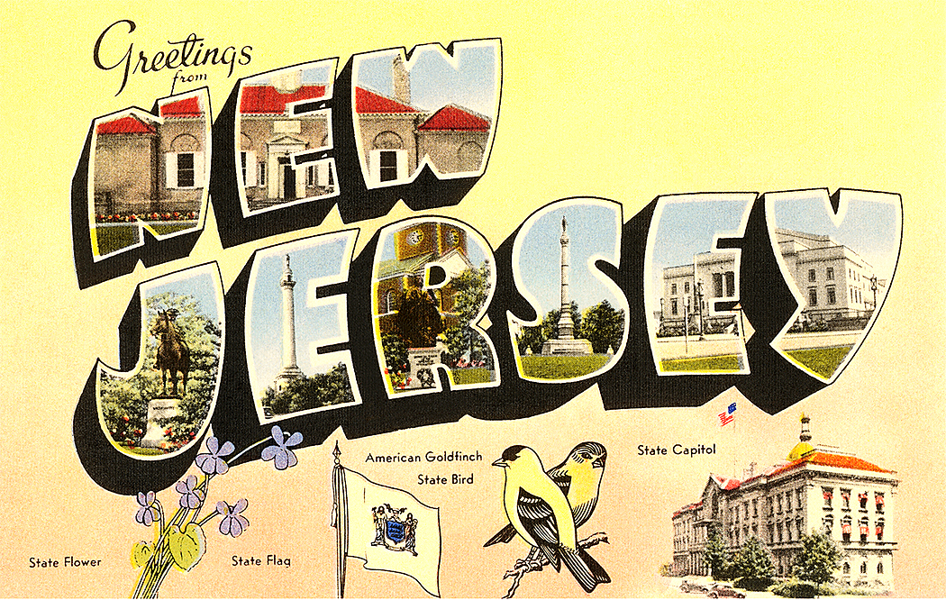
In the 1960s, I accompanied my grandmother when she went back to the Old Country for the first time since she was five years old. We went to the village where she was born, Mosby, in southern Norway, and as part of that trip, I was sent on a (literal) Cook’s tour of Western Europe, taking in Germany, the Netherlands, Belgium, Luxembourg and France. I saw the Cologne cathedral, Notre Dame de Paris, Ste. Chapelle and the Louvre, among other things. Mostly, it made suburban New Jersey seem even more banal.
Met; Guggenheim; Frick; Whitney; Cloisters; MoMA
But then, I tried to escape the Garden State as much as possible. I was lucky: I had my own Grand Tour just a few miles away. During my own high school years, living on the Jersey side of the George Washington Bridge, I spent as much time as I could in Manhattan, going to concerts and visiting all the museums: The Met, the Guggenheim, the Frick, the Whitney, the Cloisters, the Asia Society, even the long-gone Huntington Hartford Gallery of Modern Art on Columbus Circle.
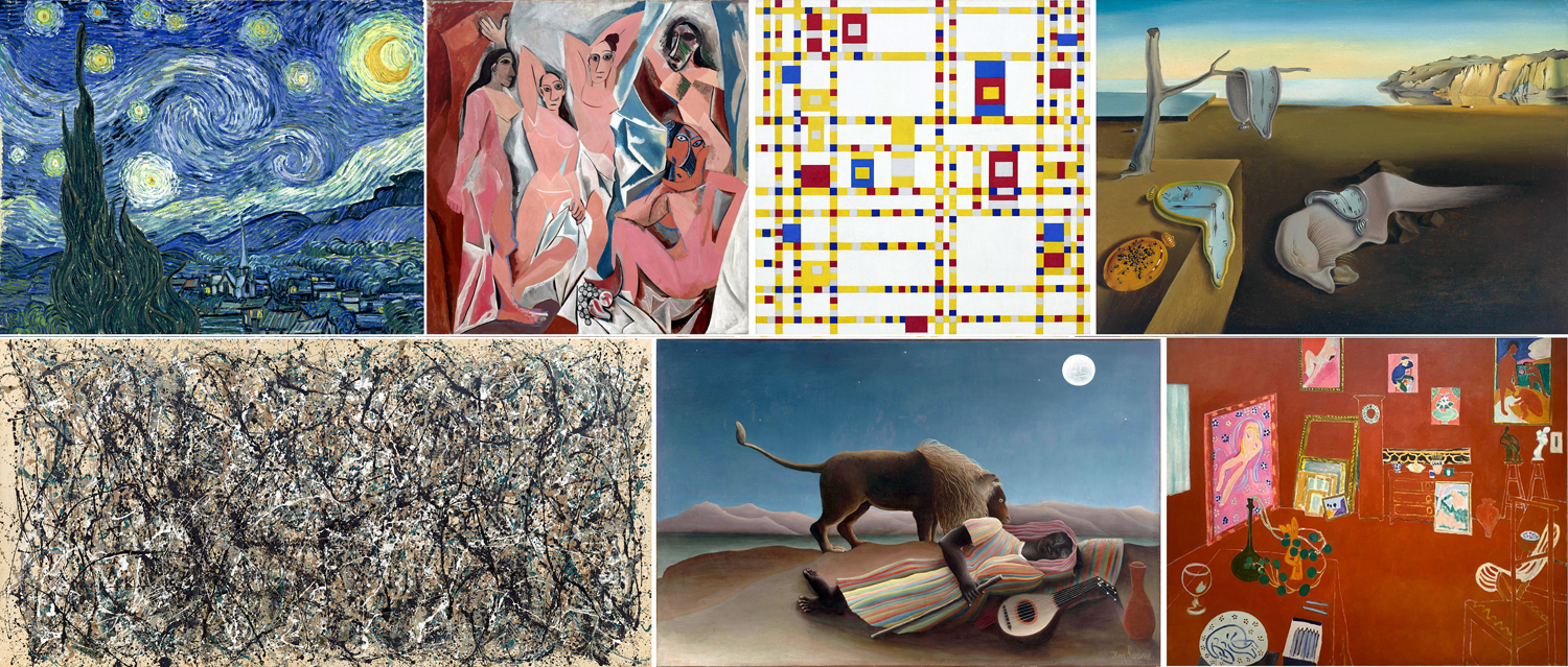
And most of all — the Museum of Modern Art, where I felt most at home. I came to know many famous paintings as old friends. Van Gogh’s Starry Night; Matisse’s L’Atelier Rouge; Picasso’s Demoiselles d’Avignon; Pollock’s One Number 31; Mondrian’s Broadway Boogie-Woogie; Henri Rousseau’s Sleeping Gypsy; Dali’s Persistence of Memory — all proper blue-chip Modern Art landmarks.
After I went away to college, I frequently made the trip to Washington, D.C., to visit the National Gallery of Art, and later, the Hirschhorn and Corcoran. I ate up art like a starving man. It’s hardly surprising that I later made my career as an art critic.
And working for the newspaper, I was sent around the country for major exhibits in Boston, New York, Chicago, LA, San Francisco, Seattle, Philadelphia. I was even sent to South Africa in 1989 to study the art scene there. And vacations brought me and my wife to France many times. Seeing as much as possible and finding troves of art in even small corners of the Continent.
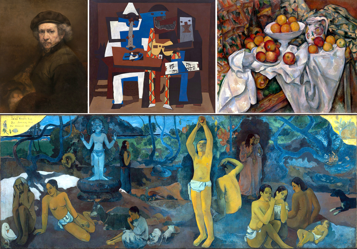
There have been dozens of important artworks I have been grateful to have known, not just in reproduction, but live, in front of my own eyes. My inner life is infinitely enriched by the experiences. There are many I could name, from Rembrandt’s self portrait in DC to Gauguin’s Where Do We Come From? What Art We? Where Are We Going? from Boston, but I need to pick out at least these six as central to my understanding of art, and of life.
When you know works from reproduction, you cannot feel their size, cannot know the precise colors and pigments used, cannot grasp their tactile surfaces. Some of the most famous art in the world is known to most people by their reproduction on coffee mugs, T-shirts or commemorative plates. What you think is art is really just iconography — the nameable subject matter. The actuality, the physicality of the work is irrelevant in such cases. Seeing the original can then be a revelation.
So here are the six works that have meant the most to me, that I am most grateful for having been able to know personally.
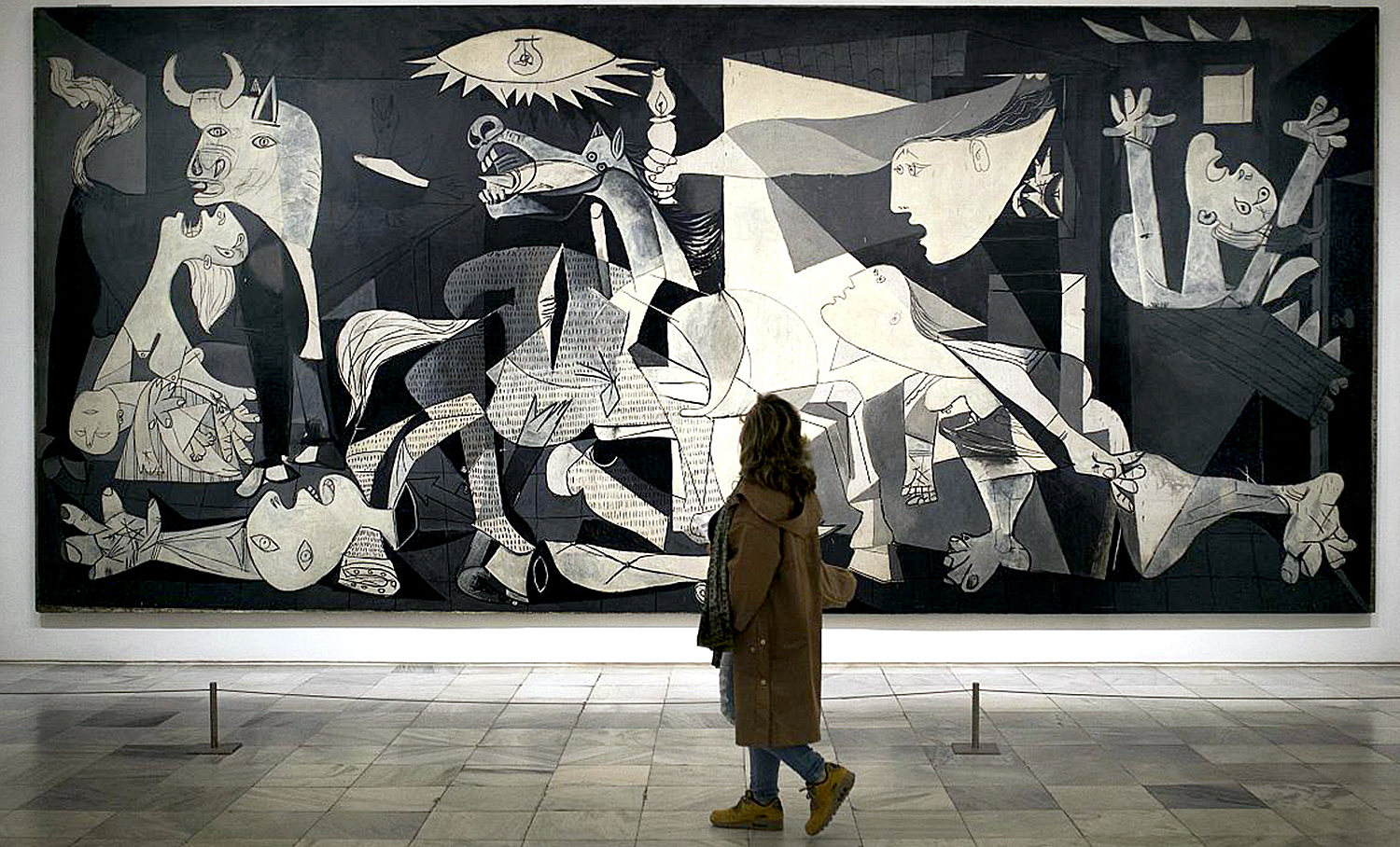
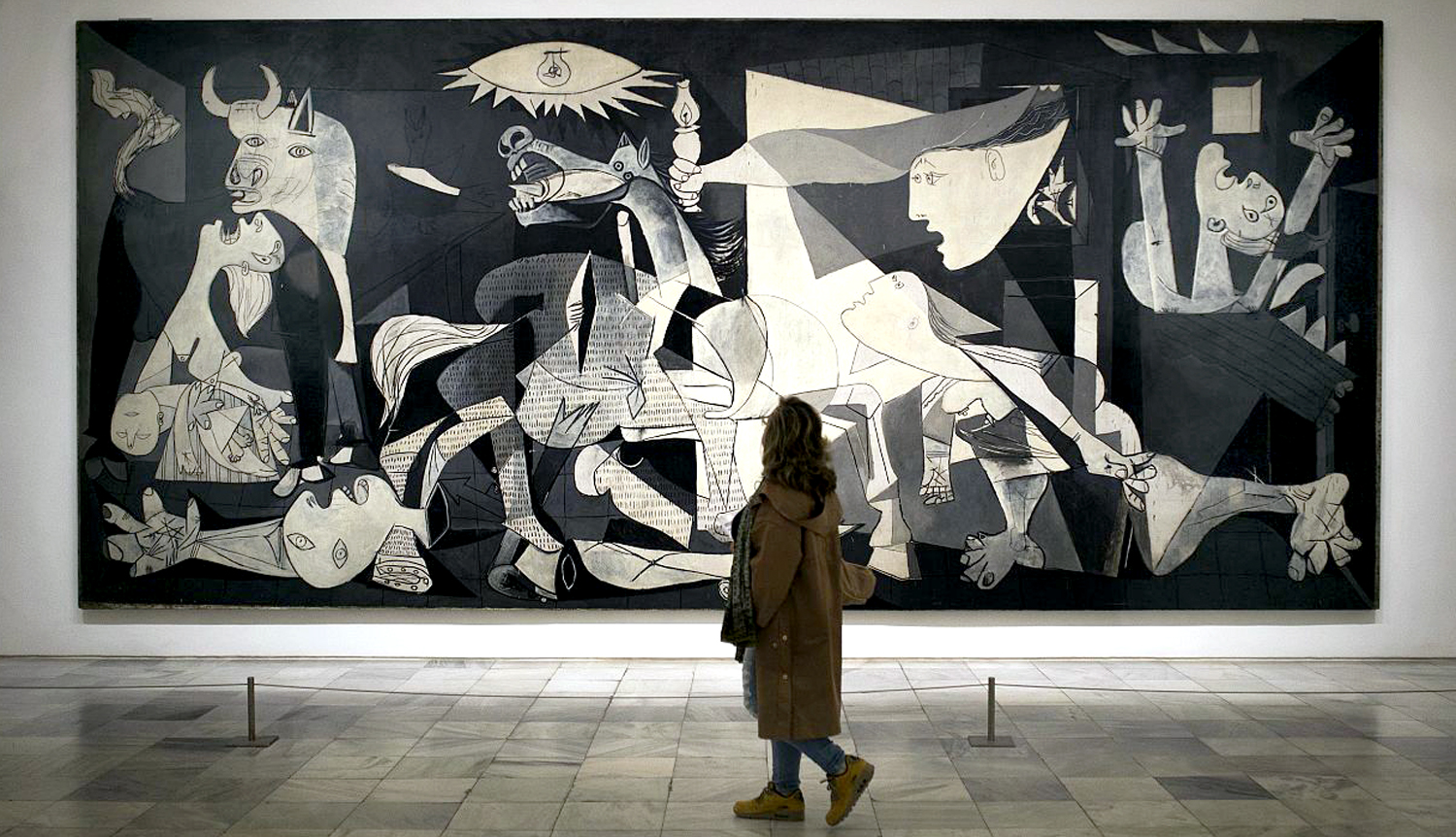
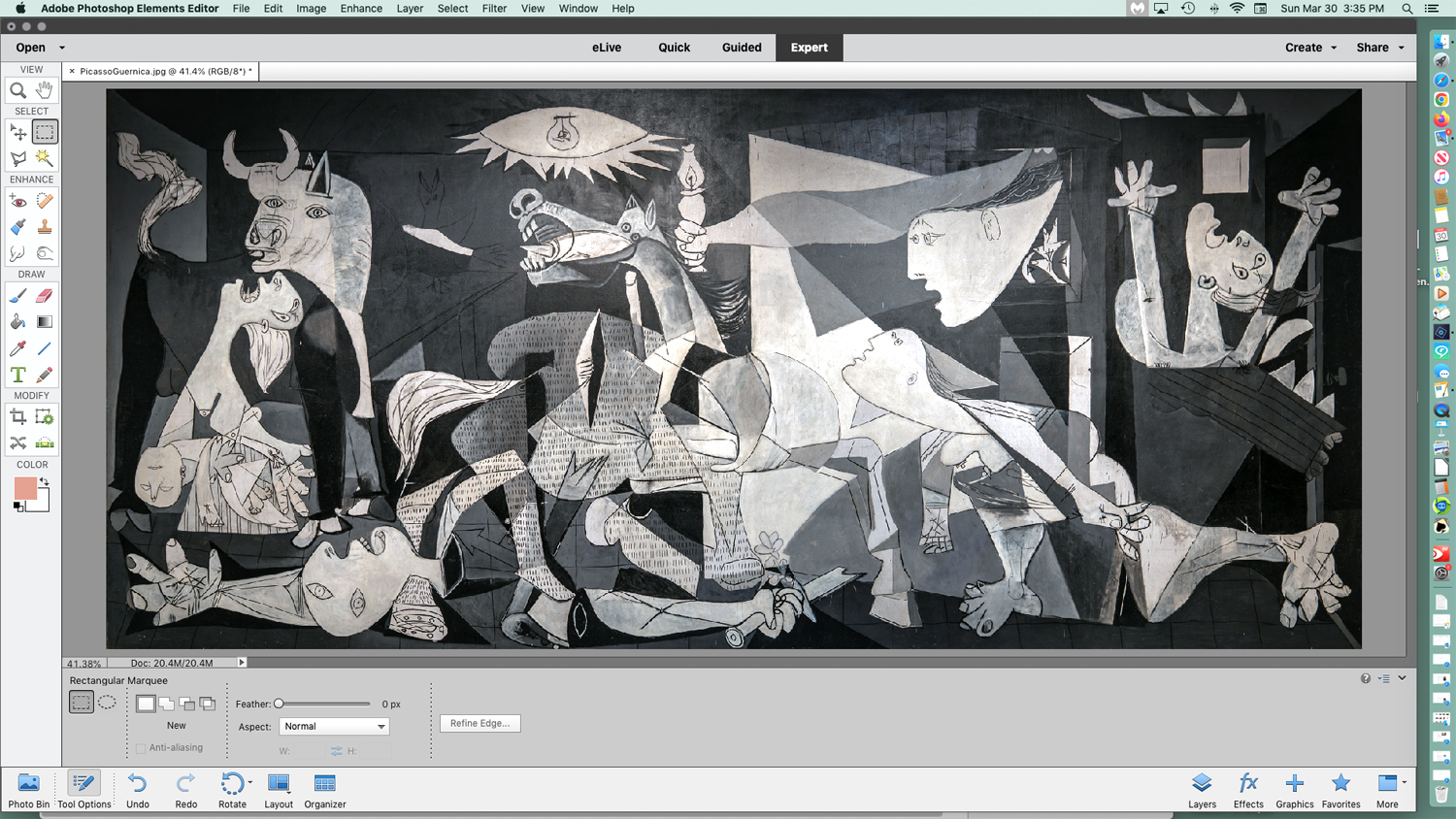
Picasso, Guernica — When I was growing up, this, perhaps the greatest painting of the 20th century, was sitting in the Museum of Modern Art in Manhattan, and I visited it often. As a teenager, I knew it was “important,” because I had seen it in books and magazines. But I thought of it as “mine,” because I knew it would always be there for me. Alas, in 1981, it was repatriated to Spain, where, I have to admit, it belongs. An old friend moved away. It was the first important artwork that I had what felt like a personal relationship with.
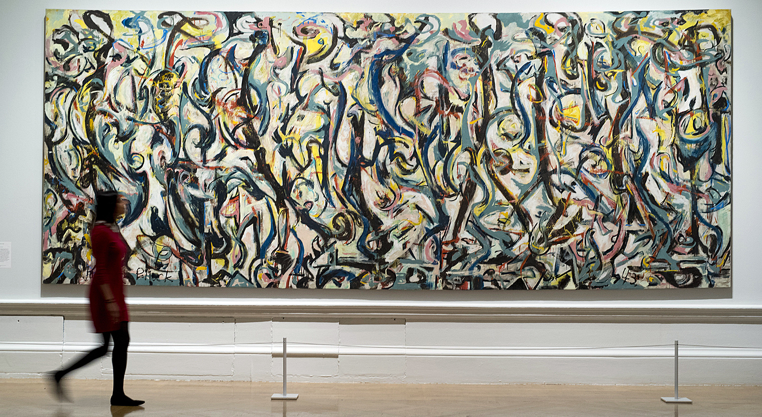
Jackson Pollock, Blue Poles — In reverse, Blue Poles is a painting that came to New York for me. Pollock’s 16-foot drip painting from 1952 was auctioned off from a private collection in 1973 and sent to Australia. I loved many of the great Pollocks from MoMA and the Met, but thought I had lost the chance forever to see perhaps his most famous work. But a retrospective Pollock exhibit in 1998 at MoMA brought it back temporarily to the Big Apple. I got to see it there, where it was the jewel-lit highlight of the last gallery.
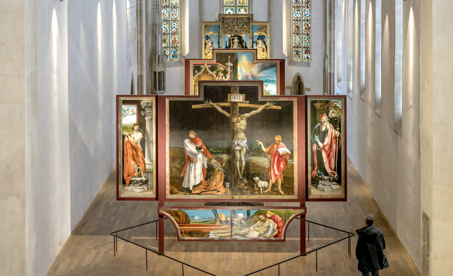
Grünewald, Isenheim Altarpiece — The giant altarpiece comprises 10 paintings by Matthias Grünewald, including the pathos-laden crucifixion as its centerpiece, and a group of polychrome wood sculptures by Nikolaus Hagenauer, executed between 1512 and 1516. It sits in the Unterlinden Museum in Colmar, Alsace, France. The altarpiece was designed to be either closed or open, with various panels showing at different times in the Catholic calendar. I have no stake in the religious significance, I cannot help but be overwhelmed by the pathos and power of the work.
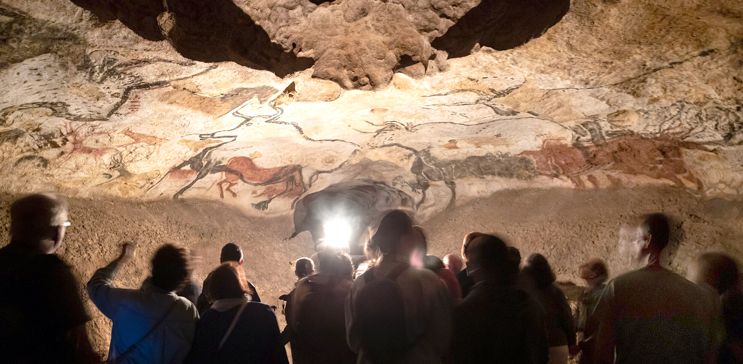
Lascaux II — The cave paintings at Lascaux, France, date from about 20,000 years ago. They were discovered in 1963 and include about 600 images of prehistoric animals. The caves have been closed since 1963 to protect them, but a copy has been made and open to the public. I never thought I would get to experience them, but I got to visit both the reproduced experience at Lascaux II, but also the genuine cave art at nearby Font-de-Gaume. Seeing the original art there threw my spine into a buzz of uncanny deep-time — a state not rational but limbic.
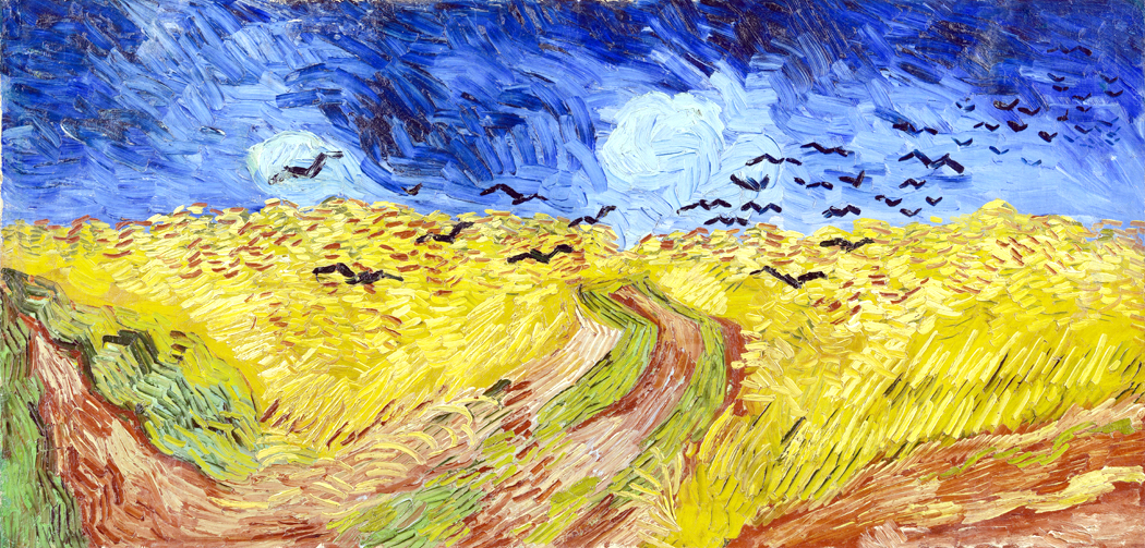
Van Gogh, Wheatfield with Crows — In 1999 the LA County Museum of Art mounted a 70-piece show of the paintings of Van Gogh from the Van Gogh Museum in Amsterdam, including many of his most famous works. My job got me sent to cover the exhibit and I was blown over by the works (also, astonished at how amateurish and awful many of his early works were: It took a while for Van Gogh to become Van Gogh).
One of the last paintings in the last gallery was Wheatfield with Crows and up close you could see who wild and feverish the artist’s brushstrokes were, and what colors sat on his pallete, left largely unblended on the canvas.
North Rose Window, Chartres Cathedral — I have been back to Chartres many times, and each visit, I spend a half hour, at least, sitting in the transept staring at the North Rose Window. It is, as I have said many times, the single most beautiful man-made creation I have ever seen. It is transcendent, a glowing object of meditation, whose shapes seem to move, to dance around the centerpoint. I am awe blasted. It almost makes up of all the misery, suffering and death human beings cause to each other.
This is, of course, a limited selection. Before writing, I made a list of paintings, sculptures, plays, operas, architecture, poems, novels — I could just make a list of the types of art that would already be too long to include in a single blog entry. Narrowing down to visual arts still left me with too many things to write about — hence my squeezing it all into only six works. (It tried to make a conventional 5, but I already feel bad about only including six.)
Seeing all this art and lamenting all that I never had a chance to see, only reinforced my sense that art is not just what makes us human, but how it makes us human.
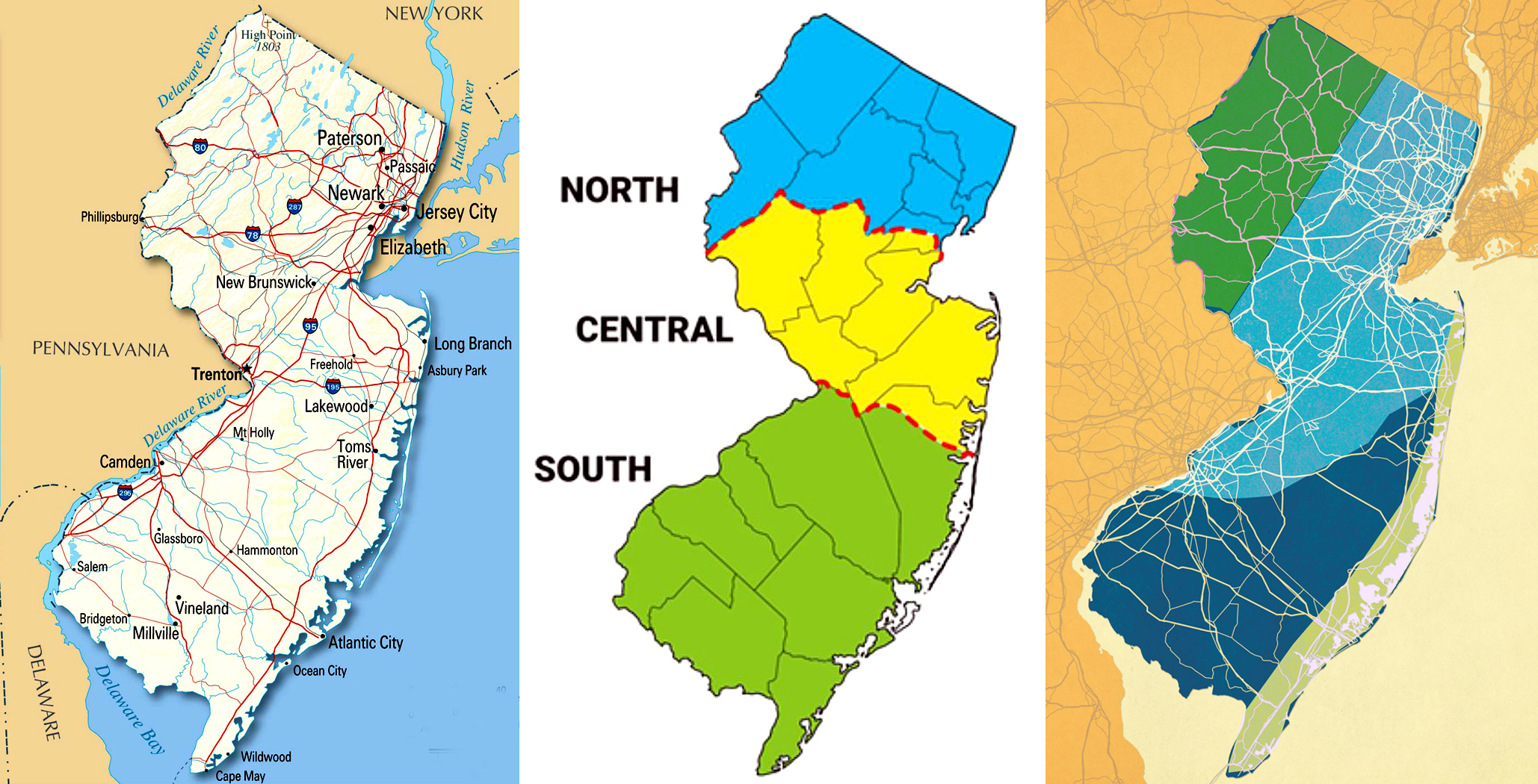
I was talking with my very Southern wife about how those brought up down here have a stronger connection to the land than us Yankees. Southerners have often lived on the same patch of land for generations and their sense of identity can course back through great-grandparents and beyond. Your sense of who you are includes the centuries before you were born. New Jersey never gave me that.
But I do have that same sense when looking at the paintings or hearing the music of the past. This all gave birth to me; it is who I am. We too often think of culture in terms of hoity-toity high culture. But really, culture is all the things that have accumulated over time to make the lives we now take for granted.
When I see or hear the so-called canonical works of Western culture, I have that sense of belonging to a long, continuous line. It speaks to me; it tells me who I am.
When I was a kid, most things in the world just were. Everything was normal, even if it wasn’t. People lived in houses, roads were paved, families had a mom and dad. And, for a kid, parents were just parents; I never gave much thought to why they did what they did. It wasn’t even that if they did something, they must have had a reason. They just did things. They were Mom and Dad, and as children, me and my brothers just followed along. As a child, the world is a given.
It’s hard to recall that state of affairs, when things happened because they happened. That they might have done things for the abstract good of their children never dawned on me. Of course, now that I am old, I look back and realize how much they did for us, things they didn’t have to do, or things they probably would have preferred to do some other way, including some other things they might have wanted to do with their sparse vacation time.
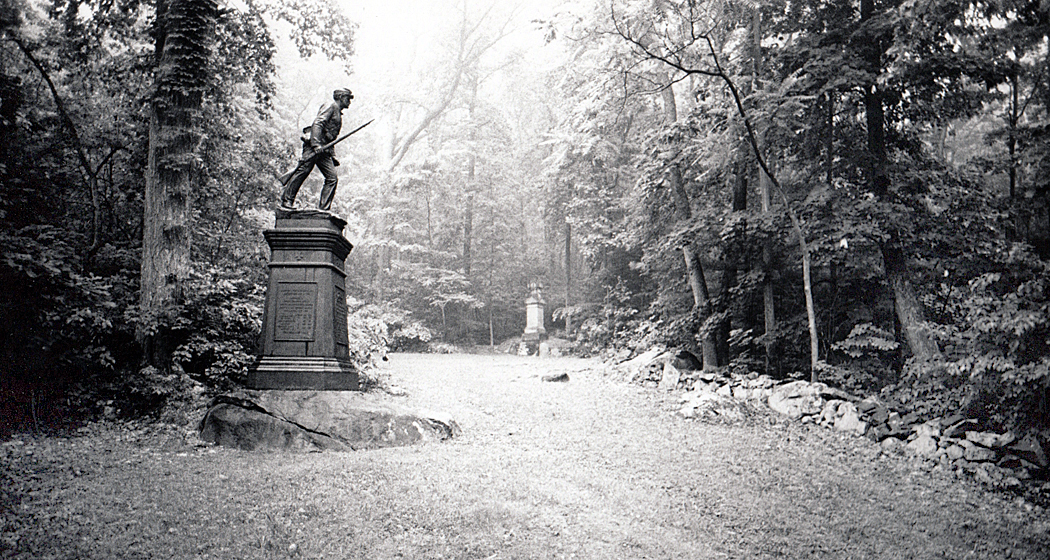
Gettysburg, Pennsylvania
But one of the things they did for us was travel. When we had our summer school vacations, Mom would pore over various brochures, magazine articles, and roadmaps and carefully plan routes to drive and sites to take in, and then, when it came time, we would load up the car and take off. We went to Washington D.C., to Niagara Falls, to Fort Ticonderoga, to Gettysburg — and many spots in between. Only later did I come to understand there was a purpose to these vacation trips. they chose these things to expose their children to history, geography, politics and to let us see what was possible outside suburban New Jersey. Travel was part of our education.
Back when they were children, they didn’t get to travel. They both grew up in northern New Jersey and neither had more than a high school education. Dad’s family was heavily religious and didn’t approve of having fun, and Mom had to raise her two younger siblings after her father died when she was still in grade school and her mother had to find work in New York City. And so, the worlds they grew up in were limited.
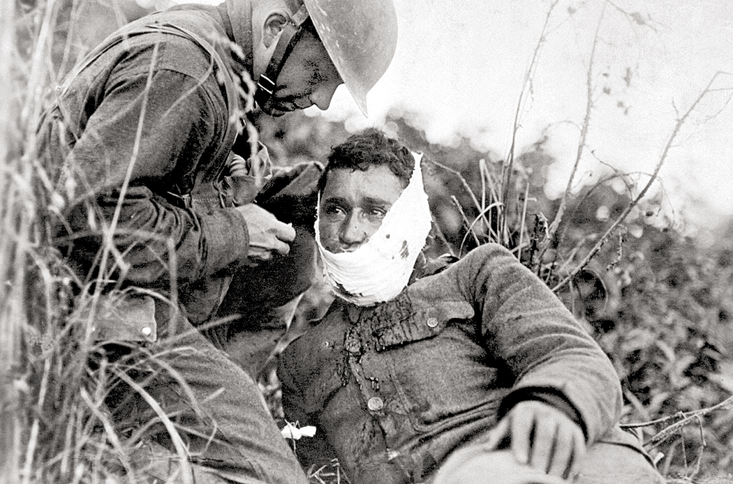
German gun, Omaha Beach, Normandy, France
But when my father was drafted in 1940, he was sent to Camp Wheeler in segregated Georgia. He didn’t talk much about his army life, but he did express shock at discovering the pervasiveness of racial discrimination. And then he was sent overseas after D-Day to France, Czechoslovakia and Germany and found that other peoples had various ways of making a decent life. His horizons were involuntarily expanded.
When they got married, shortly after the war, they felt it was important to broaden their children’s horizons, too, and to make sure we got the best educations. There was never any question that their kids would go to college. (I was told that when I entered second grade, I asked if that meant I could go to college “next year?”) Education was Priority One. Travel was a component of that.
Kristiansand, Norway
Later, when I was in high school, they made it possible for me to go to Europe, accompanying my immigrant grandmother to her birthplace in Norway, and to take a bus tour through France, Germany, the Netherlands, Belgium and Luxembourg. A few years later, my younger brother, Craig, was sent off on a similar trip.
Mark Twain famously said that “Travel is fatal to prejudice, bigotry, and narrow-mindedness, and many of our people need it sorely on these accounts. Broad, wholesome, charitable views of men and things cannot be acquired by vegetating in one little corner of the earth all one’s lifetime.”
The vast bulk of the MAGA world, it seems to me, is made up of those who have never ventured far from their birthplace. If they had seen how others live, they would not accept the lies.
Cairo, Illinois
Travel, then, has pretty much always been an essential part of my life, and having become an adult — at least as quantified in years accrued on the planet — I have continued the habit instilled by my parents. Education wasn’t only in books; I read Huckleberry Finn, of course, but I’ve also been to Mark Twain’s childhood hometown of Hannibal, Mo., and to what remains of Cairo, Ill. I’ve driven along the entire length of the Mississippi River, from Lake Itasca, Minn., to the Venice Marina where the road ends in Louisiana.
Vancouver Island, British Columbia
It is rare to mention a place I haven’t been in the continental United States or provincial Canada. Big Sur; Mt. Katahdin; the Everglades; El Paso;, the Union Pacific Bailey Train Yard in North Platte, Neb.; Hudson Bay; Halifax, Nova Scotia; the Tehachapi Loop in California; the Sturgis Rally in South Dakota; even Glacier Bay in Alaska.
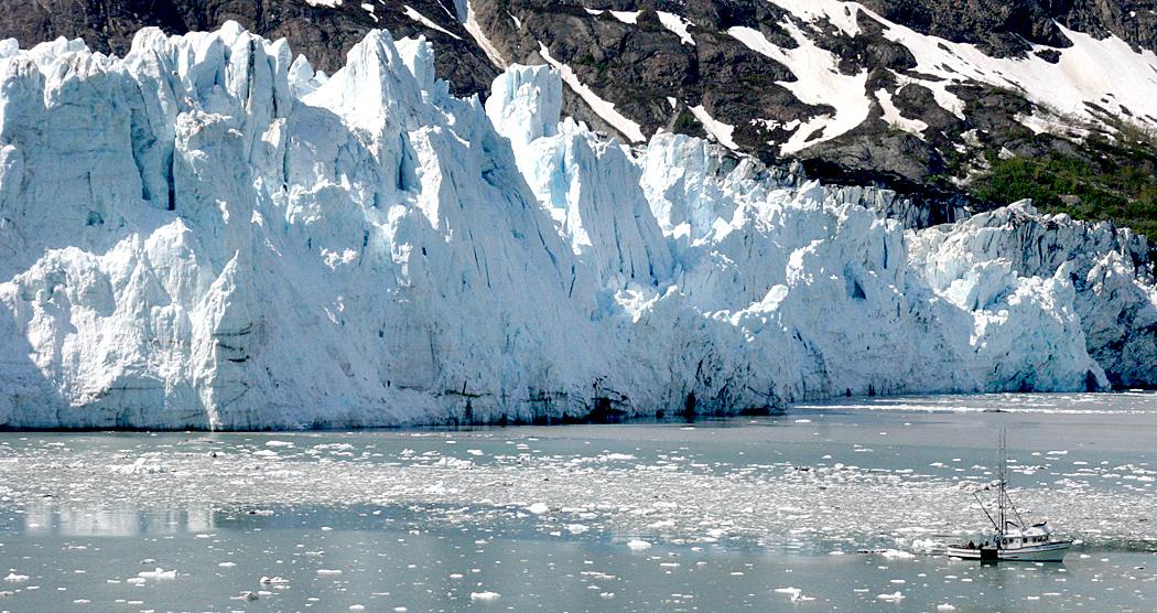
Glacier Bay, Alaska
Believe me, I can be quite irritating, when someone mentions some far-off place and I chime in, “Oh, yeah, I’ve been there. Had a great Po Boy sandwich in a little shack along the road in Pecan Island.” Which is a tiny community along the southernmost road in Louisiana. Or “Abiquiú? Yes, we visited Georgia O’Keeffe’s place there.” I am slowly learning to keep my yap shut.
Red Mesa, Navajo Reservation, Arizona
I’ve been to every state except Hawaii, and most of them many times, and every province in Canada, save only Prince Edward Island and Newfoundland. I’ve lived in four corners of the continental states, growing up in the Northeast, moving to the American South, then to Seattle in the Northwest, and spending 25 years as a writer in the Southwest. Each move gave me a chance to explore all the territory nearby, often in some detail (There’s hardly a square meter of Arizona that I haven’t been to. Go ahead, name something obscure: Ajo? Red Mesa? Tumacacori? Freedonia? Gadsden? Quartzsite? Check, check, check, check, check and check.)
Cape of Good Hope, South Africa
I’ve been to the Cape of Good Hope in South Africa and to Marylebone Road in London; I’ve been to the Chartres Cathedral, and to the bull ring in Arles, in Provence. My late wife and I went back to France many times, and drove to all six corners of “The Hexagon.”
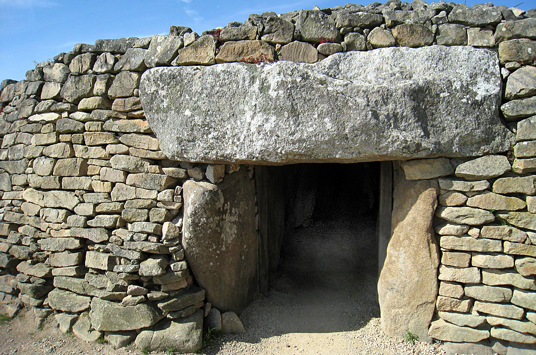
And so, yes, I’ve been to the D-Day beaches at Normandy and to the bomb craters still evident in Verdun, to the cave art along the Vézère Valley, to the paleolithic menhirs and dolmens near Locmariaquer.
Dolmen, Locmariaquer, Brittany, France
I’ve visited the Museum of Questionable Medical Devices, the Museum of Jurassic Technology and the Hammer Museum of Haines, Alaska.
And it has all been an education. I certainly learned that the omelet I get at Denny’s is a pale mutilation of the rich, creamy offering you can find at any neighborhood cafe in Paris.
O’Keeffe Country, New Mexico
Of course, I’ve also learned how little of the world I’ve actually seen. I have so much of the non-European inflected planet yet to see, although, at my age, it’s almost certain I will never get to Japan or the Seychelles or Samoa. Just as, no matter how many books I’ve read, there is always a hundred times more books I will never get to read, and not enough time left even to put a dent in that list. I keep trying.
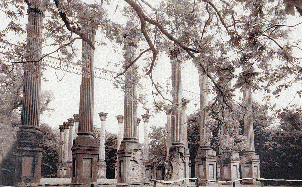
Windsor Ruins, Mississippi
And so, in addition to bragging about all the places I’ve been, I am shamed by all those places I have not gone to, just as all the art I haven’t seen, all the books I haven’t read, all the music I have never heard. But I think that it is only because of all I have read, seen, and heard, that I know enough to feel the gaping holes in my education.
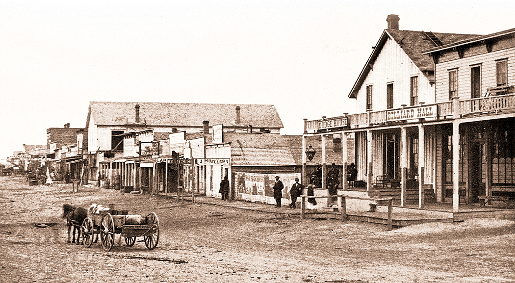
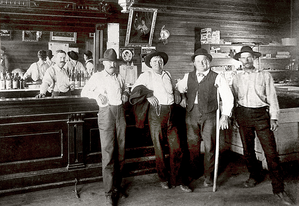
It began when I was watching syndicated reruns of old Gunsmoke episodes and I couldn’t help, as an adult, but wonder, “Where do all these people live?” I mean, there didn’t seem to be any houses in Dodge City.
Yes, we saw that Marshall Dillon slept on a cot in his office and that Miss Kitty had a room at the back of the saloon, and Doc Adams had an apartment attached to his surgery. And perhaps Sam the bartender had a room upstairs at the Long Branch and perhaps Jonas had a second-floor apartment above his general store. But the town was fully populated with people and the only street we ever see on Gunsmoke is lined with shops and businesses — at least two saloons, the Dodge House hotel and a restaurant where the gang often dined. Where were the houses?
I know it’s not really important. Westerns are America’s foundational myth, and like myths from the time of Gilgamesh through Ancient Greece and up to Gunsmoke, we don’t ask realism of the stories. They are moral tales, parables, etiologies, and euhemeristic histories. Unnecessary detail just clutters up the telling of the tale. As I said before, no one asks if Hercules had a mortgage.
But the issue of Dodge City housing interested me nonetheless.
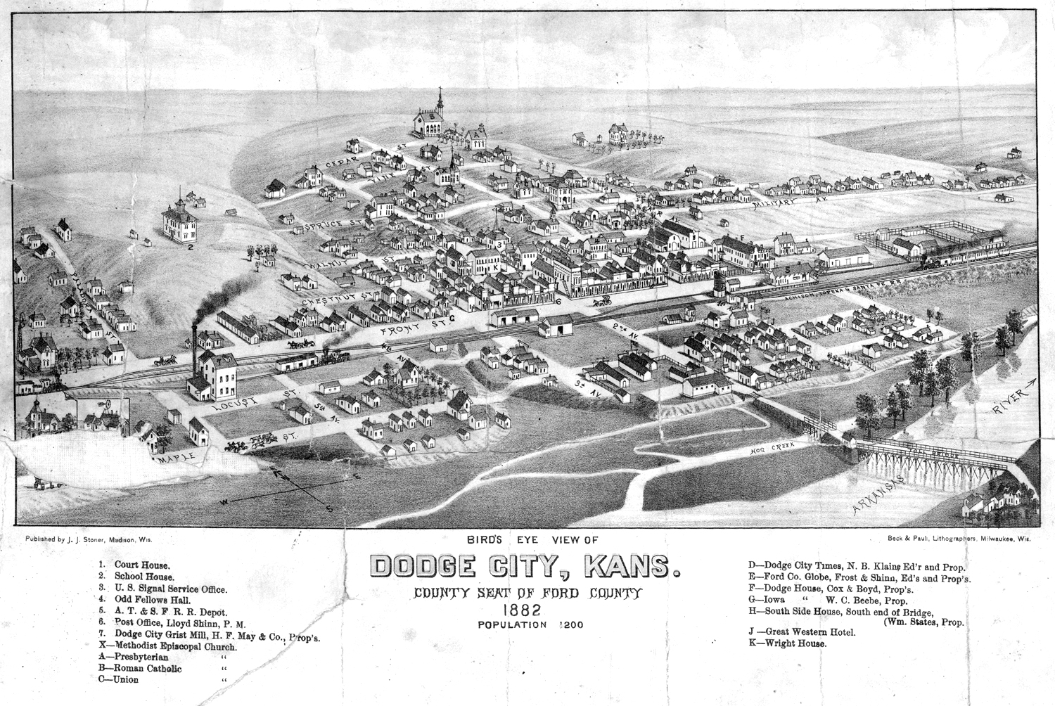
I found an old map of Dodge City from 1882 and there were plenty of houses along the side streets that led off from Front Street, the main road of the town. There were four churches, a courthouse, a school, a grist mill, an Odd Fellows Hall, a railroad depot, a newspaper office and at least four hotels, including the Dodge House, Cox & Boyd, proprietors.
Admittedly, 1882 is about five or six years later than the fictional Gunsmoke Dodge was supposedly set (according to its creators), but it should tell us something about Western settlements of the era. Yet, except for a few episodes of rowdy trail hands shooting up the place, Gunsmoke rarely mentions either the railroad or the cattle business. Where are the cattle pens? Why does no one ever mention the stink?
Then I discovered a trove of historical photographs from the Gunsmoke era and pored over them for what they might tell me.
Gunsmoke, first on radio and then on TV for 20 years was intended as an “adult” Western, with more grown-up plots and themes than the standard cowboy movie. And in the early years, largely succeeds, with some quite grim stories about the difficulties of life on the prairie. But even given that, the series relies on many of the Western movie tropes, including its sense of how a Western town is built and functions: one main street lined with storefronts and saloons.
As I have said, I am not asking a television entertainment to be a documentary, and I am not complaining that Matt Dillon’s town had little to do with the historical Dodge City. But I couldn’t help but want to find out what the reality might have been.
Ruts still visible from the Santa Fe Trail, near Dodge City
A little background: Once, there was a piece of land in the middle of the continent halfway between another piece of land controlled by people speaking English and another piece of land controlled by people speaking Spanish. And the English- and Spanish- speaking peoples wanted to do business together and so wagons of goods moved from one side of America to the other side along familiar routes that eventually became well-worn trails. The one we’re concerned with was called the Santa Fe Trail.
Of course, the parcel of land between them was not empty, but occupied by native peoples, who sometimes took exception to the Europeans who trespassed over their land, and so, the English-speaking peoples sent out their army to build forts along the trails to protect the merchants and their teamsters, and later to protect the European immigrants who wanted to live in the middle of the continent or travel across it to get to the parts further west.
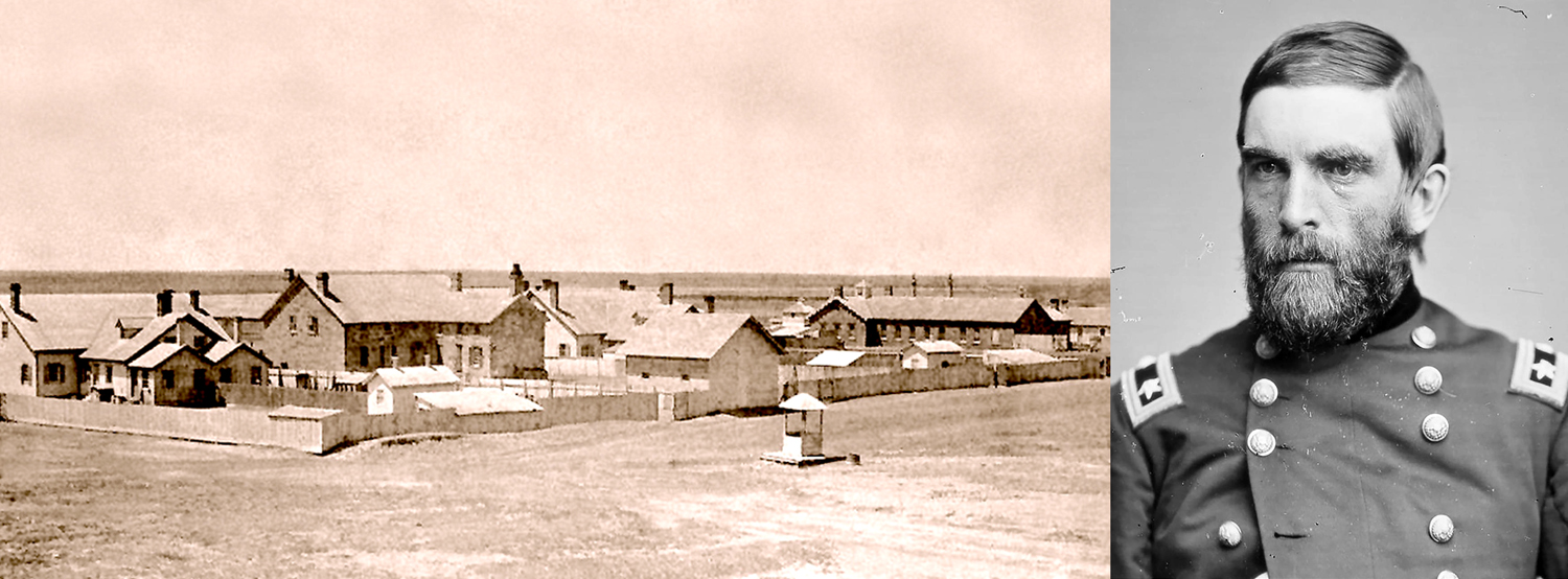
Fort Dodge in 1879 and General Grenville Dodge
And so, on April 10, 1865, a company of soldiers from the Eleventh Cavalry Regiment under orders from General Grenville M. Dodge established a camp on the Arkansas River along the Santa Fe Trail. Lacking building materials, they made dug-outs into the river banks for shelter. Dodge later wrote in his autobiography that the soldiers sarcastically named the place after him because they “were so mad at being sent there .. with so little accommodations that they named the place Camp Dodge.”
Arkansas River near Fort Dodge
Sidenote No. 1
Researching history can be a nightmare. There are ambiguous and conflicting sources everywhere. Dates are in question, name spellings are helter skelter, tall tales sometimes intrude with frequently told-fictions. First-hand accounts often appear to glorify their authors. I have tried to relate the most dependable version of Dodge City’s history, but there are sometimes smudgy areas.
For instance, Grenville Dodge isn’t the only Dodge involved, and sometimes one of the others gets credit for the fort’s name. In 1851 a Col. I Dodge established a fort to protect the Santa Fe Trail in Kansas. The fort proved temporary. Gen. Grenville Dodge ordered the construction of Fort Dodge near what is now Dodge City in 1865. Later, in 1872, the fort was commanded by Col. Richard Irving Dodge. Confusion seems inevitable.
Back to our story
The camp was soon refurbished with sod house buildings and then wood and stone buildings and officially became Fort Dodge and manned by up to four companies of soldiers.
Henry Sitler in later years, and his sod house in 1871
In 1871, rancher Henry L. Sitler built a sod house about five miles west of the fort, which became a stopping place for those traveling on the Santa Fe Trail, and a year later, a town was platted and George M. Hoover set up a tent to sell liquor to the soldiers at the fort. The Atchison, Topeka and Santa Fe Railway arrived in town later that year and things picked up quickly.
At first it was the trade in buffalo hides that built Dodge City, with the bones and skins of the buffalo sent by rail back to the east. Indeed, the settlement was first named Buffalo City.
Buffalo hides at Dodge City
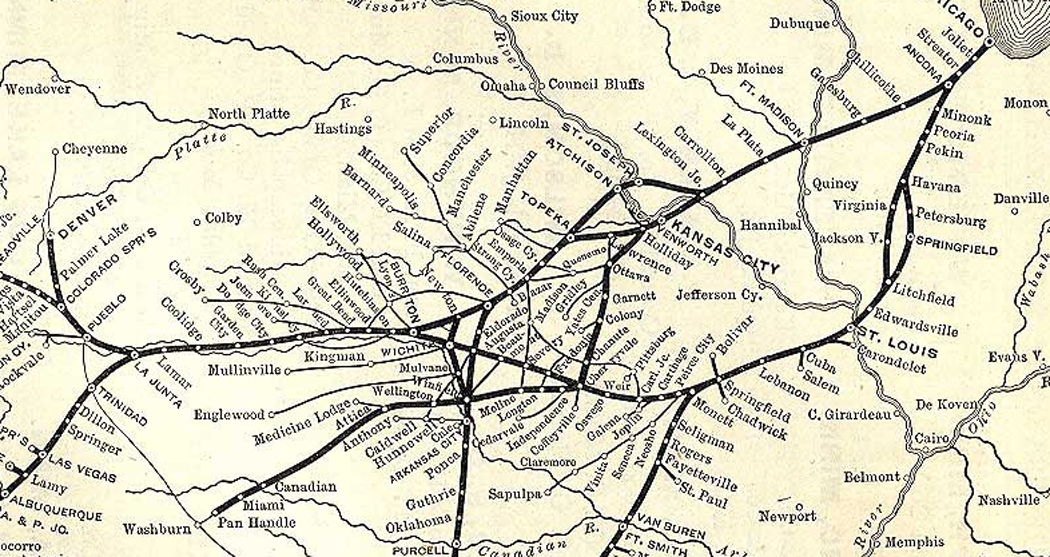
When cattle from Texas needed to be shipped to eastern markets, towns were established along the route of the railroad. In Kansas, first in Abilene, in 1867. An outbreak of cattle fever led to a quarantine line in the state, and the railhead moved further and further west, reaching Dodge City in 1876, roughly the years when fictional Marshal Dillon ruled the town.
From 1875 to 1886, some 5 million beeves were herded up the trail from Texas to Kansas railheads. In 1877 alone, Dodge City was the largest of the cattle-shipping boom towns, loading up and shipping out 500,000 head of cattle.
Route of the AT&SF Railway that got the beef to the slaughterhouses and meatpacking industry of Chicago
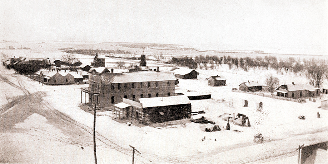
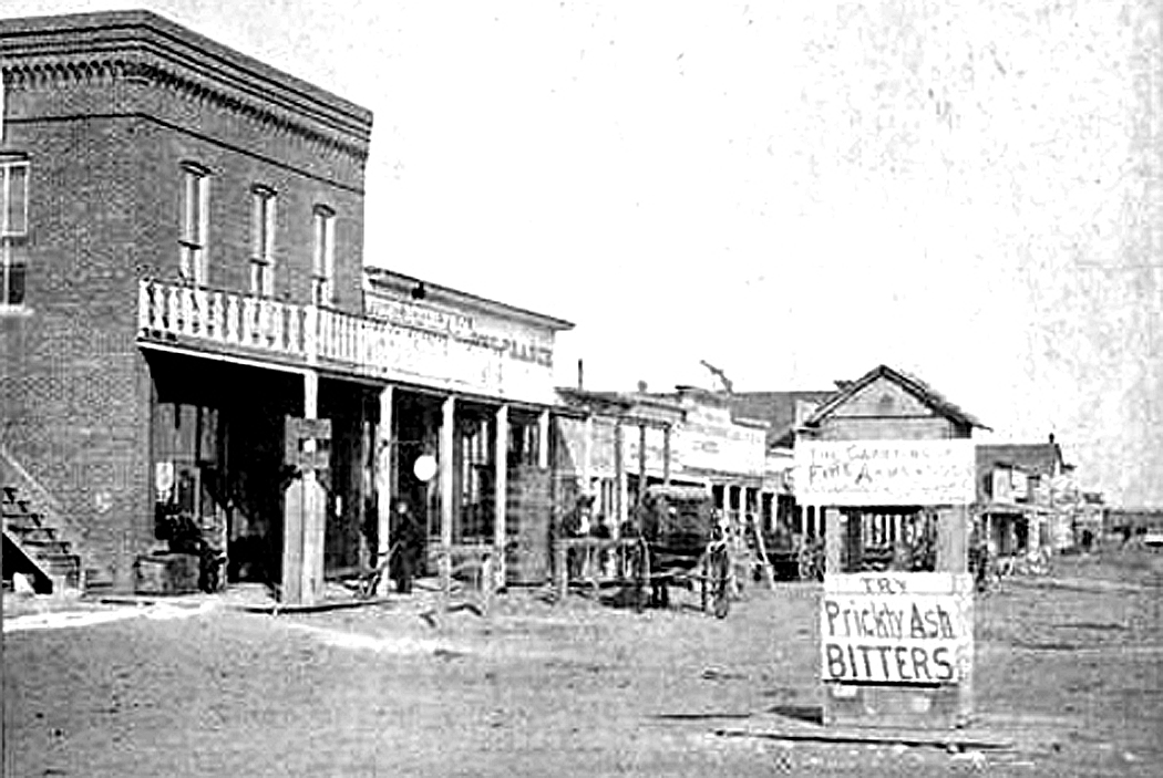
As Dodge City grew, and Kansas became more populated, the need for a fort on the Santa Fe Trail became less important, and by the end, when the fort closed in 1882, it was garrisoned by only about a dozen soldiers. The remaining buildings were later turned into a home for retired soldiers.
Dodge City, 1872
This was the milieu that the fictional Dodge City supposedly took place in.
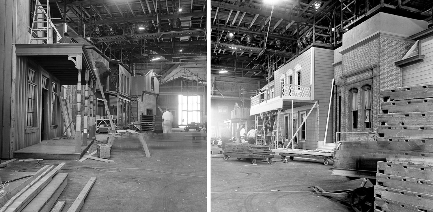
Gunsmoke remained on TV for 20 years and the town barely changed, despite having moved from its original outdoor location shooting to being filmed on fabricated sets in the studio.
Constructing Dodge City in studio for “Gunsmoke”
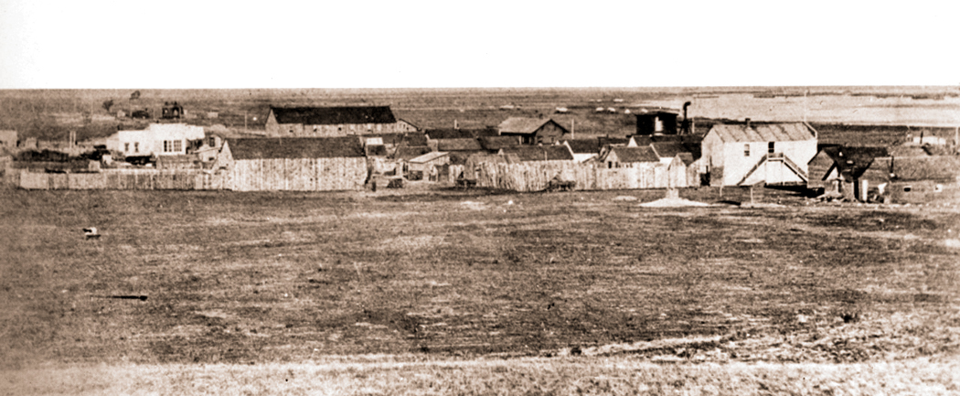
The actual town grew and changed continuously, beginning in 1871 with a population of 1 — as Henry Sitler built a sod house in the location five miles from Fort Dodge — to a population near of 1200 just five years later and to 1,763 by the 1890 census. TV’s Dodge City should have been filled with ongoing construction. The trains not only took cattle out of Dodge, but brought in supplies and lumber to build the town in a region mostly devoid of timber.
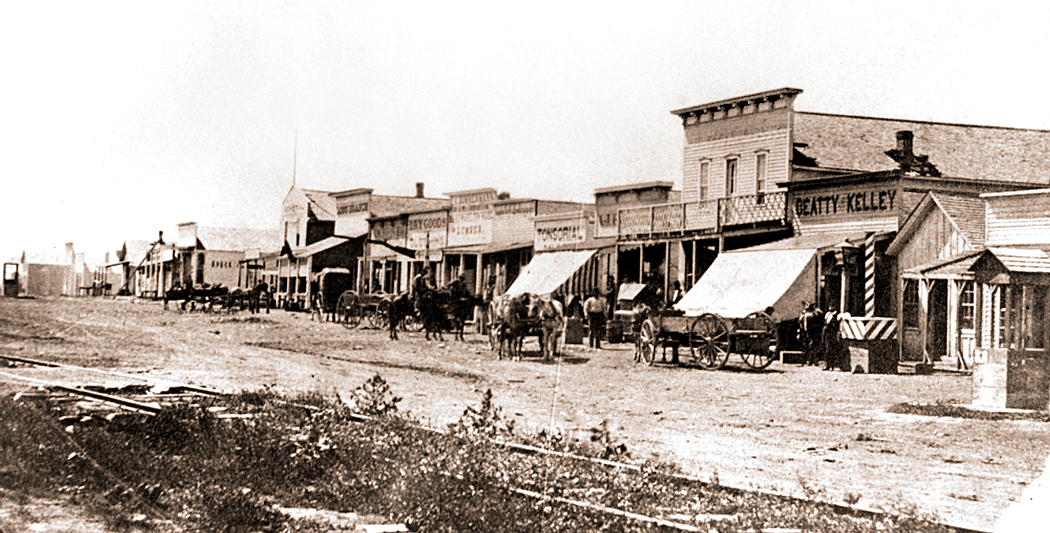
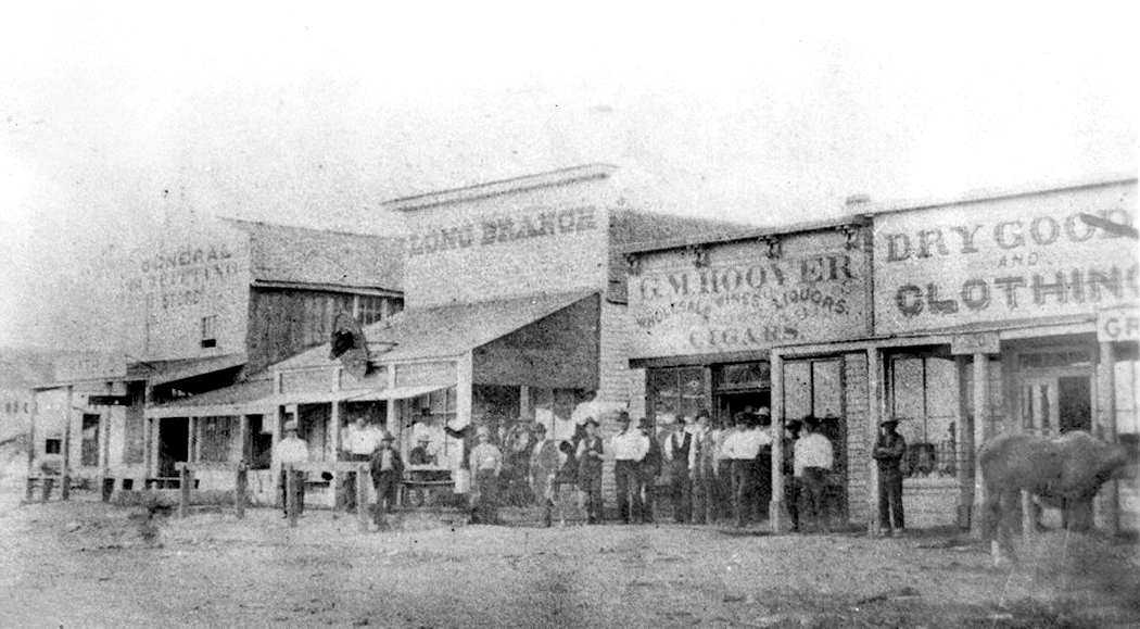
The town was incorporated and platted in 1872, and George Hoover moved to a wood building on Front Street to serve thirsty Fort Dodge soldiers, buffalo hunters and the increasing number of cattle herders.
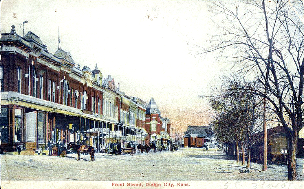
Front Street, Dodge City, 1872
Gunsmoke’s Dodge City was a standard-issue Western town, like those of so many other towns in other TV series and movies — a wide dirt street with wood-frame buildings on both sides.
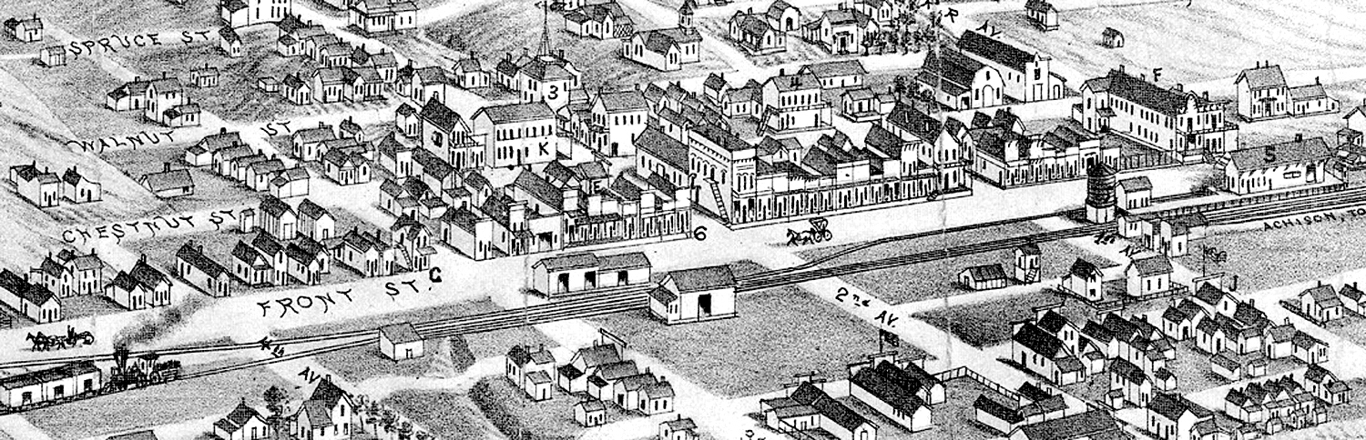
The reality of Dodge City was that it was built alongside the Arkansas River, where the Santa Fe Trail paralleled the river. When the railroad came, it, too, followed the river. The town then grew on the far side of the tracks, leaving the town plan with the river to the south, the tracks to the north, and Front Street and the primary businesses in a single row on the north side of the street, as shown in this detail of the bird’s-eye view map, from 1882.
This was a common city plan, and can be found all across both the West and the South, wherever a town grew alongside railway tracks. Tracks; road; storefronts, in that order.
Winter 1872, Dodge City
Sidenote No. 2
The constant growth of the town from 1871 to 1900 means that there is no single version of Dodge City to be had. It was always changing. Over the two decades of Matt Dillon’s TV tenure, the place barely changed a whit, although Dillon did. James Arness was 32 with a boyish face when the series began. When the series ended, he was in his 50s. Gunsmoke movies continued to be made, and by the time of the last, Gunsmoke: One Man’s Justice, from 1994, Arness was 71, which, if we insist on a concurrent timeline, puts the movie’s action into roughly 1914.
The TV show seems to remain static in time, other than the persistent aging of its inhabitants, but if we pretend the town aged as the actors did, the final episodes would have taken place in the 1890s. By then the cattle drives were long over, the town had settled into domesticity, and the six-guns and stetsons were relics of the past. The most common hat worn by men in Dodge city was a bowler.
Back to the main story
Dodge City, 1873
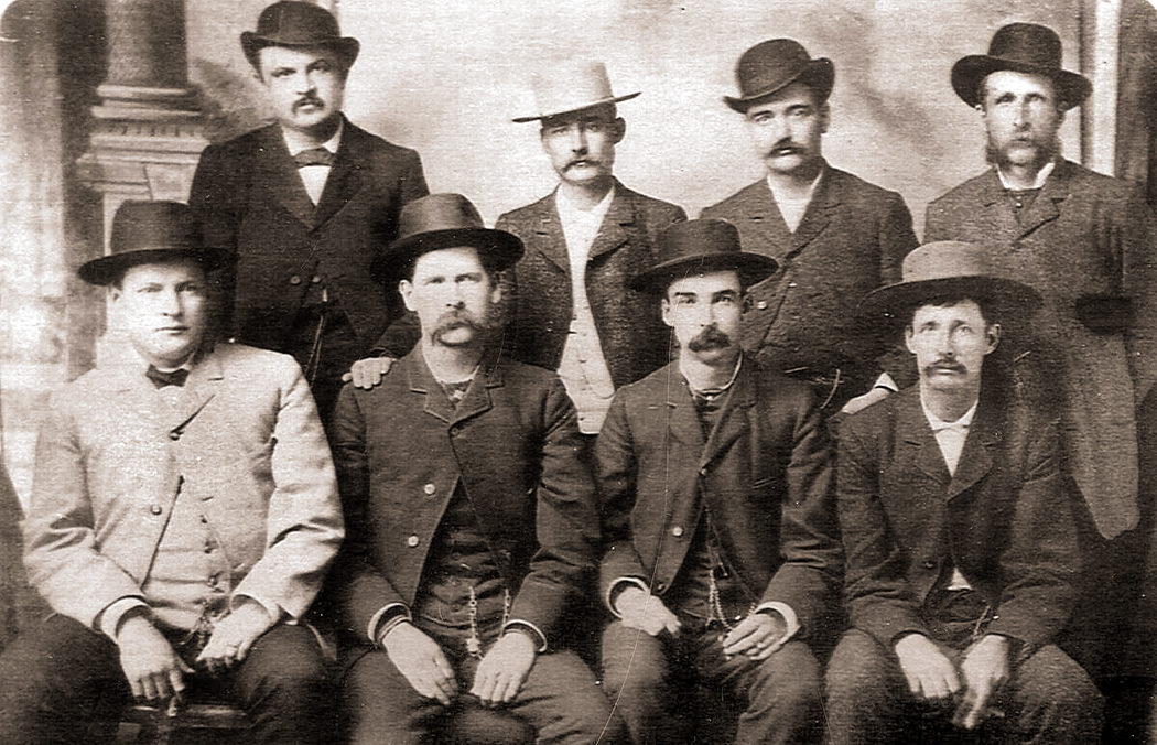
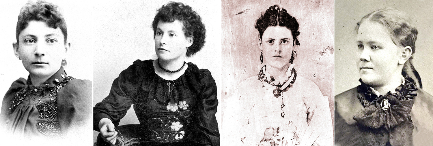
In the group of photos I collected, I found records of many of the town’s inhabitants, and they tell a story of Dodge City’s growth and character. I wanted to share a few of them. I purposely did not include information on several of the more mythic figures that are frequently dredged out to tell the tale. You can find all kinds of stories about Wyatt Earp, Doc Holliday, Dora Hand or Bat Masterson, and they have all been through the Dime Novel, Hollywood movie, TV series myth-making machine and many of their stories are questionable at best. Many conflicting versions abound.
So, I wanted to mention George Hoover, Chalk Beeson, Ben Hodges, Thomas McCarty, James “Dog” Kelley, Ormond Wright, and Squirrel Tooth Alice, among others, all of whom are central to Dodge City’s history.
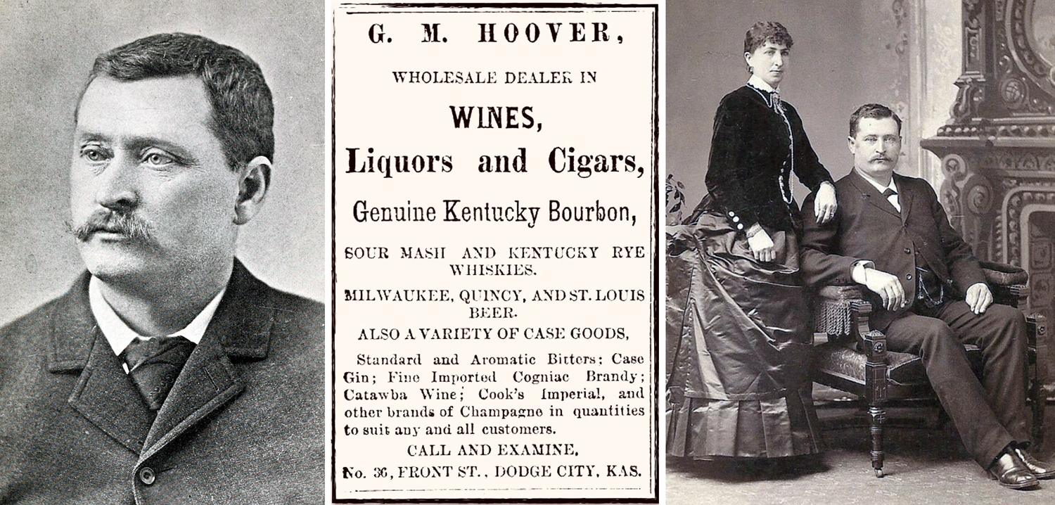
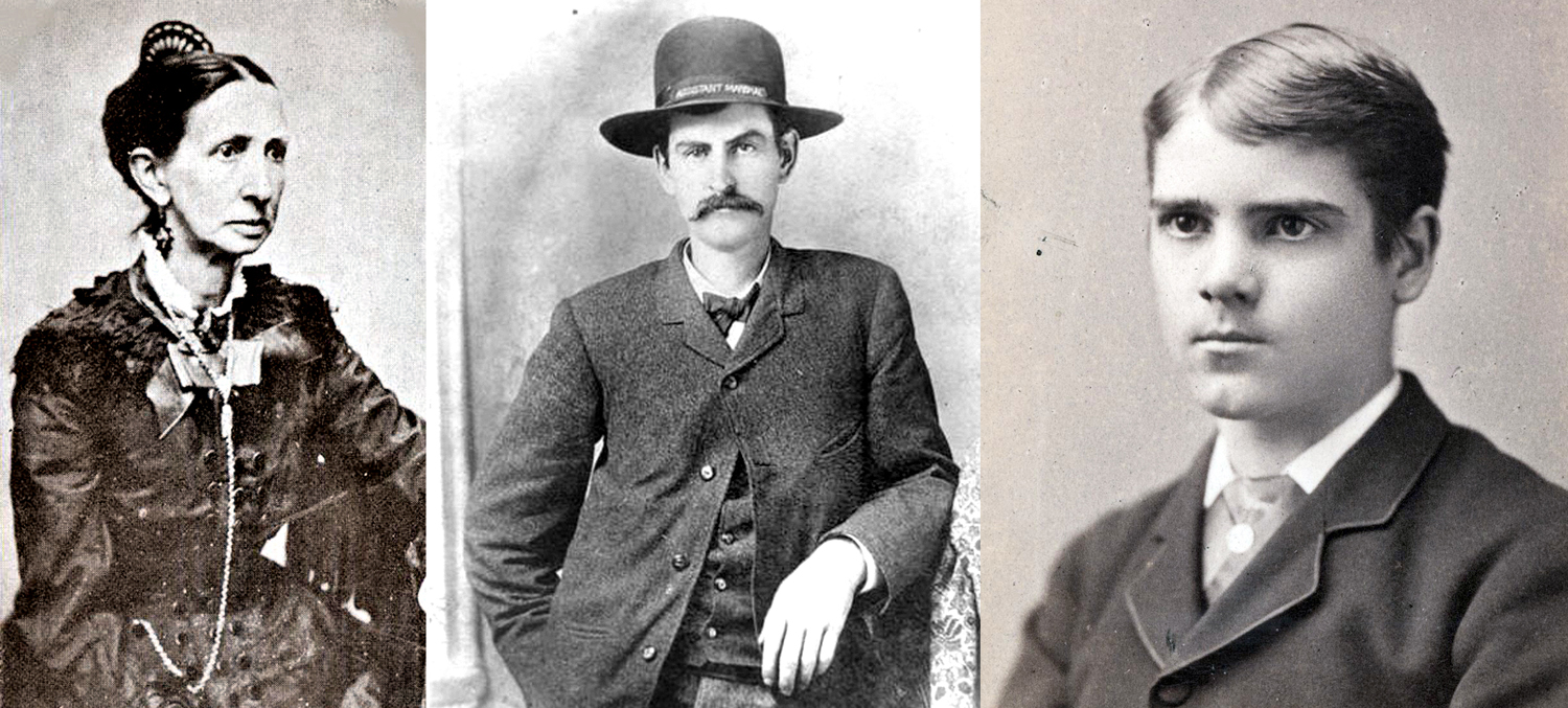
George Hoover and wife, Margaret
Hoover was the second person, after Henry Sitler, to settle on the site of what would become the town, in 1872 and set up a bar to serve travelers and the soldiers of Fort Dodge. He sold whisky by the ladle for 25 cents (equivalent value today: about $20.) At the time, alcohol was forbidden at Fort Dodge and for a radius of five miles, which is why Hoover’s tent-and-wood-plank bar was opened where it was and Dodge City took hold five miles from the fort.
Hoover became the town’s first elected mayor, reelected three times, became a state legislator, and, after many successful businesses, opened the town’s first bank. He died in 1914, a few months after his wife, Margaret, died. He said, according to the July 16, 1914, Dodge City Globe, “that he had but little desire to live longer, and declared that life had no more interest for him [after his wife’s death].”
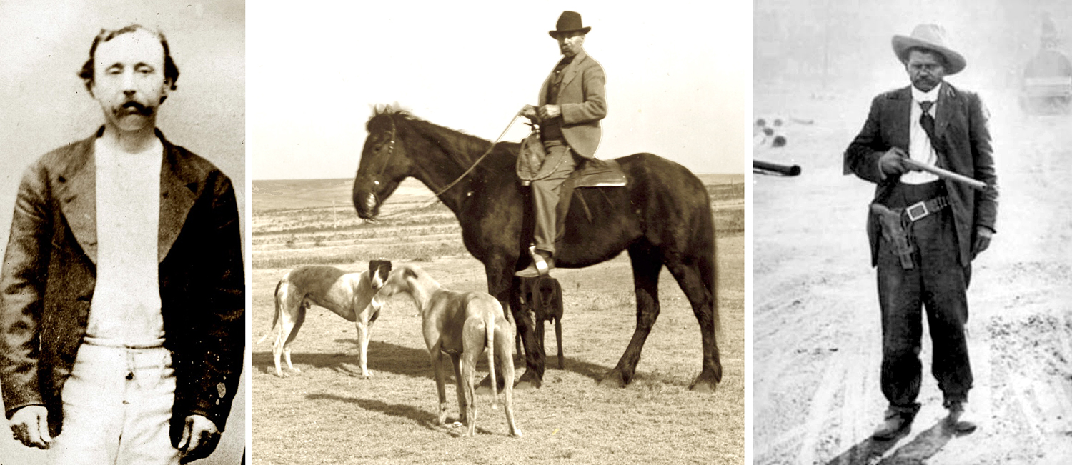
James Kelley, Kelley on horse, and Ben Hodges
British-born James Kelley was mayor of Dodge City from 1877 to 1881. He was part owner of the Beatty and Kelley Restaurant and kept a tamed black bear, named Teddy, behind the shop. Kelley had a white horse and often wore a white corduroy suit and kept a bunch of greyhounds, hence his nickname, “Dog” Kelley. His restaurant burned down in 1885 and he opened up the Kelley Opera House on the corner of Front Street and First Avenue. Kelley died in 1912, having spent his last years at the soldiers’ home at the former Fort Dodge.
Dodge City, 1878
Ben Hodges was half-Mexican, half Black and a cook’s helper on a cattle drive, who stopped in Dodge in 1872 and began a series of (unsuccessful) land-deal swindles and claims to wealth and nobility. He lived for years in a little shack on the south side of town, near the river and kept young boys fascinated with his tall tales. The town seems to have tolerated Ben as the “town character.” He was made an “Assistant Deputy” and allowed to carry a gun, minus the firing pin and his shoplifting of food from stores was accepted since, “he only took what he needed.”
When he died, in 1929, a collection was raised to buy him a plot in the elite Catholic cemetery rather than a pauper’s grave. According to one pall bearer, “We wanted him where they could keep an eye on him.”
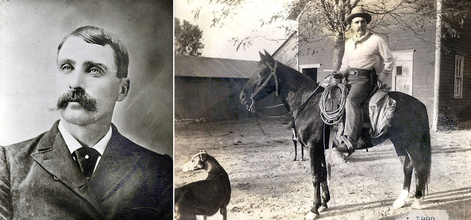
Larry Deger and T.L. McCarty
Dodge City’s original Matt Dillon and Doc Adams were Marshal Lawrence Deger and Dr. Thomas McCarty. Deger was the first marshal of the town.
From 1871 till it was incorporated in 1875, Dodge City had no law officers, and things were quite chaotic, with a number of murders gone unaddressed until a vigilance committee was formed. Unfortunately, the committee soon became the source of violence and the Kansas governor appointed Charles Bassett sheriff of Ford County in an attempt to establish some order. It is estimated that between 1872 and 1876, some 70,875 gallons of whiskey were consumed in Dodge City, which is the equivalent of approximately or 4,536,000 individual shots — a lot for a town of about a thousand citizens.
St. James Saloon, Dodge City
In 1875, Deger was appointed marshal by the town council (there is some confusion in the popular mind, as a U.S. marshal is a federal employee, while a city marshal is essentially the police chief and is hired by local government. However, in some locations, marshals were elected — it’s all quite confusing. Sheriffs are usually politicians, who are elected). Deger was a saloon keeper and took sides in a developing confrontation among townspeople between those who wanted a more open town to provide booze and professional women to cattle drivers, i.e. “good for business,” and those who wanted a quieter, more civilized town. Deger wanted peace.
What ensued in 1873 is sometimes called the Saloon Wars and sometimes the Dodge City Wars. Deger was by that time mayor and had laws passed establishing prohibition and outlawing prostitution. It was also suggested, for instance, “We should have an ordinance prohibiting the firing of guns within the city limits.” And, “We should have a law not allowing the riding of horses over sidewalks and into the saloons.”
In the course of these reforms, three “singers” at the Long Branch saloon were arrested, but none of the workers at other saloons were also nabbed. Favoritism was charged and the pro-business group, called “the gang,” hired a bunch of former lawmen as muscle for their side of the argument.
Dodge City Peace Commission
A famous photo of the group was made at the time, with (standing L-R: William Harris; Luke Short; Bat Masterson; William Petillon. And seated, L-R: Charlie Bassett, Wyatt Earp; Frank McLean; and Neil Brown.)
The sides stared each other down, but it was finally resolved without gunfire, and the Long Branch was allowed to reopen. But women in the profession were moved south of the railroad to the “wrong side of the tracks.”
Varieties Dance Hall, Dodge City
Deger married German-born Etta Engleman in 1883, and moved to Texas where he operated a lumber company. He died in 1924.
Thomas McCarty, his wife, Sarah, and Sing Lee
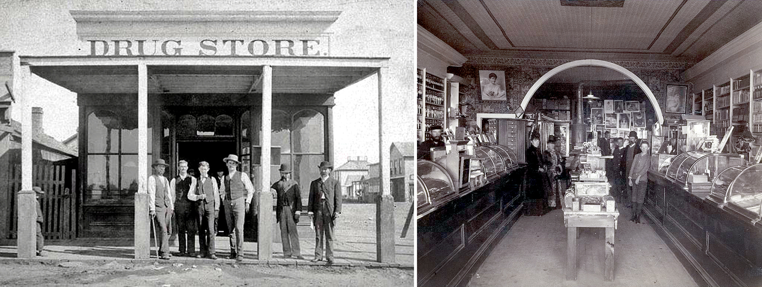
McCarty was the town’s first civilian doctor and Ford County’s first coroner. He and his wife, Sarah, arrived in Dodge City in 1872, on their way further west, but stayed in town. He operated his surgery and partnered in a drug store with Herman Fringer and later opened his own, called City Drug Store.
City Drug Store, 1877
McCarty’s son, Claude, was reputedly the first legitimate baby born in Dodge City, and later also became a doctor and with his father opened the McCarty Hospital in 1905, remodeling the old four-story Central Hotel.
The doctor’s household included a servant named Sing Lee, who wore the traditional Chinese queue.
Dr. Thomas McCarty died in 1930, ten years after his wife Sarah. His son lived until 1950.
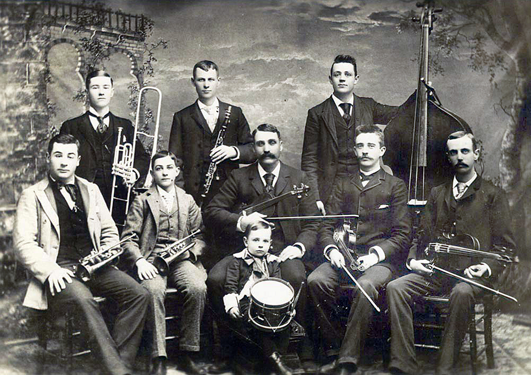
Chalkley Beeson
Chalk Beeson came to Dodge in 1874 with his wife, Ida. Soon, he received the Billiard Hall Saloon as payment for a debt and renamed it the Saratoga, one of the few that didn’t employ prostitutes. Instead, he featured a five-piece band, with himself as leader on the fiddle. In 1877, the Dodge City Times wrote, “It is a rare treat to drop in at the Saratoga upon Mr. Beeson, and listen to his last and best musical combination. Mr. Beeson is a thorough lover of good music, and by his skillful selection of good performers … draws crowds of attentive listeners.”
Dodge City Cow-Boy Band, Beeson in center with fiddle
In 1884, he expanded his band to form the Dodge City Cow-Boy Band and toured, including an appearance in the inaugural parade of President Benjamin Harrison in 1889.
Beeson was later elected sheriff of Ford County and in 1903, elected to the state legislature. He died in 1912 when he was kicked by his horse.
By the middle 1870s, there were a little over 1000 residents in Dodge City but 16 saloons. In addition to the Long Branch and the Saratoga were the Alamo, the Alhambra, the Crystal Palace, the Lone Star, the Oasis, Congress Hall and the Green Front. Some of them just one-room storefronts.
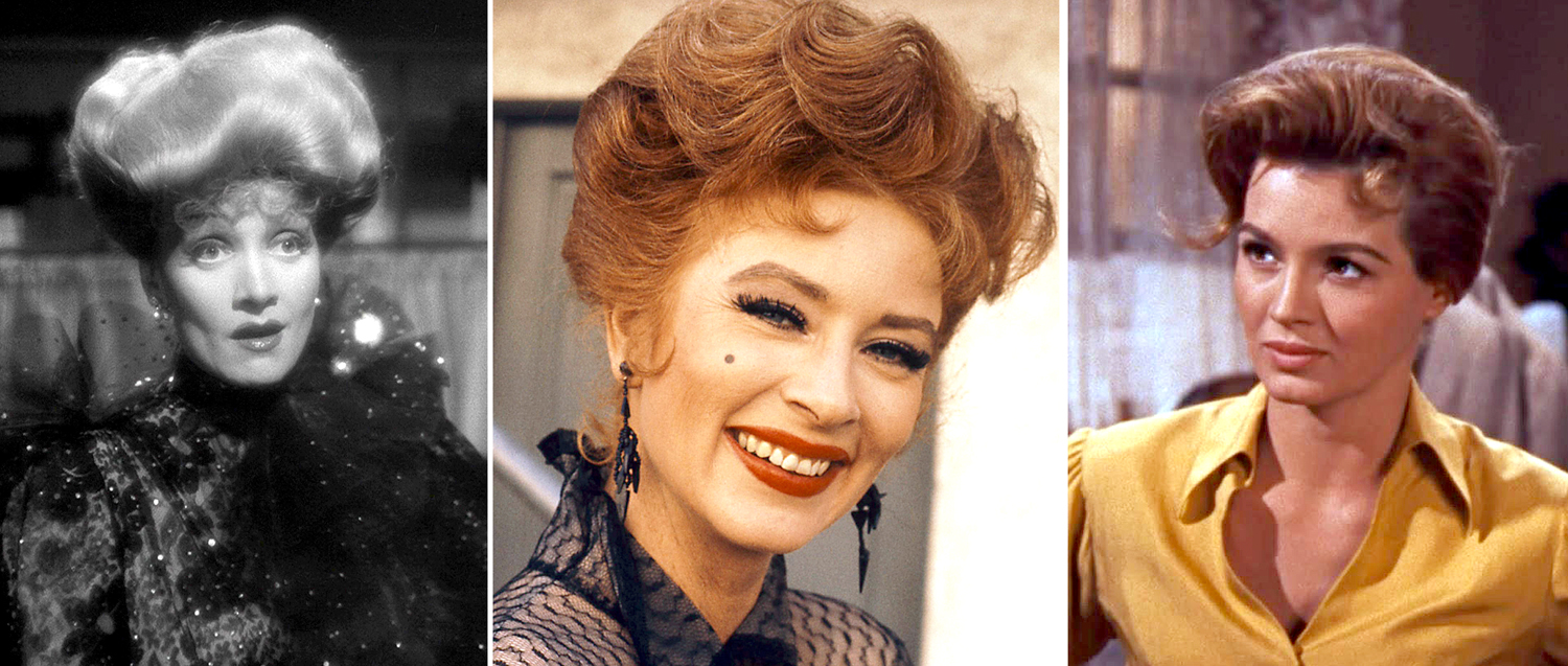
A reporter from the Hays City Sentinel wrote of Dodge City at the time, “The employment of many citizens is gambling. Her virtue is prostitution and her beverage is whisky.” On TV, the saloon girls share drinks with cowboys, but, as one writer put it, “Miss Kitty wasn’t selling chocolate bars.” We know the names of several of these hard-working women.
Sarah “Sadie” Ratzell was born in Philadelphia but grew up on a Kansas farm. When she was 18, she became a prostitute and lived with a Dodge City dance hall owner in the 1880s.
In July, 1881, she complained to then-Marshal Fred Singer about a man prowling around her home after dark. Singer found and shot 23-year-old Joseph McDonald hidden in a growth of sunflowers. A coroner’s inquest that followed notes “the latter raised his arm horizontally, as though in the act of firing. The marshal apprehended some danger from this movement, and not knowing whether the man had a pistol or not, raised his weapon and fired, the shot striking McDonald in the hand and passing into his right side, causing death in three hours.” Singer later resigned as marshal and opened saloon, which occupation he said was more financially rewarding.
Front Street with Long Branch Saloon, 1875
Squirrel Tooth Alice was born Mary Elizabeth Haley in 1855 in Texas. She was kidnapped by Comanches in 1864 and ransomed three years later. She ran away from home at 14 to become a dance-hall girl and prostitute. She hooked up with”Texas Billy” Thompson. In 1873, Thompson shot and killed the sheriff in Ellsworth, Kan., but escaped from jail and fled to Dodge City, where she took up her trade. Later the pair, by then married, moved to Colorado and later, Texas. She was known as Squirrel Tooth after a gap in her front teeth. She also kept pet prairie dogs on leash and collar. As Libby Thompson, she had nine children by several men, while running a brothel. She died in California in 1953 at the age of 97.
Rose Vastine was known as Timberline because she was 6”2’ and worked in Dodge City in the 1870s. According to one account, she was suicidal, and while later living in Creede, Colo., shot herself six times, but lived. “She made yet another attempt to shoot herself in the chest in 1893. ‘Medical attendants were at once summoned and the would-be suicide is in a fair way to recovery,’ said the newspaper.” Little else is known.
Dodge City, 1879
Celia Ann Blaylock was born in Iowa in 1850. When she was 18, she ran away from home and found her way, as Mattie Blaylock, to Dodge City, where she became a prostitute. In 1876, she took up with city deputy marshal Wyatt Earp and for six years lived as his common-law wife while maintaining her profession. She suffered from extreme migraines and became addicted to laudanum as a pain killer. She left Dodge City with him in 1879, going to New Mexico, and then to Tombstone, Ariz. Eventually Earp left her, and in 1888, she died from an overdose, ruled by the coroner as “suicide by opium poisoning.” She was 38.
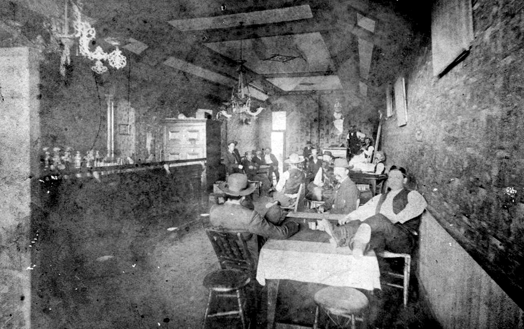
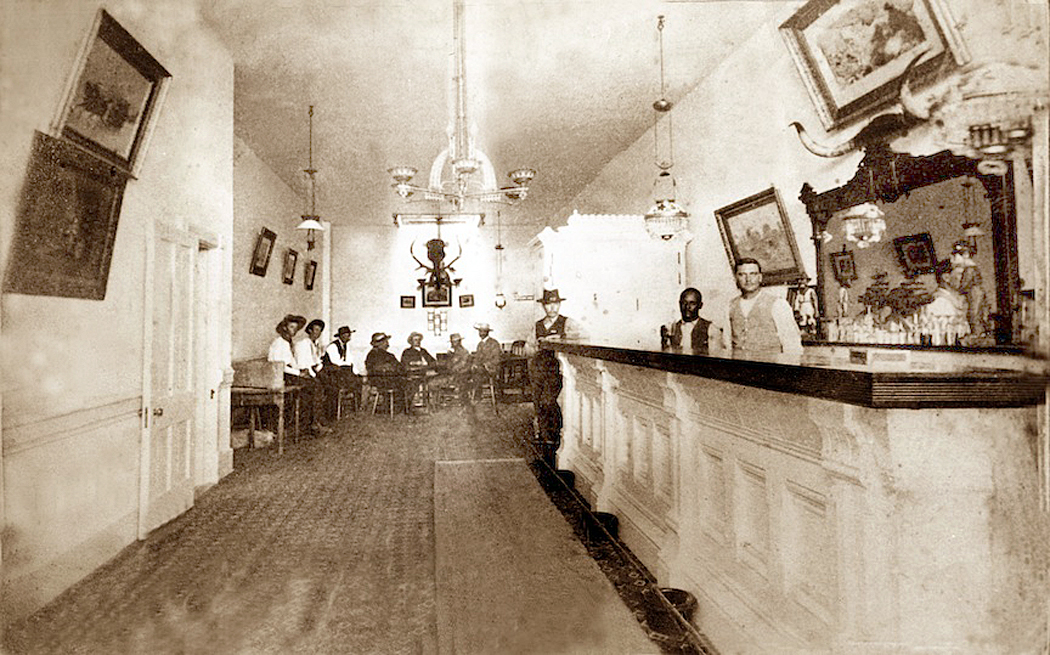
Interior, Long Branch Saloon
The Long Branch has become the most famous, although there never was a Miss Kitty. It was established in 1874 and named for its owner’s hometown of Long Branch, N.J. It passed through several hands and in 1878, Beeson bought a share in it. He sold his portion in 1883 to Luke Short.
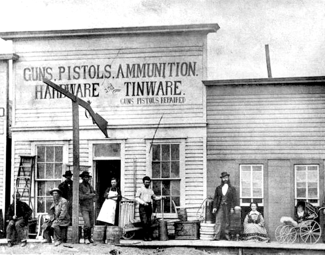
Zimmerman’s hardware store
Two years later, it burned down in a fire that destroyed much of Front Street, taking out in addition, Dog Kelley’s Opera House, Charles Heinz’s Delmonico restaurant, the York, Parker, Draper Mercantile Company, F.C. Zimmermann’s hardware store and even the first brick building in town, Robert Wright’s store, which held out long enough to retrieve a good deal of his merchandise before the building went. But, as the newspaper reported, “Some awful good whiskey was allowed to burn up.”
That fire, and a second, smaller one a month later, led the city council to establish a fire department and a city water works, with fire hydrants around the city.
Robert M. Wright and his book
There are many more citizens of Dodge back then, and I can’t include them all. One early resident (and later mayor — they all seem to have taken turns as mayor) was Robert Wright, who, in his old age, wrote a book called, Dodge City, the Cowboy Capital and the Great Southwest in The Days of The Wild Indian, the Buffalo, the Cowboy, Dance Halls, Gambling Halls, and Bad Men, published in 1913. It is loaded with familiar stories of the early times in Kansas, but also argues that it wasn’t as bad as all that. He tries to put a clean face on the popular image. (I have read it; let’s just say, Wright was not a graceful writer — it’s a tough slog). Wright dies two years after his book was published.
L-R: Margaret Walker; Dave Mather; Rev. Ormond Wright
Among the many people I have had to leave out of this blog entry are Margaret Walker, the town’s first schoolteacher; “Mysterious Dave” Mather, who owned the Opera House Saloon and was the survivor of one of the more famous gunfights in town; Rev. Ormond Wright, who presided over the first church built in Dodge, a non-denominational worship.
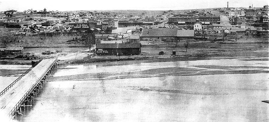
Dodge City, 1887, with Arkansas River
There were enough documented personalities from the early years of Dodge City, that a TV series could have been made without resorting to the fictions of Matt, Doc, and Kitty. (I mean no slight on Gunsmoke, which, especially in its early years did truly attempt to be more faithful to the spirit, if not the fact of its times, and was often extremely well written.)
Dodge City, 1890s
Dodge City went from tents and sod to wood frame buildings and to multi-story brick in a little over ten years, in the process building institutions, electing a town council and mayor, and hiring a police force, so that, when the cattle industry largely disappeared in the 1880s, it was prepared to be a self-sustaining community. The real town was a dynamic entity; on TV, it was just a stage set.
The foundational mythology of the United States belongs to the cowboy. An argument can be made for the Founding Fathers, but they are understood more as history than as myth. And by myth I don’t merely mean something that isn’t “true,” but as a mental model that we have absorbed as the definition of what makes us American. We are more John Wayne than we are John Adams.
Like many of us, I grew up on Westerns, although because I am in my 70s, my foundational Westerns were those from the 1930s recycled in the 1950s on television. I grew up knowing who Ken Maynard was, or Buck Jones. Back then, TV stations were starving for content to broadcast, and the pile of old Westerns filled the Saturday morning hunger. Those younger than me likely didn’t have such a cinematic indoctrination. Later TV Westerns became their version.
But, since I wrote a blog piece about TV’s Gunsmoke, (link here) I have been thinking about Westerns and their role as our national psychic subconscious, and about how the fictional version differed from the historical. And what is more, what that shift means, culturally.
It has not always meant the same thing, and the evolution over time describes the changes in America’s perception of itself.
I believe there were distinct eras of Westerns, that have evolved over the past two centuries. These versions of the West overlap, and all of them have been present from the beginning, or near enough. But the preponderance of each defines each era.
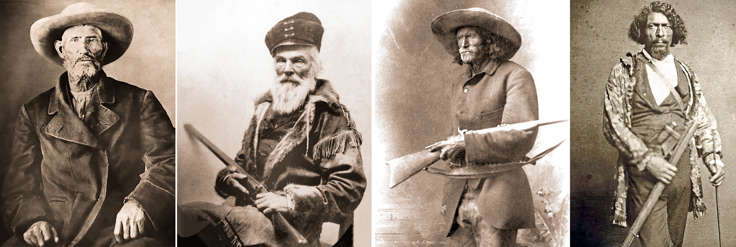
The West began in upstate New York with Natty Bumppo, or Hawkeye, as he was known in The Last of the Mohicans, and gave us the prototype of the rugged individualist. He morphed into Jim Bridger, Daniel Boone, Davy Crockett and various mountain men living in the wilderness.
Jim Bridger; Joseph Walker; Jim Baker; Jim Beckwourth
These heroes played out the myth of how we conquered a vast wilderness with rugged individualism and tenacity. It grew into the myth of Manifest Destiny.
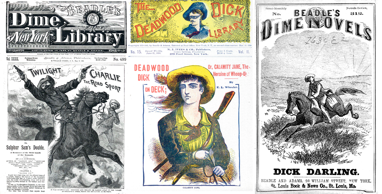
After the Civil War, when economic exploitation of the West began in earnest, with mining and cattle industries, the cowboy took over, with adventurous exploits popularized in a thousand dime novels. Certain names begin showing up with regularity, including Buffalo Bill, Wyatt Earp, Jesse James, Belle Starr. These elided into the early Western movies, including The Great Train Robbery (1903) and Across the Plains (1911), which starred Broncho Billy Anderson, the first cowboy movie star.
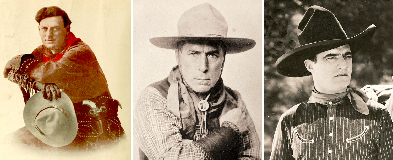
And a split in the myth. On one hand, you had William S. Hart, who attempted a level or realism in costume and plot (matched with a high level of sentimentality), and on the other hand, you had Tom Mix, the show-biz cowboy all duded out with fancy kit.
The difference was between movies made for general audiences and those aimed at children, mainly young boys. Mix brought glamour to the Western, with fancy cowboy duds and sparkling saddlery to his horse, Tony.
That split continued into the sound era with hour-long Saturday matinees with Hoot Gibson, Bob Steele and dozens of others, including John Wayne, who made scores of cheap oaters and even took to trying out as one of the singing cowboys that were briefly popular.
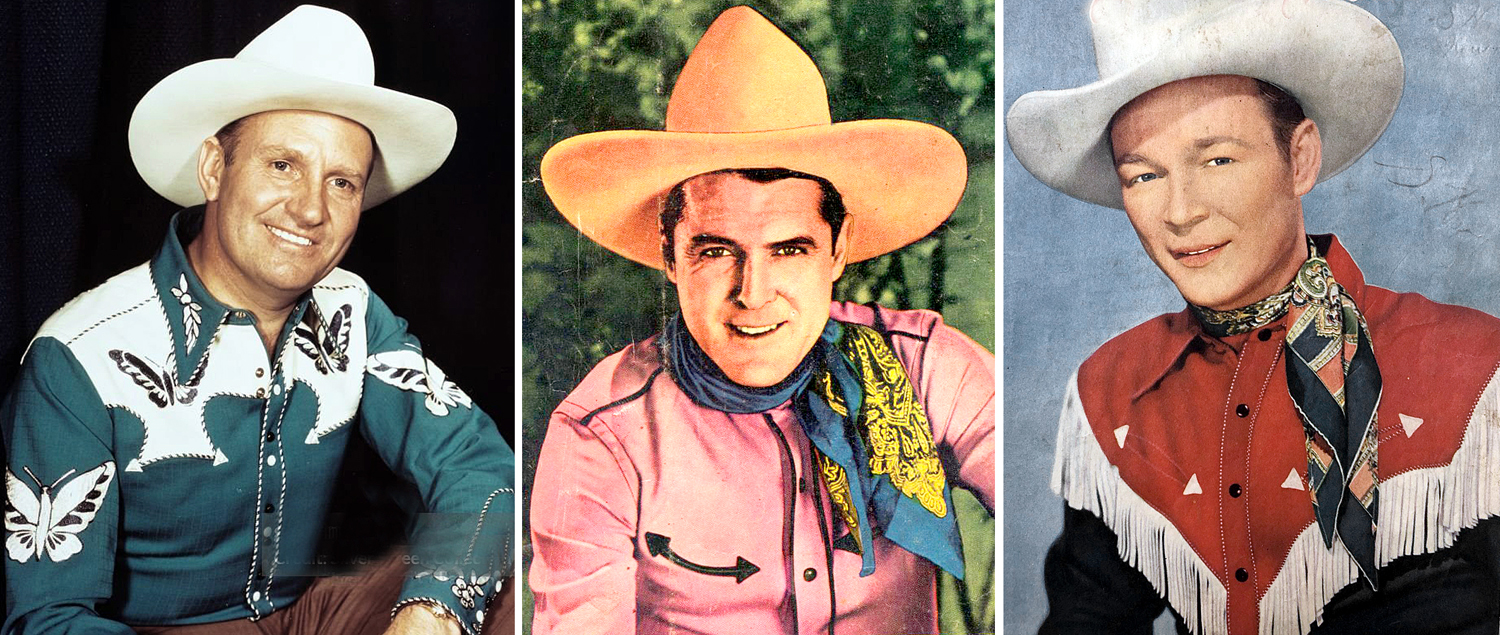
Through the 1940s, the cowboy movie became stereotyped with stars such as Roy Rogers, Gene Autry and William Boyd as Hopalong Cassidy. There was little attempt at realism. Sometimes they actually fought Nazis.
These were the cowboys wearing shirts with crescent pockets and shoulder fringe, and often sported a six-gun on each hip.
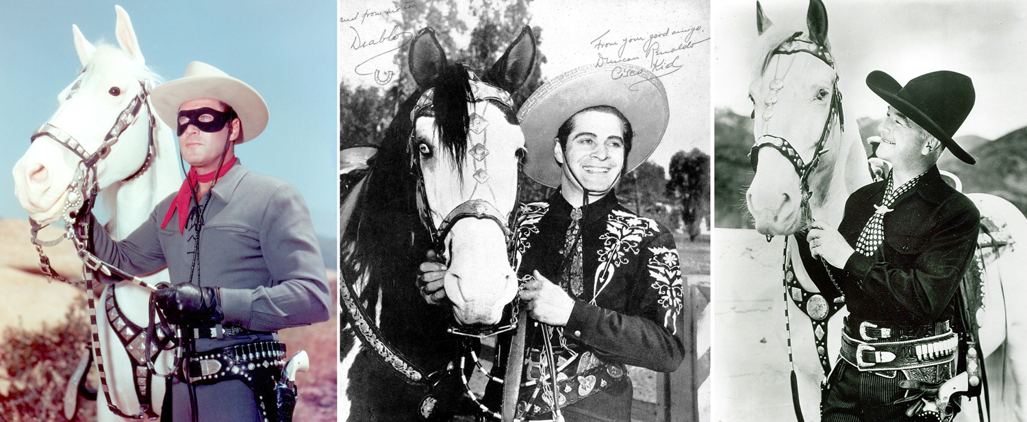
All that carried over into the television era, with a skein of popular Westerns mostly aimed at kids: The Lone Ranger; The Cisco Kid; renewed popularity of Hopalong Cassidy.
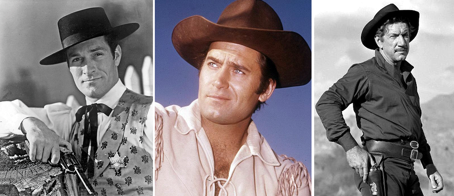
Meanwhile, there were always Westerns made for grown-ups, too. From John Ford’s Stagecoach and Howard Hawks’ Red River, through the Budd Boetticher films with Randolph Scott. There was Shane, and High Noon, and Winchester ’73.
Initially, the lone hero version carried over into the TV era, also, when The Life and Legend of Wyatt Earp, with Hugh O’Brien, kicked off a decade of evening programing with cowboy heroes, such as Cheyenne, Maverick, Have Gun — Will Travel, Bat Masterson, and The Rifleman. And, of course, Gunsmoke. You can name a dozen others. The market became glutted and then, suddenly, it seems, Westerns were shot dead.
There came a cultural shift. Maybe it was the Vietnam War, maybe it was fatigue with the cowboy cliches, but when Westerns eventually did return to the silver screen, they took a dark turn. There had been revisionist Westerns before. Indians weren’t always the bad guys. But starting in the 1960s, with films such as Ride the High Country (1962), A Fistful of Dollars (1964) and the subsequent Spaghetti Westerns, Hang’em High (1968) and ultimately, The Wild Bunch (1969), the new Western was brutal, filled with low-lifes and lots, and lots of grime.
“McCabe & Mrs. Miller”
The trend continued through McCabe & Mrs. Miller (1971) to Unforgiven (1992). Even the more positive films like those from Larry McMurtry novels or with Tom Selleck attempt a more naturalistic view of the times in which they were set.
Of course, there’s a good deal of overlap in the eras. It’s a question of what predominates in what decade. There have been revisionist Westerns from the earliest years, but this view of the overall shape of the Western in American consciousness over time is, I believe, basically accurate.
What is not accurate, though, are the Westerns themselves. Admittedly, they were never really intended as realism: They are myth and they are national epic. Our equivalent of the Iliad or the Kalevala. Even those attempting fidelity to historical fact ultimately underline the myth more than the fact. “When the legend becomes fact, print the legend.”
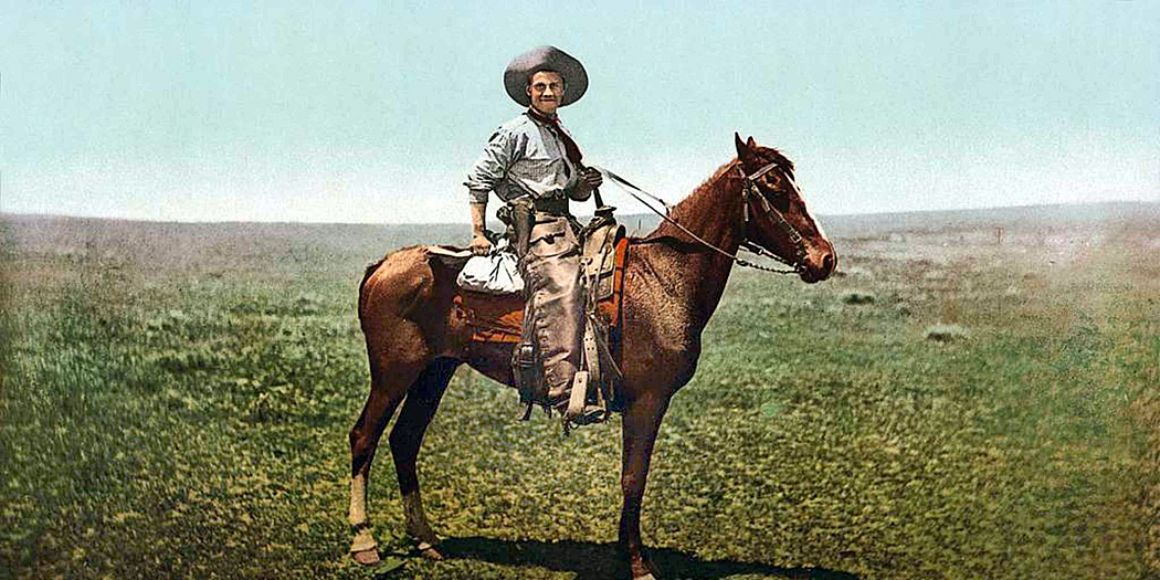
Actual cowboys
As a kid, I loved the cowboy movies, but as an adult, I am bothered by them. I try to remember they are not meant to be documentaries, but crystallizations of myth, and you don’t expect myth to be realistic. You don’t ask Hercules if he has a mortgage.
Yet, there are sore thumbs that stick out for me in almost all filmed Westerns; four of them — aspects that scream out: “No, this isn’t the way it was.” And perhaps that shouldn’t matter, but these things make it difficult for me to appreciate Westerns the way I did when I was a kid.
I have four primary gripes. They are: economy; geography; ethnic diversity; and language. Let’s take them in order.
Two movies, same location
Towns exist in Western mainly to stand in for civilization. It’s where the people are — the people largely left undefined. They stand in front of general stores or the saloon while the heroes and villains play out the ritual of the gunfight. The same set can be used and reused in many pictures, even as diverse as Westworld and Blazing Saddles. The Western movie town is just the stage set for the plot.
But actual towns are built for economic reasons. There was some industry that needed workers and the workers needed services, and so, towns grew. But in most Western movies, there doesn’t seem to be any functioning economy. There are references to cattle and ranches, but aside from giving rustlers something to do, they barely show up as economic factors.
While the standard movie Western town has its saloons, its general store, its hotel and restaurant, its stable and blacksmith, there is never a thought to where its residents get the money to pay for their drinks, meals, gingham or horseshoes. A town doesn’t grow for just no reason.
Even Dodge City, in the 1870s, when Gunsmoke is supposedly set, had a mayor and council and a police force. There would also likely have been an elected sheriff for Ford County and a judge, to say nothing of at least two lawyers, advertising on the front page of the Dodge City Times in 1878.
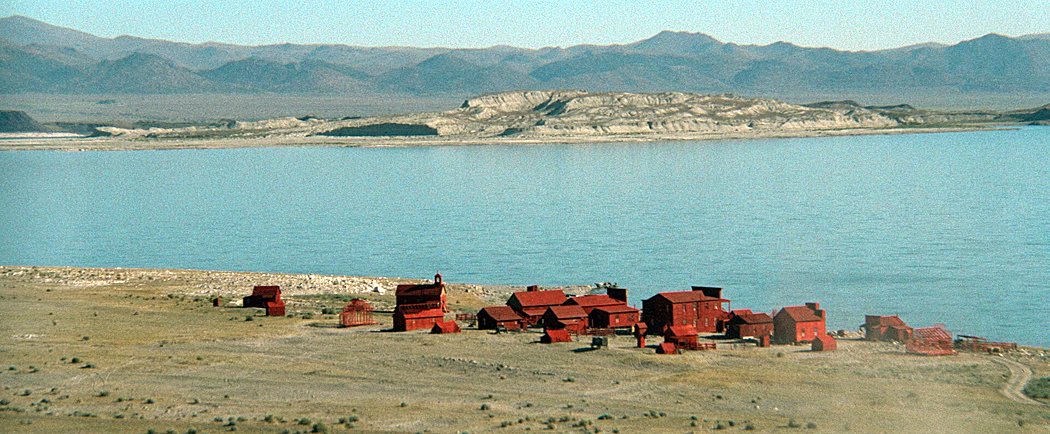
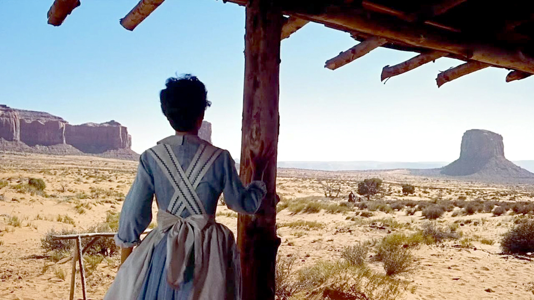
Sometimes it is downright preposterous. Consider Clint Eastwood’s High Plains Drifter. Its town is built on Mono Lake in California with no economic base at all — just a hodgepodge of buildings erected near a salty lake that cannot even provide drinking water for the residents.
“High Plains Drifter”
Or, one of my favorites, the supposed farm built in Monument Valley in Arizona, in The Searchers. The idea of such a farm is ludicrous — not made better because the landscape is supposed to stand in for Texas.
“The Searchers”
Again, there is a reason towns were built where they were. On rivers for shipping; near mines to provide supplies and provisions; along railroads to ship cattle; near army forts to unload soldiers of their pay.
As seen in the movies
My second beef with Westerns is its geography. Most of the Western tales we have historically took place in the most boring landscapes imaginable, in Kansas, Nebraska, Missouri, Texas.
What the actual working West looked like
But such places are not very photogenic. And so, we move them lock, stock and barrel to the Rocky Mountains, the Desert Southwest or California’s Alabama Hills with the Sierra Nevada in the background.
“Gunsmoke”
Even Gunsmoke, set in Kansas, sometimes shows a mountain range off in the distance sighted down the main street. (I’ll discuss Dodge City in more detail in Part 2 of this essay, to follow). Matt Dillon is sometimes shown accompanying a prisoner, for instance, across the Rocky Mountains or into the desert, hundreds of miles from his jurisdiction. To say nothing of the months it would take to ride there on the back of a horse.
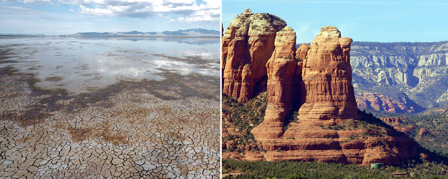
In the 1950 film Broken Arrow, Jimmy Stewart rush back from Lordsburg, N.M., to Tucson, Ariz., and somehow manages to pass through Sedona, Ariz., on the way — a detour of several hundred miles. Clearly Sedona was more photogenic than the Wilcox Playa or Benson.
Wilcox Playa (left); Sedona, Ariz. (right)
As in so many Westerns, the West is just a mental landscape, where any buttes and saguaro cactus will do as a setting.
As a sidenote, related to the geography: Cowboys stranded in the desert reach for their canteen and take a slug of water, or else hold it upside down so we can see it’s empty. I lived in the desert for 25 years and can tell you water is a big deal. Driving through Death Valley one July, I became so dehydrated I developed a headache and was beginning to become disoriented. I had to drink a full gallon of water to recover. A few swigs from a canteen is basically meaningless.
The third and fourth distortions are perhaps less important, but they nevertheless stick out for me when I’m watching an old Western. There is the lack of ethnic diversity and the matter of speech.
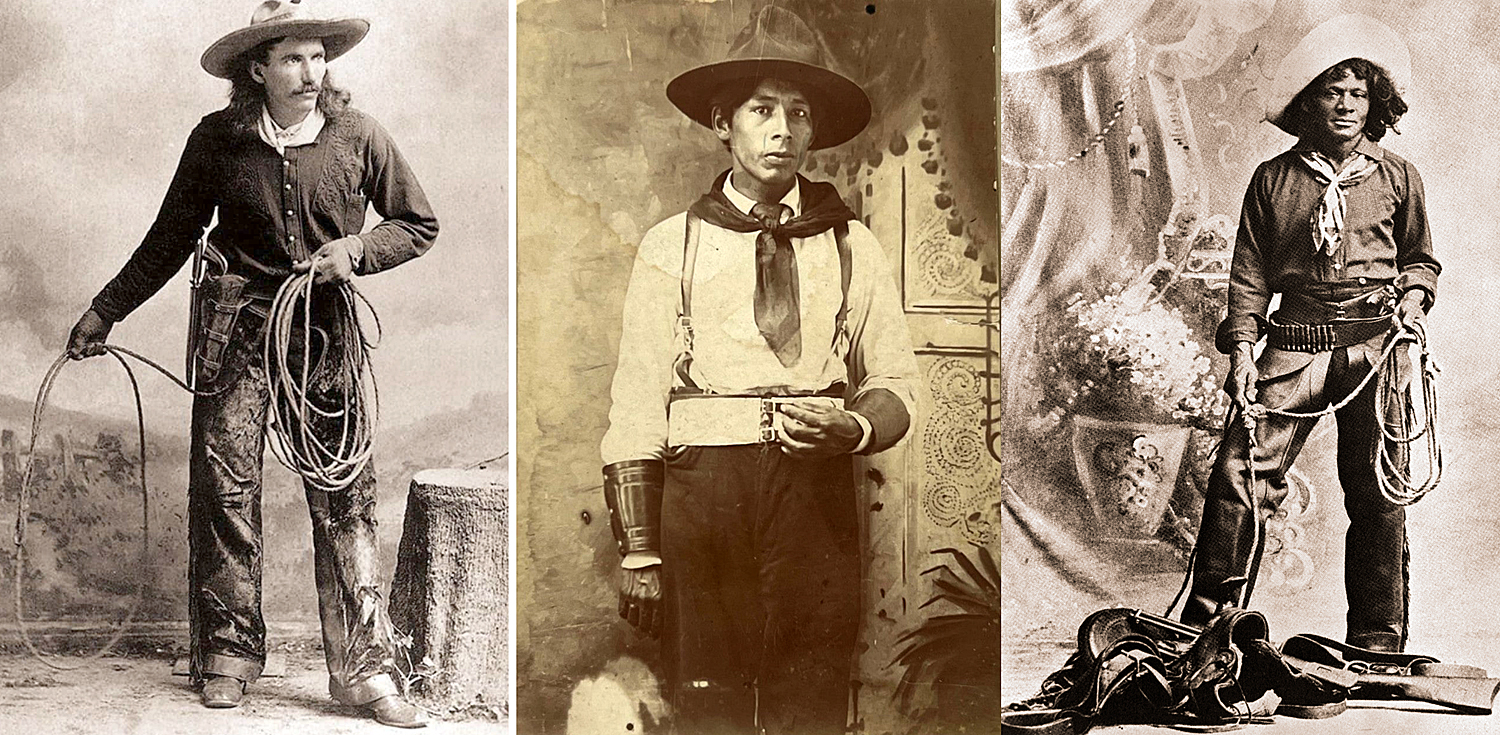
Cowboys: Vanilla, Native American; African American
It’s been documented that about a quarter of all cowboys were African-American. They don’t much show up in the movies (John Ford had his Woody Stroud and at least that was a nod to the fact). And another 20 percent were Mexican and many were Native American. In the towns, segregation was normal, even if the working cowboys out on the plains were mixed. Virtually all the laundries and restaurants in the Old West were run by Asians, mostly Chinese. Other ethnicities were notable factors in various troubles, as the Irish clashed with the English.
Finally, there is the language spoken in 19th century America, which was much more formal than we take for normal now. In the Western movies, the actors tend to speak in the manner current when the films were made, and that changes over time, just the way the hats went from 10 gallons to three pints, and the brassieres just kept getting pointier.
The evidence from letters and from novels written during the period tell us that people spoke in longer sentences with fewer contractions. At home, you might relax when talking to your spouse or children, but in public, you attempted to be correct. Even the illiterate miners and farmers spoke more formally.
This last bothers me less, because if Randolph Scott or John Wayne spoke as they would have in the Old West, the audience might laugh, or at least yawn. How often have you heard parodies of Ken Burns’ Civil War, when they read letters soldiers wrote home? What was normal speech in the 1870s sounds utterly archaic, even stilted, to our ears.
Next: Part 2 — A look at the historical Dodge City
Take two of the most famous paintings in the Louvre. Most of us first experienced them in pictures in a book, perhaps Janson’s History of Art in an art history class. Or, projected onto a screen in the darkened classroom while the teacher pointed out details of the iconography. But these are images, not paintings.
Often, today, we confuse the two, seeing pixels on a cellphone or iPad, and can easily believe we know the art because we can recognize the familiar shapes and colors. That is why so many people remark, on visiting the museum in Paris, about how “small” the Mona Lisa is.
It’s not that small, of course. It’s a fairly normal size for a Renaissance portrait, but the fact is that separated out, as it is, for display, it takes up precious little wall space. Really, most people hadn’t given any thought to the actual size of the painting when seeing the reproduction in a book. It’s just an image, an icon, familiar not only in its regular shape, but also parodied to death in comic take-offs.
You could look at the caption next to the printed image in your book, and see that there is a bunch of information in parenthesis beyond the identification of artist and title. It will often give you the date, in which museum collection it resides, and the size of the painting. In the case of the Mona Lisa, 21-by-30 inches.
But then, perhaps you wander into the gallery with Théodore Géricault’s The Raft of the Medusa. You’ve seen it in your Janson and think you know it. You don’t. It is 16-by-23 feet — the size of a billboard.
You see them as images, and they are adjusted to the size of the page and you can have no sense of their relative sizes.
But walk through the Louvre and it is quite different.
I remember when I was a teenager and going to the Museum of Modern Art in Manhattan and seeing Picasso’s Guernica, which stretched out across its own wall. You could see it from afar, stepping out of the elevator and looking to your right, several galleries away. Just under 12 feet high and 26 feet across, it was more than a painting and more than an image. It was a presence.
And that was part of its meaning. It was made in outrage over the 1937 German bombing of the Basque down in Spain and if it had been made to display comfortably on a gallery wall, it would have been just another painting for sale. But at size, it forces you to consider the suffering and death. Its size means you cannot just look away.
The world we live in is increasingly a virtual one. The TV screen, the computer screen, the cellphone screen, the tablet and even the wristwatch screen have become so normal to our daily lives it has become easy to mistake what we see there as real. It is not.
You cannot have the personal experience of Guernica from a photographic reproduction or a pixel image. You can memorize its iconography and discuss its provenance and the biography of its creator, but you will not have the gut-level experience of it I had visiting it at MoMA.
And it isn’t just the size. Seeing art in person means you can see the pigments used, the brushstrokes, the opacity or transparency of the paint, whether it is on panel or canvas — a whole range of physical properties not apparent in a reproduction, and all of it — in addition to its physical dimensions — are essential to its meaning.
And by meaning, I don’t refer to its symbology. That is language. I mean the experience of it. Vermilion or ultramarine are experiences not conveyed in ink or pixel, and that experience is meaning.
If you walk through the Louvre, another famous art history painting you find will be Veronese’s The Wedding at Cana. Another wallop in the gut. It is 22 feet high and 33 feet from side to side.
If you think of it as a biblical subject, and believe you are “getting” the painting by naming the people pictured, you have missed the central experience of the work.
Even more ordinary size paintings depend, in part, on their dimensions and how you relate to them. A life-size portrait can mimic meeting the person himself. In the Renaissance, one ideal was that a painting should be like a window through which you are looking, and so a window-size canvas was part of the experience.
A giant head is another thing altogether, like the famous head of Emperor Constantine or one of the Olmec colossal stone heads from Mexico. Their size makes you take notice. The same shape, but the size of a cantaloupe, would hardly carry the power of these monuments. I remember the first time, as a boy, I saw the Olmec head at the American Museum of Natural History in New York; the memory of it stuck to my psyche for decades after. Still does.
The same for the huge portrait heads of Chuck Close.
The word often used to describe such larger-than-life art is “heroic.” They have an effect very like that of Achilles in the Iliad or Ahab in Moby Dick. It is a word often used to describe the large paintings of the Abstract Expressionists of the late 1940s and through the 1950s. These were painters of utter seriousness of intent. The last gasp of a non-ironic age, after which came the deluge of meta.
There are artists who use mere size to impart meaning to their work, Anish Kapoor, for instance, in his huge shiny bean called Cloudgate, or the rusted steel curtains by Richard Serra that are best experienced by walking through. But notice that the giant bean is also ironic. It’s a bean, after all, raised to heroic proportions.
But those cigarette-smoking, heavy-drinking and blue-collar wearing guys at mid-century were dead serious. Jackson Pollock painted his first large painting, called Mural, in the mid-’40s. It is 8 feet by 20 feet and meant to be installed in the apartment of Peggy Guggenheim. It led to the later drip paintings that made Pollock famous — in 1949, Life magazine asked “Is he the greatest living painter in the United States?”
Pollock made paintings in various sizes, but it is his large canvases that hold the emotional power that still resonates today. I visited the huge Pollock retrospective at MoMA in 1998 and was blown away by the variety of the paintings, and got a chance, finally, to see Blue Poles, a large 1952 canvas sold to a gallery in Australia in 1973 and unavailable to American audiences since then. It was given pride of place in the exhibition and deserved it, in the center of the room, on a wall of its own. It was lit like a jewel, but a jewel 16 feet across.
Most of the Abstract Expressionist gang trafficked in scale. Franz Kline, Mark Rothko, Robert Motherwell, Barnett Newman, Willem de Kooning, Clyfford Still — all found now in museums taking up whole walls by themselves.
In the 1970s, I wandered through commercial galleries in New York and came across a back room storage of Newman paintings, being arranged for a show, and a group of them were almost two stories tall — monumental. These men (and they were almost all men) took their heroic calling seriously.
After them, the deluge. Even Motherwell turned to irony; the self-importance of the first generation could not be sustained, or even taken seriously anymore. And although Robert Rauschenberg is sometimes classed among the Abstract Expressionists, his work always played with irony.
All that was left after that was Andy Warhol and Jeff Koons. Art took a different turn.
When the Getty Center opened in Los Angeles in 1997, I was an art critic in Phoenix, Ariz., and given the assignment of covering the event. I met with Robert Irwin, who designed the landscaping for the Getty, and had a concurrent museum show at the Museum of Contemporary Art in LA. In a hallway, away from the main work in the exhibit, were a series of early paintings he made. Irwin was a thoughtful artist and his eyes glistened as he discussed those small, early canvases.
“I was thinking about the heroic nature of those Abstract Expressionist paintings,” he said. “And I wondered if they could still work if they were small.” And so, he painted a line of tiny canvases, usually no more than a foot square, with similar abstract imagery on them. Did they work? Were they still heroic? Do you have to ask?
I was born in the upper right corner of New Jersey, just to the west of the Hudson River and a few miles south of the New York state line and the Rockland State Hospital, an asylum famous for once housing Allen Ginsberg and Carl Solomon.
That corner of the map is Bergen County, the most populous county in the state and where I spent the first 17 years of my life, before I managed to escape. It is unrelentingly suburban and, to my young sensibility, numbingly banal. In my senescence, six decades later, I have moderated my disdain and now recognize it as my hatchery — and a part of my psyche that I cannot ever fully extirpate. Like Quentin Compson speaking about his native Mississippi, I can say of my own native state, “I don’t hate it. I don’t. I don’t hate it.”
The Hackensack River
Bergen County is split by two rivers, the Hackensack and the Passaic. The later forms part of the western border of the county and the Hackensack ran through the town where I was raised and drained, finally, into Newark Bay to the south, between Newark and Jersey City, two old cities that show their age.
To the east of the Hackensack, the land rises abruptly until it reaches an edge high above the Hudson River, called the Palisades, a 20-mile long series of basalt cliffs that rise to 500 feet above the water. This bit of America, from Paterson to Manhattan is the landscape of my Umwelt — etched into my psyche.
Since I grew up there and knew no better, I assumed that all rivers must be as wide as the Hudson, and when I first came South to go to college, was less than impressed with what passes for a river there. The Deep River, near my Guilford College, I could have jumped across. That’s not a river, that’s a brook (or, in Southern parlance, a creek).
But the Hudson was noble, wide and impressive. Historically, it ran through the home land of the Lenape Indians and the county is filled with towns and rivers given versions of their Indian names, including my home town, Old Tappan, which was named for the Tappan tribe of Lenape people, which may mean “cold water.” All of New Jersey and parts of Pennsylvania, Delaware and New York were originally Lenape lands.
Other Bergen County Native American names, however twisted by the ears of the early colonists, include: Hackensack; Ho-Ho-Kus; Mahwah Moonachie; Paramus; Teaneck; and Wyckoff.
Names can get quite twisted. In central Jersey the name of Cheesequake was originally the Lenape name Chiskhakink, which meant “cleared land.” Other New Jersey names, some harder to pronounce than others, at least for non-native Jerseyites, include Hoboken, Hopatcong, Manahawkin, Mantoloking, Metuchen, Neshanic, Netcong, Pahaquarry, Parsippany, Pequannock, Piscataway, Ramapo, Secaucus, Squankum, Succasunna, Weehawken, Wickatunk. And that doesn’t count the lakes, rivers and creeks: Absecon; Assunpink; Assiscunk; Hakihokake; Hockhockson; Kittatinny; Luppatatong; Machesautauxen; Metedeconk; Muksukemuk; Musconetcong; Picatinny; Pohandusing; Rancocas; Shabakunk; Waackaack; Wawayanda; Wickecheoke — and that’s about 10 percent of the list. I believe I’ve heard my cat say “Waackaack” at times.
If you’re from there, these names roll easily off the tongue, if not, well — I once heard a newscaster pronounce Parsippany as “par-suh-PAN-ee.”
Then, there’s Kinderkamack Road, which sounds like it should be among the many Dutch names in the area, but is really a version of the Lenape for “Place of the Ceremonial Dance.” But you would be forgiven for mistaking it. After the Native Americans came the Dutch, with their own names for things, such as Kill van Kull, Polifly, Paulus Hook, Schraalenburgh, and Tenafly.
There’s a lot of history in New Jersey, although most Jerseyites pay little attention to it. Not only Native American and Dutch history, but New Jersey was once a slave state. My county, Bergen, was the largest holder of enslaved people in New Jersey, with 20 percent of its population in bondage in 1800. New Jersey was the last of the Northern states to outlaw slavery. At the end of the Civil War, there were about a dozen slaves still owned in the state, eventually freed by the 13th Amendment. By the way, the state voted against Abraham Lincoln both in 1860 and in 1864.
When my father was clearing land in our back yard in Old Tappan, he dug up an old brick foundation that a local historian identified as the remains of an 18th century slave quarters.
The stony ground of the state has seen a lot of history. One of the most famous and consequential battles of the Revolutionary War was fought in Jersey, as George Washington crossed the Delaware River in the winter of 1776 and surprised British forces at Trenton. He did it again a year later.
During the Gilded Age, New Jersey was a comfortable home for corporate monopolies. Before being broken up by the Sherman Anti-Trust Act in 1911, Standard Oil of New Jersey had controlled nearly 90 percent of refined oil in the United States.
Oh, New Jersey. Wikipedia lists more than 50 New Jersey politicians convicted of crimes and corruption, most famously in recent years, Sen. Bob Menendez, who was found guilty of taking bribes after investigators found Menendez had illegally received a Mercedes-Benz car, 13 gold bars, and $486,461 in cash.
The Chin
In my own home town of Old Tappan, Mafia boss Vincent “The Chin” Gigante had a house a little more than a hundred yards from where I grew up. I didn’t know that at the time, but imagine my surprise when, at college in 1970, I turned on the radio one morning and heard the NPR announcer say that the entire police force of Old Tappan had been arrested for taking cash from Gigante’s wife, Olympia.
Other high points in New Jersey history:
It was the home, in Menlo Park, to Thomas Edison’s research laboratory, later moved to West Orange.
New Jersey was the first state to ratify Prohibition.
In 1927, the Holland Tunnel connected NJ to Manhattan, followed by the George Washington Bridge in 1931 and the Lincoln Tunnel in 1937.
In 1932, the baby of Charles Lindbergh and Anne Morrow was kidnapped from their home in Hopewell, NJ., and later found dead. A nation-wide manhunt eventually led to the arrest two years later of Bruno Hauptmann, who was convicted of and executed for the crime.
The dirigible airship Hindenburg, a German Zeppelin, exploded in flames upon landing at Lakehurst Naval Air Station in 1937, killing 13 passengers and 22 crewmen. “Oh, the humanity!”
In the infamous Mercury Theatre War of the Worlds radio broadcast of 1938, Orson Welles claimed that Martians had landed in Grovers Mill, NJ.
And on Sept. 23, 1949, Bruce Springsteen was born, in Long Branch, on the Jersey shore.
The state tends to get divided into three parts, Northern Jersey, Central and South Jerseys. The north is all suburbs of New York City; the south is oriented to Philadelphia and Central Jersey is orphaned between.
But really, there is another way of splitting up the map that is more reflective of the cultural realities. There is suburban and industrial New Jersey, which is a ribbon running from the northeastern part of the state and cuts diagonally across to the southwest, near Philly. This includes not only my Bergen County, but also Newark, Trenton, Camden, and the Oranges — pronounced locally as Onch, East Onch, South Onch, and West Onch. There is no Nawt Onch.
The second part might be considered Appalachian New Jersey and is in the northwest, largely rural and wooded, with the Kittatinny Mountains and the Delaware Water Gap. My summer Boy Scout camp was there, where I was first camper and later camp counselor.
The third part of the state might be called Confederate New Jersey, technically below the Mason-Dixon Line and composed of farm land, swamps and the infamous Pine Barrens, supposed home to the Jersey Devil, a legendary flying demon, said to have been born in 1735 as the 13th child of local woman Deborah Leeds. The child, though born normally. immediately grew wings, tail, and claws and flew out to the Pine Barrens, where, like Big Foot, it is occasionally claimed to have been spotted.
South Jerseyites can even speak with a drawl, separating them culturally from those farther north. The familiar Joisey accent has a pronounced rising “dawg” while in the south, they are closer to a descending “doag.” (The North Jersey accent is quite distinct. We once had a plumber come to fix our “terlet.”)
There is a fourth important component to the state. Some consider it part of South Jersey, but it is distinct enough — and famous enough — to warrant its own regional name. It runs down the eastern margin of the state, from Sandy Hook to Cape May and it is the Jersey Shore. It is not like any other section of the state and has gained notoriety for the empty-brained drunkenness and pointlessness of the MTV “reality” television program. The less said, the better.
The broad stripe that runs diagonally down the center of the state is the heart of what people think of as being New Jersey. Bergen, Hudson, Essex, Union, Middlesex, Mercer, Burlington, Camden and Gloucester counties and parts of others, are both the suburban and industrial centers of the state, and the source of most of the enduring cliches.
But it is the center filet that has all the housing developments, mcmansions, oil refineries and chemical plants — to say nothing of the Pulaski Skyway and the single most trenchant metaphor for the state: The NJ Turnpike. (“Where do you live?” “Exit Four.”)
When I left New Jersey as a teenager headed off to college in North Carolina, I shook the dust off my sandals and said good riddance. I despised the bourgeois banality of it all and couldn’t wait to get to the “real” stuff that higher education would show me: art and poetry and music, and — well, beer and sex. But over the years I came to realize both that New Jersey was not exceptional in its inanity — that was everywhere — and also more importantly, I had to accept that New Jersey had built my insides.
The pace, the smells, the population density, the architectural styles, the speech, the ethnic and religious diversity I had known had all become the universal norms by which I judged the world.
It came as a shock, for instance, that there were so many churches and so few synagogues in the South. In Old Tappan, there was one Protestant church and one Catholic church and the nearest synagogue was in Closter. Here in my neighborhood in Asheville, there are three churches all in walking distance. Oy.
The Trinity Reformed Church in Old Tappan was presided over by the soft-spoken Louis Springsteen whose basic message to the congregation was that good is better than evil because it’s nicer. No brimstone, no hellfire. My Catholic friends went to St. Pius X at the other end of Cripplebush Road. Some of them went to parochial school and were taught by nuns. It was all just normal, and built that normal into me. Religion made no more difference to me or my friends than hair color or freckles.
I remember my father, raised in Cliffside Park, NJ, telling us that when he was drafted at the beginning of World War II and shipped off to Camp Wheeler in Georgia, he was shocked to find out the camp was segregated. The idea had never occurred to him.
And when I was at college a group of us decided to crash a Ku Klux Klan meeting in Liberty, NC, where the main speaker was the sheriff of Forsyth County, and I was surprised to find out that among the enemies they despised were not just Black folk, but Catholics and Methodists as well. Huh? Humanity never seemed such a narrow concept where I came from.
My Boy Scout troop was presided over by Paul Weinstein and his two assistants, Vern Riportella and Arch Curry. Basically, one of each.
It all, good and bad, became the unexamined bedrock of my personality. I remain somehow in New Jersey, even though I haven’t lived there in 60 years.
The highways I knew in Paramus seemed the normal highways; the shopping malls the size of Delaware were the norms; the traffic was normal; the oil refineries burning off their excess in the night sky was normal; the bus service, the delicatessens, the pizza, were all the baselines I took elsewhere with me.
I mean, come on — you call that a pastrami sandwich?
And New Jersey set the inner tick-tock of my sense of time, a quicker pace. As I’ve aged, the clock has slowed a bit, and living in the South for the majority of my life has moderated the tempo, but it still moves too fast for some. My Anne complains that I talk too fast, according to her North Carolina metronome.
Perhaps it is because my New Jersey innards prompts me more to favor efficiency than courtliness.
And while I grew up thinking of my home state as intellectually stultified, I have to grant that there are random points of light. I hesitate to include James Fenimore Cooper among them, after reading Mark Twain’s “Fenimore Cooper’s Literary Offenses” — “Cooper has scored 114 offenses against literary art out of a possible 115. It breaks the record.” — but New Jersey was also the adopted home of Walt Whitman and the very subject and marrow of the poems of William Carlos Williams. There were also Stephen Crane, John Ciardi, Joyce Kilmer, Philip Roth, Amira Baraka (aka LeRoi Jones), George R.R. Martin, to say nothing of the Ginsbergs, père et fils. The Jersey Shore town of Long Branch alone has given us Springsteen, Norman Mailer, Robert Pinsky, and Dorothy Parker.
Springsteen, Pinsky, Mailer, Parker
New Jersey gave birth to, or was home to George Antheil, Gerard Schwarz, Astrid Varnay, Eileen Farrell, Dorothy Kirsten, Jerome Hines, Sherrill Milnes, Michael Tree, Stephen Paulus, Judith LeClair, and one-third of the Beaux Arts Trio. And that’s not even counting Count Basie or Frank Sinatra.
And visual artists: Charles Addams, John Held Jr., George Platt Lynes, Robert Smithson, Reginald Marsh, George Segal, Tony Smith, Irving Penn, Marion Post Walcott, Cindy Sherman, George Tice, and, most famously, Alfred Stieglitz.
So, there is a serious element in the state, past the saltwater taffy, Miss America contests and Giants football in the Meadowlands. I’ve read work by all the authors, listened to music by all the singers and instrumentalists, either live or on recordings, and seen and often written about the visual artists. I hope that has also seeped in to the brainbox.
After all, maybe I don’t despise New Jersey like I used to, and perhaps I am not alone in having ambivalent feelings about the places that gave us birth and nurtured us. After all, Henry Thoreau complained about the torpor of Concord farmers and townspeople at a time when that village was also home to Emerson, Hawthorne and the Alcotts. Hmm. Might make for a good sonata.
The American Southwest is the landscape of John Ford Westerns, Roadrunner cartoons and, of course George Herriman’s Krazy Kat. It is a landscape I know very well, writing about it often for The Arizona Republic when wearing my hat as travel writer. And while I can’t say I miss big-city Phoenix, I do sometimes feel quite homesick for the desert and the canyons. There is a special sense of space there, of horizons bordered not by trees or homes, but by the curve of the earth.
But there was a time before that landscape and I became intimate, when my wife and I were teachers in Virginia and first planned a summer vacation trip to the half of the country on the other side of the Mississippi River. We were unprepared, back in 1981, for what we found, having been conditioned primarily by movies, television and the occasional Arizona Highways magazine Christmas edition.
Driving west on I-40 across the Panhandle of Texas, through Amarillo, the earth was as flat as a billiard table, but at the exact border between Texas and New Mexico, the bottom dropped out of the land and the highway sloped down onto a landscape with buttes and mesas. This is the West, we thought. Finally here.
On the border between Texas and New Mexico
Carole had always been interested in Indians, and one of the goals of the trip was to visit Canyon de Chelly in the Navajo Reservation. In our Eastern ignorance, we pictured the canyon as these steep walls of rock rising up from the land on either side of us. At least, that’s what the photographs looked like.
Canyon de Chelly by Edward S. Curtis, 1904
But we had it backwards. Canyons are not cliffs rising up, but great holes dug below the surface.
We were lucky, we approached Canyon de Chelly from the east. Most people arrive through the town of Chinle, to the immediate west of the canyon. Chinle is a tourist trap of motels and souvenirs. But coming to it, as we did, there was nothing but pine covered mountains and rocky wilderness. We drove in on an unpaved road — Navajo Route 7 through Sawmill — from New Mexico and coming up to an unmarked fork in the road, we saw a Navajo man sitting next to his pickup truck, which was piled with firewood. We asked him the way to the canyon. He said nothing but turned his head and lifted his chin to point the way. We continued down a wooded hill into a low scrub land, looking across the plain, and I noticed a darker spot in the sun-splashed land. When we pulled over and parked and walked to that spot, it was 400 feet straight down to the bottom of the canyon. It was somewhat like viewing a negative instead of a photograph: It was all backward. It was down, not up. It was Bat Canyon, one of the side shoots of Monument Canyon, one of the many side canyons to the main event.
Of course, we slapped our foreheads (figuratively), because, of course, a canyon is an empty space, not a mountain range. Later as we continued on and found Chinle, and a motel for the night, we realized also how lucky we were to have found the canyon for ourselves, and not through the tourist muck. We had that side canyon all to ourselves. We sat alone on the rim looking down into the abyss for hours, listening to the breeze and the birds, before another car even drove by.
Canyon de Chelly National Monument covers 131 square miles in northeastern Arizona on the Navajo Indian Reservation. Seen from the air or on a map, it is a chicken-foot shape of multiple canyon systems that runs for about 24 miles toward the east and the Chuska Mountains.
Most tourists in Arizona head straight for the Grand Canyon, which is vastly larger and more immediately impressive. “Most famous places are always at least a little disappointing when you finally get there,” my brother once said, “but not the Grand Canyon. You just gawk at it, bigger than you had ever imagined.”
But some of us love the human size of Canyon de Chelly even more than the Grand Canyon. Many days you can pick a corner and have it all to yourself.
We went back many times, after we moved to Arizona, and Canyon de Chelly became a kind of talisman for us. One summer, probably 1998, we decided to hire a Native guide and ride horses into the canyon’s further reaches. We found Dave Wilson, who arranged for us to go up Canyon del Muerto on horses. His teen sons Delbert and Delmar came along, too.
Canyon de Chelly National Monument is divided into two main forks, the southerly one is Canyon de Chelly itself, the more northern is Canyon del Muerto. The national monument’s name is a redundancy, like “Table Mesa” or “Glendale,” since its name derives from the Navajo word for “canyon” — Tsegi — turned by quasi-French transliteration into Chelly, pronounced “Shay.” (There is also a Tsegi Canyon on the Navajo Reservation, near Kayenta, further complicating matters).
Mummy Cave
Canyon de Muerto, or “Canyon of the Dead” got its name in 1882, when topographical engineer James Stevenson discovered two prehistoric mummified bodies in a rock shelter ruin, now known as Mummy Cave, and then named the north branch of the place Canyon de los Muertos, now shortened to Canyon del Muerto.
It could have been named for other reasons. Humans have lived in Canyon de Chelly for about 5,000 years. Long before the Navajo arrived, the prehistoric Anasazi peoples lived in the area and in Canyon de Chelly had built cliff dwellings to protect them from various warring groups. Those ruins are still to be seen in the canyons. And even after the Athabascan-speaking peoples, now called Navajo, arrived, sometime around 1700, the canyon continued to provide shelter from raids and wars with other tribes. It’s a long history of wars, battles and skirmishes, but two occasions stand out more recently.
First, in 1805, Spanish forces, under Antonio Narbona trapped about 150 Navajo in a cave high on the walls of the canyon. In his report Narbona stated “They entrenched themselves in an almost inaccessible spot, and fortified beforehand, we succeeded after having battled all day long with the greatest ardor and effort, in taking it the morning after and that our arms had the result of 90 dead warriors, 25 women and children and as prisoners three warriors, eight women and 22 boys and girls.” That cave is now called Massacre Cave.
Massacre Cave
Then, in 1863, the American Army began an attempt to bring the Navajo to a new reservation at Bosque Redondo in New Mexico, and Col. Christopher (“Kit”) Carson was tasked with rounding the Indians up to march them 300 miles to their new home. He had been given orders to destroy their crops and livestock, and the famous peach orchards of Canyon de Chelly. By March of 1864, some 2,400 Navajo had been collected and marched to New Mexico in the “Long Walk.” Thousands followed in later roundups.
And so, there has been plenty of muerto in Canyon del Muertos.
It might be a good place here to discuss Navajo superstitions and taboos. The canyon is filled with Anasazi ruins — good sturdy brick homes that just need a bit of sprucing up and new roofs. But taboos keep the Navajo from using them, or even entering them. Death is a principle taboo. A person’s name who has died should not be uttered. If someone dies in a hogan, traditionally, you move out and no one ever lives in it again.
There are many more — a list of them could make a book. One online posting names more than 200 such superstitions. Do not look at lightning in a mirror or it will strike your hogan. Do not watch clouds moving in the sky or you will become a slow runner. If you see a shooting star, you have to blow at it or you will receive bad luck. Do not put salt on a piñon nut or it will snow. Do not kill grasshoppers or it will give you a nosebleed.
We already encountered one, when the Navajo man with the pickup indicated the road to take by pointing with his chin and pooched lips. Pointing with a finger is considered aggressive.
In 1993, I went to visit famous Navajo painter Jimmy Toddy in his home in Wide Ruins, on the Reservation. Unlike the hogans he had grown up in, or the ranch houses that pass for government housing on the Reservation, in 1947, he built a two-story frame house with a stone foundation. I parked in the dust of his front yard and entered through a front door that was off its hinges. “I never fixed it,” he told me. “There are bees that made a hive there and it would bring bad luck if I didn’t let them fly anywhere inside or outside.”
At the newspaper where I worked, I became friends with Betty Reid, a Navajo reporter. She asked me to help her copy edit a proposal for a book she was planning.
“Yuhzhee is my Navajo name,” she said. “It means ‘short,’ or ‘small’ in English.” She spoke only Navajo until she was seven and her family, who raised sheep, lived near the edge of the Grand Canyon at a place called Bii Daa. “I’m a middle-age journalist who walked away from a traditional life to write for newspapers,” she said. “The two worlds are very different.”
I once asked her about the superstitions. “Yes, we are very superstitious.” “Do you believe in them still?” I asked. “Oh, no. Very few younger Navajos still hold on to such things. They make no sense.”
She paused a beat. “I still do them, though.”
But back to 1998. My wife, Carole, had been fascinated by Indians and Indian culture since she was a little girl and collected arrowheads turned up by North Carolina farmers plowing their fields. She had always wanted to ride horses with Indians, and now she was getting her chance with Dave Wilson.
We drove to his home, on a bluff just above the entrance to the canyons. His wife invited us in as Dave got the horses ready. It seemed like a very ordinary ranch house with modest furnishings, except that it had a dirt floor and just by the front door was a TV console with its tube removed, letting it serve as a home for a few chickens.
I had never ridden a horse before, if you don’t count a pony ride at the state fair when I was a little boy. Dave assured us his horses were used to beginners and it would be easy. Just follow him.
We mounted the horses and followed Dave and his two sons, each on his own horse. He didn’t lead us down a road, but straight down the side of the hill, at a precipitous angle. I had to lean back so far in the saddle, my head rested on my horse’s rump. Luckily, the horse knew what he was doing. I certainly didn’t. Their hooves slid and kicked up gravel the whole way down.
At the bottom of the hill, it flattened out and we rode into the canyon mouth, turning left into Canyon del Muerto. My horse was balking. It lagged behind the rest and they had to stop so I could catch up. At one point the horse, apparently impatient, began to trot after the others and I feared I would fall off. New Jersey boys make poor cowboys.
What can I say? Not only was I a poor equestrian, but my body was not built for the saddle. One sees bow-legged cowpokes in the movies, who have long acclimatized to the barrel-shaped body of a horse, but my straight legs were agonizingly twisted to the stirrups, feeling like my knee cartilage was being torn sideways from my leg bones. It was a form of Medieval torture. Nobody expects the Spanish Inquisition.
Carole, on the other hand, was in horse heaven. I tried to last through the first few miles, but eventually, I had to get off and let my legs assume their normal lines. I limped around my sturdy mount, trying to regain the use of my knee joints.
Dave had, no doubt, come across such greenhorns before and kindly offered to continue our tour of the canyon by car, and sent one of his sons back out of the canyon to bring back his station wagon. About 20 minutes later, it arrived and we all got in and began the tour again. The older son led the horses back home.
But then, the car got a flat tire. Neither Dave, nor his remaining son, Delbert, cussed or fumed, but acted as if this were just a normal course of events. We got out and waited. Dave took out the spare, but it was flat, too. He never expressed any emotion about it all. It’s just normal.
Carole on horseback; Delbert Wilson drawing; me, standing
Other tour cars passed us, other horse tours. But Dave never said a word to any of them, never asked for help. We sat in the sand for perhaps two hours. Delbert began drawing in the wet sand with a stick, to the delight of Carole, who was an art teacher. The sun went behind the canyon walls and it began to darken.
It must have been about 7 p.m. when another car arrived, driven by Dave’s wife. We all got in and drove back out the canyon and up to Dave’s house (taking the road this time), where they apologized for the cock-up. They offered to feed us supper, but Carole wanted to get back to our motel. Dave’s wife gave Carole a gift of a small necklace and we all smiled and thanked one another.
The impassivity that Dave showed with the problems we faced, we came to know as one of the cultural characteristics of the Navajo — which we learned over time with the many other Navajos we came to know and become friends with. I don’t know what Dave was feeling inside, but outwardly, it was all the same to him.
When we got back to Phoenix, we mailed a box of presents up to the Wilsons.
Canyon de Chelly National Monument is situated on land owned by the Navajo nation, and travel in the park is open only to tribal members or those accompanied by authorized Navajo guides, such as Dave Wilson. The only exception to that is a public trail from the cliff edge down to the White House Ruins, about five miles up from the canyon mouth. You walk down a steep path, 600 feet down through switchbacks and tunnels to the canyon floor. The trail is about 2.5 miles long and leaves you at the foot of White House Ruins, an Anasazi cliff dwelling, first built around A.D. 1060.
The pueblo originally had an estimated 80 rooms, on two levels, with some featuring a light plaster, which led to the Navajo name for the site, Kinii’ ni gai — which means “White House.”
White House ruins by O’Sullivan, Gilpin, Adams, and me
The cliffs above the ruins are streaked with desert varnish, a mix of iron and manganese oxide, that makes a visual scene that is absolute catnip to photographers. The first photo of the ruins and the varnish was made in 1873 by Timothy O’Sullivan, but a parade of others have followed, including Laura Gilpin in 1930, Ansel Adams in 1950 (having made an almost identical photo in 1942), and me in 1981. Gilpin visited and studied the Navajos and the land they occupy and published, in 1968, the classic book, The Enduring Navajo. It is still in print.
The scene absolutely frames itself, which means that hosts of images are basically repeats.
Photos by Tad Nichols, 1931; Jerry Jacka, 1976; Don Whitebread, 2009; Patrick McBride, 2012; Richard Boutwell, 2017
It’s a highly tempting subject and I’m sure that many other tourists have made the same picture, now with their iPhones.
Without getting down into the canyon, you can drive along its rim, both along the south branch and the north, with overlooks at such famous vistas as Spider Rock and Massacre Cave.
You stand at the rim of Canyon de Chelly on the Navajo Reservation and look down to the braided stream at the bottom that scoured this great hole out of the sandstone and wonder how long it must have taken. Then you see the tiny Anasazi relics built into the walls of the rock and realize how long people have been living here, and then you see the sandstone itself an think about how much longer ago — exponentially longer — that ancient river deltas deposited the silt that later became that stone.
We visited Canyon de Chelly many times, and at one point, Carole applied for a teaching job on the Reservation. We drove up for an interview, but the terms of the employment contract would have made it difficult to ever afford to live there — the 10-month contract came with a 10-month lease on a home, meaning we would have to leave with all our belongings during the summer months. It was clear they would rather have a Navajo teacher than a bilagáana. We couldn’t begrudge them that.