
Two things about Texas: It’s big and it’s empty.
For most of us, crossing Texas along the interstate, it is two days of tedium, flatness and gravel, waiting to get from the desert West to the humid East.
But there is another way to eliminate the tedium of the unavoidable crossing of the world’s largest vacant lot: Slow down, take your time and enjoy it.
That is what I decided to do when faced with yet another transcontinental automobile trip. I stayed off the interstate and took the back roads from El Paso to Beaumont, passing great views, interesting topography, peculiar history and even more peculiar people.
Mile 0 is the boundary between New Mexico and Texas, entering the state at Anthony. I drove through in the early morning, with the sun just sitting on the horizon, the Franklin Mountains to the east looking the color and texture of gray suede. The dew had raised the smell of the creosote bush.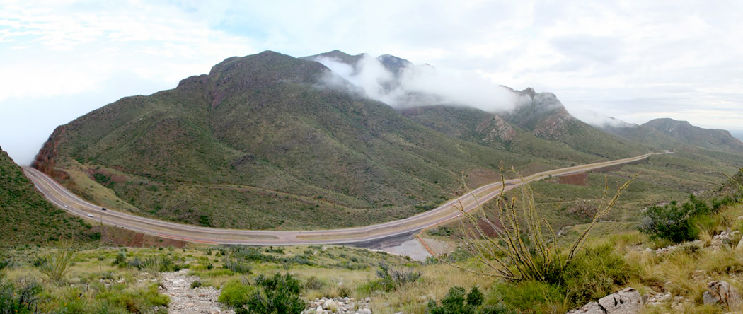
The first real chance to get off I-10 comes with the Trans-Mountain Expressway, that lifts you up and over the mountains and into Fort Bliss, just north of El Paso. As you descend, you pass the U.S. Border Patrol Museum and the streets of the military  reservation named for out of date missiles: Minuteman and Bomarc.
The next goal is the Hueco Mountains along U.S. 62. As you get to the top, at mile 56, you can spot the Guadalupe Mountains, highest point in the state, some 75 miles in the future.
The road passes along the dry regions of western Texas, with few people and even fewer gas stations. The first is at Cornudas, a one-time Butterfield State stop, now a dilapidated gas station and cafe, with souvenirs.
The sign outside reads, “Welcome to beautiful downtown Cornudas, pop. 5 or 6.”
Inside, the cafe is covered from head to foot in collectibles: old hubcaps, old postcards, things written on old napkins, old license plates, old photos and newspaper clippings. The ceiling is hung with things, including souvenir ballcaps, each individually wrapped in clear plastic.
The tables, too, are loaded down with writings, some printed, some hand-written, then covered with plastic. The table legs are wrapped in blue-jeans legs and bottomed with cowboy boots.
And on every table, along with menu and salt and pepper shakers, are copies of Lyndon LaRoushe’s wack-o New Federalist newsletters. This is a cafe with a political point of view.
And one table, near the cash register, sit two or three aging, potbellied “cowboys,” dressed in overalls and scratchy with whiskers. They look up at me as I enter, as if I were a spy come to undo their righteous cabal.
Nevertheless, I have a wonderful breakfast, which I recommend to all, a good Spanish omelet, toast and sliced fried potatoes.
When I finish, I ask if I can get gas.
“Sorry, we’re all out,” the waitress tells me. “But you can get some up about 15 miles at Route 1111.”
Paying the bill, I say to the nice woman behind the counter, “You sure are a far piece from civilization,” and she said with a smile that was only slightly ominous, “That just the way we want to keep it.”
Unfortunately, the gas station at the crossroads is closed. But another 15 miles down the way, at Salt Flat, there is another. Actually, it is a pile of corrugated tin and stucco buildings surrounded with cyclone fence. I pull in, amble up to the office and find it is locked, despite the “Open” sign in the window.
A dog barks, then another, then a few more. Behind the fence they are howling. A house sits across the dirt lot from the pump. Its door is closed. No one stirs. The sun is beating down. I honk my horn. I ring the doorbell. Nothing. Silence, except for the dry, angry barking of junkyard dogs.
West Texas is a very empty place. The air is desiccated, the ground is sandy, the mountains are heated stones, even in October.
It is not surprising that this group of shanties in Salt Flat seems like a set for one of those cheap made-for-TV stalker films. The area was also the site of the 1877 El Paso Salt Wars, when private industry bought the land and began charging for the salt that had previously been collected free by Indians and Mexicans. Many lives were lost.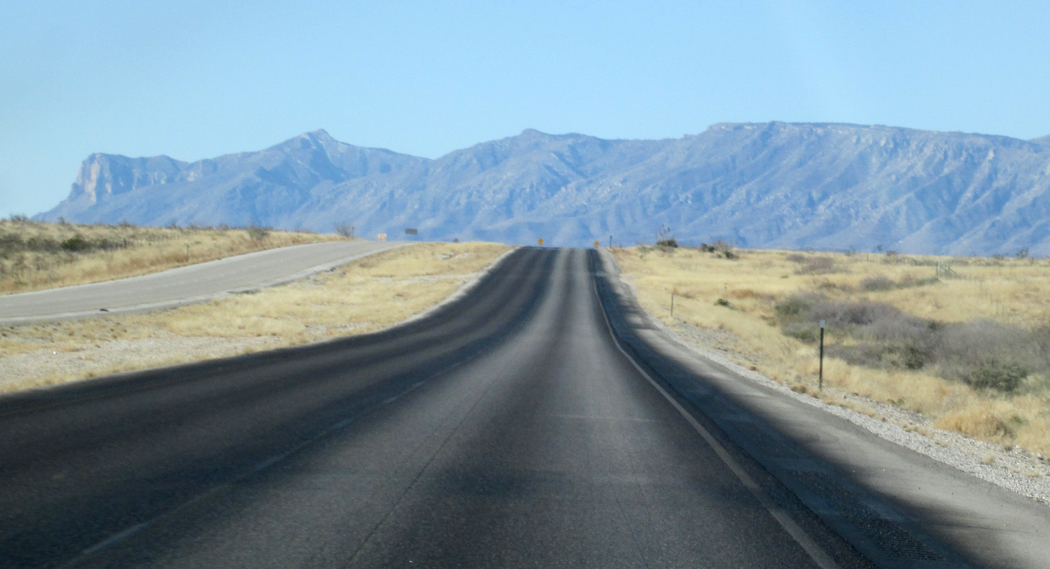
The road curls just south of El Capitan, the prominent peak at the head of the Guadalupe Mountains and one of Texas’ national parks.
To the east at mile 105, the Delaware Mountains are lined with some 65 electricity-generating windmills.
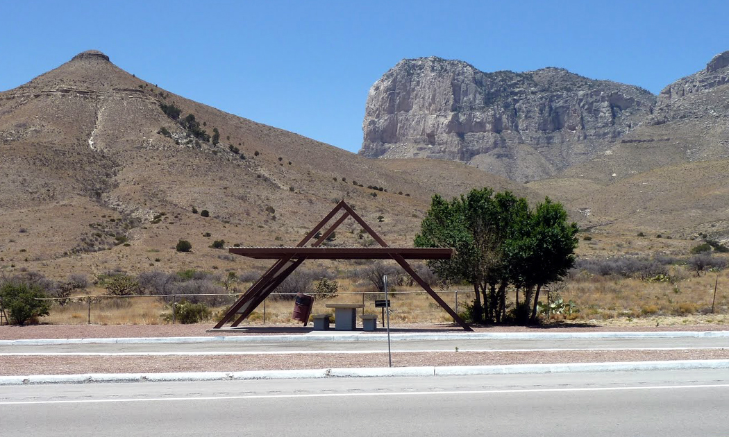
But it is the Guadalupes that dominate. In their wrinkled canyons are trees and streams. There is birdlife and butterflies. At the visitor center little yellow butterflies wink in the butterfly weed.
“We had fall color here last week,” the ranger tells me. “But we had a 90-mile-an-hour wind come through and we don’t have any fall color anymore.”
They also don’t have any gas. The nearest is in the next state, 35 miles to the north at White City, N.M., near Carlsbad Caverns.
But I take the turn southeast to Orla. At mile 145, I enter the Central Time Zone, but time is certainly meaningless here among the cows and chaparral.
At the Orla Grocery, mile 185, the sign says, “It’s a long way to anywhere from Orla Grocery.”
The town is made up of a few sagging shacks, some tilted all the way over. There is also a yard filled with oil-drilling machinery, marking a change in geography. From here to the Hill Country, there is oil.
Reeves County, which includes both Orla and Pecos, is a flat, arid grassy land. In Pecos, the historical marker tells about the Pecos cantaloupe:
“Nationally famed melon, originated in this city. Residents from 1880s grew melons in gardens, noting sun and soil imparted a distinctive flavor.”
It goes on to say, “Famed lecturer Helen Keller, Presidents Eisenhower and Johnson, and many other distinguished persons have ordered and appreciated Pecos cantaloupes.”
But it is oil that is most apparent, especially as you enter the rocky hill country near Iraan.
The town is named for Ira G. Yates and his wife, Ann. It was under his ranch that the Marathon Oil Company — then Ohio Oil — discovered the biggest oil field in Texas and one of the biggest in the world.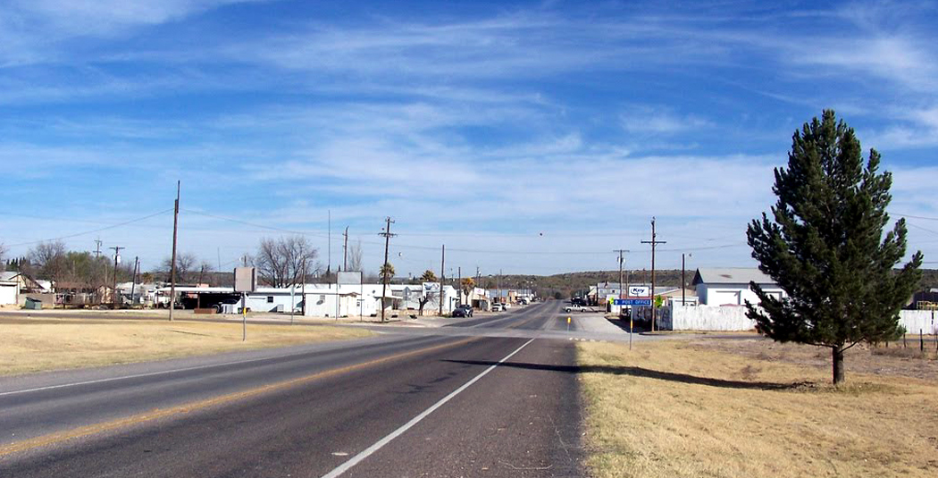 Previously, oil experts had agreed, “You won’t find oil west of the Pecos River.” But they did. Within a year of the first well, struck in 1926, the Yates field had 100 wells dug. It now has more than 600.
Iraan is also the birthplace of the comic strip, “Alley Oop.” It was created by V.T. Hamlin while he lived here. Giant statues at the town playground immortalize Oop, his girl friend Ooola and his dinosaur, a 65-foot-long Dinny.
In the middle of town, the school sports a sign that says, “Iraan Braves, 1996 Double-A State Football Champs. 16-0.”
It is a long draw — some 90 miles — to the next town, Eldorado. The road, U.S. 190, passes some of the most beautiful scenery in Texas, with mesas and buttes, trees and scrub.
But at the halfway point through the state, at Brady and mile 507, is the geographical center of Texas. Or so the town claims.
As the crow flies, it is 437 miles to the state’s westernmost point, 341miles from the most easterly point, 401 miles from the most southerly point and 412 miles from the most northerly.
“Enclosed within the 4,137-mile perimeter of the state are 267,339 square miles or 7.4 percent of the nation’s total area,” says the historical marker. “Fifteen of the 50 states could be readily accommodated within Texas’ borders — with more than 1,000 square miles left over.”
It isn’t only the land that changes as I head into the eastern half of the state. The humidity rises, so that when I wake up the next morning after a night in the motel at Brady, the streets are so wet with dew, it looks as if it had rained in the night.
The heavy dew also brings out the smell of the grass and the dirt.
South of Brady, U.S. 87 enters the Texas Hill Country, an bubble of limestone that rises in the center of the state and continues north from the Balcones Escarpment. It is an oasis in the monotony of Texas landscape, with streams, forests, lakes and the former home of former President Lyndon Johnson.
It comes as a shock to me how incredibly beautiful the LBJ Ranch actually is. And it is also a shock to hear Johnson, in old TV footage shown at the visitor center, talk about his love of the land.
I grew up at a time when Johnson was demonized for his policy on the Vietnam War. I never thought of him as anything but a power-mad monomaniac. But the LBJ Ranch, mile 592, humanizes him considerably.
On the TV footage, he talks about watching deer jump the fence on the farm, about watching a yearling fawn, about raising the cattle and sheep. He speaks with genuine affection and without any of the boilerplate rhetoric that was his signature.
And I realized how Southern he must have been, how much the land meant to him, despite anything he did in the “halls of power.”
I walk around the property on the edges of the Pedernales River, along Williams Creek that empties into the river.
There is the tannic smell of autumn leaves on the ground; there is hackberry and post oak and Virginia creeper along the fenceposts.
The creek is filled with bluegill sunfish, Texas softshell turtle, minnows, yellow mudturtles, bullfrogs, Rocky Mountain toads, crayfish, Rio Grande leopard frogs and the blotched water snake.
It is nature full of its variety. The river itself has kingfishers, mallards, Texas sliders, coots, largemouth bass, red sunfish and catfish.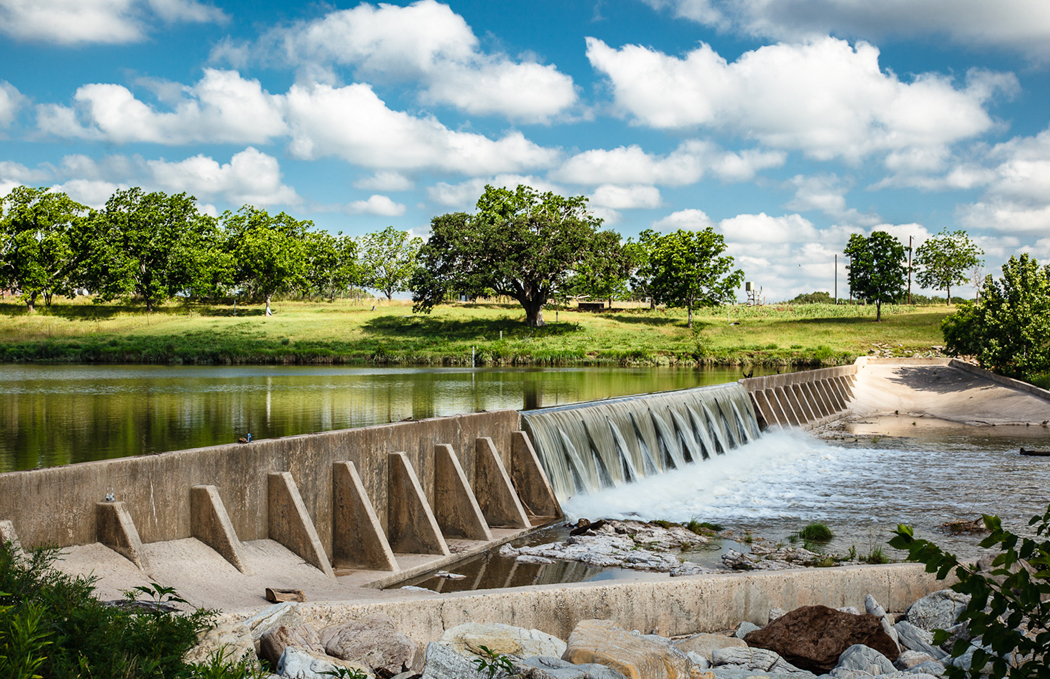
As I stand on the bank of the river, under a pecan tree, hundreds of years old, a black anhinga flies up over the small dam that creates a cascade in the river, and four white geese try to cross the dam from the opposite shore. No, it’s five.
A nature trail winds around a fenced in deer enclosure and one of them comes up to nibble some grass I hold out for it.
The trail continues into a small demonstration farm, typical of those in the area when Johnson was young. Five sheep and two little lambs are resting and sleeping. One of the lambs is curled up in a ball next to the woodpile. 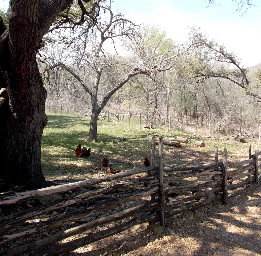 Uncounted chickens run around the yard under the shade of post oaks and sumac and one big old live oak.
A few feet on, I spot a newborn lamb, just a few months old, his ears sticking straight out, catching the sun from behind. He is looking right at me.
Over my head, I can’t quite see him in the sunlight, but I hear him tapping: It is a flicker.
And over the very top, there is a hawk flying, soaring over the top of the farm. The little lamb shakes his head and flaps his ears.
The ranch is a paradise, an Eden, and I want to stay here.
From the ranch to the Louisiana boundary, Texas becomes increasingly Southern rather than Western. The landscape becomes more forested, the towns closer together and the traffic thicker. And the humidity becomes intense.
I pass Dripping Springs at mile 629, Ledbetter at mile 728. At mile 766, I cross the Brazos River. It is still full from last summer’s heavy rains.
At mile 803, I see my first mention of the word “Cajun,” and I know I am near the end of the state.
At mile 823, I enter Cut and Shoot, a town more memorable in name than substance. It is just another junked up Southern town, filled with pickup trucks and Carol Sue’s Country Kitchen: “Dine in, Carry out, We deliver, Barbecue and fixin’s.”
After the dryness of western Texas, it is frightening to see the Trinity River in flood, swollen way over the woods on each side of its banks. The adjoining farm fields are lakes, with a few old cornstalks sticking up through the surface. The river water is still moving with a swiftness that looks as if it could wash away a town.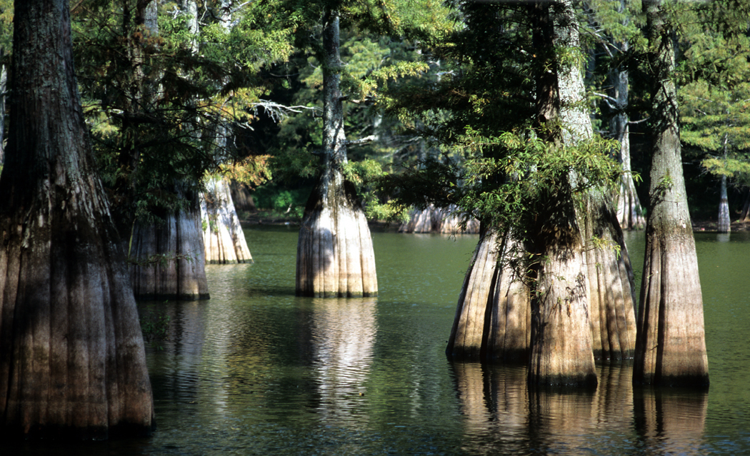
And north of Sour Lake, the many sections of Big Thicket National Preserve looks as if it might as well be Louisiana, with its cypress sloughs and dense forests of beech, magnolia and loblolly pine.
I join I-10 once again in Beaumont, mile 905, and it will be interstate from here on. And I cross the Sabine River into Louisiana at mile 933. The interstate mile marker reads 881, which means I have only added 52 miles by taking the back roads.
But I have seen, heard, smelled and tasted so much more.
