Archive

Tag Archives: cadillac mountain

In October my ex-wife and I decided to take a drive from Asheville, N.C., to Sullivan, Maine, to visit our old college friends, Sandro and Mu. This is Part 4 of that trip. 

Oct. 21

State mottos. “Virginia is for lovers.” “West Virginia: Almost Heaven.” New Jersey: “Home of  Jimmy Hoffa.” And Maine: “The way life is supposed to be.”

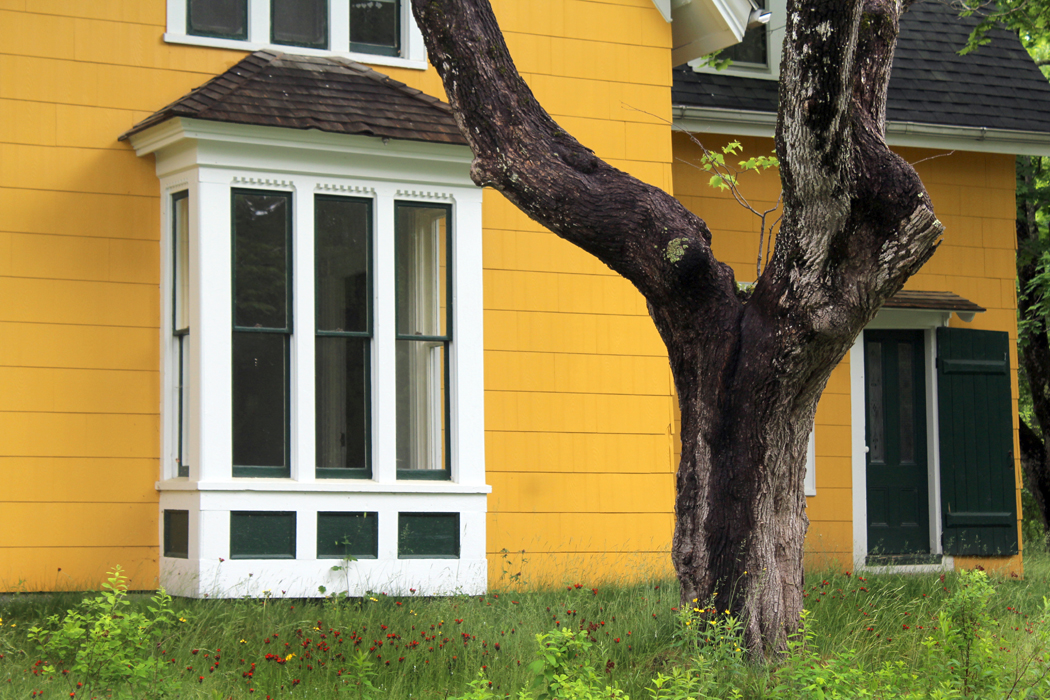
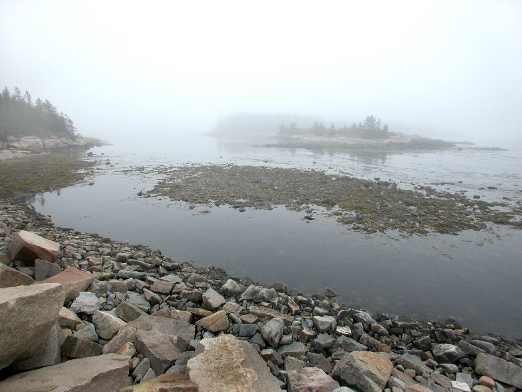
I need to catch up on a few things I’ve passed over so far. One of these is Mount Desert Island, or MDI as it is called here. One of the things Anne wanted to see was Bar Harbor, MDI, and Acadia National Park. 

Perhaps I am too jaded: I’ve been going there since 1978 and in the summer, it is so jammed that you can hardly move an elbow without stabbing the next guy. This was October and the crowds have drained out, although even a fall visit means traffic. 

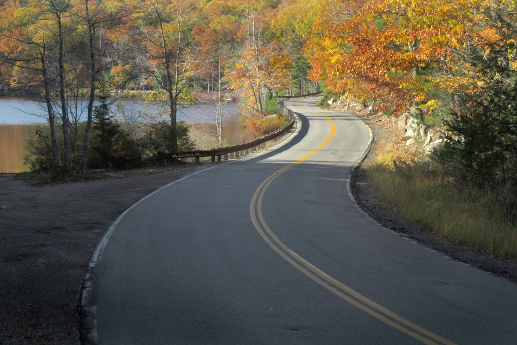
We took the park road around the eastern lobe of the island. There are parking turnouts along the way, but as we drove, each was filled. A few places along the one-way road have a parking lane on the right, and we squeeze into one or two of those to get out and look. 

MDI is shaped on the map something like a lobster claw, with eastern and western halves, divided by a long, narrow inlet called Somes Sound. The busier half of the island is the east. The posher is the west, although if you continue on the loop road past Southwest Harbor and back up the westernmost coast, it is pretty much wilderness.

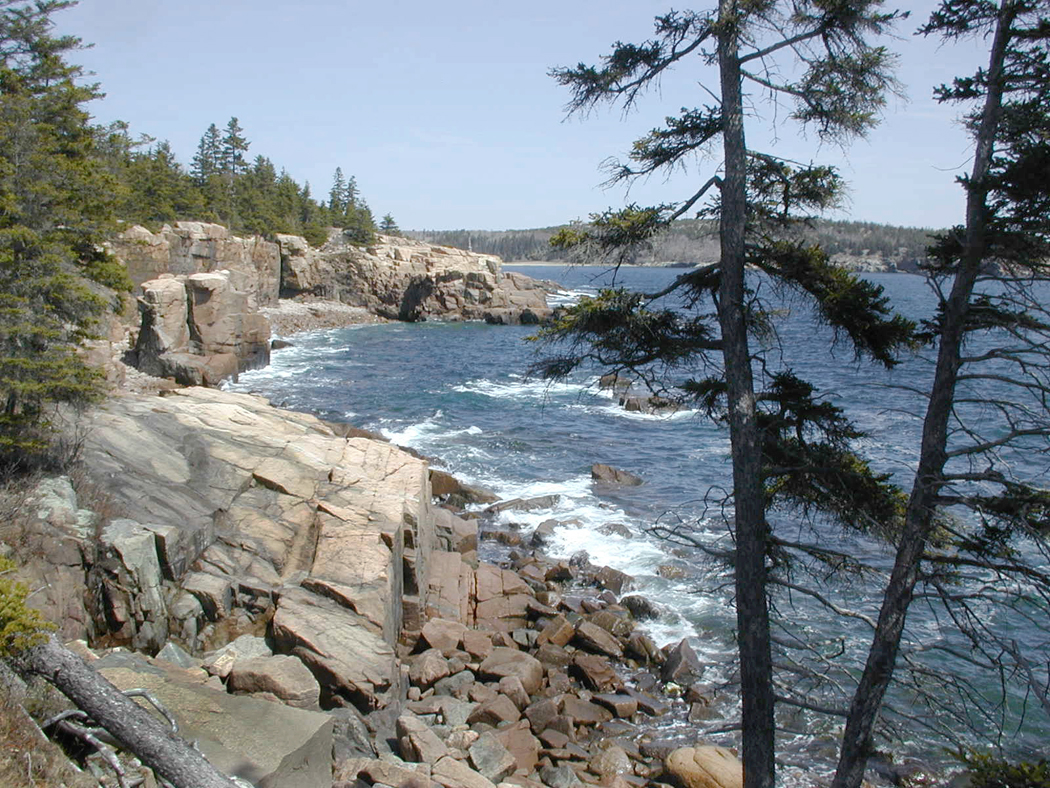
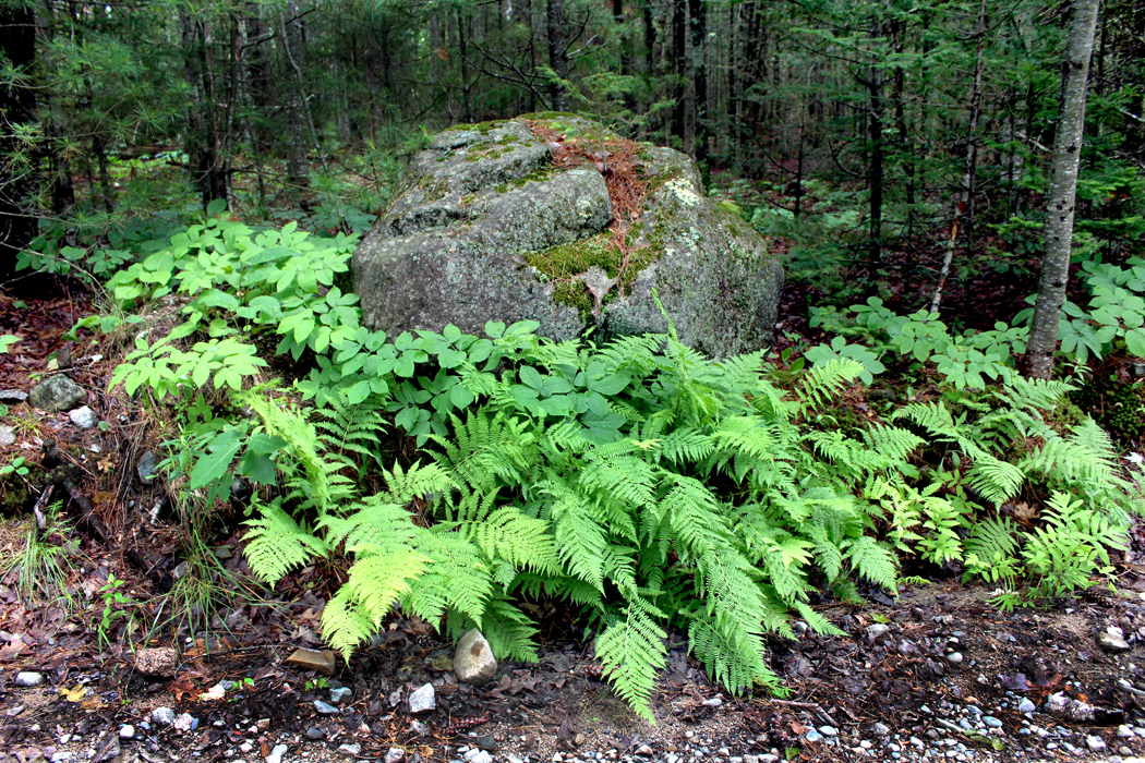
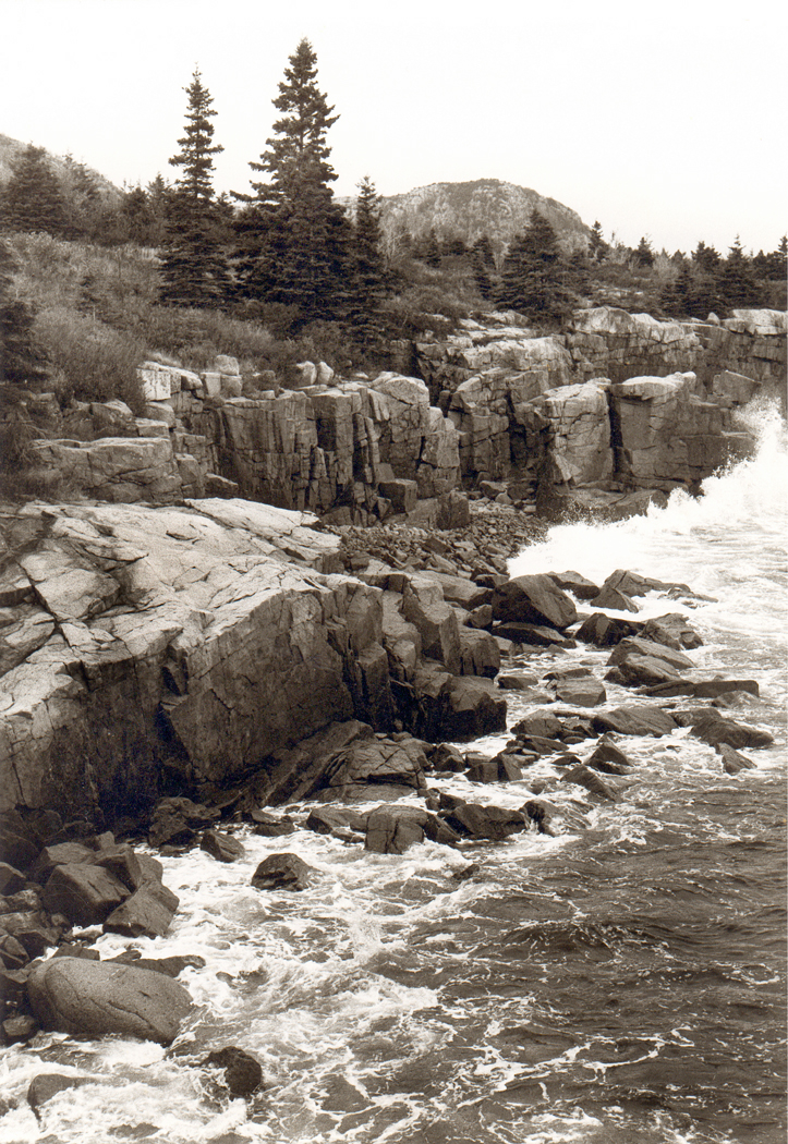
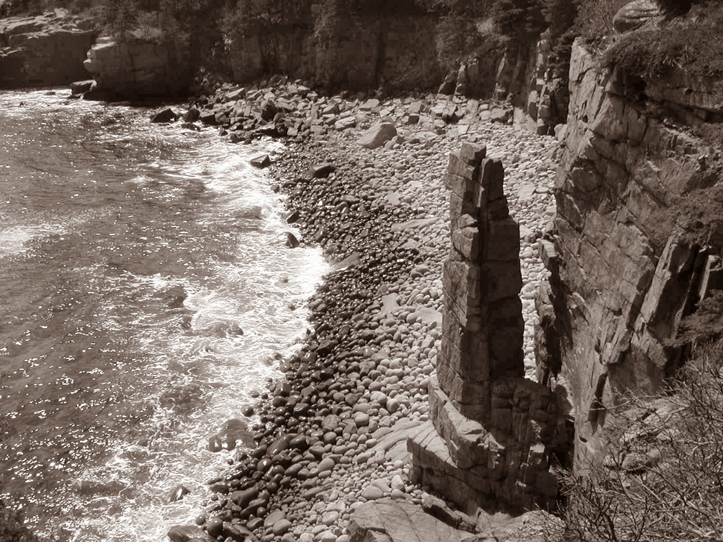
Most of the national park is in the eastern half, and the road passes Thunder Hole, Monument Cove and places so scenically perfect you can believe you have entered an idealized simulacrum of reality. 

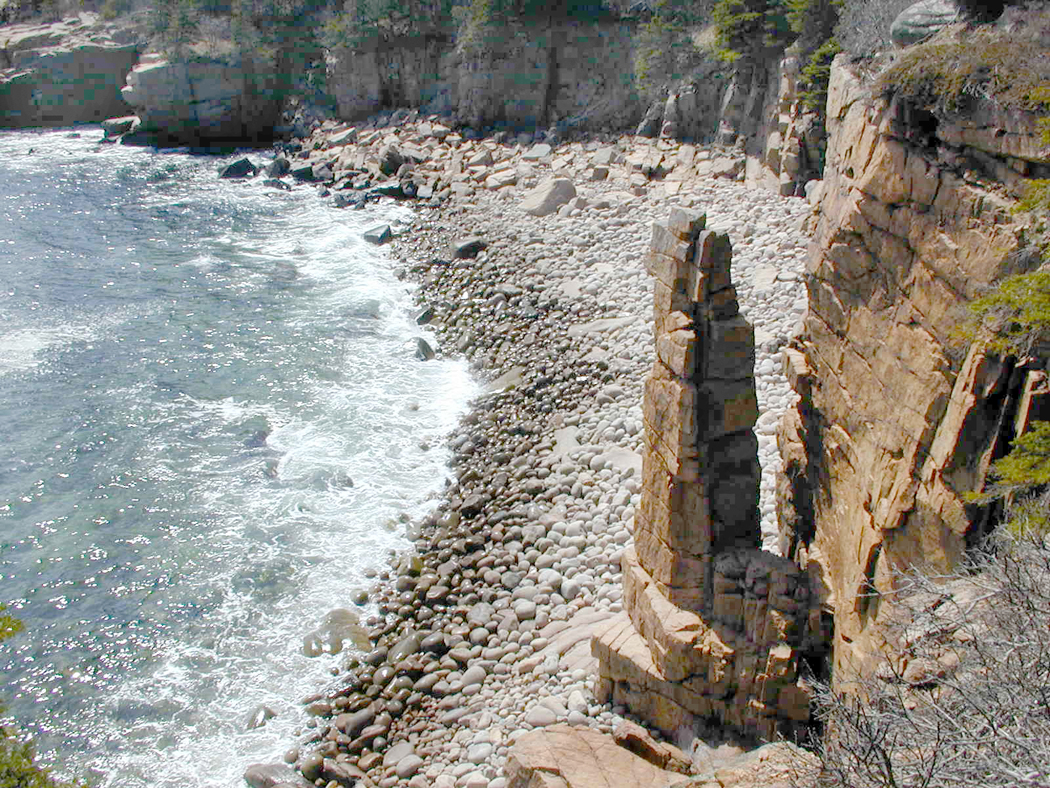
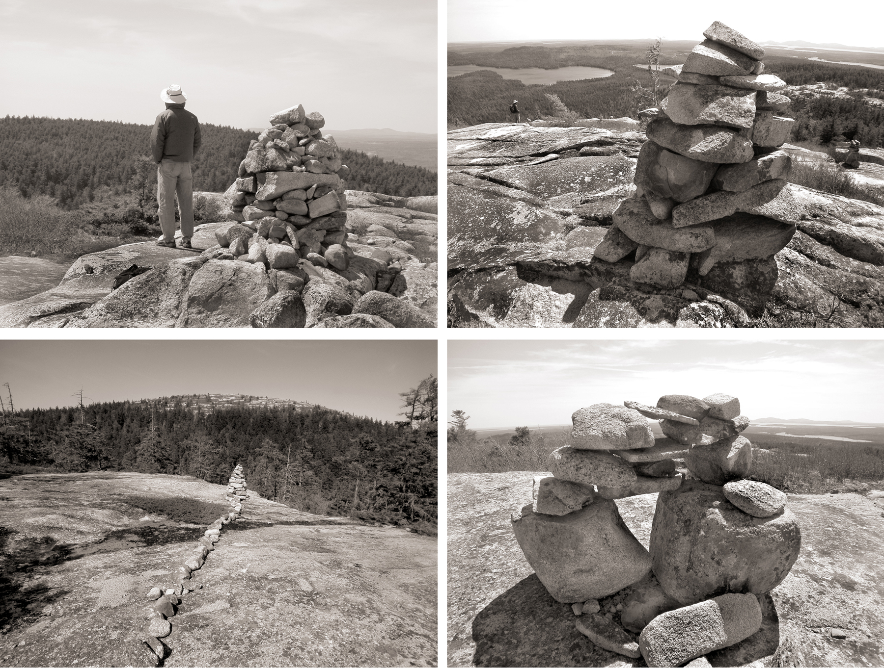
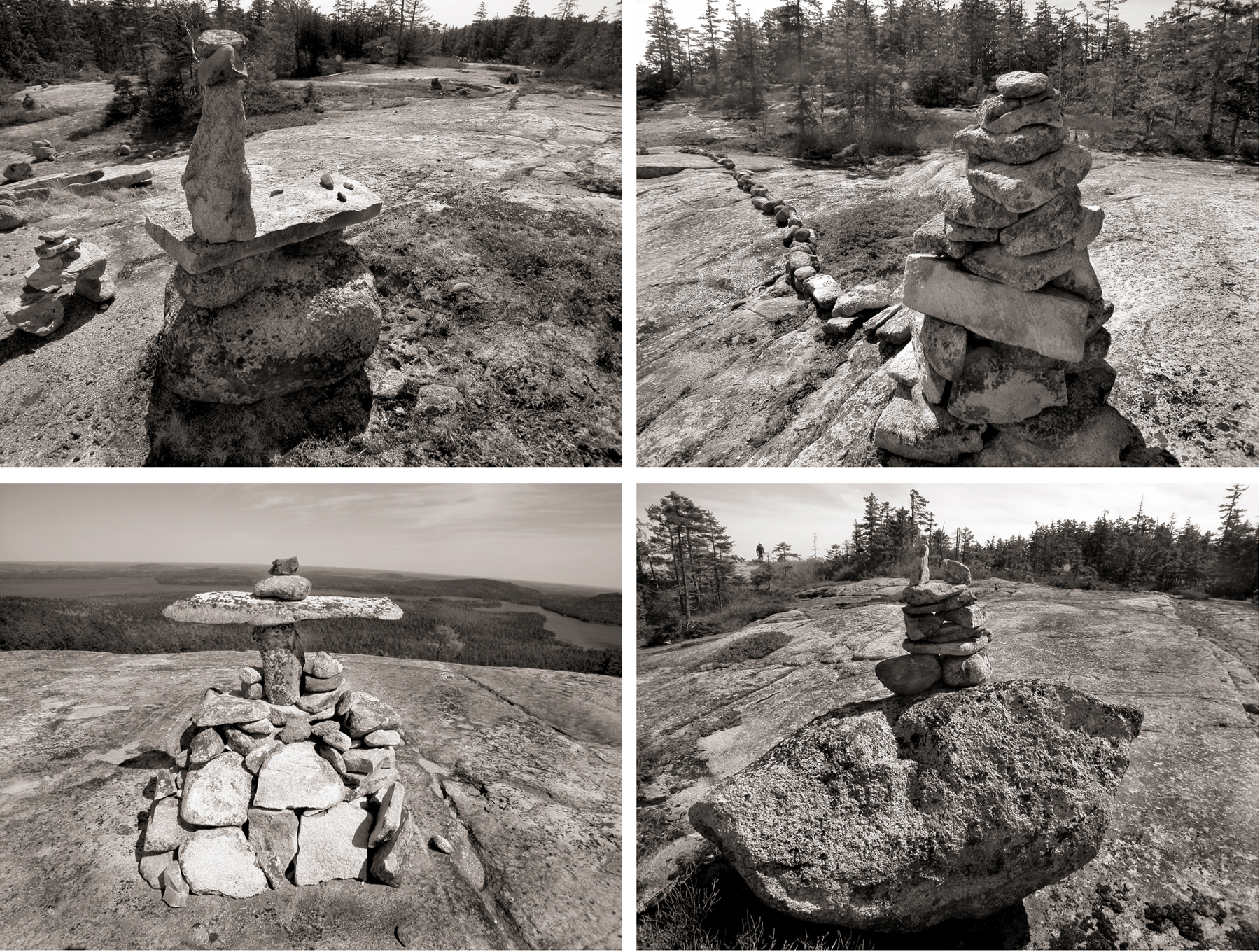
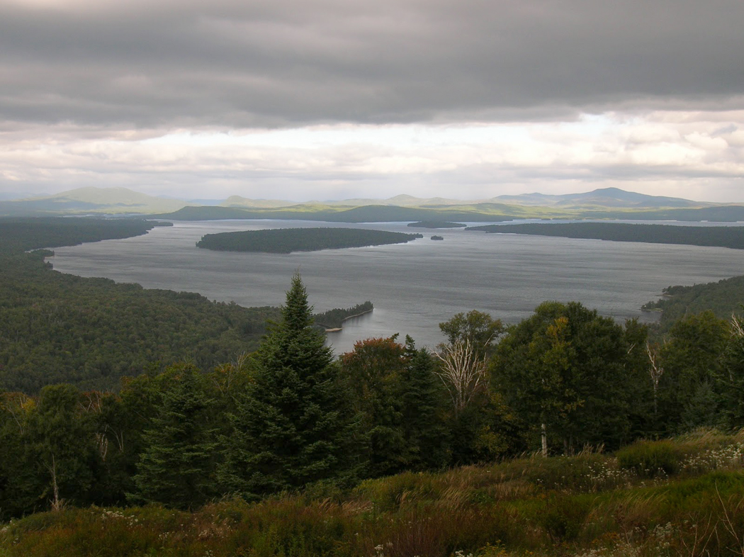
Finally, there is the road up Cadillac Mountain. It rises above the tree line to a rocky crest and a parking lot, filled with people making photos and filled with tour busses. 

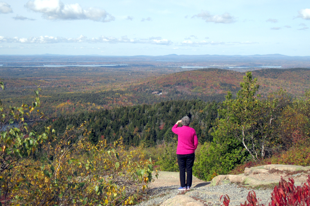
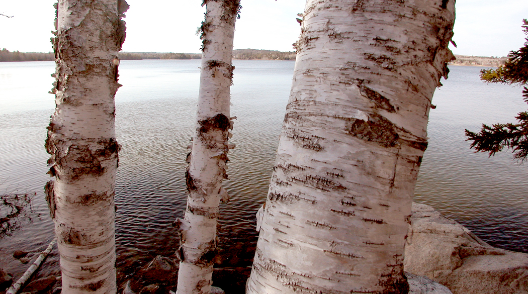
The view is stunning, and we can look out over Frenchman’s Bay and see Schoodic Mountain, which sits over Sullivan. 

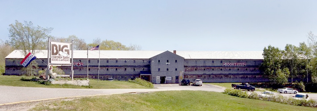
That visit was earlier in the week, but on this Monday, we head west from Ellsworth to the Big Chicken Barn, which is an antique and used book store west of Ellsworth; it is the size of an aircraft hangar. You can’t really compare it to any other used bookstore. When you are at one end of the books and look south, you cannot actually see the south end of the building.

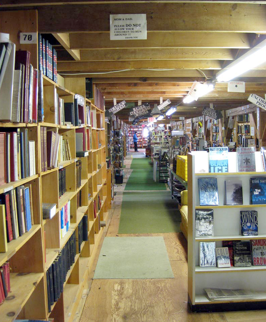
And unlike so many mini-mall used bookshops, it isn’t filled with paperback romance novels, but with the real treasure a booklover seeks: Old books printed with letterpress type on rag paper, bound in leather or buckram, all piled on unfinished shelves like so much cordwood piled in a shed waiting for winter. One could browse for months. 

The problem I had was that although there were tons of books that caught my attention, and that I sort of wanted, there were none I could justify buying and adding to the midden of books already at the house. As I have gotten older, I am divesting my home of books more than acquiring them. It’s one of the things that comes with age and retirement. 

I did finally buy Philip Roth’s Zuckerman Bound, a compilation of all the Nathan Zuckerman books Roth wrote. I am embarrassed to admit that I have never read any Roth. I am now making up for that.

We were originally planning to leave on Wednesday and head home to Asheville, but Anne is having back trouble and is flat on a heating pad today. At 1 p.m., she has an appointment with a massage therapist. So we are waiting to see if she feels better after that, and will now probably leave on Thursday. Or Friday. Or Saturday. Anyway, we expect to be back before Halloween.

While Anne is having her back rolfed, I will be driving inland to find some good photos that are NOT of the rocky coast. And — more honestly — to listen to some Mahler on the car CD player as I drive. I miss my music. In the car, Anne would rather listen to NPR to keep up with the latest Trump news. Political chaos theory.

On the way out of Sullivan, I went to a Dollar General store. First time visitor. I was astonished. Anne swears by them, but I have simply never gone into one. As I left the house, I asked Anne if there was anything I could get her. She asked for a heating pad (the one she’s using is borrowed). I doubted they would have such a thing, but I said I’d look. When I got to the store (which is just down the street) it was as if an avalanche of American culture had its moraine enclosed in a box. I wandered up and down the aisles in rapt admiration, as if I were walking through a museum. They have pretty much everything.

The manager was a young man, about 25, with a a two-day growth beard and an apron, and he asked me if I needed help finding anything. “Do you have, by any slight chance, a heating pad?” “Yes, follow me.” He walked about five aisles over and down halfway toward the storefront and pulled a box from the bottom shelf. “Twelve Ninety-five,” he said. I added it to the armful of items I was purchasing: a box of kitchen trash bags, an extension cord, a micro-fiber cloth to clean the inside of the car’s windshield, a bag of Fritos, a 50-cent minbar of Dove dark chocolate to feed the monkey on my back, and a pretty green, leaf-design reusable shopping bag to carry it all in.

The trash bags were to help us with the refuse. In Asheville, we divide ours by garbage and recycles. Two dumpsters. But here, we had to go through the trash and separate the recyclables from the regular junk and all that from the compost. Three bags; one for each. In Maine, every can and bottle has a redeemable price, five to fifteen cents. Jay and Gina save them all up, take them to the redemption center (which doesn’t look at all like a church), and donate the money to an animal rescue fund.

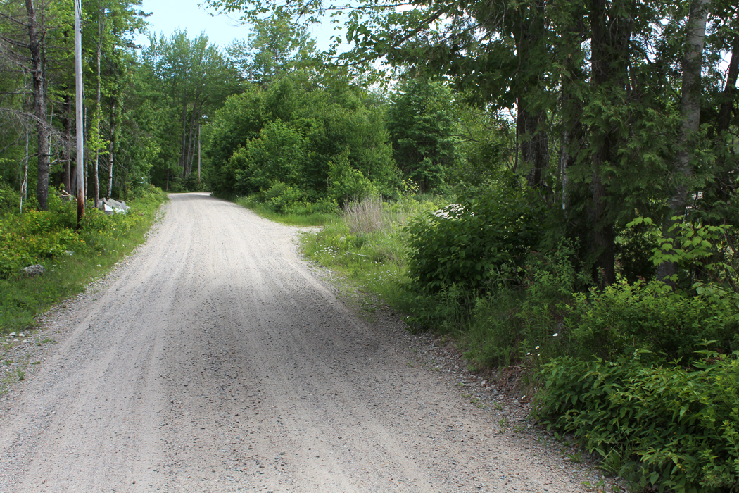
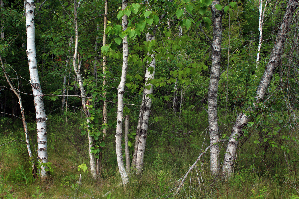
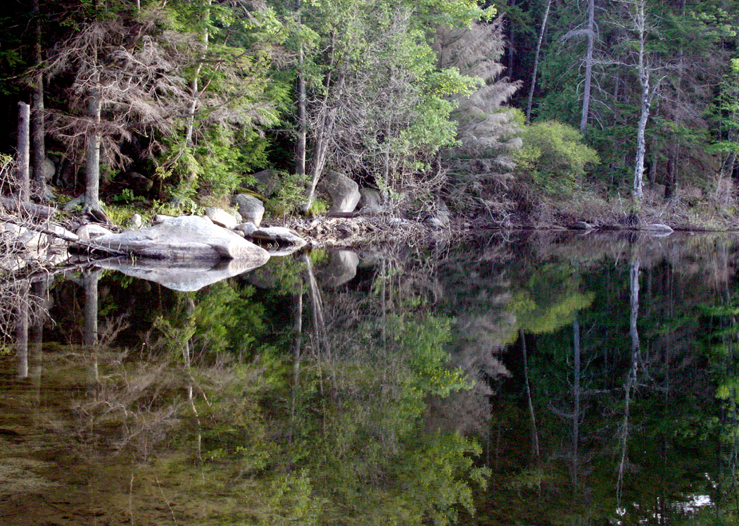
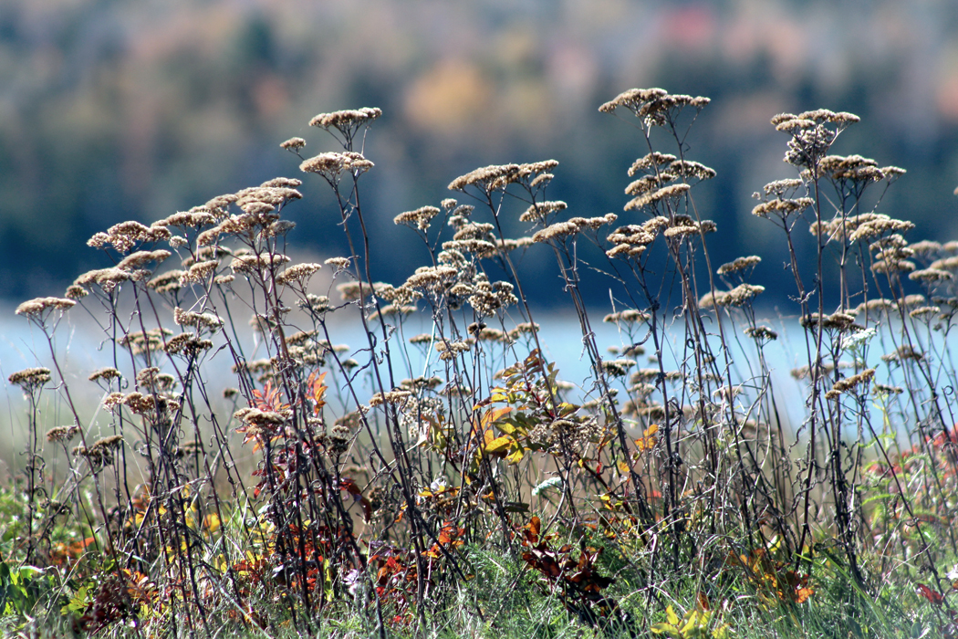
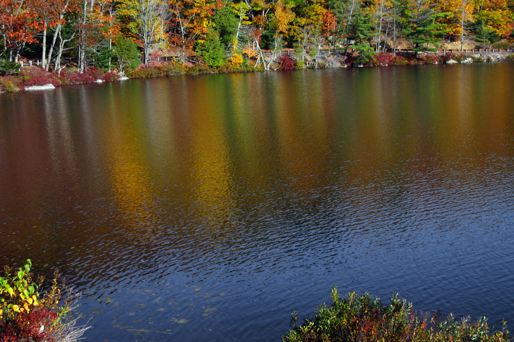
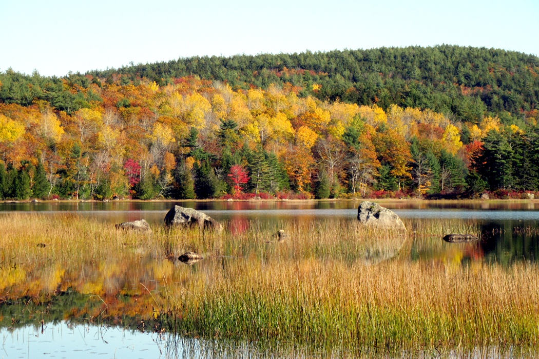
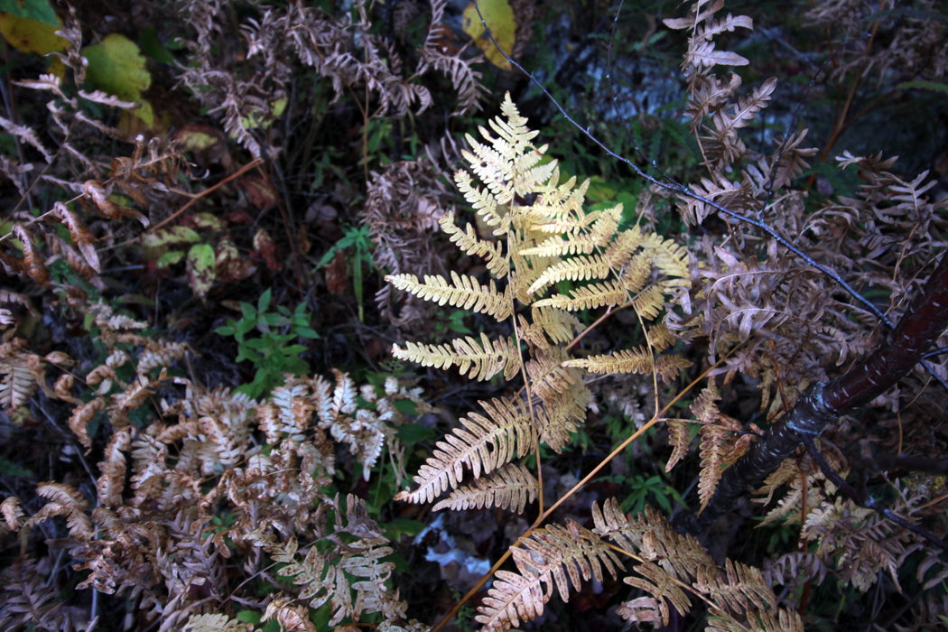
I drove north of town, and cut east along Route 182 from Franklin to Cherryfield, a road that took me through endless woods and lakes: Fox Lake, Tunk Lake, Long Pond. I stopped at each and enjoyed the fall color

The color reflected in the water

The reeds along the shore

Driving for me is relaxing. 

Traffic was light to the point of being almost non-existent, and the hour-and-a-half of puttering along was exactly the right length to listen to all of Mahler’s Third Symphony. 

Oct. 22

Anne and I went to a local quickie grocery for breakfast this morning. Dunbar’s has been here in Sullivan since 1881. Obviously through several changes of hand or generation. It was going to close two years ago, but two hippies bought it and turned it from a 7-Eleven kind of place into an upscale joint where they had free-trade coffee and imported wines. They also added a lunch counter and a deli section. Anne wanted to try it, and so we went. She had a bacon and egg biscuit — normal for breaking fast — but I saw the daily special: two pulled-pork tacos. Loaded with lettuce, tomato, guacamole, onion and cheese. “Hold the sour cream,” I said, proud of my abstemiousness. They were yummy, but a bit sloppy. 

I walked up to the counter to ask for a fork to shovel up the overspill and mentioned to the counterman that when a Mexican makes a taco, he always uses two tortillas for each taco, the outer one to hold together the inner one. “This is Maine,” was his terse reply. With a smile; he wasn’t being snotty.

Anne planned to hit thrift stores with Mu, which left me free to drive up the coast to Corea, which is a fishing village on Schoodic Peninsula, just south of Gouldsboro. My goal was to drive as many back roads as possible, as deep into the woods as possible, and make as many photographs as possible.

I turned off the main road onto a dirt road and drove deep into the brush, before picking up pavement about a mile or so in, The road looped around the north end of a spike in the peninsula and I saw not a single other car for at least 10 miles.

I put 65 miles on the car during this jaunt. I drove down the road at 7 mph taking in all the view. If I saw something I wanted to photography, I braked, opened the driver-side window and poked the camera out and clicked. Everything I photographed during this portion of the excursion was on the driver’s side.

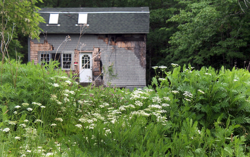
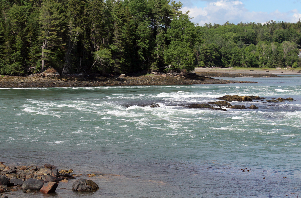
Corea is a rocky cove at the southeast end of the peninsula and a lobster fishery center, with a warehouse, dozens of dories and boats and, at low tide, as I came through, docks that towered above the floating boats below, waiting for the tides to rise and level them out. 

Corea was the home of the writer Louise Dickenson Rich, who wrote a famous best-seller in the 1950s titled We Took to the Woods, which is largely about Corea. Because of the boats and the wharves, Corea is one of the most photographed spots in Maine. It is picture-skew.

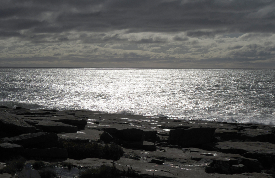
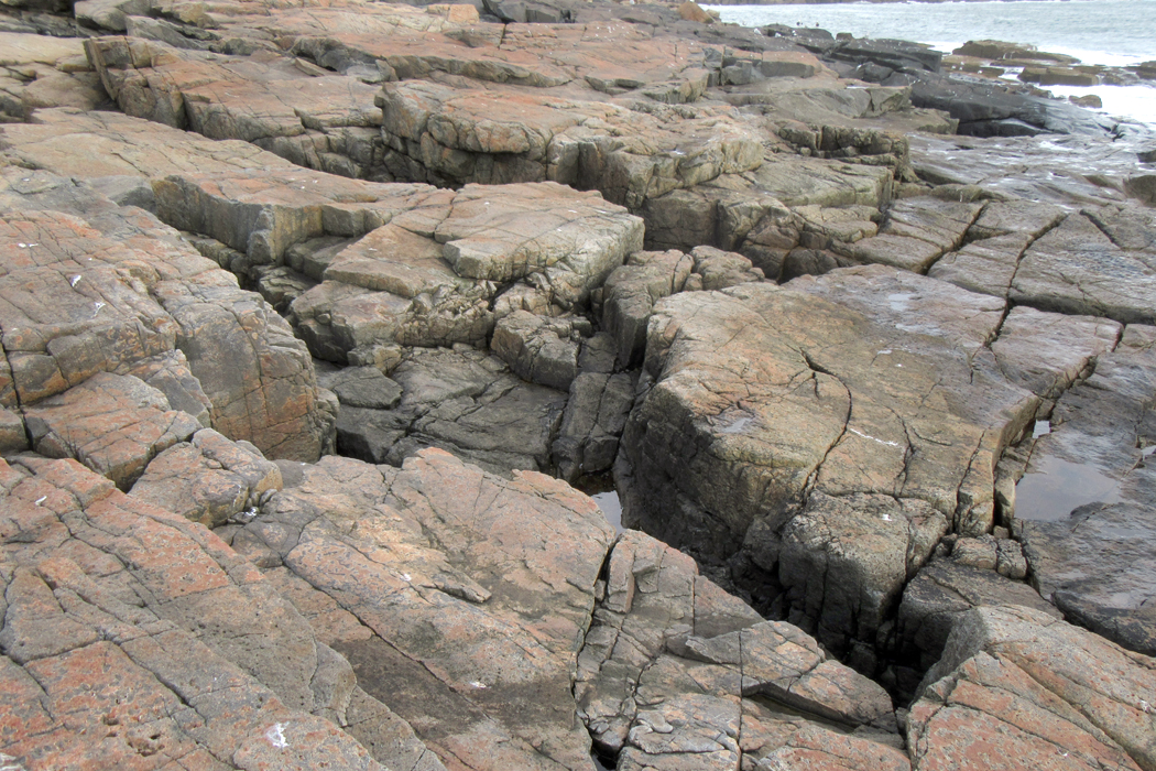
I then passed through Prospect Harbor, Birch Harbor and Winter Harbor and took the Schoodic Point loop again. 

The other day, when I was there with Anne, she got cold and tired and we didn’t stay as long as I would have wanted, but today I was alone and could walk down the rocks all the way to the water.

I am old. Way too old. I can no longer gambol over the rocks like a goat. In fact, I walked so tentatively, I moved rather like a tree sloth edging out on a branch. I scouted out a path along the flattest portions of the rock, making a circuitous route down to the water that probably stretched three or four times longer than the crow-fly route. Like little Billy in Family Circus cartoons.

There were a few iffy places where I had to jump over a crevice  or hold onto an outcropping as I needed to hold my balance. But I got down there, and enjoyed the barrenness, the isolation, the chill, the wind, the spume, the overcast sky, the numbness on my cheeks. This is the way the Maine coast is supposed to be.

Anyway, when I got back to the apartment where we are staying, Anne had bought another pair of shoes at the thrift store she had gone to with Mu. That makes four pair of shoes she has purchased on this trip. Sometimes the gender stereotype matches the reality.

Oct. 23

Sandro and Mu have been feeding us each night with such treats that they entice us to stay several extra days. There is the promise of duck and of Lobster Thermidor. 

“We’re not having that tonight,” Mu said. “We’re having red cabbage and apples with mashed potatoes and sausages.” The hidden agenda being that if we had what Sandro called a “junk meal” tonight, it would add a day to our stay, because we wouldn’t want to miss the lobster tomorrow night and the duck breast on the next and therefore couldn’t leave till Friday at the earliest.

It wasn’t a “junk meal” at all. It was really delicious. Mu grew the cabbage herself in a garden plot she shares with her sister in Hancock, which offers public gardening plots. The apples we brought from West Virginia. The mashed potatoes are Sandro’s specialty, loaded with cream and butter. The sausage was chicken. Mu has decided she will no longer eat any meat from a mammal. Chicken OK. Lobster OK. Cod OK. Pork — No-no. The sausage I had was spiced with jalapeños. All washed down with Stella Artois.

It’s supposed to rain tomorrow again. I probably won’t be traveling, but plan to spend the day with Sandro. We haven’t had a really good, thorough chin-wag so far this visit. Tomorrow should be the day.

All those years ago, when I lived with them in a country house in Summerfield, N.C., Sandro and I would climb out a dormer window and sit on the roof at night, smoking cigars and discussing deep and meaningful ideas. Mu allowed no cigars indoors. 

Sandro and I became friends 50 years ago at college and shared an enthusiasm for classical music. We have been brothers since then. When I went through some hard times, he and Mu took me in till I got back on my feet. 

Once, in the extravagance of young men, we listened to all 16 of Beethoven’s string quartets in one sitting, followed by another go in which we attempted all 32 of his piano sonatas. We were blasted before we could make it to the end. 

Now, in Maine, we are old men. 

To be continued

Click on any image to enlarge

“Which way to Millinocket?”

“Don’tcha move a goddamn inch.” 

Maine jokes — an acquired taste, perhaps. So many of them are built on city slickers asking for directions. “You can’t get there from here.” (Say it with the accent: “You cahn’t get they-ah from hee-ah.”) Lost travelers always seem to find farmers willing to guide them: “First, you drive up a mile, mile-and-a-half maybe, and turn left where the old church used to be.” 

“Used to be.” It is a familiar refrain in the more rural and forgotten areas of the state, and along the coast north of Acadia National Park, where few out-of-staters are likely to venture — an area known as “Down East.” 

There is much that “used to be” in Sullivan, Maine, a small community on Taunton Bay about 15 miles beyond where the tourists turn off U.S. 1 to Mt. Desert Island and Acadia. With a population of about 1200 spread over half a dozen townlets between Hancock and Gouldsboro, it has been home to my best friends from college for about 30 years. Over that time I have visited them often. 

They have an old farmhouse (I call it a farmhouse, although there is no farm) in North Sullivan along the road that parallels Taunton and Hog bays. Like much in the town, it is weathered and steeped in character. 

Sullivan has changed over those decades, although you might not notice it if it were your first visit. It still looks quaint, as if it were some Down-East Brigadoon. But there are many things that “used to be.” 

The Singing Bridge

For me, the most notable is the loss of the singing bridge from Hancock to Sullivan over the narrows between Frenchman’s and Taunton bays. The old bridge had a steel mesh roadway and every time a car ran over it, it roared like a banshee. That steel-truss bridge was replaced in 1999 by the “silent bridge,” made from prosaic concrete. 

Taunton Bay

The singing bridge was opened in 1926, replacing, after many years, the original wooden toll bridge that was washed away by winter ice a few years after it opened in the 1820s. Between bridges, a ferry ran from south shore to north — a flat boat that held one carriage at a time and charged a dime for a crossing. The Waukeag Ferry went out of business when the singing bridge opened. 

Stuffy

You get attached to something and then, it’s gone. When we first started going up to Sullivan, there was, just across the bridge, a small, wooden roadside ice cream stand called “Stuffy’s,” which also sold lobster rolls and the best lobster bisque I ever ate. We went back there for lunch many times. Of course, it is now gone. 

Abandoned quarry

So are the granite quarries that used to support the town, and so are the silver mines that made the town viable in the first place. 

According to A Gazetteer of the State of Maine, published in 1886, “There are now eleven incorporated companies owning mines in the town, most or all of them being operated. Work has been done also in five or more unincorporated mines. There has been completed in the vicinity a concentrating mill and smelting works for reducing silver ore.

“On the various streams there are two saw-mills, two stave mills, one shingle-mill, and one grist-mill. … A steamboat touches at Sullivan Falls three times a week.”

All gone. 

The Native American name for the area was Waukeag. It was first settled by the French in the early 1700s, but was given to English-speaking settlers by the colonial government of Massachusetts in 1761, when it was called New Bristol. It was incorporated in 1789 under the name of Sullivan, one of the original settlers. At the time of the Revolutionary War, there were just 20 families in town. By 1870, the population was 796. In 1880 it was 1,023. It is not much bigger than that now. 

Schoodic Mountain

As you drive north on U.S. 1 through Sullivan, you can often spot Frenchman’s Bay to your right, a vast tidal flat at low tide, a lake at full. In the distance to the south you can see Cadillac Mountain and Mt. Desert Island. Just north of the highway is Schoodic Mountain, 1,069 feet high, and Tunk Lake, where Rear Admiral Richard Byrd used to have a vacation home. 

On the peninsula just south is Sorrento, a resort town a bit more upscale than Sullivan. 

Reversing Falls

And at the mouth of the inlet, where Taunton Bay dwindles to the narrows that used to be called Sullivan River and opens onto Frenchman’s Bay, the tide creates what is known as a “reversing falls,” where the rising tide creates a dangerous rapids heading into Taunton Bay, and with a falling tide, creates the same rapids in the opposite direction. The current is fierce, up to 13 knots. 

But it is Taunton Bay Road that is what I am most interested in. Just after the silent bridge, there is a left turn that takes you through West and North Sullivan along the eastern shore of Taunton Bay. It continues out of town along Hog Bay and into Franklin. The road is beaded with old homes, usually clapboard with front porches and foundations or stoops made from granite once quarried locally. 

Across the water, Taunton Bay opens up into Egypt Bay and the town of Egypt, made famous — or notorious — by Carolyn Chute’s 1994  book, The Beans of Egypt, Maine. 

Among other losses in Sullivan are Jerry’s Hardware and, while Gordon’s Wharf is still extant, the busy fishing business is gone. There are a few family cemeteries, an art studio where stone sculpture is made, and a ceramic studio. 


This last time I visited, I attempted to make a “portrait” of this end of Sullivan, the way Alfred Stieglitz made a portrait of Georgia O’Keeffe — hundreds of photos that I hoped would, in aggregate, give a sense of the place. I can only share a tiny fraction here. You can find a more detailed portrait of a single house at (link here). 

There are three reasons to photograph something you care about. First, simply to capture it so as to possess it, for the sake of memory, the way you keep old snapshots of family birthdays and vacations. Second is to create art, that is, to make an image out of shapes and colors in a design that has graphic interest. But third is to see.

We look over so much at every minute of every day, but seldom see it. Looking closely, paying attention to details, absorbing character, seeing relationships — these things come with seeing with purpose. Seeing is engaging. Engaging is being alive. 

Wandering through Sullivan, I wanted to gather albumblätter  for my scrapbook; I also wanted to make something that might be, in its tiny way, considered art; but most of all, I wanted to use my camera as a way of focusing my sometimes wayward attention on something I want to know more deeply.  It is a way of expressing affection. Photographing, done this way, is a means of caring.

To collect snaps, or to frame art are fine in themselves, but using the lens to focus the mind and heart is infinitely more rewarding. It creates meaning.

Click on any image to enlarge

carnac-alignment

We went to see the stones. They stretched for miles, each stone like an  upright soldier in a formation. They are called “menhirs,” and they populate the area around the seaside town of Carnac in Brittany.

When we drove up to the first formation, the sun was low in the sky and shadows stretching long. We stopped by a field filled with menhir and dolmen, the ancient stones erected some 7,000 years ago for god knows what purpose. Thousands of the stones in stripes across fields, and made of a type of granite that is not local. No one knows how they were made nor why. Carole was especially worried about why.

“Maybe they were religious,” she said. That is the most common supposition. But that didn’t really satisfy her.

“I know,” she said, “they must have been used for some sport. If something was important enough for men to exert this much communal effort to transport tons of stones over miles and miles, there must be a stick and a ball involved.”

We’d drive for a few more miles and she’d pop out with, “Or maybe they were the foundation for some kind of building,” and then, after not saying anything for a long while, “Maybe they were meant to line up like soldiers; maybe they scared off an enemy.” She seemed obsessed with the stones.

tourists-at-the-menhir

Click on any photo to enlarge


The next day, we went out to explore. Some 4,000 menhirs, or upright granite stones, from about three feet high to almost 20 feet, are striped across the landscape in three or four major “alignments,” as they are called.

Erected some 5 thousand years ago, or maybe 7 thousand — it all seems lost in the haze of prehistory — the Celtic forebears of the Bretons hauled these logs of granite from their origin, miles away, and lined them up over the rolling meadows just north of town.

No one knows that they were erected for. The usual theories of religious meaning are trotted out, but no one really knows. Carole persists for a while that they must have been used for some sort of sport or game, going on the theory that only a Superbowl or the Olympics can bring that much commitment out of a guy, let alone a lot of guys.

menhir-3

We talked about it at lunch, in Locmariaquer, the site of some other megaliths.

Over the oysters, I said, “I think that it is just as likely that someone in the old days went crazy, heard voices in his head telling him to to this, and he then, through the intensity of his insanity, persuaded the community to erect the menhirs. Like a sachem in an Indian tribe. ”

Carole dislike the idea that this might reflect badly on shamans. She maintains there is a difference between visions and psychosis. She has her own reasons for holding this distinction.

“That’s not quite what I mean,” I said. “I mean that someone genuinely nutso hears voices, like Son of Sam — ‘My dog told me to do it’ — and because to ordinary people a shaman and a nutjob are very hard to tell apart, they might have signed on to follow him, the way the Germans signed on to follow Hitler to Valhalla.”

“But the shaman’s vision is always one to help the people, never to harm them,” Carole said.

“Well, Hitler certainly thought he was helping Germany, but we’re getting off on a tangent,” I said. “I just mean that, well, like Moses in the desert, perhaps touched by the sun and heat, came up with a lot of crazy ideas, maybe some prehistoric Celt went off the deep end and the voices in his head told him they needed to build a field of giant upright granite stones.

“It makes as much sense as any of the other ideas,” I said.

Of course, we’ll never know. Carole is obsessed with them right now, wanting to have an answer.

“Don’t you want to know?” She asked.

“But I can’t know.”

“But doesn’t it eat at you?”

“No, I can’t say so,” I said.

“It’s driving me nuts,” she said.

menhir-6

Later, in the evening, after supper, sitting in the hotel room, she started up once more.

“I thought they might be made as a display to the stars, or a sighting device to line up with stars or the sun or the moon seasonally,” she said. She sat for a moment and then began a litany of possible explanations.

“Maybe people stood on them and covered their bodies and the rocks with some sort of long garment that made them look like thousands of extremely tall and powerful people.

“Maybe they were set up to baffle a stampeding herd of animals.

“Maybe they were set up to make it difficult for an enemy to advance.”

I imagined them like some prefiguration of pachinko, used as a military tactic. Ingenious, I thought.

“Maybe,” she went on, “they were put in the ground so that if one were far, far from home, one could climb up into the mountains and look down and find these stones as a marker for home.”

The only problem with that: No mountains here.

menhhir-7

“Maybe they were part of corrals and used for the beginning domestication of animals.

“Maybe they were racetrack lanes for racing animals.

“Maybe they used to be part of another kind of a structure that included wood and animal hides.

“Maybe they were part of ancient stalls filled with trade goods.

“Maybe they were an arduous maze a person had to thread through like the meditation mazes in cathedrals.

“Maybe they had something to do with cognitive development — a step between concrete thinking and abstract thinking. Maybe they used them to learn to count from one to a thousand.”

After worrying about this for two days, she continued as we drove out of town, on to Concarneau.

“I need to know what they were for,” she said. “I still think my best guess is that they were for some sort of ball game. You know men are fascinated by a combination of sticks and balls and counting. The counting is important.”

menhir-7

A woman we met, who was from Great Britain, said that she read that the rocks at Stonehenge were transported from far away, also, and that there is a theory that they came from a site powerfully effective in healing.

“But I don’t think that is what these stones were for,” Carole said after we drove on. “They must have been for something massive, because there were thousands of them. They must have been very important for the people who arranged them, because the second group we looked at were actually stone paths, completely straight, leading toward the horizon for many many many miles. So I thought maybe this part of the stone arrangement is a runway for souls. Souls taking off to their journey to the afterlife on foot, that is.

“Maybe they were foundation stones upon which wooden logs were placed for some type of a floor and another structure made of wood came up higher. If they were used as foundation, the equidistant placing of them makes sense, because they are about as far apart as an ordinary tree trunk.

“Or maybe creatures with immense strength arrived from outer space and used some sort of anti-gravity device to pick the rocks up and put them down again in this part of France.

“Maybe they are thousands of monoliths like the black rectangle in 2001: A Space Odyssey.

“Maybe they were a huge dentist office and each person had his own stone to come to and bang his head against until he was senseless and no longer could feel the toothache.”

She was beginning to get a little punchy.

“I also think my first impression of them might be worth something —  that was that they were the earth’s teeth.”

cairn-frontispiece

Part 2

I am a reasonable man and my goals are reasonable. Some burn for the challenge of climbing great peaks; my more modest goals involve the less famous ones. They can have their Everest, their K-2, their Matterhorn or Aconcagua. I have Tucker Mountain.

It sits in Hancock County, on the coast of Maine, north of where any tourists go. From its summit, there is a great view to the south and Cadillac Mountain and Mt. Desert Isle. Its summit, by the way, tops out at 394 feet above sea level. More my style. Still, in places, it is a rugged enough hike.

My friend Alexander wanted to show me the view, and we walked through the mossy woods up past rocky outcrops and on to the goal. Along the way, we kept passing cairns — piles of rock set up by hikers. Some were simply rock-piles, but others showed more ambition, and could easily have passed for sculpture in any trendy art gallery. The more of them we passed, the more it seemed as if something cultural were going on — that there must be some compulsion to make these stony reminders that Kilroy was here.

cairn-quad-01

I photographed them as we walked, and by the end of the day, I had something like 50 or 60 images of them, and that counts having given up on cataloging every single instance; I did not photograph many of the more mundane piles.

I don’t know if such things litter the tops of all the local mountains. I don’t remember seeing so many cairns when Alexander and I climbed the summit of the more daunting Schoodic Mountain nearby (summit: 1,069 feet). Perhaps the cairns on Tucker Mountain (I should call it Tucker Hill) are the work of a single artist, or a single obsessive personality, or a small group of people wanting to make a statement. Usually cairns are left either to mark the trail, or to commemorate some important event. These seemed to exist for their own sake.

But they certainly brought to mind the dolmens, cromlechs and menhirs of Celtic Europe. They don’t have the permanence of those menhirs, which have survived thousands of years; these cairns are just rock set on rock, so the first hard frost could topple them. But I had to wonder if the impulse might have been the same: Make my mark — the X on the dotted line — the proof that someone was here.

cairn-quad-02

There is a resistance to cairns; many dedicated hikers despise them for being unnatural, and for being the equivalent of vandalism. I can’t join their ranks. The best of these cairns are genuine works of art and should be appreciated for such. Their artifice can hardly be a valid source of complaint when the hikers are marching along equally artificial trails through the woods, marked with paint blazes or diamond-shaped route markers stapled to tree trunks.

The cairn-makers may well think of themselves as being clever, postmodern, or snarky, but the bottom line, on which their “X” resides, is that the cairns are the universal cry of the one among the many, like the opening wail of the newborn baby: I am here.

Part 4: In which we enter the landscape of the mind

Sorrento dock

Each of the United States has its own flavor, its own existence as myth. It is the sense one has, if one does not live in that state, but imagines what it would be like to visit.

One imagines what Arizona must be like, with its cowboys and cactus, but the reality of Phoenix — “Cleveland in the Desert” — negates that myth. That is the nature of myth.

Some states have bigger personae. California, for instance, which existed as myth both for “Forty-Niners” and for Okies. Montana offers big skies and clean air. Oregon had its trail and Mississippi has its Yoknapatawpha County.

Texas claims for itself the largest myth, although it is hard to warrant such big ideas if you have actually been to Midland or Odessa. Texas is only big in hectares. Otherwise, it is the state of large hats as substitutes for small manhood.

Each state has its mythic presence, although it is hard to make the case for Delaware as anything but the “gateway to New Jersey,” and the Garden State gains any resonance it has only from Tony Soprano and Bruce Springsteen.

But one state led all the rest historically in this landscape of the mind, as a special place in the American imagination, a place you dream about when you think your daily life is too mundane.

Lubec

Lubec

Historically, the state that has had the longest claim on the American spirit is Maine, with its deep woods and rocky coast, its taciturn, independent people and its echoing loons. Maine is the original great escape, the place to go to return to nature and feel what it is like canoeing across a backwoods lake with a mist rising from the water.

Maine is the place Henry David Thoreau went when his Walden Pond seemed too citified. Maine is the place that dozens of American artists went to find some glimmer of inspiring wilderness.

It’s also the place the 19th-century robber barons went for summer vacations.

As America has expanded westward, Maine has lost some of its magic, but it is still a mythical place, drawing millions of visitors every year.

But there isn’t a single Maine. Regionally, there are at least four Maines.

The first is the southern coast, which first attracted a wealthy clientele a hundred years ago. This is where old money came for the summer. It is where former President George H.W. Bush had his place in Kennebunkport. It is also home to the new Yuppie tourism centers on Penobscot Bay, where you can always get a good brioche: Camden and Rockport. They are not much different, in their way, from Carmel, Calif., or Sedona, Ariz. — all trendy shops and new museums. You visit L.L. Bean in Freeport, and see a hundred other factory outlet stores.

Mooselookmeguntic Lake

Mooselookmeguntic Lake

Then, there is the mountainous Maine of the western part of the state with its thousand lakes, from Rangeley Lake to Mooselookmegunticook. This is the part of Maine famous for its out-of-place town names: Mexico, Norway, Paris. It is a place to go for fishing and camping or renting a cabin for a week.

The large northern part of the state is especially impressive. Vast tracts of woodland crisscrossed by narrow logging roads down which rumble the most frightening, earthshaking pulpwood trucks, piled high and tenuously with rattling bundles of spruce trunks. It is the north of Baxter State Park and Mount Katahdin. This is the Maine that Thoreau wrote about in his book, The Maine Woods. It is also the part of the state, on its eastern side, where they grow potatoes.Maine tree

But it is the fourth Maine that I love the most: the upper coast, from Mount Desert Island to the Canadian border.

This is Down East. It is the least touched by commercialism. It is still composed of blue-collar working towns where men go out to fish or pull lobsters from the rocky-bottomed sea. It is old wooden houses on granite foundations and cars rusted out from wet, salty winters.

Otter Cove, Acadia NP

Otter Cove, Acadia NP

It is called Down East because when 19th-century sailing packets traveled up the coast from Boston, they sailed downwind, with the prevailing breezes abaft. Back then, Maine was still part of Massachusetts. Maine owes its statehood to slavery: The Missouri Compromise of 1820 let the slave state Missouri enter the union, but separated Maine from Massachusetts and entered it as a state at the same time to keep a balance of free and slave states in Congress.

The coast of Maine is about 250 miles long, as the crow flies, but it must have been a very drunken crow that first flew the distance. With all the bays and headlands, the actual distance of that zig-zag coastline is closer to 3,000 miles. And that’s not counting the islands, thousands of them.

Mount Desert Island is the largest of them. It is properly pronounced Mount “Dessert,” as if it were filled with chocolate moose, but most people just call it MDI and be done with it. MDI is the home of Acadia National Park, one of the most beautiful in America.

Monument Cove, Acadia NP

Monument Cove, Acadia NP

It is also the home of Bar Harbor, one of the most congested towns. In the summer, Bar Harbor is a vacation nightmare, with no parking, crowded restaurants and no room at the inn.

Acadia National Park covers about half the island and includes Cadillac Mountain, the tallest mountain on the East Coast north of Rio de Janeiro. At 1,530 feet, it catches the first rays of sunlight to hit the U.S. each day.

A road to the top provides splendid views.

But it is the view of Cadillac Mountain, rather than the view from it that is best. And the best views are from the coast roads that continue farther down east.

The real Down East begins beyond MDI. From Ellsworth — which may look like one unending K mart and KFC — you drive east and north on U.S. 1 and you leave all the tourists and development behind.

Fox Lake

Fox Lake

The towns you pass are small and picturesque: Sullivan, Gouldsboro, Sorrento, Winter Harbor, Jonesport. You see tall church steeples and town squares with bronze statues of World War I soldiers.

This is Maine for the traveler rather than the tourist. You won’t find many fancy restaurants, and the motels are all low-dollar. Look instead for breakfast in the local lunch counter with the lobstermen. There are no “destination locations.” You have to be interested in the place for itself, and not for an amusement park.

If you are looking to get away from it all, Down East is the definition of the phrase.

Machias

Machias

There are mountains to be climbed, woods to be hiked, lakes to be canoed. There are heaths to be gleaned of their blueberries and birds to scout out and listen to.

Blueberry heath

Blueberry heath

If you hike in the woods behind Sullivan, off Taunton Bay, you will find the abandoned granite quarries that used to provide curbstones for the cities of the East Coast.

Climb 1,069-foot Schoodic Mountain for the panoramic view. Or if that is too high, try 397-foot Tucker Mountain. A walk through the birches and alders will bring you to a splendid view of Frenchman Bay and Cadillac Mountain.

Schoodic Point, Acadia NP

Schoodic Point, Acadia NP

From Gouldsboro, head south to Schoodic Point, which is part of Acadia, but without the crowds. The waves boom on the rocks and a cold ocean separates you from Cadillac in the west. If there is one perfect place to visit Down East, Schoodic Point is it.

Quoddy Head Lighthouse

Quoddy Head Lighthouse

Or take the narrow road south of Lubec and you will come to the West Quoddy Head lighthouse, the easternmost point in the U.S. Out on the horizon you will see Canada’s Grand Manan Island. It might as well be China.

Take a look at any map of the eastern bump of Maine and see how the web of roads thin out. Hancock and Washington counties are nearly unpaved. It is empty. It is beautiful. It is the real Maine.

NEXT: Maine redux