Archive

Tag Archives: maps

My Uncle Stanley had an ambition in life to own a Weimaraner hound. I was only a boy at the time and didn’t quite understand the appeal of such a dog, but for the IBM typewriter technician he was, living in New Jersey in the 1960s, I imagine it had something of the attraction a solid gold toilet had for Elvis Presley. The rest of us had dogs that we lucked into, finding a stray, or getting a mutt from the dog pound. But the Weimaraner was a pricey breed and my uncle wanted one. He finally got one. It was a nice dog, but for me, that’s just what it was — a dog. 

Many, I think, have some similar focus in their lives, some object that signifies arrival, or a sense of completeness in life. Most items hold that position only for as long as they are unachieved. Yet there remains a pride in the achievement, even if the reward is rather less than anticipated. 

I think of those who have yearned to own a Cadillac. They may live in a mobile home and work as janitor in the local factory, but if they can park a Caddy out front, it will show they aren’t complete failures. 

As in the familiar song, St. James Infirmary: When I die, “Put a twenty-dollar gold piece on my watch chain,/ So the boys’ll know that I died standin’ pat.”

The idea of getting that bit you believe you want or need is common. Perhaps it is a $300 Wüsthof chef knife; or a Rolex watch; or a bespoke suit from Hong Kong. Whatever is your icon of either quality or status or style, it chases you through life until you can finally afford it. I certainly have felt it. When I was young, it was a Nikon camera, then a Leica and then a Hasselblad. I finally got each and while I wasn’t disappointed — they are all as good as their reputations — they never quite made that great a difference in the photographs I made. 

I imagine that if the People’s Republic of China ever finally get their hands on Taiwan, it will not prove to be quite so satisfying a triumph as they had imagined. 

I never chased a particular car or watch, but there are books I longed for. I have managed to get some of them; others still elude me. But here are the big three I lusted after for years.

The Times Comprehensive Atlas of the World

Beginning in the third grade, I loved maps. And what I loved more than any were the big maps in the classroom that were pulled down like a windowshade, and were richly colored in thick inks — not halftone dots: The green was dark green ink, not a mix of yellow and cyan dots. Mountain regions were a rich chestnut brown. Those maps were beautiful. They may have been out of date even in my childhood, but I didn’t love them for their accuracy, but as art. 

Years later, I found something very similar in older editions of the Goode’s School Atlas, where the maps were created using wood engravings, so there were straight-line cross-hatchings for shadings, and again, multi-colored inks for the printing. I saw them as art books. I found a few in old, musty used book stores and I still treasure them. 

The very first puzzle pieces I remember, as far back as infancy, were map puzzles, where each U.S. state was a single piece. I took apart and redid that states puzzle hundreds of times, even as, in my infant-tongue the states were Uncle Homer and Miss Thompson. 

Later, as a young man, newly empowered with a car and an income, I began traveling, and to aid that travel, I had a Rand McNally Road Atlas. I have updated them every other year or so, but I also acquired vintage versions from 1935 and 1942, which are things of beauty of their own, in two-color printing, with most roads in dark blue and highways in red. I treasure the old ones, while the newer, full-color maps are merely disposable useful tools. 

But, out there on the horizon, was the Times Comprehensive Atlas of The World, published in constantly updated editions from 1895 through its 16th edition in 2023. By 1959, the Midcentury Edition of the atlas was a five-volume elephant folio edition measuring 12-by-19-inches. It was the Cadillac of world atlases and it was way out of my price range when I was young. I did manage to get the single volume 10th edition, picked up used. 

It was a large, handsome volume. The maps were halftones, so, not as esthetically distinct as the Goode’s, but still, it was by all counts the best atlas on the market. Unfortunately, when I retired, I had to sell off about 75 percent of my library to make the move across the country from Phoenix to North Carolina, and the Times atlas was one of the casualties. Kept the Goode’s, though. 

The Encyclopedia Brittanica

By the time I was in sixth grade, I wanted to learn everything. I was young enough still to think that possible. And where would I find all this knowledge? I’d read the encyclopedia. 

My neighbors had an old Compton’s Picture Encyclopedia, from the 1930s, which they gave us, and I read it over and over, with its streamlined steam trains, autogyros and biplanes. But even as a kid, I knew the books were out of date. A wonderful long entry on “The Great War,” but, although I was reading it in 1953 or so, less than 10 years after WWII, there was no mention of any of it. 

My mother wanted to help, and so, she began buying the promotional supermarket offering Funk and Wagnalls, one per week, for 99 cents each, until we had the full set, cheaply printed and bound. I used them for years to write theme papers for school. But I always knew that they weren’t the “real thing.” For that I needed the Britannica, which was way outside my family’s budget. 

I continued lusting for my own Encyclopedia Britannica, all through college, the jobs that followed and into my years at the newspaper in Arizona, when I finally got a set at Bookman’s, a used book store in Mesa. But my enthusiasm was tempered by the fact that the set I got was not the traditional Britannica, but the combined “micropædia” and “macropædia,” in which the entries were divided into the more popular entries, in shorter, easier to read versions — the micropædia — and the more in-depth entries in the rest of the volumes. It felt like a dumbed-down, even trendy version of what I truly wanted. I wanted the Belmondo Breathless and got the Richard Gere Breathless

Years later, I came across the revised 14th edition, in 24 volumes and its leathery maroon covers and thistle logo, and managed to buy it. This was the real thing, at last. The pride of my collection. 

At Bookman’s, I later also found a facsimile version of the original three-volume Encyclopædia Britannica, from 1768. The replica was quite convincing, even including (imitation) foxing on some of the pages. More interesting was evidence that the 18th century project engaged the enthusiasm of its makers early on, and then rather petered out. The first volume covers the letters “A” and “B.” The second includes “C” through “L.” And the third and slimmest volume gets to cover everything else to the letter “Zed.” The facsimile edition was published in 1971. 

Then, of course, the internet came along, with its Wikipedia. The Britannica sat on the shelf as a kind of trophy, but largely unused. And when we moved, it was one of the casualties. So long in the getting, so short in the forgetting. 

The Oxford English Dictionary

But the real prize, the one thing that I lusted for more than any other, was the Oxford English Dictionary, the 20 volume final word on the English language. 

I was a long-time reader of dictionaries. From second-grade on, I loved learning vocabulary. From 8th grade on, I loved learning the etymologies of words, and how they could change meaning over time. The OED contained all that information. Entries were long, involved and gave dozens, maybe scores, of citations, each dated and quoted. A simple word with multiple meanings, such as “set,” went on for pages, and required 60,000 words to describe some 580 senses. The whole of the dictionary was 21,730 pages and 59 million words covering more than 300,000 entries. It was heaven. It was also pricey. The set could sell from $1500 to $2000, depending on where you bought it. 

The full OED is still my unicorn. I have never found an affordable used set. But, in the 1970s, the Oxford Press put out a 2-volume Compact Edition, with every four pages of the original OED shrunk photomechanically down to quarter-size and printed four original pages squeezed into each single page of the edition, which required the use of a magnifying glass (included) to be able to read it. The Compact Edition was offered at rock-bottom price as a promotion through a book club, and I signed on, and got my copy.

It is very hard to read, even with the magnifying glass, and the volumes were big and bulky and uncomfortable to use, but at least I owned a version of the OED. This was as close as I got to Nirvana. 

I still have the Compact Edition, occupying the upper shelf of a coat closet. I haven’t dragged it out in years, but I still have it, a reminder of those things I once thought would change my life forever. Perhaps they did. 

So, what did you always want and did or didn’t finally achieve? 

Click on any image to enlarge

In addition to this blog, which I have been writing since 2012, I have written a monthly essay for the Spirit of the Senses salon group in Phoenix, Ariz., since 2015. I was, at various times, a presenter for the salon, which arranges six to 10 or so lectures or performances each month for its subscribers. Among the other presenters are authors, Nobel Prize-winning scientists, musicians, lawyers and businessmen, each with a topic of interest to those with curious minds. I recently felt that perhaps some of those essays might find a wider audience if I republished them on my own blog. This is one, from Jan. 1, 2020, is now updated and slightly rewritten.

“Constantinople is not Constantinople anymore…”

That’s how the song goes. “Constantinople is now Istanbul…” etc. etc. for the rest of the tune. The change in name happened officially in 1926, although it took until the 1950s before the switch made it down to the level of a pop tune.

This is hardly the first time that the city on the Bosphorus has switched identities. If we look in the rearview mirror, the city has been named Stamboul, Istanbul, Constantinople, Islambol, Constantinople (again), Byzantium, Nova Roma, Augustina Antonina, Byzantium (again) and, according to Pliny the Elder, was first founded as the city of Lygos by Thracian immigrants in 13th or 11th century B.C.E.

Besides the official names, there are the names the city was known by in other languages and cultures. For instance, the Vikings called it Miklagarth or “Big Wall.” It is Tsargrad (or “Caesar City”)  in old Slavic languages (and remains so in Bulgarian). To the Persians, it was Takht-e Rum, or “Throne of the Romans.” In Medieval Spain, it was Kostandina. And in old Hebrew, it was Kushta.

During the Ming Dynasty in China, the city was Lumi, but in the Qing Dynasty it was Wulumu, or alternately, Gongsidangdinebole. That’s a mouthful. In modern Pinyin Chinese, it is Yisitanbao, in which you can hear the echo of “Istanbul.”

I bring this up, oddly, because Ukraine is so much in the news. When I was learning geography in grade school (another outdated name), it was “the Ukraine,” very much parallel to “the Argentine,” or “the Midwest.” A few years ago, the definite article was officially sent packing.

The issue was born of history. In the 12th century, the city of Kiev dominated the trade routes from northern Europe to Constantinople and the region developed into a quasi-nation called the Kievan Rus. Later, the city of Moscow, to the north, grew stronger and became dominant.

And so, there were two Russias and the larger, ruled by Moscow, acquired the name “Russia,” and the lesser became known as “Little Russia,” or Malaya Rossiya, or, for short, Mala Rus.

(Excuse this oversimplification of history. This is not even the Cliff Notes version of Russian and Ukrainian history and leaves out a whole lot, but I hope gives the gist of what goes on with the naming of the spot on the globe. I have not even begun to mention the Tatars.)

To continue: With Muscovite Russia taking over, what was called Little Russia was seen as a kind of borderland between Russia and Poland. A “buffer zone.” Russia has always been obsessed with buffer zones. By the most commonly accepted etymology, “Ukraine” means “borderland.” And hence, the definite article. The Ukraine: The Borderland.

As a digression — Piotr Illich Tchaikovsky wrote six symphonies. The three final ones are huge, grand statements and a bulwark of the symphonic repertoire. The first three are lesser works. His second symphony is known as the “Little Russian” symphony. Many people have assumed it was a smaller symphony that was somehow Russian. But it is named for the composer’s use of Ukrainian folk tunes in the music. Hence: “Little Russian.”

Back to the story. With the fall of the Soviet Union and the rise of Ukrainian nationalism, there was a backlash against any idea that their nation was the little brother and popular sentiment abhorred the older idea of Little Russia. They resented the popular image that they were the hicks and hillbillies of the Steppes. And they equally it hurt their national pride that they were merely a borderland between other, more important powers.

The country also has a more recent beef with their former overlords. Through the first half of the 20th century, Ukraine was devastated by Soviet  policy. In the 1930s, untold millions were starved to death by Stalin. Later, untold millions were killed by Hitler. This sorry story is recounted brilliantly in Timothy Snyder’s 2010 book, Bloodlands. Grim but important reading.

And so, once they were independent, in 1991, they asked the world to drop the article in their name, and on Dec. 3 of that year, the Associated Press officially changed the style and asked newspapers to use “Ukraine” and no longer “the Ukraine.”

I remember when that happened. I was working at The Arizona Republic; it was a small footnote to that year. The AP frequently updates its stylebook, but the loss of the “the” struck me at the time as kind of ugly. Linguistically, I liked the distinction the nation had as an outlier. I have always liked language anomalies.

Sorry. I keep getting distracted. So, after the Russian annexation of Crimea and the invasion of Russian-ish troops into eastern Ukraine, the leader of the separatist movement and head of the self-proclaimed state of Donetsk People’s Republic, Alexander Sakharchenko, proposed renaming his portion of the Ukraine as Malarus, or “Little Russia,” to acknowledge his allegiance to the idea of a single grand Rus. The idea went nowhere; even the Russian-leaning populace wanted to distance themselves from the old idea of “little brother.”

We have a habit, probably hard-wired into our evolution, of thinking of the world as static, as a given. We may change, we may age, we may marry and divorce, but the land we live on is permanent. It is not.

Not only are nations and borders constantly shifting, but rivers change course, mountains lose half their height overnight (Mt. St. Helens or  Vesuvius). You can find on the internet several YouTube animations demonstrating the wiggling, shifting borders of nations over the past thousand years. Poland notoriously rolls around like mercury on a plate. Even after World War II, the whole of Poland lifted up its skirts and moved 200 miles to the west.

But for our purpose here, it is the names of places that I want to point out. They change constantly. Either because the old name has demeaning connotations, or because of political change, or the splitting up of ethnic portions of a once-single nation, or the rising linguistic influence of a powerful imperialist neighbor.

So, not only has the Ukraine become Ukraine, but Peking has become Beijing; Bombay is now Mumbai; Upper Volta became Burkina Faso. Cambodia turned to Kampuchea, but then went back. Burma tried on Myanmar and is now loosening up to be Burma again. But Rangoon is pretty secure as Yangon.

As political influence shifts, names come in and out of circulation. Where Germany and Poland contend, you sometimes have both names, such as Danzig and Gdansk, Stetin and Szczecin, or Auschwitz and Oswiecim.

Czechoslovakia is now the Czech Republic and Slovakia. Mapmakers must go crazy trying to keep up.

Even in Ukraine, Kiev is changing to Kyiv.

Persia became Iran in 1935; the Kingdom of Hejaz and Nejd became Saudi Arabia in 1932; Abyssinia turned into Ethiopia in 1941; Siam became Thailand in 1949.

One of my favorites — In 1384, the Duchy of Brabant became Burgundian Netherlands; a century later, it became Habsburg Netherlands. Give another hundred years and it became Spanish Netherlands. In 1713, it became Austrian Netherlands followed in 1815 as the United Kingdom of the Netherlands, only to turn a few years later into what we now know as Belgium. There is a bubbling separatist movement that may turn the whole thing back into two countries: Wallonia and Brabant, bringing full circle.

Utah was once called Deseret. Kolkata was once Calcutta. St. Petersburg became Petrograd became Leningrad became St. Petersburg once again.

I don’t think even Ovid could have kept up with all the shifting identities.

Bechuanaland is Botswana; Basutoland is Lesotho; Ceylon is Sri Lanka; British Honduras is Belize; Dahomey is Benin; Madras is Tamil Nadu; Londonderry is Derry. Russia itself went through a cataclysmic shirt to the Union of Soviet Socialist Republics to the Russian Federation and back to good ol’ Russia.

Joseph Stalin kept the commissars humming. The city of Tsaritsyn was renamed in his honor as Stalingrad. But genocidal dictators come and go, and now the city is Volgograd. Dushanbe in Tajikistan was changed to Stalinabad in 1929 to honor Uncle Joe, and was de-Stalinized later, returning it to Dushanbe. Of course, the man history knows as Stalin wasn’t born that way; he was originally Iosep Besarionis dze Jughashvili.

I could go on listing name changes. Illyricum in the Roman Empire was Yugoslavia during the Cold War and has since shattered into various entities, forming and reforming now into Slovenia, Croatia, North Macedonia, Bosnia and Herzegovina, Serbia and Montenegro. Give it time and the region will certainly transform again.

The point of all this is that the world is dynamic. Our sense of it is static, but the reality is constantly shifting. When I hear politicians rail on about national sovereignty or diplomatic recognition for rogue states, I turn my head and blush for them. It is all just snakes in a bucket, over time, wriggling and writhing. New York was once New Amsterdam; Oslo used to be Christiania; Guangdong was first known to us as Canton.

Nothing stays the same. It is always changing. Tempus fugit. Everything fugit.

Even Regina, Saskatchewan was once a town named Pile of Bones.

Part 1: The Thing

Abstract art has several jobs, but one of the most important is to take the bits of the visual world around us, separate them from their context, and allow us to see them freshly. By removing color, texture, and pattern from their received meaning allows us to pay attention to the building blocks of vision. As if we could take the music of speech and remove the words from them, so only the sensuous vestige remains.

In most of the visual world we live in, we have given meanings to what we see, like seeing the diagrammatic picture of a man or woman on the restroom door. And in “reading” the visual world this way, as a sort of language, we too easily fail to actually see what we are looking at: We simplify and name: That is “green,” rather than “that is the green of kelp,” or “the green of grass.” Two very different greens. And there are thousands of greens. If we abstract the color from its worldly signature, we can place two greens next to each other and force ourselves to notice.

The same is true for texture, reflectivity, surface (whether matte or glossy), size or scale, the opacity or translucency of pigment — a thousand different qualities of sight, and of the visual world we inhabit, but where habit has dulled our perception — and our delight.

Still, no matter how abstracted from the quotidian an image may be, there remains some remnant of its source. We tend to recognize a certain green by the chords it sounds in our memory, our sense memory. We respond to this green or that in part — and idiosyncratically — by the way it calls to mind the emotions and pleasures we attach to it in a rather Proustian way.

Thus, although we may think of abstract art as a kind of rationalized set of color and pattern, line and texture, we can never entirely divorce our response to it from the experience of our own lives.

So, we are left with complicated response to art that on the surface seems to have no meaning.

(It’s no use making the argument that such response is too subjective, too personal. Our response to any art, no matter how abstract or how realistic, is always personal. Abstraction, again, reminds us of what we don’t normally think about.)

Painters have the advantage that they can invent shapes and lines from nothing but cobalt blue and vermilion. But a photographer is left with a more direct connection to the world outside his head. The camera must be pointed at something.

So, to make the same sort of visual argument as an abstract painter, the photographer has to use the real world and re-see it in some way as to make it unrecognizable. The two most immediate ways to do that are to get so close that all context is stripped away, or to step so far back that the perspective is one that no ordinary human can recognize it.

It is why I always book a seat by a window when I fly. I can look out the window and see the colors, textures and patterns of the planet below me, and make designs with them with my camera.

I self-published a book of such abstractions using the website, blurb.com. You can find the book here, and open it up in preview mode: http://www.blurb.com/b/1376943-windowseat

The skin of the continent becomes a canvas painted in swirls and pools, like some de Kooning or Pollock, Rothko or Diebenkorn. If you look, you can see again.

Part 2: The Metaphor

We live on a planetary canvas; colors and shapes are spread across the stretched linen of the Earth’s surface, although we have to step back to see it with any clarity.

The best way to do that is to climb up into the air. Up a tree and the neighborhood looks different; up a mountain and the valleys change; up in a jet plane and whole quarters of the continent are transformed.

That is the gift of the window seat. The view out and down paints a completely different picture of the world: clouds below us; shadows stretch out for dozens of miles late in the day, or as the sun rises; seas catch the sunlight in a scatter of sparks; the sky overhead is so dark a blue as to mimic midnight at midday.

I love flying. There is nothing quite so exciting as seeing a whole state underneath you opened up like a life-size map.

From 30,000 feet, you get a sense of the world as a tiny globe and can see whole ranges of many mountains as single features, like wrinkles on a face.

Few of us will ever see the Earth from the moon, or even from orbit, but anyone with a boarding pass can have his sensibility slapped silly with the incredible beauty of the planet.

So I always book a window seat for the show. And no matter how long the flight, I’m glued, stiff-necked, to the view.

You can spot the Rio Grande and its terrace, the Mississippi and its wiggle. You can tell Chicago from Detroit, Oklahoma from Arkansas.

Several times on cross-country flights, sitting on the north side of the plane, away from the glare of the direct sun, I looked out the window and down below the jet would be a floating pool of light, moving with the plane at some 500 mph. It is called a “glory” and it is certainly well-named. It is a visual effect much like a rainbow, and no two people see it in just the same place.

It can be seen at a point 180 degrees opposite the sun, speeding across the map-landscape below, crossing interstates and rivers, past the pegged dots of new housing developments, looking like mitochondria in an electron microscope, or the great circles of irrigated crops — great green coins spaced across Texas.

But it isn’t just the landforms that excite me. Even bad weather keeps my attention. Think of all the thousands of generations of humans who were never able to see the tops of clouds, which form their own fantastic landscapes, with mountains and valleys of crenellated whiteness.

The pilot curves the jet route in wide circles around a towering thunderhead, bleach-white at top and sooty at bottom, with its cauliflower protuberances catching new light. The distance is crowded with them, sprouting like mushrooms to the horizon. Dozens of fresh, new thunderstorms rising sunward like children reaching up for their mothers.

Over California once, after a rainstorm, with a low mist of water evaporating up into the atmosphere, the millions of puddles aggregated their mirror effect into a single flash, moving at the speed of the plane and making Fourth of July lightning bolts that flashed just beneath the surface of the mist, the way you can sometimes see the blood pulsing under the skin of a newborn. It gave me a feeling of intimacy with the planet.

Or a night flight, with the ground black underneath you as you fly over the empty expanses of the Southwest, with the small embers of tiny desert communities coming periodically into view, glowing like the last bit of a dying campfire. As you approach Phoenix, those embers gather into a vast pattern of incandescence, like some great lava field, with the glowing magma breaking through the cracks of the cooling stone above it. Almost nothing is as radiant as a city at night seen from the air. You want to hold your palms out toward it, to warm your hands in its heat.


Earthbound, we have a very bland, utilitarian sense of the celestial body we ride around on. It is all streets and signage, houses and mini malls. It is the place we go to work every day, the place where we watch television in the evening.

It is true, to those who have the eyes to see it, the planetary nature of our home is there to be seen: Daybreak shows us the sun breeching the horizon and moving across the heavens; the stars are there to see at night; there are rainy days and lightning storms to remind us of the larger forces. But they have all become ordinary through habit and usage. How many of us take the time to look up and admire a mackerel sky or a fair-weather cumulus cloud floating puffy on the slightly denser air beneath it?

But take an elevator to 30,000 feet and you get the god’s-eye view, moving across the curved surface of the world, where the people aren’t even ants and where the Earth is one small aggie in a great colliding pile of cosmic marbles.

Click any image to enlarge

Mercator map

Topo mapAn ideology is like a road map. It contains a schematized version of the world. But, it is always a simplified and distorted version. It may show the roads, or be covered with circles of topographic tree rings, or be great blotches of geological information. But it by necessity ignores a great deal of information to clarify some single small aspect.

It is hardly surprising, then, that a conservative sees a different world from a liberal; one is looking at highways and the other is looking at landforms. But this is not simply binary: The libertarian has a different map from a neocon, the religious right has yet another map, and the fiscal conservative yet another — and all call themselves, in one sense or another, conservative. The same variety can be found at every point in the political spectrum. Just consider how many spatting socialist parties join in war against each other.

geological mapAnd all of this is only the plethora of maps held by political enthusiasts. Politics, after all, is only one tiny corner of human consideration. Look at the range of literary theory, from Formalism through Structuralism to Post-structuralism, from deconstruction to neo-Marxian criticism. Each of them has its own roadmap and each ignores any tiny detail that might confuse the clarity of their ideology.

Or religion. No, let’s narrow it to Christianity. Or further, let’s narrow it to Protestant Christianity with its Methodists, Lutherans, Congregationalists, Presbyterians, Baptists — oh, heck, lets just look at Baptists. There are Free Will Baptists, Primitive Baptists, African-American Baptists, Landmarkism, Missionary Baptists, Fundamental Baptists, Progressive Baptists, Reformed Baptists, Sovereign Grace Baptists, Southern Baptists and Two-Seed-in-the-Spirit Predestination Baptists. And that only scratches the surface. Each is separated from the others by a map that emphasizes some single detail that serves as sufficient cause for a schism from some parent group, whose roadmap leads directly to Hell.

Treasure Island map

Treasure Island map

(This is the sticking point for Pascal’s wager: That if you don’t believe in God and he exists, you go to eternal damnation; if you do believe and there turns out not to be a God, then you are no worse off than if you didn’t believe. Therefore, said Pascal, the smart money is on believing: You have a one-in-four chance of salvation; the atheist belief has a certainty of annihilation. The fly in the ointment is this proliferation of sects. Which God do you place your wager upon? Choose wrong and, whoosh, you slide down the chute to perdition. That one-in-four bet now looks more like the state lottery.)

Mercator projection

Mercator projection

The world map most of us remember from the walls of our schoolrooms was the Mercator map, which attempted to show the oceans most accurately to aid navigation, while distorting the landmasses to accommodate that. We have become so used to the Mercator look, that any other map looks somehow “wrong.” If you take the Peters map, for instance, it looks highly ideological, as if it’s trying to make a propaganda point. Of course, it is, but so was the Mercator map. Where is Europe? Why shouldn’t China be at the center?

Gall-Peters projection

Gall-Peters projection

Try to take the globe and flatten it into a map and you are forced to distort. No way around it. The problem is that a map is not an accurate depiction of reality, but a schema, a simplified, diagrammatic visual representation.

Goode homolosine projection

Goode homolosine projection

Comedian Steven Wright once said, “I have a map of the United States … Actual size. It says, ‘Scale: 1 mile equals 1 mile.’ I spent last summer folding it. I hardly ever unroll it. People ask me where I live, and I say, ‘E6.’ ”

But even life size, the map is still flat when the world is all bumpy, and Wright’s lifesize map is still on the human scale.

Norwegian coastlineConsider the fractal nature of the Norwegian coast (as designed by Slartibartfast). How many miles of coastline is there in Norway? Depends entirely on how accurate you want to be. If you look at it as the crow flies, it is something like a thousand miles. But there are all those fjords and inlets. Add them to the calculation and you wind up with an accepted length of 25,000 miles — enough to circle the globe. But that doesn’t count the islands. Add those and you are up to 80,000 miles. But let’s lower the fractal scale: The usual numbers are calculated in a rather crude way. The fjords might be considered, but how about the river mouths leading to the fjords, the creeks feeding the rivers, the constant wavering of shoreline zigging and zagging. Look at it not at a mere human scale, but on the microscopic, and you realize that you can re-add-up the length of the coast of Norway to something like infinity. Reality is that infinity. Existence is overwhelming. So forgive me if I snort at your conservative roadmap, or your Marxist theory of history, or your prescriptive grammar.

It is no different from any other version of reality, any ideology, religion, artistic convention or psychological theory. Reality is maimed.

And so, ideology is always mistaken. Always. It cannot be otherwise.

road mapEvery ideology is based on a synoptic description of the world, a limited model of the way things are: a map. That map, whether it is the right-wing Mercator of nationalism, privatized economy, traditional marriage and organized religion, or the left-wing Peters of fair distribution of wealth, cultural tolerance, the evils of a class system and mistrust of big business – that model is always too simplistic, too limited, too rationalized, too coherent, to encompass the vast, unwieldy, incoherent, and imponderable experience of being alive.

Our lives, among the swirling trillions of stars, the millions of species of plant and animal, in the midst of an atmosphere ruled by chaos theory, with the billions of synapses in each of the billions of brains that populate this ball of dirt, are too complex to fit into any ideology. Is the standard-bearer of Progressivism a millionaire? Is the Christian conservative a secret frottagist or Republican pedophile? Is the classical scholar a fan of hip-hop?  Does the Andean priest speak Church Latin? We should never be surprised.

No ideology can grasp the shifting variety of the world: When we look for the particle, we find the wave; when we look for the wave, we find the particle.

goode mapWhen I was growing up — in the Antediluvian Age when everyone smoked Lucky Strikes and cars all had clutches and carburetors — the maps in my grade school rooms had 48 states on them.

Those classroom roll-down maps were beautiful to my young eyes — all that green, yellow and ruddy brown in wood engraving density. They are maps that have never been equalled, and I knew, looking at the map, pulled down in front of the black chalkboard, that I wanted to go to every one of those states and see if Colorado were really the color of chestnuts, if Florida were really Kelly green. It seemed so lush.

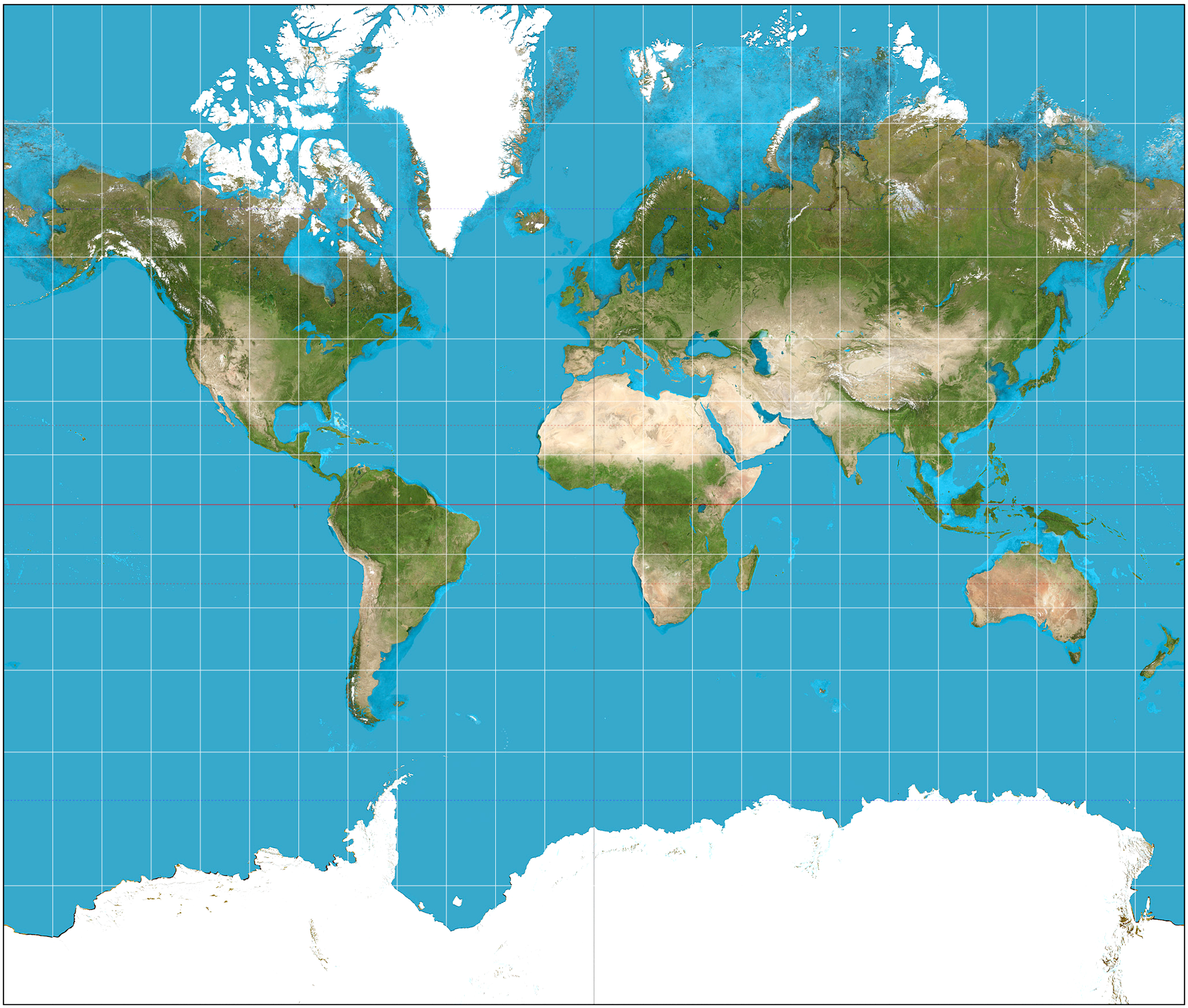
Over the years, I’ve gone to — and written about — all 48 contiguous United States, seven Canadian provinces, a couple of edgings into Mexico and a few places in Europe and Africa.

In each of the places I’ve been, there is a top sight to see, like the Grand Canyon in Arizona or Yellowstone in Wyoming. And I’ve loved them all.

But there are also smaller, less well-known places that have quietly become some of my favorites. I’m sure everyone has the same: places where something special happened, or that sum up the qualities of a state or region, or that just seem so relaxed and beautiful that they draw you back over and over.

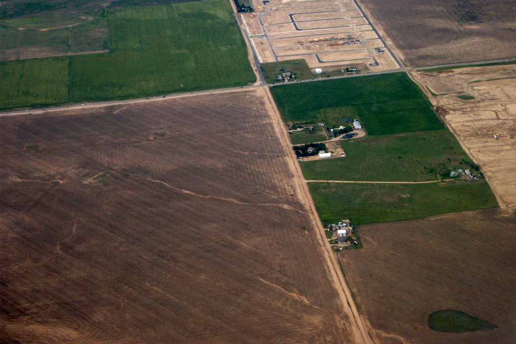
For me, such places are often remote from normal tourism attractions. I am a sucker for unspoiled grasslands in the Great Plains, for alligator-filled swampland in the South, for backcountry roads in the Appalachians. Others may look for happy crowds to join, for music and dancing or roller coasters. My favorites, however, tend to be empty of people, silent and to provide long views over a significant arc of the planet.

So, here are a few of those places, listed state by state.

edmund pettus bridge

Alabama

If you want to learn about the Deep South and how much it has changed, you should visit Selma. It is where the great Civil Rights march of 1965 began, crossing the Edmund Pettus Bridge and heading on to the state capitol at Montgomery. If you think the battle is over, you should visit Selma and see, despite how far we have come, how distant is the horizon.

Badger Springs Road 1Arizona

Of course, the Grand Canyon is on our license plates, but almost any other square foot of the state is nearly as wonderful, from Hoover Dam to Douglas, from Four Corners to Yuma. But I have a special place in my heart for an obscure exit ramp from I-17 north of Phoenix. Badger Springs Road is a bit of largely undisturbed desert, with trails and cactus, and I can always pull off the highway and find a bit of peace and quiet.
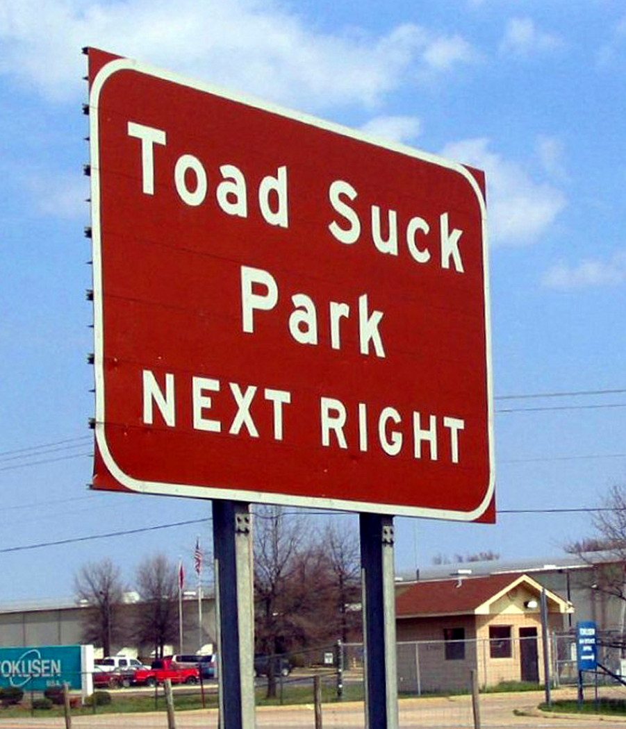
Arkansas


The state is rich in rural areas, craggy in the north, flat and muddy in the east through the Mississippi flood plain, steamy with hot springs toward the south. But the little town of Toad Suck in the center of the state seems even a little quieter, a little more remote than most, and is graced with a state park as well, along the Arkansas River. No hotels, but friendly people.

manzanar

Northern California

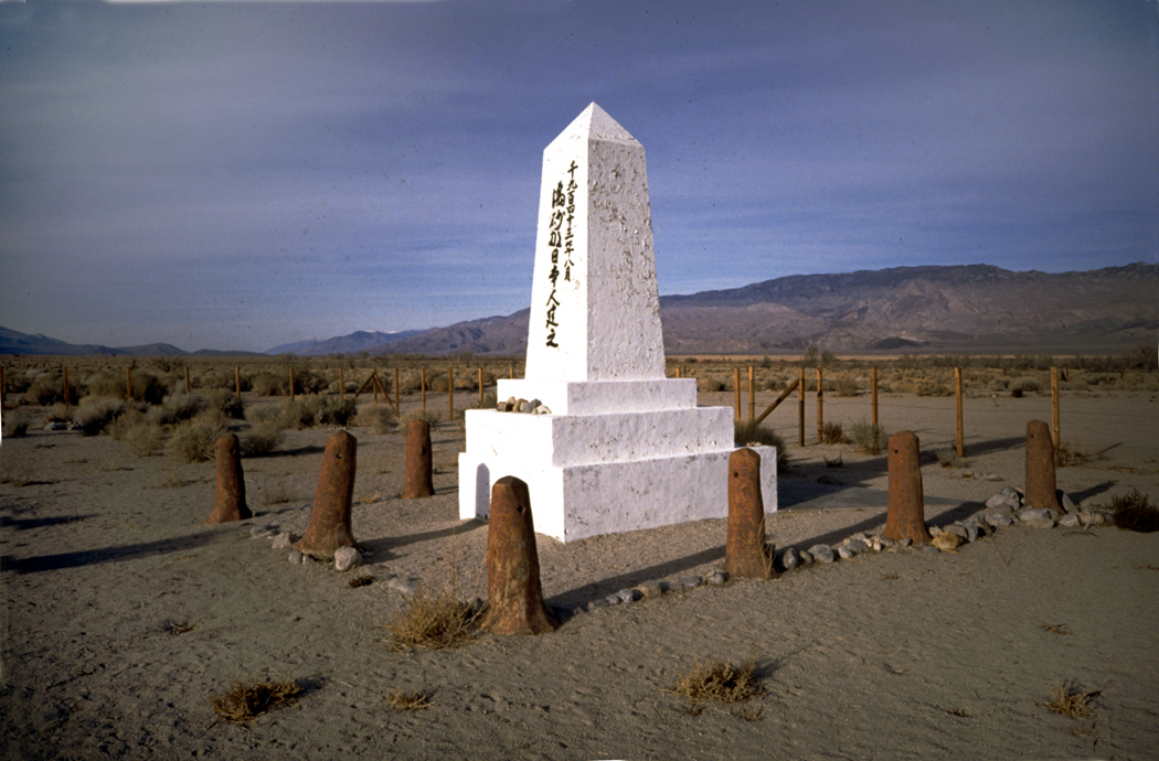
California is too rich; I have to split it in two. Even then, I could name a dozen places in each half: In the north — Tule Lake National Wildlife Reserve, Mono Lake on the eastern side of the Sierras, Lassen National Park, the Humboldt Redwoods, the tule marshes along the Sacramento River. But I keep coming back to Owens Valley, just below Mt. Whitney. From the soda-flat Owens Lake north to the ruins of the Manzanar Relocation Center — where Japanese-Americans were interned during World War II — the valley is both picturesque — the Alabama Hills where so many Western films were shot among the wonderland of rocks — and historic — in addition to the concentration camp, there is the sorry and violent tale of how a thirsty Los Angeles stole the valley’s water earlier in the century.

Southern California

East of San Diego is one of California’s most pristine deserts. It is called Anza-Borrego Desert State Park and it is the primordial home of all those Washington palm trees that line the streets of Phoenix. Borrego Springs is a surprisingly kempt little town in the middle of it, but the rest of the park usually seems as empty as a college campus during spring break.

Pawnee Buttes 5 copy

Colorado

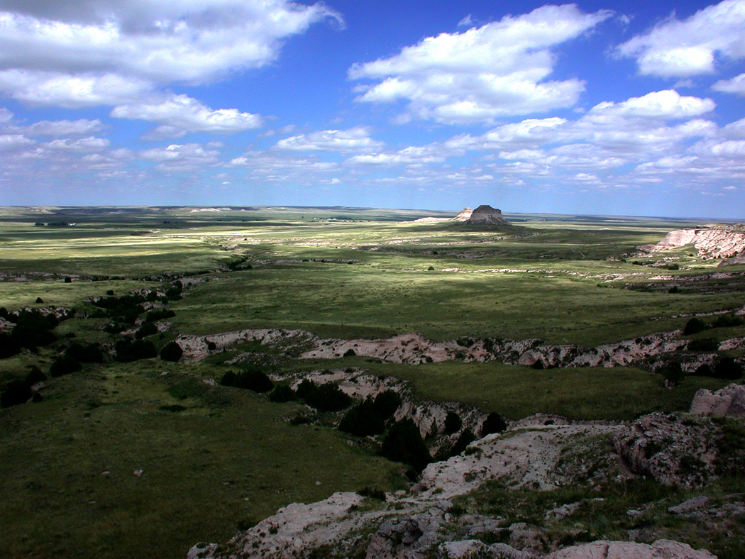
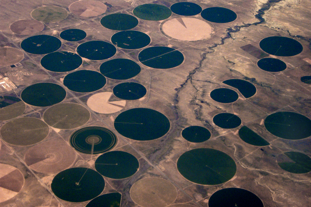
For most people, the state probably brings to mind skiing or expansion baseball, or an over-hyped beer, and certainly Colorado is best remembered for post-card mountains — all those “fourteeners” — but I love the Pawnee National Grasslands, one of the best places to get a sense of what the West was really about, what the Great American Desert was — not desert, but the Great Plains, vast, sweeping and grassy.
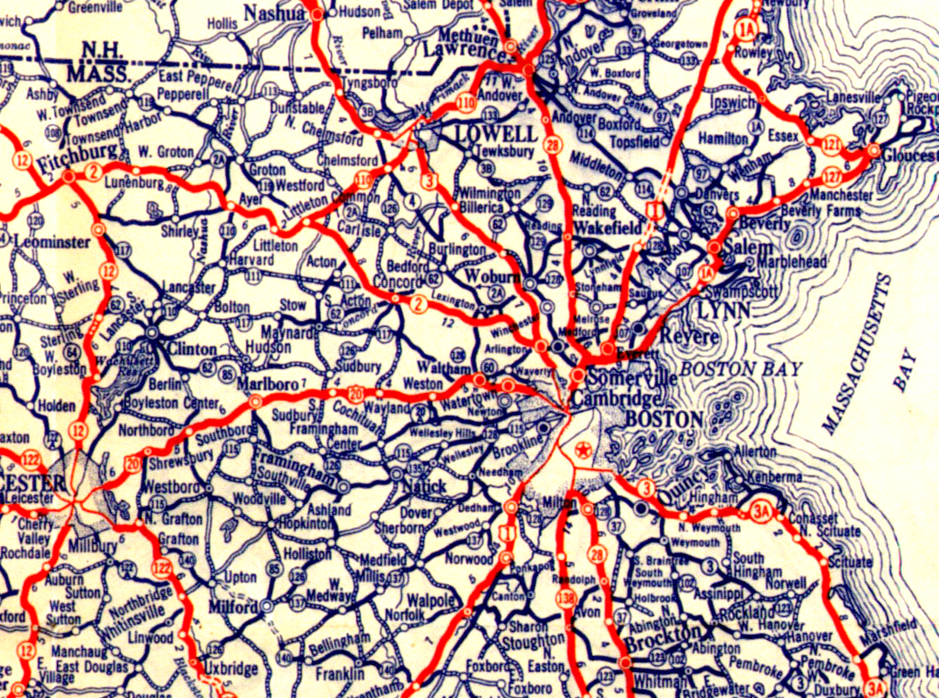
Connecticut

There is no more peaceful a river valley in the nation than the Housatonic north of New Milford. The Appalachian Trail winds along a portion of its banks. There are covered bridges, meadows and not too far away, near Cornwall, there is a large stand of virgin white pine, called the Cathedral Pines. U.S. 7 parallels the river most of the way.

Delaware

Delaware is a tiny state, and most people notice it, if at all, for the chemical plants and refineries that stick their bellowing smokestacks into the air, and the highways that pass through it on their way elsewhere, up over the twin Delaware Memorial Bridge. But there are the “Hooks” — Prime Hook and Bombay Hook national wildlife refuges, swampy and woodsy on the broad mouth of Delaware Bay.

Florida

If you cannot get enough of the Everglades, or if the national park is too crowded, head north off U.S. 41 on any of a dozen gravel roads into Big Cypress National Preserve. Or take the loop road to the south, through incredible cypress wetlands, with sagging Spanish moss and blackwater swamps.

Okefenokee

Georgia

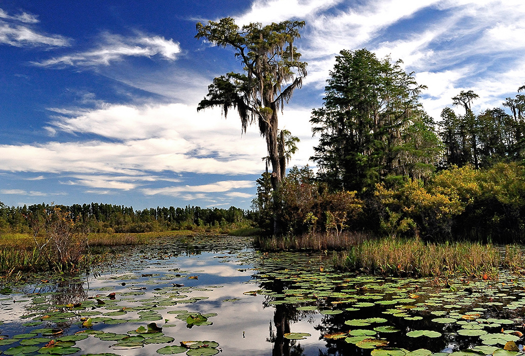
The Okefenokee is my favorite swamp. That’s saying a lot. I’ve seen more wildlife in it than in any other. Drive up Georgia 177 from Edith into the Stephen C. Foster State Park and rent a canoe. Paddle within inches of swimming alligators. Look into the trees for the snake birds — anhingas — with their darting necks and their wings spread out in the sun to dry.

Idaho

With its camas prairies, steep mountains and gaping canyons, the Nez Perce Indian Reservation is one of the most beautiful parts of this beautiful state. You can see the valley where Chief Joseph began his tragic 1,500-mile unsuccessful flight to freedom for his people in 1877.

Mississippi barge

Illinois

Chicago has big shoulders in the north, but down at the very bottom are the forlorn toes of Cairo, one of the most memorable of Mississippi River towns. It is aging, with peeling paint and boarded up storefronts, but you can feel in the humid air the history behind it. And you can see the conjoining of the muddy Mississippi water with the clearer, faster moving Ohio River. Boats and barges move past in the misty mornings like iron dreams.

Indiana

If you want to find the prototype of Disney’s “Main Street U.S.A.,” you couldn’t do better than to see Paoli, in the southern part of the state. No more perfect quiet little Middle-American village can be found. There are no tourists and nothing to do, but imagine what it must be like to live there, under the spreading chestnut trees just off the town square.

Iowa

Iowa is sometimes surreal: At the bottom of the bluffs of the Mississippi are cities filled with Victorian architecture. There are trees and vines. On top of the bluffs, there are endless rolling farms, with silos instead of trees, like some Grant Wood painting. The best of the cities is Dubuque, one of the greatest surprises of my travels. It is one of America’s most beautiful cities.

Kansas

If you want to get away from civilization, you can hardly do better than the middle of Kansas. Just north of Lebanon is the “Geographical Center of the Conterminous U.S.,” which is a highly qualified title to be proud of. But    you stand there, looking out over the grass and wonder, if they dropped the Big One here, would anyone hear it?

harlan county ky

Kentucky

   The state is mud in the west, limestone in the center and coal in the east. Among the stumpy, round-bumped mountains of coal-mining Harlan County and neighboring Letcher County, are some of the poorest homes and interesting people of the country.

atchafalaya thicket

Louisiana

It surprises even me, but one of my favorite places is along the Interstate. For 20 miles, I-10 rises on piers over the Atchafalaya Swamp. Take an exit into the dark woods and drive along the river into old, mossy river towns, built where the terra is not so firma. Even the pavement seems squishy beneath your feet.

Schoodicwaves2x

Maine

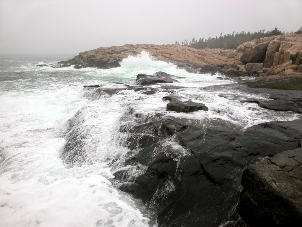
Everybody heads to Bar Harbor, where the T-shirt shops and frozen yogurt stores are chock-a-block. Pass on that and head to Schoodic Point further north. Also part of Acadia National Park, it is one of the ruggedest, rockiest parts of the rocky Maine coast.

Maryland

Antietam National Battlefield, near Sharpsburg, is the most emotional Civil War site I have visited. Every aspect of the fight, and all the blood and bullet-holes, seem spread out graphically, and the spirits of the dead and suffering seem almost palpable at the sunken road called Bloody Lane.

Greylock Mt from Melville home Mass

Massachusetts

Arrowhead is the one-time home of Herman Melville in Pittsfield. The house is actually a character in many of his stories, and you can look out the second-floor window of his study, where he wrote Moby Dick, and see the saddle-back peak of Mt. Greylock to the north, “Charlemagne among his peers.”

Michigan

The Upper Peninsula is a big place, but everywhere you turn, there are forests, lakes and rivers, including Papa Hemingway’s Big Two-Hearted River. It’s hard to pick a single place, but there is always the drive on U.S. 2 along the southern shore of the peninsula along Lake Michigan.

Minnesota

A river doesn’t really start from a single source, but the agreed fiction is that the Mississippi begins at Lake Itasca, southwest of Bemidji. The lake is not that large, by Minnesota standards, and seems quite placid. The “father of waters” begins at a reedy little outlet that you can step across and brag you crossed the Mississippi on foot.

Mississippi

The blues began in the Mississippi Delta, and they are still played in the shabby juke joints of Clarksdale, one of those old, cracked-concrete, grass-in-the-railroad-ties, dying-downtown Deep South county seats. Everybody you see, sitting on their porch fronts, seems more human, more profound. Maybe it’s the blues.

Missouri

The Ozark Mountains can be beautiful, with lichen-covered limestone and rivers that disappear underground. Like at Big Spring State Park on the Current River, where the river comes gushing back out of the rock like a fountain.

bear paw surrender site

Montana

Chief Joseph began his three-and-a-half month trek in 1877 in Idaho, he ended it on the flat, grassy, empty plains of northern Montana, at a place called the Chief Joseph Battlefield near the Bears Paw Mountains, only 40 miles from the safety his Nez Perce Indians sought in Canada. He was captured by the U.S. Army, and promised “From where the sun now stands, I will fight no more forever.”

bailey yard nebraska

Nebraska

People look at me funny when I tell them that Nebraska is probably my favorite state to visit. The sand hills, the puny “national forest,” the Platte River and Scotts Bluff — they all seem unbearably windblown and lonesome. I love them all, but in North Platte, you cannot feel alone at the biggest railroad freight yard in the country. You can watch trains all day.

Nevada

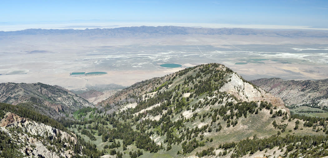
If Nebraska is my favorite state, Nevada is probably my least favorite. It is empty, true, but its emptiness seems hard and thoughtless, like a biker at a roadside bar and casino. But I cannot deny the beauty of such places as Big Smoke Valley, between the Toiyabe and Toquima mountains, and the wide sagebrush plains where you don’t see a car for hours, but maybe a dozen dusty pickups.

New Hampshire

The Kancamagus Highway is one of the most beautiful drives in the country, winding through the White Mountains along the Swift River. It goes from Lincoln to Passaconaway and passes some stunning stony waterfalls.

pulaski skyway copy

New Jersey

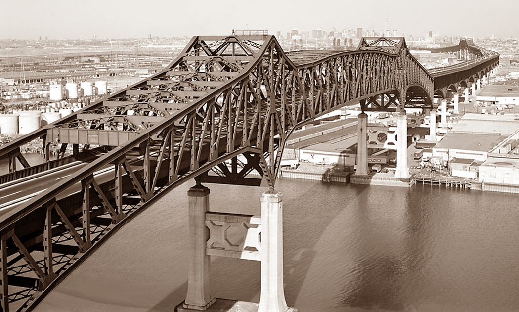
This is the state where I grew up. I came to despise the suburban banality of most of the state, but I loved two things: the northwest corner, with its minuscule mountains and bucolic forests; and most of all, the industrial corridor of the Jersey Turnpike, with its refineries, chemical plants and the always-beautiful Pulaski Skyway.

New Mexico

At the top of the Sacramento Mountains, in the Lincoln National Forest is a place called Cloudcroft. There is great camping, wild animals and — usually — clean air that is so clear, it could cut diamonds.

Bear Mtn Bridge

New York

New York offers more than any other single state except California. There are dozens of favorite sites, from Montauk Point to Niagara Falls. But I will always have a special affection for Harriman State Park, along the Hudson River, and Bear Mountain, that looks down at the gorge, just south of West Point and its military academy. Seven Lakes Drive, through the park, is what nature in the East is all about.

Ashe County road, creek &dogwoo

North Carolina

No question here: Ashe County, tucked up in the northwest part of the state, above the Blue Ridge, is away from the normal tourist loop, but more beautiful than any other place north of the Smoky Mountains. Any gravelly back road will take you to something surprising and there is the New River to canoe down.

Sunflowers Zap North Dakota

North Dakota

It hardly counts for anything, and there is no real reason to visit, but I cannot get enough of Zap, a tiny crossroads, where the roads don’t go anywhere. Between Beulah and Golden Valley, Zap sits among the rising and dropping swell of the grasslands, with the occasional pond for cattle to drink from.

Virginia Kendall SP, Ohio 3 copy

Ohio

Just south of Cleveland, there is a small bit of woods and rock called Virginia Kendall Park. It is right next to the larger Cuyahoga Valley National Recreation Area, and benefits from more people going there than here. There is a rocky bluff in the middle of the park and echoing voices in the forest among the leaf litter.

Oklahoma

One of the worst massacres of the so-called Indian Wars took place just outside of Cheyenne, along the Washita River. The site is now nothing but grass, a line of trees along the water, and some outcroppings of rock. But the surrounding Black Kettle National Grasslands can give you a real sense of what the land looked like 121 years ago.

Columbia River Gorge Oregon-Washington

Oregon

The Columbia River Gorge is one of the scenic wonders of America, and one of the most scenic drives is along the old, outmoded Columbia River Gorge Scenic Highway, which rises up the mountainside above the interstate highway, and takes you through more waterfalls than any comparable stretch of road outside Hawaii.

falling water

Pennsylvania

The second most famous house in America — after the White House — is probably Frank Lloyd Wright’s Fallingwater, a vacation home he designed for Pittsburgh’s wealthy Kaufman family beginning in 1934. It is also one of the most beautiful buildings in the country, sitting literally atop a waterfall and jutting out over the small forest glen.

Rhode Island

If you’re on the A-list, you’ll naturally gravitate to Newport and its extravagant mansions. I’m not on that list; I prefer the more humble Conanicut Island, where real people live. It sits in the middle of Narragansett Bay and gives you a good sense of what life on the bay is like.

South Carolina

Myrtle Beach gets all the traffic and spring-breakers, but Huntington Beach, 10 miles further south along Murrell’s Inlet, is the better place to be. With Huntington Gardens just across the street, with all those animal sculptures of Anna Hyatt Huntington, and a fresh-water alligator pond next to the salt marsh, Huntington Beach is a great — a great — place for seeing birds.

pine ridge rez

South Dakota

The Pine Ridge Indian Reservation may be poor, but it is beautiful. And as with many places noted for its poverty, it is very real. The people take the time to talk to you and there is history at every turn in the road — not all of it very comfortable for an Anglo to remember.

Tennessee

Most of the crowds at Great Smoky Mountains National Park gather along U.S. 441 across the crest of the range, or in Cades Cove in the southwest of the park. But one of the great drives, and less crowded, is up the Little River Road through the back side of the park. It follows the cascading Little River most of the way, and finds its way back to the visitors center at Sugarlands.

lbj ranch grandparentshouse

Texas

Even Texans will tell you the center of their state is the best part: The Texas Hill Country is an oasis in the middle of a state that sometimes seems like nothing more than the world’s largest vacant lot. And the best part of the Hill Country is found at the LBJ Ranch near Johnson City. It is no wonder that our 36th president loved his ranch so much. It is a jewel in a perfect setting.

Utah

Is there a square inch of the state that doesn’t deserve to be a national park? I haven’t found it. But one of the most overlooked gems is the ride along Utah 128 from Moab to Cisco. Through most of its route, the road seems to be the one you would imagine at the bottom of the Grand Canyon. Well, perhaps that exaggerates it a wee bit. But it is special.

coolidge plymouth

Vermont

Near Plymouth is the birthplace and homestead of Calvin Coolidge, who has recently lost his title as the president we made the most jokes about. In fact, Silent Cal was a smart cookie and not at all the buffoon stand-up comics make him out to be. He was raised in a tiny Yankee village that is preserved as a state park.

Monticello Entrance Hall copy

Virginia

Virginia is another state that seems to have more than its fair share of special places. Perhaps it’s history, perhaps geography, but almost anywhere you turn, there is something that will draw you back over and over. Still, there is something special about Thomas Jefferson’s mountaintop home, Monticello, a monument to just how profoundly beautiful a little nuttiness can be. The Age of Reason meets Henry Thoreau.

Washington

Eastern Washington is largely a blank spot in America’s consciousness. Seattle, the Olympics, the Cascades, Mt. Rainier — they are all in the west. But there is hardly an odder or more peculiar and spooky landscape on Earth than what is called the Channeled Scablands east of the Cascades. The Grand Coulee Dam blocks the Columbia River there, where a prehistoric flood scraped the earth clean for hundreds of miles.

West Virginia

The Hawks Nest, on U.S. 60 between Gauley Bridge and Ansted, looks out over the deep declivity of the New River Gorge and is one of the great scenic views of the eastern U.S.

Frosty dawn Wisconsin

Wisconsin

Southern Wisconsin has many treasures, including the Mustard Museum in Mt. Horeb, and the world’s largest six-pack of beer at La Crosse, but nothing can beat the genuine zaniness of the Dickeyville Grotto, a religious site in Dickeyville created out of broken bottles, seashells, stones and broken crockery. It is one of the great “outsider art” sites, and don’t miss the tribute to Columbus.

Wyoming

What’s the highest, most alpine road in America that actually goes somewhere? Undoubtedly, it is the Bear Tooth Highway, U.S. 212 from Red Lodge, Mont., to Yellowstone National Park. It climbs up over Bear Tooth Pass at 10,940 feet and provides more long Rocky Mountain views than any other road. Look out for the marmots.