Part 1: Bad weather and Longinus
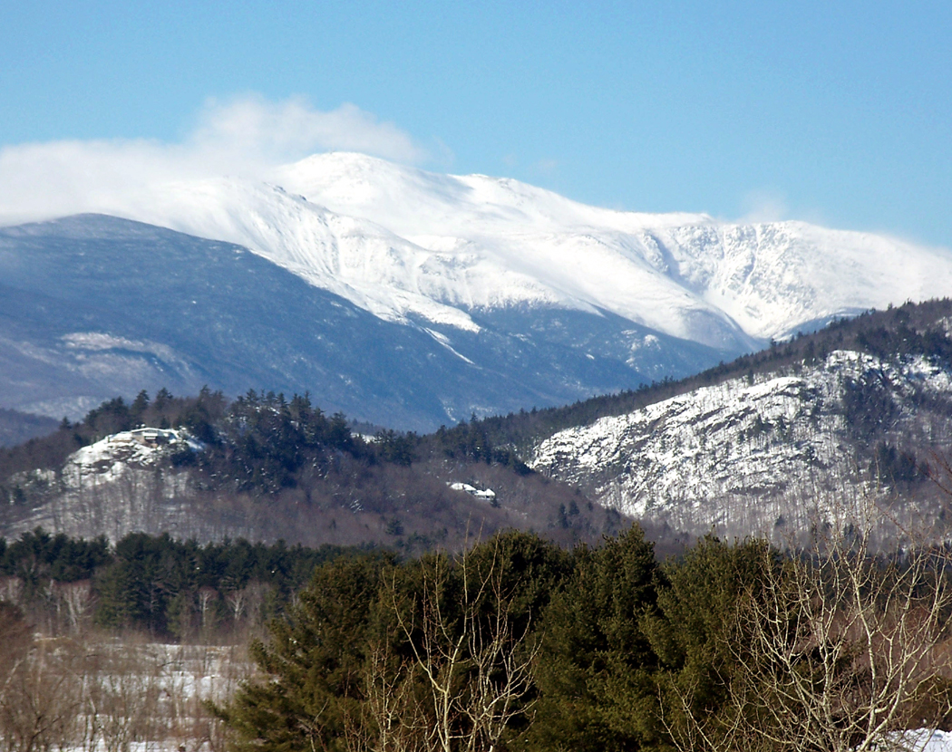
Mt. Washington
It is not at all unusual to drive past the most imposing mountains in the East and not even see them.
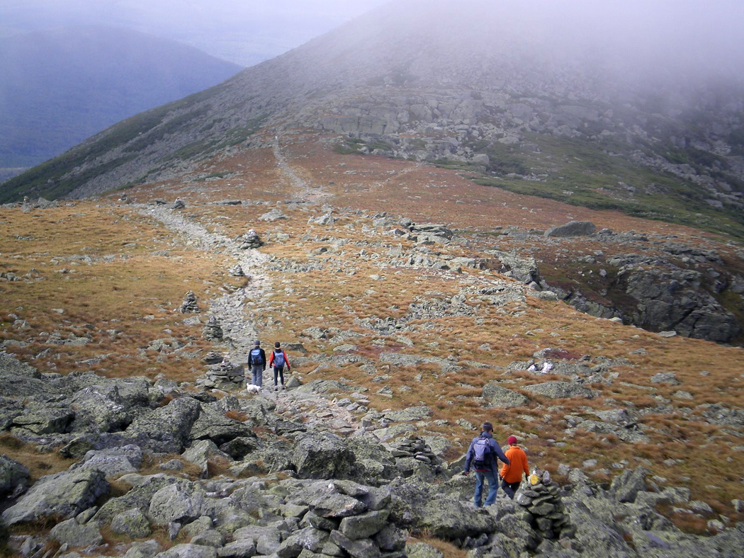
The White Mountains of New Hampshire may not be taller than those in the Smokies down South, but because they are so much farther north, their tops bust through the tree line and leave their summits raw with rock. They are craggy and wild.
Between Mt. Washington and Mt. Clay
But the weather can hide them in swirling mists and all you see is a whitish, nebulous screen blotting out the roadsides as you drive past.
The northern Appalachians strive to reach the Whites, beginning with the low Litchfield Hills in Connecticut that grow into the Berkshires in Massachusetts and the Green Mountains of Vermont. The White Mountains cap this part of the cordillera, climaxed with the Presidential Range in northern New Hampshire and its imposing Mount Washington, which, at 6,288 feet, is the highest peak in the Northeast.
It is an impressive sight, if you are lucky enough to see it.
But Mount Washington’s other claim to fame is that it suffers the worst weather in the world outside the polar regions — at least the worst weather reported by an official weather station. 
On April 12, 1934, the wind spat across the top of the mountain at 231 mph, the highest wind speed ever recorded on this planet. That’s about a third the velocity of a shotgun blast. Winds in excess of 100 mph are not uncommon, and there are fog and mist at the summit at least part of 300 days every year.
The building at the summit has to be held down with guy wires.
And then there are the snow and ice. Most of the annual 70 inches of precipitation comes in the form of snow. But this whiteout isn’t unique to Mount Washington. Other mountains also hide in the clouds.
When Henry David Thoreau climbed Mount Katahdin, which rises 5,267 feet above sea level in Maine, he faced more winds and mist.
”It was like sitting in a chimney and waiting for the smoke to blow away,” he wrote in his book The Maine Woods. ”It was, in fact, a cloud factory.
”Occasionally, when the windy columns broke in to me, I caught sight of a dark, damp crag to the right or left, the mist driving ceaselessly between it and me. It reminded me of the creations of the old epic and dramatic poets, of Atlas, Vulcan, the Cyclops, and Prometheus. Such was Caucasus and the rock where Prometheus was bound.”
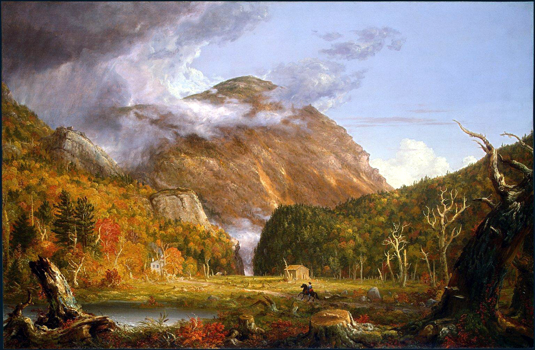
“Crawford Notch” by Thomas Cole
One can see the weather in the painting by the great 19th-century American artist Thomas Cole, whose Crawford Notch captures the mizzly scene: A mountain on the left is obscured in scud; on the right, sunlight glows from the opposing crest. At the bottom of the valley, a horseman heads for a log cabin.
The painting, at the National Gallery in Washington, D.C., looks as wild and Romantic as it sounds. You certainly don’t believe for a moment that Cole has not exaggerated the effect to make a more dramatic painting. But I’ve driven through Crawford Notch, a valley just south of Mount Washington, and seen the same blowing clouds, sweeping from the peaks on my left to those on my right.
The northerly end of the Appalachians is less populated than the southern or central parts. There are more animals, and it is not that unusual to see moose wandering the roadsides. Loons swim in the lakes, and black bears rummage through the woody underbrush.

Lake Ambejejus, Maine
As the mountains hunker down again north of the Whites, their loss of altitude is made up for in the profusion of lakes. Western Maine is as wet as Minnesota, and as good for canoeing. The lakes have long, difficult Indian names, such as Mooselookmegunticook, Apmogenegamook, Nesowadnehunk and Ambajejus. Such names are a linguistic wilderness all their own.
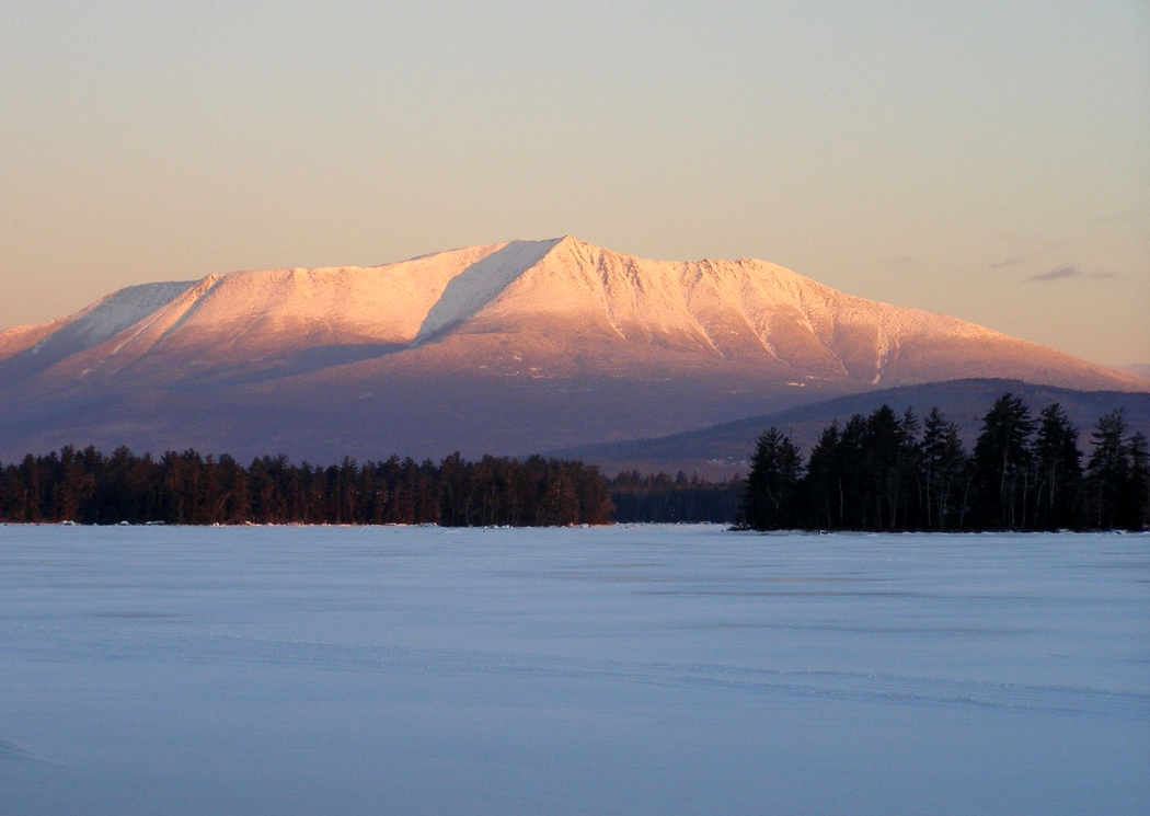
Mt. Katahdin
But in Baxter State Park, the land rises high once again, reaching its peak at Katahdin, a monadnock, or mountain remaining after erosion has washed away the rest of the range. Katahdin can be seen from Interstate 95, 30 miles away, rising above the green-treed plain.
At least, when the weather is clear.
NEXT: Kancamagus Highway
