Yosemite Falls, Yosemite NP Calif

Scarcely 100 miles separate the lowest and highest points in the 48 states.

There is no more striking contrast in America than to drive from Death Valley to Yosemite Valley. In July, it may be 120 in one place and snowing in the other, only a hundred or so miles to the west.

The range of the Sierra Nevada blocks the way west for hundreds of miles; if anything can be called the bony spine of California, the mountains can. They continually surprise with color, size and expanse. John Muir called it the “Range of Light,” and he didn’t have to be a poet to think that up.

There are only a few places where pavement jumps the hump.

One of those is the Tioga Road over Tioga Pass. It climbs and twists to the 9,945-foot summit and the first time I drove it, it closed over with gray sky and fog. The fog turned to ice and, just as we passed the entrance gate to the national park, it turned to great gobs of wet snow. The road winds around the mountains and though there are sharp twists and drops of thousands of feet, there were few guard rails.OLYMPUS DIGITAL CAMERA

But I hardly knew the danger, because there was no declivity to be seen, not much of anything but wet, icy pavement and the occasional car going in the opposite direction.

I drove slowly and with tight fists on the steering wheel. As we descended from the pass, the snow changed slowly back to sleet and then rain. The glorious views promised by the road markers were curtained by the mist. All but the road and a few trees alongside it were white with fog.

We reached the Tuolumne Meadows Visitor Center in a heavy drizzle and went in to find a warm and dry wood fire in their Buck stove. Outside, it was in the low 40s; inside was a toasty 70 degrees. The building was an old one of log and hand-hewn boards.

I had always wondered how to pronounce “Tuolumne” but I had never guessed “twa-lum-nee,” which is what the ranger said.tuolumne meadows

The meadows, the biggest in Yosemite, stretched for a mile or so, rolling softly in short grasses and erratic boulders. It was bissected by the Tuolumne River, a shallow brook meandering among the oozy weeds. The fog was lifting and we could see the bases of the mountains that ringed the meadow, but their peaks were still obliterated.

Tioga Road continued all the way through the park, past Lake Tenaya and Porcupine Flat. The lower mountains, beginning to show themselves, were shear domes of exfoliating granite with twisted junipers growing from solid stone in their higher elevations. All the naked stone and rushing water filled every expectation I ever had about the high Sierra.???????????????????????????????

We had not planned on stopping at the valley. I half wanted to go and see the glories pictured in the Ansel Adams photographs, but I also knew that Yosemite Valley is one of the most crowded places in all the national parks, and I hate crowds.

And I knew that many of the Adams pictures had been snapped in the ’30s and ’40s, when there were fewer tourists and fewer buildings:  Judging from our map, there appeared to be no fewer than 200 buildings on the valley floor.

But we went, anyway, and it turned out wonderfully. There are giant hotels and vast campgrounds in the valley, but a short jaunt around a bend in the road and they disappear.

The gray rock walls of the valley were showing to a height of 800 feet and were obscured higher than that with the low-hanging scud that scooted by in the breeze, changing the face of the valley from moment to moment. Yosemite Valley, Yosemite NP Calif

Through the center of that stony valley cascades the Merced River. In the spring, it floods and in the late summer, it can dry up. We were halfway between the extremes and it burbled satisfyingly between lines of rustling willows.

With the dark trees in the foreground and the cloudy ceiling over the vertical rock walls behind, it would have been hard to come up with a more sublime scene. No Bierstadt can compare, no Moran, no Cropsey. They seem literary; the scene before us was breathing the now.

Mt Whitney, Sierra Nevada from Lone Pine Calif

I first visited Lone Pine, Calif., in 1982, but I’ve known it by heart since the early ’50s. I didn’t know where it was, but I saw the boulder piles of its Alabama Hills in every B-Western I watched on TV. For a small boy growing up in New Jersey, the Alabama Hills was the West.

The tiny, dusty town lies directly under Mt. Whitney, the tallest mountain in the Sierra Nevadas, and the the highest in the lower 48. The snow streaked arete forms an impenetrable wall to the west of Owen’s Valley, which Lone Pine sits in the center of. To the east, the impressive Inyo Mountains look soft and velvety in contrast to the hard, stony face of the Sierras.Hoppy Rocks Hiding

And the low, brown foothills of the Sierras were the location sets of hundreds of Hopalong Cassidy, Three Mesquiteers, Bob Steele and Tom Mix films. Whenever Hoppy had to evade the gang of bad guys chasing him, he’d duck behind the rocks of the Alabama Hills and watch them thunder by in a dust cloud. One such rock-pile is still known as the “Hoppy Rocks.”

It wasn’t just Westerns that were made in Lone Pine, though. The valley and hills stood in for India in The Lives of the Bengal Lancers, Kim, King of the Khyber Rifles and Gunga Din. For the last, a great “Temple of Kali” was built up in the hills.

It was also the location for Humphrey Bogart’s “Mad Dog” Earle in High Sierra.

Later, the terrain was the backdrop for The Lone Ranger, Wild Bill Hickock, Gunsmoke, Rawhide, Bonanza and Have Gun, Will Travel.

You can hardly watch a Western without seeing those great rubble-heaps of boulders catching the afternoon sun.AlaHills rocks

But for me, it is the silvery grays of the landscape, shot in orthochromatic film in the ’30s, that define what the West looks like. It is the scenery in every Hoot Gibson, Ken Maynard, Buck Jones and Gene Autry film.

You can drive down Movie Road, up the west slopes of the Alabama Hills, and see where the Lone Ranger was ambushed in the very first episode, see where John Wayne and his Singing Riders captured Black Bart’s gang in Westward Ho, and see where Gene Autry jumped from his horse, Champion, to a speeding convertible in Trail to San Antone.

There are more sites up Tuttle Creek Road, including the “Hoppy Cabin,” where William Boyd lived during the shooting of the Hopalong Cassidy films. The cabin is still there. You will recognize it from other films it’s been in.hoppys cabin

Over the years, many sets have been built in the hills, but except for the Hoppy Cabin, they are all gone. The Bureau of Land Management, which administers the area, has dedicated nearly 30,000 acres as the Alabama Hills Recreation Area and plans to preserve the Hills in as close to a natural state as possible.

The hills, by the way, were named at the time of the Civil War by a group of Southern-sympathizer miners, who were looking for gold among the rocks. When the Confederate cruiser, C.S.S. Alabama, wreaked havoc on Union shipping, they named their claimsite after the ship.

In retaliation, 15 miles to the north, Union-sympathizing miners named their claim “Kearsarge,” after the Yankee ship that sank the Alabama. That name remains on a mountain peak, a pass and a town east of Independence in the Inyos.AlaHills medium view hiding place

wm mulholland opening day

”There it is – take it.”

At the time, before talkies made Hollywood America’s Bartlett, those were the most famous words ever spoken in Los Angeles.

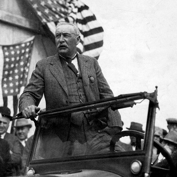
The city’s chief engineer, William Mulholland, addressed a full one-fifth of the city’s population at the lavish opening ceremony for the aqueduct he built. It was 1913, Los Angeles was a small, drought-plagued city. The sluice gate opened, the water rushed into the canal. LA aqueduct opening day

”There it is — take it!” he said to the assembled 40,000 Angelenos.

And as I was driving down Cahuenga Boulevard, I saw the sign for the road that is the city’s only remaining prominent memorial to Big Bill Mulholland, the man who made Los Angeles possible.

In another of his grand projects for the city, he built a road along the ridge of the Santa Monica Mountains from Hollywood to the ocean, a kind of scenic drive for picnickers and tourists. I saw the off ramp: ”There it is — take it,” I thought.

INTO THE HILLS

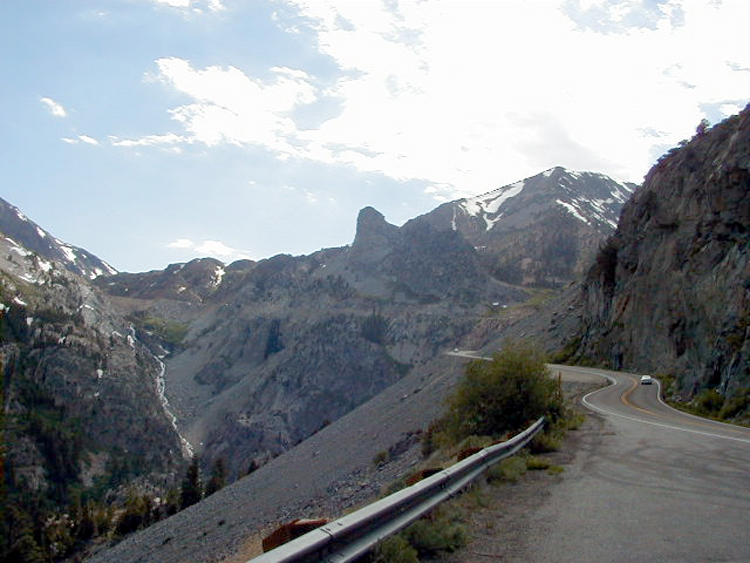
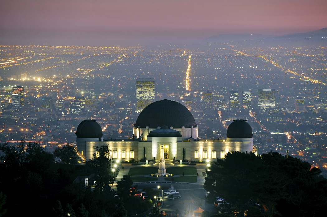
Mulholland Drive Scenic Highway runs 55 miles, on and off, east and west, through several diverse visions of Los Angeles, from the ritziest of exclusive neighborhoods to the most desolate wilderness. It begins in the hills above the Hollywood Bowl and ends at the Pacific Ocean just short of the Ventura County line. mulholland house

Once, the road was nicknamed “Bad Boy Drive” because it was home to such actors as Jack Nicholson, Warren Beatty and the late Marlon Brando. There are still celebrities who live along Mulholland, but now, you are more likely to find the grandiose homes of producers and agents.

Among those who live, or have lived on this famous windy road are Madonna, Arsenio Hall, Molly Ringwald, John Lennon, Roman Polanski, Ida Lupino, Joan Fontaine, Mary Tyler Moore, Faye Dunaway, and Bruce Willis and Demi Moore (remember when they were the hot couple?) And, of course, Vanna White. But you shouldn’t expect to find their names on their mailboxes by the road. The only names you will see prominently mentioned on signs belong either to real-estate firms or home-security agencies.

Every fifth car you pass seems to belong to a private security agency. They patrol the neighborhoods just like city cops.

Although to call this a neighborhood, is like calling Aztec gold ”a chunk of dirt.”

NOW THAT’S REAL ESTATE

The homes are huge: One mansion-size house just being built turns out to be only the top level of a two-level complex. You can see the second level down the side of a canyon that becomes visible only after you turn a corner. There must be 40 rooms to each section. A six-court tennis compound is built on a platform that juts out over the declivity below. Like much in the first 10 miles of Mulholland Drive, it is a monument to human excess. house on mulholland

It probably will be bought by a Hollywood producer.

As for turns, the road has a million of ’em. It twists and winds its tire-squeaking way along the narrow ridge crest, with views of Hollywood on one side and the San Fernando Valley on the other.

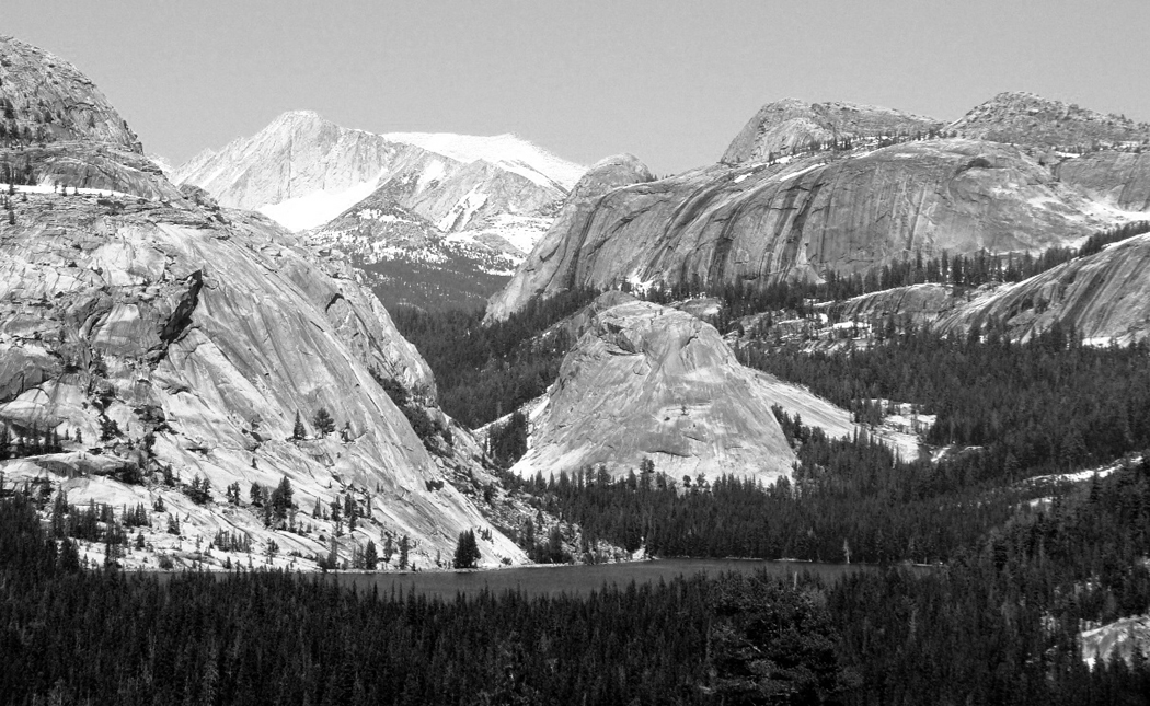
On a clear day — admittedly a rare occurrence — you can see all the way to the Santa Susanna and San Gabriel Mountains to the north, through which Mulholland dug his epic ditch.

Standing on one of the neatly manicured scenic overlooks, you can spot the distant reservoirs that marked the terminus of the 233-mile Los Angeles Aqueduct.

It is an impressive view of an impressive project.

BIG BILL

But then Mulholland was an impressive man. At 6 feet tall, with his walrus mustache and hale physique, he was the perfect model of the American self-made man. Wm Mulholland in folder

He was born in Belfast, Ireland, in 1855 and worked as a day laborer and sailor before settling in California at the age of 22. His native energy and drive elevated him from a zanjero, or ditch digger, to the head of the city water department, where he became chief engineer. LA aqueduct inverted siphon

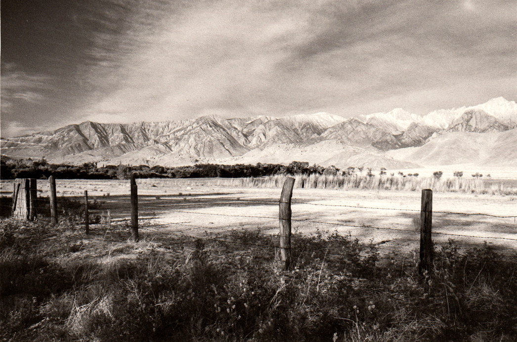
In the early years of this century, he conceived a plan with former Los Angeles Mayor Fred Eaton to bring water to the parched land by diverting the Owens River through a 233-mile canal — including 53 miles of tunnel and 12 miles of siphon pipes — to Los Angeles.

The project took 10 years to finish and claimed five lives, but it brought the single commodity the city most needed — water.

The story of the corruption and greed that attended the canal is told in fictional form in Roman Polanski’s classic film, Chinatown. It has the decade wrong and the personality of Mulholland wrong, but it has the greed and corruption right.

But although everyone around Mulholland seems to have cashed in on the land boom, from Eaton to newspaper publisher Harrison Gray Otis, Mulholland never showed any interest in money or politics. When at the height of his popularity he was touted as a possible mayoral candidate, he replied, ”I’d sooner give birth to a porcupine backwards.”

VALLEY VIEWS

The scenic overlooks are a little different from those along other scenic highways in America. Their names give them away, for one thing. mulholland view hollywood bowl

The first is the Hollywood Bowl Overlook. There are familiar put-a-quarter-in binoculars on pedestals along its edge, but the sights are pure L.A. Point 21 on the compass is the castle that used to be Madonna’s house, and as so many, now owned by a Hollywood suit.

The next pullout is the Universal City Overlook.

The road twists its way as you head west, from the luxury homes to those that are merely outrageously expensive. Outside each house are multiple trash bins for various recyclings. There are also several parks in the canyons lined with brittle yellow shale and Russian thistle.

At Laurel Canyon Park, everyone using it seems to have a dog on a leash. Maybe that is to protect them: A sign on the chain-link fence reads, ”Warning: Mountain Lions.”

Also on the fence is a bulletin board filled with homemade lost-dog notices. LA from mulholland

Twelve miles from the beginning of Mulholland Drive, you cross the San Diego Freeway (Interstate 405). Two miles later, and the ride begins to get rough.

At Encino Hills Road, the pavement gives out. Cars no longer can ride the gravel road: It’s a hiking path now. It’s a tricky turn because there are no clear road signs telling you which way to go, but Mulholland is the cow path to the left with the deep gullies in it.

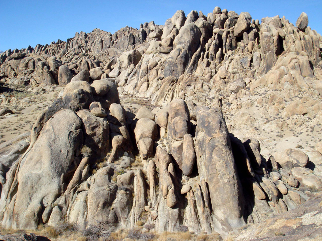
For the next eight miles, Mulholland Drive is a primitive dirt road, through the heart of what might be called the Santa Monica Mountains wilderness, if only it weren’t for the litter alongside the road and the high-tension lines that cut across the spine of the mountain chain.

Mulholland, himself, hit some rough road. At the height of his success, having built the canal and a dozen dams and reservoirs that allowed Los Angeles to grow from a sleepy little town to one of America’s major cities, his bubble burst.

Or rather, his dam burst.

 CAREER ENDING DISASTER

A few minutes before midnight on March 12, 1928, the St. Francis Dam gave way, pouring 12 billion gallons of water down the narrow San Francisquito Canyon and killing 500 people. st francis dam day after

A wall of water up to 100 feet high tore through the valley and obliterated all signs of human habitation. It left parts of Ventura County under a 70-foot-thick blanket of slimy debris. Fifty years later, bodies still were being dug up.

Mulholland views disaster site

Mulholland views disaster site

Mulholland was ultimately held responsible for building the dam on a site that was geologically unsound. He always believed the dam was the victim of sabotage by farmers from Owens Valley, whose water he had taken to satisfy Los Angeles. There had been many bombings on the aqueduct. This was merely the worst, he believed.

All evidence was destroyed by the torrent of water, so to this day, there is no certain answer for what caused the dam to break, but Mulholland was the man in charge and he suffered the consequences. Public opinion turned. Mulholland Dam and Reservoir was renamed the Hollywood Reservoir.

The dam had broken, and so had Mulholland’s spirit.


GRIT AND BUMP

Before that section of the road was closed to automobile traffic, I had the chance to drive the entire route. On the part now closed, all dirt and gravel, the car bounced mercilessly over the ruts, past San Vicente Mountain and a city park that now is boarded up. It was too remote to patrol, and vandalism and graffiti disfigure even the fence around the former parking area.

Through most of the unpaved section of Mulholland, I could not drive faster than 10 mph, but the views were stunning.

You could also spot a car here or there parked, with a man scanning the brushy hills with binoculars. They were part of L.A. County’s volunteer Arson Patrol, keeping a lookout for miscreants vile enough to set fires in the city’s vulnerable wilderness.

At Topanga Canyon Road, the pavement picks up again, and the character of the road changes once more. mulholland highway vista

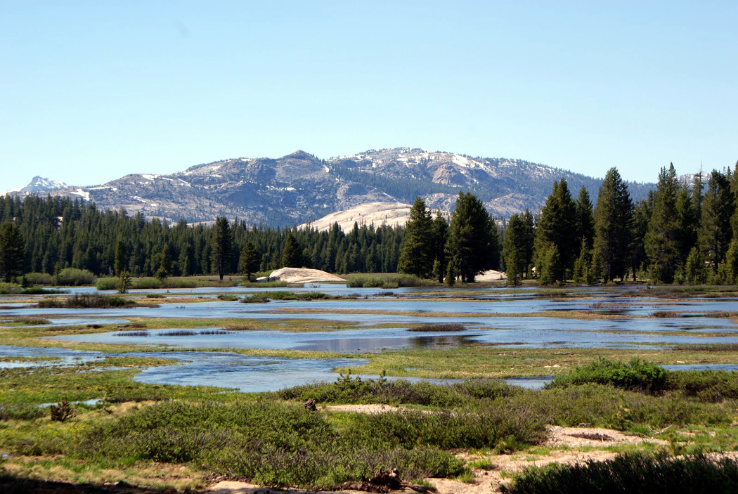
For the next 30 miles, the road — now called Mulholland Highway — is a comfortable rural byway through tiny communities, such as Calabasas, alternating with the Santa Monica Mountains National Recreation Area.

There are camping, hiking and horseback riding to be had at such National Recreation Area sites as Rocky Oaks.

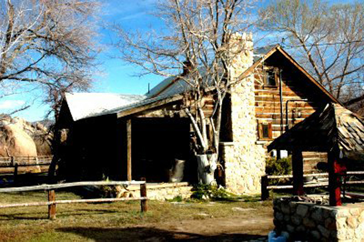
At the turn of the century, Rocky Oaks was a farm. It was hit by the usual California catastrophes of fire and flood. The Agoura Fire in 1978 destroyed all buildings, and the land was finally bought by the National Park Service in 1980. Its hiking and bridal paths take you through riparian forests to brushy mountain peaks.

At Saddle Rock, Mulholland Highway turns toward the ocean.

TARNISHED LEGACY

Nine months after the collapse of the St. Francis Dam, William Mulholland retired. He was 73 years old and had worked for the Los Angeles Department of Water and Power for 51 years.

He lived out the rest of his life in bouts of depression and increasing Parkinson’s disease. He died in 1935 at 79. He was not forgotten, but the luster of his years of civic service had been tarnished.

But that slowly changed, and by 1992, after 20 years of citizen effort, the Los Angeles City Council adopted the Mulholland Scenic Parkway Specific Plan. It established the parkway as a memorial to the ”chief engineer” and a review board to shape the environment of the parkway’s unique features and resources. mulholland vista with ocean

The Santa Monica Mountains Conservancy, along with the Los Angeles Mountains Recreation and Conservation Authority and the California Resources Agency, maintains the overlooks and informative plaques that tell the story of Mulholland and the natural features of Los Angeles, the Santa Monica Mountains and the San Fernando Valley to the north.

And if Mulholland’s end wasn’t the crowning glory that his regal life deserved, the end of Mulholland Highway is.

As it dumps out onto the Pacific Coast Highway two miles from the Ventura County line, it meets the Pacific Ocean at Leo Carillo State Beach, one of the most beautiful beaches in a string of state beaches along the Pacific Coast Highway. leo carillo state beach

I parked the car and walked to the shoreline, passing a brown thrasher nesting in the dune shrubs. I held still as she flicked her tail up and disappeared into the twiggery.

Along the surf, I watched pelicans, dowitchers, sanderlings, gulls and terns.

Out in the water, wrapping themselves with kelp were a pair of otters. A pair of fishermen stood on the rocks above the water, their long poles out over the foam, and the redwings chirped their ”ooklaroo” behind me as the sun set over the horizon.

It is 55 miles back to the buzz of the city from this spot. It might as well be 55 centuries.

forest lawn 3

Some people lament the passing of the old Hollywood. Others put it on their vacation schedules.

For the old Hollywood may be dead and buried, but it’s not gone. It is still there under the loamy earth of Los Angeles.

You can visit Cecil B. DeMille’s burial plot, Peter Lorre’s crypt site, even the final resting place of Hopalong Cassidy’s horse, Topper.

Lest you think this too ghoulish, I should mention that there are tours and theme parks devoted to the dear departed. You can find full-color tourism brochures at hotel check-in desks. Tourism is encouraged at some (though not all) celebrity graveyards.

You want to see Tyrone Power’s grave? Hollywood Forever Cemetery will give you a map to the tombstones of the famous dead.

Forest Lawn even has a gift shop.

So if you are tired of all the usual destinations in Southern California or if you want an offbeat vacation, try visiting some of these sites.

It works best if you have a sense of humor about it. But it should be a quiet sense of humor. These are working cemeteries and although they welcome visitors, rowdiness and impertinence — to say nothing of loud radios and beer drinking — can wind up in your being asked to leave.

Enjoy the peace and solitude but no picnicking.

forest lawn 1

FOREST LAWN MEMORIAL PARK

The largest and most famous cemetery in the Los Angeles area is Forest Lawn. Actually, there are five Forest Lawns, with sites in Glendale, Hollywood Hills, Cypress, Covina Hills and Sunnyside. Each has a different organizational theme.

But it is the original location in Glendale that should be visited first.

”So much to see for free!” says the memorial park’s brochure.

”Imagine, in one afternoon you can see exact replicas of Michelangelo’s greatest works … Leonardo da Vinci’s immortal Last Supper re-created in brilliant stained glass … two of the world’s largest paintings … original bronze and marble statuary, rare coins, valuable 13th-century stained glass, Old World architecture.”

And several suits of armor, to say nothing of a stone head named Henry from Easter Island. Forestlawn mosaic

The exhibits mix high art with religious kitsch and naive patriotism.

The Court of Freedom, for instance, includes a 20-foot-high mosaic of the signing of the Declaration of Independence, flanked by tablets engraved with selected highlights of the Bill of Rights and the Declaration of Independence.

And make sure you get a copy of the event schedule at the gate so you don’t miss anything.

One season, Forest Lawn featured concerts by the Valleyaires Barber Shop Singers, the Burbank Chamber Orchestra and the Notre Dame Irish Knight Band.

”It’s Showtime!” the leaflet says. ”History comes alive at Forest Lawn.”

Sample shows include ”A Visit with Michelangelo,” with an actor impersonating the famous sculptor, and similar events with visits with Lincoln, Washington and Montezuma.

Each of the locations hosts a million visitors a year. mystery of life forest lawn

Forest Lawn probably could not have happened anywhere but Los Angeles.

The vision for Forest Lawn came to a former cowboy and miner named Hubert Easton. At age 31 in 1912, he came to a 55-acre cemetery in Tropico, now Glendale, as sales manager.

He found the cemetery business too dreary and decided to eliminate tombstones and add lots of rolling lawns, statues and fountains.

”Forest Lawn will be more than a cemetery,” he wrote. ”It will be a memorial park, a place for people young and old to visit and enjoy … a place where not only will the sorrowing be comforted but the spirits of all who enter will be uplifted.”

He also figured out that he could sell burial plots to the living in anticipation of later need — a revolutionary idea at the beginning of the century — and he added a working mortuary to the grounds on the principle that people would be attracted to one-stop shopping. Forestlawn David

His ideas caught fire. His sales jumped 250 percent the first year alone.

Over the years, the property was decorated with a huge quantity of art, mostly reproductions of famous pieces. Most of Michelangelo’s best-known statues can be found on-site.

Perhaps the most memorable art is not the most famous. What you never can forget once you have been through the memorial park is the incredible number of maudlin and sentimental statues, Victorian kitsch of angels protecting unbearably innocent little babes or mothers standing protectively over their children or faces of white-bread Sunday-school devotion.

They are everywhere in the park, which also is divided into sections with names such as Slumberland, Lullabyland and Inspiration Slope.

In many portions of the park, there is a continual murmur of devotional music, the kind of Mantovani Londonderry Air that makes the park into something very like a perpetual car dealership commercial.

The kitsch reaches high dudgeon at the Hall of the Crucifixion-Resurrection, which houses one of the world’s largest paintings, Polish artist Jan Styka’s 195-foot-long Crucifixioncrucifixion theater forest lawn

It dwarfs an IMAX film screen and shows a Victorian vision of the death of Christ with a cast of thousands. It is presented in a huge, very dark and reverent theater, complete with theater seats and a recorded narration that leaves you walking out of the building to the sounds of Handel’s Hallelujah Chorus.

The building also shares its space with Robert Clark’s Resurrection, which makes the Styka painting seem low-key and tasteful in comparison.

I am in no way intending to make fun of anyone’s religion. The reverence anyone feels toward these spiritual events is noble and understandable. It is the aesthetic garishness of the paintings that makes me turn my head in embarrassment.

Yet they must be seen. For to understand America, you must understand Hollywood, and to understand Hollywood, you must come to know Forest Lawn.

Hollywood Forever Cemetary02

HOLLYWOOD FOREVER CEMETERY

Forest Lawn takes itself very seriously — I suppose it should.

But management there is reluctant to tell visitors where celebrities are buried. It is the final resting place of such Hollywood luminaries as Clark Gable, W.C. Fields, Nat ”King” Cole and Jean Harlow, but you will discover the grave sites only by luck.

At the Hollywood Forever Cemetery, 6000 Santa Monica Blvd., Hollywood, stop at the front office to get a photocopied map marked with many of the celebrity graves.

The atmosphere is very different from Forest Lawn. Gone is the grandiosity, gone is the perfect manicure. The graveyard is falling down and not always perfectly mowed. Many headstones are tumbling over, and even the larger monuments are looking kind of sad.

Yet it is the place to go to see Rudolph Valentino’s final resting place, a shoulder-high drawer in the Hollywood Cathedral Mausoleum. The famous ”Lady in Black” no longer visits, yet on the day I visited, there were fresh roses ornamenting the plaque.

Cecil B. DeMille’s plot is suitably gaudy, and Douglas Fairbanks Sr.’s grave has a reflecting pool although the water is rather murky. And both Darla Hood and Carl ”Alfalfa” Switzer are found here. Among the other celebrities are Edward G. Robinson, John Huston, Eleanor Powell, Janet Gaynor, Erich Wolfgang Korngold, Adolphe Menjou, Paul Muni and Woody Herman. mel blanc grave

If you are a real Hollywood buff, you may notice the small, bronze plaque for Virginia Rappe. She was the unfortunate starlet who died in the Fatty Arbuckle scandal.

Someone besides me remembers, for the small cypress tree above the plaque was adorned with several red ribbons and there were flowers on the nameplate.

And Mel Blanc’s headstone actually says, ”That’s all folks.”

In all, about 400 celebrities are buried there.

The Hollywood Forever Cemetery was founded in 1899 and originally consisted of 100 acres. It has shrunk considerably and is backed now by a factory of corrugated tin.

Los Angeles Pet Memorial Park

LA MEMORIAL PET CEMETERY 

”It’s sad, but Rudolph Valentino’s dog’s grave is better kept than his own,” says the woman at the Los Angeles Memorial Pet Cemetery in Calabasas.

Valentino’s Doberman pinscher, Kabar, is only one of many celebrity pets buried on the hillside next to the U.S. 101 freeway. The cemetery is immaculately well-kept. It was not always so. Kabar headstone pet cemetery

The park opened in 1928, and among the 30,000 or so animals interred there are the pets of Jimmy Durante, Mickey Rooney, Humphrey Bogart, Angie Dickinson, Bud Abbott and Eddie Fisher.

But by the late ’60s, the family who owned the cemetery no longer could keep it up and donated it to the Los Angeles Society for the Prevention of Cruelty to Animals, which also found it too expensive and difficult to operate. They were in the process of selling the land to a developer when a group of the pet owners banded together to save the place.

In 1986, the consortium of pet lovers bought the land and managed in the process to persuade the California Legislature to pass a law declaring that all pet cemeteries must remain so in perpetuity, so no dog lover should worry that someday his Fido’s grave will be bulldozed over for a 7-Eleven. topper headstone pet cemetery

The entrance to the cemetery is obscure, and you must drive through some nasty industrial roads to get there, but once inside the gates, everything is sunlight and green hills.

There is a fountain and a statue of St. Francis, and you can tell that the non-profit S.O.P.H.I.E. Inc. (Save Our Pets’ History In Eternity) that operates the park really cares about the animals in its charge.

It does not encourage tourism and doesn’t want to be seen as a freak show, but it will accept visits from anyone interested in what it has been doing.

And perhaps you may find the grave of Hopalong Cassidy’s horse, Topper, or the modest plaque above the final resting place of Petey, the ring-eyed dog from the Our Gang comedies.

LA freeways

An awful lot of bull hockey has been written about Los Angeles: It has been called the ”City of Dreams” and ”the world’s storyteller.”

But I am not interested in that part of the city. You can keep all the actors (save those still waiting tables) and keep all the studios. Underneath and beyond is a Los Angeles that I love. It is the city of smog, freeways, barrios and signs written in Korean and Armenian. It is a city so alive that it actually buzzes.

When I tell my friends that I love LA, they look at me funny. But it is true. I love the traffic. I love the commercial clutter. I love the bad air.

The traffic gives me time to listen to music on the radio. The commercial clutter turns into poetry if read in the right mood, and the bad air diffuses the naked sunlight to bathe the city in a brilliant glow that makes house paint seem incandescent.

I’m not sure I would want to live in the city, but once or twice a year, it is good to visit the City of Angels just to have the voltage increased in my neurological wiring.

Just what is LA?

According to one writer, it is ”mudslides, fires, earthquakes, Santa Ana winds.” And to another, it is ”falafel joints, collapsible apartments, visible air.”

And for performance artist Ann Magnuson, it is ”cheap pedicures, perpetual sun, guilt-free careerism, seeing Vincent Price at the 7-Eleven, having a back yard, no cockroaches, true love and Disneyland. Every day is like Saturday.”

It is a city that looks like a living hand-tinted postcard. LA panorama with snowcaps

Of course, Los Angeles is more than Los Angeles. It is in Dorothy Parker’s words or H.L. Mencken’s — the saying is so apt, any wit might well have said it — ”27 suburbs in search of a city.”

From San Bernardino to Calabasas, from Costa Mesa to the Santa Clarita Valley, it is a sprawling, throbbing, thriving endless urban glory.

It is strip malls with Korean groceries and underground parking, and it is great Indian restaurants.

Or as demographer Kevin McCarthy puts it: ”Los Angeles is the new Ellis Island.”

And that means that you can find things in Los Angeles. Ethnic food isn’t confined to Chinese and Thai. You can find Armenian food, Sri Lankan food, Honduran food, and I have no doubt if I looked hard enough, I could find a place to eat the cuisine of the Fiji Islanders.

I can find books in any language, recordings of any music, clothing of any national origin.

Los Angeles is genuinely cosmopolitan; I feel there as I must likely have felt in Amsterdam in the 17th century or Venice in the 16th century. I cannot remain awake and self-satisfied at the same time.

Of course, when something is cosmopolitan, that means it includes a great deal we might feel uncomfortable about.

Mystery writer Walter Mosley wrote, ”It’s a land on the surface of dreams. And then there’s a kind of slimy underlayer. The contrast of beauty and possibility and that ugliness and corruption is very powerful.”

You ride up over Sepulveda Pass on the 405 and spread out before you is all of the San Fernando Valley, one vast Vaseline smear of suburbia and middle-class values — and you know that this is the world capital of porno films.

As George Will put it, ”Some Americans despise Los Angeles, just as some Europeans despise America, and for the same reason. Los Angeles, like America, like freedom applied, is strong medicine — an untidy jumble of human diversity and perversity.”

It is also hazy sunlight and palm trees.

”The light in Southern California demands strong colors,” wrote Postmodernist architect Michael Graves. ”Here the sun plays a major role in modeling the texture and surface of buildings, making them sparkle and dance.”

Los Angeles is the most verbal city I know. Signs are everywhere and prodigiously redundant.

For Los Angeles, more than any city I’ve ever seen, is a city of small business. Sure there are chains and franchises, but butted up against one another like soup cans on a grocery-store shelf along any major street are small shops selling everything imaginable: shalom hunan

Teriyaki burritos — Shalom Hunan, Kosher Chinese Restaurant — Modern Prosthetics.

The smallest corner minimall has a rack of signs along the street with something like 25 small logos plastered on it. Then the stores themselves have signs over their doors and windows, and finally there are broadsheets taped up against the glass. It is an alphabetical bombardment:

Any plain garment cleaned and pressed $1.25 — 100 percent human hair and wig sale — Two-Star Bakery — A-1 Smog, pass or don’t pay — Tabu Tattoos.

What do you make of “Donuts and Chinese Food”?

They all add up to a kind of commercial poetry.

When I’m in LA, I cruise up and down Wilshire Boulevard, enjoying the Deco Moderne architecture; up and down the Sunset Strip, looking at the storefront restaurants; and up and down La Brea Avenue, looking at the art galleries and antiques shops.

I take La Cienega Boulevard over the Baldwin Hills, Mulholland Drive past the homes of Madonna and Jack Nicholson.

But most of all, I take the small streets with unremembered names past the one-floor houses with their front lawns and front porches, the tiny, unglamorized neighborhoods of the city — California bungalows and stucco homes on hillsides. calif bungalow

Children play in the streets, cars sit in driveways outside garages too stuffed with dunnage to be driven into, and on the corner a Burger King with exactly six (already full) parking spots.

It is the city’s great cosmic joke that everything depends on having a car but nowhere in LA is there available parking. It is like musical chairs. You can circle a block 10 times waiting to pull up to the curb to get your morning bagel.

Of course, there is that other LA, the one we know from television and the movies. That is the city where all the starlets have day jobs and the men all wear shades to protect their eyes from the shine of their own smiles.

You find this LA, too, in the trendier restaurants, where you can overhear people say things like: ”I’ve done a lot of second A.D. work” and ”My boyfriend keeps buying properties and he wants me to produce them.”

But that’s not the LA I’m talking about.

I’m talking about the Los Angeles River: All the city’s riverbeds are concrete troughs. You drive over them on bridges from the 1930s and see under you broad, dry expanses of concrete, with narrow sluices in the middle filled with flowing water — or is it sewage? The riverbeds are so evocative they’ve shown up in films ranging from Terminator 2 to Them!, in which giant ants live in the city’s underworld.

I’m talking about the cemeteries: Los Angeles graveyards are filled with stars. And Forest Lawn, the most famous, is filled with music. Smarmy string orchestras play Danny Boy over loudspeakers so that you feel like you are stuck in an eternal Lawrence Welk show. At the Hollywood Memorial Cemetery, you can find the mausoleum with Rudolph Valentino’s ashes. At the L.A. Pet Cemetery, you can find the plot of his dog.

Oh, and then, there are the freeway flyovers: Traffic whirls around like a video game, up and over. Driving under the overpasses, you have a great sculptural, architectural sense of the space dissected by concrete. Driving over them, you have views of the city and its mountain borders. You are flying.nat hist museum

And there are institutions, like the Museum of Natural History. At Exhibition Park, it seems the badly-cared-for 80-year-old Los Angeles County Museum of Natural History is always under restoration. Whole wings are closed off for repair. But every time I visit the city, I have to go to see the great taxidermy and diorama halls of North American mammals. You stand in the darkened hall and imagine yourself at Yellowstone looking at moose or in Virginia looking at the possum.OLYMPUS DIGITAL CAMERA

And don’t forget the La Brea Tar Pits. There is a very good museum at the tar pits, which will explain all about the saber-toothed tiger and the dire wolf. There are mastodon skeletons and a working lab you can watch. But I just like to walk around the surrounding fields and watch the bubbles blurt up through the goo and smell the petro-stink. Once in a while you find a bird caught dead in the tar at the bottom of a small steaming pit. It tells you at least as much about the power of the tar as the museum exhibits.

Most tourists visit Hollywood Boulevard, and the walk of stars. But I like the Baldwin Hills. In the 1940s, a low-cost housing development modeled on a New Jersey project was built on the hills south of Venice Boulevard. It is 80 acres of one- and two-story homes with gardens and sycamore trees. It is one of the most pleasant neighborhoods to drive through when you feel the need to get off the screaming meemies of La Cienega Boulevard on your way south to the airport. It is bordered by fields of petroleum pumps, dipping their beaks up and down.

Tourists like the Santa Monica Pier, and so do I. The arch over the pier says ”yacht harbor, sport fishing, boating, cafes,” but this pier is better visited for skeet ball and cotton candy. There is a carousel and always dozens of people hanging over the edge with fishing lines. Underneath, the surf washes up on the sand and sunbathers stretch out on terry cloth. There is a seedy quality to it, which brings it to life, where many more modern and clean amusement parks feel synthetic.watts tower

There is great art at the LA County Museum of Art (LACMA), but there is also the Watts Tower. In 1921, Italian immigrant Simon Rodia began building a monument to trash. Using any scraps of pottery, glass, steel and concrete he could find, he put together LA’s answer to the Eiffel Tower. He worked on the tower for 33 years, and it rises nearly 100 feet over the neighborhood. Of his life’s work, he said, ”I had in mind to do something big, and I did it.” It is one of the world’s greatest pieces of folk art.

That’s Los Angeles. It is sui generis, and, if not always a delight for the senses, it is always a ripe and luscious source of sense data.

As Raymond Chandler said, ”Anyone who doesn’t like it is either crazy or sober.”

No, what I love is to walk along the grass on the beach side of Ocean Avenue in Santa Monica and smell the heady combination of salt spray and bus fumes, watching the sun expire into the hazy horizon, knowing I’m on my way to a great souvlakia. Skateboarders squirt past and retirees sit on the benches and read newspapers. The hotel signs begin to light up and you know that the city doesn’t close down, it just puts on its night face. LA griffith observatory

hale telescope

When I was a boy, like many boys, I developed an interest in astronomy.

I spent many frozen February nights outside my New Jersey home enjoying “good seeing,” when the cold air kept the stars from twinkling too aqueously. It was an interest I shared with my best high school friend — known as “Gizmo” — and we often used his 6-inch telescope to watch the rings of Saturn or the wrinkled “terminator” of the moon — the deckled line between sunlight and shadow roughened by lunar craters and mountains.

And when there was a total eclipse of the sun in 1964, Gizmo’s father drove us both up to Maine to get the best view. The birds stopped singing in the sudden darkness and Giz and I stopped talking as we were caught up by the final glimmer of Bailey’s Beads — that last-second “diamond ring” before totality — which gave way to a black hole in the sky surrounded by a fluorescent curtain of corona.

As we grew older, Gizmo’s interest proved more genuine. He was inclined toward science and mathematics and went off to Rensselaer Polytechnic Institute in upstate New York. My interest in the heavens turned out to be the interest of a humanities student — a little too much gee-whiz and not enough trigonometry.

Nevertheless, as a boy, I read everything I could on the subject. One name kept popping up: that of Palomar Observatory with its 200-inch Hale Telescope. All the best photographs, it seemed, were taken through that monster instrument.star picture

It was, I knew, the largest telescope in the world — a title it held until only recently — and sat on a mountaintop somewhere in the West.

And that is the rub. Being from New Jersey, everything beyond the Delaware River was a little fuzzy to me. I guess I knew Palomar was in California, but where in that state, I never really had a clue. The telescope existed rather in some ideal region, not subject to county zoning restrictions or state tax laws. It was just “Palomar.”

So, when I found ourselves in Southern California, driving up Interstate 15 from San Diego, when I came upon the exit for Cal. 76 north of Escondido and a roadsign mentioned Palomar.

I took the detour.

Palomar Mountain is a real place, with real stones and real trees, and, I’m sure, real county ordinances.

It is not easy to get to. It is way off the Interstate, down winding narrow roads through small towns and valley farms. The road gets narrower and more twisted as you turn off Cal. 76 and begin to climb Palomar Mountain on Cal. Route S6. There are some 24 switchbacks on the way up, with long views of an empty part of the state each time the road pokes into the open.090-S24342

The mountain is 5,600 feet high, with a broad flat saddle top. You turn off Cal. S6 onto Canfield Road and it loops the final miles to the parking lot at the observatory.

The woods that have bounded the road gives way to an open space filled with more ferns than you normally find outside of coastal Maine. They sit in the fields along the final few hundred yards to the glaring white dome at the edge of a rise.

The building is immense. The rotating dome is 135 feet in diameter and tall enough to fit a 13-story building inside and still raise a flagpole on top of the building.Palomar Observatory

Although the observatory opened in 1948, its design is from an earlier decade. Plans for a giant telescope were begun in the 1920s and work on casting the telescope’s glass mirror began in 1934. Work had to be halted during World War II. So, when it opened after the war, the building still bore the stylistic marks of the earlier Art Deco style. It is a plain building, but the ornament and proportions are unmistakable.

Yet, it is the machine inside the building we have come to see.

Little effort has been made to accommodate the visitor: There is a parking lot and a small, outdated museum and gift shop at the bottom of the hill. Inside the dome, there is only a small, poorly marked visitors’ gallery, glassed-in to keep the hoi polloi from gumming up the work of busy scientists.

Still, in the daylight murk of the closed up dome, you can see a giant, mechanical eye, the size of a coastal gunnery emplacement.

And it does bear some resemblance to a mammoth cannon, with a barrel that can be pointed in any direction.

Only, instead of pumping ordnance into enemy lines, it swallows down the buckshot of stars, giving astronomers a peek at distant points of light so dim and distant, they speak of the birth of the universe.

The very first photographs taken through the telescope doubled the size of the known universe. Later work doubled it again, when Palomar astronomers discovered quasars.

Size isn’t just for the heavens, though. The rotating part of the dome weighs in at 1,000 tons. The moving parts of the telescope weighs 530 tons. The mirror, nearly 17 feet across, weighs 14.5 tons.hale telescope cutaway

Yet, despite its massiveness, it only takes a tiny motor of one-twelfth horsepower to slew it around its bearings. In fact, you could, if anyone would let you, move that 530 tons with a single finger judiciously placed, it is balanced so well. It helps that it is mounted on a pad of moving oil, a thousandth of an inch thick, which keeps the weight riding frictionlessly.

Astronomy has moved ahead, working with computer images now instead of photographic plates. Yet, in the small museum at the site, you can see large transparencies of some of the observatory’s more famous images.

Perhaps because I grew up and became a writer rather than a scientist, I miss the awe and beauty of those million-dotted pictures, glowing white hot, like Moses’ bush, and giving a visual, esthetic image of the majesty and immensity of the universe.

The great full-color and false-color images from the Hubble telescope have replaced the old Palomar pictures in the minds of most younger humanities students, giving a newer, more rainbowed sense of the awe of the universe. But for me, it is a reminder of who I was and how I got to where I am.

Sometimes, it is why we travel, rather than where, that is the story.

Bakersfield

Bakersfield

California is probably the best known state in the union. The whole state, it seems, has been thrown up in Technicolor on local movie screens around the country, or used as a set for some TV show or other.

The hills of San Francisco, the peaks of the Sierra Nevada, the back lots of Los Angeles all are widely known and recognized.

But the long, flat middle of the state is for most Americans a total mystery. The Great Central Valley — called San Joaquin to the south and Sacramento to the north — has the visibility of mud.

As you drive down from the Tehachapi Mountains, you can see the valley stretch out in front of you, flat as a billiard table and topped off with a familiar-looking brown cloud. To the west, you can see the coast ranges; to the east, the Sierra Nevada, crested with a line of white this time of year. And down the middle, the boring, flat, squared-off agricultural land that feeds the nation. outside bakersfield

It has been estimated that the annual income from agriculture in the Central Valley is greater than the total value of all the gold mined in the state since 1848.

It is true that tourists don’t often come through the valley. Unless they are crossing from Yosemite to San Francisco, they are unlikely to ever come near it. And there is not much to see, if you are looking for Knott’s Berry Farm or Disneyland.

What there is are vast fields of vegetables, orchards of oranges, vineyards of grapes, interrupted by corrugated aluminum processing plants with adjacent high-tension power lines and railroad sidings.

And, in the southern end of the valley, around Bakersfield, oil wells, refineries and vast, ugly tank farms, with row on row of oil tanks, painted white and lettered with corporate logos. oil pumps outside bakersfield

And in between, a great scattering of dust. It rises like a plume behind every tractor, every pickup that edges a plowed field.

Most of the Central Valley looks like it came right out of one of those WPA photographs from the Depression: sun-baked migrant workers in old paint-flaked clapboard houses with collapsed front porches next to the irrigation canal.

And always the wind and sun and dust. The elements are leading citizens in the San Joaquin Valley.

The connection with the Depression is even more real than apparent: Between 1935 and 1940, the population of Bakersfield and surrounding Kern County grew more than 63 percent, with most of that increase accounted for by the ”Okies” who migrated from the Dust Bowl in America’s middle.

It is probably a great place to live. But it doesn’t seem like much of a place to visit.

Yet, there are reasons to visit. Aside from finding out where your beans and asparagus come from, you can learn something of the history of the region and its ethnic makeup.

In Bakersfield, for instance, you should stop at Benji’s Basque restaurant on the edge of town.

Inside, they will serve you family-style with huge portions of food. First comes the cabbage soup with hot sauce and beans; you add them to taste.

Basque bean and cabbage soup

Basque bean and cabbage soup

A loaf of sourdough bread and fresh butter sit on the table.

Lamb comes to you in a wine gravy, with heaps of fried potatoes.

And if you have room for dessert, Basque cake tastes a bit like a zwieback before it has gotten hard.

Bakersfield’s long and contentious history can be learned at the Kern County Museum and the Pioneer Village next door.

Kern County Museum

Kern County Museum

You learn how waves of development swept over the area. Land interests bought up huge tracts, and when irrigation made farming possible, the town grew, with all the local chamber-of-commerce pride that usually accompanies such economic success.

Large brick buildings sprang up downtown. Railroad depots were built. And large mercantile stores opened their doors.

You can see the process at the museum, although it is also true that, local pride notwithstanding, the process is the same in almost any agricultural town. The same farm implements are on display, the same original newspaper office, the same ”old-time” drugstore.

For it is Bakersfield’s ordinariness that is its fascination.

The town almost could have been dropped in place from Iowa or Kansas.

And although California has a reputation for political wackiness, with Hollywood celebrities endorsing pet causes and so-called ”tree-huggers” in the north, the huge Central Valley is as conservative as water.

tehachapi loop

You don’t get an adequate idea of California’s southern mountains when approaching from the east through the Mojave Desert. They look like little more than stony hills breaking through from the plain.

But climb them from the west and you will rise 4,000 feet through grassy canyons. Or from the south along Interstate 15, when you climb from Rancho Cucamonga to the cloudy heights of Cajon Summit at 4,257 feet. It is all uphill, but after you reach the top, there is no other side to climb down. The Mojave Desert sits on a plateau that stretches from the northern side of the San Gabriel Mountains.

The desert stretches out flat, with straight roads for a hundred miles. U.S. 395 runs along its western side in an arrow shot from Adelanto to Red Mountain. It crosses California 58 and skirts the edge of Edwards Air Force Base, where NASA’s shuttle frequently landed, to an audience of appreciative retirees who brought their RVs to the desert to see the event.

Edwards Air Force Base

Edwards Air Force Base

The small, scrubby town of Mojave sits on the junction of 58 and California 14. In December, it is cold at night, and aside from the dozen or so truck stops and convenience stores, the most notable thing about the town is the number of freight trains that barrel through, blasting their horns all night long, at the rate of something like one every 10 or 20 minutes. The ground rumbles as they spew sooty turbocharger exhaust into the air.

It’s a good place to watch for locomotive paint jobs, too. In this day of railroad mergers, you never know what you will see.

Mojave, Calif.

Mojave, Calif.

Originally, the line was shared by the Southern Pacific and the Santa Fe in an unusual agreement in which the corporate competitors decided to cooperate and share expenses. But now that the Santa Fe has linked up with Burlington Northern (already a corporate mix of earlier railroads), and the SP has joined with the Union Pacific, trains pass through town with engines from any of the ancestral rail lines.

The diesels sport the colorful red, yellow and silver or the navy and yellow of AT&SF, interspersed with transient locomotives bearing the old Burlington Northern green. One experimental paint job I saw was an unconvincing hybrid with a big, ugly BNSF written on the side of the engine in non-too-professional lettering.

The SP locomotives are painted soot black and are the least interesting in the country (or were until the conglomerate Norfolk Southern began to copy them with the attitude of ”paint ’em black and the dirt won’t show.”

But the yellow and gray of UP spruces up the look along the line, and every once in a while, you see the sickly blue of a Conrail engine.

I mention all this about the trains for two reasons. First, because they kept me awake most of the night, rattling my motel windows. And second, because it is at Mojave that the trains make the big turn westward to drop down Tehachapi Pass.

The pass, again, isn’t much from the east. A slight rise over the pass, at 3,793 feet, and an initially slow descent, hardly visible, through the town of Tehachapi and the broad Tehachapi Valley, with its ranches and cement plants.

But then the hill steepens, dropping toward the great San Joaquin Valley below. And just above the town of Keene, the track makes a huge, nearly double loop, letting the train down more gently than the slope of the canyon would otherwise allow. tehachapi look aerial

This is the famous Tehachapi Loop, built in 1876 by the Southern Pacific under its engineer, William Hood. To allow the trains to climb a 2-1/2 percent grade from Caliente, near the bottom of the hill, to Tehachapi Summit, a distance of about 15 miles, Hood had to lay 27 miles of track, looping and curving all through the hillsides and over Tehachapi Creek. There are innumerable bridges and 17 tunnels.

Or, there were 17 tunnels until the earthquake of 1952. Now, there are 16.

You can take a narrow, winding road from Keene back up under the freeway and up the canyon to get a good look at the loop. About three miles from the town, there is a stone monument that tells very briefly the story of the engineering feat. From the parking pullout, you have a pretty good view of the grand circle of tracks.

But to really get a sense of the spiral, you need to drive an additional 150 yards uphill and take the well-worn footpath onto the grassy knoll that rises above the loop. Below you to the southeast, the track winds back uphill. As the track goes under you, through a tunnel, it comes out to the north and begins a wide turn to the west, around a pyramid hill in the center of the loop, creating a circle that is 3,795 feet in circumference.

The dual line of rail then sweeps back around the hill toward you again, and circles down underneath itself and into a tunnel.

A normal-length freight train at this point doubles under itself as it circles around the track. Nothing I’ve ever seen in the real world of railroads looks so much like the standard model-train layout, with its combination of tunnels, spirals and circles.

In the days of steam, SP had some of the biggest locomotives ever built to climb the Tehachapi Mountains. With 16 drive wheels each, they were used in teams of three and four at the head of each freight train, with another three or four scattered in the middle and at the end as ”helpers.” steaam power2

The giant steam engines had their cabs at the front, so that their engineers wouldn’t asphyxiate from engine smoke as they pulled through the tunnels.

Nowadays, as many as a dozen diesels will be scattered throughout the train for pulling power. Because not so many engines are needed to go downhill, sometimes a group of four diesels will ”deadhead” downhill, without any train behind, so they can link up with another uphill train.

Aside from the diesels and the four-lane divided highway that parallels the tracks most of the way downhill, not much has changed over the years. What was written in the 1939 Federal Writers Project Guide to California still holds true:

The Tehachapi grade ends below Caliente, and ”the mountains are behind, imposing, verdant, dulled with purple; ahead is the flat and monotonous plain of the San Joaquin Valley. The tops of grimy oilwell derricks loom in the distance; as the road continues westward, their numbers increase, dotting the checkerboard of tilled fields like black-headed pins on a field map.”

imperial dunes

What Americans have done to the desert is not encouraging.

The drive from Blythe, Calif., to Brawley on California 78 is a microcosm of the problem. You can pile up the insults that the desert has suffered.

California 78 is an old, two-lane blacktop that passes through the agricultural area outside Blythe. Before you leave the river, you pass retirement communities and winter-resident trailer parks. They pile directly on scrap yards and petroleum tanks. One wonders what the attraction of living there might be. The whiff of gasoline in the dawn? The lulling sound of traffic on the interstate?

Blythe, California

Blythe, California

Farther away from Blythe, the bustle of franchise foods and self-serve gas stations gives way to the quiet perpetuity of farmland.

The buildings you pass are poor and the names on mailboxes and storefronts are largely Hispanic. Community stores, such as the ones in Ripley or Neighbors, are dilapidated and have graffiti sprayed on their side walls.

Ripley, California

Ripley, California

The Colorado river plain is flat and fields spread out to the horizons. At one point, the highway passes close to the river, or rather, the oxbow lakes left behind when the meandering river cut through its own bottomland. The rushy, reedy water’s edge comes up to the shoulder.

The road takes several right-angle turns — as such roads always do in farmland — and eventually passes beyond the reach of the canal irrigation and back into Sonoran Desert, with its ash-pile hills and scrubby creosote.

But just as you think you are passing into wilderness, you find the slag hills of industrial mining. What appears at first to be mesas in the distance turn out to be piles of industrial debris. The closer you get, the more obvious are the dirt roads cut into the hills. Derelict mine-shaft machinery sits silhouetted on the horizon.

And as you pass the Gold Basin Mine and the Rainbow Mine, suddenly the desert is fenced off, with spirals of barbed wire cresting the tornado fence that goes on for miles. But it is not a fence to protect the private property of the mine owners, rather it is to protect the desert tortoise.

Signs every 50 yards or so posted on the fence warn you to keep out, that the tortoise is endangered and is protected behind the fences. But one look through the mesh and you know the tortoise hasn’t got much of a chance: The hills are slag and the dirt has been scraped flat.

If there are mountains in the distance, they are hard to see as I drive through. A blue haze, the color of stale cigarette smoke, hangs in the air and blots out the view. When a range of mountains finally shows in front of you, it turns out to be not rock but sand. dunes sign

The Imperial Dunes cross the highway, catching the smoky, filtered sunlight at an angle, showing off their sensuous curves and rhythmic flow.

But as soon as you are upon them, you see that the sand is not so smooth as you thought. In fact, it is scarred like a burn-victim’s skin. Every foot of dune is lined and corrugated with thousands and thousands of dune-buggy tracks. There is a section protected from the abuse, but outside the ”Angle” on the west side of the road, not a single square rod of unblemished sand remains.

And I’m passing on a weekday, which tells me that this damage doesn’t repair so quickly as the sand on the beach that smoothes out after each change of tide.

The dunes are still impressive: They are much more so here than along I-8, where most people are familiar with them. The view from the Osborne Overlook is like that from a mountain turnout. If it were not for the blue murk, you could see two states and two countries.

As the road drops down from the dunes back into the desert, you think, perhaps, now it will be OK. But the signs along the road read ”Danger” and ”Peligro.” It is a live bombing range. Don’t enter the desert, the signs along the road warn, because there are unexploded shells buried in the sand. blythe farmfield

Finally, the road re-enters the agricultural area east of Brawley. A sea of green. Lettuce or sugar beet extend to the horizon, and more salt cedar trees are being cut down as they age and rot. More used farm machinery for sale. More small, wooden homes beside the road with old cars parked in their dusty driveways.

The houses and the people you pass, with their donkeys in paddocks and their battered pickup trucks, seem like something directly out of the WPA photographs of the ’30s. You almost look for Tom Joad. Used farm machinery piles up in rusty lots.

Brawley, California

Brawley, California

The town of Brawley is just as decayed. It once must have been a pretty place. The main street is wide, with an island down the middle. But along its edges are empty stores and a boarded-up movie theater whose style says that perhaps in the ’40s, it was the kind of place that people came to for a Hollywood escape from the hard life of the farm.

From Brawley, you drive down California 86 to the interstate and pass sugar refineries and agricultural warehouses. Closer in to El Centro, the seas of growing green turn into seas of red-tile roofs, in the brand-new but already debilitating sameness of the desert’s version of Long Island’s Levittown. ”And they’re all made of ticky tacky and they all look just the same.”

Life in the desert has always been hard. It used to be hard on the residents and turned them into wizened whiskered eccentrics who live in lopsided mobile homes piled up with dirt on their sides.

Nowadays, life in the desert remains hard, but it is hardest now on the desert itself.

For the next several weeks, this blog will chronicle a road trip taken from Tijuana, Mexico, to Vancouver, Canada, up through California, Oregon and Washington. In 1937, photographer Edward Weston was awarded a Guggenheim Fellowship and set out on a similar trip, and in 1940, published a book of his photographs, with text by his wife, Charis Wilson, called “California and the West.” In some humble way, this is an update. 

Avenida Constitucion

Avenida Constitucion

 VISITING TIJUANA

I hadn’t really looked forward to visiting Tijuana. It is, after all, a border town. Such places traditionally are tacky beyond belief. I’d seen Nogales, Sonoyta and Ciudad Juarez, and must say they give me the creeps.

But I was pleasantly surprised by Tijuana. Of course, it’s tacky. It wouldn’t be Tijuana without that. But it is also a legitimate city and, if you get off the main tourist drag, a thrilling town to be in.

Just a few hours in the city will teach you things about your own country that you hadn’t considered. Our own folkways contrast to the Mexican so that for the first time, you understand your own quirks.

Noise, for instance. In the United States, we are used to a lower level of sound than you find in Tijuana, where every store seems to blast musica into the street in deafening volumes. tijuana storefront

And there are smells. Almost all of them are wonderful smells. I didn’t smell any stale urine until I walked back into the U.S.

Instead, I smelled lemons, roasting chickens, fresh leather, chile peppers, piles of fresh vegetables, cilantro and vanilla.

There are some less pleasant smells, too. Cigarette smoke is everywhere. And Mexican ideas of automobile emissions are very different from ours. They seem to think the more emissions, the more money you make.

Money is the single ubiquitous thought in Tijuana. Economics blot out every other concern. I didn’t see any religious symbols except those for sale, I didn’t see any art except that for sale, I didn’t see any culture except that for sale.

At every square inch of the city, there is somebody scratching out a buck, or a peso — although almost everything sold on Avenida Revolucion is priced in American dollars.

Jewelry, leather, tequila, cheap blankets, more marionettes than I’ve ever seen in one place — they tend to be Disney cartoon characters.

And questionably Cuban cigars — the sign on the store awning read: ”Cuban Cigars Since 1492.”

And mannequins. Most stores show off their wares on stiff Anglo-looking mannequins. In one, gender identity turned into street theater as fake beards were displayed on women’s fashion-model heads.

In another, the most elaborate wedding dresses were in the storefront, on mannequins with their faces turned away from the street. tijuana wax museum

MUSEO DE CERA

If you don’t find enough of the mannequins in the stores, you should try the Tijuana Wax Museum, which advertises ”More than 60 figures,” although I didn’t count quite that many when I walked through.

Many of the figures are distinctively Mexican: There are Emiliano Zapata and Pancho Villa. Cantinflas has his place of honor. But so do Elvis and Michael Jackson.

Mexican history is prominent, but the figure of Father Eusebio Kino looked uncomfortably like Bela Lugosi. I wondered if he had been recycled from an old Dracula tableau.

I was there at opening time, but no one else was, including the people who ran the place. About 15 minutes later, someone showed up and unlocked the door, flipped on the lights and began taking admission money.

Don’t miss Rita Canseco — she is a national heroine, although we know her here better as Rita Hayworth. And whole halls are devoted to the Mexican equivalents of Merle Haggard and Hank Snow.

I knew I couldn’t leave town without eating some Mexican food, so I wandered into Tilly’s Fifth Avenue, a dark little smoky place on Avenida Revolucion. An attractive young woman stood outside the door hawking for the place. There are people outside every door in Tijuana like carnival barkers trying to draw you in, even in mid-December, when I seemed to be about the only gringo on the streets. tijuana streethawker

The food was very good, a great deal funkier than the normal American version of the cuisine — with more character and flavor. The big combo plate and a homemade lemonade came to $6. But the best thing was the bowl of chips and salsa.

The chips were thick, crunchy and corn. The salsa fresca was the best I’ve ever eaten. It came in a tacky plastic bowl textured to imitate the ancient soapstone molcajetes of the countryside.

Meanwhile, American TV blasted over our heads on multiple monitors, flickering like moths. You couldn’t hear it, however, because the Beatles played on the jukebox without end. ”Love, love me do.”

TWO TASKS

I had two things I wanted to get done in Tijuana. First, I needed to find a place to buy crepe paper. My wife had charged me with the responsibility of bringing her the paper so she can make paper flowers.

Second, I wanted a Tijuana haircut.

I know that sounds like something you say about Mexican traffic: ”That bus cut me off so close, I got a Tijuana haircut.” But really, I just wanted to try out a Mexican barber. Mexican barber

It was a chilly, drizzly December day and I walked up and down the streets of downtown. Men on street corners asked each time I went by, ”Taxi, you want taxi?” Others held out armfuls of cheap costume jewelry necklaces, ”Hey, Mr. Whiskers, look at this. You buy?”

Tijuana is a border town and full of all the heroic tackiness that implies, but it is different from Nogales. For one thing, it is bigger. It is the fourth-largest city in Mexico, with a population of about a million. Which makes it considerably more urban and cosmopolitan. You know you are in a city.

Avenida Revolucion, the main street in downtown, exists mainly for the tourists. It’s hard to believe there is a large enough market counting the entire world for all the leather that is being sold. Open-front stores with piles of cheap blankets alternate with shops selling cheap watches and restaurants selling cheap tequila. Outside every one of them, someone is calling out to you as you walk past: ”Look at this. You buy?” and ”Hungry, Mister? We got lunch.”

Even at 10 in the morning, they are selling lunch.

I soon wandered off Revolution Avenue. If you walk west a few blocks, past Avenida de Constitucion, you come across something a little less like Mexican Disneyland. Markets sell food, stationery supplies, wedding dresses — all the things a normal Mexican needs.

I was looking for a store that sold crepe paper. I stopped at a magazine kiosk and asked, in my best dime-store Spanish, ”Donde esta un papelador?” The news vendor looked at me as if I were speaking Uzbekh, so I tried again, ”Necesito papel para flores.” tijuana street

This made sense to him. His eyes lit up and he held up four fingers and pointed west. ”Tres cuadros,” he said, pulling back one of the fingers. ”Three blocks this way.”

So I walked through the rain past the hordes of people, smelling delicious food from streetside vendors as I went. After four blocks, there still was nothing that looked like it sold paper. I found lots of cassette tapes, more leather, plenty of fruit-juice stands, but no paper.

I asked another news vendor. He held up one finger, then held it up again, but covered the top joints. One and a half blocks, he means, and back the other way.

TIJUANA HAIRCUT

I walk, but find no store. What I do find is a barber. It is a tiny storefront shop with red and white stripes above the door. It is an old, falling-apart building wedged between leather shops.

So I go in. An elderly man is seated in the near chair, getting his hair trimmed. A woman sits in the other chair, waiting for a customer. She is not sure I am it.

I make the international gesture of haircut to her, swooping a karate chop over the top of my head, and she smiles, gets up and tells me to sit. I am not sure what to tell her. I want a crew cut — my semiannual hatchet job.

”Corta?” she asks.

”Cortissima,” I reply.

The shop is large enough for only two ancient barber chairs, a few waiting chairs and a mirror that hangs shoulder-high along the wall. At the back of the shop near the ceiling is printed, in very neat block letters, professionally painted, ”El Trabajo todo se vence” — Work conquers all.

I had the odd feeling that this sounded rather too much like the words over the front gate of Auschwitz, but I’m sure it had more to do with the barber’s work ethic.

And she gave me a full going-over. I swear before God and man that my ears have never been lower. After the buzz saw came the scissors to clean up anything left and finally, lather and straight razor to make a passing lane between my ears and hairline.

All this was accompanied by choking clouds of powder, brushed on liberally, and the splash of flowery, yet medicinal, cologne up the back of my neck.

It was all I could have asked for, short of macassar oil. I got my Tijuana haircut and I will wear it proudly for the rest of my travels.

FINALLY, PAPER

And as I left the shop, dropping a huge tip into the barber’s hand, I asked again for a paper shop. The barber took me outside the shop, pointed down the street and told me to go one block, cross the street, go a half-block up and on the right would be a papelaria. He repeated it.

And sure enough, when I walked there, a huge warehouse of a store was filled with everything you could possibly make from paper, from school notebooks to wallpaper. And down the end of the store were huge racks of crepe paper. Mexican papelaria

My wife had sent me to Mexico to buy the paper because, she says, American crepe paper is no good anymore. If you want to make Third World crafts, you have to start with Third World supplies.

I piled up about $20 worth in an assortment of floral colors and wrapped them up in a plastic garbage bag I had brought along for the purpose.

I felt like Martha Stewart or something: I had planned ahead, knowing it would likely be raining in Tijuana and I would likely be buying paper products, so I brought the bag to protect the paper from the rain.

And when I got back on the bus to return to the United States, the sun broke through and briefly scratched a piece of rainbow against the dark clouds to the north.border crossing

As I left town, I passed more shops, more barkers yelping. I passed old women sitting on the sidewalk with trinkets for sale. I passed bars, restaurants and more leather.

And when we got as far as the lines of cars backed up at the border when the bus driver told me it might be faster if I got out and walked the rest of the way. I did.