“Tehachapi, Tehachapi, I think I can, I think I can”

You don’t get an adequate idea of California’s southern mountains when approaching from the east through the Mojave Desert. They look like little more than stony hills breaking through from the plain.
But climb them from the west and you will rise 4,000 feet through grassy canyons. Or from the south along Interstate 15, when you climb from Rancho Cucamonga to the cloudy heights of Cajon Summit at 4,257 feet. It is all uphill, but after you reach the top, there is no other side to climb down. The Mojave Desert sits on a plateau that stretches from the northern side of the San Gabriel Mountains.
The desert stretches out flat, with straight roads for a hundred miles. U.S. 395 runs along its western side in an arrow shot from Adelanto to Red Mountain. It crosses California 58 and skirts the edge of Edwards Air Force Base, where NASA’s shuttle frequently landed, to an audience of appreciative retirees who brought their RVs to the desert to see the event.

Edwards Air Force Base
The small, scrubby town of Mojave sits on the junction of 58 and California 14. In December, it is cold at night, and aside from the dozen or so truck stops and convenience stores, the most notable thing about the town is the number of freight trains that barrel through, blasting their horns all night long, at the rate of something like one every 10 or 20 minutes. The ground rumbles as they spew sooty turbocharger exhaust into the air.
It’s a good place to watch for locomotive paint jobs, too. In this day of railroad mergers, you never know what you will see.
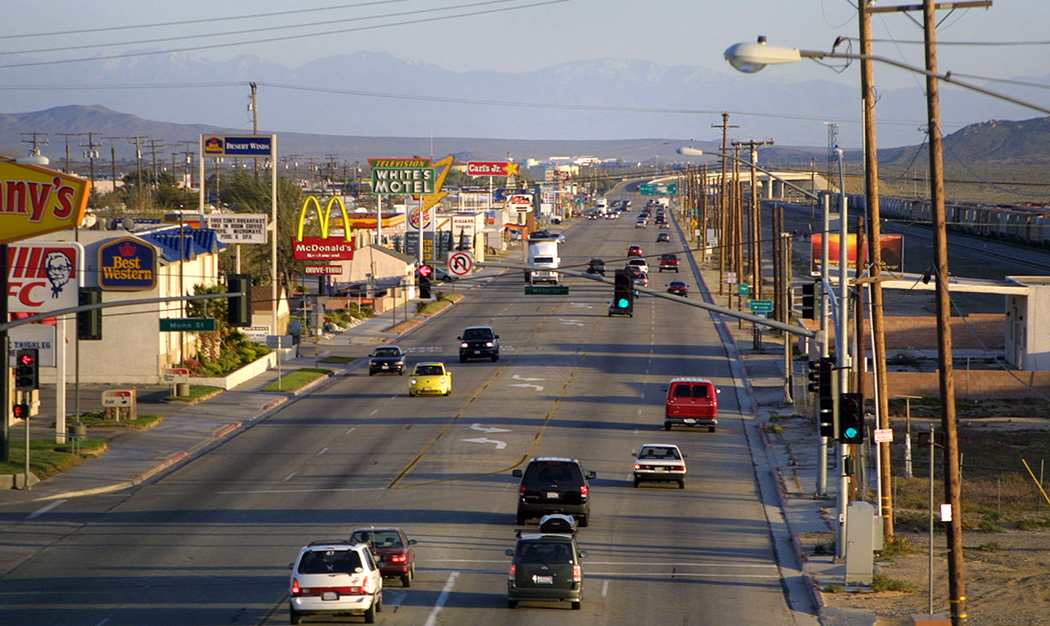
Mojave, Calif.
Originally, the line was shared by the Southern Pacific and the Santa Fe in an unusual agreement in which the corporate competitors decided to cooperate and share expenses. But now that the Santa Fe has linked up with Burlington Northern (already a corporate mix of earlier railroads), and the SP has joined with the Union Pacific, trains pass through town with engines from any of the ancestral rail lines.
The diesels sport the colorful red, yellow and silver or the navy and yellow of AT&SF, interspersed with transient locomotives bearing the old Burlington Northern green. One experimental paint job I saw was an unconvincing hybrid with a big, ugly BNSF written on the side of the engine in non-too-professional lettering.
The SP locomotives are painted soot black and are the least interesting in the country (or were until the conglomerate Norfolk Southern began to copy them with the attitude of ”paint ’em black and the dirt won’t show.”
But the yellow and gray of UP spruces up the look along the line, and every once in a while, you see the sickly blue of a Conrail engine.
I mention all this about the trains for two reasons. First, because they kept me awake most of the night, rattling my motel windows. And second, because it is at Mojave that the trains make the big turn westward to drop down Tehachapi Pass.
The pass, again, isn’t much from the east. A slight rise over the pass, at 3,793 feet, and an initially slow descent, hardly visible, through the town of Tehachapi and the broad Tehachapi Valley, with its ranches and cement plants.
But then the hill steepens, dropping toward the great San Joaquin Valley below. And just above the town of Keene, the track makes a huge, nearly double loop, letting the train down more gently than the slope of the canyon would otherwise allow. 
This is the famous Tehachapi Loop, built in 1876 by the Southern Pacific under its engineer, William Hood. To allow the trains to climb a 2-1/2 percent grade from Caliente, near the bottom of the hill, to Tehachapi Summit, a distance of about 15 miles, Hood had to lay 27 miles of track, looping and curving all through the hillsides and over Tehachapi Creek. There are innumerable bridges and 17 tunnels.
Or, there were 17 tunnels until the earthquake of 1952. Now, there are 16.
You can take a narrow, winding road from Keene back up under the freeway and up the canyon to get a good look at the loop. About three miles from the town, there is a stone monument that tells very briefly the story of the engineering feat. From the parking pullout, you have a pretty good view of the grand circle of tracks.
But to really get a sense of the spiral, you need to drive an additional 150 yards uphill and take the well-worn footpath onto the grassy knoll that rises above the loop. Below you to the southeast, the track winds back uphill. As the track goes under you, through a tunnel, it comes out to the north and begins a wide turn to the west, around a pyramid hill in the center of the loop, creating a circle that is 3,795 feet in circumference.
The dual line of rail then sweeps back around the hill toward you again, and circles down underneath itself and into a tunnel.
A normal-length freight train at this point doubles under itself as it circles around the track. Nothing I’ve ever seen in the real world of railroads looks so much like the standard model-train layout, with its combination of tunnels, spirals and circles.
In the days of steam, SP had some of the biggest locomotives ever built to climb the Tehachapi Mountains. With 16 drive wheels each, they were used in teams of three and four at the head of each freight train, with another three or four scattered in the middle and at the end as ”helpers.” 
The giant steam engines had their cabs at the front, so that their engineers wouldn’t asphyxiate from engine smoke as they pulled through the tunnels.
Nowadays, as many as a dozen diesels will be scattered throughout the train for pulling power. Because not so many engines are needed to go downhill, sometimes a group of four diesels will ”deadhead” downhill, without any train behind, so they can link up with another uphill train.
Aside from the diesels and the four-lane divided highway that parallels the tracks most of the way downhill, not much has changed over the years. What was written in the 1939 Federal Writers Project Guide to California still holds true:
The Tehachapi grade ends below Caliente, and ”the mountains are behind, imposing, verdant, dulled with purple; ahead is the flat and monotonous plain of the San Joaquin Valley. The tops of grimy oilwell derricks loom in the distance; as the road continues westward, their numbers increase, dotting the checkerboard of tilled fields like black-headed pins on a field map.”
