Archive

Tag Archives: Appalachian Mountains

It has been 50 years since I was a Yankee student at Guilford College in Greensboro, N.C. The day I arrived, as a tender freshman, a 20-foot banner hung from the front of my dorm that said, “Forget? — Hell!” I had never been any farther south than Washington DC. I didn’t know what that meant until someone told me. The South has a long memory — at least for a grudge. 

I have since come to love the American South, and have lived in it longer than I have lived in any other region of the country. I don’t share its politics, but I was at a Quaker college and its values were those I shared. I studied hard — not really true: I took lots of courses and wanted to learn everything, but I can’t say with any honesty that I was a hardworking student. I read constantly, but not always those things required for my courses. 

One day, another student, Big Jim McLarty, said, “I’m going hiking in the Smokies next week. Wanna come?” The Great Smoky Mountains National Park strides the boundary between North Carolina and Tennessee with some of the highest peaks east of the Rockies. The Appalachian Trail balances on the top of its ridges. Big Jim wanted to hike the central portion of the range, to Ice Water Springs. 

Big Jim was the son of a noted Methodist minister from Asheville, and the baby brother of the actress whose stage name was Eileen Fulton. (Birth name: Margaret Elizabeth McLarty). For 50 years, she was a fixture on the soap opera, As the World Turns, where she played Lisa Miller Hughes Eldridge Shea Colman McColl Mitchell Grimaldi Chedwyn, wife of six husbands, divorced three times, widowed four times, participant in more than 30 love affairs and victim of amnesia, kidnapping, hysterical pregnancy and auto accidents.

Big Jim had a “stage name,” too. He was the Nunny (more properly, The Noney.) When he first came to Guilford, he had to fill out a form with personal information and in the box for “church preference,” he wrote: “None.” It caused a kerfuffle at the time (We’re talking the late ’60s in the South, where there is a church on every other street corner) and he became known for his freethinking answer. (I came a few years later, and when I had to answer the same question — church preference — I put down: “Gothic.”)

Anyway, The Noney said just to pack sleeping bags. He would bring the food for the trip. “I have lots of stuff left over from earlier camping trips,” he said. 

And so, we drove up U.S. 421, U.S. 64 and U.S. 70 to Asheville, where we stopped at The Noney’s ancestral home to pick up his gear and then drove down past Maggie Valley and Lake Junaluska to the Smokies. The sunny day turned cloudy and The Noney explained that the mountains sometimes make their own weather. This was a new concept to me and I was suitably amazed. Nothing like that happened in New Jersey, where I grew up. The turnpike never made its own weather, although perhaps the Monsanto plant did. 

We parked in Newfound Gap and began the hike about three miles north on the Appalachian Trail and stopped for the night at a lean-to at Ice Water Springs. 

The woods were thick around us, but you could see parts of Tennessee to the west. There was a wooden lean-to in a clearing. It had eight bunks along its back wall, in double decker, and with a chain link fence across its front. 

“Are there bears?” I asked, with some thought to my own safety. We didn’t have any bears in New Jersey. My only experience with a real bear had been at the Bronx Zoo. Other than that, there was Yogi Bear on TV and when I was an infant, a giant stuffed panda bear. But there were actual bears in these woods. 

“Don’t worry,” said The Noney. “You just treat ’em like a big dumb dog.” This pretty well capsulized The Noney’s approach to life in general. He was one of those sparkly people that nothing bad ever touches — or who remain unaware that bad things are even a possibility. 

It remained overcast and by late afternoon, I was standing just outside the lean-to making photographs, when a bear crossed the path about 30 feet away. It spotted me, hesitated a moment and then charged. It lumbered (as bears do) straight at me and got to within a few feet of me before turning away and running off into the woods. Big Dumb Dog. Big Dumb Me — I stood there and took a photo of the bear charging. Maybe it wasn’t the biggest bear in the woods, but it was big enough. And I snapped the shutter instead of ducking.

Come dinner time and the dusk, and The Noney scrounged around in his knapsack and pulled out a handful of tinfoil bags, looking for a dehydrated dinner. But there was nothing but dehydrated strawberry milkshakes. “I guess I must have already used up all my dinners,” he said. We were hungry after a day’s hiking and bruin-dodging, but the cupboards were bare. Lucky for us, some other campers in the lean-to were generous and offered us some of their food. The Noney just laughed it off. 

And so, in the middle of the night, sleeping behind the wire-mesh fencing that protected the lean-to inhabitants from the creatures of the woods (although not from the mice), a noise woke me up. The knapsacks hanging on the wall were rocking back and forth, the fencing was jangling. A bear — rather larger than the one I photographed — was attempting to steal our bindle, reaching between the fencing and the wall, stretching out its paw to get the goodies. It was pitch dark. I didn’t know what to do.

Then The Noney flew from his sleeping bag as if he were shot from a cannon, and screaming at the top of his lungs with his arms flailing, running toward the bear. The bear was stopped short and the half-dozen campers in the other bunks were jerked awake not knowing what all the noise was about. The Noney screamed and flailed; the bear withdrew judiciously and everyone else’s flashlights turned on. The Noney stood in the spotlight and smiled. “Big dumb dog.” 

Linville Falls
It has been nearly 50 years since I first saw Linville Falls in the Blue Ridge Mountains of North Carolina. Back then, getting there meant finding an unmarked gravel road and an unmarked dirt parking lot — really just a thicker place in the road to pull over into.Linville Falls 03

Then we followed a spongy, loamy footpath under the hickories and oaks toward the distant roar of the waterfall on North Carolina’s Linville River. No one was there but us and we picnicked on the rocks over the crashing water. The upper falls are a broad, shallow drop, but at the lower falls, the quartzite pulls tight, constricting the river and forcing it down a spiraling chute that drops over the edge of the cliff and down 75 feet to the river and Linville Gorge.Linville upper falls

It is an impressive torrent with a basso profundo roar, and nothing will ever change the way it seemed to me that day, as I leaped over rocks, crossing the white water to the other shore so I could climb on the gnarled rock to see down the waterway.

Leaping from rock to rock across the cataract could easily have got me killed, swept over the precipice, but I was young, and therefore, an idiot.

I’ve been back many times over the years. The National Park Service built a paved road from the Blue Ridge Parkway, making it easier to find. Then they paved the parking lot and built a pedestrian bridge over the river upstream from the falls.Linville Falls from above

The last time I went back, there was a visitor’s center and a souvenir shop and a parade of vacationers trotting down the path to the fenced-in overlook. The falls are just as impressive, but the experience isn’t.

If I speed up those five decades in my head like time-lapse photography, I can see time take shape. It builds and it destroys in a constant rise and fall like an ocean tide.

And what comes in, ebbs.

A few years ago, my wife and I visited another familiar site, on Old Route 16, a dirt road that drops down the side of the Blue Ridge from Ashe County towards North Wilkesboro. When we lived in the mountains, we used to visit an abandoned farmsite along the road, halfway down the mountain face.

There was a clearing in the wood and an old wooden house with a broad porch that looked out over the steep valley below. Above us was the spot ominously known as the “Jumpin’-Off Place.”

We could picnic on the porch with the bluebird and tanager singing in front of us, the buzz of insects all around and the gentle breeze rattling the grass in the field.Linville trillium

It had been 20 years since we visited that farmhouse and we thought we should see what had become of it.

About three miles down the old dirt road, we passed where it should have been, but there was no break in the forest, no open field. We couldn’t find the house. We kept driving, hoping we’d find something that looked familiar, but we didn’t. Finally we stopped the car where the farm should have been and walked deep into the woods.

Buried a hundred yards into the tangle of maple trees was a naked standing chimney, completely eaten up by brush and undergrowth.

When I climbed down the hill towards it, I discovered the forest floor was spongy with rotten boards, completely collapsed in on themselves, with a few nailheads still showing.

In the years since we last visited, the old house had been completely digested by the woods, leaving only the indigestible brickwork of the twin-sided chimney.OLYMPUS DIGITAL CAMERA

And the once-glorious view of the declivity was now completely obscured by trees and brush. Instead of a vacant field overgrown, the house was survived only by complete woods.

In just those few years.

Nature can reclaim an entire farm in 20 years and leave nothing behind but the masonry. And that won’t last much longer.


State Line tex-NMTo see the world, you fly around it; to learn about your neighborhood, you walk through it; but to appreciate something about the country you live in, there is nothing better than an automobile.Clouds from plane

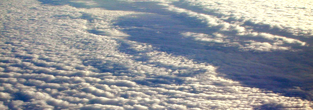
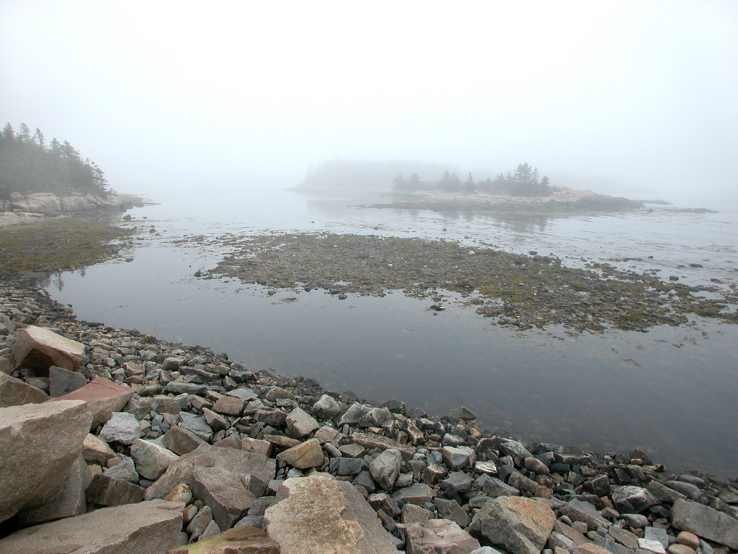
A jet flies too high and fast to take in any detail. The country is too big to slog through on foot. A car is the perfect compromise, letting you pass over a significant portion of the nation each day, but allowing you the leisure to stop and sniff the magnolias in Mississippi, the rank ecstatic yellow sunflowers in North Dakota — and the lingering odor of peanut butter at Graceland.

It’s summer again, and once more, I open up another brand-new Rand McNally road atlas and begin planning a drive around the North American continent.Sunflowers North Dakota

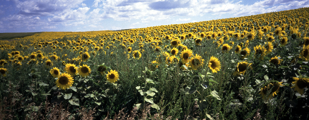
In the past 15 years, I’ve made the round-trip across the United States at least a dozen times. I feel like Magellan when I start once more on the circumvehiculation of America.

I’ve done it alone and with my wife. I’ve done it camping and in motels. I’ve done it in summer and in winter. I’ve done it in as long as two months and as short as two weeks. Last year, I made it from Phoenix to North Carolina over a weekend, but I’m not likely to repeat that butt-numbing feat.

Yet I am planning another road trip this spring.

Friends tell me I am nuts, a masochist torturing myself or a sadist torturing my wife, but I keep setting out.

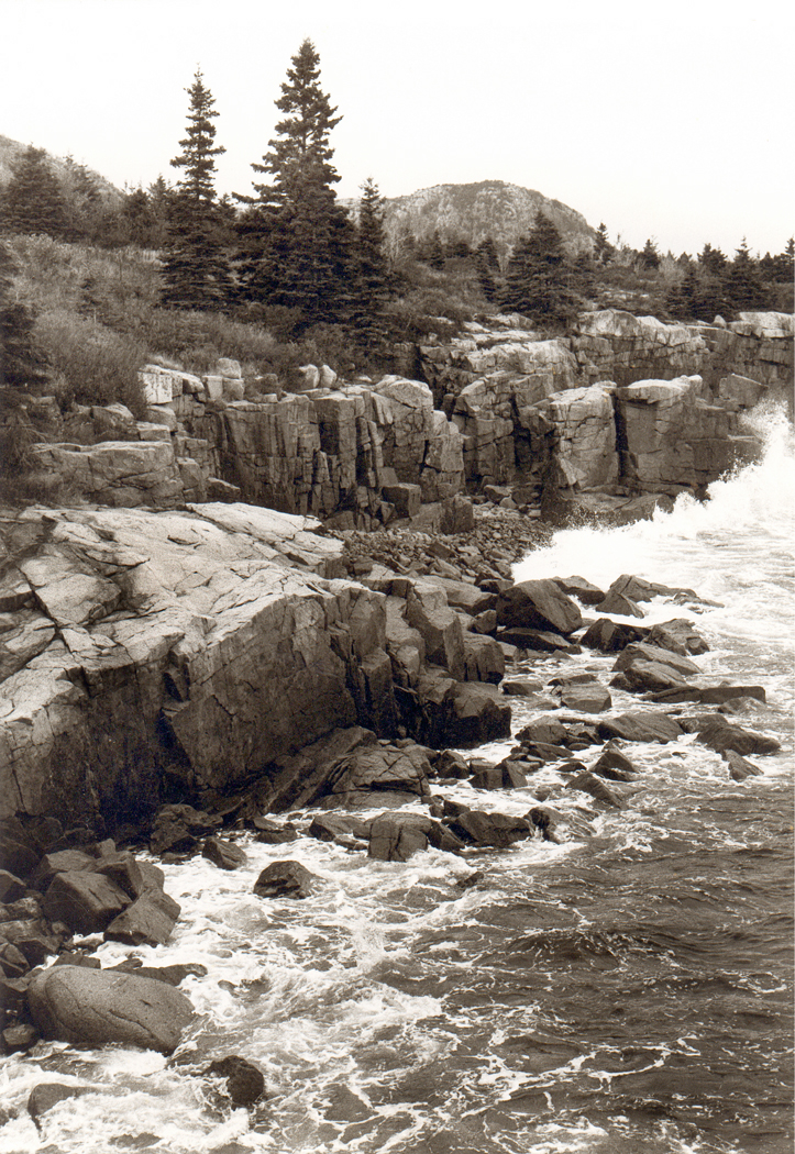
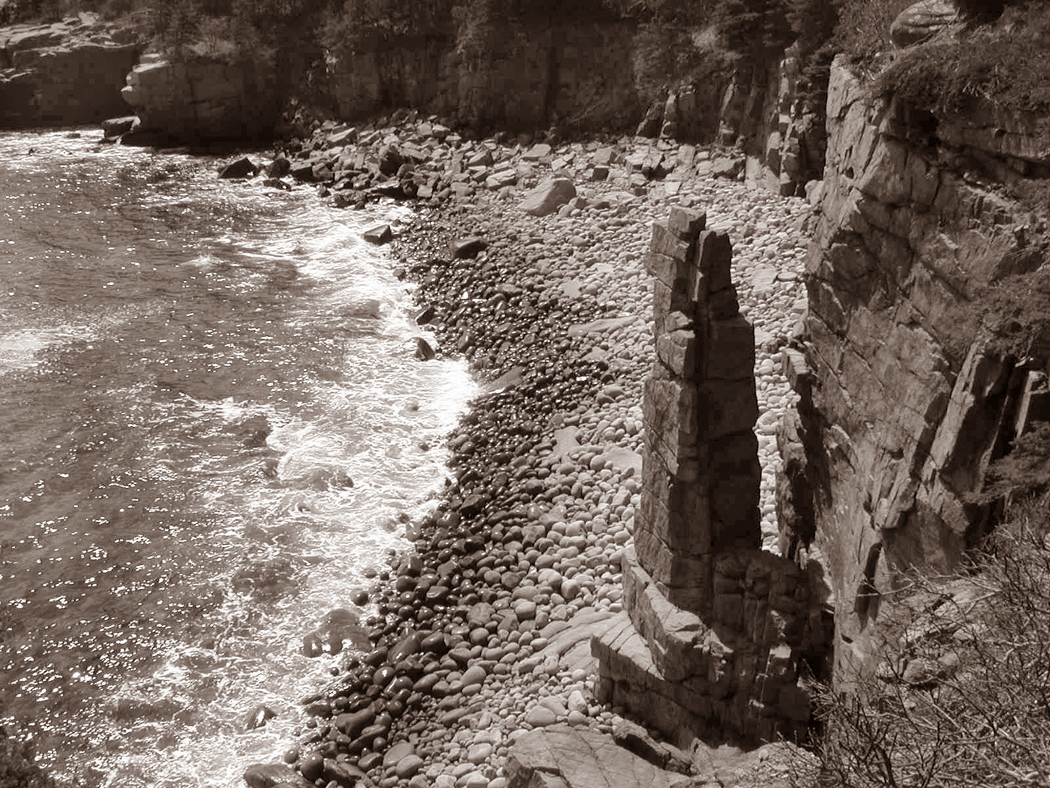
There is always something new to see, or some old friend to revisit: I’ve been to North Carolina’s Outer Banks something like 40 times, and I’m beginning to develop the same relationship with Maine’s Down East. When I have lived in the East, I couldn’t wait to visit New Mexico again.Baldwin Co. Ala. sunset

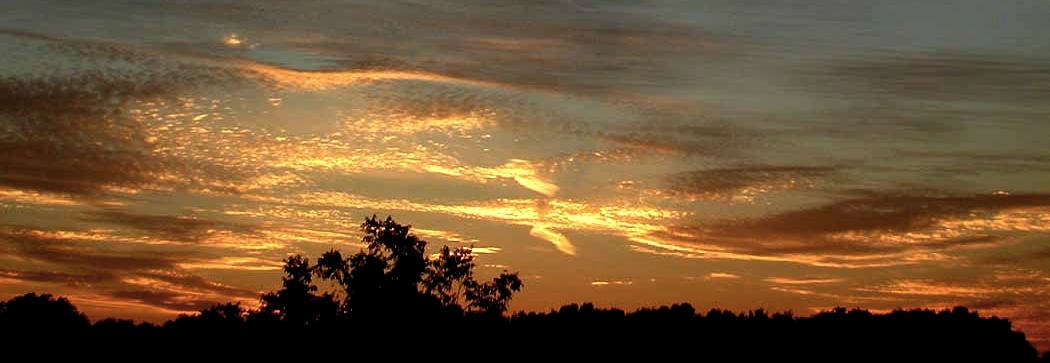
There are soft-shelled crabs to be eaten in Virginia, salmon in Seattle. There are pirogis in Wisconsin and scrapple in Philadelphia. You can only get pizza in New Jersey, you can only get barbecue in eastern North Carolina, or a real Cuban sandwich in Miami.

Barns in Pennsylvania have stone foundations; in Georgia, they rest lumber right on the ground. In Wisconsin, the barns are red; in North Carolina, it’s the dirt that’s red; the gray, weathered barns aren’t painted at all.

I remember passing through Iowa and being astonished to see a farmfield filled with hogs and each animal had its private home, looking like a Levittown of doghouses.

In southern Arizona, I passed something very similar, but it was for fighting roosters.Bear Mtn Bridge

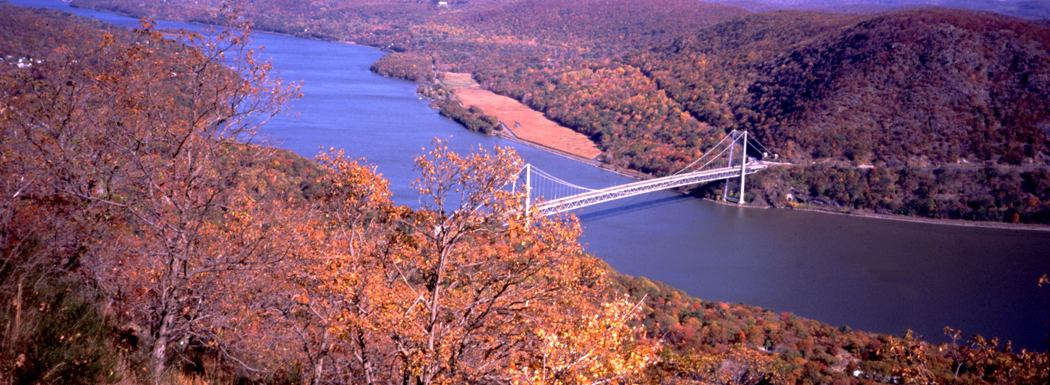
American regionalism is alive, despite network television and corporate advertising. America hasn’t yet been completely turned into one great food court of McDonald’s and Arby’s.

If you think you have only a choice between Pepsi and Coke, wait till you pop the top of a Double Cola in Reidsville, N.C.

Try one at the Sanitary Cafe, where calf’s brains are the breakfast special.Cadillac Ranch Amarillo Texas

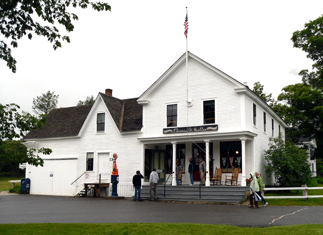
I’ve been to most of those landmark places you’ve heard of: International Falls, Minn.; Walla-Walla, Wash.; Langtry, Texas; Cairo, Ill.; Appomattox, Va.; Intercourse, Pa.; West Point, N.Y.

There are some great old iron bridges across the Susquehanna River in Pennsylvania, some great concrete bridges in central New Jersey that speak of the the great age of American highway building in the 1930s.

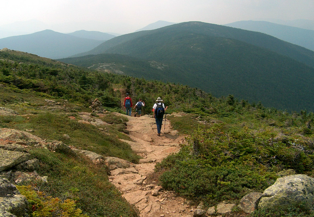
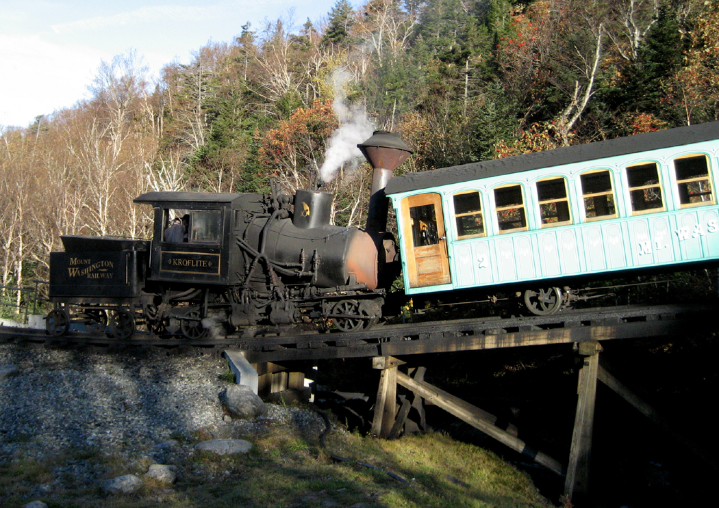
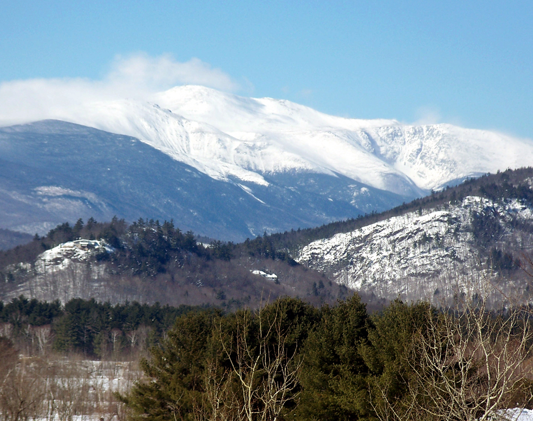
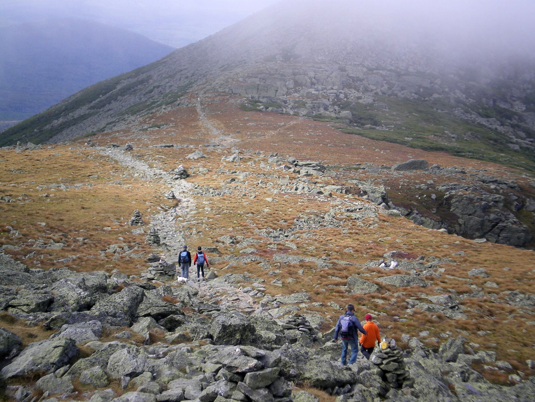
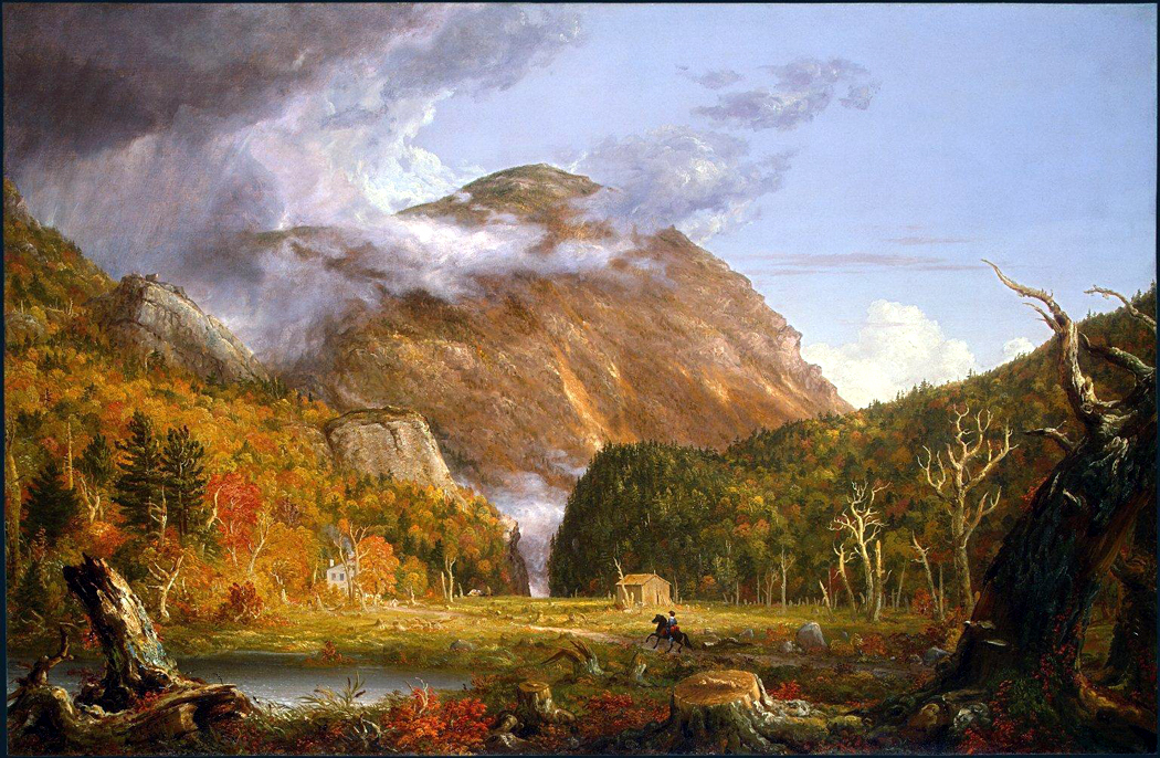
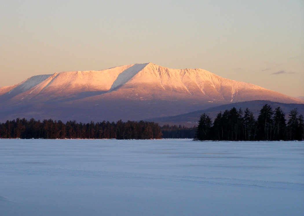
I’ve been up Pikes Peak in Colorado and up Mt. Washington in New Hampshire.

I’ve been over Lake Ponchartrain in Louisiana and across the floating bridge over the Hood Canal in Puget Sound north of Seattle.Columbia River Gorge Oregon-Washington

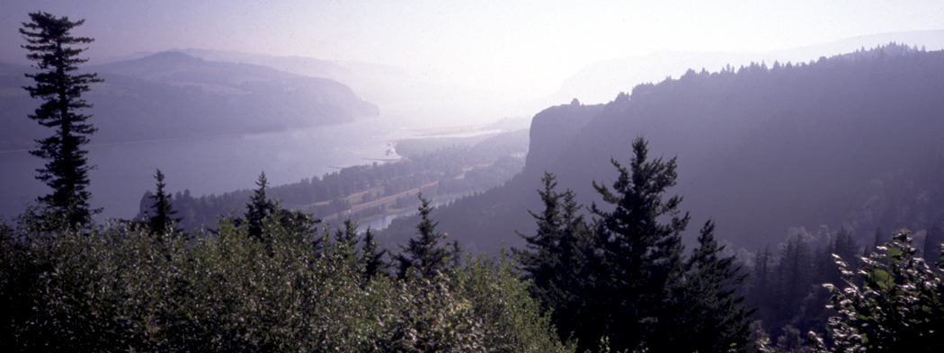
It helps if you love to drive, and I know not everyone has that passion. My brother hates driving, for instance. He views an automobile vacation like a two weeks stuck in an elevator. He can’t wait for his floor to arrive so he can get the heck out.

But most elevators don’t have windows.

As I watch the landscape pass across my windshield, like a travelog on a movie screen, I get a sense of the whole elephant, not just his trunk or tail.

Of course, we are talking here about a two-lane blacktop trip, not a bland rush down an interstate highway, where one stretch of concrete pavement can be distinguished from another only by the names on the exit signs.factory, trees, Lowell, Mass

It is a particular kind of travel and has nothing in common with the destination-vacation of the tourism industry. I have no interest in waiting on Disney World lines for thrill rides or Lake Winnibigoshish for a week of trout fishing. You can have your three days lounging on the sands of Bimini or your Love Boat cruise.

Instead, I get to travel an arc of the planet, get to feel in my bones the curvature of the earth and the roughness of its skin. It is through driving across its surface that I get some body-feel for the size of the globe: It is roughly 10 times the distance I drive to get from Phoenix to New York City. New Orleans
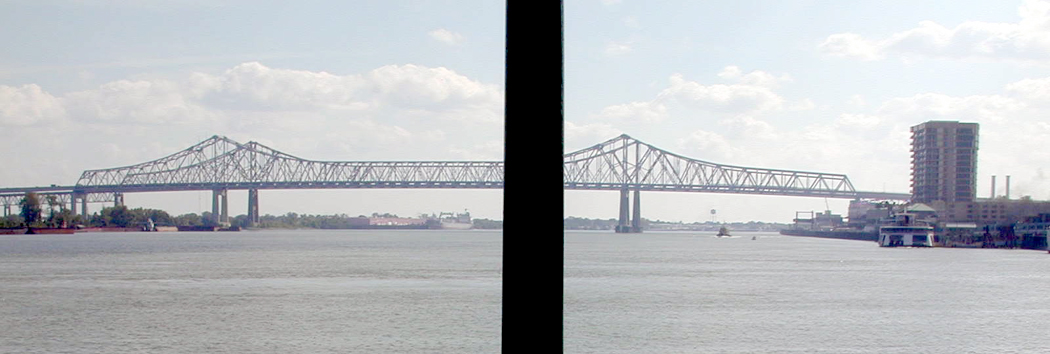
That’s not some numbers on some mileage chart, but a distance I know by the seat of my pants.

It’s also a lot smaller than the world seemed before I began driving.

In those years, my wife and I have been to each of the 48 contiguous state at least twice and most more frequently; we have been to all but one of the Canadian provinces; and even skirted into Mexico a little bit.

And each of those trips could have produced a Blue Highways, a book-length summation of what we saw and learned.Frosty dawn Wisconsin

Part 2

Over the past decade and a half, I’ve put enough vacation miles on the cars I’ve owned to equal driving around the world 2 1/2 times. You don’t drive that much without learning a few things.

The first is, of course, to stay off the interstates. You may get there faster, but not by much, and you’ll be bored the whole drowsy way. And in much of the country — and especially in the West — speed limits on smaller highways is not much lower than on the four-lanes, and with less traffic.Golden Gate Bridge SF Calif

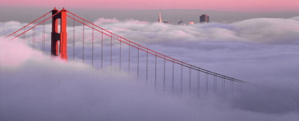
Have a rough itinerary and plan how many miles per day you are willing to drive. This is more important for a passenger: Driving will keep you occupied, but your partner may go stir crazy sitting in a seat while going across some of the flatter places in Texas; Don’t overdo it. Marriages hang in the balance.

But never make your itinerary too rigid. You will discover unexpected things along the way; let yourself enjoy them.Gorilla, Am Mus Nat Hist04 copy

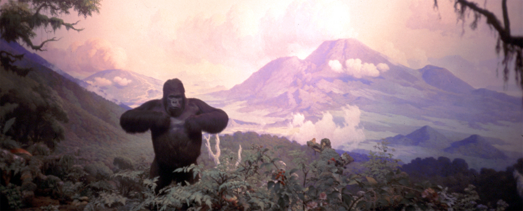
We never reserve motel rooms, so we never feel forced to get somewhere by nightfall. There are enough motels along the way. Even national parks, with their crowds, often have last minute cancellations. We’ve pulled into the Grand Canyon and into Yellowstone and gotten a room. But have a contingency plan.

One year, we hit South Dakota the week of the Sturgis Motorcycle Rally and there were no vacancies for 200 miles around. We had to drive into the next state to find a room. But that brings up the next lesson:

Don’t be afraid of mishaps and adventures. They may be uncomfortable during the trip, but they will be the best stories you tell your friends. No matter how bad it gets, it will provide the most vivid memory.Imperial Dunes California

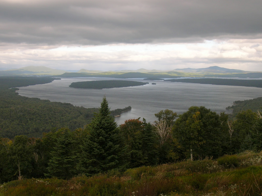
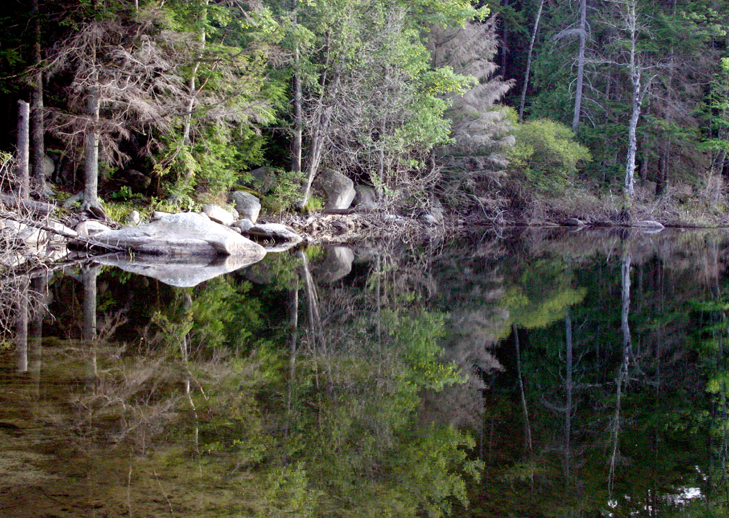
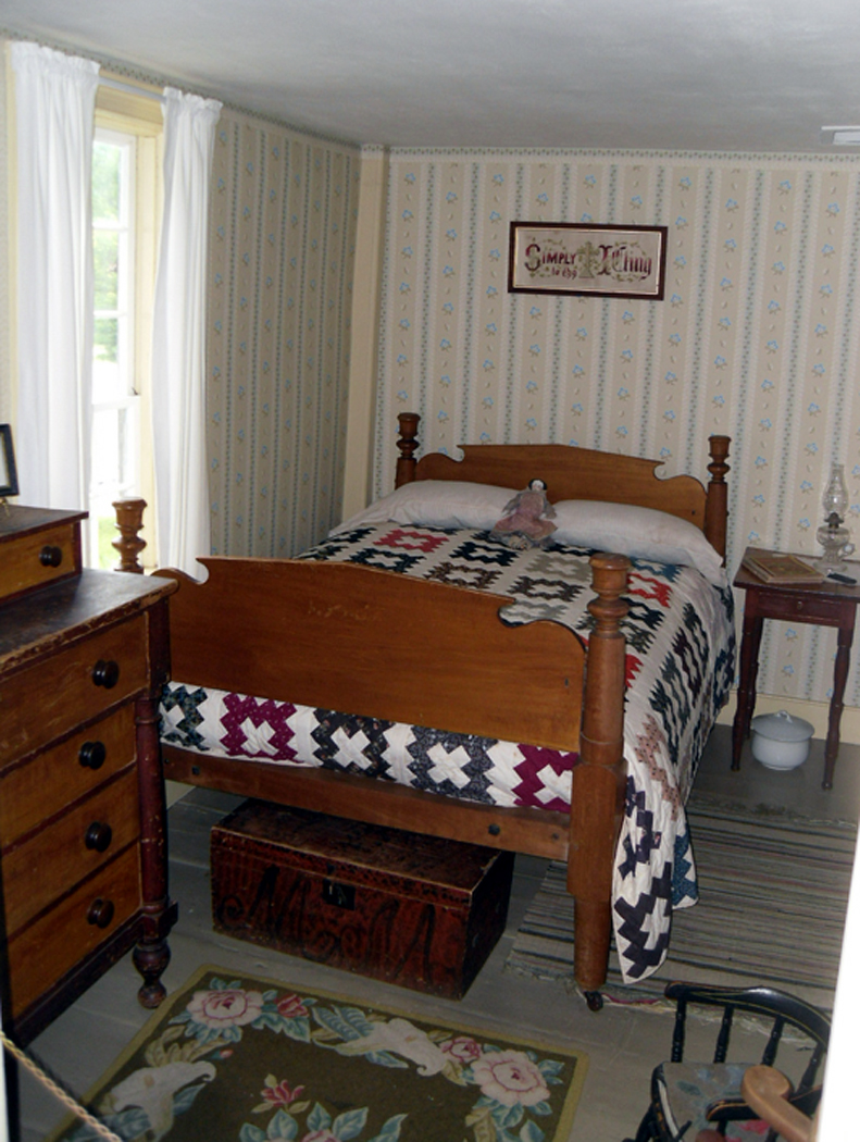
Don’t drive every day; take some time to spend in a single spot. Three days we spent in a cabin on Daicey Pond in Maine’s Baxter State Park were three of the best days we ever spent — hiking, canoeing, watching moose and listening to loons at the base of Mount Katahdin. Not once did we start the car. When we finally left, we were ready for more miles.

There are things you should always have in your car: water, a blanket, Fig Newtons, a road atlas, your address book with phone numbers. Forest Lawn cemetery LAI also carry an entrenching tool — one of those small folding shovels you can buy at army surplus stores — for digging out when I get the car stuck in sand or mud.

Don’t be afraid of dirt roads. There are some amazing rewards at the end of a bit of gravel.

We also always carry a small library of Peterson nature guides, two pairs of binoculars, camera equipment and twice the amount of film I think I can possibly shoot.

And finally, my nomination for the greatest invention of the 20th century: cruise control. It keeps your right foot from cramping up on the gas pedal. I was 45 before I ever tried it and I’ll never be that stupid again.
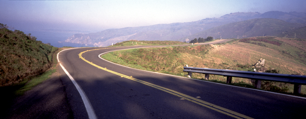
pacific coast highway California

Part 3

What makes for good driving?

I don’t know about others, but for me, optimum driving conditions include:

–Little or no traffic for infinite miles ahead, with no stoplights.

–Interesting and varied weather; I don’t want incessant sunshine any more than I want endless rain. A front moving through gives me a constantly changing cloud show.Greylock Mt from Melville home Mass

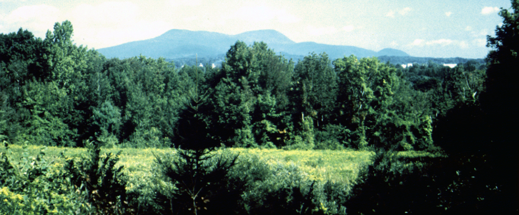
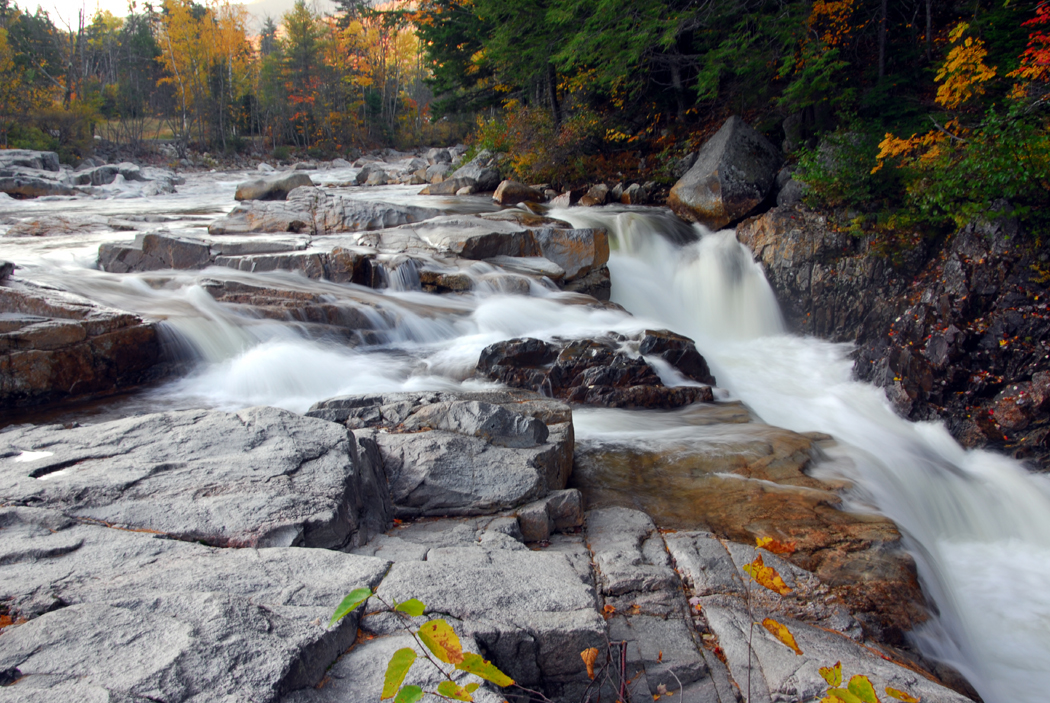
–An old road with a history. Route 66 is the most famous, but not the only one. I especially enjoy roads that follow geology: along a mountain range or river, so that the road seems to belong to the earth, rather than denying it.

–Occasional side roads, preferably gravel, for a change of pace.

–Periodic change of landscape, such as when you drive from the Plains to the Rocky Mountains, or from the white sands of the Atlantic Coastal Plain into the hilly interior of the Piedmont.

— A regional food specialty you haven’t tried yet and no chain restaurants.leo carillo st beach california

— A few museums and a few national parks. I gotta have both.

— A used book store in every town.

— A pile of Haydn symphonies on CD to run through the dashboard player.

–A clean windshield. This last must be renewed frequently. Bugs bust on the glass.Mississippi barge

Part 4

The dozen most scenic drives in the 48 states:

1. Beartooth Highway, U.S. 212 from Red Lodge, Mont., to Yellowstone National Park.

2. The Pacific Coast Highway, Calif. 1, from San Luis Obispo to Leggett, Calif..

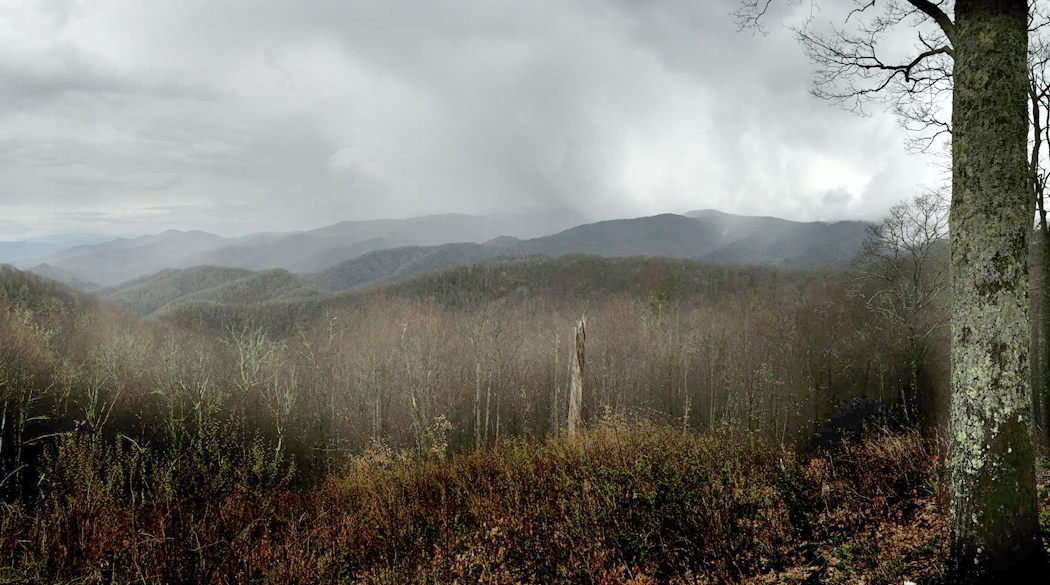
3. Blue Ridge Parkway, from Waynesboro, Va. to Smoky Mountains National Park, N.C.

4. N.C. 12 from Nags Head to Okracoke, N.C.

5. Ariz. 264 from Ganado to Tuba City, Ariz.

6. U.S. 1 from Miami to Key West, Fla.

7. La. 82 from Perry, La., to Port Arthur, Texas.

8. U.S. 1 from Ellsworth to Calais, Maine.

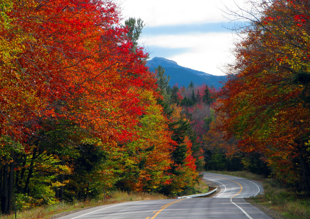
9. Kancamagus Highway, N.H. 112, from Conway to Lincoln, N.H.

10. Tex. 170 from Presidio, Texas, to Big Bend National Park.

11. Utah 12 from Red Canyon to Torrey, Utah.

12. Wash. 14 though the Columbia River Gorge from Camas to Plymouth, Wash.Niagara Falls

Part 5

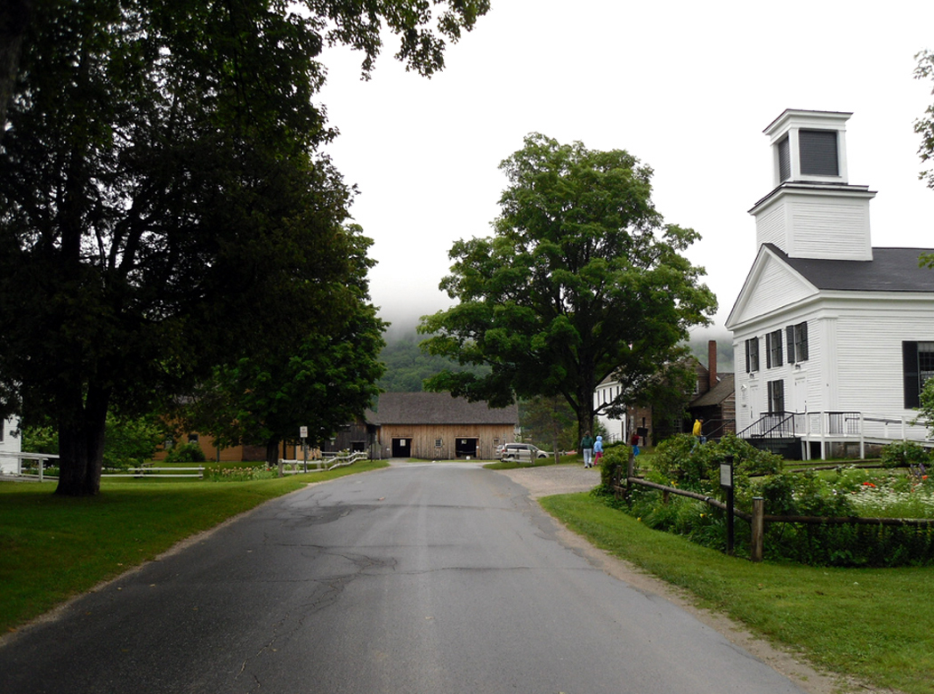
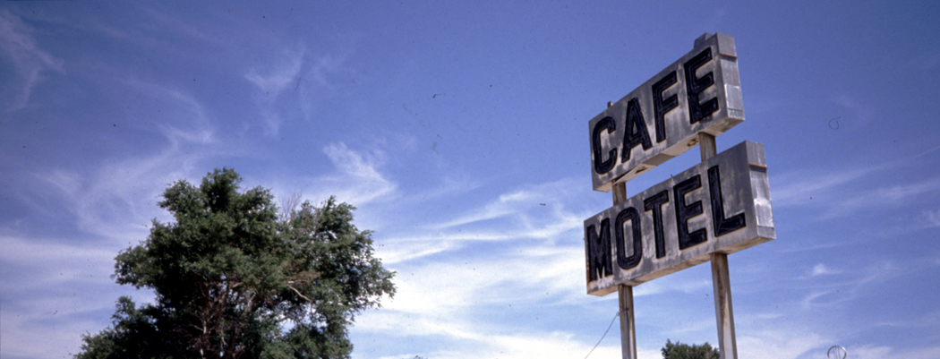
It isn’t just the flashy, famous places that draw the true driver. In fact, commercial destinations, such as Disney World or Las Vegas, are probably best gotten to by airplane and shuttle bus, so you can give over all your time to waiting in lines.

No, in a car, some of the best experiences come by rolling through the kind of places that fall through the cracks of marketing. Places “below the radar,” so to speak, of commercial development.mobile bay point clear

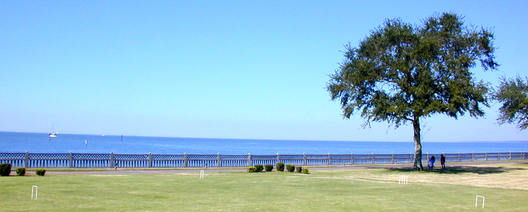
The small towns, endless farms, mountain ranges, Indian reservations — these are the places you have the opportunity to discover things for yourself. In the big theme parks, you get a uniform experience, developed through marketing research. The ride you take is the same ride millions of others take.

But when you talk to the harried but chummy waitress in Doumar’s, an original ’50s style drive-in on Monticello Ave. in Norfolk, Va., you are talking to a real person, a one-on-one experience that is particular and individual. You get a flavor of place, of culture, of people, of individuals.Page Dam Arizona

To say nothing of the flavor of ice cream, in a cone as close to identical as possible to the original waffled cone Abe Doumar is credited with inventing in 1904. They still make them on the same old wheezy portable machine. If your lucky, they’ll be making them while you eat.

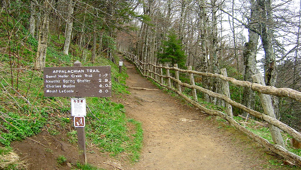
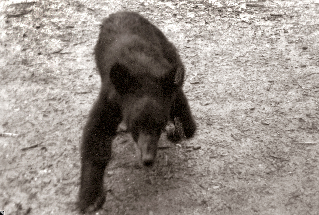
Likewise, there is nothing predictable about the starfish you find in an Oregon tidepool, or the bears in the Smoky Mountains. You get to experience the infinite variety of real life.Sierra Nevada Mts California

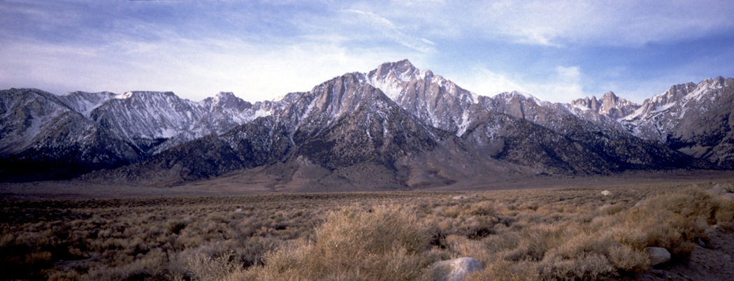
Of course, I have my favorites.

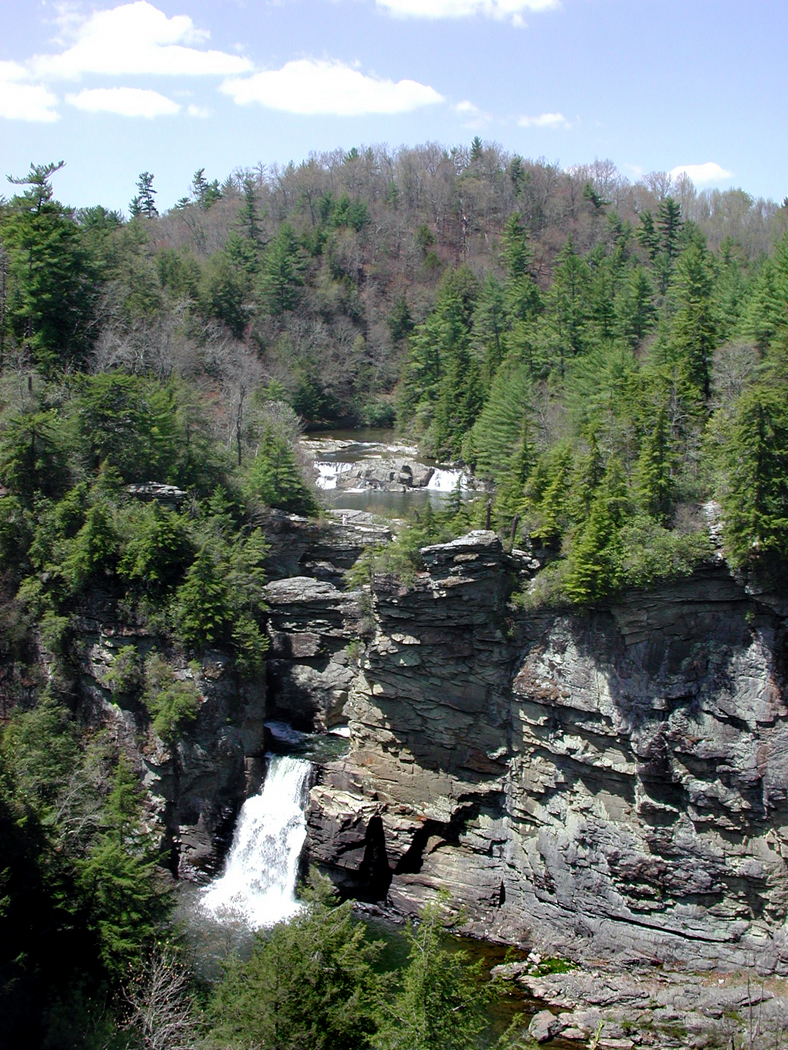
Among the 48 states, I can never find the end of either California or North Carolina. They are both richly varied.

California seems to have everything from the world-navel of pop culture to the most remote wilderness. It has more than any other single state.Thunder hole Acadia NP Maine

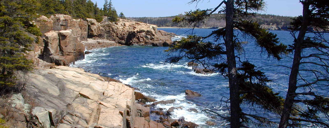
But North Carolina is nearly as varied geographically, and it has B&G fried pies, the most soul-satisfying food in the world. North Carolina also has the Blue Ridge Mountains and the Outer Banks.

And I cannot get enough of the great, grassy, rolling middle of America. When I tell people I love driving through Nebraska, they look at me like I just said I was born on the Hale-Bopp Comet. But just pull into one of those one-street towns with the grain elevator towering over the single railroad track and have lunch in the cafe where the farmers eat.Yellowstone Nat Park Wyoming

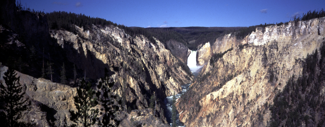
Or imagine the wagonloads of immigrants trudging along the Platte River, with Scotts Bluff on the horizon.

The pace is slower, more humane in Nebraska.

Humankind developed on the grasslands of Africa, and Nebraska, especially, seems to call atavistically to me, reawakening my genetic love of savannas.Monument Valley Arizona

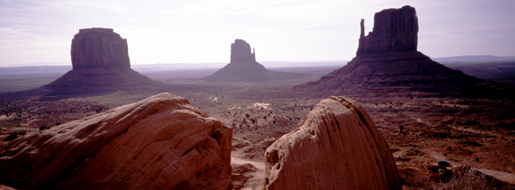
It’s easy to love the broad vistas of the West. Southern Utah doesn’t seem to have a square inch that isn’t photogenic, and the Grand Tetons of Wyoming are mountains right out of central casting: They are to other mountains what Cary Grant is to most men.

But I also love the Mid-Atlantic states. Sometimes, a Western forest is too much of the same thing. You can walk for miles in the Cascades of Washington and see only two kinds of trees: Douglas fir and Western redcedar.Zabriskie Point Death Valley Calif

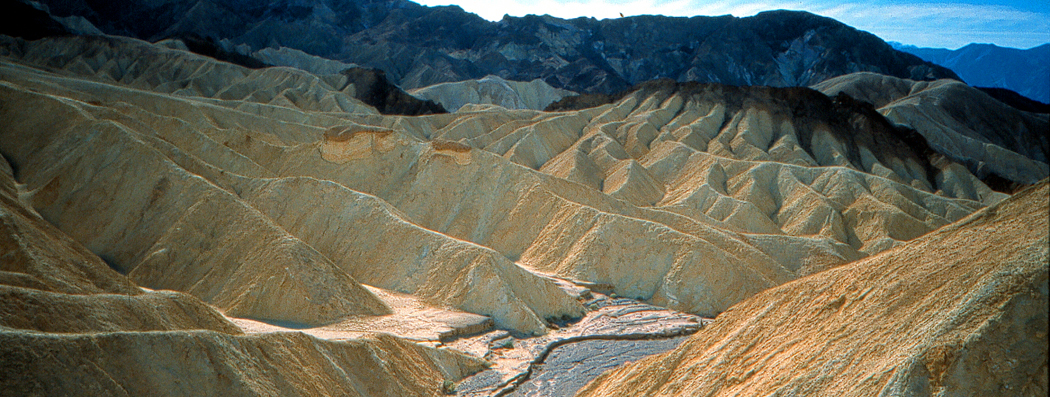
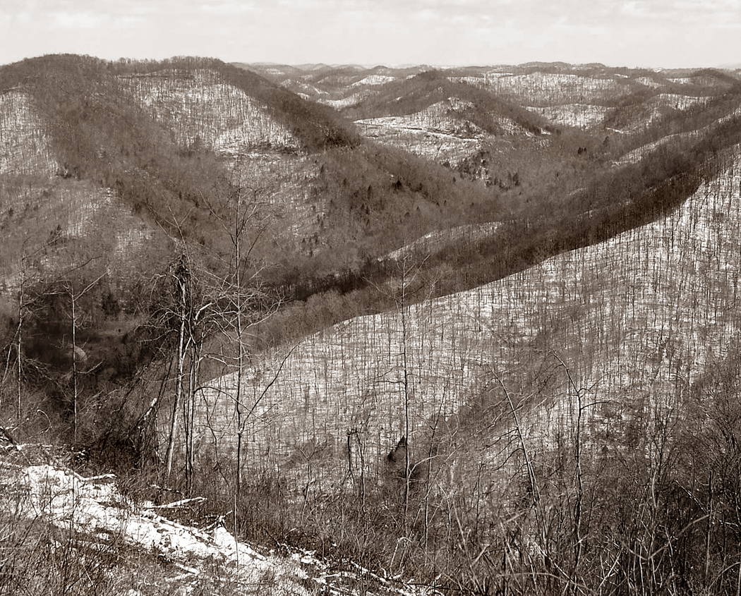
It’s different in Pennsylvania or Tennessee. In the great Appalachian mountain chain of the East, there are more species of plant life than in all of Europe. The variety is blinding: Redbud in spring, Tulip tree in summer. White pine, pin oak, red maple, sweetgum, sycamore, witch hazel, horse chestnut — and hundreds more.

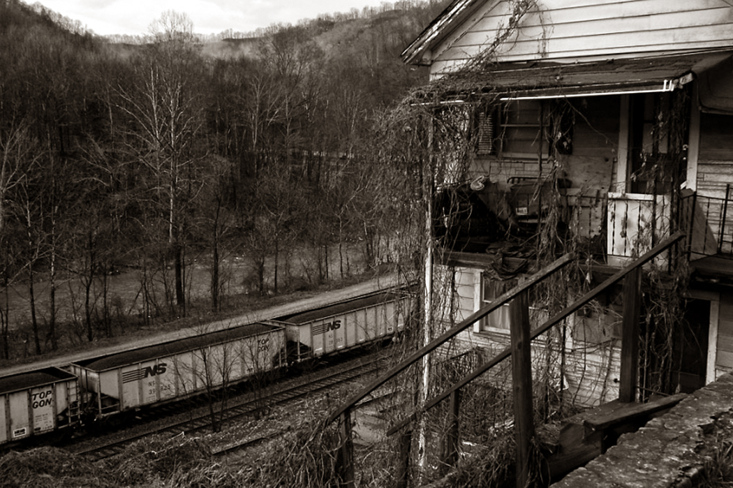
And there is something humanizing about the landscape. This is land which has been lived in for hundreds of years. It is still wild, but it has made peace with the humans who live there and send smoke up their stony winter chimneys.Zion National Park Utah

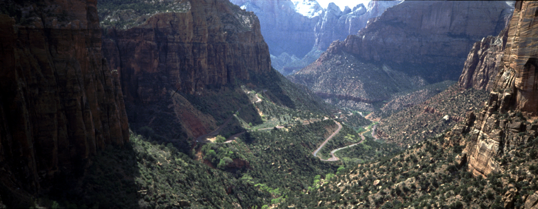
In the past, I avoided cities the way I avoid Justin Bieber songs. The noise, nuisance, dirt and traffic were everything I was trying to avoid by getting on the road.

But I have come to terms with them, also. After all, it is in Chicago, Philadelphia, New York and Boston that you find the symphony orchestras, natural history museums, ethnic foods and imposing architecture.Mississippi River Hannibal Missouri

The greatest city for driving is Los Angeles. It may be the home of the cultural antichrist, but it is also a great fermenting, creative pot, with lots of roads that take you past inventively loopy buildings: The Tail ’o the Pup hot dog stand, the downtown Coca-Cola bottling plant in the form of an ocean liner.

In LA, you can’t get anywhere without wheels. It is the perfect American city.mobile bay

There are two states that I have to admit I don’t particularly enjoy: New Jersey, probably because I grew up there and don’t feel much urge to go back; and Florida, which is supposed to be a Southern state, but it has been given over to graceless Yankees. But even in Florida, I have to admit I love the Cubano culture of Miami and the Everglades, proving that there is always something of worth.

coal town wv
The view from the top of the mountain gives you the conventionally Romantic view of the landscape, the long view, closer to heaven and further from the streets. The view is pristine, and the tiny ants below, with their Ford Pintos and 7-Elevens, hardly muck up the scene.

It is the Romanticism of Caspar David Friedrich, of Frederic Edwin Church, of Albert Bierstadt and the landscape stands in for a kind of vast, sublime Eden.

This is the view of West Virginia promulgated by its official state song: “Almost Heaven.” And it isn’t that such a view is false. It isn’t false — there really is great beauty in the mountainscape of the state as seen from its peaks — but it is partial. Conversely, it is easy to see the bottoms of the mountains as some sort of dystopia: the epitome of Appalachia and its poverty, meth use, grime, coal-mining eco-disaster and educational malaise. coal tipple wv bw

But there is a Romanticism of the hill-bottoms, too. I don’t mean a nostalgia for the black-and-white WPA photographs and the “simpler, old-timey folksiness.” That kind of Romanticism is a refusal to recognize reality. That isn’t really Romanticism, it is escapism.

No, I mean that the soot, the coal trains, the sludgy stream in the mountain cove, the old homes, with their collapsing porches and front yard full of automotive detritus can elicit their own sense of the sublime.

You drive through the valleys of West Virginia coal country, around the impeding hills to the next valley and you pass grade crossings, coal tipples, rusting car frames half submerged in the streams, and lines of houses just up the hill from the road. Next to the road is the railroad track and next to that is the stream, all following the same geography. appalachian plateau BW cropped

The central part of the state, the Appalachian Plateau, is a weathered peneplain, where all the mountains are rounded bumps all about the same height, like the mountains children put into their tempera paintings, one seen in between two others.

It is primarily in these mountains that coal is mined. And in those valleys, crossed with a braid-work of streams, railroad tracks and roads, that most people live and work. Pocohontas wv

In the south, you have McDowell County, a center of coal production country spreading into Kentucky and western Virginia. The collapse of the industry means that the population is one-fourth what it was in 1950, poverty is rampant, and for those men that remain, the average lifespan is the lowest in the U.S. — 12 years shorter than the national average.

In the plateau region, which is what most people think of as “typical” West Virginia, the roads meander through the V-notches between the hills; it is impossible to drive in a straight line anywhere. You are always curving around some mountain into the next valley and around the next mountain.

Until the opening of the West Virginia Turnpike and I-77 and I-79 (work not completed until 1987), traveling anywhere in West Virginia was a slow and tortuous process, and locations not a hundred miles apart as the crow flies, could be more than 250 by car. Aside from the chute-the-chute of the Interstate system, driving in the state is still pretty much a slalom. bradshaw wv

In the small towns, smeared longways along the streams and tracks, the hardware stores and groceries have largely been supplanted by Dollar Stores and coin laundries, and the largest private employer in McDowell County is the Walmart. There are satellite dishes — many dangling and unhooked. The macadam at the gas station is potholed and the store sign advertises prices for cigarettes by the carton.

But, despite this triumph of entropy, the landscape has significance. It has meaning: Just ask any who live there. They may be needy to escape, but if they leave, they pine to return. It is a landscape that gets under your skin, like coal dust gets under your fingernails. keystone wv night coal mine bw

It is a mythic landscape, not a pristine one. It tells us things about the universe and about life.

It is a landscape with its own hell: underground fires that can last decades and at night glow red and orange like the combustion of hell. Some count over 500 such fires in West Virginia. Avernus may be the gate to the underworld for the ancient Romans, but it is West Virginia in the New World. coal train and house

The slow rusting of old refrigerators and Chevys, and abandoned buildings overgrown with weeds and vines, their glass broken out and now enameled with spray-can art, and the closed factories, with lines of smokestacks — these all tally the losses, the sucking down into the past of the present, spinning like water around a drain before disappearing into oblivion. This, too, is sublime. We feel it more in places like West Virginia; it is instantly visible.

Also, because the land is littered with the obsolete and abandoned, you can see them, can pay attention. In suburbia, familiarity has dulled our senses and we hardly notice the clapboards, the street curbs, the cars in the shopping center parking lots, the school buildings, the very trees that line the roads. They are there to be seen, but who actually looks? coal train in rain bw

In this moonscape of detritus, waste, loss and forgetting, the details are burned once again into us, made unfamiliar by rot and decay, so we can see them again. The very “thingness” of each chesspiece on this gameboard of depletion makes them palpable and gives them presence, and presence imbues meaning — significance.

There is a difference between the pretty and the beautiful. Postcard sunsets and green mountain vistas are all pretty enough, but they distract us from the essential facts; they are a magician’s misdirection, keeping our eye from the real thing. As Tom Robbins wrote, “The ugly may be beautiful; the pretty, never.” The real thing is our gaze into the eye of eternity, and you get that from contemplating anything bigger, vaster, scarier, more overwhelming than yourself. coopers wv grad crossing

Yes, you can look at the old tires and relic houses and see only a failed economy, but you look instead at the passing of time engraved on those same objects and you see intense beauty.

Conclusion: In which the mountains dip into the sea

St. Georges de Malbaie Gaspe

St. Georges de Malbaie Gaspe

The Gaspe Peninsula in southern Quebec sticks out beneath the mouth of the St. Lawrence Seaway like a pouting lower lip.

It juts into the Gulf of St. Lawrence, protected from the open Atlantic by Nova Scotia and Newfoundland. There it sits, home to cod fisherman and farmers and an increasing number of vacationers. gaspesie 5

The peninsula’s interior is wild and mountainous — the last hurrah for the Appalachian chain — but its perimeter is bucolic, with small, quiet villages, each with a church steeple at its center.

Between Matane, where the peninsula begins, and Cape Gaspe, where it ends 200 miles later, there are only two roads that cross the interior.

Chic-Choc mountains

Chic-Choc mountains

From north to south, the roads leave the St. Lawrence, climb the Notre Dame and Shickshock mountains (aka Chic-Choc, in the bilingual nation) and wander down the deep river valleys lined with pine, fir and birch, only to come out on the prairie-lined towns along the Baie des Chaleurs.

The spine of the Appalachians runs the length of the Gaspe and it finally dives under the salt water at Forillon National Park, only to churn up the water beyond land’s end in a series of offshore shoals before sinking down into the sea bottom.

That last flowering of the ancient mountain chain is a splendid one, as the rock hangs over the water in a scalloped series of cliffs, each with a small semicircle of beach under it. The beach is made up, though, not of sand, but of small, smooth lozenges of stone that hiss and rattle as the breakers foam through them.

Cap Bon Ami, Forillon National Park

Cap Bon Ami, Forillon National Park

Nor does the shore slope smoothly into the water. All along the water’s edge, there are upended strata of rock that make for good clambering. At Cap Bon Ami — named for an old sea captain who spelled his own name Bonamy, and not for the scouring powder — the park road ends and you begin to hike.

A short way downhill from the parking lot, there is an observation deck and a set of several hundred stairs down to the beach. From that point, you can see the whitish cliffs spreading out in both directions. Cormorants and sea gulls swoop around you. Behind you rises Mont St. Alban, the last high peak of the Appalachians, which isn’t even 1,000 feet above the sea.

And in front of you, the sea itself spreads out like a gleaming satin tablecloth, flat and rippling with the sheen of daylight.

This is the sea that Jacques Cartier saw in 1534 when he made his first voyage to the New World. The French explorer discovered the native peoples of the area and kidnapped two of them to take back to show off to the king. On his second voyage, Cartier did not stop at Gaspe. Perhaps he knew his welcome no longer would be warm.

Gaspesie

Gaspesie

The few hardy French pioneers who took to living in the ”Gaspesie,” as the area is called by Francophones, found their towns burned down in the first half of the 18th century, when the English attempted a takeover of the whole New World. The Acadians, as the local French were known, were arrested, deported or forgotten.

In the following years, wars in Europe and North America sent migrants to Gaspe. Among them were American Loyalists fleeing the American Revolution, Irish fleeing potato famine, and merchants and fishermen from the islands of Guernsey and Jersey.

They settled in a patchwork across the peninsula, leaving towns along the coast as ethnic enclaves. That is why, in this corner of the French-chauvinist province of Quebec, you find towns named New Carlisle, Chandler and Newport, where English is the predominant language.

Mont Louis

Mont Louis

The interaction of languages produced a few oddities: What originally had been ”Hunger Point” in French, or Pointe a la Faim, was translated by the English as Point Fame, which later was retranslated into French as the current Pointe a la Renommee.

What was once ”Grande Grave” — named for the type of pebble beach called grave in French — was pronounced ”Grand Grave” in English, like a burial plot. This then later was spelled in French as Grand Greve, to match the sound of the English.

Most who lived in the region became fishermen. In the 19th century, large fishing corporations set up and ran ”company towns” that abused their workers in the same manner as mine owners in West Virginia. The families always owed money to the company store. There was no money; debts were paid in dried codfish, which the companies shipped out and resold at good profit.

Those who were lucky enough to avoid the codfish treadmill turned to subsistence farming. A few became whalers.

Peggy's Cove

Peggy’s Cove

Such a life continued unchanged until the 1920s, when roads were built, a railroad came through, and mail-order catalogs appeared. Electricity showed up after World War II, and the area, once as remote as anything in North America, began joining the 20th century.

Today, the southern and northern rims of the peninsula are very different.

Along the southern shore the towns collect around river mouths, surrounded by prairies of long grass blowing in the almost-constant wind. The land is flat, but you can look inland to the mountains.

The north shore, though, is right up against the hills, which break off into the water in bright bluffs and craggy cliffs. The one road that manages to squirrel from town to town is constantly climbing steep slopes and dropping down to the town in the next hollow.

And although the southern shore is ethnically varied, the north is almost entirely French.

There are two towns of note: Perce and Gaspe, both at the sea-end of the peninsula.

Perce

Perce

Perce is a tiny resort town parked near Perce Rock, an offshore seastack with a hole eroded through it like a giant stony donut. The town is the closest thing the Gaspe has to a tourist trap and the road through town will slow you down in summer with traffic stopping for souvenir shops and fancy restaurants.

There are also boat trips available to the large Ile de Bonaventure, sitting just offshore and one of the great bird-watching spots in the world.

Gaspe, on the other hand, is a working town and capital of the region. It is not particularly scenic, with its banks and gas stations, but it sits near the head of Gaspe Bay, the small inlet that separates the Forillon Park from the rest of the peninsula. It is at Gaspe that Cartier first landed. A museum commemorates the event.

Forillon Nationa Park

Forillon Nationa Park

And it is at Gaspe that we met the woman who runs the bookstore called the Librairie Alpha on the town’s hillside among the narrow, gray streets. She lamented the passing of the old days, and more, the old winters.

”It snows quite a lot in Gaspe,” she said in heavily accented English. ”But it doesn’t snow like it used to 20 years ago.

”I don’t know what has happened, but it isn’t so deep as it was in my childhood.”

In the winter, the bay ices over. It freezes ”as far out as the horizon,” she said. It stays frozen from December to April and people go out on the ice and fish.

”But they aren’t really there for fish,” she said. ”They bring beer and have parties on the ice.

”It freezes down two meters.”

In the winter, an icebreaker sails up into town as far as the bridge, breaking up the ice, but in a week, it is solid again, she told us.

But it doesn’t snow like it used to.

”I remember my father telling us about the really deep snows and how the snow would be so deep that everyone in the village would slide down their own rooftops into the snow.”

She said she remembered doing that when she was a child, but except once, the snow doesn’t pile up to the eaves anymore.

”Two years ago, it snowed so much, I took my children up to the roof to slide down. They may never have that chance again.”


L’ENVOI

 house montage

Gaspe is the ”roof of the Appalachians.” It is the final glory of the mountain range that begins in Alabama and rises like a spine through the East.

It is also a place of roofs. The old houses with their clapboard siding and double-insulated windows sport shingles of many bright colors. There are some that are royal blue, others Kelly green. If there are no shingles, but a tin roof, it is painted. I saw one that was the color of lilacs. Orange and red are also popular. house 5

But it isn’t only the roofs. The houses themselves are often quite garish. One two-story house we passed in Grande Vallee was green on the bottom and pink on the top, with corner accents of opposing hues. house 1

There was a green barn in Perce that was the color of mint. Its owner must have had a little left over, because he painted only one face of his house, sitting next to the barn, with the same breath-mint shade. The other three sides of the house were a peeling white. house 8

There were yellow houses, purple houses, pink houses and orange ones. The shades of green were staggering, sometimes two shades on the same building. house 10

Not all houses were oddly colored; the majority remained white and their roofs remained black or gray. Yet enough houses were tarted up to prove that it is a folkway on the Gaspe. house 2

It is true, however, that the majority of garish houses were on the south shore of the peninsula. Once we hit the northern shore, the strange colors nearly disappeared. Only once or twice in each village would you find a tin roof painted sky blue or vermilion.

Part 5: In which we consider living in Maine

front door

Maine is poor and that makes it rich.

Compare it with suburban Massachusetts and you see the difference. In the hills around Boston, the old homes have added jalousie windows — large panes of plate glass — and behind them you can see a collection of things bought in antiques shops. Out front is a Volvo or a Beemer.

But in backwoods Maine, the same antiques have gathered dust in the old farmhouse since they were new. Out front is a rusted Chevrolet or a Ford pickup. Barn

The New England homes, with their thin clapboards, are thickly painted and repainted their chalky white, and the paint nevertheless peels back on the window trim, showing gray, weathered wood underneath. The foundations are wavy with age and the lines of clapboard match them, looking like uneven topographic lines of a map. Screen doors have holes; barn doors sag on their hinges. But it is the sagging of use, not of neglect. In Rumford Point, for instance, many homes proudly tell the date they were built. You see ”1762” on one door, ”1780” on another. On one small building, you see ”1964,” which is a joke. Lubec hillside

Along the Androscoggin River are tall-steepled churches left over from the middle of the past century, still with their signs out front: Services held 10:30 a.m. Sunday. House side

One of the characteristics you notice is that the farmhouses are connected to the barns by a covered series of adjacent outbuildings. The winters are so severe that no one wants to go outside to tend the livestock, so you pass from the kitchen to the garage to the toolshed to the barn, all in toasty comfort. Well, as toasty as you can be when the siding boards are as loose as lattice and don’t always come down to the dirt, leaving an ankle-high draft. Yellow house

There are scrollwork on the eaves, wide fans over the door transoms, white fences along the sidewalks and, even in midsummer, storm windows. For even in July, on a wet, rainy day, it can be a raw, humid 70 degrees and it gets into your joints, so you feel arthritic. Or perhaps they are needed for protection against mosquitoes as big as hailstones that gather in swarms in cool, muggy air. Maine Schoodic door

But the countryside is poor, or if not poor — because that brings to mind inner-city malnourishment and anomie — certainly not well-off. As in much of southern Appalachia, the poverty is misleading. The people own their homes, grow their own food, know their own land. There is a Yankee self-sufficiency that grows with the spartan winters, lack of amenities and isolation.

NEXT: The Appalachians enter Canada

Part 4: In which we enter the landscape of the mind

Sorrento dock

Each of the United States has its own flavor, its own existence as myth. It is the sense one has, if one does not live in that state, but imagines what it would be like to visit.

One imagines what Arizona must be like, with its cowboys and cactus, but the reality of Phoenix — “Cleveland in the Desert” — negates that myth. That is the nature of myth.

Some states have bigger personae. California, for instance, which existed as myth both for “Forty-Niners” and for Okies. Montana offers big skies and clean air. Oregon had its trail and Mississippi has its Yoknapatawpha County.

Texas claims for itself the largest myth, although it is hard to warrant such big ideas if you have actually been to Midland or Odessa. Texas is only big in hectares. Otherwise, it is the state of large hats as substitutes for small manhood.

Each state has its mythic presence, although it is hard to make the case for Delaware as anything but the “gateway to New Jersey,” and the Garden State gains any resonance it has only from Tony Soprano and Bruce Springsteen.

But one state led all the rest historically in this landscape of the mind, as a special place in the American imagination, a place you dream about when you think your daily life is too mundane.

Lubec

Lubec

Historically, the state that has had the longest claim on the American spirit is Maine, with its deep woods and rocky coast, its taciturn, independent people and its echoing loons. Maine is the original great escape, the place to go to return to nature and feel what it is like canoeing across a backwoods lake with a mist rising from the water.

Maine is the place Henry David Thoreau went when his Walden Pond seemed too citified. Maine is the place that dozens of American artists went to find some glimmer of inspiring wilderness.

It’s also the place the 19th-century robber barons went for summer vacations.

As America has expanded westward, Maine has lost some of its magic, but it is still a mythical place, drawing millions of visitors every year.

But there isn’t a single Maine. Regionally, there are at least four Maines.

The first is the southern coast, which first attracted a wealthy clientele a hundred years ago. This is where old money came for the summer. It is where former President George H.W. Bush had his place in Kennebunkport. It is also home to the new Yuppie tourism centers on Penobscot Bay, where you can always get a good brioche: Camden and Rockport. They are not much different, in their way, from Carmel, Calif., or Sedona, Ariz. — all trendy shops and new museums. You visit L.L. Bean in Freeport, and see a hundred other factory outlet stores.

Mooselookmeguntic Lake

Mooselookmeguntic Lake

Then, there is the mountainous Maine of the western part of the state with its thousand lakes, from Rangeley Lake to Mooselookmegunticook. This is the part of Maine famous for its out-of-place town names: Mexico, Norway, Paris. It is a place to go for fishing and camping or renting a cabin for a week.

The large northern part of the state is especially impressive. Vast tracts of woodland crisscrossed by narrow logging roads down which rumble the most frightening, earthshaking pulpwood trucks, piled high and tenuously with rattling bundles of spruce trunks. It is the north of Baxter State Park and Mount Katahdin. This is the Maine that Thoreau wrote about in his book, The Maine Woods. It is also the part of the state, on its eastern side, where they grow potatoes.Maine tree

But it is the fourth Maine that I love the most: the upper coast, from Mount Desert Island to the Canadian border.

This is Down East. It is the least touched by commercialism. It is still composed of blue-collar working towns where men go out to fish or pull lobsters from the rocky-bottomed sea. It is old wooden houses on granite foundations and cars rusted out from wet, salty winters.

Otter Cove, Acadia NP

Otter Cove, Acadia NP

It is called Down East because when 19th-century sailing packets traveled up the coast from Boston, they sailed downwind, with the prevailing breezes abaft. Back then, Maine was still part of Massachusetts. Maine owes its statehood to slavery: The Missouri Compromise of 1820 let the slave state Missouri enter the union, but separated Maine from Massachusetts and entered it as a state at the same time to keep a balance of free and slave states in Congress.

The coast of Maine is about 250 miles long, as the crow flies, but it must have been a very drunken crow that first flew the distance. With all the bays and headlands, the actual distance of that zig-zag coastline is closer to 3,000 miles. And that’s not counting the islands, thousands of them.

Mount Desert Island is the largest of them. It is properly pronounced Mount “Dessert,” as if it were filled with chocolate moose, but most people just call it MDI and be done with it. MDI is the home of Acadia National Park, one of the most beautiful in America.

Monument Cove, Acadia NP

Monument Cove, Acadia NP

It is also the home of Bar Harbor, one of the most congested towns. In the summer, Bar Harbor is a vacation nightmare, with no parking, crowded restaurants and no room at the inn.

Acadia National Park covers about half the island and includes Cadillac Mountain, the tallest mountain on the East Coast north of Rio de Janeiro. At 1,530 feet, it catches the first rays of sunlight to hit the U.S. each day.

A road to the top provides splendid views.

But it is the view of Cadillac Mountain, rather than the view from it that is best. And the best views are from the coast roads that continue farther down east.

The real Down East begins beyond MDI. From Ellsworth — which may look like one unending K mart and KFC — you drive east and north on U.S. 1 and you leave all the tourists and development behind.

Fox Lake

Fox Lake

The towns you pass are small and picturesque: Sullivan, Gouldsboro, Sorrento, Winter Harbor, Jonesport. You see tall church steeples and town squares with bronze statues of World War I soldiers.

This is Maine for the traveler rather than the tourist. You won’t find many fancy restaurants, and the motels are all low-dollar. Look instead for breakfast in the local lunch counter with the lobstermen. There are no “destination locations.” You have to be interested in the place for itself, and not for an amusement park.

If you are looking to get away from it all, Down East is the definition of the phrase.

Machias

Machias

There are mountains to be climbed, woods to be hiked, lakes to be canoed. There are heaths to be gleaned of their blueberries and birds to scout out and listen to.

Blueberry heath

Blueberry heath

If you hike in the woods behind Sullivan, off Taunton Bay, you will find the abandoned granite quarries that used to provide curbstones for the cities of the East Coast.

Climb 1,069-foot Schoodic Mountain for the panoramic view. Or if that is too high, try 397-foot Tucker Mountain. A walk through the birches and alders will bring you to a splendid view of Frenchman Bay and Cadillac Mountain.

Schoodic Point, Acadia NP

Schoodic Point, Acadia NP

From Gouldsboro, head south to Schoodic Point, which is part of Acadia, but without the crowds. The waves boom on the rocks and a cold ocean separates you from Cadillac in the west. If there is one perfect place to visit Down East, Schoodic Point is it.

Quoddy Head Lighthouse

Quoddy Head Lighthouse

Or take the narrow road south of Lubec and you will come to the West Quoddy Head lighthouse, the easternmost point in the U.S. Out on the horizon you will see Canada’s Grand Manan Island. It might as well be China.

Take a look at any map of the eastern bump of Maine and see how the web of roads thin out. Hancock and Washington counties are nearly unpaved. It is empty. It is beautiful. It is the real Maine.

NEXT: Maine redux

Part 3: In which a previous president gets some work done

plymouth notch

As in the rest of the country, the modern world of CVS pharmacies, Burger Kings and Pep Boys has superseded the old neighborhood stores and previous ways of life in New England. Vermont has pushed back more than other states, but life is modernizing there, too.

Silent Cal

Silent Cal

But if you want to find out what old country life was really like, the best place to get a hint is at the Calvin Coolidge State Historic Site in Plymouth Notch. There, you can see the house where the taciturn and much-maligned 30th president was born, and a second where he grew up. You also can see the giant woodshed needed to keep the house marginally above freezing in the winter; you can see the two-hole privy and the smelly kerosene lanterns.

For Calvin Coolidge grew up in old country Vermont. It was hard work, and there were no potpourris nestled in the corner with the perfumed smell of herbs and spices. The smell of the house must have been a little closer to horse manure, which was collected in the stable — attached to the house like a modern-day garage — and was shoveled through a trapdoor to a collection pit under the house. coolidge 14

His quilt didn’t have cute children printed on it. In fact, when he was 10 years old, Coolidge made a quilt for himself. It is a very good quilt, too. Old Cal was pretty good with his hands. In his house, there is a chest of drawers he made when he was a little older. He would have been a right good carpenter if he had chosen that line of work.

”After the winter work of laying in a supply of wood had been done,” Coolidge wrote in his autobiography, ”the farm year began about the first of April with the opening of the maple-sugar season. This was the most interesting of all the farm operations to me.”

In a good season, they processed as much as a ton of maple syrup. But that is not all. ”After that, the fences had to be repaired where they had been broken down by the snow, the cattle turned out to pasture, and the spring planting done. Then came sheep-shearing time, which was followed by getting in the hay, harvesting and threshing of the grain, cutting and husking the corn, digging the potatoes and picking the apples. Just before Thanksgiving, the poultry had to be dressed for market, and a little later, the fattened hogs were butchered and the meat salted down. Early in the winter, a beef creature was slaughtered.

Coolidge works the horses

Coolidge works the horses

”The work of the farm was done by the oxen, except running the mowing machine and horse rake. I early learned to drive oxen and used to plow with them alone when I was 12 years old. Of course, there was the constant care of the domestic animals, the milking of the cows and taking them to and from pasture, which was especially my responsibility.”

And all around the village of Plymouth Notch, maintained as a state park, you can see the results of that self-reliance, which is the hallmark of the mountain population. coolidge 6

You can see the dark room where Coolidge, then vice president, learned of Warren Harding’s death. Coolidge’s father, a notary public, swore his son in as president using the oath Calvin had typed out on the family typewriter.

Asked how he knew he could swear in his son, old Col. Coolidge said, ”I didn’t know I couldn’t.”

NEXT: Remembering Maine

Part 2: In which certain suggestions are made

Kancamagus Highway

Kancamagus Highway

One of the best ways to see the wild parts of New England is via the Kancamagus Highway, which runs between Lincoln and Conway, N.H. Along its 35 miles, you pass white-water rivers, towering granite and long views from the mountain passes.

The road, which was opened only in 1968, climbs from the Pemigewasset River to Kancamagus Pass, crossing the crest at 2,850 feet and following the Swift River down the other side.

Rocky Gorge on the Swift River

Rocky Gorge on the Swift River

Near the Bear Notch Road turnoff is the Passaconaway Historic Site, with a nature center and summer demonstrations by craft workers in period costume. In the Rocky Gorge Scenic Area are waterfalls, hiking paths and camping in the Covered Bridge Campground.

But it isn’t the only road worth taking. The road up Mount Washington is a thrill ride of declivities and chasms, bound together with the coil of roadway.

To be sure, there are three choices for getting up Mount Washington.

Appalachian Trail, Presidential Range

Appalachian Trail, Presidential Range

The first is to climb on foot; the Appalachian Trail winds up the rocky slopes, but it is probably too strenuous for most visitors.

Mt. Washington Auto Road, with cog railway tracks in foreground.

Mt. Washington Auto Road, with cog railway tracks in foreground.

The second choice is to drive up the Mount Washington Auto Road, opened in 1861. It is a harem-scarem eight-mile drive that averages 12 percent grades and snakes around hairpin turns, and when you get back down, you probably will buy the popular bumper sticker that reads ”I survived the Mt. Washington Auto Road.” cog railway

The easiest way up is the Mount Washington Cog Railway, which climbs the other side of the mountain from Crawford Notch. The 3 1/2-mile trip, which climbs grades up to 37 percent, takes a little longer, but is great fun.

Both road and rail have what may seem ”steep” admission prices.

The New England states are small, but each offers something for the traveler.

In Vermont, the countryside itself is reason to visit, and just about anywhere you go is scenic, though more gentle than New Hampshire. Popular tourist stops include Queechee Gorge, Woodstock and Weston, all of which are filled with places to separate the tourist from his money.

Ben and Jerry factory

Ben and Jerry factory

For some people, the most magnetic draw of the state will be Ben and Jerry’s Ice Cream Factory in Waterbury, with half-hour tours and samples. It is now the No. 1 tourist attraction in the state.

The Massachusetts portion of the Appalachians highlights Mount Greylock and the Berkshires. But there is also historic Stockbridge and its Norman Rockwell Museum — and, if you can find it, the former Alice’s Restaurant.

Arrowhead

Arrowhead

Author Herman Melville wrote several short stories about the Berkshire Mountains, and you can visit his home, Arrowhead, in Pittsfield, where his notorious “piazza” on the north side of his home, looks out on Mt. Greylock — “Charlemagne among his peers.”

And in Maine, Baxter State Park is a treasure. A few nights in a wood-heated cabin beside Daicey Pond, under the shadow of Mount Katahdin, will fix what ails you and set the universe right.

Reich Museum

Reich Museum

But if that doesn’t work, try the Wilhelm Reich Museum, in Rangely, which its tenant called his ”Orgone Energy Observatory.” In a nutshell, so to speak, Reich believed that you could use great sex to make it rain.

NEXT: Cool Calvin Coolidge

Part 1: Bad weather and Longinus

Mt. Washington

Mt. Washington

It is not at all unusual to drive past the most imposing mountains in the East and not even see them.

The White Mountains of New Hampshire may not be taller than those in the Smokies down South, but because they are so much farther north, their tops bust through the tree line and leave their summits raw with rock. They are craggy and wild.

Between Mt. Washington and Mt. Clay

Between Mt. Washington and Mt. Clay

But the weather can hide them in swirling mists and all you see is a whitish, nebulous screen blotting out the roadsides as you drive past.

The northern Appalachians strive to reach the Whites, beginning with the low Litchfield Hills in Connecticut that grow into the Berkshires in Massachusetts and the Green Mountains of Vermont. The White Mountains cap this part of the cordillera, climaxed with the Presidential Range in northern New Hampshire and its imposing Mount Washington, which, at 6,288 feet, is the highest peak in the Northeast.

It is an impressive sight, if you are lucky enough to see it.

But Mount Washington’s other claim to fame is that it suffers the worst weather in the world outside the polar regions — at least the worst weather reported by an official weather station. mt washington chained building

On April 12, 1934, the wind spat across the top of the mountain at 231 mph, the highest wind speed ever recorded on this planet. That’s about a third the velocity of a shotgun blast. Winds in excess of 100 mph are not uncommon, and there are fog and mist at the summit at least part of 300 days every year.

The building at the summit has to be held down with guy wires.

And then there are the snow and ice. Most of the annual 70 inches of precipitation comes in the form of snow. But this whiteout isn’t unique to Mount Washington. Other mountains also hide in the clouds.

When Henry David Thoreau climbed Mount Katahdin, which rises 5,267 feet above sea level in Maine, he faced more winds and mist.

”It was like sitting in a chimney and waiting for the smoke to blow away,” he wrote in his book The Maine Woods. ”It was, in fact, a cloud factory.

”Occasionally, when the windy columns broke in to me, I caught sight of a dark, damp crag to the right or left, the mist driving ceaselessly between it and me. It reminded me of the creations of the old epic and dramatic poets, of Atlas, Vulcan, the Cyclops, and Prometheus. Such was Caucasus and the rock where Prometheus was bound.”

"Crawford Notch" by Thomas Cole

“Crawford Notch” by Thomas Cole

One can see the weather in the painting by the great 19th-century American artist Thomas Cole, whose Crawford Notch captures the mizzly scene: A mountain on the left is obscured in scud; on the right, sunlight glows from the opposing crest. At the bottom of the valley, a horseman heads for a log cabin.

The painting, at the National Gallery in Washington, D.C., looks as wild and Romantic as it sounds. You certainly don’t believe for a moment that Cole has not exaggerated the effect to make a more dramatic painting. But I’ve driven through Crawford Notch, a valley just south of Mount Washington, and seen the same blowing clouds, sweeping from the peaks on my left to those on my right.

The northerly end of the Appalachians is less populated than the southern or central parts. There are more animals, and it is not that unusual to see moose wandering the roadsides. Loons swim in the lakes, and black bears rummage through the woody underbrush.

Lake Ambejejus, Maine

Lake Ambejejus, Maine

As the mountains hunker down again north of the Whites, their loss of altitude is made up for in the profusion of lakes. Western Maine is as wet as Minnesota, and as good for canoeing. The lakes have long, difficult Indian names, such as Mooselookmegunticook, Apmogenegamook, Nesowadnehunk and Ambajejus. Such names are a linguistic wilderness all their own.

Mt. Katahdin

Mt. Katahdin

But in Baxter State Park, the land rises high once again, reaching its peak at Katahdin, a monadnock, or mountain remaining after erosion has washed away the rest of the range. Katahdin can be seen from Interstate 95, 30 miles away, rising above the green-treed plain.

At least, when the weather is clear.

NEXT: Kancamagus Highway