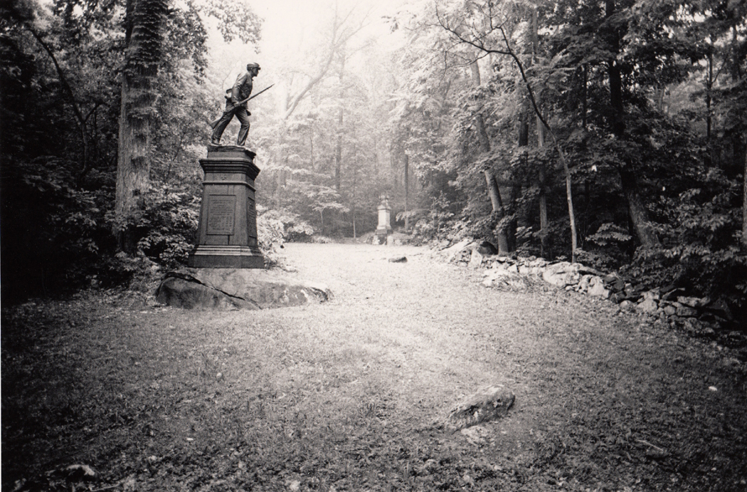
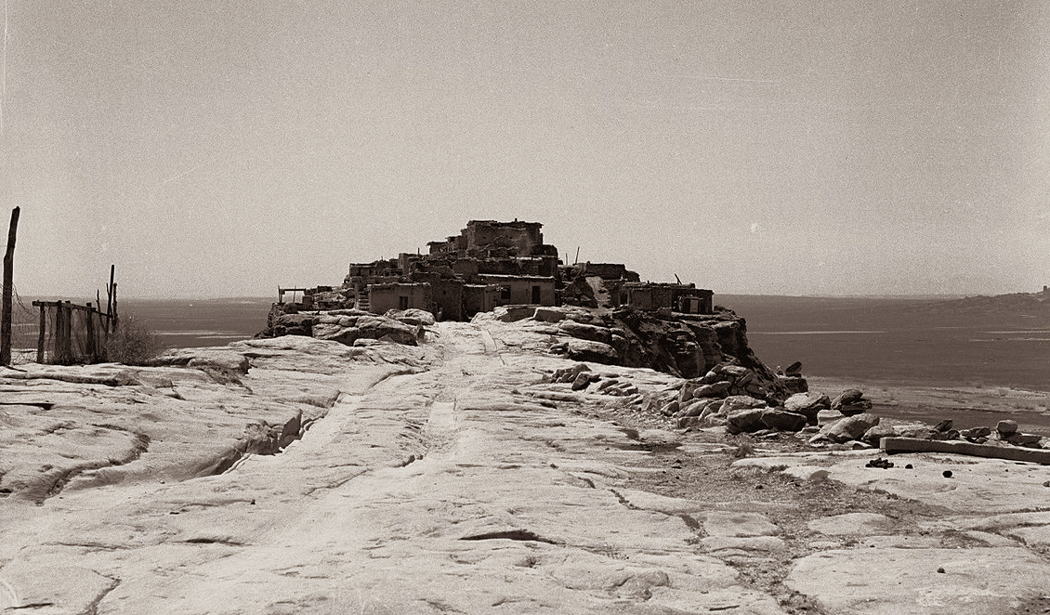
Archive

Tag Archives: travel

Walpi

Walpi

The best Christmas I ever had was the Christmas of four gifts.

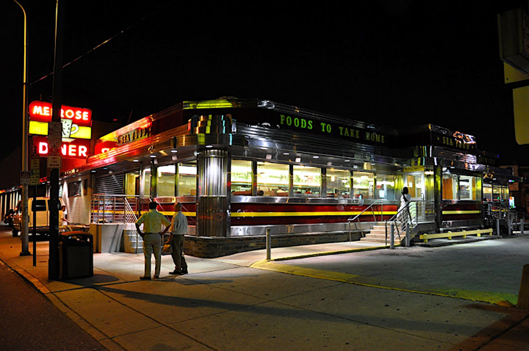
It happened on the Hopi Reservation a few years ago, when my wife and I left Phoenix because we just couldn’t take another holiday season under the palm trees.

Like many who lived in the desert, Carole and I grew up elsewhere, where Christmas meant freezing weather and the possibility of snow. Santa rides a sleigh, after all. But in Phoenix, Santa wears sunglasses. It just doesn’t seem right.

Not that we thought we’d find a traditional Christmas among the Hopi. Their traditions are rather different. But we thought we could at least escape the TV beer ads littered with reindeer and find something new outside the city where the backyard Christmas barbecue passes for holiday cheer.

Maybe we couldn’t have our old traditions, but we could start new ones.

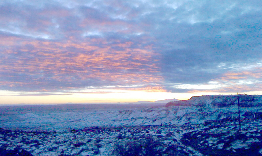
If the traffic and commotion of the city get on your nerves, no better tonic exists than a visit to the three great mesas of yellow-gray sandstone that rise like gigantic library lions from the vast plains of the Colorado Plateau. Atop them the Hopi have built most of their villages, all from the stone of the hills. crow mother

From the mesa-top the view is biblical: You can see for what seems forever. The San Francisco Peaks sit on the horizon, some 75 miles to the southwest, yet they seem so close you feel you can walk to them.

On that Christmas Day, the temperature was about 29 degrees and the sun was low and cold, poking through an intermittent overcast. We stopped at the base of First Mesa to get gas at the little store in Polacca. We also bought a few gifts — some coffee and sugar — to bring to the women on the mesa-top who give tours of the village.

When we got back in the car, we discovered the woman behind the counter had quietly dropped candy and fruit into the poke with our purchases.

That was the first gift.

WALKING INTO HISTORY

The highlight of a visit to the three villages atop First Mesa is a tour of Walpi. The Hopi have lived in the community on the prow of the mesa for at least 1,000 years and some of the stone homes seem to be almost that old.

You park your car in the middle village, Sichomovi, and find a tour guide in Ponsi Hall, the community center. From there, you walk out across the narrow stone causeway to Walpi. Our guide was a woman we had met on several previous visits to the area. She is a warm, generous woman who was free with her answers to our many questions. I will not embarrass her by printing her name. walpi homes

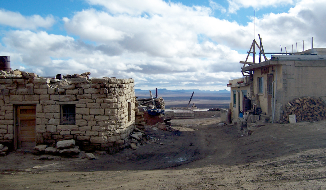
She showed us the ancient masonry, the village layout, the meaning of the kivas and their spindly ladders that protrude from the ground. She told us of the kachinas, of blue cornmeal and of pahoes , or prayer sticks, whose feathers danced in the breeze on the edge of the mesa.

She also told us of her life in San Diego and how after years away from the mesa, she felt drawn back to it. pot carrier

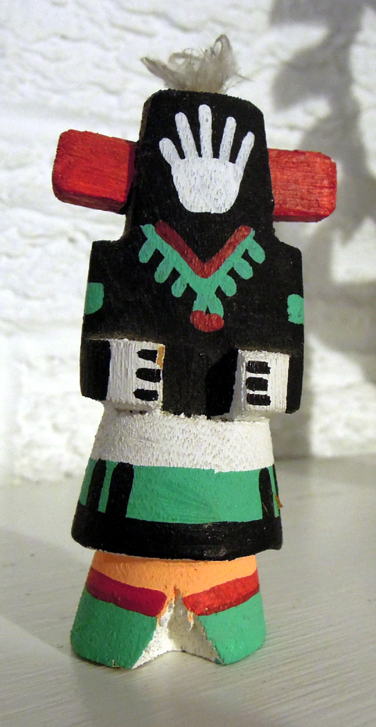
And she told us how, like many Hopi women of First Mesa, she makes pottery.

Unlike most, though, she doesn’t make bowls, but effigies of turtles.

”They are like the Hopi,” she said. ”They live a slow-paced life.”

At the highest point of Walpi we came to the home of her aunt, who is one of the better-known Hopi potters. The old woman and Carole hit it off perfectly. They seemed to speak the same language.

They talked for quite a while. At one point, Carole asked if she knew where we might buy some of the blue cornmeal we had seen all over the reservation, and the woman reached a brown paper bag down from a high shelf and gave it to Carole, with instructions for cooking Hu zru’ su ki , or fried blue-corn polenta.

And when we bought one of her bowls, she smiled and whispered something in Carole’s ear and sprinkled some corn pollen into the pot.

That was the second gift.

OFF THE USUAL TOUR

Then, on our swing around the north side of the mesa top, our guide stopped in front of one small, square building and invited us in. It was her home, and inside, her daughter was putting the final touches of frosting on a batch of Christmas cookies. Hopi pot 2

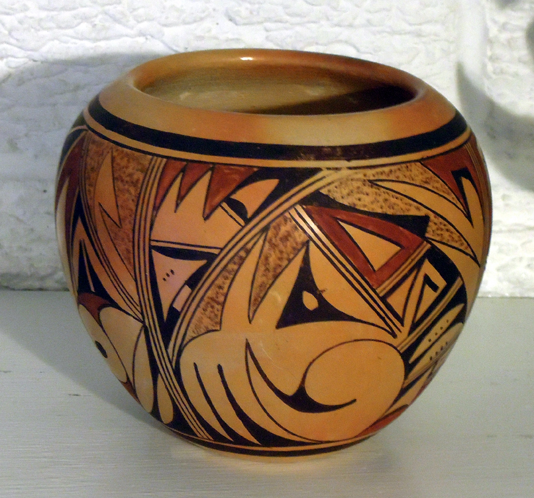
The small room, with its stone floor covered with small rugs, was a toasty 75 degrees, with a fire going in the woodstove and condensation beading on the icy window glass. The family was bustling around, with Uncle in the back room attaching some down to the end of a ”lightning stick” and two boys helping the daughter with the cookies the way youngsters always help — by eating them.

A narrow shelf ran around the top of the room, about a foot below the ceiling, holding a collection of kachina dolls, lightning sticks, a toy bow and arrow and pottery.

Our guide explained what they were and handed out cookies. They were angels, and they were the best Christmas cookies I’ve ever eaten.

That was the third gift.

So, it was Christmas Day in the gracious, generous Hopi home, spending the afternoon with the family of a woman we now consider a friend.

When we stepped back out into the cold to leave, snow was falling all over Hopiland.

And that was the fourth gift: the wonderful warmth of Christmas snow, dropping gently in large flakes, catching on our hair and coats.

So, I say on leaving the mesas in my best attempt at Hopi: Quo-Quai – Thank you.hopi snow

Conclusion: In which the mountains dip into the sea

St. Georges de Malbaie Gaspe

St. Georges de Malbaie Gaspe

The Gaspe Peninsula in southern Quebec sticks out beneath the mouth of the St. Lawrence Seaway like a pouting lower lip.

It juts into the Gulf of St. Lawrence, protected from the open Atlantic by Nova Scotia and Newfoundland. There it sits, home to cod fisherman and farmers and an increasing number of vacationers. gaspesie 5

The peninsula’s interior is wild and mountainous — the last hurrah for the Appalachian chain — but its perimeter is bucolic, with small, quiet villages, each with a church steeple at its center.

Between Matane, where the peninsula begins, and Cape Gaspe, where it ends 200 miles later, there are only two roads that cross the interior.

Chic-Choc mountains

Chic-Choc mountains

From north to south, the roads leave the St. Lawrence, climb the Notre Dame and Shickshock mountains (aka Chic-Choc, in the bilingual nation) and wander down the deep river valleys lined with pine, fir and birch, only to come out on the prairie-lined towns along the Baie des Chaleurs.

The spine of the Appalachians runs the length of the Gaspe and it finally dives under the salt water at Forillon National Park, only to churn up the water beyond land’s end in a series of offshore shoals before sinking down into the sea bottom.

That last flowering of the ancient mountain chain is a splendid one, as the rock hangs over the water in a scalloped series of cliffs, each with a small semicircle of beach under it. The beach is made up, though, not of sand, but of small, smooth lozenges of stone that hiss and rattle as the breakers foam through them.

Cap Bon Ami, Forillon National Park

Cap Bon Ami, Forillon National Park

Nor does the shore slope smoothly into the water. All along the water’s edge, there are upended strata of rock that make for good clambering. At Cap Bon Ami — named for an old sea captain who spelled his own name Bonamy, and not for the scouring powder — the park road ends and you begin to hike.

A short way downhill from the parking lot, there is an observation deck and a set of several hundred stairs down to the beach. From that point, you can see the whitish cliffs spreading out in both directions. Cormorants and sea gulls swoop around you. Behind you rises Mont St. Alban, the last high peak of the Appalachians, which isn’t even 1,000 feet above the sea.

And in front of you, the sea itself spreads out like a gleaming satin tablecloth, flat and rippling with the sheen of daylight.

This is the sea that Jacques Cartier saw in 1534 when he made his first voyage to the New World. The French explorer discovered the native peoples of the area and kidnapped two of them to take back to show off to the king. On his second voyage, Cartier did not stop at Gaspe. Perhaps he knew his welcome no longer would be warm.

Gaspesie

Gaspesie

The few hardy French pioneers who took to living in the ”Gaspesie,” as the area is called by Francophones, found their towns burned down in the first half of the 18th century, when the English attempted a takeover of the whole New World. The Acadians, as the local French were known, were arrested, deported or forgotten.

In the following years, wars in Europe and North America sent migrants to Gaspe. Among them were American Loyalists fleeing the American Revolution, Irish fleeing potato famine, and merchants and fishermen from the islands of Guernsey and Jersey.

They settled in a patchwork across the peninsula, leaving towns along the coast as ethnic enclaves. That is why, in this corner of the French-chauvinist province of Quebec, you find towns named New Carlisle, Chandler and Newport, where English is the predominant language.

Mont Louis

Mont Louis

The interaction of languages produced a few oddities: What originally had been ”Hunger Point” in French, or Pointe a la Faim, was translated by the English as Point Fame, which later was retranslated into French as the current Pointe a la Renommee.

What was once ”Grande Grave” — named for the type of pebble beach called grave in French — was pronounced ”Grand Grave” in English, like a burial plot. This then later was spelled in French as Grand Greve, to match the sound of the English.

Most who lived in the region became fishermen. In the 19th century, large fishing corporations set up and ran ”company towns” that abused their workers in the same manner as mine owners in West Virginia. The families always owed money to the company store. There was no money; debts were paid in dried codfish, which the companies shipped out and resold at good profit.

Those who were lucky enough to avoid the codfish treadmill turned to subsistence farming. A few became whalers.

Peggy's Cove

Peggy’s Cove

Such a life continued unchanged until the 1920s, when roads were built, a railroad came through, and mail-order catalogs appeared. Electricity showed up after World War II, and the area, once as remote as anything in North America, began joining the 20th century.

Today, the southern and northern rims of the peninsula are very different.

Along the southern shore the towns collect around river mouths, surrounded by prairies of long grass blowing in the almost-constant wind. The land is flat, but you can look inland to the mountains.

The north shore, though, is right up against the hills, which break off into the water in bright bluffs and craggy cliffs. The one road that manages to squirrel from town to town is constantly climbing steep slopes and dropping down to the town in the next hollow.

And although the southern shore is ethnically varied, the north is almost entirely French.

There are two towns of note: Perce and Gaspe, both at the sea-end of the peninsula.

Perce

Perce

Perce is a tiny resort town parked near Perce Rock, an offshore seastack with a hole eroded through it like a giant stony donut. The town is the closest thing the Gaspe has to a tourist trap and the road through town will slow you down in summer with traffic stopping for souvenir shops and fancy restaurants.

There are also boat trips available to the large Ile de Bonaventure, sitting just offshore and one of the great bird-watching spots in the world.

Gaspe, on the other hand, is a working town and capital of the region. It is not particularly scenic, with its banks and gas stations, but it sits near the head of Gaspe Bay, the small inlet that separates the Forillon Park from the rest of the peninsula. It is at Gaspe that Cartier first landed. A museum commemorates the event.

Forillon Nationa Park

Forillon Nationa Park

And it is at Gaspe that we met the woman who runs the bookstore called the Librairie Alpha on the town’s hillside among the narrow, gray streets. She lamented the passing of the old days, and more, the old winters.

”It snows quite a lot in Gaspe,” she said in heavily accented English. ”But it doesn’t snow like it used to 20 years ago.

”I don’t know what has happened, but it isn’t so deep as it was in my childhood.”

In the winter, the bay ices over. It freezes ”as far out as the horizon,” she said. It stays frozen from December to April and people go out on the ice and fish.

”But they aren’t really there for fish,” she said. ”They bring beer and have parties on the ice.

”It freezes down two meters.”

In the winter, an icebreaker sails up into town as far as the bridge, breaking up the ice, but in a week, it is solid again, she told us.

But it doesn’t snow like it used to.

”I remember my father telling us about the really deep snows and how the snow would be so deep that everyone in the village would slide down their own rooftops into the snow.”

She said she remembered doing that when she was a child, but except once, the snow doesn’t pile up to the eaves anymore.

”Two years ago, it snowed so much, I took my children up to the roof to slide down. They may never have that chance again.”


L’ENVOI

 house montage

Gaspe is the ”roof of the Appalachians.” It is the final glory of the mountain range that begins in Alabama and rises like a spine through the East.

It is also a place of roofs. The old houses with their clapboard siding and double-insulated windows sport shingles of many bright colors. There are some that are royal blue, others Kelly green. If there are no shingles, but a tin roof, it is painted. I saw one that was the color of lilacs. Orange and red are also popular. house 5

But it isn’t only the roofs. The houses themselves are often quite garish. One two-story house we passed in Grande Vallee was green on the bottom and pink on the top, with corner accents of opposing hues. house 1

There was a green barn in Perce that was the color of mint. Its owner must have had a little left over, because he painted only one face of his house, sitting next to the barn, with the same breath-mint shade. The other three sides of the house were a peeling white. house 8

There were yellow houses, purple houses, pink houses and orange ones. The shades of green were staggering, sometimes two shades on the same building. house 10

Not all houses were oddly colored; the majority remained white and their roofs remained black or gray. Yet enough houses were tarted up to prove that it is a folkway on the Gaspe. house 2

It is true, however, that the majority of garish houses were on the south shore of the peninsula. Once we hit the northern shore, the strange colors nearly disappeared. Only once or twice in each village would you find a tin roof painted sky blue or vermilion.

Part 5: In which we consider living in Maine

front door

Maine is poor and that makes it rich.

Compare it with suburban Massachusetts and you see the difference. In the hills around Boston, the old homes have added jalousie windows — large panes of plate glass — and behind them you can see a collection of things bought in antiques shops. Out front is a Volvo or a Beemer.

But in backwoods Maine, the same antiques have gathered dust in the old farmhouse since they were new. Out front is a rusted Chevrolet or a Ford pickup. Barn

The New England homes, with their thin clapboards, are thickly painted and repainted their chalky white, and the paint nevertheless peels back on the window trim, showing gray, weathered wood underneath. The foundations are wavy with age and the lines of clapboard match them, looking like uneven topographic lines of a map. Screen doors have holes; barn doors sag on their hinges. But it is the sagging of use, not of neglect. In Rumford Point, for instance, many homes proudly tell the date they were built. You see ”1762” on one door, ”1780” on another. On one small building, you see ”1964,” which is a joke. Lubec hillside

Along the Androscoggin River are tall-steepled churches left over from the middle of the past century, still with their signs out front: Services held 10:30 a.m. Sunday. House side

One of the characteristics you notice is that the farmhouses are connected to the barns by a covered series of adjacent outbuildings. The winters are so severe that no one wants to go outside to tend the livestock, so you pass from the kitchen to the garage to the toolshed to the barn, all in toasty comfort. Well, as toasty as you can be when the siding boards are as loose as lattice and don’t always come down to the dirt, leaving an ankle-high draft. Yellow house

There are scrollwork on the eaves, wide fans over the door transoms, white fences along the sidewalks and, even in midsummer, storm windows. For even in July, on a wet, rainy day, it can be a raw, humid 70 degrees and it gets into your joints, so you feel arthritic. Or perhaps they are needed for protection against mosquitoes as big as hailstones that gather in swarms in cool, muggy air. Maine Schoodic door

But the countryside is poor, or if not poor — because that brings to mind inner-city malnourishment and anomie — certainly not well-off. As in much of southern Appalachia, the poverty is misleading. The people own their homes, grow their own food, know their own land. There is a Yankee self-sufficiency that grows with the spartan winters, lack of amenities and isolation.

NEXT: The Appalachians enter Canada

Part 4: In which we enter the landscape of the mind

Sorrento dock

Each of the United States has its own flavor, its own existence as myth. It is the sense one has, if one does not live in that state, but imagines what it would be like to visit.

One imagines what Arizona must be like, with its cowboys and cactus, but the reality of Phoenix — “Cleveland in the Desert” — negates that myth. That is the nature of myth.

Some states have bigger personae. California, for instance, which existed as myth both for “Forty-Niners” and for Okies. Montana offers big skies and clean air. Oregon had its trail and Mississippi has its Yoknapatawpha County.

Texas claims for itself the largest myth, although it is hard to warrant such big ideas if you have actually been to Midland or Odessa. Texas is only big in hectares. Otherwise, it is the state of large hats as substitutes for small manhood.

Each state has its mythic presence, although it is hard to make the case for Delaware as anything but the “gateway to New Jersey,” and the Garden State gains any resonance it has only from Tony Soprano and Bruce Springsteen.

But one state led all the rest historically in this landscape of the mind, as a special place in the American imagination, a place you dream about when you think your daily life is too mundane.

Lubec

Lubec

Historically, the state that has had the longest claim on the American spirit is Maine, with its deep woods and rocky coast, its taciturn, independent people and its echoing loons. Maine is the original great escape, the place to go to return to nature and feel what it is like canoeing across a backwoods lake with a mist rising from the water.

Maine is the place Henry David Thoreau went when his Walden Pond seemed too citified. Maine is the place that dozens of American artists went to find some glimmer of inspiring wilderness.

It’s also the place the 19th-century robber barons went for summer vacations.

As America has expanded westward, Maine has lost some of its magic, but it is still a mythical place, drawing millions of visitors every year.

But there isn’t a single Maine. Regionally, there are at least four Maines.

The first is the southern coast, which first attracted a wealthy clientele a hundred years ago. This is where old money came for the summer. It is where former President George H.W. Bush had his place in Kennebunkport. It is also home to the new Yuppie tourism centers on Penobscot Bay, where you can always get a good brioche: Camden and Rockport. They are not much different, in their way, from Carmel, Calif., or Sedona, Ariz. — all trendy shops and new museums. You visit L.L. Bean in Freeport, and see a hundred other factory outlet stores.

Mooselookmeguntic Lake

Mooselookmeguntic Lake

Then, there is the mountainous Maine of the western part of the state with its thousand lakes, from Rangeley Lake to Mooselookmegunticook. This is the part of Maine famous for its out-of-place town names: Mexico, Norway, Paris. It is a place to go for fishing and camping or renting a cabin for a week.

The large northern part of the state is especially impressive. Vast tracts of woodland crisscrossed by narrow logging roads down which rumble the most frightening, earthshaking pulpwood trucks, piled high and tenuously with rattling bundles of spruce trunks. It is the north of Baxter State Park and Mount Katahdin. This is the Maine that Thoreau wrote about in his book, The Maine Woods. It is also the part of the state, on its eastern side, where they grow potatoes.Maine tree

But it is the fourth Maine that I love the most: the upper coast, from Mount Desert Island to the Canadian border.

This is Down East. It is the least touched by commercialism. It is still composed of blue-collar working towns where men go out to fish or pull lobsters from the rocky-bottomed sea. It is old wooden houses on granite foundations and cars rusted out from wet, salty winters.

Otter Cove, Acadia NP

Otter Cove, Acadia NP

It is called Down East because when 19th-century sailing packets traveled up the coast from Boston, they sailed downwind, with the prevailing breezes abaft. Back then, Maine was still part of Massachusetts. Maine owes its statehood to slavery: The Missouri Compromise of 1820 let the slave state Missouri enter the union, but separated Maine from Massachusetts and entered it as a state at the same time to keep a balance of free and slave states in Congress.

The coast of Maine is about 250 miles long, as the crow flies, but it must have been a very drunken crow that first flew the distance. With all the bays and headlands, the actual distance of that zig-zag coastline is closer to 3,000 miles. And that’s not counting the islands, thousands of them.

Mount Desert Island is the largest of them. It is properly pronounced Mount “Dessert,” as if it were filled with chocolate moose, but most people just call it MDI and be done with it. MDI is the home of Acadia National Park, one of the most beautiful in America.

Monument Cove, Acadia NP

Monument Cove, Acadia NP

It is also the home of Bar Harbor, one of the most congested towns. In the summer, Bar Harbor is a vacation nightmare, with no parking, crowded restaurants and no room at the inn.

Acadia National Park covers about half the island and includes Cadillac Mountain, the tallest mountain on the East Coast north of Rio de Janeiro. At 1,530 feet, it catches the first rays of sunlight to hit the U.S. each day.

A road to the top provides splendid views.

But it is the view of Cadillac Mountain, rather than the view from it that is best. And the best views are from the coast roads that continue farther down east.

The real Down East begins beyond MDI. From Ellsworth — which may look like one unending K mart and KFC — you drive east and north on U.S. 1 and you leave all the tourists and development behind.

Fox Lake

Fox Lake

The towns you pass are small and picturesque: Sullivan, Gouldsboro, Sorrento, Winter Harbor, Jonesport. You see tall church steeples and town squares with bronze statues of World War I soldiers.

This is Maine for the traveler rather than the tourist. You won’t find many fancy restaurants, and the motels are all low-dollar. Look instead for breakfast in the local lunch counter with the lobstermen. There are no “destination locations.” You have to be interested in the place for itself, and not for an amusement park.

If you are looking to get away from it all, Down East is the definition of the phrase.

Machias

Machias

There are mountains to be climbed, woods to be hiked, lakes to be canoed. There are heaths to be gleaned of their blueberries and birds to scout out and listen to.

Blueberry heath

Blueberry heath

If you hike in the woods behind Sullivan, off Taunton Bay, you will find the abandoned granite quarries that used to provide curbstones for the cities of the East Coast.

Climb 1,069-foot Schoodic Mountain for the panoramic view. Or if that is too high, try 397-foot Tucker Mountain. A walk through the birches and alders will bring you to a splendid view of Frenchman Bay and Cadillac Mountain.

Schoodic Point, Acadia NP

Schoodic Point, Acadia NP

From Gouldsboro, head south to Schoodic Point, which is part of Acadia, but without the crowds. The waves boom on the rocks and a cold ocean separates you from Cadillac in the west. If there is one perfect place to visit Down East, Schoodic Point is it.

Quoddy Head Lighthouse

Quoddy Head Lighthouse

Or take the narrow road south of Lubec and you will come to the West Quoddy Head lighthouse, the easternmost point in the U.S. Out on the horizon you will see Canada’s Grand Manan Island. It might as well be China.

Take a look at any map of the eastern bump of Maine and see how the web of roads thin out. Hancock and Washington counties are nearly unpaved. It is empty. It is beautiful. It is the real Maine.

NEXT: Maine redux

Part 3: In which a previous president gets some work done

plymouth notch

As in the rest of the country, the modern world of CVS pharmacies, Burger Kings and Pep Boys has superseded the old neighborhood stores and previous ways of life in New England. Vermont has pushed back more than other states, but life is modernizing there, too.

Silent Cal

Silent Cal

But if you want to find out what old country life was really like, the best place to get a hint is at the Calvin Coolidge State Historic Site in Plymouth Notch. There, you can see the house where the taciturn and much-maligned 30th president was born, and a second where he grew up. You also can see the giant woodshed needed to keep the house marginally above freezing in the winter; you can see the two-hole privy and the smelly kerosene lanterns.

For Calvin Coolidge grew up in old country Vermont. It was hard work, and there were no potpourris nestled in the corner with the perfumed smell of herbs and spices. The smell of the house must have been a little closer to horse manure, which was collected in the stable — attached to the house like a modern-day garage — and was shoveled through a trapdoor to a collection pit under the house. coolidge 14

His quilt didn’t have cute children printed on it. In fact, when he was 10 years old, Coolidge made a quilt for himself. It is a very good quilt, too. Old Cal was pretty good with his hands. In his house, there is a chest of drawers he made when he was a little older. He would have been a right good carpenter if he had chosen that line of work.

”After the winter work of laying in a supply of wood had been done,” Coolidge wrote in his autobiography, ”the farm year began about the first of April with the opening of the maple-sugar season. This was the most interesting of all the farm operations to me.”

In a good season, they processed as much as a ton of maple syrup. But that is not all. ”After that, the fences had to be repaired where they had been broken down by the snow, the cattle turned out to pasture, and the spring planting done. Then came sheep-shearing time, which was followed by getting in the hay, harvesting and threshing of the grain, cutting and husking the corn, digging the potatoes and picking the apples. Just before Thanksgiving, the poultry had to be dressed for market, and a little later, the fattened hogs were butchered and the meat salted down. Early in the winter, a beef creature was slaughtered.

Coolidge works the horses

Coolidge works the horses

”The work of the farm was done by the oxen, except running the mowing machine and horse rake. I early learned to drive oxen and used to plow with them alone when I was 12 years old. Of course, there was the constant care of the domestic animals, the milking of the cows and taking them to and from pasture, which was especially my responsibility.”

And all around the village of Plymouth Notch, maintained as a state park, you can see the results of that self-reliance, which is the hallmark of the mountain population. coolidge 6

You can see the dark room where Coolidge, then vice president, learned of Warren Harding’s death. Coolidge’s father, a notary public, swore his son in as president using the oath Calvin had typed out on the family typewriter.

Asked how he knew he could swear in his son, old Col. Coolidge said, ”I didn’t know I couldn’t.”

NEXT: Remembering Maine

Part 2: In which certain suggestions are made

Kancamagus Highway

Kancamagus Highway

One of the best ways to see the wild parts of New England is via the Kancamagus Highway, which runs between Lincoln and Conway, N.H. Along its 35 miles, you pass white-water rivers, towering granite and long views from the mountain passes.

The road, which was opened only in 1968, climbs from the Pemigewasset River to Kancamagus Pass, crossing the crest at 2,850 feet and following the Swift River down the other side.

Rocky Gorge on the Swift River

Rocky Gorge on the Swift River

Near the Bear Notch Road turnoff is the Passaconaway Historic Site, with a nature center and summer demonstrations by craft workers in period costume. In the Rocky Gorge Scenic Area are waterfalls, hiking paths and camping in the Covered Bridge Campground.

But it isn’t the only road worth taking. The road up Mount Washington is a thrill ride of declivities and chasms, bound together with the coil of roadway.

To be sure, there are three choices for getting up Mount Washington.

Appalachian Trail, Presidential Range

Appalachian Trail, Presidential Range

The first is to climb on foot; the Appalachian Trail winds up the rocky slopes, but it is probably too strenuous for most visitors.

Mt. Washington Auto Road, with cog railway tracks in foreground.

Mt. Washington Auto Road, with cog railway tracks in foreground.

The second choice is to drive up the Mount Washington Auto Road, opened in 1861. It is a harem-scarem eight-mile drive that averages 12 percent grades and snakes around hairpin turns, and when you get back down, you probably will buy the popular bumper sticker that reads ”I survived the Mt. Washington Auto Road.” cog railway

The easiest way up is the Mount Washington Cog Railway, which climbs the other side of the mountain from Crawford Notch. The 3 1/2-mile trip, which climbs grades up to 37 percent, takes a little longer, but is great fun.

Both road and rail have what may seem ”steep” admission prices.

The New England states are small, but each offers something for the traveler.

In Vermont, the countryside itself is reason to visit, and just about anywhere you go is scenic, though more gentle than New Hampshire. Popular tourist stops include Queechee Gorge, Woodstock and Weston, all of which are filled with places to separate the tourist from his money.

Ben and Jerry factory

Ben and Jerry factory

For some people, the most magnetic draw of the state will be Ben and Jerry’s Ice Cream Factory in Waterbury, with half-hour tours and samples. It is now the No. 1 tourist attraction in the state.

The Massachusetts portion of the Appalachians highlights Mount Greylock and the Berkshires. But there is also historic Stockbridge and its Norman Rockwell Museum — and, if you can find it, the former Alice’s Restaurant.

Arrowhead

Arrowhead

Author Herman Melville wrote several short stories about the Berkshire Mountains, and you can visit his home, Arrowhead, in Pittsfield, where his notorious “piazza” on the north side of his home, looks out on Mt. Greylock — “Charlemagne among his peers.”

And in Maine, Baxter State Park is a treasure. A few nights in a wood-heated cabin beside Daicey Pond, under the shadow of Mount Katahdin, will fix what ails you and set the universe right.

Reich Museum

Reich Museum

But if that doesn’t work, try the Wilhelm Reich Museum, in Rangely, which its tenant called his ”Orgone Energy Observatory.” In a nutshell, so to speak, Reich believed that you could use great sex to make it rain.

NEXT: Cool Calvin Coolidge

Part 1: Bad weather and Longinus

Mt. Washington

Mt. Washington

It is not at all unusual to drive past the most imposing mountains in the East and not even see them.

The White Mountains of New Hampshire may not be taller than those in the Smokies down South, but because they are so much farther north, their tops bust through the tree line and leave their summits raw with rock. They are craggy and wild.

Between Mt. Washington and Mt. Clay

Between Mt. Washington and Mt. Clay

But the weather can hide them in swirling mists and all you see is a whitish, nebulous screen blotting out the roadsides as you drive past.

The northern Appalachians strive to reach the Whites, beginning with the low Litchfield Hills in Connecticut that grow into the Berkshires in Massachusetts and the Green Mountains of Vermont. The White Mountains cap this part of the cordillera, climaxed with the Presidential Range in northern New Hampshire and its imposing Mount Washington, which, at 6,288 feet, is the highest peak in the Northeast.

It is an impressive sight, if you are lucky enough to see it.

But Mount Washington’s other claim to fame is that it suffers the worst weather in the world outside the polar regions — at least the worst weather reported by an official weather station. mt washington chained building

On April 12, 1934, the wind spat across the top of the mountain at 231 mph, the highest wind speed ever recorded on this planet. That’s about a third the velocity of a shotgun blast. Winds in excess of 100 mph are not uncommon, and there are fog and mist at the summit at least part of 300 days every year.

The building at the summit has to be held down with guy wires.

And then there are the snow and ice. Most of the annual 70 inches of precipitation comes in the form of snow. But this whiteout isn’t unique to Mount Washington. Other mountains also hide in the clouds.

When Henry David Thoreau climbed Mount Katahdin, which rises 5,267 feet above sea level in Maine, he faced more winds and mist.

”It was like sitting in a chimney and waiting for the smoke to blow away,” he wrote in his book The Maine Woods. ”It was, in fact, a cloud factory.

”Occasionally, when the windy columns broke in to me, I caught sight of a dark, damp crag to the right or left, the mist driving ceaselessly between it and me. It reminded me of the creations of the old epic and dramatic poets, of Atlas, Vulcan, the Cyclops, and Prometheus. Such was Caucasus and the rock where Prometheus was bound.”

"Crawford Notch" by Thomas Cole

“Crawford Notch” by Thomas Cole

One can see the weather in the painting by the great 19th-century American artist Thomas Cole, whose Crawford Notch captures the mizzly scene: A mountain on the left is obscured in scud; on the right, sunlight glows from the opposing crest. At the bottom of the valley, a horseman heads for a log cabin.

The painting, at the National Gallery in Washington, D.C., looks as wild and Romantic as it sounds. You certainly don’t believe for a moment that Cole has not exaggerated the effect to make a more dramatic painting. But I’ve driven through Crawford Notch, a valley just south of Mount Washington, and seen the same blowing clouds, sweeping from the peaks on my left to those on my right.

The northerly end of the Appalachians is less populated than the southern or central parts. There are more animals, and it is not that unusual to see moose wandering the roadsides. Loons swim in the lakes, and black bears rummage through the woody underbrush.

Lake Ambejejus, Maine

Lake Ambejejus, Maine

As the mountains hunker down again north of the Whites, their loss of altitude is made up for in the profusion of lakes. Western Maine is as wet as Minnesota, and as good for canoeing. The lakes have long, difficult Indian names, such as Mooselookmegunticook, Apmogenegamook, Nesowadnehunk and Ambajejus. Such names are a linguistic wilderness all their own.

Mt. Katahdin

Mt. Katahdin

But in Baxter State Park, the land rises high once again, reaching its peak at Katahdin, a monadnock, or mountain remaining after erosion has washed away the rest of the range. Katahdin can be seen from Interstate 95, 30 miles away, rising above the green-treed plain.

At least, when the weather is clear.

NEXT: Kancamagus Highway

 Part 3: A chance to pull overroadside america exterior


The central Appalachians — through Pennsylvania, New Jersey and New York — is the natal home of the cheesy roadside attraction. Many are now gone, but many also remain, often looking cheesier and more shopworn than ever. The Catskill Game Farm is no longer there, but Santa’s Workshop is still going strong.

They are also home to many early resorts and vacation hotels, pitched on mountain ranges not far outside the cities of Philadelphia or New York, where urban dwellers could spend a week or two breathing healthy mountain air — the Poconos or the Catskills.

And hikers can follow trails through the many state parks, or the long Appalachian Trail, which courses through the three states, weaving a path that avoids urbia and suburbia and finds the long, bent ridge lines of the breadloaf mountains.

Roadside America

Roadside America

This section of the Appalachians is the most highly populated, but there are still bits of woods and rock. But that population also meant it was economically feasible to build those legendary roadside attractions — Crystal Caves and Frontier Towns — that once punctuated the now-forlorn backroads and highways.

The quintessential tourist mecca is Roadside America in Shartlesville. It is a model-train layout the size of a department store. Opened in 1941, the exhibit is run by the descendants of its creator. Stay for the simulation of night, when all of the buildings light up and Kate Smith sings God Bless America while a spotlight shines on the Statue of Liberty. roadside america 4

Not much can live up to that. But there is the Sturgis Pretzel House in Lititz, which is the nation’s oldest operating pretzel factory, where you can learn the craft.

Also in Lititz are the Wilbur Chocolate factory and the Heritage Map Museum. wilbur chocolate facade

In nearby Ephrata is the Ephrata Cloister, which has a dozen well-preserved 250-year-old wooden buildings, including dormitories for the communal society of religiously celibate German Pietists.

In York, in the heart of Pennsylvania Dutch country, you can visit the Weightlifting and Softball Hall of Fame and the Harley-Davidson assembly plant and museum.

In Columbia, there is the Watch and Clock Museum, and Meadeville is the ”birthplace of the zipper.”

And near Harrisburg, Three Mile Island and its remaining nuclear power plant is on the Susquehanna River. Gettysburg, Pa copy

More serious sites include Gettysburg National Military Park in Gettysburg and the Johnstown Flood National Memorial near Johnstown, where the National Park Service is showing its version of an Imax-style film with stunning special effects re-creating the devastating 1889 flood that killed more than 2,000 people.

Only a slice of the Appalachians cuts through New Jersey. The most important stop is the Delaware Water Gap National Recreation Area along the Delaware River. There are some exhibits, 200 miles of roads through the mountain country and uncounted hiking paths. high point state park

High Point State Park is the highest point in the state. Both it and the Water Gap include portions of the Appalachian Trail, the 2,000-mile footpath that runs along the Appalachian crest from Georgia to Maine.

The rest of New Jersey’s mountains are kind of pathetic: The Watchung Mountains in the center of the state peak out at 879 feet above sea level.

Kaaterskill Falls

Kaaterskill Falls

But New York, home to the Catskills and the Adirondacks, is one of the champions of roadside kitsch. There are dinosaurs, giant lumberjacks, recreated 19th century villages and Niagara Falls — the granddaddy of all vacation (and honeymoon) hucksterism.

Santa’s Workshop in North Pole, N.Y., is called the oldest theme park in the U.S. It opened in 1949 and used to have a petting zoo. There are dozens of Santalands and Christmas villages around the country, but this one, in northern New York, was the first, and it still gives an idea of the old-fashioned roadside attraction that has been eaten up by the Disney Worlds and Five Flags of the world.

Washington Irving wrote about the Dutch settlers of the Hudson Valley in such stories as The Legend of Sleepy Hollow and Rip Van Winkle. His estate in Tarrytown is called Sunnyside and is a delightful look at life in the early part of the last century.

Sunnyside

Sunnyside

A little farther north and on the other side of the river are Harriman and Bear Mountain state parks. Seven Lakes Drive takes you through the crisp lake country of Harriman, and Perkins Drive takes you to the summit of Bear Mountain, where, on a clear day, you can see as far as Manhattan.

Just north of Bear Mountain Bridge is the National Military Academy at West Point, with its parade grounds, faux medieval architecture and stunning view of the Hudson River and Storm King Mountain.

And naturalist John Burroughs’ birthplace and final home are commemorated in the John Burroughs Memorial Field, near Roxbury. On the way, don’t miss Kaaterskill Falls, one of the most famous and oft-painted waterfalls in the country.

John Burroughs' Woodchuck Lodge, Roxbury, NY

John Burroughs’ Woodchuck Lodge, Roxbury, NY

And in Cooperstown, there is not only the Baseball Hall of Fame, but Fenimore House, the home of James Fenimore Cooper, best known as the man who invented John Wayne — aka Leatherstocking, Hawkeye, the Pathfinder and Natty Bumppo — and the Farmer’s Museum and Village Crossroads, home to the Cardiff Giant, greatest archaeological hoax of all time. cardiff giant recumbent

NEXT: New England Appalachians

Part 2: In which the lucky reader gets to eat pie

29 Diner

Central Appalachia is the home of the stainless-steel restaurant.

Built of sparkling glass, steel and neon, these old diners are beacons from America’s earlier decades, of a time when all highways had two lanes and to eat out meant a ”blue plate special.”

These days, there are a lot of ”Postmodern” diners around the country, with cute names such as the Five and Diner or the Road Kill Cafe, but they are not really diners. They play doo-wop music on the jukebox, often have young gum-chewing waitresses, menus written with cloying puns and lots of atmospherically campy Hollywood publicity photos on the wall.

But they are not really diners. They are theme parks. Those who eat there are more likely yuppies than truck drivers. bendix diner

The real thing is not nearly so self-conscious. Pennsylvania, New Jersey and southern New York are their natural environment. You find the real thing huddling along the sides of old U.S. highway routes.

The real things were establishments where you could get a ”regular” meal at an inexpensive price. Meatloaf, mashed potatoes and gravy were the norm, or ham with a ring of canned pineapple on top, or roast beef topped with the same brown gravy you found on the meatloaf. Ethnic food meant spaghetti.

Haute cuisine it was not, but it was filling. Wellsboro Diner interior

Or is — the diners still exist, although not as common as they once were, now replaced by burger and fried-chicken franchises.

The real diner doesn’t usually have young fresh-faced waitresses in pink skirts and cute white hats. Instead, you more likely will be served by a wrinkled, gravel-voiced waitress who has served meatloaf to truckers for 30 years.

There is no glamour in real diners. They are noisy, smoky and busy. The pie is good and is often baked on the premises. The coffee is good if you are lucky. If you are not, it will be able to etch glass, and in the bottom of the Syracuse stoneware cup, you will find a layer of sediment to chew on, that will keep you awake for three weeks into Tuesday.

The heyday of the diner stretched from the late 1930s into the ’60s. The earliest prefabricated diners were of porcelain enamel rather than steel. The smooth, pearly colors in panels along the side imitated the look of railway cars, leading many people to believe that diners were adapted railroad dining cars. They were not.

They were built in factories, such as the Jerry O. Mahoney Co. of Bayonne, N.J., or the Kullman Dining Car Co. of Harrison, N.J. Assembled in the factory, they were pulled into pieces and trucked to the site and reassembled by a factory team.

Their construction made them easy to move later on, if the owner thought a new location meant better business. serros diner vintage

Serro’s Diner, a famous old place in Irwin, Pa., cost $23,000 when it was built in the 1950s. The original building later was moved to Butler, Pa., where it was renamed Morgan’s Eastland Diner. The Serro family bought a new diner in Irwin. serros diner postcard

Such stories are common in the diner world.

Less common is the alternate spelling of ”diner.” In northwestern Pennsylvania, with a spillover into Ohio and West Virginia, the word often is spelled ”dinor.” Park Dinor Lawrence Twp PA

The food is the same, however. Some diner specialties are not likely to win the American Heart Association seal of approval.

You can find fried krautcakes, scrapple and fried eggs, chicken and waffles, fried sticky buns and ”Texas Tommies,” which are hot dogs split longways, stuffed with American cheese and wrapped shut with bacon and then deep-fried. cherry pie

But the signature of most diners is their pie. Apple, lemon meringue, coconut cream, rhubarb, cherry, strawberry, shoofly, pecan, sweet potato, Key lime, lemon chess, mincemeat, banana cream, pumpkin — even grasshopper pie.

And they sit in glass cases, lighted like jewelry under the cash register, or in revolving plexiglass towers. pie tower

Some diners, such as the Melrose in Philadelphia, became so famous for their pies that they built full-scale bakeries on the back of the building. melrose diner, philly

So, after you’ve eaten your pot roast, stay and have a slice of pie with a cup of coffee before setting out on the highway again. It’ll put you in the mood.

NEXT: Roadside attractions

Part 1: In which the mountains change character

Bear Mountain Bridge, Hudson River

Bear Mountain Bridge, Hudson River

If you look at a map of Pennsylvania, you will notice that all roads through the central part of the state seem to travel in long parallel curves, sweeping like lines of marching soldiers taking a ”column right.” eastern pa map

In few places in the country do the road maps so accurately reflect the topography: Those highways follow the valleys between the Appalachian ridges that bend through the state. One ridge lies behind another, lined up like so many pleats in a curtain.

The high, wild Appalachians of the South give way to the rural hillsides of Pennsylvania, New Jersey and New York.

The central Appalachians are even pronounced differently. In the South, the middle syllable rhymes with the ”a” of ”apple;” in the North, the ”a” becomes long and rhymes with ”hey,” a word you will hear with increasing frequency the closer you draw to Philadelphia. harvestore silo and barn

So, as the ”Apple-LATCH-ins” give way to the ”Apple-LAY-chins,” the whole character of the land changes. Hardscrabble family farms give way to large dairies. Small gray weatherboard barns give way to large red barns with blue Harvestore silos. Tobacco gives way to coal mining and steel mills.

Finally, as you travel north and east near Philadelphia and New York, the land becomes suburban.

The roads do manage to cross the ridges occasionally, although something as big as the Pennsylvania Turnpike finds it easier to tunnel under Tuscarora and Blue mountains on its way to the flatter eastern portion of the state.

What is more surprising is that at least three major rivers cut through the mountains, too.

Susquehanna River

Susquehanna River

The Susquehanna and Delaware rivers in Pennsylvania slice through them in what are called water gaps. The most famous of these, the Delaware Water Gap, knifes through the Kittatinny Ridge and divides its Pennsylvania and New Jersey halves.

Old post card

Old post card

And in New York, the Hudson River cuts through the Ramapo and Catskill mountains as it drops south from Albany to Manhattan.

These rivers helped create the history of the area, providing routes for early settlers to cross the difficult mountains.

Most famous among the early settlers are the Pennsylvania Dutch peoples of Lancaster and York counties — although you will find them north well into the mountains. Among them are the Amish and Mennonite ”Plain People” of the popular imagination.

They were German immigrants who began coming to the religious-tolerant commonwealth in the 1600s. Others were Swiss, and French Huguenots.

The Pennsylvania Dutch, though, were not Dutch. They were mostly German, and the German word for themselves, ”Deutsch,” was mistranslated.

By 1790, they made up a third of the state’s population.

But there were many real Dutch immigrants up the Hudson River Valley. Their influence is found in such names as Yonkers, Peekskill, Staatsburg and the Catskills.

Catskill Mountains and Hudson River

Catskill Mountains and Hudson River

All through the region you can find the influence of ethnic groups unheard of in the more culturally uniform Southern mountains: There are Irish, Italian, Spanish and Jewish enclaves in the mountains. It is in the Catskills of New York that the famous ”Borscht Belt” of Jewish resorts gave rise to a whole generation of stand-up comics. Does the name Shecky Greene ring a bell?

Shecky Greene

Shecky Greene

What may be surprising, though, is how much nature there is surviving in the central Appalachians. So close to Pittsburgh, Philadelphia and New York City, there are still forest and wild lands.

You can find much of this along the Appalachian Trail as it curls through the region.

The footpath, which begins in Georgia and ends in Maine, enters Pennsylvania near Gettysburg, climbing through the Michaux State Forest and along the ridge of South Mountain. Geologically speaking, this is the northernmost tip of the Blue Ridge. Snowy Mountain, Mount Alto and Pleasant Peak are all just about 2,000 feet high.

Devil's Den, Gettysburg, Penn.

Devil’s Den, Gettysburg, Penn.

The trail crosses the Susquehanna just north of Harrisburg and climbs along Blue Mountain, the largest of the parallel ridges.

Big Mountain, Penn.

Big Mountain, Penn.

There it passes Hawk Mountain Sanctuary, where geology and prevailing winds create a perfect spot to view migrating birds, and especially a series of birds of prey, including Cooper’s, sharp-shinned, red-tailed and red-shouldered hawks and bald eagles.

On the ridge, at about 1,500 feet, you can see the quilt of farms and forests that spread out in the valleys below. The gray Tuscarora sandstone is tumbled about the peak, covered by patches of green lichen.

Past the resort-area Poconos, the trail follows the Kittatinny Ridge to the Delaware Water Gap and on into New Jersey, following the wooded northwestern edge of that state past long, clear lakes and Boy Scout summer camps to High Point State Park, at 1,800 feet the highest elevation in the state.

The trail loops to the southeast for a short bit before heading north into New York near Greenwood Lake.

There, it follows the Ramapo Mountain into Harriman and Bear Mountain state parks, finally crossing the Hudson River on the Bear Mountain Bridge before heading north again, across the Taconic Mountains and into New England. Hudson panorama

At the bridge, the Appalachian Trail is only 35 miles north of Manhattan and only about 100 feet above sea level.

The woods along the trail are increasingly littered with boulders — chunks of granite or sandstone torn from the bedrock by the continental glaciers of 18,000 years ago. It makes for a beautiful woodland vista, but it is hell for farming.

Storm King Mountain, Hudson River

Storm King Mountain, Hudson River

And unlike the woodlands in the South, cluttered with undergrowth, the woods of Pennsylvania and New York are easy to traipse through. There are rocks underfoot, but not a lot of shrubbery. You step through a cushion of rotting leaves, brown and soft to the sole of your shoe.

It is true that the central Appalachians are less distinctively mountains than their brothers to north and south. They often feel more like hills. Yet the farther you manage to find yourself from the population centers, the more you will uncover the familiar Appalachian culture.

In the plateaus south and east of Pittsburgh, for instance, you still can be eyed suspiciously by a farmer who wonders why you are taking a photograph of his farm. If you hear him talk, you still will hear the short syllables and clipped speech of the mountaineer. You will find homesteads with kitchen gardens and men on autumn weekends walking the gravel back roads with their sons, shotguns slung middle-broke over their shoulders and the two in matching red plaid coats, out for a bit of hunting, hoping perhaps to scare up a turkey.

NEXT: Home of the diner