Archive

Tag Archives: california

I have lived in the four corners of the U.S. Born in the Northeast, I went to college in the Southeast, later moved to the Pacific Northwest and for 25 years, lived in the desert Southwest. I found value and pleasure in each region. 

But having moved back to North Carolina after so many years in Arizona, I am having lurching pangs from missing the West. I cannot deny that when I lived in Seattle, I had similar pangs about the South — I missed the tremendous variety of plant life when faced with forest consisting of nothing but Douglas fir and western redcedar. Hundreds of miles of Douglas fir and western redcedar. Where were the dogwoods, the sweetgums, the witch hazel, the sassafras, the red maple, canoe birch, beech, elm, oak? 

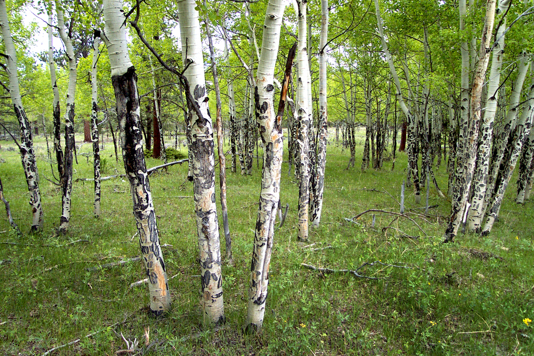
Aspens, Rocky Mountain National Park, Colo.

And so, I moved back to the East and back to North Carolina, where I had by then spent the largest portion of my life. I met my wife there and some years later, we moved to Phoenix, Ariz., where she got a job teaching and I found my life’s work writing for the newspaper. For the paper, I did a lot of traveling, and visited every state west of the Mississippi to write art and/or travel stories. It is always a pleasure to travel on someone else’s dollar. 

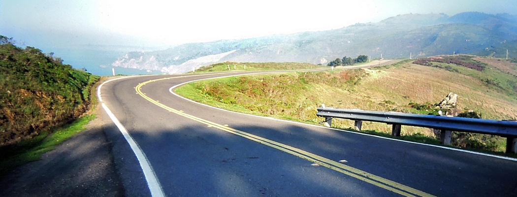
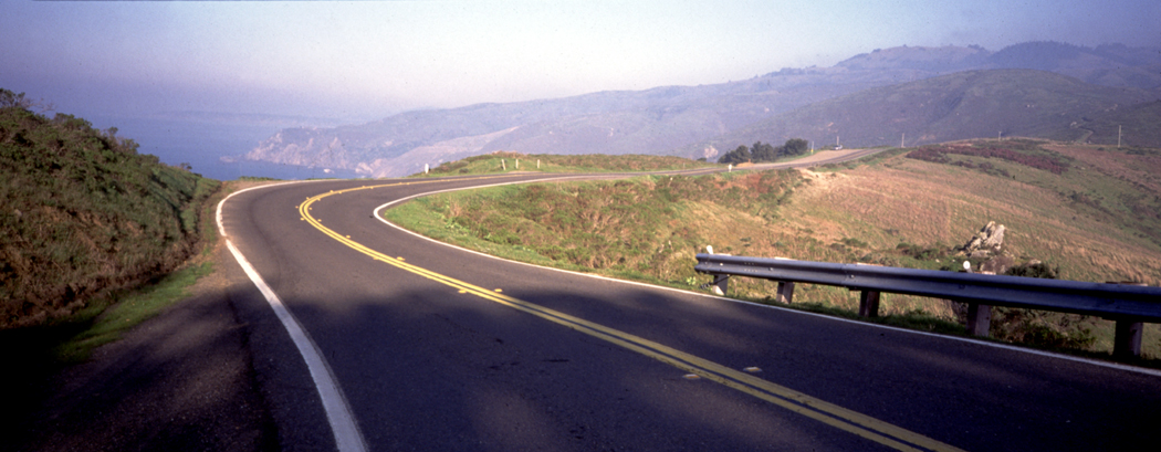
Pacific Coast Highway, Marin County, Calif.

After retirement, we moved back to the mountains of North Carolina, which I love. But I have to admit a nagging desire to spend time again in the desert, on the Colorado Plateau, driving up the coast of California, or revisiting the less glamorous portions of Los Angeles. The American West has wormed itself into my psyche and I feel almost as if some part of it has been amputated and I’m now feeling “phantom pain” or at least pangs in the missing limb. 

It is not the idea of the West that I harbor. The idea has been around since before Columbus thought to sail west to find the East. It was there for Leif Erickson; it was there for the Phoenicians; and before that for the Indo-Europeans. It was the idea that grabbed the early American colonists who saw the trans-Appalachian lands and envied their possession.

The West of the mind is a West of infinite possibility, of clean slate and fresh start, of fantastic riches to be had, of prelapsarian goodness. People emigrated to the West for a better life and a quarter-section. 
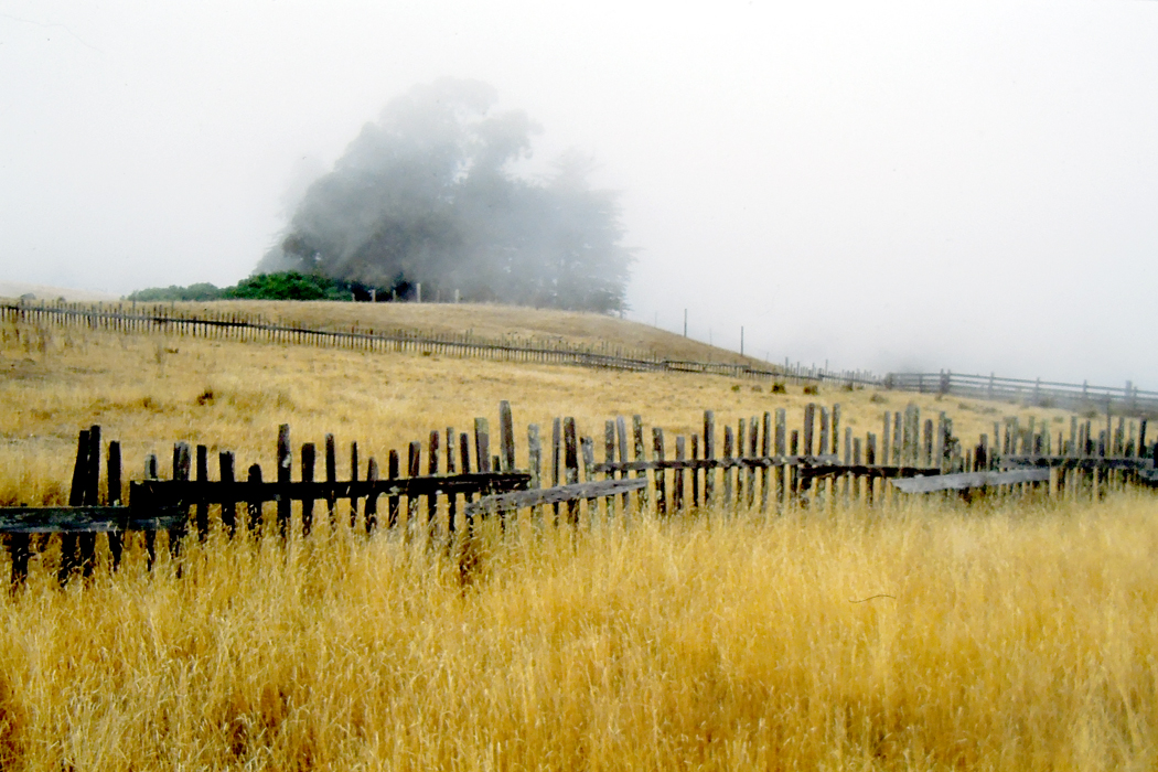
Fort Bragg, Calif.

The reality, of course, is something different: not enough rain for crops, prairie fires and tornadoes, mountain ranges nearly impossible to cross. And an indigenous people we first needed to wipe out and then mythologize into something noble and vanishing — as if the erasure had happened on its own. 

The Greeks had the Iliad and the Odyssey; we had our two epics: First, the Civil War, which is our battle epic, and then the wandering to find a new home in our Westward expansion, our odyssey. We made movie stars of our cowboys. The West of the movies is scenic and immaculate. It is a cinemascope landscape. 

But that isn’t the West I miss. The West I knew isn’t pristine; it is dusty, dry, spackled with convenience stores and gas stations, and getting hotter every year. It is even boring: If you’ve ever driven across Wyoming, you know what I mean. It has been described as “miles and miles of miles and miles.” 

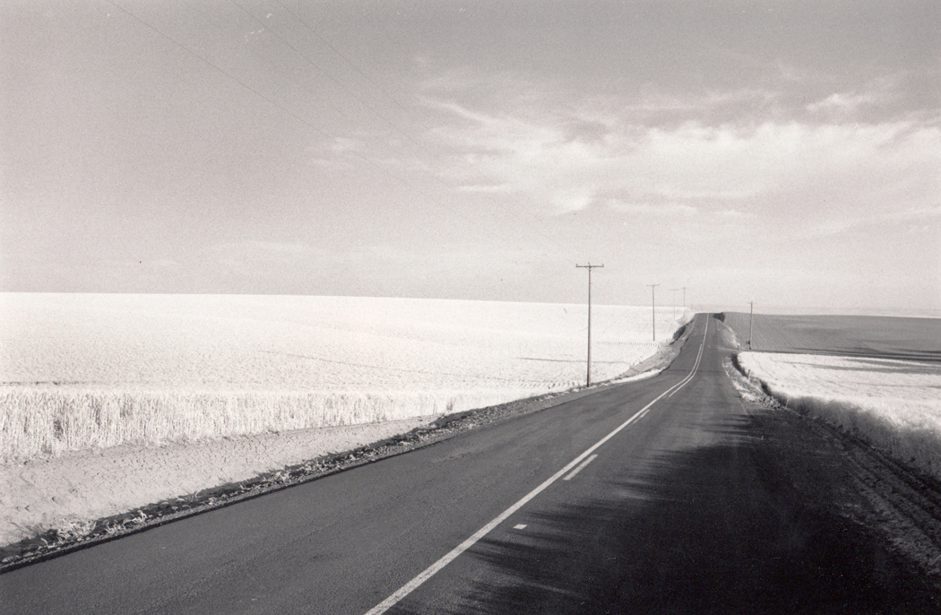
Near Pendleton, Ore.

Gertrude Stein’s description of America is really a description of the West: “In the United States there is more space where nobody is than where anybody is. This is what makes America what it is.”

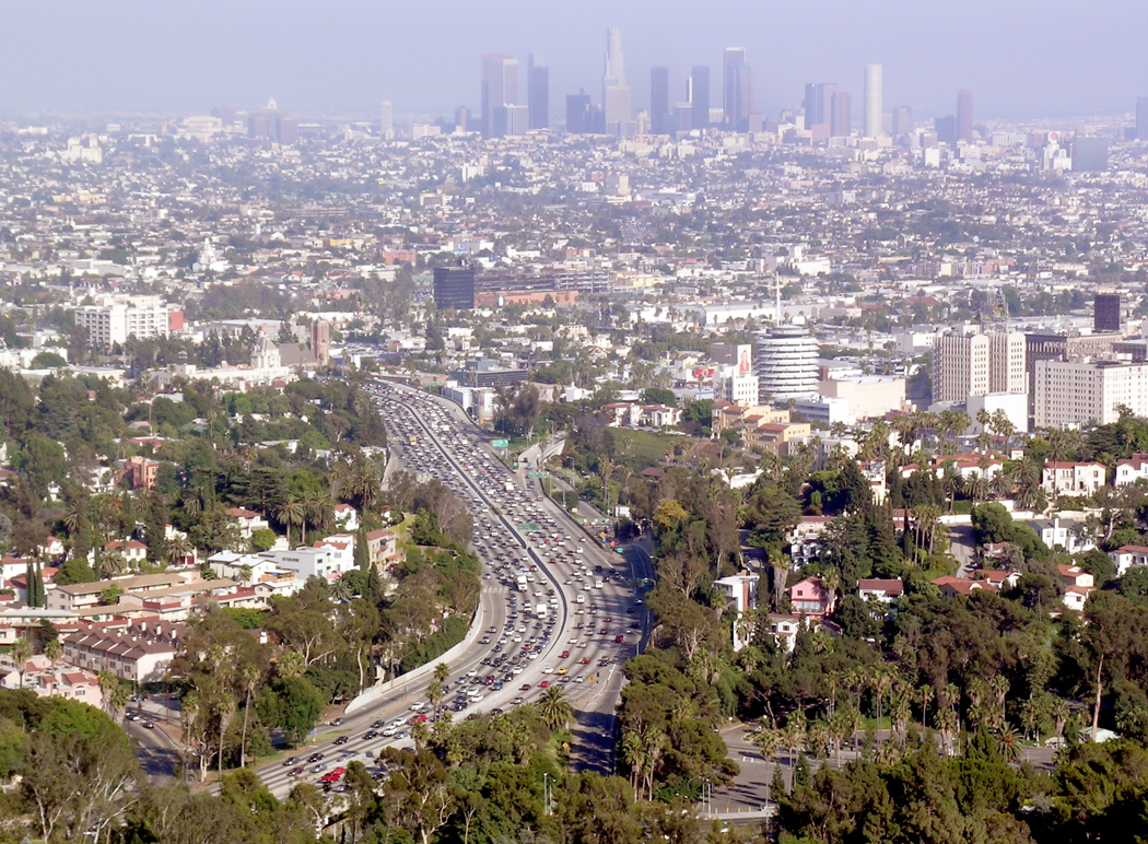
The West I miss in my deep heart’s core is the dusty, windblown vastness, but it is also the crowded, traffic-choked cities. I miss Los Angeles as much as I miss the Rocky Mountains. 

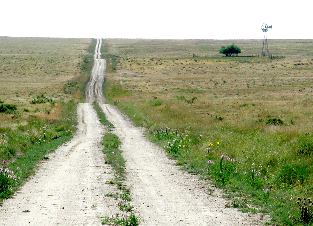
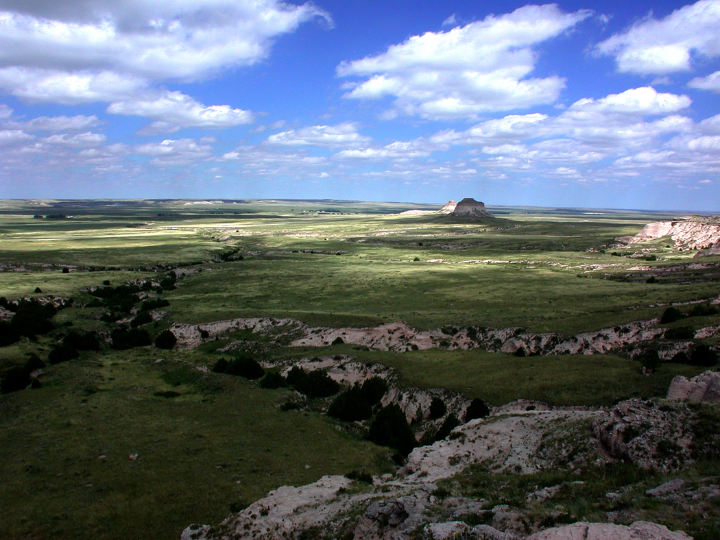
And let’s be clear. There are four very different Wests. There is the Great Plains region; 
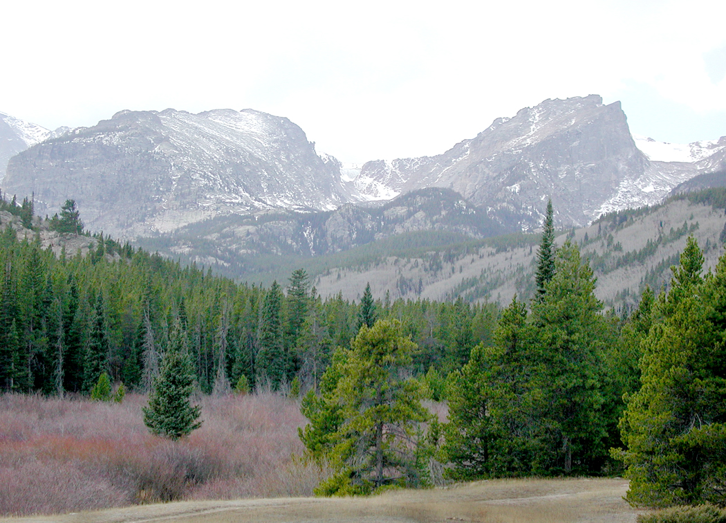
the mountain West; 

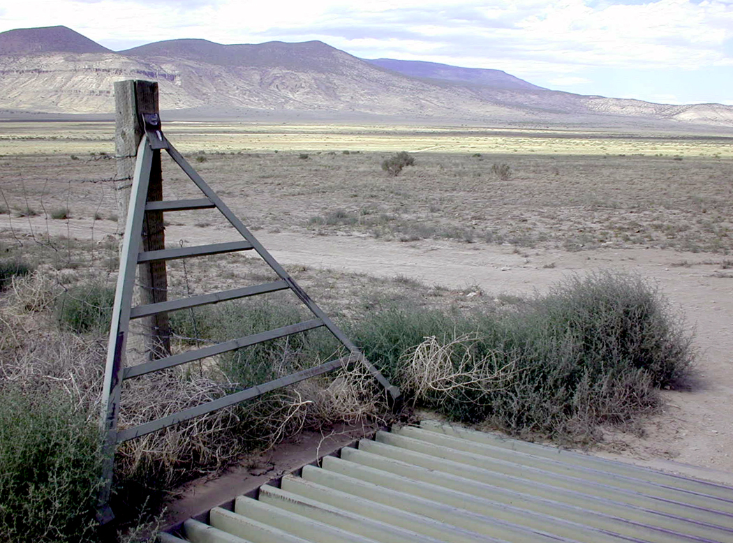
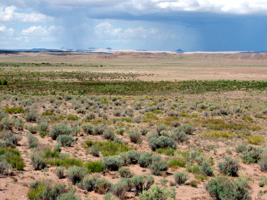
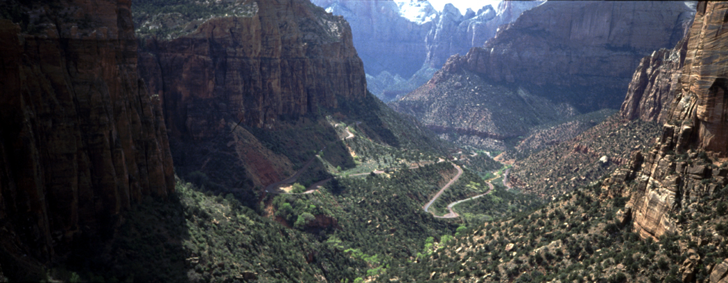
there is the desert West; 

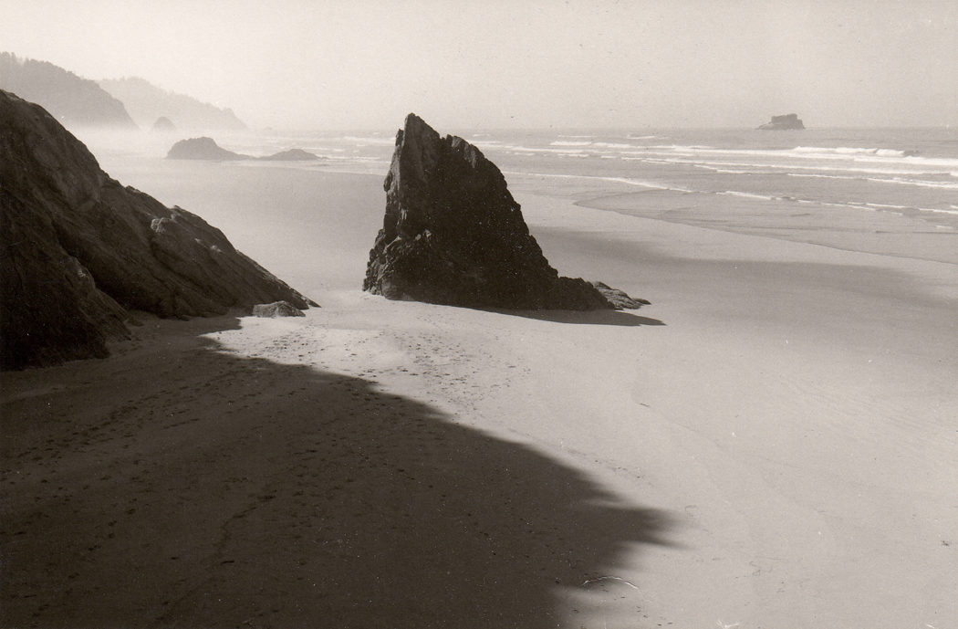
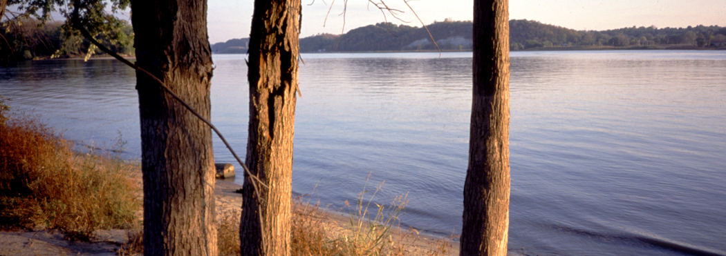
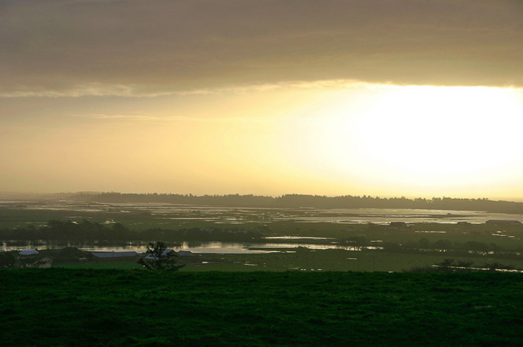
and the Pacific West. 

Each has its character and its psychic magnetism. I am drawn to each. 

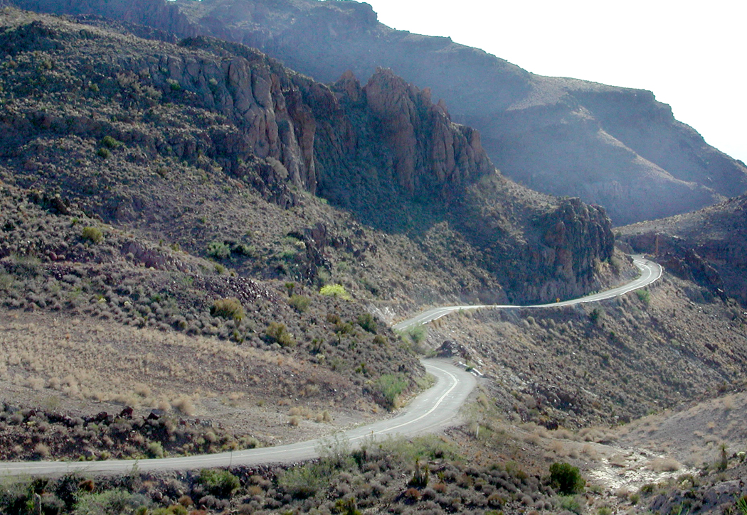
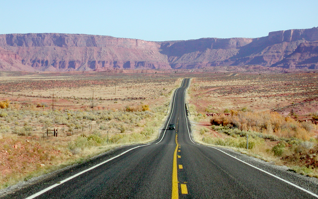
Route 66 near Oatman, Ariz.

The flat middle of the country is usually forgotten when we talk of the West. In the movies, Dodge City always seems to have the Sierra Nevadas in the background. The Kansas reality is very different: grassy, flat, and smelling of cattle dung. 

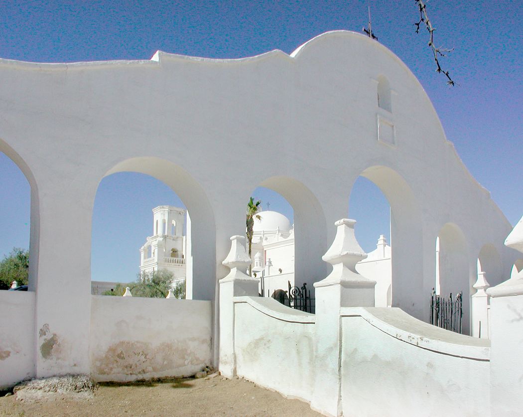
San Xavier del Bac, Tucson, Ariz.

As you drive across the Staked Plains of West Texas, you feel you might as well be out on the high seas with no land in sight. Indeed, that is how Herman Melville describes it in his story/poem, John Marr, about an old salt now living in the center of the continent. “Hooped round by a level rim, the prairie was to John Marr a reminder of ocean.” And the wind in the tall grass makes waves that undulate like the sea. 

Friends used to laugh when they asked where I planned to spend my vacation and I said, “Nebraska.” No one, they said, goes to Nebraska. How about the beach? How about Manhattan. But I had in my head a sense of Manhattan, Kansas, instead. I loved seeing grasslands, badlands, farmlands and cowhands. 

Republican River, Kansas

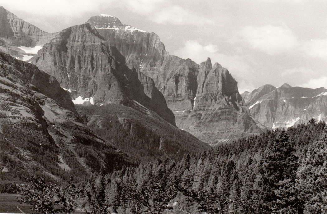
The mountain West is spread into broad bands. The largest is the Rocky Mountains that were such a barrier to the early pioneers.  We drove up and through the Rockies in many of its latitudes, from the Southern Rockies in New Mexico to Glacier National Park in Montana — and further up into Banff and Jasper parks in Alberta. 

My wife wanted to see bears. When we camped, she threatened to tie a peanutbutter sandwich to a string and drag it through the campsite, saying, “Here, Mr. Bear. Here, Mr. Bear.” I persuaded her that was a bad idea, but we found several bears on the side of the road as we drove. 

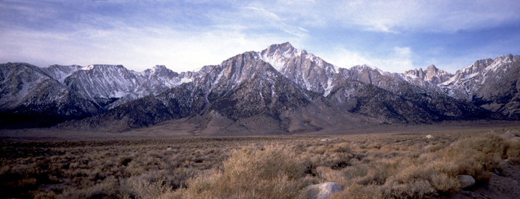
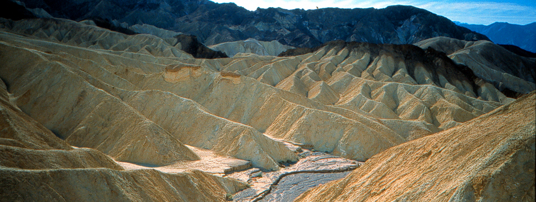
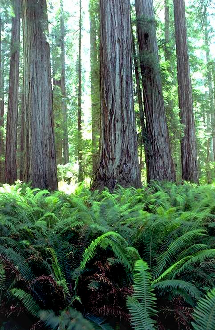
Then, there are the Sierra Nevadas of California, some of the most photogenic peaks in the country, and the background to so many cowboy movies of the ’30s and ’40s. The mountains are home to the sequoia forests and Yosemite National Park. The lowest point in the U.S. is Death Valley and the highest peak in the Lower 48 is Mount Whitney of the Sierras and they are only about 80 miles apart. You can practically see one from the other. 

The Sierras eventually turn into the Cascade Mountains in Oregon and Washington, and a series of giant volcanoes, such as Mt. Baker, Mt. Hood, and Mt. Rainier. And Mt. St. Helens. I have climbed up portions of Rainier and walked along the Nisqually Glacier on its southwestern face. On a clear day in Seattle, the snowy, ghostlike presence of Mt. Rainier seems like a permanent cloud on the horizon south of the city. It is immense. 

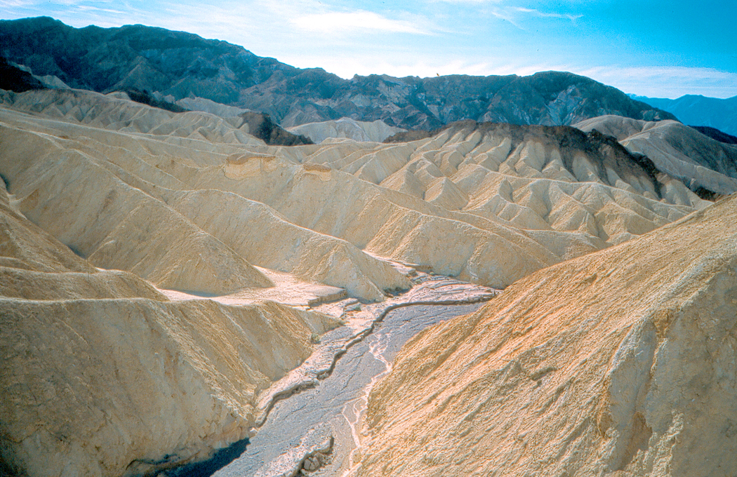
Zabriskie Point, Death Valley, Calif.

The desert West is the one I know best. I lived in it for a quarter of a century, in Phoenix. But it is not Phoenix that I miss, except for the friends I left there. No, Phoenix is merely Cleveland in the desert. But outside of the city the desert is beautiful. In a good year — about one in every 15 — the winter rains make the desert floor a paint palette of wildflowers. The January explodes. 

To the north of the city, the Colorado Plateau is what I miss the most, those long vistas of grassland and badlands, the Navajo and Hopi reservations, the mesas and canyons, the Colorado River and a half-dozen national parks. The plateau continues north into Utah and into the southern parts of Colorado.

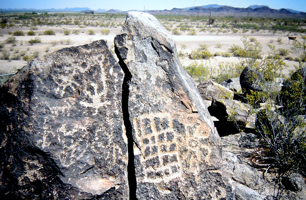
Petroglyphs scar the rocks and cheap souvenir shops, like those called “Chief Yellowhorse” dot the interstate. 

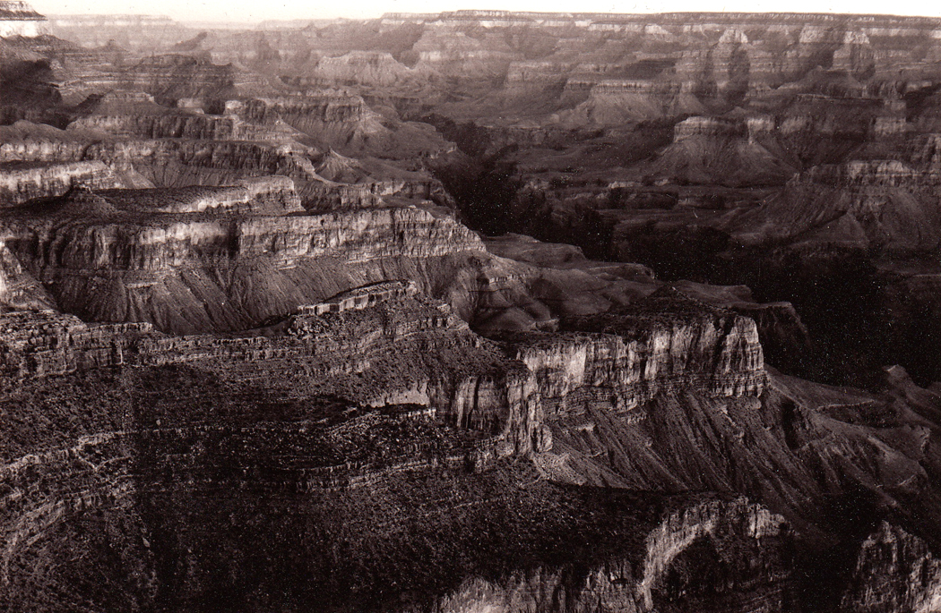
I can no longer count the number of times I have visited the Grand Canyon, both north and south rims, and the forlorn and uninhabited parts of the western stretches of the canyon on what is called the Arizona Strip. Anytime someone visited us in Phoenix, we took them up to see the Canyon. Pictures just don’t suffice; you have to see in to understand the awe. A picture is static, but the canyon changes color minute by minute as the sun slides across the sky and clouds pass over the rock. One of my great experiences was to arrive before dawn and watch the growing light slowly illuminate the stone and see the slim, glowing white ribbon of river a mile below us. 

South of Phoenix, there is the Sonoran Desert, with its Saguaro cactus and unending greasewood plains. And rivers with no water in them. The common joke in Arizona was about a long-time desert rat who took a trip to New York City and when he returned, his friend asked him about it. He saw all the sights, including the Empire State Building and the Brooklyn Bridge. “And did you see the Hudson River?” “Yeah, but there weren’t nothing to see; it was covered in water.” 

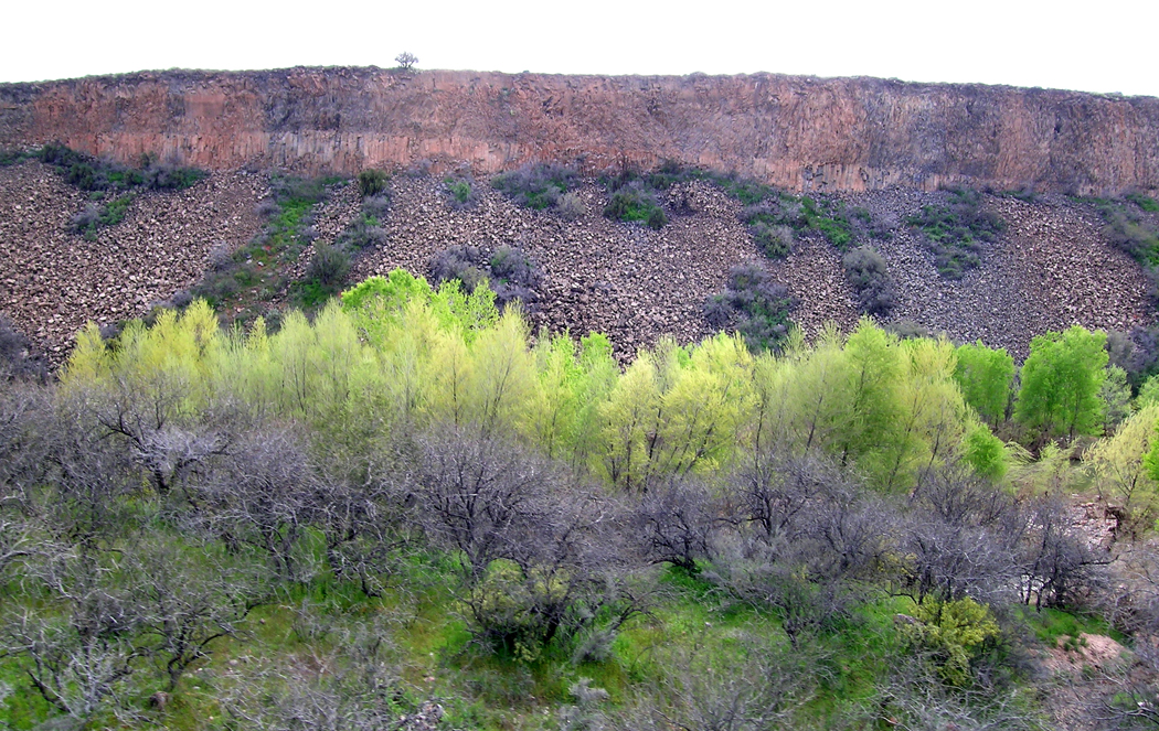
Lavender Pit, Bisbee, Ariz.

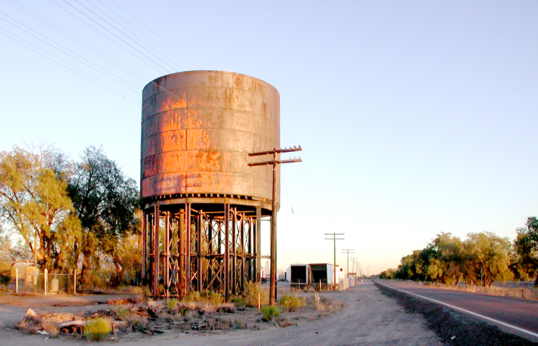
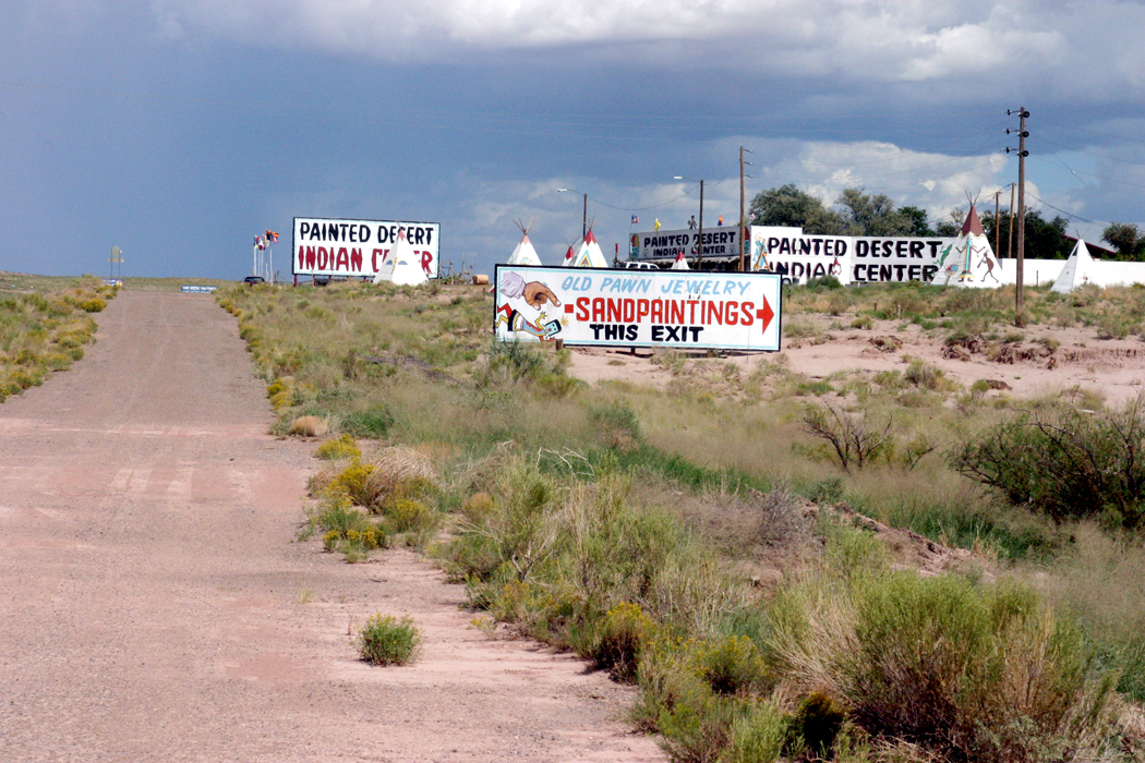
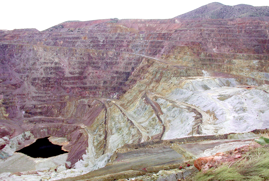
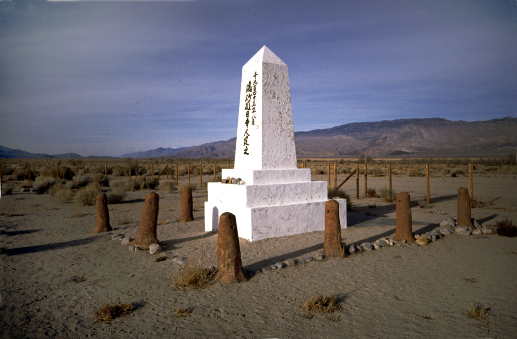
The picturesque parts of the desert are certainly attractive, but what I miss are the unlovely bits. The decrepit mobile home parks of Quartzsite, in the middle of nowhere, with its pyramid monument to Hi Jolly, the camel herder hired by the U.S. Army in a futile experiment. The burned out and abandoned shacks in 29 Palms, Calif.; the stink of dead fish along the shores of the Salton Sea; the shimmering fata morgana over the Wilcox Playa; the city-size holes in the ground where copper is hauled from the pits; and the mountain ranges of slag heaps hanging over the cities of Miami and Claypool. 
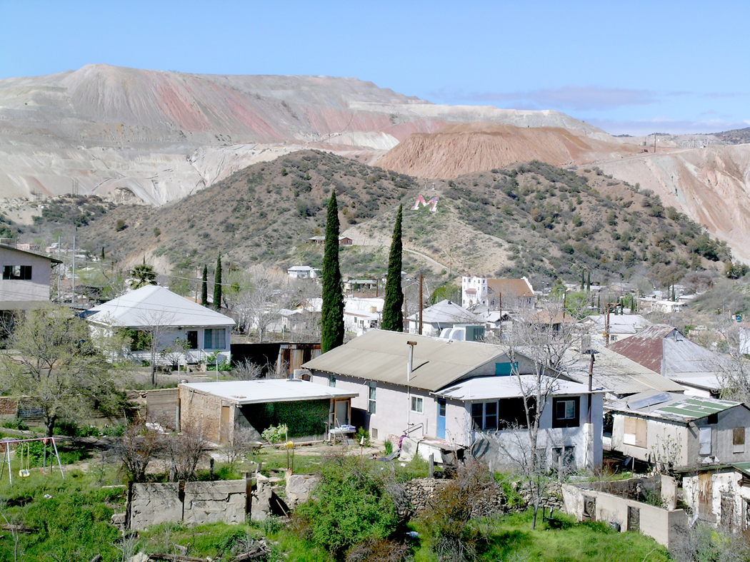
Miami, Ariz.

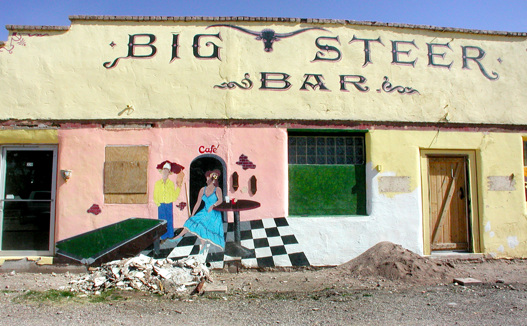
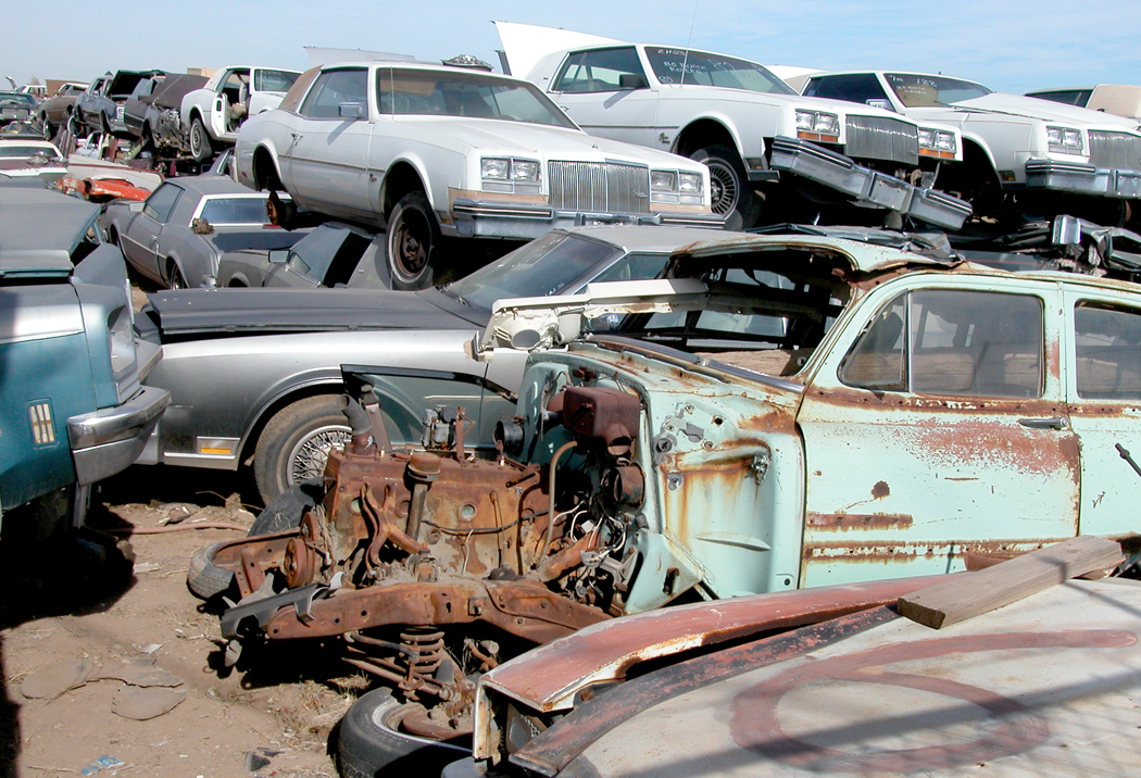
In so much of the desert, it is not the unsullied nature that used to be there, but the used-up quality, the peeled paint and weathered wood and broken-out windows, the abandoned and rusting cars, the roads cracked with weeds growing through. These would never be called pretty, but they have an intense kind of beauty about them. There is something very human about the ruins that no bland red sunset can match. 

As I said, it is the physicality of the West that speaks to me, not the idea. It is the West as it is, not as it is imagined to have been. 

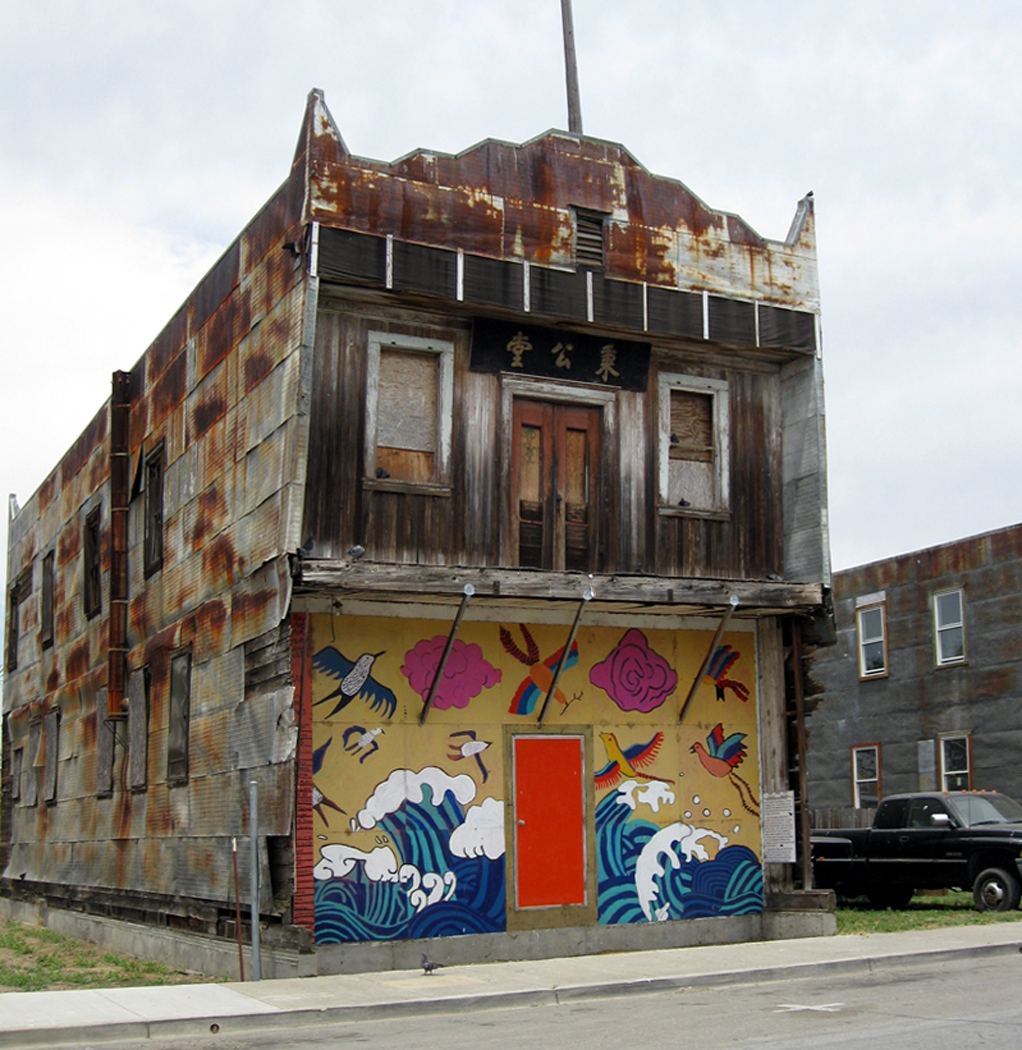
Mural, Los Angeles, Calif.

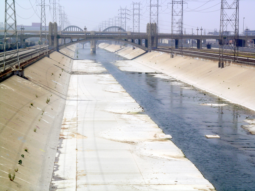
This is true also of the Pacific West. I have written many times about Los Angeles and the parts of the city I love most: the concrete river, 

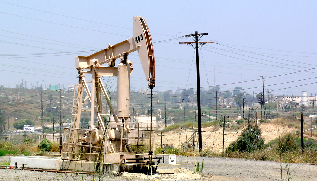
the oil wells on the Baldwin Hills,

the thousands of little strip malls and their ethnic restaurants and food markets. The bungalow houses, the back streets, the Deco architecture. 

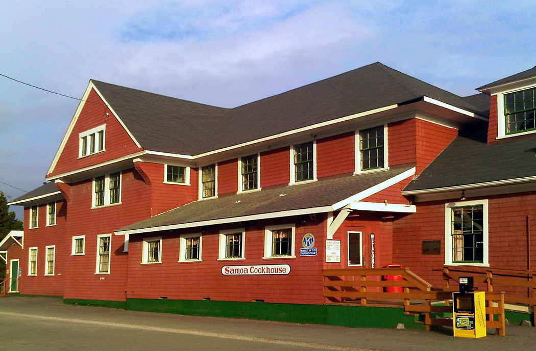
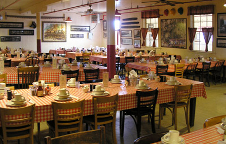
I have driven from Tijuana to Vancouver along the coast, soaking up cities and redwoods, mountains and rushing rivers; the Samoa Cookhouse of Eureka; the bridges of Conde McCullough; the stonehenge of Maryhill; the Channeled Scablands; the floating bridge over Lake Washington; the Olympic Mountains. 

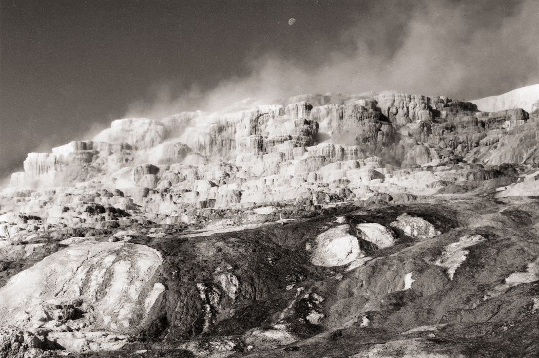
Jupiter Hot Springs, Yellowstone National Park

I have visited every state except Hawaii and every Canadian province except Prince Edward Island and Labrador, and I have absorbed the geography into my tiny head, swallowed whole. 

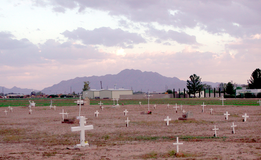
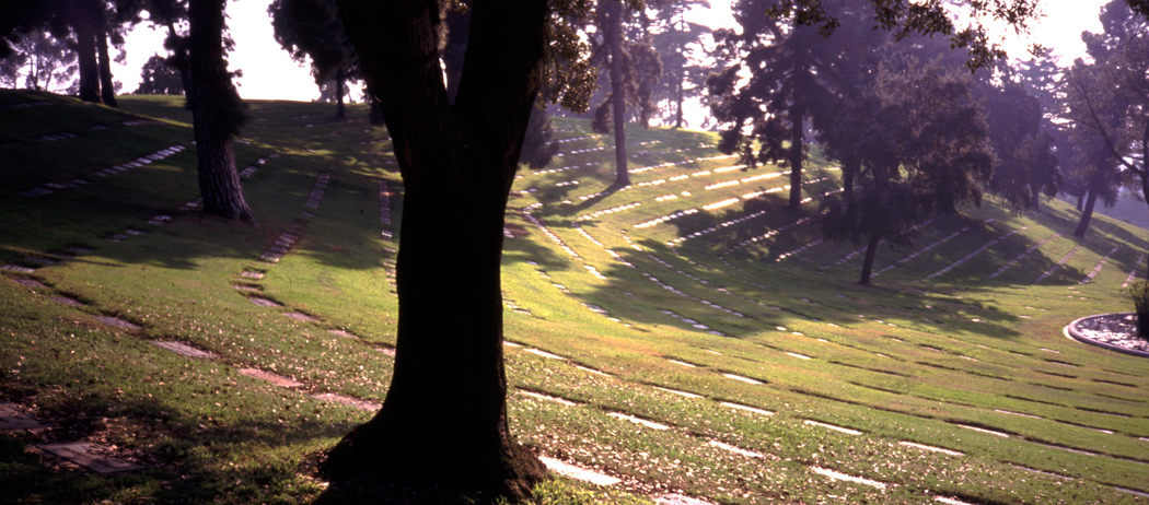
Mexican cemetery, Chandler, Ariz.

We all become the landscape we have lived in. It is what makes a Southerner so darned Southern, the Yankee so taciturn, the desert rat so possessive of his burning sun-broiled gravel. In the past — and still in the American South — people tend to live within a few miles of where they were born, and their regional differences become part of their DNA. In more mobile times, when so many move around the country or even to foreign climes, that conflation of land and psyche may attenuate. But it is still there, defining, in lesser or greater extent, who we are and what we feel and think. It is why red states tend to be rural and blue states urban. 
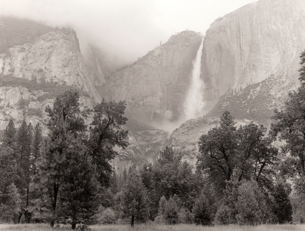
Yosemite Falls

And because I lived in the dry air so long, with the greasewood flats and the arroyos and the roadrunners and javelinas, the West — not the idea, but the real thing — has become a part of my insides. It is why even in the gorgeous Blue Ridge, I miss the desert, mountains, plains and cities of the West. We are in some part, the same thing. 

Click on any image to enlarge

goode mapWhen I was growing up — in the Antediluvian Age when everyone smoked Lucky Strikes and cars all had clutches and carburetors — the maps in my grade school rooms had 48 states on them.

Those classroom roll-down maps were beautiful to my young eyes — all that green, yellow and ruddy brown in wood engraving density. They are maps that have never been equalled, and I knew, looking at the map, pulled down in front of the black chalkboard, that I wanted to go to every one of those states and see if Colorado were really the color of chestnuts, if Florida were really Kelly green. It seemed so lush.

Over the years, I’ve gone to — and written about — all 48 contiguous United States, seven Canadian provinces, a couple of edgings into Mexico and a few places in Europe and Africa.

In each of the places I’ve been, there is a top sight to see, like the Grand Canyon in Arizona or Yellowstone in Wyoming. And I’ve loved them all.

But there are also smaller, less well-known places that have quietly become some of my favorites. I’m sure everyone has the same: places where something special happened, or that sum up the qualities of a state or region, or that just seem so relaxed and beautiful that they draw you back over and over.

For me, such places are often remote from normal tourism attractions. I am a sucker for unspoiled grasslands in the Great Plains, for alligator-filled swampland in the South, for backcountry roads in the Appalachians. Others may look for happy crowds to join, for music and dancing or roller coasters. My favorites, however, tend to be empty of people, silent and to provide long views over a significant arc of the planet.

So, here are a few of those places, listed state by state.

edmund pettus bridge

Alabama

If you want to learn about the Deep South and how much it has changed, you should visit Selma. It is where the great Civil Rights march of 1965 began, crossing the Edmund Pettus Bridge and heading on to the state capitol at Montgomery. If you think the battle is over, you should visit Selma and see, despite how far we have come, how distant is the horizon.

Badger Springs Road 1Arizona

Of course, the Grand Canyon is on our license plates, but almost any other square foot of the state is nearly as wonderful, from Hoover Dam to Douglas, from Four Corners to Yuma. But I have a special place in my heart for an obscure exit ramp from I-17 north of Phoenix. Badger Springs Road is a bit of largely undisturbed desert, with trails and cactus, and I can always pull off the highway and find a bit of peace and quiet.

Arkansas


The state is rich in rural areas, craggy in the north, flat and muddy in the east through the Mississippi flood plain, steamy with hot springs toward the south. But the little town of Toad Suck in the center of the state seems even a little quieter, a little more remote than most, and is graced with a state park as well, along the Arkansas River. No hotels, but friendly people.

manzanar

Northern California

California is too rich; I have to split it in two. Even then, I could name a dozen places in each half: In the north — Tule Lake National Wildlife Reserve, Mono Lake on the eastern side of the Sierras, Lassen National Park, the Humboldt Redwoods, the tule marshes along the Sacramento River. But I keep coming back to Owens Valley, just below Mt. Whitney. From the soda-flat Owens Lake north to the ruins of the Manzanar Relocation Center — where Japanese-Americans were interned during World War II — the valley is both picturesque — the Alabama Hills where so many Western films were shot among the wonderland of rocks — and historic — in addition to the concentration camp, there is the sorry and violent tale of how a thirsty Los Angeles stole the valley’s water earlier in the century.

Southern California

East of San Diego is one of California’s most pristine deserts. It is called Anza-Borrego Desert State Park and it is the primordial home of all those Washington palm trees that line the streets of Phoenix. Borrego Springs is a surprisingly kempt little town in the middle of it, but the rest of the park usually seems as empty as a college campus during spring break.

Pawnee Buttes 5 copy

Colorado

For most people, the state probably brings to mind skiing or expansion baseball, or an over-hyped beer, and certainly Colorado is best remembered for post-card mountains — all those “fourteeners” — but I love the Pawnee National Grasslands, one of the best places to get a sense of what the West was really about, what the Great American Desert was — not desert, but the Great Plains, vast, sweeping and grassy.

Connecticut

There is no more peaceful a river valley in the nation than the Housatonic north of New Milford. The Appalachian Trail winds along a portion of its banks. There are covered bridges, meadows and not too far away, near Cornwall, there is a large stand of virgin white pine, called the Cathedral Pines. U.S. 7 parallels the river most of the way.

Delaware

Delaware is a tiny state, and most people notice it, if at all, for the chemical plants and refineries that stick their bellowing smokestacks into the air, and the highways that pass through it on their way elsewhere, up over the twin Delaware Memorial Bridge. But there are the “Hooks” — Prime Hook and Bombay Hook national wildlife refuges, swampy and woodsy on the broad mouth of Delaware Bay.

Florida

If you cannot get enough of the Everglades, or if the national park is too crowded, head north off U.S. 41 on any of a dozen gravel roads into Big Cypress National Preserve. Or take the loop road to the south, through incredible cypress wetlands, with sagging Spanish moss and blackwater swamps.

Okefenokee

Georgia

The Okefenokee is my favorite swamp. That’s saying a lot. I’ve seen more wildlife in it than in any other. Drive up Georgia 177 from Edith into the Stephen C. Foster State Park and rent a canoe. Paddle within inches of swimming alligators. Look into the trees for the snake birds — anhingas — with their darting necks and their wings spread out in the sun to dry.

Idaho

With its camas prairies, steep mountains and gaping canyons, the Nez Perce Indian Reservation is one of the most beautiful parts of this beautiful state. You can see the valley where Chief Joseph began his tragic 1,500-mile unsuccessful flight to freedom for his people in 1877.

Mississippi barge

Illinois

Chicago has big shoulders in the north, but down at the very bottom are the forlorn toes of Cairo, one of the most memorable of Mississippi River towns. It is aging, with peeling paint and boarded up storefronts, but you can feel in the humid air the history behind it. And you can see the conjoining of the muddy Mississippi water with the clearer, faster moving Ohio River. Boats and barges move past in the misty mornings like iron dreams.

Indiana

If you want to find the prototype of Disney’s “Main Street U.S.A.,” you couldn’t do better than to see Paoli, in the southern part of the state. No more perfect quiet little Middle-American village can be found. There are no tourists and nothing to do, but imagine what it must be like to live there, under the spreading chestnut trees just off the town square.

Iowa

Iowa is sometimes surreal: At the bottom of the bluffs of the Mississippi are cities filled with Victorian architecture. There are trees and vines. On top of the bluffs, there are endless rolling farms, with silos instead of trees, like some Grant Wood painting. The best of the cities is Dubuque, one of the greatest surprises of my travels. It is one of America’s most beautiful cities.

Kansas

If you want to get away from civilization, you can hardly do better than the middle of Kansas. Just north of Lebanon is the “Geographical Center of the Conterminous U.S.,” which is a highly qualified title to be proud of. But    you stand there, looking out over the grass and wonder, if they dropped the Big One here, would anyone hear it?

harlan county ky

Kentucky

   The state is mud in the west, limestone in the center and coal in the east. Among the stumpy, round-bumped mountains of coal-mining Harlan County and neighboring Letcher County, are some of the poorest homes and interesting people of the country.

atchafalaya thicket

Louisiana

It surprises even me, but one of my favorite places is along the Interstate. For 20 miles, I-10 rises on piers over the Atchafalaya Swamp. Take an exit into the dark woods and drive along the river into old, mossy river towns, built where the terra is not so firma. Even the pavement seems squishy beneath your feet.

Schoodicwaves2x

Maine

Everybody heads to Bar Harbor, where the T-shirt shops and frozen yogurt stores are chock-a-block. Pass on that and head to Schoodic Point further north. Also part of Acadia National Park, it is one of the ruggedest, rockiest parts of the rocky Maine coast.

Maryland

Antietam National Battlefield, near Sharpsburg, is the most emotional Civil War site I have visited. Every aspect of the fight, and all the blood and bullet-holes, seem spread out graphically, and the spirits of the dead and suffering seem almost palpable at the sunken road called Bloody Lane.

Greylock Mt from Melville home Mass

Massachusetts

Arrowhead is the one-time home of Herman Melville in Pittsfield. The house is actually a character in many of his stories, and you can look out the second-floor window of his study, where he wrote Moby Dick, and see the saddle-back peak of Mt. Greylock to the north, “Charlemagne among his peers.”

Michigan

The Upper Peninsula is a big place, but everywhere you turn, there are forests, lakes and rivers, including Papa Hemingway’s Big Two-Hearted River. It’s hard to pick a single place, but there is always the drive on U.S. 2 along the southern shore of the peninsula along Lake Michigan.

Minnesota

A river doesn’t really start from a single source, but the agreed fiction is that the Mississippi begins at Lake Itasca, southwest of Bemidji. The lake is not that large, by Minnesota standards, and seems quite placid. The “father of waters” begins at a reedy little outlet that you can step across and brag you crossed the Mississippi on foot.

Mississippi

The blues began in the Mississippi Delta, and they are still played in the shabby juke joints of Clarksdale, one of those old, cracked-concrete, grass-in-the-railroad-ties, dying-downtown Deep South county seats. Everybody you see, sitting on their porch fronts, seems more human, more profound. Maybe it’s the blues.

Missouri

The Ozark Mountains can be beautiful, with lichen-covered limestone and rivers that disappear underground. Like at Big Spring State Park on the Current River, where the river comes gushing back out of the rock like a fountain.

bear paw surrender site

Montana

Chief Joseph began his three-and-a-half month trek in 1877 in Idaho, he ended it on the flat, grassy, empty plains of northern Montana, at a place called the Chief Joseph Battlefield near the Bears Paw Mountains, only 40 miles from the safety his Nez Perce Indians sought in Canada. He was captured by the U.S. Army, and promised “From where the sun now stands, I will fight no more forever.”

bailey yard nebraska

Nebraska

People look at me funny when I tell them that Nebraska is probably my favorite state to visit. The sand hills, the puny “national forest,” the Platte River and Scotts Bluff — they all seem unbearably windblown and lonesome. I love them all, but in North Platte, you cannot feel alone at the biggest railroad freight yard in the country. You can watch trains all day.

Nevada

If Nebraska is my favorite state, Nevada is probably my least favorite. It is empty, true, but its emptiness seems hard and thoughtless, like a biker at a roadside bar and casino. But I cannot deny the beauty of such places as Big Smoke Valley, between the Toiyabe and Toquima mountains, and the wide sagebrush plains where you don’t see a car for hours, but maybe a dozen dusty pickups.

New Hampshire

The Kancamagus Highway is one of the most beautiful drives in the country, winding through the White Mountains along the Swift River. It goes from Lincoln to Passaconaway and passes some stunning stony waterfalls.

pulaski skyway copy

New Jersey

This is the state where I grew up. I came to despise the suburban banality of most of the state, but I loved two things: the northwest corner, with its minuscule mountains and bucolic forests; and most of all, the industrial corridor of the Jersey Turnpike, with its refineries, chemical plants and the always-beautiful Pulaski Skyway.

New Mexico

At the top of the Sacramento Mountains, in the Lincoln National Forest is a place called Cloudcroft. There is great camping, wild animals and — usually — clean air that is so clear, it could cut diamonds.

Bear Mtn Bridge

New York

New York offers more than any other single state except California. There are dozens of favorite sites, from Montauk Point to Niagara Falls. But I will always have a special affection for Harriman State Park, along the Hudson River, and Bear Mountain, that looks down at the gorge, just south of West Point and its military academy. Seven Lakes Drive, through the park, is what nature in the East is all about.

Ashe County road, creek &dogwoo

North Carolina

No question here: Ashe County, tucked up in the northwest part of the state, above the Blue Ridge, is away from the normal tourist loop, but more beautiful than any other place north of the Smoky Mountains. Any gravelly back road will take you to something surprising and there is the New River to canoe down.

Sunflowers Zap North Dakota

North Dakota

It hardly counts for anything, and there is no real reason to visit, but I cannot get enough of Zap, a tiny crossroads, where the roads don’t go anywhere. Between Beulah and Golden Valley, Zap sits among the rising and dropping swell of the grasslands, with the occasional pond for cattle to drink from.

Virginia Kendall SP, Ohio 3 copy

Ohio

Just south of Cleveland, there is a small bit of woods and rock called Virginia Kendall Park. It is right next to the larger Cuyahoga Valley National Recreation Area, and benefits from more people going there than here. There is a rocky bluff in the middle of the park and echoing voices in the forest among the leaf litter.

Oklahoma

One of the worst massacres of the so-called Indian Wars took place just outside of Cheyenne, along the Washita River. The site is now nothing but grass, a line of trees along the water, and some outcroppings of rock. But the surrounding Black Kettle National Grasslands can give you a real sense of what the land looked like 121 years ago.

Columbia River Gorge Oregon-Washington

Oregon

The Columbia River Gorge is one of the scenic wonders of America, and one of the most scenic drives is along the old, outmoded Columbia River Gorge Scenic Highway, which rises up the mountainside above the interstate highway, and takes you through more waterfalls than any comparable stretch of road outside Hawaii.

falling water

Pennsylvania

The second most famous house in America — after the White House — is probably Frank Lloyd Wright’s Fallingwater, a vacation home he designed for Pittsburgh’s wealthy Kaufman family beginning in 1934. It is also one of the most beautiful buildings in the country, sitting literally atop a waterfall and jutting out over the small forest glen.

Rhode Island

If you’re on the A-list, you’ll naturally gravitate to Newport and its extravagant mansions. I’m not on that list; I prefer the more humble Conanicut Island, where real people live. It sits in the middle of Narragansett Bay and gives you a good sense of what life on the bay is like.

South Carolina

Myrtle Beach gets all the traffic and spring-breakers, but Huntington Beach, 10 miles further south along Murrell’s Inlet, is the better place to be. With Huntington Gardens just across the street, with all those animal sculptures of Anna Hyatt Huntington, and a fresh-water alligator pond next to the salt marsh, Huntington Beach is a great — a great — place for seeing birds.

pine ridge rez

South Dakota

The Pine Ridge Indian Reservation may be poor, but it is beautiful. And as with many places noted for its poverty, it is very real. The people take the time to talk to you and there is history at every turn in the road — not all of it very comfortable for an Anglo to remember.

Tennessee

Most of the crowds at Great Smoky Mountains National Park gather along U.S. 441 across the crest of the range, or in Cades Cove in the southwest of the park. But one of the great drives, and less crowded, is up the Little River Road through the back side of the park. It follows the cascading Little River most of the way, and finds its way back to the visitors center at Sugarlands.

lbj ranch grandparentshouse

Texas

Even Texans will tell you the center of their state is the best part: The Texas Hill Country is an oasis in the middle of a state that sometimes seems like nothing more than the world’s largest vacant lot. And the best part of the Hill Country is found at the LBJ Ranch near Johnson City. It is no wonder that our 36th president loved his ranch so much. It is a jewel in a perfect setting.

Utah

Is there a square inch of the state that doesn’t deserve to be a national park? I haven’t found it. But one of the most overlooked gems is the ride along Utah 128 from Moab to Cisco. Through most of its route, the road seems to be the one you would imagine at the bottom of the Grand Canyon. Well, perhaps that exaggerates it a wee bit. But it is special.

coolidge plymouth

Vermont

Near Plymouth is the birthplace and homestead of Calvin Coolidge, who has recently lost his title as the president we made the most jokes about. In fact, Silent Cal was a smart cookie and not at all the buffoon stand-up comics make him out to be. He was raised in a tiny Yankee village that is preserved as a state park.

Monticello Entrance Hall copy

Virginia

Virginia is another state that seems to have more than its fair share of special places. Perhaps it’s history, perhaps geography, but almost anywhere you turn, there is something that will draw you back over and over. Still, there is something special about Thomas Jefferson’s mountaintop home, Monticello, a monument to just how profoundly beautiful a little nuttiness can be. The Age of Reason meets Henry Thoreau.

Washington

Eastern Washington is largely a blank spot in America’s consciousness. Seattle, the Olympics, the Cascades, Mt. Rainier — they are all in the west. But there is hardly an odder or more peculiar and spooky landscape on Earth than what is called the Channeled Scablands east of the Cascades. The Grand Coulee Dam blocks the Columbia River there, where a prehistoric flood scraped the earth clean for hundreds of miles.

West Virginia

The Hawks Nest, on U.S. 60 between Gauley Bridge and Ansted, looks out over the deep declivity of the New River Gorge and is one of the great scenic views of the eastern U.S.

Frosty dawn Wisconsin

Wisconsin

Southern Wisconsin has many treasures, including the Mustard Museum in Mt. Horeb, and the world’s largest six-pack of beer at La Crosse, but nothing can beat the genuine zaniness of the Dickeyville Grotto, a religious site in Dickeyville created out of broken bottles, seashells, stones and broken crockery. It is one of the great “outsider art” sites, and don’t miss the tribute to Columbus.

Wyoming

What’s the highest, most alpine road in America that actually goes somewhere? Undoubtedly, it is the Bear Tooth Highway, U.S. 212 from Red Lodge, Mont., to Yellowstone National Park. It climbs up over Bear Tooth Pass at 10,940 feet and provides more long Rocky Mountain views than any other road. Look out for the marmots.


State Line tex-NMTo see the world, you fly around it; to learn about your neighborhood, you walk through it; but to appreciate something about the country you live in, there is nothing better than an automobile.Clouds from plane

A jet flies too high and fast to take in any detail. The country is too big to slog through on foot. A car is the perfect compromise, letting you pass over a significant portion of the nation each day, but allowing you the leisure to stop and sniff the magnolias in Mississippi, the rank ecstatic yellow sunflowers in North Dakota — and the lingering odor of peanut butter at Graceland.

It’s summer again, and once more, I open up another brand-new Rand McNally road atlas and begin planning a drive around the North American continent.Sunflowers North Dakota

In the past 15 years, I’ve made the round-trip across the United States at least a dozen times. I feel like Magellan when I start once more on the circumvehiculation of America.

I’ve done it alone and with my wife. I’ve done it camping and in motels. I’ve done it in summer and in winter. I’ve done it in as long as two months and as short as two weeks. Last year, I made it from Phoenix to North Carolina over a weekend, but I’m not likely to repeat that butt-numbing feat.

Yet I am planning another road trip this spring.

Friends tell me I am nuts, a masochist torturing myself or a sadist torturing my wife, but I keep setting out.

There is always something new to see, or some old friend to revisit: I’ve been to North Carolina’s Outer Banks something like 40 times, and I’m beginning to develop the same relationship with Maine’s Down East. When I have lived in the East, I couldn’t wait to visit New Mexico again.Baldwin Co. Ala. sunset

There are soft-shelled crabs to be eaten in Virginia, salmon in Seattle. There are pirogis in Wisconsin and scrapple in Philadelphia. You can only get pizza in New Jersey, you can only get barbecue in eastern North Carolina, or a real Cuban sandwich in Miami.

Barns in Pennsylvania have stone foundations; in Georgia, they rest lumber right on the ground. In Wisconsin, the barns are red; in North Carolina, it’s the dirt that’s red; the gray, weathered barns aren’t painted at all.

I remember passing through Iowa and being astonished to see a farmfield filled with hogs and each animal had its private home, looking like a Levittown of doghouses.

In southern Arizona, I passed something very similar, but it was for fighting roosters.Bear Mtn Bridge

American regionalism is alive, despite network television and corporate advertising. America hasn’t yet been completely turned into one great food court of McDonald’s and Arby’s.

If you think you have only a choice between Pepsi and Coke, wait till you pop the top of a Double Cola in Reidsville, N.C.

Try one at the Sanitary Cafe, where calf’s brains are the breakfast special.Cadillac Ranch Amarillo Texas

I’ve been to most of those landmark places you’ve heard of: International Falls, Minn.; Walla-Walla, Wash.; Langtry, Texas; Cairo, Ill.; Appomattox, Va.; Intercourse, Pa.; West Point, N.Y.

There are some great old iron bridges across the Susquehanna River in Pennsylvania, some great concrete bridges in central New Jersey that speak of the the great age of American highway building in the 1930s.

I’ve been up Pikes Peak in Colorado and up Mt. Washington in New Hampshire.

I’ve been over Lake Ponchartrain in Louisiana and across the floating bridge over the Hood Canal in Puget Sound north of Seattle.Columbia River Gorge Oregon-Washington

It helps if you love to drive, and I know not everyone has that passion. My brother hates driving, for instance. He views an automobile vacation like a two weeks stuck in an elevator. He can’t wait for his floor to arrive so he can get the heck out.

But most elevators don’t have windows.

As I watch the landscape pass across my windshield, like a travelog on a movie screen, I get a sense of the whole elephant, not just his trunk or tail.

Of course, we are talking here about a two-lane blacktop trip, not a bland rush down an interstate highway, where one stretch of concrete pavement can be distinguished from another only by the names on the exit signs.factory, trees, Lowell, Mass

It is a particular kind of travel and has nothing in common with the destination-vacation of the tourism industry. I have no interest in waiting on Disney World lines for thrill rides or Lake Winnibigoshish for a week of trout fishing. You can have your three days lounging on the sands of Bimini or your Love Boat cruise.

Instead, I get to travel an arc of the planet, get to feel in my bones the curvature of the earth and the roughness of its skin. It is through driving across its surface that I get some body-feel for the size of the globe: It is roughly 10 times the distance I drive to get from Phoenix to New York City. New OrleansThat’s not some numbers on some mileage chart, but a distance I know by the seat of my pants.

It’s also a lot smaller than the world seemed before I began driving.

In those years, my wife and I have been to each of the 48 contiguous state at least twice and most more frequently; we have been to all but one of the Canadian provinces; and even skirted into Mexico a little bit.

And each of those trips could have produced a Blue Highways, a book-length summation of what we saw and learned.Frosty dawn Wisconsin

Part 2

Over the past decade and a half, I’ve put enough vacation miles on the cars I’ve owned to equal driving around the world 2 1/2 times. You don’t drive that much without learning a few things.

The first is, of course, to stay off the interstates. You may get there faster, but not by much, and you’ll be bored the whole drowsy way. And in much of the country — and especially in the West — speed limits on smaller highways is not much lower than on the four-lanes, and with less traffic.Golden Gate Bridge SF Calif

Have a rough itinerary and plan how many miles per day you are willing to drive. This is more important for a passenger: Driving will keep you occupied, but your partner may go stir crazy sitting in a seat while going across some of the flatter places in Texas; Don’t overdo it. Marriages hang in the balance.

But never make your itinerary too rigid. You will discover unexpected things along the way; let yourself enjoy them.Gorilla, Am Mus Nat Hist04 copy

We never reserve motel rooms, so we never feel forced to get somewhere by nightfall. There are enough motels along the way. Even national parks, with their crowds, often have last minute cancellations. We’ve pulled into the Grand Canyon and into Yellowstone and gotten a room. But have a contingency plan.

One year, we hit South Dakota the week of the Sturgis Motorcycle Rally and there were no vacancies for 200 miles around. We had to drive into the next state to find a room. But that brings up the next lesson:

Don’t be afraid of mishaps and adventures. They may be uncomfortable during the trip, but they will be the best stories you tell your friends. No matter how bad it gets, it will provide the most vivid memory.Imperial Dunes California

Don’t drive every day; take some time to spend in a single spot. Three days we spent in a cabin on Daicey Pond in Maine’s Baxter State Park were three of the best days we ever spent — hiking, canoeing, watching moose and listening to loons at the base of Mount Katahdin. Not once did we start the car. When we finally left, we were ready for more miles.

There are things you should always have in your car: water, a blanket, Fig Newtons, a road atlas, your address book with phone numbers. Forest Lawn cemetery LAI also carry an entrenching tool — one of those small folding shovels you can buy at army surplus stores — for digging out when I get the car stuck in sand or mud.

Don’t be afraid of dirt roads. There are some amazing rewards at the end of a bit of gravel.

We also always carry a small library of Peterson nature guides, two pairs of binoculars, camera equipment and twice the amount of film I think I can possibly shoot.

And finally, my nomination for the greatest invention of the 20th century: cruise control. It keeps your right foot from cramping up on the gas pedal. I was 45 before I ever tried it and I’ll never be that stupid again.pacific coast highway California

Part 3

What makes for good driving?

I don’t know about others, but for me, optimum driving conditions include:

–Little or no traffic for infinite miles ahead, with no stoplights.

–Interesting and varied weather; I don’t want incessant sunshine any more than I want endless rain. A front moving through gives me a constantly changing cloud show.Greylock Mt from Melville home Mass

–An old road with a history. Route 66 is the most famous, but not the only one. I especially enjoy roads that follow geology: along a mountain range or river, so that the road seems to belong to the earth, rather than denying it.

–Occasional side roads, preferably gravel, for a change of pace.

–Periodic change of landscape, such as when you drive from the Plains to the Rocky Mountains, or from the white sands of the Atlantic Coastal Plain into the hilly interior of the Piedmont.

— A regional food specialty you haven’t tried yet and no chain restaurants.leo carillo st beach california

— A few museums and a few national parks. I gotta have both.

— A used book store in every town.

— A pile of Haydn symphonies on CD to run through the dashboard player.

–A clean windshield. This last must be renewed frequently. Bugs bust on the glass.Mississippi barge

Part 4

The dozen most scenic drives in the 48 states:

1. Beartooth Highway, U.S. 212 from Red Lodge, Mont., to Yellowstone National Park.

2. The Pacific Coast Highway, Calif. 1, from San Luis Obispo to Leggett, Calif..

3. Blue Ridge Parkway, from Waynesboro, Va. to Smoky Mountains National Park, N.C.

4. N.C. 12 from Nags Head to Okracoke, N.C.

5. Ariz. 264 from Ganado to Tuba City, Ariz.

6. U.S. 1 from Miami to Key West, Fla.

7. La. 82 from Perry, La., to Port Arthur, Texas.

8. U.S. 1 from Ellsworth to Calais, Maine.

9. Kancamagus Highway, N.H. 112, from Conway to Lincoln, N.H.

10. Tex. 170 from Presidio, Texas, to Big Bend National Park.

11. Utah 12 from Red Canyon to Torrey, Utah.

12. Wash. 14 though the Columbia River Gorge from Camas to Plymouth, Wash.Niagara Falls

Part 5

It isn’t just the flashy, famous places that draw the true driver. In fact, commercial destinations, such as Disney World or Las Vegas, are probably best gotten to by airplane and shuttle bus, so you can give over all your time to waiting in lines.

No, in a car, some of the best experiences come by rolling through the kind of places that fall through the cracks of marketing. Places “below the radar,” so to speak, of commercial development.mobile bay point clear

The small towns, endless farms, mountain ranges, Indian reservations — these are the places you have the opportunity to discover things for yourself. In the big theme parks, you get a uniform experience, developed through marketing research. The ride you take is the same ride millions of others take.

But when you talk to the harried but chummy waitress in Doumar’s, an original ’50s style drive-in on Monticello Ave. in Norfolk, Va., you are talking to a real person, a one-on-one experience that is particular and individual. You get a flavor of place, of culture, of people, of individuals.Page Dam Arizona

To say nothing of the flavor of ice cream, in a cone as close to identical as possible to the original waffled cone Abe Doumar is credited with inventing in 1904. They still make them on the same old wheezy portable machine. If your lucky, they’ll be making them while you eat.

Likewise, there is nothing predictable about the starfish you find in an Oregon tidepool, or the bears in the Smoky Mountains. You get to experience the infinite variety of real life.Sierra Nevada Mts California

Of course, I have my favorites.

Among the 48 states, I can never find the end of either California or North Carolina. They are both richly varied.

California seems to have everything from the world-navel of pop culture to the most remote wilderness. It has more than any other single state.Thunder hole Acadia NP Maine

But North Carolina is nearly as varied geographically, and it has B&G fried pies, the most soul-satisfying food in the world. North Carolina also has the Blue Ridge Mountains and the Outer Banks.

And I cannot get enough of the great, grassy, rolling middle of America. When I tell people I love driving through Nebraska, they look at me like I just said I was born on the Hale-Bopp Comet. But just pull into one of those one-street towns with the grain elevator towering over the single railroad track and have lunch in the cafe where the farmers eat.Yellowstone Nat Park Wyoming

Or imagine the wagonloads of immigrants trudging along the Platte River, with Scotts Bluff on the horizon.

The pace is slower, more humane in Nebraska.

Humankind developed on the grasslands of Africa, and Nebraska, especially, seems to call atavistically to me, reawakening my genetic love of savannas.Monument Valley Arizona

It’s easy to love the broad vistas of the West. Southern Utah doesn’t seem to have a square inch that isn’t photogenic, and the Grand Tetons of Wyoming are mountains right out of central casting: They are to other mountains what Cary Grant is to most men.

But I also love the Mid-Atlantic states. Sometimes, a Western forest is too much of the same thing. You can walk for miles in the Cascades of Washington and see only two kinds of trees: Douglas fir and Western redcedar.Zabriskie Point Death Valley Calif

It’s different in Pennsylvania or Tennessee. In the great Appalachian mountain chain of the East, there are more species of plant life than in all of Europe. The variety is blinding: Redbud in spring, Tulip tree in summer. White pine, pin oak, red maple, sweetgum, sycamore, witch hazel, horse chestnut — and hundreds more.

And there is something humanizing about the landscape. This is land which has been lived in for hundreds of years. It is still wild, but it has made peace with the humans who live there and send smoke up their stony winter chimneys.Zion National Park Utah

In the past, I avoided cities the way I avoid Justin Bieber songs. The noise, nuisance, dirt and traffic were everything I was trying to avoid by getting on the road.

But I have come to terms with them, also. After all, it is in Chicago, Philadelphia, New York and Boston that you find the symphony orchestras, natural history museums, ethnic foods and imposing architecture.Mississippi River Hannibal Missouri

The greatest city for driving is Los Angeles. It may be the home of the cultural antichrist, but it is also a great fermenting, creative pot, with lots of roads that take you past inventively loopy buildings: The Tail ’o the Pup hot dog stand, the downtown Coca-Cola bottling plant in the form of an ocean liner.

In LA, you can’t get anywhere without wheels. It is the perfect American city.mobile bay

There are two states that I have to admit I don’t particularly enjoy: New Jersey, probably because I grew up there and don’t feel much urge to go back; and Florida, which is supposed to be a Southern state, but it has been given over to graceless Yankees. But even in Florida, I have to admit I love the Cubano culture of Miami and the Everglades, proving that there is always something of worth.

humboldt redwoodsAt a pull-off along the Highway of the Giants in the Redwoods of Northern California a lumbering, topheavy RV pulled to the side of the road and stopped. Its driver got out, walked to a spot about 25 feet behind the vehicle, raised his camera, snapped one picture, got back in and drove off.

I’d seen many people line the wife and kids up against a scenic backdrop, or ask Aunt Emily to smile in front of the Grand Canyon, but this was the first time I’d seen anyone take a picture of his truck.

In a way, it made sense. The redwoods are notoriously difficult to photograph. They seem like they’d make wonderful subjects: They are green, tall, impressive and make their own weather. But they only grow in the lowlands and river bottoms and are surrounded by dense hills. There is no way to step back and get them all in perspective. Heck, there is no way to step back and get them all in the viewfinder. One has to be satisfied with bits and chunks of tree trunk surrounded by ferny growth.redwood ferns vertical

And even that is disappointing photographically. I set up my camera at an especially impressive trunk, maybe 15 feet in diameter, covered in green moss. In front of it were the biggest ferns I had ever seen in my life, with fronds that were six feet long. I looked at them carefully in my viewfinder, with my camera set on a tripod. I groaned. Since everything was of the same immense scale, the picture looked like an ordinary patch of ferns in front of an ordinary tree.

The only solution is to put something whose size you know in front of the tree, something like the wife and kids — or your RV.

As an aside, I want to mention the obsessive proclivity of the West Coast states for naming every Department of Transportation speed bump in memory of someone. The Muriel O. Ponsler Memorial Wayside was little more than a widening in the road so cars could pull over and see the ocean. There is the Joseph and Zipporah Russ Memorial Grove in the redwoods. The habit is essentially harmless, but it helps if you pay attention to the name you are commemorating. We soon passed over a bridge named for Elmer Hurlbutt. The Hurlbutt Bridge: Someone was asleep at the switch when that got named.zion tourists

But what I meant to talk about when I started writing this column was why people make photographs when traveling. The answer seems simple at first: They make pictures to help them remember the trip, or so they can show their friends that they were, in fact, to the redwoods or the Grand Canyon.

But after years of watching people raise their Nikons to their eyes, I am not so certain anymore that the pictures are always aids to memory.

Because the pictures are made so offhandedly, and their makers so quickly jump back in their RVs and drive off to the next natural wonder, I believe they must use the photographs instead as a substitute for memory.

Instead of really experiencing the woods, with its dripping humidity and spongy forest floor, its green smells and muffled silence, they use the camera to arrest a slice of vision that they can take home and dissect, using the image rather than the trees as their primary experience of the redwoods.

It may be that we have become so acculturated to the television reality that the aromatic reality of primary experience no longer retains its validity. It must be transmuted into a Kodak moment — metamorphosed from sense experience to media experience — before it is taken seriously.

But, more likely, people have always done the same, zooming past the magic to chalk up another name on their life list of scenic destinations.

In 1937, long before television became the central fact of American life, photographer Edward Weston was using his huge, cumbersome 8-by-10 camera to photograph Zabriskie Point in Death Valley. A car pulled up with three German couples, among them were six cameras — “One woman had none, but one man had two.”

“The five enthusiasts lined up, focussed on the same view, decided on the exposure, made the picture. Four of them lined up at the other side of the turnaround, made a second picture in unison. Then they climbed back in the car and drove away.”

Eureka flooding

Winter means rain in Northern California, and I visited when winter meant more rain than usual. Of course, it is the rain that makes the area so green.

But as I drove from Sacramento to the coast, it poured constantly. My window fogs, and I could barely see for 140 miles till I got to Willits, on U.S. 101, the ”Redwood Highway,” which I planned to take to Eureka, an additional 130 miles up the coast. US101 sign

Unfortunately, a flashing sign by the side of the road in Willits tells me, ”Road Closed 125 miles . . . no detour,” which means that I’m cut off from my destination, and the only way around the problem is to drive back to the interior of the state — a backtrack of nearly 300 miles.

So I make a calculated gamble and push on north despite the sign, hoping that whatever the problem is, it might be corrected in the 2-1/2 hours it will take me to reach it.

If my gamble fails, I have an even longer return trip, just to get back to square one. At least it would be one of the most beautiful drives in the world — 101 passes both redwood country and the Northern California coast.

Even on a day of torrential downpour, there is still much to see. Near Benbow, the road snakes leisurely through the Richardson Grove of redwoods, where even when it rains, the windshield stays dry, with the evergreen umbrella several hundred feet overhead.

The farther north I get, however, the emptier the road becomes. I can drive for miles through the green hillsides without passing another car in either direction. I must admit, it does not look promising.

As I drive past the turnoff for the Avenue of the Giants in Phillipsville, the Eel River is a swollen chocolate torrent. Each time the road crosses the river, it looks angrier.

By the time I hit Fortuna on the Sandy Prairie just south of Eureka, the rain has abated, but the road is still a sloppy mess.

And it all comes to a halt at the Loleta offramp. Another flashing sign warns, ”Road Closed,” and a line of cars and trucks a mile long is stock-still.

A friendly CalTrans worker has parked his dump truck in the middle of the road and is directing the motionless line up the offramp. I ask him what’s going on and he explains that Salmon Creek has flooded the highway, pushed back on the muddy tidal flats by the incoming tide.

”Two to three feet of water on the pavement,” he says. ”Been like that since 5 p.m. yesterday.”

The result is that the entire northwestern corner of the state is incommunicado. There is no way between the north and the south. klamath river bear

It may seem odd that a state as big as California, and one that relies as much on the tourist dollar, would allow the possibility that only a single line of asphalt might run through the area. It is true that the mountains are difficult to engineer roads through, but the fact is that there is a 90-mile stretch of mountain with no paved roads running east-west, and only the single strand of 101 going north-south.

In fact, this lack of roads has always been a sore point in Northern California. The residents have felt neglected by their state government, so much so that in 1941, the northern counties of California and the southern counties of Oregon, who felt likewise forgotten, attempted to secede from their states and form a new state called Jefferson.

Roadblocks were put up on the few highways there were, Yreka was chosen state capital and Judge John C. Childs was inaugurated as governor.

The whole thing was only half serious and half publicity stunt, and it all came to a crashing halt with Pearl Harbor. But that wasn’t the first time the region had talked secession. Earlier attempts to form the states of Shasta, and later, Klamath, came to naught in the 19th century.

There is still a feeling of independence in the area.

”For us, California doesn’t start till you get to Willits,” the CalTrans worker told me as we sat in gridlock on the road.

Then came the break: With the change of tides, the water was receding and, although the northbound lane of 101 was still underwater, the slightly higher southbound lane was passable, in convoy with a highway-patrol car in the lead. Eureka farmland

First the southbound traffic came through and passed us. A few drivers gave the CalTrans worker a big thumbs up and a smile.

”On this side, when they’re freed up, they give us the thumb, when they’re stuck going nowhere, it’s a different finger. Then we’re nobody’s friend.”

The fact is that the region has been staggered by near-record rainfall. In the 24-hour period before I drove up the highway in December, just under 5 inches of rain fell, just hundredths of an inch shy of the record. And 2 more inches had fallen this morning. Schools were closed, roads were underwater everywhere. Nearby Ferndale was partly evacuated. Power lines were out and communities were stockpiling sandbags.

Whole farms were lakes. I passed a herd of very worried cattle, which were mooing up a storm. The calves sounded frightened, up to their hocks in water.

So what could make me venture 140 miles up a road I knew to be closed? Why did I make the gamble?

Because of the Samoa Cookhouse. samoa cookhouse2

Eureka is a logging town, and the last remaining logging-company cookhouse remains in business and open to the public on the spit of sand across Humboldt Bay from Eureka.

In the building originally constructed for workers of the Hammond Lumber Co. in 1906, and now owned by Louisiana Pacific, a concessionaire operates the cookhouse as a restaurant using the original kitchen and providing authentic menus. samoa cookhouse tables

In the four huge dining rooms, up to 300 people sit 10 at a table to eat family-style meals of multiple entrees.

For $10.95, I had soup and salad, followed by roast beef and fried pork-chop steaks, with baked potato, vegetables and homemade bread cut into inch-thick slices. Dessert was apple pie.

The menu varies from day to day. You don’t have a choice, you eat what they’re cooking, but you can’t complain.

”Second helpings can be had on anything in the place,” the waitress explains.

Few people could feel the need.

Perhaps the most popular meal is breakfast, which starts at 6 a.m., and consists of flapjacks, eggs, sausage, juice, bread and jam and coffee. The cookhouse is open seven days a week for all three meals and is worth braving the possibility of a 300-mile detour.

Near Bruhel's Point, Mendocino Cty, Calif

Near Bruhel Point in northern California, the rocky cliffs look out over the Pacific Ocean in a way that is common to much of the northern coast.

From the top of the bluffs, the view is spectacular; it seems as if you can see everything. But don’t be fooled: It’s a lie.

Everywhere, when you take the time, the hidden secrets of place slowly let themselves be seen, as if they were cats waiting to test you out and see if you are friend or foe.

As the landscape allows you nearer, you find details and surprises.

The narrow sandy beach was perhaps a hundred feet below and we could see no way down but to climb. What we couldn’t tell was that the hillside was so steep and so gravelly, that we began to slip and slide, tossing pebbles every which way. They only prudent way to descend was on our backsides.

The surf crashed around the rocks that stuck out of the sand off shore. The biggest of the rocks was about 40 feet high and had trees growing on its summit. The others were smaller and grew bushes, lichen, mosses and nearer the tide line, barnacles and sea weed.

All around were poppies and a variety of succulent phlox that seemed to carpet all the drier rocks in yellow flowers.bruhel point tidal pool starfish

At the tideline the hidden world opens up in a delight of color and textures. The starfish clinging to the tide-wet rocks were maroon and ocher, with a knobbly surface that seemed artificial. They moved slowly over the crust of barnacles enjoying the tidepool version of the businessman’s lunch.

Another pool was full of anemones and purple sea urchins.

Echinoderms live on a different clock from us. They sway and move with the infinite deliberation of a bomb squad.

But for every hidden treasure you find, there is a payment to be made.

We enjoyed our visit there for about an hour and then started worrying about how we were going to climb back up to the car.

We wandered down the beach looking for an easier climb and found what looked like a good way out at the creek mouth. All along the coast, there are headlands that jut out toward the sea and coves cut back into the mainland where streams let out. The hill was less steep there, but there was small shanty built under the trees there and we didn’t know if we would be disturbing anyone.

It was then that we spotted the two large and hungry-looking German shepherd guard dogs legging it to us at an alarming speed. They bore down on us with all the fury of avenging gods, protecting the sacred center of the Earth.

So with teeth flying and paws scratching sand, they ran up to us barking like schizophrenics.

At such times, you don’t know what you will do. I stood in front of my wife to protect her, wondering if a swift kick to the nose would discourage the hounds.

When they reached a point about 10 feet from us, I heard a sound come out of my mouth, with all the authority I could muster:

“Sit!!!”

The two hounds came to a toe-nail scratching halt, looked at me quizzically for a second or two, barked, snarled, whimpered and then sat down and wagged their tails.

We edged ourselves away slowly in the shallow water and along the beach, away from the dogs; they sat for a few seconds and then retreated to the shanty.Bruhel's Point, Calif 2

Eventually, we found a spot a little less steep than the one we descended and, with hard work and diligence worthy of Horatio Alger, we scratched our way back up to the top. We swigged some water, collected our thoughts and eased the car back onto the road.

About a hundred yards down the highway, we found a set of stairs that descended all the way to the beach. It had been hidden from us by a small headland of rock.

If I were Montaigne, I might find a moral in that.

pacific coast highway

The Pacific Coast Highway travels up the western edge of the North American continent like the vein down the back of a shrimp. 

It has claim to being the single most scenic road in America, passing between the mountains and the sea for 1,500 miles from Southern California to Puget Sound in Washington. 

There may be shorter sections of other roads through the Rocky Mountains or the Appalachians that are equally stunning, but nothing approaches the Pacific Coast Highway for glory over so long a haul. 

If you pick it up in San Francisco, you cross the Golden Gate Bridge and north of the city, you take the cutoff for California Highway 1, leaving behind U.S. 101, and head for the hills. The road to the coast is so curvy and filled with switchbacks, you swear to give up driving altogether. But it finally breaks out onto the sea, and the ride is one of the best in the world.PCH north of SF

The northern half of the Pacific Coast Highway is notable for its quiet emptiness, but that doesn’t mean there is nothing to do. 

Among the attractions you will pass on the Pacific Coast Highway driving from San Francisco to Olympia, Wash.: 

Marin Headlands National Recreation Area — Within sight of the Golden Gate Bridge, the headlands rise above the frequent fog and provide hiking, beaches, history and a Nike missile silo. golden gate bridge in fog

Muir Woods National Monument — One of the great groves of redwood trees, just a short hop from the city and great place for a quiet walk in the woods. 

Bolinas — The small town at the south end of Point Reyes doesn’t encourage tourism. Its citizens have been known to take down the road sign out on the highway to mislead travelers. But it so beautiful a town you can understand why they want to keep it to themselves. 

Point Reyes National Seashore — California 1 rides literally atop the San Andreas fault along the eastern edge of Point Reyes. On the other side, a renegade tectonic plate slowly has floated from Southern California to its current location north of San Francisco. Its hills, beaches and farms eventually will move north to Alaska, but give it a few million years to do so.

We’ll take the road further north, but let’s now consider the southern part of the route. We’ve already covered the glory of the Big Sur, but not all of the southern half of the road is quite so sublime. 

It is, of course, not a single highway, but a confusion of roads, for the PCH, as it is known in LA, is not an official name but a popular one, and it covers several U.S. and state route numbers. 

It is best known, for instance, as the beach road in Santa Monica. You will hear natives say they are going to take the PCH to Point Dume or Leo Carrillo State Beach, but the map of the area shows that the road they drive actually is called Palisades Beach Road. 

What is more, when it was cut through the bluff bottom in 1929, it was called the Roosevelt Highway. That is still its secondary name. 

It is also California Route 1. Through most of the state, the PCH follows California 1 and U.S. 101, hugging the coast and its scenery. 

The PCH is born haltingly and in patches south of Los Angeles. 

If you drive north from San Diego, you will be able to skirt the ocean through the city suburbs. California S21 goes through Del Mar and Cardiff-by-the-Sea, but north of Oceanside, you have no choice: You have to get on the interstate. Interstate 5 goes through Camp Pendleton and San Clemente to the actual origin of California 1 near San Juan Capistrano. 

As it travels north through Orange County and Los Angeles, California 1 is just a city street, blocked with stoplights and suffocated with traffic. It isn’t until Santa Monica that it develops its character. The spiritual beginning of the highway is where Interstate 10 ends and dumps out on the PCH under the muddy slumping palisades past the Santa Monica Pier. PCH begins at santa monica

This is the beach California is famous for — surfers and frozen yogurt shops, lifeguard stands and parking lots crammed to the gills with shiny Hondas and Toyotas. The land of swelling bikinis and glistening sunglasses. 

On summer weekends, the traffic is bumper to bumper through Topanga Beach and Malibu. It doesn’t let up — and then only a little — till past Point Dume. But the wait is worth it as the natural world reasserts itself at El Matador, El Pescador and Leo Carrillo state beaches. PCH at_Gladstones Malibu

And if you are lucky enough to be there at midweek in midwinter, you can have the beach all to yourself. Los Angeles is just a bad urban memory. 

For the next 100 miles, the road alternates between beach and city, passing Oxnard, Santa Barbara and San Luis Obispo on one hand and Point Magu, Refugio Beach and Pismo Beach on the other. The road takes a long inland detour around Vandenberg Air Force Base, through Lompoc, beloved foil for W.C. Fields, and although the ocean is hidden, the grassy golden hills of California make a fitting substitute. 

It is north of Morro Bay, however, that the PCH earns its reputation. It would be hard to find a more stunning stretch of coast road anywhere. 

California 1 rides a shelf above the sea cliffs with the ocean on the west and the foothills of the Santa Lucia Mountains to the east. At times, the mountains crowd on the highway; elsewhere, the broad grassy plain widens out, pushing the mountains back. Farmhouses and pasture fence off the flats and some of the country’s best campsites are just beside the road. 

William Randolph Hearst’s castle, San Simeon, is the biggest single attraction in the area. The original yellow journalist and the newspaper publisher who brought us the Spanish-American War spent more than a quarter of a century building the mansion, turning it into a grandiose monument of risible bad taste. 

So much for the comic relief: The grand climax of the entire West Coast rises out of the water north of San Simeon. Big Sur, it is called, and it is the very model of the rocks and sea fighting over territory. Bixby Creek Bridge Big Sur

The highway through the area wasn’t opened until 1937. Men died cutting the road from the mountains. It corkscrews in and out of coves and headlands, up and down, with precipices to one side and breakers to the other. 

Writer Henry Miller lived in the area in a little shack on Anderson Creek for years. 

”Often when the clouds pile up in the north and the sea is churned with whitecaps, I say to myself: ‘This is the California that men dreamed of years ago, this is the Pacific that Balboa looked out on from the Peak of Darien, this is the face of the Earth as the creator intended it to look.’ ” 

Miller also said, ”It was here at Big Sur that I first learned to say amen!”  

Everything beyond the Big Sur is anticlimactic: The land slowly uncurls and flattens and the real estate becomes populated. Carmel-by-the-Sea is a town of tourists and the slumming wealthy. Coffee shops replace redwoods and couture replaces granite. 

Just outside of town, there is Point Lobos State Reserve, a jutting peninsula filled with sea-weathered rock and Monterey cypress. 

And in the town of Monterey, the aquarium is a perennial favorite. 

But the landscape seems hopelessly mercantile after the sublimity of Sur. Monterey Bay is one vast, flat, muddy estuary given over to the growing of garlic and artichokes. 

North of Santa Cruz, nature reasserts herself, though less majestically. At Point Año Nuevo, there is a state reserve where elephant seals breed each winter. Access is by ticket only, and reservations are a necessity. Pigeon Point lighthouse PCH

A few miles along the road, Pigeon Point Lighthouse is the site of a hostel run by American Youth Hostels with a hot tub perched on a rocky cliff. 

The landscape is green and wet, with creeks gathering from the mountain runoff and pouring into the ocean in sandy deltas lined with beach. There is little traffic most of the year, despite the proximity of San Jose, less than 10 miles away but shielded from the coast by impassable mountains. PCH Pacifica headland

But the closer you get to San Francisco, the more development you find. North of Half Moon Bay, there is only one more brief run of wildness, as the road has to bend around San Pedro Mountain. At the place called Devil’s Slide, where the road cuts through a very unstable portion of the mountain, the road often has been closed by landslide. It is now bypassed by the Tom Lantos Tunnels, which are more efficient, but less adventurous. 

The southern half of the Pacific Coast Highway alternates between the most asphalt-choked cities and the most untamed nature, culminating in the great crescendo of the Big Sur. 

It can be seen as a kind of symphony, building to a grand outburst of brass and timpani, then quieting down to a final city cadence. From Los Angeles to San Francisco — something like 500 miles by this circuitous route — you can forget the planet is filled to the breaking point with humanity. You can reacquaint yourself with the elemental forces of rock, water and air and recharge your batteries. 

But there are some people who say it gets even better. North of San Francisco, there is almost nothing but nature. golden gate bridge

If the southern half is a symphony of alternating moods, the northern half of the PCH is more like the Bach cello suites: solitary, quiet, sublime but reflective. At times, you may feel as if you are the only car on the only road in the hemisphere. 

There are state beaches and parks along the way, and a few towns, like Fort Ross and Albion, but for the most part, this is a road between a green interior and a rocky blue sea: a ribbon of innigkeit. At least until you come back to quasi-civilization at Eureka, and the road (now U.S. 101) heads north into Oregon. 

Along the way, there are punctuations. 

Fort Ross State Historic Park — North of the Russian River, you find explanations for the name: Russian architecture speaks of the days when that nation attempted to colonize the western rim of North America. Sonoma Valley fence

Mendocino — One of the most beautiful of the small towns along the PCH, Mendocino is in grave danger of selling out to tourism. It still is worth visiting, but it will not be long before it goes the way of Ferndale to the north. 

Fort Bragg — Much more blue-collar, and therefore much more real, than its tourist-funded neighbors, the town is home to lumber mills and commercial fishing. In it, you can catch the flavor of what actual living is like on the Northern California coast. Mendocino County, Calif Fort Bragg

Leggett — At this little town, not much more than a point on the map, California 1 rejoins U.S. 101 for the trip through the heart of Redwoodland. It is also the home of the ”original” drive-through tree (there are several others). 

Avenue of the Giants — A 33-mile side road that parallels the main highway from Phillipsville to Jordan Creek, California 254 is an old byway that takes you through the heart of the old tourist redwood areas. There are lots of places to buy clocks made from redwood, and several old-fashioned tourist traps for kids. It is hokey enough to be worth visiting. It is also beautiful. 

Humboldt Redwoods State Park — One of the largest stands of redwood, with 50,000 acres along the Eel River, this is the true heart of redwood country. Camping, hiking and just sucking in the ether makes this one of the best stops along the route. 

Scorched redwood, Humboldt Redwoods State Park

Scorched redwood, Humboldt Redwoods State Park

Ferndale — If you really, really want a place to buy souvenirs and ”old fashioned” candy, the likes of which no old-timer ever saw, Ferndale is the place to do it. Like a chunk of gingerbread Disneyland set down in paradise, it reminds us, if we are ever in danger of forgetting, that America runs on money. 

Eureka — The largest town on the route north of San Francisco, Eureka is another gritty blue-collar town, and a healthy dose of reality after the ersatz huckstering of Ferndale. It is also the home of the Samoa Cookhouse, one of the great eating places in the state, where food is served family style and in huge doses. 

Redwood National Park — Spread out in discontiguous patches through Northern California like spots on a Holstein cow, the park protects about 100,000 acres of redwood. It isn’t the best or most impressive stand of redwoods — I recommend Homboldt for that — it still is worth stopping for, especially for the parts that front the ocean. 

Oregon Dunes National Recreation Area — For 50 miles north of Coos Bay, the oceanfront consists of mountainous sand dunes. At Honeyman State Park, 10 miles south of Florence, a 150-foot dune rises over a reflecting pond. 

Sea Lion Caves — Just north of Florence, the waves have cut a monster cave in the sea cliffs and thousands of stellar sea lions come there each year to breed. It is the only such rookery on the American mainland. It is a much worthier stop than it might sound like: The tourist trap angle is played down and the animals are real and fascinating. 

US101 Near Yachats

US101 Near Yachats

Yachats — This small town is the perfect seaside vacation resort, with all the restaurants and motels, marinas and beaches that implies. Oregonians come here to rent ”cottages” for a week or two in the summer. 

Oregon Coast Aquarium — In Newport, the aquarium is an up-to-date modern facility with wonderful exhibits and a must-stop location along the highway, just under one of Oregon’s great, green bridges, this over Yaquina Bay. 

Tillamook — One of the few places where the highway steps back from the water, Tillamook is the home of a cheese factory with tours and the world’s largest all-wooden building, which is, in fact, a blimp hangar with an airplane museum inside. 

Seaside — Actually, the whole piece of coastline from Rockaway Beach through Cannon Beach to Seaside more closely mimics the New Jersey shore than anyplace else in America. It is a place for frozen yogurt, saltwater taffy and bicycle rentals. 

Fort Clatsop — When the Lewis and Clark expedition finally made it to the Pacific in 1805, they stayed in a tiny wooden fort they built and named Fort Clatsop after the local Indians. The re-creation of this fort is one of the great historic sites and gives you a chance to learn how the 40 men, one woman and a baby spent the miserable winter before heading back to civilization. 

Aberdeen — The Aberdeen, Hoquiam bi-city area is built on the lumber business, or at least it used to be. The factories and docks are still there, although not always busy. This industrial town is also the birthplace of Kurt Cobain and you can visit the high school he attended; a scholarship has been set up in his name, sort of the equivalent of a good citizenship award named for Vidmar Quisling. 

Olympic National Park seashore

Olympic National Park seashore

Hoh River Rain Forest — The western side of the Olympic Peninsula gets nearly 12 feet of rain annually, making its temperate forest of hemlock, cedar and Sitka spruce luxuriant beyond all bounds. Giant ferns catch the humidity and green out the understory and all winter long – the rainy season – drops of water spatter from the leafage. 

Olympic National Park — North of the Quinault Indian Reservation, the highway pokes out to the ocean once more, and the Olympic Coastal Strip, part of the national park, follows the shoreline for 57 miles, making this the longest wilderness coastline in the continental U.S. 

Hurricane Ridge — The northern entrance to Olympic National Park sits just south of Port Angeles and the long climb up to Hurricane Ridge is one of the great alpine drives. You likely will pass mountain goats, elk and tons of yellow marmots, and it is not unlikely you will come across snow all year long. 

Olympia — Home of Olympia beer — called ”Oh-lee” by the locals – and the end of the route. It is the state capital, but, most of all, it’s a good place to have a beer and celebrate the end of the drive.

alcatraz

It’s called “The Rock,” and its legacy is one of brutality and violence, the result of its history as a fort, military prison and federal penitentiary, but Alcatraz Island also has another, softer face.

The 22 acres of sandstone in the middle of San Francisco Bay has seen both sides of humanity.

Most people know the plug-ugly faces of the gangsters who were sent to the prison. Al Capone and Machine Gun Kelly were only two of the hundreds of miscreants who spent portions of their lives on the Rock.

But because the guards and wardens who ran the place often had families, the softer side of humanity planted roses and hung curtains. The result is a rock transformed to a garden alive with wildflowers and birds.

Of course, the birds have always been there. When the Spanish first sighted the rock in the middle of the bay in 1775, the ship’s captain wrote that the island was “so barren and craggy that it could provide no shelter even for small craft” and they named it La Isla de los Alcatraces, or the Island of the Cormorants, for the number of the birds they found there.alcatraz island 19th c

The Rock remained uninhabited — essentially uninhabitable — until 1859, when the United States Army decided it was a grand spot for a fort to protect the city. Everything necessary to make the fort function had to be imported. That includes not only food and water and building materials, but even dirt.

The dirt was not brought in to make flower gardens, but to construct breastworks around the fort, protecting gun emplacements from incoming artillery fire.

But by 1892, Alcatraz’s batteries were obsolete and the cushioning dirt was gradually moved to residences to allow officers’ wives to spruce up the place. By World War I, there was a concerted effort by the military “to improve the rock itself so that its own beauty shall be in harmony with that of its surroundings.”

And a newspaper account from 1918 reports, “the visitor who comes here expects to find a barren rock, but as he strolls over it, he is surprised to find roses in bloom, sweet peas, lilies and a large variety of other flowers in all their beauty and fragrance. … In this way, barren wastes are converted into garden spots, and ugliness is transformed into beauty.”

In 1924, the California Spring Blossom and Wildflower Association planted hundreds of trees on the island and spread wildflower seed.

But as a fort, Alcatraz had become entirely obsolete and much too expensive to run. So, in 1933, it was signed over to the Federal Bureau of Prisons.alcatraz prison on island

FBI Director J. Edgar Hoover was looking for a “superprison” to hold the most incorrigible inmates who caused trouble at other penitentiaries. And in 1934, Alcatraz opened — and shut — its doors for the first time on what became a long line of notorious hard cases.

Some, like the famous “Birdman of Alcatraz,” Robert Stroud, spent as long as six years in “segregation” or solitary confinement in what is called “D Block.” Whitey Philips spent 13 years there.

“It was cold, it was damp,” says former inmate Jim Quillen, in a tour tape offered by the National Park Service. “And the wind used to just blow through there — you could hear it. At night, you could hear it whistling through the windows.”

Cells 9 through 14 were known as “The Hole,” where inmates were often kept in the dark 24 hours a day. Quillen says he dealt with the darkness by an obsessive game he played.

“When I’d go in the Hole, what I used to do was I’d tear a button off my coveralls, I’d flip it up in the air, then I’d turn around in circles, then I’d get down on my hands and knees and I’d hunt for that button. And then when I found the button, I’d stand up and I’d do it again.”Park Avenue Alcatraz

In their tiny cells or behind the walls of the recreation yard, prisoners had only the merest glimpse of the outside world.

You can walk through the prison now as a tourist and step into a cell to imagine what it must have been like. Cold, clammy, dark and hard, surrounded by steel and concrete.

From some cells, you can see out the second-story windows, through bars, into tree branches.

And you can imagine what the inmates heard of wind, birds and people on the outside.

“The yacht club, which was directly across from the island, would always have a big New Year’s party,” Quillen says. “If the wind was blowing from that direction to the Rock, you could actually hear people laughing, you could hear music, you could hear girls laughing, you know. You could hear all the sounds that were coming from the free world.”

The history of Alcatraz is a history of decay and obsolescence. By 1963, the cell house at the top of the Rock was coming apart. Attorney General Robert Kennedy decided it cost too much to repair the prison and he ordered it closed.

It remained abandoned until a group of American Indians occupied it in 1969 and claimed it as Indian land. They remained until 1971.

In 1973, the National Park Service took it over and made it part of the Golden Gate National Recreation Area.

And it is the romance of the gangsters that brings some 750,000 visitors to the island each year.

They can tour the gray cement prison and the dour fort and residences that surround it. A tape-recorded tour lets them hear the words of some of the yeggs who lived there.

But outside the cell house, among the ruins of old houses and barracks, it is the wildflowers that have taken over, turning the rock into a paradise of blackberries, poppies, cypress and roses.

In the history of Alcatraz, no prisoner ever escaped alive. But it is a delicious irony that these flowers, once planted in housewives’ formal gardens, are known botanically as “escapes.”

deltaview aerial

Most of California is crisp and dry, but the middle of the state is surprisingly soggy.

The Sacramento and San Joaquin rivers join with a host of smaller streams to fill up the deep indentation of San Francisco Bay. Along the way, they create the California Delta. map of delta

Many people don’t even know about the Delta. Here, at the confluence of the rivers, a huge triangular piece of geography that used to be marshland and estuary has been turned by hard labor into a quilt of “sunken islands” that run from Stockton north to Sacramento.

That’s right, sunken islands.

In the 19th century, swampland was sold off at $1 an acre to anyone who would build dikes and levees and drain the formerly submerged land.

And they knew just who would do the work. Thousands of Chinese immigrants who had just finished working on the transcontinental railroad were hired to dig and haul dirt and build up the levees. Windmills were constructed to pump water. And when all was done, California had acquired even more rich, fertile black dirt, spread flat as a tablecloth, in which to grow even more food.

Still, the soil was a little softer than normal, so it’s only fitting that the poem Casey at the Bat, and its proverbial Mudville, should be about Stockton.

In Stockton, too, came the invention of the Caterpillar tractor, needed to negotiate all that mud when ordinary tractors would bog down. OLYMPUS DIGITAL CAMERA

It’s quite a shock to come across the skyscraping bridge on California 160 at Antioch, over the tidal Sacramento River, and descend into land that is visibly lower than the river you just crossed.

If you drive along one of the levee roads, you will look out one side of the car and see the broad waters a few feet below the levee edge, its banks congested with reeds. But look out the opposite window and you look over toward the land and see acres and acres of the tops of pollarded pear trees, with the occasional barn roof peering through. It’s disconcerting.

The Delta is broken up into dozens of these large sunken islands, each ringed with a lip of levee. Farmhouses, even whole towns, are constructed in the bottomland.

One of those towns is Isleton, on Andrus Island, which is separated from Brannan Island by only a ditch. It was built by and for the Chinese laborers beginning in 1874. Later, Japanese agricultural workers came, taking over the northern end of town. Tong chapater house

It burned to the ground in 1925 and, when it was rebuilt, they decided to replace the original wood with corrugated tin and stucco, the better to discourage future fires. This gives the town that scrappy tin WPA feel.

In the 1930s, the town called itself the Asparagus Center of the World because it produced 90 percent of the world’s canned asparagus.

The rank of two- and three-story tin buildings lines Second Street, just under the levee. If the town is not technically a ghost town, it nevertheless looks lonesome. The Japanese population was dispersed to concentration camps during World War II and much of the Chinese population has drifted to San Francisco looking for work.

There is some activity. An old bar has been turned into a bed and breakfast, although it was closed the day I came through town. A few other shops are open, but many of the buildings are boarded up or abandoned.

The old Tong Society building is turned into a museum.

Next door, the Quong Wo Sing Co. is a hardware store. Like most of the buildings in Isleton, its paint is peeling and its trim sags.

Halfway down the block is a little antiques store. I asked its owner whether she didn’t feel a little anxious with a river flowing overhead.

”Oh, never,” she said. ”I’m much more concerned about earthquakes than floods. No one here worries much about the river.”

They were flooded once, she explained. In 1972, a farmer had taken out one of the irrigation pipes that run under the levees so they can water their crops, and he forgot to replace it. River water rushed through and weakened the earthworks, which then collapsed. But they fixed the hole and drained the land again.

”We’ve never once been in danger from high tides or spring floods. They’ve never even come close to the top of the levees. The only trouble we had was caused by carelessness.”

She has been proved right more than once. In 1998, when levees broke throughout the Delta, Isleton remained low and dry. In fact, some of the people who were evacuated from flooding elsewhere were put up at Isleton’s Hotel Del Rio for the duration. delta infrastructure

Isleton has one other claim to, if not fame, then footnote: It is the site of the annual Isleton Crawdad Festival, held each summer.

The highway continues atop the levee, paralleling the Sacramento River all the way to the state capital. It crosses sides a few times over old iron truss and girder drawbridges and passes several more towns. Some, like Walnut Grove, take the precaution to build their civic buildings up at the level of the levee.

The river itself isn’t exactly wild, either. It is largely channelized and makes long, straight runs between marinas. One branch of the river has been turned into the Sacramento Deep Water Ship Canal, making the inland city a seaport.

And much of the water never makes it to San Francisco Bay. Instead, it is pumped south so 20 million people in Southern California can pour themselves a glass of water.

castroville artichokes

It is one of the eeriest sights I have ever seen: miles and miles of dense, spiky artichokes, looking like a carpet of green sharks’ teeth on the hillsides. It seems like the kind of alien vegetation a Hollywood art director would design for a Star Trek sequel set on some lush, hostile planet where the foliage dines on people in a nice vinaigrette.

As you drive inland from Monterey, you run across the characteristic pattern of California agriculture. Instead of small, mixed-product farms, you have specialized industrial production. san juan bautista agriculture

So that the area near Castroville is all nettled with artichokes and up the road, you pass through towns claiming to be the ”mushroom capital of the world” and the strawberry capital, followed by fields of broccoli, orchards of apples and, finally, the town of Gilroy, around which grows 90 percent of the world’s garlic.

But that’s not the way farming began in the Santa Clara region.

Exactly 200 years ago, a Roman Catholic mission was built at the foot of the Gabilan Mountains, overlooking a broad flat valley. San Juan Bautista was the 15th mission built in California in a series that attempted to space them a single day’s journey apart, from San Diego to Solano, north of San Francisco. Eventually, 21 missions were built.

A portion of their original connecting ”Camino Real,” or Royal Road, is still visible near the mission, named after John the Baptist.

In May of 1797, a detachment of six Spanish soldiers arrived in the area and began construction. They built a chapel, a granary, a rectory and a guardhouse.

One month later, Father Fermin Lasuen came to the new mission from San Jose and dedicated the site.

As with other missions, its goal was to baptize local Indians and spread the word of the Church. By the year 1800, there were more than 500 Indians, from most of the 23 nearby tribes, living in the mission and farming the land around it.

Also in that year, the first major recorded earthquake hit and devastated the compound. A second church, which eventually became the largest in the series, was begun. The church of San Juan Bautista, in the small town of the same name, had a long nave and two aisles, unheard of in California when it was completed in 1812.

It is still an active parish church, although it is also a tourist attraction, with a small museum and gift shop.

The Church is advised to build on rock and not on sand, but the biblical injunction fails to make note of plate tectonics: San Juan Bautista’s nearest neighbor is the noted San Andreas Fault. As you stand near the mission’s large front doors, you can look out over the green valley behind the church and see the odd, torn ground surface, scars of grinding geology.

The mission has suffered numerous tremors. In the Big One of 1906 that most people call the San Francisco Earthquake, San Juan Bautista’s side walls collapsed. The aisles were abandoned and the central nave bricked up to make a much narrower church. It wasn’t until 1976 that the original floor plan was restored when piles of old, crumbled adobe were recycled and made into new bricks for the project. san juan bautista facade

The mission is also known by millions of moviegoers as the location for the church-tower acrophobia in Alfred Hitchcock’s Vertigo, when Jimmy Stewart tries to save Kim Novak.

But there are odder episodes: One-eyed stagecoach driver Charlie Parkhurst lived in the town that grew around the mission. Charlie was born as Charlotte and picked up the masculine habits of cussing, tobacco chewing and firearms and later became — 50 years before women’s suffrage — the first female to vote in California, although the truth of the matter wasn’t known at the time. san juan bautista interior

But that can’t really be said to be the most peculiar incident in the mission’s history. That palm goes to the story of a hurdy-gurdy’s military use.

In 1828, the mission acquired an English barrel organ. That is one of those ”music box” instruments that makes music with a large rotating cylinder covered in a pattern of protruding pins. It is an impressive thing, with mock organ pipes showing on its front through Gothic wooden tracery.

One day, some hostile Tulare Indians attacked the mission, roaring into the compound. An alarm was sounded, but the place was essentially unarmed. The padre had one last desperate idea and brought out the barrel organ and began cranking.

The Indians stopped cold and began singing. And then they decided they liked the music so much, they laid down their arms and decided to stay at the mission.