sea lion caves interior

The Pacific coast has its share of tourist traps. You can drive through the middle of redwood trees, see Paul Bunyan and Babe the Blue Ox at the Mystery Trees, or you can shop in a beached ship.

Most of these venerable stops are getting on in years and it shows in the generally seedy look of weathered paint and warped lumber.

And one of the oldest attractions on the Oregon coast had always sounded just as depressing. I had passed the Sea Lion Caves, about 10 miles north of Florence, several times, but had never deigned to go in. It was my loss. sea lion caves building

For although the caves first waylaid tourists in 1932, it is surprisingly well kept. The small shop at the top of the cliffs that serves as ticket booth and souvenir stand looks as if it were built last year.

Your ticket gets you an elevator ride 208 feet down into the cliff rock, and when you get off, you are in a subterranean cave with a gallery view of the only mainland sea-lion rookery in the world.

The star of this show is the Steller’s sea lion, the larger of the two West Coast sea lions, and you will see up to 200 of them lounging on the rock in the cave below or diving into the pounding surf that tears into the cave every few seconds.

Most people go in the summer. This is a mistake. First of all, you have to fight hoards of tourists and you are whisked down the elevator and back up in as short a time as possible to make room for the next gang.

Second, it is in the winter and spring when the sea lions come to the cave to live and breed.

I was there in December, which like most months on the Oregon coast, is the rainy season. It was 43 degrees with a steady 20 knot wind, gusting to 35 — there is a weather station on site to keep track of these things — and a constant downpour of icy rain, the kind that soaks down to the bone. sea lion caves

In the cave, you are protected from the wind, but it is just as cold and raw, and there is the added pleasure of the barks and yowls of 200 yammering sea lions, which is as loud as certain places at an airport, and the smell, which has been likened to sweat-soaked sneakers, but I say is closer to warm kimchi.

The cave itself is immense: The floor covers two acres under a cave-dome 125 feet above the surf. The waves crash into the west-facing opening and slosh and foam across the piles of rock on the cave floor, where the sea lions sit and howl at each other.

In December, too, it is very dark in the cave. The low sun and the cloudy skies make for perpetual twilight in the cave; it glows with the burnished light of a cathedral interior.

The murk hides the animals at first. It’s hard to see them, although by ear and nose, their presence is well proved.

When you adjust to the gloom, you are shocked to see hundreds of them. Some of the rocks you first saw turn out instead to be a mother and her cub. A young male stands on the peak of the highest rock and lets his throat cut loose straight up into the air.

The gallery where you stand is 50 feet above the throng, and you are separated from the main part of the cave by a chain-link fence.

I watched the goings on — which looked more than anything else I can think of like the floor of a political convention — and only later realized that one sea-lion cow was directly under me on the other side of the fence. I had thought she was a rock, but she rolled over, threw one flipper up into the air like a shark fin and used her hind flipper to scratch her ribs.

She got up and watched me watching her. She stared for some time and weaved her head back and forth, the way you see circus seals bob when performing. I weaved back at her. When she finally decided that the long nose of the big sea lion watching her was really only my ball cap, she lost interest and flopped down again to try to sleep. She must have been an insomniac, because she tossed and turned for some time trying to find the comfortable position.

The cold finally got to me. I lost feeling in my knuckles. I was the only one in the cave, except for the attendant, a genial elderly man with a cultivated New England manner of speaking.

”Not very busy today,” I ventured. ”Must be a madhouse in the summer, though.”

”It moves right along,” he said. ”Our busiest day last summer, we had 1,723 people. The elevator couldn’t get’em up and down fast enough.”

The main natural entrance to the cave was discovered by a fisherman in 1880. He later bought the property, although there wasn’t much he could do with it, as there were no roads in that part of Oregon.

It wasn’t until the Coast Highway, now U.S. 101, was built that anyone thought of developing the property. And when they did, they provided a downhill climb of a quarter mile followed by descent down 250 stairs into a secondary natural opening to the cave. It wasn’t until 1961 that an elevator was installed, making the drop to the gallery possible for anyone but the best athletes. Heceta Head Lighthouse

Now, that secondary opening is a balcony looking out to the north of the bluff where the cave is situated. And framed by the rocky window is a view of the Heceta Head lighthouse. No more archetypally Oregon coast scene could be possible: A rocky headland topped with dark green trees is crowned with the squat white shaft of the lighthouse, which beams out its flash every 10 seconds.

When I rode the elevator back up and got out into the wind at the top of the cliff, I looked out over the ocean and saw a dark gray squall moving on the surface of the water headed directly at me. I thought it a good idea to go the the souvenir shop and wait for it to pass.

Eureka flooding

Winter means rain in Northern California, and I visited when winter meant more rain than usual. Of course, it is the rain that makes the area so green.

But as I drove from Sacramento to the coast, it poured constantly. My window fogs, and I could barely see for 140 miles till I got to Willits, on U.S. 101, the ”Redwood Highway,” which I planned to take to Eureka, an additional 130 miles up the coast. US101 sign

Unfortunately, a flashing sign by the side of the road in Willits tells me, ”Road Closed 125 miles . . . no detour,” which means that I’m cut off from my destination, and the only way around the problem is to drive back to the interior of the state — a backtrack of nearly 300 miles.

So I make a calculated gamble and push on north despite the sign, hoping that whatever the problem is, it might be corrected in the 2-1/2 hours it will take me to reach it.

If my gamble fails, I have an even longer return trip, just to get back to square one. At least it would be one of the most beautiful drives in the world — 101 passes both redwood country and the Northern California coast.

Even on a day of torrential downpour, there is still much to see. Near Benbow, the road snakes leisurely through the Richardson Grove of redwoods, where even when it rains, the windshield stays dry, with the evergreen umbrella several hundred feet overhead.

The farther north I get, however, the emptier the road becomes. I can drive for miles through the green hillsides without passing another car in either direction. I must admit, it does not look promising.

As I drive past the turnoff for the Avenue of the Giants in Phillipsville, the Eel River is a swollen chocolate torrent. Each time the road crosses the river, it looks angrier.

By the time I hit Fortuna on the Sandy Prairie just south of Eureka, the rain has abated, but the road is still a sloppy mess.

And it all comes to a halt at the Loleta offramp. Another flashing sign warns, ”Road Closed,” and a line of cars and trucks a mile long is stock-still.

A friendly CalTrans worker has parked his dump truck in the middle of the road and is directing the motionless line up the offramp. I ask him what’s going on and he explains that Salmon Creek has flooded the highway, pushed back on the muddy tidal flats by the incoming tide.

”Two to three feet of water on the pavement,” he says. ”Been like that since 5 p.m. yesterday.”

The result is that the entire northwestern corner of the state is incommunicado. There is no way between the north and the south. klamath river bear

It may seem odd that a state as big as California, and one that relies as much on the tourist dollar, would allow the possibility that only a single line of asphalt might run through the area. It is true that the mountains are difficult to engineer roads through, but the fact is that there is a 90-mile stretch of mountain with no paved roads running east-west, and only the single strand of 101 going north-south.

In fact, this lack of roads has always been a sore point in Northern California. The residents have felt neglected by their state government, so much so that in 1941, the northern counties of California and the southern counties of Oregon, who felt likewise forgotten, attempted to secede from their states and form a new state called Jefferson.

Roadblocks were put up on the few highways there were, Yreka was chosen state capital and Judge John C. Childs was inaugurated as governor.

The whole thing was only half serious and half publicity stunt, and it all came to a crashing halt with Pearl Harbor. But that wasn’t the first time the region had talked secession. Earlier attempts to form the states of Shasta, and later, Klamath, came to naught in the 19th century.

There is still a feeling of independence in the area.

”For us, California doesn’t start till you get to Willits,” the CalTrans worker told me as we sat in gridlock on the road.

Then came the break: With the change of tides, the water was receding and, although the northbound lane of 101 was still underwater, the slightly higher southbound lane was passable, in convoy with a highway-patrol car in the lead. Eureka farmland

First the southbound traffic came through and passed us. A few drivers gave the CalTrans worker a big thumbs up and a smile.

”On this side, when they’re freed up, they give us the thumb, when they’re stuck going nowhere, it’s a different finger. Then we’re nobody’s friend.”

The fact is that the region has been staggered by near-record rainfall. In the 24-hour period before I drove up the highway in December, just under 5 inches of rain fell, just hundredths of an inch shy of the record. And 2 more inches had fallen this morning. Schools were closed, roads were underwater everywhere. Nearby Ferndale was partly evacuated. Power lines were out and communities were stockpiling sandbags.

Whole farms were lakes. I passed a herd of very worried cattle, which were mooing up a storm. The calves sounded frightened, up to their hocks in water.

So what could make me venture 140 miles up a road I knew to be closed? Why did I make the gamble?

Because of the Samoa Cookhouse. samoa cookhouse2

Eureka is a logging town, and the last remaining logging-company cookhouse remains in business and open to the public on the spit of sand across Humboldt Bay from Eureka.

In the building originally constructed for workers of the Hammond Lumber Co. in 1906, and now owned by Louisiana Pacific, a concessionaire operates the cookhouse as a restaurant using the original kitchen and providing authentic menus. samoa cookhouse tables

In the four huge dining rooms, up to 300 people sit 10 at a table to eat family-style meals of multiple entrees.

For $10.95, I had soup and salad, followed by roast beef and fried pork-chop steaks, with baked potato, vegetables and homemade bread cut into inch-thick slices. Dessert was apple pie.

The menu varies from day to day. You don’t have a choice, you eat what they’re cooking, but you can’t complain.

”Second helpings can be had on anything in the place,” the waitress explains.

Few people could feel the need.

Perhaps the most popular meal is breakfast, which starts at 6 a.m., and consists of flapjacks, eggs, sausage, juice, bread and jam and coffee. The cookhouse is open seven days a week for all three meals and is worth braving the possibility of a 300-mile detour.

Near Bruhel's Point, Mendocino Cty, Calif

Near Bruhel Point in northern California, the rocky cliffs look out over the Pacific Ocean in a way that is common to much of the northern coast.

From the top of the bluffs, the view is spectacular; it seems as if you can see everything. But don’t be fooled: It’s a lie.

Everywhere, when you take the time, the hidden secrets of place slowly let themselves be seen, as if they were cats waiting to test you out and see if you are friend or foe.

As the landscape allows you nearer, you find details and surprises.

The narrow sandy beach was perhaps a hundred feet below and we could see no way down but to climb. What we couldn’t tell was that the hillside was so steep and so gravelly, that we began to slip and slide, tossing pebbles every which way. They only prudent way to descend was on our backsides.

The surf crashed around the rocks that stuck out of the sand off shore. The biggest of the rocks was about 40 feet high and had trees growing on its summit. The others were smaller and grew bushes, lichen, mosses and nearer the tide line, barnacles and sea weed.

All around were poppies and a variety of succulent phlox that seemed to carpet all the drier rocks in yellow flowers.bruhel point tidal pool starfish

At the tideline the hidden world opens up in a delight of color and textures. The starfish clinging to the tide-wet rocks were maroon and ocher, with a knobbly surface that seemed artificial. They moved slowly over the crust of barnacles enjoying the tidepool version of the businessman’s lunch.

Another pool was full of anemones and purple sea urchins.

Echinoderms live on a different clock from us. They sway and move with the infinite deliberation of a bomb squad.

But for every hidden treasure you find, there is a payment to be made.

We enjoyed our visit there for about an hour and then started worrying about how we were going to climb back up to the car.

We wandered down the beach looking for an easier climb and found what looked like a good way out at the creek mouth. All along the coast, there are headlands that jut out toward the sea and coves cut back into the mainland where streams let out. The hill was less steep there, but there was small shanty built under the trees there and we didn’t know if we would be disturbing anyone.

It was then that we spotted the two large and hungry-looking German shepherd guard dogs legging it to us at an alarming speed. They bore down on us with all the fury of avenging gods, protecting the sacred center of the Earth.

So with teeth flying and paws scratching sand, they ran up to us barking like schizophrenics.

At such times, you don’t know what you will do. I stood in front of my wife to protect her, wondering if a swift kick to the nose would discourage the hounds.

When they reached a point about 10 feet from us, I heard a sound come out of my mouth, with all the authority I could muster:

“Sit!!!”

The two hounds came to a toe-nail scratching halt, looked at me quizzically for a second or two, barked, snarled, whimpered and then sat down and wagged their tails.

We edged ourselves away slowly in the shallow water and along the beach, away from the dogs; they sat for a few seconds and then retreated to the shanty.Bruhel's Point, Calif 2

Eventually, we found a spot a little less steep than the one we descended and, with hard work and diligence worthy of Horatio Alger, we scratched our way back up to the top. We swigged some water, collected our thoughts and eased the car back onto the road.

About a hundred yards down the highway, we found a set of stairs that descended all the way to the beach. It had been hidden from us by a small headland of rock.

If I were Montaigne, I might find a moral in that.

pacific coast highway

The Pacific Coast Highway travels up the western edge of the North American continent like the vein down the back of a shrimp. 

It has claim to being the single most scenic road in America, passing between the mountains and the sea for 1,500 miles from Southern California to Puget Sound in Washington. 

There may be shorter sections of other roads through the Rocky Mountains or the Appalachians that are equally stunning, but nothing approaches the Pacific Coast Highway for glory over so long a haul. 

If you pick it up in San Francisco, you cross the Golden Gate Bridge and north of the city, you take the cutoff for California Highway 1, leaving behind U.S. 101, and head for the hills. The road to the coast is so curvy and filled with switchbacks, you swear to give up driving altogether. But it finally breaks out onto the sea, and the ride is one of the best in the world.PCH north of SF

The northern half of the Pacific Coast Highway is notable for its quiet emptiness, but that doesn’t mean there is nothing to do. 

Among the attractions you will pass on the Pacific Coast Highway driving from San Francisco to Olympia, Wash.: 

Marin Headlands National Recreation Area — Within sight of the Golden Gate Bridge, the headlands rise above the frequent fog and provide hiking, beaches, history and a Nike missile silo. golden gate bridge in fog

Muir Woods National Monument — One of the great groves of redwood trees, just a short hop from the city and great place for a quiet walk in the woods. 

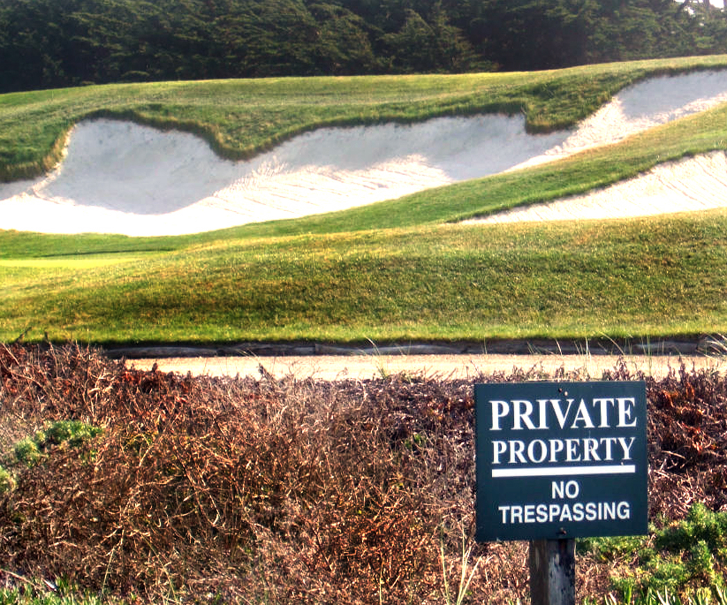
Bolinas — The small town at the south end of Point Reyes doesn’t encourage tourism. Its citizens have been known to take down the road sign out on the highway to mislead travelers. But it so beautiful a town you can understand why they want to keep it to themselves. 

Point Reyes National Seashore — California 1 rides literally atop the San Andreas fault along the eastern edge of Point Reyes. On the other side, a renegade tectonic plate slowly has floated from Southern California to its current location north of San Francisco. Its hills, beaches and farms eventually will move north to Alaska, but give it a few million years to do so.

We’ll take the road further north, but let’s now consider the southern part of the route. We’ve already covered the glory of the Big Sur, but not all of the southern half of the road is quite so sublime. 

It is, of course, not a single highway, but a confusion of roads, for the PCH, as it is known in LA, is not an official name but a popular one, and it covers several U.S. and state route numbers. 

It is best known, for instance, as the beach road in Santa Monica. You will hear natives say they are going to take the PCH to Point Dume or Leo Carrillo State Beach, but the map of the area shows that the road they drive actually is called Palisades Beach Road. 

What is more, when it was cut through the bluff bottom in 1929, it was called the Roosevelt Highway. That is still its secondary name. 

It is also California Route 1. Through most of the state, the PCH follows California 1 and U.S. 101, hugging the coast and its scenery. 

The PCH is born haltingly and in patches south of Los Angeles. 

If you drive north from San Diego, you will be able to skirt the ocean through the city suburbs. California S21 goes through Del Mar and Cardiff-by-the-Sea, but north of Oceanside, you have no choice: You have to get on the interstate. Interstate 5 goes through Camp Pendleton and San Clemente to the actual origin of California 1 near San Juan Capistrano. 

As it travels north through Orange County and Los Angeles, California 1 is just a city street, blocked with stoplights and suffocated with traffic. It isn’t until Santa Monica that it develops its character. The spiritual beginning of the highway is where Interstate 10 ends and dumps out on the PCH under the muddy slumping palisades past the Santa Monica Pier. PCH begins at santa monica

This is the beach California is famous for — surfers and frozen yogurt shops, lifeguard stands and parking lots crammed to the gills with shiny Hondas and Toyotas. The land of swelling bikinis and glistening sunglasses. 

On summer weekends, the traffic is bumper to bumper through Topanga Beach and Malibu. It doesn’t let up — and then only a little — till past Point Dume. But the wait is worth it as the natural world reasserts itself at El Matador, El Pescador and Leo Carrillo state beaches. PCH at_Gladstones Malibu

And if you are lucky enough to be there at midweek in midwinter, you can have the beach all to yourself. Los Angeles is just a bad urban memory. 

For the next 100 miles, the road alternates between beach and city, passing Oxnard, Santa Barbara and San Luis Obispo on one hand and Point Magu, Refugio Beach and Pismo Beach on the other. The road takes a long inland detour around Vandenberg Air Force Base, through Lompoc, beloved foil for W.C. Fields, and although the ocean is hidden, the grassy golden hills of California make a fitting substitute. 

It is north of Morro Bay, however, that the PCH earns its reputation. It would be hard to find a more stunning stretch of coast road anywhere. 

California 1 rides a shelf above the sea cliffs with the ocean on the west and the foothills of the Santa Lucia Mountains to the east. At times, the mountains crowd on the highway; elsewhere, the broad grassy plain widens out, pushing the mountains back. Farmhouses and pasture fence off the flats and some of the country’s best campsites are just beside the road. 

William Randolph Hearst’s castle, San Simeon, is the biggest single attraction in the area. The original yellow journalist and the newspaper publisher who brought us the Spanish-American War spent more than a quarter of a century building the mansion, turning it into a grandiose monument of risible bad taste. 

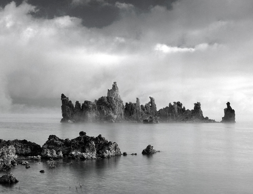
So much for the comic relief: The grand climax of the entire West Coast rises out of the water north of San Simeon. Big Sur, it is called, and it is the very model of the rocks and sea fighting over territory. Bixby Creek Bridge Big Sur

The highway through the area wasn’t opened until 1937. Men died cutting the road from the mountains. It corkscrews in and out of coves and headlands, up and down, with precipices to one side and breakers to the other. 

Writer Henry Miller lived in the area in a little shack on Anderson Creek for years. 

”Often when the clouds pile up in the north and the sea is churned with whitecaps, I say to myself: ‘This is the California that men dreamed of years ago, this is the Pacific that Balboa looked out on from the Peak of Darien, this is the face of the Earth as the creator intended it to look.’ ” 

Miller also said, ”It was here at Big Sur that I first learned to say amen!”  

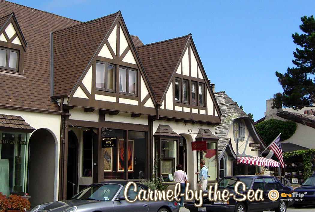
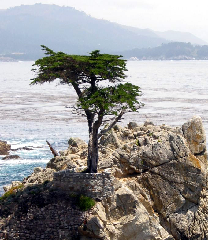
Everything beyond the Big Sur is anticlimactic: The land slowly uncurls and flattens and the real estate becomes populated. Carmel-by-the-Sea is a town of tourists and the slumming wealthy. Coffee shops replace redwoods and couture replaces granite. 

Just outside of town, there is Point Lobos State Reserve, a jutting peninsula filled with sea-weathered rock and Monterey cypress. 

And in the town of Monterey, the aquarium is a perennial favorite. 

But the landscape seems hopelessly mercantile after the sublimity of Sur. Monterey Bay is one vast, flat, muddy estuary given over to the growing of garlic and artichokes. 

North of Santa Cruz, nature reasserts herself, though less majestically. At Point Año Nuevo, there is a state reserve where elephant seals breed each winter. Access is by ticket only, and reservations are a necessity. Pigeon Point lighthouse PCH

A few miles along the road, Pigeon Point Lighthouse is the site of a hostel run by American Youth Hostels with a hot tub perched on a rocky cliff. 

The landscape is green and wet, with creeks gathering from the mountain runoff and pouring into the ocean in sandy deltas lined with beach. There is little traffic most of the year, despite the proximity of San Jose, less than 10 miles away but shielded from the coast by impassable mountains. PCH Pacifica headland

But the closer you get to San Francisco, the more development you find. North of Half Moon Bay, there is only one more brief run of wildness, as the road has to bend around San Pedro Mountain. At the place called Devil’s Slide, where the road cuts through a very unstable portion of the mountain, the road often has been closed by landslide. It is now bypassed by the Tom Lantos Tunnels, which are more efficient, but less adventurous. 

The southern half of the Pacific Coast Highway alternates between the most asphalt-choked cities and the most untamed nature, culminating in the great crescendo of the Big Sur. 

It can be seen as a kind of symphony, building to a grand outburst of brass and timpani, then quieting down to a final city cadence. From Los Angeles to San Francisco — something like 500 miles by this circuitous route — you can forget the planet is filled to the breaking point with humanity. You can reacquaint yourself with the elemental forces of rock, water and air and recharge your batteries. 

But there are some people who say it gets even better. North of San Francisco, there is almost nothing but nature. golden gate bridge

If the southern half is a symphony of alternating moods, the northern half of the PCH is more like the Bach cello suites: solitary, quiet, sublime but reflective. At times, you may feel as if you are the only car on the only road in the hemisphere. 

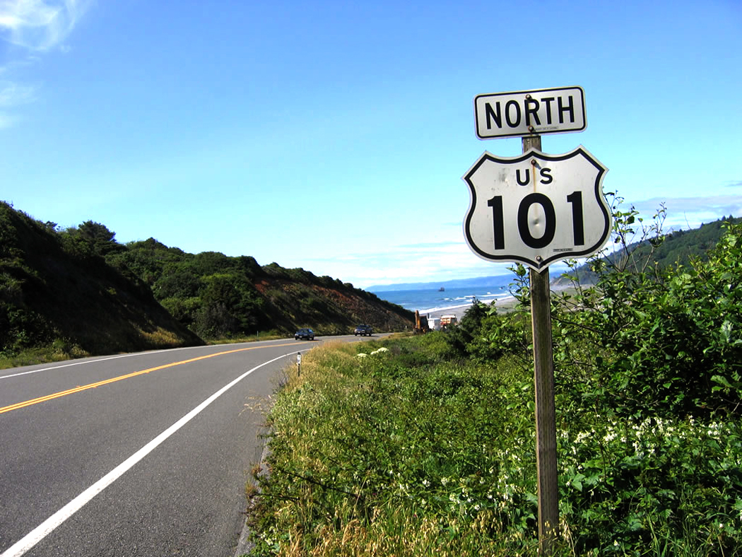
There are state beaches and parks along the way, and a few towns, like Fort Ross and Albion, but for the most part, this is a road between a green interior and a rocky blue sea: a ribbon of innigkeit. At least until you come back to quasi-civilization at Eureka, and the road (now U.S. 101) heads north into Oregon. 

Along the way, there are punctuations. 

Fort Ross State Historic Park — North of the Russian River, you find explanations for the name: Russian architecture speaks of the days when that nation attempted to colonize the western rim of North America. Sonoma Valley fence

Mendocino — One of the most beautiful of the small towns along the PCH, Mendocino is in grave danger of selling out to tourism. It still is worth visiting, but it will not be long before it goes the way of Ferndale to the north. 

Fort Bragg — Much more blue-collar, and therefore much more real, than its tourist-funded neighbors, the town is home to lumber mills and commercial fishing. In it, you can catch the flavor of what actual living is like on the Northern California coast. Mendocino County, Calif Fort Bragg

Leggett — At this little town, not much more than a point on the map, California 1 rejoins U.S. 101 for the trip through the heart of Redwoodland. It is also the home of the ”original” drive-through tree (there are several others). 

Avenue of the Giants — A 33-mile side road that parallels the main highway from Phillipsville to Jordan Creek, California 254 is an old byway that takes you through the heart of the old tourist redwood areas. There are lots of places to buy clocks made from redwood, and several old-fashioned tourist traps for kids. It is hokey enough to be worth visiting. It is also beautiful. 

Humboldt Redwoods State Park — One of the largest stands of redwood, with 50,000 acres along the Eel River, this is the true heart of redwood country. Camping, hiking and just sucking in the ether makes this one of the best stops along the route. 

Scorched redwood, Humboldt Redwoods State Park

Scorched redwood, Humboldt Redwoods State Park

Ferndale — If you really, really want a place to buy souvenirs and ”old fashioned” candy, the likes of which no old-timer ever saw, Ferndale is the place to do it. Like a chunk of gingerbread Disneyland set down in paradise, it reminds us, if we are ever in danger of forgetting, that America runs on money. 

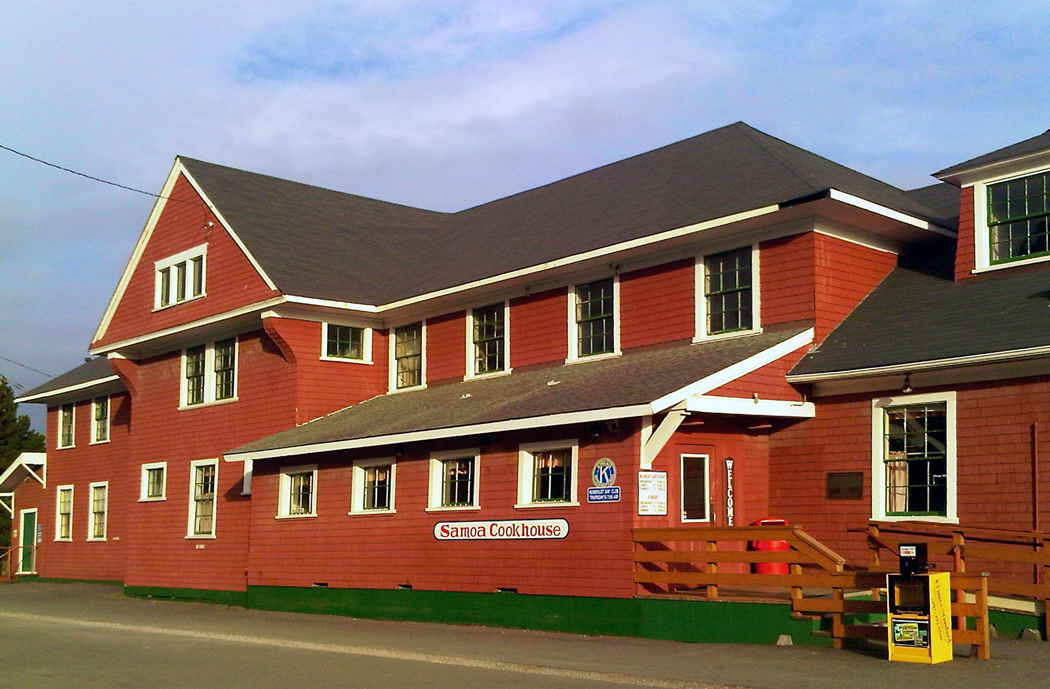
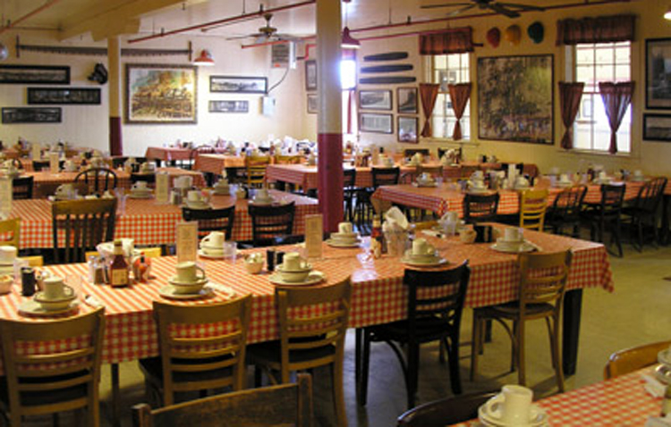
Eureka — The largest town on the route north of San Francisco, Eureka is another gritty blue-collar town, and a healthy dose of reality after the ersatz huckstering of Ferndale. It is also the home of the Samoa Cookhouse, one of the great eating places in the state, where food is served family style and in huge doses. 

Redwood National Park — Spread out in discontiguous patches through Northern California like spots on a Holstein cow, the park protects about 100,000 acres of redwood. It isn’t the best or most impressive stand of redwoods — I recommend Homboldt for that — it still is worth stopping for, especially for the parts that front the ocean. 

Oregon Dunes National Recreation Area — For 50 miles north of Coos Bay, the oceanfront consists of mountainous sand dunes. At Honeyman State Park, 10 miles south of Florence, a 150-foot dune rises over a reflecting pond. 

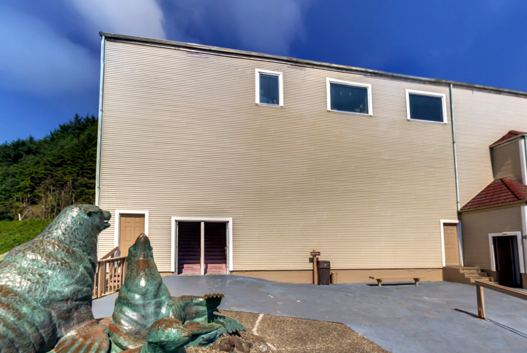
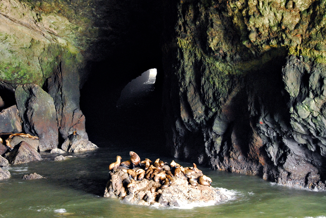
Sea Lion Caves — Just north of Florence, the waves have cut a monster cave in the sea cliffs and thousands of stellar sea lions come there each year to breed. It is the only such rookery on the American mainland. It is a much worthier stop than it might sound like: The tourist trap angle is played down and the animals are real and fascinating. 

US101 Near Yachats

US101 Near Yachats

Yachats — This small town is the perfect seaside vacation resort, with all the restaurants and motels, marinas and beaches that implies. Oregonians come here to rent ”cottages” for a week or two in the summer. 

Oregon Coast Aquarium — In Newport, the aquarium is an up-to-date modern facility with wonderful exhibits and a must-stop location along the highway, just under one of Oregon’s great, green bridges, this over Yaquina Bay. 

Tillamook — One of the few places where the highway steps back from the water, Tillamook is the home of a cheese factory with tours and the world’s largest all-wooden building, which is, in fact, a blimp hangar with an airplane museum inside. 

Seaside — Actually, the whole piece of coastline from Rockaway Beach through Cannon Beach to Seaside more closely mimics the New Jersey shore than anyplace else in America. It is a place for frozen yogurt, saltwater taffy and bicycle rentals. 

Fort Clatsop — When the Lewis and Clark expedition finally made it to the Pacific in 1805, they stayed in a tiny wooden fort they built and named Fort Clatsop after the local Indians. The re-creation of this fort is one of the great historic sites and gives you a chance to learn how the 40 men, one woman and a baby spent the miserable winter before heading back to civilization. 

Aberdeen — The Aberdeen, Hoquiam bi-city area is built on the lumber business, or at least it used to be. The factories and docks are still there, although not always busy. This industrial town is also the birthplace of Kurt Cobain and you can visit the high school he attended; a scholarship has been set up in his name, sort of the equivalent of a good citizenship award named for Vidmar Quisling. 

Olympic National Park seashore

Olympic National Park seashore

Hoh River Rain Forest — The western side of the Olympic Peninsula gets nearly 12 feet of rain annually, making its temperate forest of hemlock, cedar and Sitka spruce luxuriant beyond all bounds. Giant ferns catch the humidity and green out the understory and all winter long – the rainy season – drops of water spatter from the leafage. 

Olympic National Park — North of the Quinault Indian Reservation, the highway pokes out to the ocean once more, and the Olympic Coastal Strip, part of the national park, follows the shoreline for 57 miles, making this the longest wilderness coastline in the continental U.S. 

Hurricane Ridge — The northern entrance to Olympic National Park sits just south of Port Angeles and the long climb up to Hurricane Ridge is one of the great alpine drives. You likely will pass mountain goats, elk and tons of yellow marmots, and it is not unlikely you will come across snow all year long. 

Olympia — Home of Olympia beer — called ”Oh-lee” by the locals – and the end of the route. It is the state capital, but, most of all, it’s a good place to have a beer and celebrate the end of the drive.

alcatraz

It’s called “The Rock,” and its legacy is one of brutality and violence, the result of its history as a fort, military prison and federal penitentiary, but Alcatraz Island also has another, softer face.

The 22 acres of sandstone in the middle of San Francisco Bay has seen both sides of humanity.

Most people know the plug-ugly faces of the gangsters who were sent to the prison. Al Capone and Machine Gun Kelly were only two of the hundreds of miscreants who spent portions of their lives on the Rock.

But because the guards and wardens who ran the place often had families, the softer side of humanity planted roses and hung curtains. The result is a rock transformed to a garden alive with wildflowers and birds.

Of course, the birds have always been there. When the Spanish first sighted the rock in the middle of the bay in 1775, the ship’s captain wrote that the island was “so barren and craggy that it could provide no shelter even for small craft” and they named it La Isla de los Alcatraces, or the Island of the Cormorants, for the number of the birds they found there.alcatraz island 19th c

The Rock remained uninhabited — essentially uninhabitable — until 1859, when the United States Army decided it was a grand spot for a fort to protect the city. Everything necessary to make the fort function had to be imported. That includes not only food and water and building materials, but even dirt.

The dirt was not brought in to make flower gardens, but to construct breastworks around the fort, protecting gun emplacements from incoming artillery fire.

But by 1892, Alcatraz’s batteries were obsolete and the cushioning dirt was gradually moved to residences to allow officers’ wives to spruce up the place. By World War I, there was a concerted effort by the military “to improve the rock itself so that its own beauty shall be in harmony with that of its surroundings.”

And a newspaper account from 1918 reports, “the visitor who comes here expects to find a barren rock, but as he strolls over it, he is surprised to find roses in bloom, sweet peas, lilies and a large variety of other flowers in all their beauty and fragrance. … In this way, barren wastes are converted into garden spots, and ugliness is transformed into beauty.”

In 1924, the California Spring Blossom and Wildflower Association planted hundreds of trees on the island and spread wildflower seed.

But as a fort, Alcatraz had become entirely obsolete and much too expensive to run. So, in 1933, it was signed over to the Federal Bureau of Prisons.alcatraz prison on island

FBI Director J. Edgar Hoover was looking for a “superprison” to hold the most incorrigible inmates who caused trouble at other penitentiaries. And in 1934, Alcatraz opened — and shut — its doors for the first time on what became a long line of notorious hard cases.

Some, like the famous “Birdman of Alcatraz,” Robert Stroud, spent as long as six years in “segregation” or solitary confinement in what is called “D Block.” Whitey Philips spent 13 years there.

“It was cold, it was damp,” says former inmate Jim Quillen, in a tour tape offered by the National Park Service. “And the wind used to just blow through there — you could hear it. At night, you could hear it whistling through the windows.”

Cells 9 through 14 were known as “The Hole,” where inmates were often kept in the dark 24 hours a day. Quillen says he dealt with the darkness by an obsessive game he played.

“When I’d go in the Hole, what I used to do was I’d tear a button off my coveralls, I’d flip it up in the air, then I’d turn around in circles, then I’d get down on my hands and knees and I’d hunt for that button. And then when I found the button, I’d stand up and I’d do it again.”Park Avenue Alcatraz

In their tiny cells or behind the walls of the recreation yard, prisoners had only the merest glimpse of the outside world.

You can walk through the prison now as a tourist and step into a cell to imagine what it must have been like. Cold, clammy, dark and hard, surrounded by steel and concrete.

From some cells, you can see out the second-story windows, through bars, into tree branches.

And you can imagine what the inmates heard of wind, birds and people on the outside.

“The yacht club, which was directly across from the island, would always have a big New Year’s party,” Quillen says. “If the wind was blowing from that direction to the Rock, you could actually hear people laughing, you could hear music, you could hear girls laughing, you know. You could hear all the sounds that were coming from the free world.”

The history of Alcatraz is a history of decay and obsolescence. By 1963, the cell house at the top of the Rock was coming apart. Attorney General Robert Kennedy decided it cost too much to repair the prison and he ordered it closed.

It remained abandoned until a group of American Indians occupied it in 1969 and claimed it as Indian land. They remained until 1971.

In 1973, the National Park Service took it over and made it part of the Golden Gate National Recreation Area.

And it is the romance of the gangsters that brings some 750,000 visitors to the island each year.

They can tour the gray cement prison and the dour fort and residences that surround it. A tape-recorded tour lets them hear the words of some of the yeggs who lived there.

But outside the cell house, among the ruins of old houses and barracks, it is the wildflowers that have taken over, turning the rock into a paradise of blackberries, poppies, cypress and roses.

In the history of Alcatraz, no prisoner ever escaped alive. But it is a delicious irony that these flowers, once planted in housewives’ formal gardens, are known botanically as “escapes.”

deltaview aerial

Most of California is crisp and dry, but the middle of the state is surprisingly soggy.

The Sacramento and San Joaquin rivers join with a host of smaller streams to fill up the deep indentation of San Francisco Bay. Along the way, they create the California Delta. map of delta

Many people don’t even know about the Delta. Here, at the confluence of the rivers, a huge triangular piece of geography that used to be marshland and estuary has been turned by hard labor into a quilt of “sunken islands” that run from Stockton north to Sacramento.

That’s right, sunken islands.

In the 19th century, swampland was sold off at $1 an acre to anyone who would build dikes and levees and drain the formerly submerged land.

And they knew just who would do the work. Thousands of Chinese immigrants who had just finished working on the transcontinental railroad were hired to dig and haul dirt and build up the levees. Windmills were constructed to pump water. And when all was done, California had acquired even more rich, fertile black dirt, spread flat as a tablecloth, in which to grow even more food.

Still, the soil was a little softer than normal, so it’s only fitting that the poem Casey at the Bat, and its proverbial Mudville, should be about Stockton.

In Stockton, too, came the invention of the Caterpillar tractor, needed to negotiate all that mud when ordinary tractors would bog down. OLYMPUS DIGITAL CAMERA

It’s quite a shock to come across the skyscraping bridge on California 160 at Antioch, over the tidal Sacramento River, and descend into land that is visibly lower than the river you just crossed.

If you drive along one of the levee roads, you will look out one side of the car and see the broad waters a few feet below the levee edge, its banks congested with reeds. But look out the opposite window and you look over toward the land and see acres and acres of the tops of pollarded pear trees, with the occasional barn roof peering through. It’s disconcerting.

The Delta is broken up into dozens of these large sunken islands, each ringed with a lip of levee. Farmhouses, even whole towns, are constructed in the bottomland.

One of those towns is Isleton, on Andrus Island, which is separated from Brannan Island by only a ditch. It was built by and for the Chinese laborers beginning in 1874. Later, Japanese agricultural workers came, taking over the northern end of town. Tong chapater house

It burned to the ground in 1925 and, when it was rebuilt, they decided to replace the original wood with corrugated tin and stucco, the better to discourage future fires. This gives the town that scrappy tin WPA feel.

In the 1930s, the town called itself the Asparagus Center of the World because it produced 90 percent of the world’s canned asparagus.

The rank of two- and three-story tin buildings lines Second Street, just under the levee. If the town is not technically a ghost town, it nevertheless looks lonesome. The Japanese population was dispersed to concentration camps during World War II and much of the Chinese population has drifted to San Francisco looking for work.

There is some activity. An old bar has been turned into a bed and breakfast, although it was closed the day I came through town. A few other shops are open, but many of the buildings are boarded up or abandoned.

The old Tong Society building is turned into a museum.

Next door, the Quong Wo Sing Co. is a hardware store. Like most of the buildings in Isleton, its paint is peeling and its trim sags.

Halfway down the block is a little antiques store. I asked its owner whether she didn’t feel a little anxious with a river flowing overhead.

”Oh, never,” she said. ”I’m much more concerned about earthquakes than floods. No one here worries much about the river.”

They were flooded once, she explained. In 1972, a farmer had taken out one of the irrigation pipes that run under the levees so they can water their crops, and he forgot to replace it. River water rushed through and weakened the earthworks, which then collapsed. But they fixed the hole and drained the land again.

”We’ve never once been in danger from high tides or spring floods. They’ve never even come close to the top of the levees. The only trouble we had was caused by carelessness.”

She has been proved right more than once. In 1998, when levees broke throughout the Delta, Isleton remained low and dry. In fact, some of the people who were evacuated from flooding elsewhere were put up at Isleton’s Hotel Del Rio for the duration. delta infrastructure

Isleton has one other claim to, if not fame, then footnote: It is the site of the annual Isleton Crawdad Festival, held each summer.

The highway continues atop the levee, paralleling the Sacramento River all the way to the state capital. It crosses sides a few times over old iron truss and girder drawbridges and passes several more towns. Some, like Walnut Grove, take the precaution to build their civic buildings up at the level of the levee.

The river itself isn’t exactly wild, either. It is largely channelized and makes long, straight runs between marinas. One branch of the river has been turned into the Sacramento Deep Water Ship Canal, making the inland city a seaport.

And much of the water never makes it to San Francisco Bay. Instead, it is pumped south so 20 million people in Southern California can pour themselves a glass of water.

castroville artichokes

It is one of the eeriest sights I have ever seen: miles and miles of dense, spiky artichokes, looking like a carpet of green sharks’ teeth on the hillsides. It seems like the kind of alien vegetation a Hollywood art director would design for a Star Trek sequel set on some lush, hostile planet where the foliage dines on people in a nice vinaigrette.

As you drive inland from Monterey, you run across the characteristic pattern of California agriculture. Instead of small, mixed-product farms, you have specialized industrial production. san juan bautista agriculture

So that the area near Castroville is all nettled with artichokes and up the road, you pass through towns claiming to be the ”mushroom capital of the world” and the strawberry capital, followed by fields of broccoli, orchards of apples and, finally, the town of Gilroy, around which grows 90 percent of the world’s garlic.

But that’s not the way farming began in the Santa Clara region.

Exactly 200 years ago, a Roman Catholic mission was built at the foot of the Gabilan Mountains, overlooking a broad flat valley. San Juan Bautista was the 15th mission built in California in a series that attempted to space them a single day’s journey apart, from San Diego to Solano, north of San Francisco. Eventually, 21 missions were built.

A portion of their original connecting ”Camino Real,” or Royal Road, is still visible near the mission, named after John the Baptist.

In May of 1797, a detachment of six Spanish soldiers arrived in the area and began construction. They built a chapel, a granary, a rectory and a guardhouse.

One month later, Father Fermin Lasuen came to the new mission from San Jose and dedicated the site.

As with other missions, its goal was to baptize local Indians and spread the word of the Church. By the year 1800, there were more than 500 Indians, from most of the 23 nearby tribes, living in the mission and farming the land around it.

Also in that year, the first major recorded earthquake hit and devastated the compound. A second church, which eventually became the largest in the series, was begun. The church of San Juan Bautista, in the small town of the same name, had a long nave and two aisles, unheard of in California when it was completed in 1812.

It is still an active parish church, although it is also a tourist attraction, with a small museum and gift shop.

The Church is advised to build on rock and not on sand, but the biblical injunction fails to make note of plate tectonics: San Juan Bautista’s nearest neighbor is the noted San Andreas Fault. As you stand near the mission’s large front doors, you can look out over the green valley behind the church and see the odd, torn ground surface, scars of grinding geology.

The mission has suffered numerous tremors. In the Big One of 1906 that most people call the San Francisco Earthquake, San Juan Bautista’s side walls collapsed. The aisles were abandoned and the central nave bricked up to make a much narrower church. It wasn’t until 1976 that the original floor plan was restored when piles of old, crumbled adobe were recycled and made into new bricks for the project. san juan bautista facade

The mission is also known by millions of moviegoers as the location for the church-tower acrophobia in Alfred Hitchcock’s Vertigo, when Jimmy Stewart tries to save Kim Novak.

But there are odder episodes: One-eyed stagecoach driver Charlie Parkhurst lived in the town that grew around the mission. Charlie was born as Charlotte and picked up the masculine habits of cussing, tobacco chewing and firearms and later became — 50 years before women’s suffrage — the first female to vote in California, although the truth of the matter wasn’t known at the time. san juan bautista interior

But that can’t really be said to be the most peculiar incident in the mission’s history. That palm goes to the story of a hurdy-gurdy’s military use.

In 1828, the mission acquired an English barrel organ. That is one of those ”music box” instruments that makes music with a large rotating cylinder covered in a pattern of protruding pins. It is an impressive thing, with mock organ pipes showing on its front through Gothic wooden tracery.

One day, some hostile Tulare Indians attacked the mission, roaring into the compound. An alarm was sounded, but the place was essentially unarmed. The padre had one last desperate idea and brought out the barrel organ and began cranking.

The Indians stopped cold and began singing. And then they decided they liked the music so much, they laid down their arms and decided to stay at the mission.

17-mile drive

I love California, with its green trees and golden, grassy hills. I love its desert and its two great cosmopolitan cities. But I know that the state isn’t perfect. There are earthquakes, bad air and traffic.

And there is the problem of Carmel: A worm in the apple.

This is like being in love with a beautiful woman and hating her taste in gaudy gold necklaces, for Carmel, like jewelry, is about money.

It reminds me of Beverly Hills with a view, all shops and wealthy wives promenading in the tree-shaded sidewalks with their Lhasa apsos.

It is a shame, because the area is one of the coast’s most beautiful. The churning sea whips granite rocks topped with arthritic Monterey cypress trees. carmel postcard

Yet its residents have turned Carmel into a kind of Disneyland for the Gold Card. Fake Tudor storefronts mix with artificially quaint habits, such as the lack of street addresses and mail delivery.

City fathers have banned fast food to the fringes of town, but they have been less inclined to stem the spread of Armani shops and Ralph Lauren boutiques.

As a row of greedy storefronts waiting to pick your pockets, there is little difference between Carmel and a Mexican border town except the income levels.

At one time, Carmel was something of an ”artists’ colony.” Before it was priced out of their reach, the town was home to writers such as Jack London, Mary Austin and Sinclair Lewis. Poet Robinson Jeffers built a stone house and wrote about the wind-swept ruggedness of rock and ocean.

Painter Maynard Dixon lived there for a while, and photographer Edward Weston made Carmel his home.

Now, there are many art galleries, but precious little art. Most of what is for sale are little more than expensive souvenirs, and just as tasteful in their way as Statues of Liberty with thermometers stuck in their ribs.

Traffic, especially on weekends, is gridlocked. People want to see what there is to see, hoping that includes former Mayor Clint Eastwood.

And if they continue farther north and pay the hefty toll — as much as a full-price movie ticket — to drive the famed 17-Mile Drive, what they will see for more than half of those miles are the fenced-in back yards of the wealthy. 17mile drive house 2

The road finally breaks out along the coast, where you can see the twisted Monterey cypress trees and the surf-bashing rocks, but you also see one golf course after another, with all kinds of ”Keep Out” signs. private property

Pebble Beach is only the most famous of the courses.

The Drive began as a gravel carriage road in the 1880s for residents of the elegant Hotel Del Monte, which was built by Charles Crocker. Writer Robert Louis Stevenson lived briefly in the area and saw its early, Mexican character eroded by people like Crocker, who he called ”millionaire vulgarians.” Lone cypress in 17-mile drive

Those millionaires managed to buy up most of the peninsula and privatize it, which means they even can threaten to sue anyone taking pictures of their ”Lone Cypress” that hugs the rock along the Drive and has become the trademark for the Pebble Beach Co. Working artists are not even allowed to make a painting of the tree without ”prior written consent of the Company,” according to the brochure.

The company employs a ”director of intellectual property” to make sure no one misappropriates their tree.

The whole thing feels mean-spirited. No one can take the joy out of living like a lawyer.

big sur coast

The sun is dropping into the Pacific, and I’m turning north on the Coast Highway, headed for Big Sur.

The California coast south of Monterey is one of the most glorious in the world. It is a great bumping of hard stone and cold seawater. The headlands jut out into the ocean and the waves erode them back, and at all times you hear either surf or wind, and often cannot tell which.

It is one of those animated places in the world’s geology that reminds you that even if there were no people on it, even if no animals, the Earth would still be alive.

Twilight is early and long in December, and although it has been a clear blue day, there is a ridge of fog out at sea that threatens to come inland and block the last rays of sunlight.

It is about 4 p.m. as I leave Morro Bay and head north. The highway is a four-lane divided road and traffic zips at 70 mph past the small resort towns of Harmony, Cambria and San Simeon.

Then the road becomes narrow and so curvy it seems like an asphalt moth as it flits up to the right and down to the left, not making up its mind where it wants to go.

I have been driving nearly 300 miles since leaving the Mojave Desert in the morning. And I’m feeling a little giddy as I drive the car like an arcade game, following the twisting road, racking up points by passing slower traffic.

The fog bank stays out over the water, but a large, dark patch of cloud lowers over the coastal mountains that rise up out of the water. The Coast Highway hugs the shoulders of those mountains, wrapping into the coves, where streams drop into the sea, and back out around the headlands.

For patches, the road will straighten out as it passes through flat grasslands that make a border between the sea cliffs and the more inland hills, but just as you get used to that, the road climbs up and over a rocky promontory and begins weaving again.

This is not a road for everyone. You have to love driving. I do.

So as the sun goes cold behind the fog, and the light turns a shadowless twilight, I race along like a maniac. big sur

It’s most likely that I’m a bit daffy from long hours behind the wheel, but I can’t help myself. I’m enjoying screeching around the bends, taking the hairpin turns on what feels like two wheels, and passing every slow road-clogger whose backside I come up against.

It is a 90-mile stretch along the Big Sur, that great rocky headland that sticks its face into the sea wind between San Luis Obispo and Monterey. In places, the road is nearly washed away. Only one lane remains and traffic has to take turns going north or south along the remaining pavement.

And with the sun finally below the horizon, there is a strip of bright sky remaining above the fog belt and below the great dark cloud. It is reflected in the sea in a phosphorescent turquoise green that cannot be real.

As I whip along the road with my up-beams gleaming back at me from the reflectors on the road stripe, I can occasionally see a flash of light in the corner of my eye. When I look, there is nothing, but when I turn back to the road, it flashes again.

I almost think it is an angel flying beside my Toyota, keeping me safe; but no, it turns out to be my own running lights reflecting off the guard rail at the edge of the road.

When the last bit of dusk has been drenched in black, there is nothing to see but the reflectors. They dance in my eyeballs. I recognize the symptoms of road hypnosis, but I don’t slow down.

Up the rise, around the tight bend, down over the bridge and up the next rise, all I see is the twin yellow lines of dots flashing at me from the center of the road.

The windshield begins to fog. I wipe it inside with a cloth.

A car comes the other way. I drop to low beam. big sur river inn sign

It is completely black, but there are grades of black showing in front of me. The blackest black is rock, rising to the right side of the road. The lightest black is the ocean below.

I am doing 55 around turns that say ”Curve: 25 mph,” alternately braking and accelerating. It has become a game.

But when I finally recognize my own exhaustion, I pull into a motel on Pheneger Creek and feel how cold the air is. I am almost shaking from tiredness. I cannot wait to sleep.

Mono Lake From Mt Dana

You drop down nearly 2,000 feet from Conway Pass in the Sierras, taking U.S. 395 over the top, and spy in the distance a very large, whitish lake. It is Mono.

The alkali lake, which Mark Twain called the ”Dead Sea of California,” nests at about 6,000 feet in a drainless basin, surrounded by sagebrush and mountains.

”Half a dozen little mountain brooks flow into Mono Lake, but not a stream of any kind flows out of it,” Twain wrote in one of the few lines in his book Roughing It that isn’t a complete lie.

From "Roughing It"

From “Roughing It”

He also wrote, ”Mono Lake lies in a lifeless, treeless, hideous desert, 8,000 feet above the level of the sea, and is guarded by mountains 2,000 feet higher, whose summits are always clothed in clouds.”

I should point out he has the altitude wrong, both for the lake and for the surrounding mountains, which, in fact, rise up to 4,000 feet higher than the lake, as Mono Dome tops out at 10,500 feet, with a load of snow in December.

”This solemn, silent, sailless sea — this lonely tenant of the loneliest spot on earth — is little graced with the picturesque. It is an unpretending expanse of grayish water, about a hundred miles in circumference, with two islands in its center, mere upheavals of rent and scorched and blistered lava, snowed over with gray banks and drifts of pumice stone and ashes, the winding sheet of the dead volcano, whose vast crater the lake has seized upon and occupied.”

Well, the lake is about 100 square miles in area, but in circumference is considerably smaller than Twain brags. The actual circumference alters with the water level — which changes with the climate, both meteorologically and politically — and is about half what Twain has.

But his greatest calumny is in saying the landscape is not picturesque. Mono lake tufa

For Mono Lake, sitting at the base of the great, battleship-gray Sierra Nevada Mountains, is one of the most beautiful sights in the eastern part of the state.

The sight of water alone, in the midst of the high desert, is a delight to look upon. But the lake is surrounded by minty-green sagebrush — which will perfume your fingers for the rest of the day if you crush a few leaves under your nose to gather the aroma — and its surface is broken by the eruptions of tufa towers.

These towers, created underwater out of calcium carbonate, look like giant African termite mounds, except they are as hard as concrete, which they very nearly are.

They are formed when fresh water, bearing calcium, bubbles up from springs under the lake and mixes with the carbonate in the lake water. The towers rise higher and higher until they reach the surface of the water.

And when the water recedes, as it has done in the past 50 years, the towers are exposed to the air, looking like great sand castles clustered near the shoreline. A few sit out on high ground, 20 feet high. mono lake monochrome

Twain also has it wrong when he suggests the lake is lifeless. There are two main inhabitants of the water. First, the trillions of tiny brine shrimp, and second, the equally attractive brine fly, whose larvae live underwater and forage on the algae that grow there. In the summer, the shores are blackened with the adult flies.

Brine shrimp

Brine shrimp

And they in turn attract up to 90 percent of the sea gulls that live on the California coast, who migrate in the summer over the Sierras to breed and to feast on the banquet of buzzing lunch.

About 80 species of bird make the trip to Mono for the festival. That includes an estimated 800,000 eared grebes and 150,000 phalaropes.

Mono’s biggest problem is Los Angeles, about 250 miles away and thirsty for the water that flows into the lake.

Beginning in 1941, LA began diverting the water from four of the tributary streams. Over the next decades, the water dropped 45 feet and doubled in salinity, making life difficult for the creatures that depended on it. The exposed salt flats created corrosive dust storms. The island where the gulls laid their eggs was connected to the shore by a land bridge, allowing predators to feast on the eggs. Trout fishing dried up in several streams.

No one seemed to care, as long as LA spigots gushed forth. No one but the few people who loved Mono. The Mono Lake Committee and the National Audubon Society, with some others, brought suit and in 1994, after 16 years of court battles, research and hearings, the state Water Resources Control Board issued orders to protect the lake and raise the surface level of the lake by 17 feet over the next 20 years.

In the meantime, Mono Lake sits in its landlocked basin reflecting the blue Sierra sky and looking like a fantasyland of surreal castles.