Archive

Tag Archives: frenchman’s bay

“Which way to Millinocket?”

“Don’tcha move a goddamn inch.” 

Maine jokes — an acquired taste, perhaps. So many of them are built on city slickers asking for directions. “You can’t get there from here.” (Say it with the accent: “You cahn’t get they-ah from hee-ah.”) Lost travelers always seem to find farmers willing to guide them: “First, you drive up a mile, mile-and-a-half maybe, and turn left where the old church used to be.” 

“Used to be.” It is a familiar refrain in the more rural and forgotten areas of the state, and along the coast north of Acadia National Park, where few out-of-staters are likely to venture — an area known as “Down East.” 

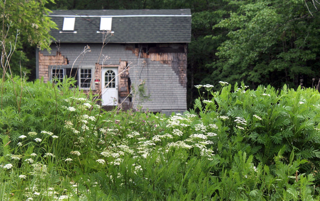
There is much that “used to be” in Sullivan, Maine, a small community on Taunton Bay about 15 miles beyond where the tourists turn off U.S. 1 to Mt. Desert Island and Acadia. With a population of about 1200 spread over half a dozen townlets between Hancock and Gouldsboro, it has been home to my best friends from college for about 30 years. Over that time I have visited them often. 

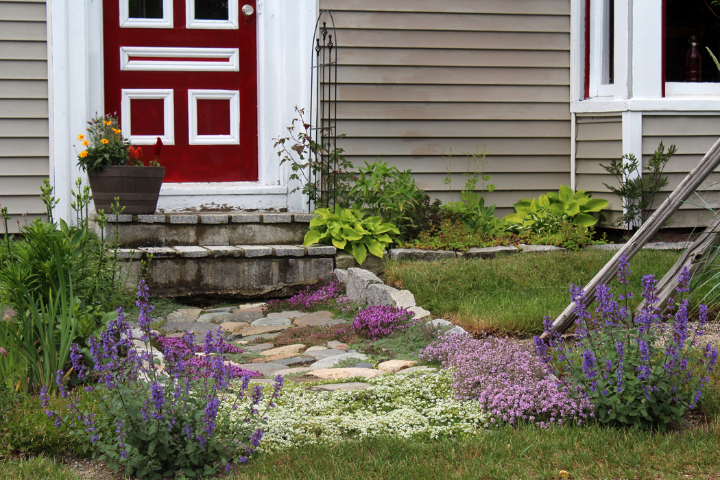
They have an old farmhouse (I call it a farmhouse, although there is no farm) in North Sullivan along the road that parallels Taunton and Hog bays. Like much in the town, it is weathered and steeped in character. 

Sullivan has changed over those decades, although you might not notice it if it were your first visit. It still looks quaint, as if it were some Down-East Brigadoon. But there are many things that “used to be.” 
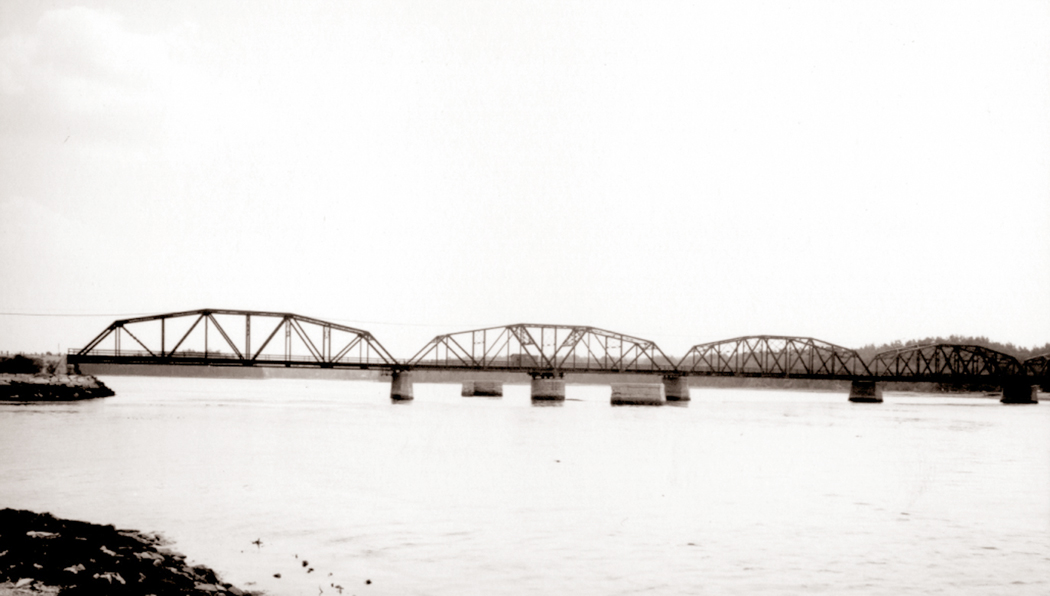
The Singing Bridge

For me, the most notable is the loss of the singing bridge from Hancock to Sullivan over the narrows between Frenchman’s and Taunton bays. The old bridge had a steel mesh roadway and every time a car ran over it, it roared like a banshee. That steel-truss bridge was replaced in 1999 by the “silent bridge,” made from prosaic concrete. 
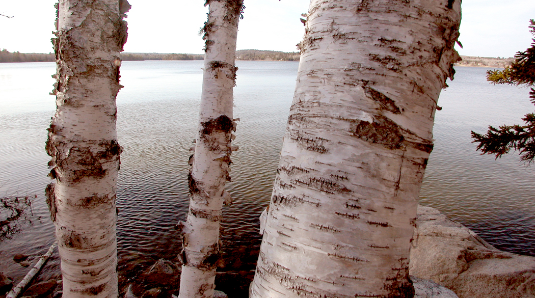
Taunton Bay

The singing bridge was opened in 1926, replacing, after many years, the original wooden toll bridge that was washed away by winter ice a few years after it opened in the 1820s. Between bridges, a ferry ran from south shore to north — a flat boat that held one carriage at a time and charged a dime for a crossing. The Waukeag Ferry went out of business when the singing bridge opened. 

Stuffy

You get attached to something and then, it’s gone. When we first started going up to Sullivan, there was, just across the bridge, a small, wooden roadside ice cream stand called “Stuffy’s,” which also sold lobster rolls and the best lobster bisque I ever ate. We went back there for lunch many times. Of course, it is now gone. 

Abandoned quarry

So are the granite quarries that used to support the town, and so are the silver mines that made the town viable in the first place. 

According to A Gazetteer of the State of Maine, published in 1886, “There are now eleven incorporated companies owning mines in the town, most or all of them being operated. Work has been done also in five or more unincorporated mines. There has been completed in the vicinity a concentrating mill and smelting works for reducing silver ore.

“On the various streams there are two saw-mills, two stave mills, one shingle-mill, and one grist-mill. … A steamboat touches at Sullivan Falls three times a week.”

All gone. 

The Native American name for the area was Waukeag. It was first settled by the French in the early 1700s, but was given to English-speaking settlers by the colonial government of Massachusetts in 1761, when it was called New Bristol. It was incorporated in 1789 under the name of Sullivan, one of the original settlers. At the time of the Revolutionary War, there were just 20 families in town. By 1870, the population was 796. In 1880 it was 1,023. It is not much bigger than that now. 

Schoodic Mountain

As you drive north on U.S. 1 through Sullivan, you can often spot Frenchman’s Bay to your right, a vast tidal flat at low tide, a lake at full. In the distance to the south you can see Cadillac Mountain and Mt. Desert Island. Just north of the highway is Schoodic Mountain, 1,069 feet high, and Tunk Lake, where Rear Admiral Richard Byrd used to have a vacation home. 

On the peninsula just south is Sorrento, a resort town a bit more upscale than Sullivan. 
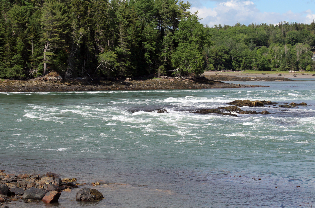
Reversing Falls

And at the mouth of the inlet, where Taunton Bay dwindles to the narrows that used to be called Sullivan River and opens onto Frenchman’s Bay, the tide creates what is known as a “reversing falls,” where the rising tide creates a dangerous rapids heading into Taunton Bay, and with a falling tide, creates the same rapids in the opposite direction. The current is fierce, up to 13 knots. 

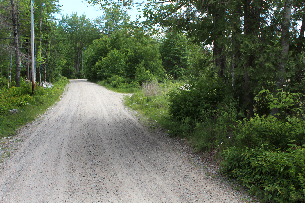
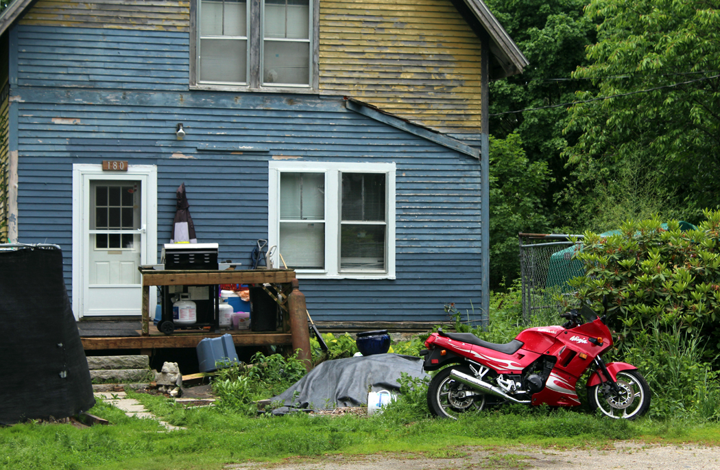
But it is Taunton Bay Road that is what I am most interested in. Just after the silent bridge, there is a left turn that takes you through West and North Sullivan along the eastern shore of Taunton Bay. It continues out of town along Hog Bay and into Franklin. The road is beaded with old homes, usually clapboard with front porches and foundations or stoops made from granite once quarried locally. 

Across the water, Taunton Bay opens up into Egypt Bay and the town of Egypt, made famous — or notorious — by Carolyn Chute’s 1994  book, The Beans of Egypt, Maine. 

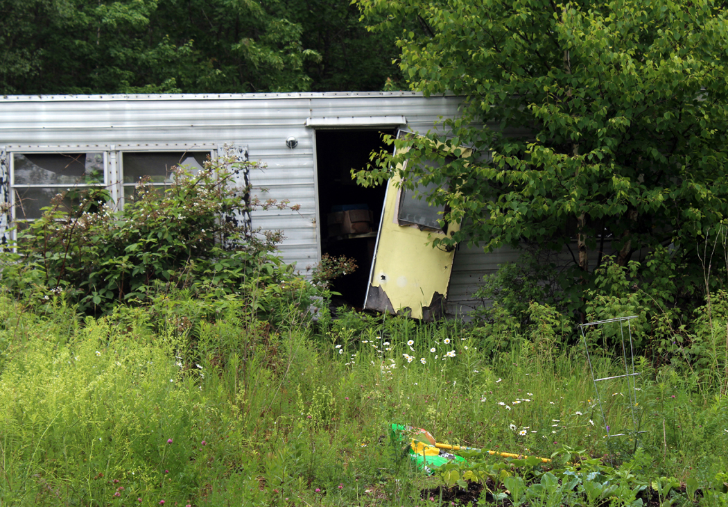
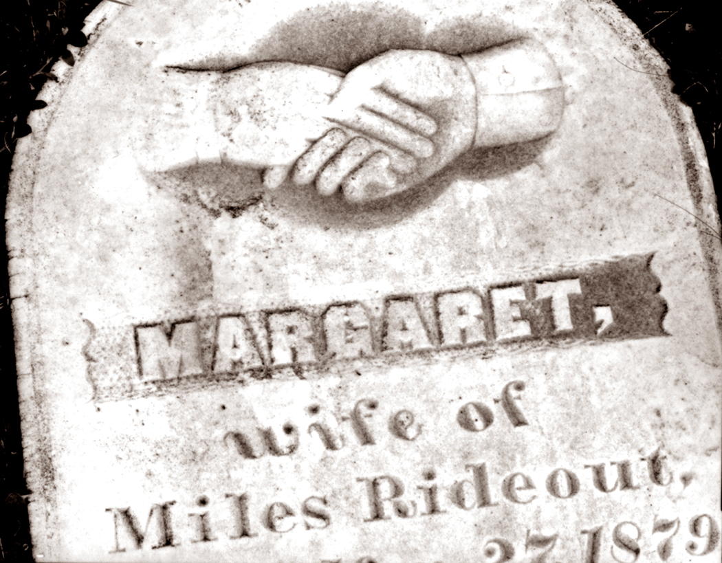
Among other losses in Sullivan are Jerry’s Hardware and, while Gordon’s Wharf is still extant, the busy fishing business is gone. There are a few family cemeteries, an art studio where stone sculpture is made, and a ceramic studio. 


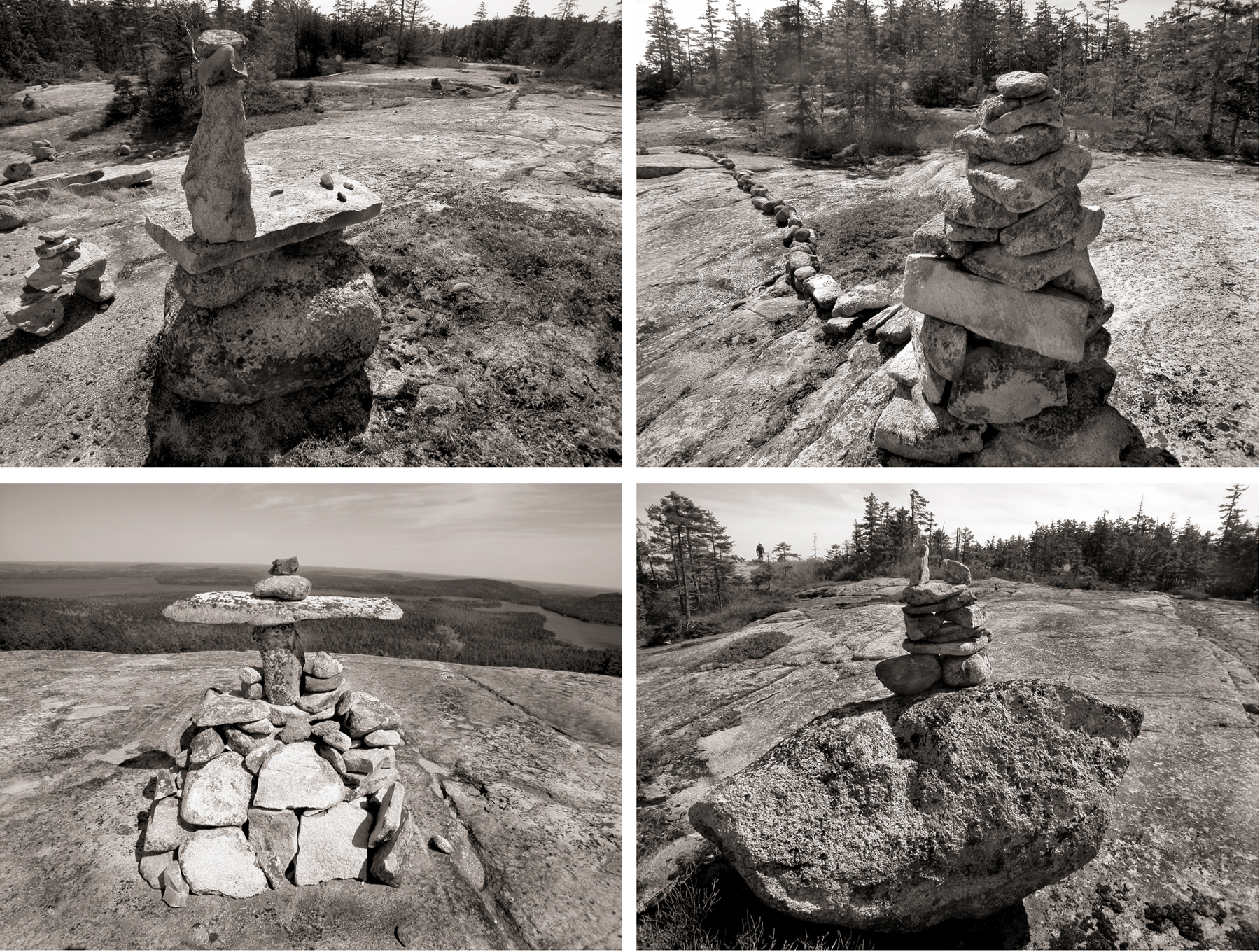
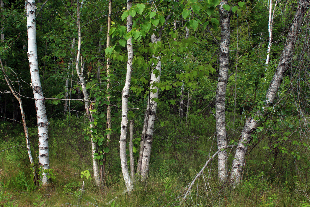
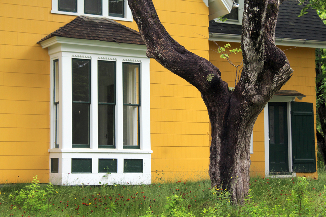
This last time I visited, I attempted to make a “portrait” of this end of Sullivan, the way Alfred Stieglitz made a portrait of Georgia O’Keeffe — hundreds of photos that I hoped would, in aggregate, give a sense of the place. I can only share a tiny fraction here. You can find a more detailed portrait of a single house at (link here). 

There are three reasons to photograph something you care about. First, simply to capture it so as to possess it, for the sake of memory, the way you keep old snapshots of family birthdays and vacations. Second is to create art, that is, to make an image out of shapes and colors in a design that has graphic interest. But third is to see.

We look over so much at every minute of every day, but seldom see it. Looking closely, paying attention to details, absorbing character, seeing relationships — these things come with seeing with purpose. Seeing is engaging. Engaging is being alive. 

Wandering through Sullivan, I wanted to gather albumblätter  for my scrapbook; I also wanted to make something that might be, in its tiny way, considered art; but most of all, I wanted to use my camera as a way of focusing my sometimes wayward attention on something I want to know more deeply.  It is a way of expressing affection. Photographing, done this way, is a means of caring.

To collect snaps, or to frame art are fine in themselves, but using the lens to focus the mind and heart is infinitely more rewarding. It creates meaning.

Click on any image to enlarge

carnac-alignment

We went to see the stones. They stretched for miles, each stone like an  upright soldier in a formation. They are called “menhirs,” and they populate the area around the seaside town of Carnac in Brittany.

When we drove up to the first formation, the sun was low in the sky and shadows stretching long. We stopped by a field filled with menhir and dolmen, the ancient stones erected some 7,000 years ago for god knows what purpose. Thousands of the stones in stripes across fields, and made of a type of granite that is not local. No one knows how they were made nor why. Carole was especially worried about why.

“Maybe they were religious,” she said. That is the most common supposition. But that didn’t really satisfy her.

“I know,” she said, “they must have been used for some sport. If something was important enough for men to exert this much communal effort to transport tons of stones over miles and miles, there must be a stick and a ball involved.”

We’d drive for a few more miles and she’d pop out with, “Or maybe they were the foundation for some kind of building,” and then, after not saying anything for a long while, “Maybe they were meant to line up like soldiers; maybe they scared off an enemy.” She seemed obsessed with the stones.

tourists-at-the-menhir

Click on any photo to enlarge


The next day, we went out to explore. Some 4,000 menhirs, or upright granite stones, from about three feet high to almost 20 feet, are striped across the landscape in three or four major “alignments,” as they are called.

Erected some 5 thousand years ago, or maybe 7 thousand — it all seems lost in the haze of prehistory — the Celtic forebears of the Bretons hauled these logs of granite from their origin, miles away, and lined them up over the rolling meadows just north of town.

No one knows that they were erected for. The usual theories of religious meaning are trotted out, but no one really knows. Carole persists for a while that they must have been used for some sort of sport or game, going on the theory that only a Superbowl or the Olympics can bring that much commitment out of a guy, let alone a lot of guys.

menhir-3

We talked about it at lunch, in Locmariaquer, the site of some other megaliths.

Over the oysters, I said, “I think that it is just as likely that someone in the old days went crazy, heard voices in his head telling him to to this, and he then, through the intensity of his insanity, persuaded the community to erect the menhirs. Like a sachem in an Indian tribe. ”

Carole dislike the idea that this might reflect badly on shamans. She maintains there is a difference between visions and psychosis. She has her own reasons for holding this distinction.

“That’s not quite what I mean,” I said. “I mean that someone genuinely nutso hears voices, like Son of Sam — ‘My dog told me to do it’ — and because to ordinary people a shaman and a nutjob are very hard to tell apart, they might have signed on to follow him, the way the Germans signed on to follow Hitler to Valhalla.”

“But the shaman’s vision is always one to help the people, never to harm them,” Carole said.

“Well, Hitler certainly thought he was helping Germany, but we’re getting off on a tangent,” I said. “I just mean that, well, like Moses in the desert, perhaps touched by the sun and heat, came up with a lot of crazy ideas, maybe some prehistoric Celt went off the deep end and the voices in his head told him they needed to build a field of giant upright granite stones.

“It makes as much sense as any of the other ideas,” I said.

Of course, we’ll never know. Carole is obsessed with them right now, wanting to have an answer.

“Don’t you want to know?” She asked.

“But I can’t know.”

“But doesn’t it eat at you?”

“No, I can’t say so,” I said.

“It’s driving me nuts,” she said.

menhir-6

Later, in the evening, after supper, sitting in the hotel room, she started up once more.

“I thought they might be made as a display to the stars, or a sighting device to line up with stars or the sun or the moon seasonally,” she said. She sat for a moment and then began a litany of possible explanations.

“Maybe people stood on them and covered their bodies and the rocks with some sort of long garment that made them look like thousands of extremely tall and powerful people.

“Maybe they were set up to baffle a stampeding herd of animals.

“Maybe they were set up to make it difficult for an enemy to advance.”

I imagined them like some prefiguration of pachinko, used as a military tactic. Ingenious, I thought.

“Maybe,” she went on, “they were put in the ground so that if one were far, far from home, one could climb up into the mountains and look down and find these stones as a marker for home.”

The only problem with that: No mountains here.

menhhir-7

“Maybe they were part of corrals and used for the beginning domestication of animals.

“Maybe they were racetrack lanes for racing animals.

“Maybe they used to be part of another kind of a structure that included wood and animal hides.

“Maybe they were part of ancient stalls filled with trade goods.

“Maybe they were an arduous maze a person had to thread through like the meditation mazes in cathedrals.

“Maybe they had something to do with cognitive development — a step between concrete thinking and abstract thinking. Maybe they used them to learn to count from one to a thousand.”

After worrying about this for two days, she continued as we drove out of town, on to Concarneau.

“I need to know what they were for,” she said. “I still think my best guess is that they were for some sort of ball game. You know men are fascinated by a combination of sticks and balls and counting. The counting is important.”

menhir-7

A woman we met, who was from Great Britain, said that she read that the rocks at Stonehenge were transported from far away, also, and that there is a theory that they came from a site powerfully effective in healing.

“But I don’t think that is what these stones were for,” Carole said after we drove on. “They must have been for something massive, because there were thousands of them. They must have been very important for the people who arranged them, because the second group we looked at were actually stone paths, completely straight, leading toward the horizon for many many many miles. So I thought maybe this part of the stone arrangement is a runway for souls. Souls taking off to their journey to the afterlife on foot, that is.

“Maybe they were foundation stones upon which wooden logs were placed for some type of a floor and another structure made of wood came up higher. If they were used as foundation, the equidistant placing of them makes sense, because they are about as far apart as an ordinary tree trunk.

“Or maybe creatures with immense strength arrived from outer space and used some sort of anti-gravity device to pick the rocks up and put them down again in this part of France.

“Maybe they are thousands of monoliths like the black rectangle in 2001: A Space Odyssey.

“Maybe they were a huge dentist office and each person had his own stone to come to and bang his head against until he was senseless and no longer could feel the toothache.”

She was beginning to get a little punchy.

“I also think my first impression of them might be worth something —  that was that they were the earth’s teeth.”

cairn-frontispiece

Part 2

I am a reasonable man and my goals are reasonable. Some burn for the challenge of climbing great peaks; my more modest goals involve the less famous ones. They can have their Everest, their K-2, their Matterhorn or Aconcagua. I have Tucker Mountain.

It sits in Hancock County, on the coast of Maine, north of where any tourists go. From its summit, there is a great view to the south and Cadillac Mountain and Mt. Desert Isle. Its summit, by the way, tops out at 394 feet above sea level. More my style. Still, in places, it is a rugged enough hike.

My friend Alexander wanted to show me the view, and we walked through the mossy woods up past rocky outcrops and on to the goal. Along the way, we kept passing cairns — piles of rock set up by hikers. Some were simply rock-piles, but others showed more ambition, and could easily have passed for sculpture in any trendy art gallery. The more of them we passed, the more it seemed as if something cultural were going on — that there must be some compulsion to make these stony reminders that Kilroy was here.

cairn-quad-01

I photographed them as we walked, and by the end of the day, I had something like 50 or 60 images of them, and that counts having given up on cataloging every single instance; I did not photograph many of the more mundane piles.

I don’t know if such things litter the tops of all the local mountains. I don’t remember seeing so many cairns when Alexander and I climbed the summit of the more daunting Schoodic Mountain nearby (summit: 1,069 feet). Perhaps the cairns on Tucker Mountain (I should call it Tucker Hill) are the work of a single artist, or a single obsessive personality, or a small group of people wanting to make a statement. Usually cairns are left either to mark the trail, or to commemorate some important event. These seemed to exist for their own sake.

But they certainly brought to mind the dolmens, cromlechs and menhirs of Celtic Europe. They don’t have the permanence of those menhirs, which have survived thousands of years; these cairns are just rock set on rock, so the first hard frost could topple them. But I had to wonder if the impulse might have been the same: Make my mark — the X on the dotted line — the proof that someone was here.

cairn-quad-02

There is a resistance to cairns; many dedicated hikers despise them for being unnatural, and for being the equivalent of vandalism. I can’t join their ranks. The best of these cairns are genuine works of art and should be appreciated for such. Their artifice can hardly be a valid source of complaint when the hikers are marching along equally artificial trails through the woods, marked with paint blazes or diamond-shaped route markers stapled to tree trunks.

The cairn-makers may well think of themselves as being clever, postmodern, or snarky, but the bottom line, on which their “X” resides, is that the cairns are the universal cry of the one among the many, like the opening wail of the newborn baby: I am here.