Archive

Tag Archives: U.S. 101

USACE Tillamook Bay Oregon

Tillamook has a more interesting history than most towns of its size and obscurity.

While most towns north or south of it on the Oregon coast have catered to the vacationer, with beachfront motels and seafood restaurants, Tillamook remains a working town.

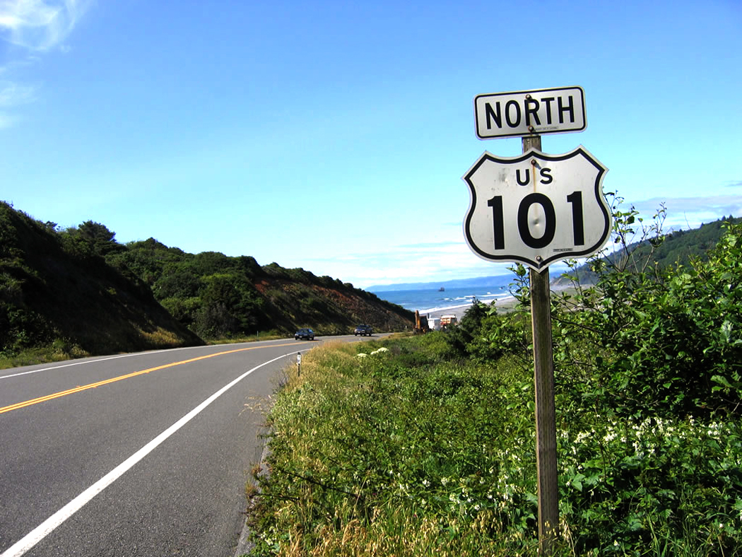
And although it is situated along U.S. 101, which is the famous Coast Highway, Tillamook is back from the ocean, in a wide flat valley filled with cows and lumber.

There are also a series of prominent mud flats.

But the predominant impression is of green: vast pastures filled with cows. Tillamook is primarily a dairy town, with several cheese factories.

There is a short-line railroad with a diesel locomotive painted in the black-and-white patchwork of a Holstein cow. Tillamook Cheese Factory

Self-guided tours of the Tillamook Cheese factory are available, with samples of curd and Cheddar. The factory produces 40 million pounds of cheese each year. You can watch it being made in 40-pound cubes and then cut by automated cheese slicers into smaller familiar sizes. An small army of snood-headed women watches over the assembly line to keep track of errant chunks of cheese and misshapen cubes.

I briefly considered buying a whole 40-pound block but changed my mind when I discovered it would cost about $120.

The high school football team is known as “The Fighting Cheesemakers.”

Tillamook was also the site of the worst natural disaster in Oregon history, in 1933 with the first of a series of devastating forest fires known as the ”Tillamook Burn.”

The fire had a 15-mile front and in only two days destroyed 255,000 acres. And the fire raged for four weeks.

Fires recurred every six years until 1951, causing them to be named the ”six-year jinx.” Ultimately, 325 square miles were burned. It cost $13 million to reforest the blasted areas, which now look green and woodsy.

Natural devastation also did in the vast land speculation known as Bayocean. Beginning in 1906, a series of investors cooked up a scheme to turn a sand spit at the mouth of Tillamook Bay into a vacation paradise, with cottages, hotels and a gigantic natatorium with heated water.

Bayocean natatorium and dance hall

Bayocean natatorium and dance hall

Lots were sold, buildings were built and sales were slow, in part because there was no way to get to the development. There were neither roads nor trains, and the yacht that was supposed to carry passengers across the bay was too large to pass over the mud bars.

But more devastating was the fact that the builders hadn’t taken into account the nature of spits: They grow and shrink with the waves, and it wasn’t long before Bayocean’s cottages fell into the aggressive surf. There was a brief period of prosperity in the community during the ’20s, but by 1932 the natatorium collapsed into the sea. In 1952, a storm split the spit into three smaller islands. The last vestiges of construction on the spit were wiped out in 1960. Today, it is just a story they tell in town.

Bayocean hotel view

Bayocean hotel view

I doubt many in Tillamook still sing the popular song from 1925, Tillie From Tillamook: ”Tillamook Tillie got wild one day, packed up her things and went away. She got weary of the birds and the bees and living on Tillamook cheese.”

According to the song, she moved to Manhattan and the chorus sings out: ”Wooden shoes, a hole in her sock, knees that knock-knock, knock-knock. She’s lopsided and she got that way getting up at break of day. Tillie, Tillie, Tillie, sweeter than the new mown hay. She’s the crash of Broadway today!”

Another piece of Tillamookana, however, is still there to see, just south of town: the world’s largest wooden building. It is a blimp hangar built during World War II for the Navy. There used to be two of them, but one burned down in 1992 when its contents, $300,000 worth of straw, caught fire. The conflagration was so intense that the fire drew 80 mph winds into the hangar.
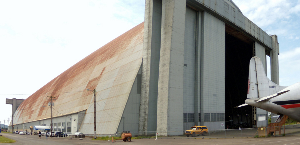
Hangar B

Hangar B

The remaining hangar for now contains the Tillamook Air Museum, with a handful of World War II-era planes, a couple of blimps and some helicopters, along with interpretive exhibits that tell the story of the hangars and the blimps that were used during the war to patrol the Pacific looking for Japanese submarines.

The building is 1,080 feet long, 300 feet wide and 195 feet high and covers 7 acres. You can’t miss it as you drive along 101. There are geological features listed on maps that are smaller than this great humpbacked mega quonset hut.

sea lion caves interior

The Pacific coast has its share of tourist traps. You can drive through the middle of redwood trees, see Paul Bunyan and Babe the Blue Ox at the Mystery Trees, or you can shop in a beached ship.

Most of these venerable stops are getting on in years and it shows in the generally seedy look of weathered paint and warped lumber.

And one of the oldest attractions on the Oregon coast had always sounded just as depressing. I had passed the Sea Lion Caves, about 10 miles north of Florence, several times, but had never deigned to go in. It was my loss. sea lion caves building

For although the caves first waylaid tourists in 1932, it is surprisingly well kept. The small shop at the top of the cliffs that serves as ticket booth and souvenir stand looks as if it were built last year.

Your ticket gets you an elevator ride 208 feet down into the cliff rock, and when you get off, you are in a subterranean cave with a gallery view of the only mainland sea-lion rookery in the world.

The star of this show is the Steller’s sea lion, the larger of the two West Coast sea lions, and you will see up to 200 of them lounging on the rock in the cave below or diving into the pounding surf that tears into the cave every few seconds.

Most people go in the summer. This is a mistake. First of all, you have to fight hoards of tourists and you are whisked down the elevator and back up in as short a time as possible to make room for the next gang.

Second, it is in the winter and spring when the sea lions come to the cave to live and breed.

I was there in December, which like most months on the Oregon coast, is the rainy season. It was 43 degrees with a steady 20 knot wind, gusting to 35 — there is a weather station on site to keep track of these things — and a constant downpour of icy rain, the kind that soaks down to the bone. sea lion caves

In the cave, you are protected from the wind, but it is just as cold and raw, and there is the added pleasure of the barks and yowls of 200 yammering sea lions, which is as loud as certain places at an airport, and the smell, which has been likened to sweat-soaked sneakers, but I say is closer to warm kimchi.

The cave itself is immense: The floor covers two acres under a cave-dome 125 feet above the surf. The waves crash into the west-facing opening and slosh and foam across the piles of rock on the cave floor, where the sea lions sit and howl at each other.

In December, too, it is very dark in the cave. The low sun and the cloudy skies make for perpetual twilight in the cave; it glows with the burnished light of a cathedral interior.

The murk hides the animals at first. It’s hard to see them, although by ear and nose, their presence is well proved.

When you adjust to the gloom, you are shocked to see hundreds of them. Some of the rocks you first saw turn out instead to be a mother and her cub. A young male stands on the peak of the highest rock and lets his throat cut loose straight up into the air.

The gallery where you stand is 50 feet above the throng, and you are separated from the main part of the cave by a chain-link fence.

I watched the goings on — which looked more than anything else I can think of like the floor of a political convention — and only later realized that one sea-lion cow was directly under me on the other side of the fence. I had thought she was a rock, but she rolled over, threw one flipper up into the air like a shark fin and used her hind flipper to scratch her ribs.

She got up and watched me watching her. She stared for some time and weaved her head back and forth, the way you see circus seals bob when performing. I weaved back at her. When she finally decided that the long nose of the big sea lion watching her was really only my ball cap, she lost interest and flopped down again to try to sleep. She must have been an insomniac, because she tossed and turned for some time trying to find the comfortable position.

The cold finally got to me. I lost feeling in my knuckles. I was the only one in the cave, except for the attendant, a genial elderly man with a cultivated New England manner of speaking.

”Not very busy today,” I ventured. ”Must be a madhouse in the summer, though.”

”It moves right along,” he said. ”Our busiest day last summer, we had 1,723 people. The elevator couldn’t get’em up and down fast enough.”

The main natural entrance to the cave was discovered by a fisherman in 1880. He later bought the property, although there wasn’t much he could do with it, as there were no roads in that part of Oregon.

It wasn’t until the Coast Highway, now U.S. 101, was built that anyone thought of developing the property. And when they did, they provided a downhill climb of a quarter mile followed by descent down 250 stairs into a secondary natural opening to the cave. It wasn’t until 1961 that an elevator was installed, making the drop to the gallery possible for anyone but the best athletes. Heceta Head Lighthouse

Now, that secondary opening is a balcony looking out to the north of the bluff where the cave is situated. And framed by the rocky window is a view of the Heceta Head lighthouse. No more archetypally Oregon coast scene could be possible: A rocky headland topped with dark green trees is crowned with the squat white shaft of the lighthouse, which beams out its flash every 10 seconds.

When I rode the elevator back up and got out into the wind at the top of the cliff, I looked out over the ocean and saw a dark gray squall moving on the surface of the water headed directly at me. I thought it a good idea to go the the souvenir shop and wait for it to pass.

Eureka flooding

Winter means rain in Northern California, and I visited when winter meant more rain than usual. Of course, it is the rain that makes the area so green.

But as I drove from Sacramento to the coast, it poured constantly. My window fogs, and I could barely see for 140 miles till I got to Willits, on U.S. 101, the ”Redwood Highway,” which I planned to take to Eureka, an additional 130 miles up the coast. US101 sign

Unfortunately, a flashing sign by the side of the road in Willits tells me, ”Road Closed 125 miles . . . no detour,” which means that I’m cut off from my destination, and the only way around the problem is to drive back to the interior of the state — a backtrack of nearly 300 miles.

So I make a calculated gamble and push on north despite the sign, hoping that whatever the problem is, it might be corrected in the 2-1/2 hours it will take me to reach it.

If my gamble fails, I have an even longer return trip, just to get back to square one. At least it would be one of the most beautiful drives in the world — 101 passes both redwood country and the Northern California coast.

Even on a day of torrential downpour, there is still much to see. Near Benbow, the road snakes leisurely through the Richardson Grove of redwoods, where even when it rains, the windshield stays dry, with the evergreen umbrella several hundred feet overhead.

The farther north I get, however, the emptier the road becomes. I can drive for miles through the green hillsides without passing another car in either direction. I must admit, it does not look promising.

As I drive past the turnoff for the Avenue of the Giants in Phillipsville, the Eel River is a swollen chocolate torrent. Each time the road crosses the river, it looks angrier.

By the time I hit Fortuna on the Sandy Prairie just south of Eureka, the rain has abated, but the road is still a sloppy mess.

And it all comes to a halt at the Loleta offramp. Another flashing sign warns, ”Road Closed,” and a line of cars and trucks a mile long is stock-still.

A friendly CalTrans worker has parked his dump truck in the middle of the road and is directing the motionless line up the offramp. I ask him what’s going on and he explains that Salmon Creek has flooded the highway, pushed back on the muddy tidal flats by the incoming tide.

”Two to three feet of water on the pavement,” he says. ”Been like that since 5 p.m. yesterday.”

The result is that the entire northwestern corner of the state is incommunicado. There is no way between the north and the south. klamath river bear

It may seem odd that a state as big as California, and one that relies as much on the tourist dollar, would allow the possibility that only a single line of asphalt might run through the area. It is true that the mountains are difficult to engineer roads through, but the fact is that there is a 90-mile stretch of mountain with no paved roads running east-west, and only the single strand of 101 going north-south.

In fact, this lack of roads has always been a sore point in Northern California. The residents have felt neglected by their state government, so much so that in 1941, the northern counties of California and the southern counties of Oregon, who felt likewise forgotten, attempted to secede from their states and form a new state called Jefferson.

Roadblocks were put up on the few highways there were, Yreka was chosen state capital and Judge John C. Childs was inaugurated as governor.

The whole thing was only half serious and half publicity stunt, and it all came to a crashing halt with Pearl Harbor. But that wasn’t the first time the region had talked secession. Earlier attempts to form the states of Shasta, and later, Klamath, came to naught in the 19th century.

There is still a feeling of independence in the area.

”For us, California doesn’t start till you get to Willits,” the CalTrans worker told me as we sat in gridlock on the road.

Then came the break: With the change of tides, the water was receding and, although the northbound lane of 101 was still underwater, the slightly higher southbound lane was passable, in convoy with a highway-patrol car in the lead. Eureka farmland

First the southbound traffic came through and passed us. A few drivers gave the CalTrans worker a big thumbs up and a smile.

”On this side, when they’re freed up, they give us the thumb, when they’re stuck going nowhere, it’s a different finger. Then we’re nobody’s friend.”

The fact is that the region has been staggered by near-record rainfall. In the 24-hour period before I drove up the highway in December, just under 5 inches of rain fell, just hundredths of an inch shy of the record. And 2 more inches had fallen this morning. Schools were closed, roads were underwater everywhere. Nearby Ferndale was partly evacuated. Power lines were out and communities were stockpiling sandbags.

Whole farms were lakes. I passed a herd of very worried cattle, which were mooing up a storm. The calves sounded frightened, up to their hocks in water.

So what could make me venture 140 miles up a road I knew to be closed? Why did I make the gamble?

Because of the Samoa Cookhouse. samoa cookhouse2

Eureka is a logging town, and the last remaining logging-company cookhouse remains in business and open to the public on the spit of sand across Humboldt Bay from Eureka.

In the building originally constructed for workers of the Hammond Lumber Co. in 1906, and now owned by Louisiana Pacific, a concessionaire operates the cookhouse as a restaurant using the original kitchen and providing authentic menus. samoa cookhouse tables

In the four huge dining rooms, up to 300 people sit 10 at a table to eat family-style meals of multiple entrees.

For $10.95, I had soup and salad, followed by roast beef and fried pork-chop steaks, with baked potato, vegetables and homemade bread cut into inch-thick slices. Dessert was apple pie.

The menu varies from day to day. You don’t have a choice, you eat what they’re cooking, but you can’t complain.

”Second helpings can be had on anything in the place,” the waitress explains.

Few people could feel the need.

Perhaps the most popular meal is breakfast, which starts at 6 a.m., and consists of flapjacks, eggs, sausage, juice, bread and jam and coffee. The cookhouse is open seven days a week for all three meals and is worth braving the possibility of a 300-mile detour.