Archive

Tag Archives: travel

old manse with wallThe Old Manse is one of the most extraordinary houses in America. It saw the birth of two revolutions and was lived in by a string of some of the most exceptional Americans every to grace a town noted for exceptional people.
rw emerson

Concord is that town, a small, suburban Massachussets community, only 15 miles west of Boston. There is a grassy town square with its monument, a hillside cemetery, a single street lined with shops and several venerable old churches with  white, pointy steeples.

Concord was also, for a time in the center of the last century, the intellectual center of the young nation. Among its residents were writers, preachers, lecturers, editors and abolitionists. Some of their names are still current: Ralph Waldo Emerson, Henry David Thoreau, Louisa May Alcott, Daniel Chester French — sometimes it seems you have to have three names to live in Concord — and Nathaniel Hawthorne, who broke the three-name rule. Others were once as eminent, but are now remembered mostly by scholars and readers of history books: Amos Bronson Alcott, William Ellery Channing the younger, and Ezra Ripley among them.old manse 1930s

The Manse sits on a wooded rise on Monument Street north of the town center. It is a two story wood frame, gambrel center-entrance twin chimney Colonial house, now with gable windows in the roof and most of its paint gone, leaving a gray, old weathered building in the arbor of trees and vines. It is notable for its many tiny rooms, unusual for an eminent house of that time.old north bridge from manse

Its back yard slopes off toward the Concord River and the Old North Bridge, where American Minutemen fought British regulars on April 19, 1775 and “fired the shot heard round the world.”

That was the first revolution the house presided over.

Mary Moody Emerson, who was an infant at the time, used to say that she, too was “in arms” that day, because she was held up by her mother to the second-floor window of the Old Manse to witness the battle.

Her father, Reverend William Emerson, built the Manse in 1770.

“It was all mother’s fault that the Manse was cut up into so many small rooms,” she later wrote. “My father built it just according to her ideas and she used to say, ‘she was tired of great barns of rooms’ so he had all the rooms little boxes to please her.”ezra ripley silhouette

When William Emerson died in 1776, from disease contracted at Fort Ticonderoga, his widow tried to carry on by herself, but then, in 1780, she married the formidable Reverend Ezra Ripley. He preached up a thunder for 63 years as minister of Concord.

Ripley’s step-grandson, Ralph Waldo Emerson, remembered him this way: “Dr. Ripley prays for rain with great explicitness on Sunday, and on Monday the showers fell. When I spoke of the speed with which his prayers were answered, the good man looked modest.”

And when he died, he was laid out “Majestic and noble,” recalled Ralph’s older sister, Ellen.

“Waldo, taken to see him, walked round and round the couch and at last asked, ‘Why don’t they keep him for a statue?’ ”

Mary Moody Emerson became an eccentric, herself. She was witty, bright and well-read and was Ralph Waldo’s favorite aunt. “For years,” he wrote, “she had her bed made in the form of a coffin. … She made up her shroud, and death still refusing to come, and she thinking it a pity to let it die idle, wore it as a night-gown, or a day-gown, nay, went out to ride in it, on horseback, in her mountain roads, until it was worn out. Then she had another made up. …. I believe she wore out a great many.”old manse dining room

Ralph Waldo only lived at the Manse for a single year, but it was for him and important year. It was at the Manse that he wrote his first, and most influential essay, “Nature,” which spelled out the tenets of Transcendentalism.

That was the second revolution. It altered the intellectual direction of the country and was the first genuinely American philosophical venture. Its effects can still be seen in American culture, from the photographs of Ansel Adams to the American national park system.sophia peabody 2

In July 1842, Nathaniel Hawthorne and his bride, Sophia Peabody (that’s “So-FYE-uh PEEB-iddy”), became tenants at the Old Manse. They stayed three years “in Eden,” he wrote.

He wrote many of his best known short stories in the Old Manse and also the introductory essay for the volume of stories known as Mosses from an Old Manse.

Ralph Waldo, recently married and removed to his own house, had suggested the Old Manse to Hawthorne. Henry Thoreau became Hawthorne’s gardener. The couple was transcendently happy.nathaniel hawthorne

“We seem to have been translated to the other state of being, without having passed through death,” he wrote.

The house had always before reflected the dour Puritan esthetic of its builder, but the young couple redecorated it, brightening it up and modernizing.

“It required some energy of imagination to conceive the idea of transforming this musty edifice, where the good old minister had been writing sleepy sermons for more than a half-century, into a comfortable modern residence,” he wrote. By the aid of cheerful paint and (wall)paper, a gladsome carpet, pictures and engravings, new furniture, bijouterie and a daily supply of flowers, it has become one of the prettiest and pleasantest rooms in the whole world.”

In the north window of the upstairs study, Hawthorne and his wife scribed sweet nothings into the glass.old manse window

“Man’s accidents are God’s purposes. Sophia A. Hawthorne, 1843.”

“Nathaniel Hawthorne. This is his study, 1843.”

“The smallest twig leans clear against the sky.”

“Composed by my wife and written with her diamond.”

“Inscribed by my husband at sunset, April 3, 1843. On the gold light. S.A.H.”

The scratchings are still there to be seen. We think them immeasurably romantic. Their landlord looked at it something more like vandalism and they were asked to move out.sarah ripley

Samuel Ripley and his wife, Sarah, then moved in.

Sarah was perhaps the brightest light ever to live in the Old Manse. She was exceptional in any age, and a miracle in her own.

With only a year and a half of formal schooling, Sarah went on to teach herself botony, calculus, Greek, Latin, and most modern European languages. When she was in her 60s, she took up Sanskrit.

She apologized to one visitor that she still needed a Sanskrit dictionary to help her, implying that she could read the Odyssey or the Aeneid the way some people read the daily newspaper.

She sighed, “I cannot think in Sanskrit,” recalls her grandson, Edward Simmons.

Another visitor records a trip to the Old Manse and seeing Sarah rock the cradle with one leg while cooking dinner with her hands and tutoring one student in German and another in geometry.

Ralph Waldo wrote of her, “Mrs. Ripley is superior to all she knows. She reminds one of a steam-mill of great activity and power which must be fed, and she grinds German, Italian, Greek, Chemistry, Metaphysics, Theology, with utter indifference which, — something she must have to keep the machine from tearing itself.”old manse kitchen

The Manse remained in the Emerson-Ripley-Ames family until 1939, when the family transferred the property to the Trustees of Reservations, a non-profit organization that maintains historic properties in Massachussets.

“The Concord literati are gone,” wrote Simmons, “the town has completely changed, but the Old Manse is still there, holding many secrets.”

skull heartTen years ago, the Paris police discovered an outlaw movie theater, complete with bar and restaurant, hidden in a sealed-off old quarry tunnel under the 16th Arrondissement, just across the Seine from the Eiffel Tower.

“The whole thing ran off a professionally installed electricity system and there were at least three phone lines down there,” police were reported to say.

Three days later, when they came back to dismantle the illegal theater, it had all been packed up and shipped out, leaving only a single note for the police: “Do not try to find us.”

Every city has an underground.

But in Paris, the underground is literal. Ten percent  of the city is built above underground caves, tunnels and medieval limestone quarries. When building foundations are constructed, the tunnels have to be taken into account, and since no one in Paris has a complete and accurate map of the tunnels, it sometimes becomes a problem.

It is estimated that there are some 180 miles  of tunnel beneath the streets of Paris – and that’s not counting the 1,300 miles of sewers or 125 miles  of subways.old paris tunnel

Access to most of the tunnels has been illegal for civilians since 1955, but hordes of young people have been using them for recreation – of various sorts – since they were constructed. Even now, everything from rock concerts to picnics are held in the limestone tunnels by those called “cataphiles,” after the catacombs of the city. Less innocently, they are also the site of many drug deals and other underworld activity.

During World War II, the tunnels provided shelter for the Resistance. In the 1950s, there were underground jazz clubs. A fascination with the underworld is hardly a new thing.

From Ulysses to Dante, we have been deeply curious about a world that seems mysterious and dark, dangerous and illicit. And even for some tourists, a visit to the sunless portions of a city is an irresistible draw.

Luckily, there are legal ways to visit the subterranean Paris.

catacombs 1

CATACOMBS

When Paris was young and the Romans gave the orders, many of its important buildings were constructed of limestone quarried in the local hills. As the city grew, the quarries dug deeper into the hills, and the beige limestone city overtook its suburbs and their quarries, which now honeycomb the hills of Montparnasse and Montmartre.

By 1786,  Paris had grown to more than a half-million people, and there was need for fresh real estate. The city council decided it could empty out the cemeteries and use the land to build on, and so, from 1786 to 1860, graveyards were dug up and their bones transported to the tunnels under Montparnasse. In all, more than 5 million bodies made the move.

They are an eerie sight in the dark. All that death, all those bones, all that underworld, Avernus, Chiron, Cerberus.

The trip through the catacombs is long and arduous, with stairs going down six stories into the bedrock of Paris, then a good half mile of twisting narrow tunnels before you ever even get to the bones.catacombs halt sign

“Stop!” said the sign above the final door. “You are entering the empire of the dead.”

The tunnel contorts around in the underworld, with niches to right and left piled with the bones torn up from Paris graveyards.catacombs 2 - skulls

Millions of the dead from Paris’s past are piled here, with a wall of tibias and skulls making a kind of bone-dike, holding the remaining body parts behind it. Usually, the bones are assembled almost like masonry, with the knob-ends of the tibia bones left end out, and a line of skulls across them, like strata in rocks, or ornament in brickwork.

The tunnels are never higher than about 6-feet and maybe 2 inches high, and only one person wide. Their floors are often damp or wet with cave-drizzle.

Electric lights are placed on the walls every 10 or 15 feet, but with fairly low wattage bulbs.

catacomb cornerSigns were left with the bones describing what cemetery they were disinterred from, almost like regimental monuments in a battlefield.

After snaking through the underworld for perhaps a mile, you came to an even narrower spiral stone staircase with 84 steps, as the sign says, bringing you those six stories up from Hades, and you open out into a side street from a nondescript stone building-front with no markings to warn anyone this is the exit from Tartarus.

The trip is a genuine experience, an encounter with history.

Going through the tunnels is a completely alimentary experience. The bowels of the earth. Expelled into sunlight.

paris sewer 5

THE SEWERS

The sewer system of Paris is one of the world’s wonders. If straightened out, they could run from Paris to Istanbul.

They have a place in fable and lore far exceeding that of any other sewer system in the world: They are the tunnels through which Jean Valjean carried the wounded Marius in Les Miserables.

“By degrees, we will admit, a certain horror seized upon him. The gloom which enveloped him penetrated his spirit. He walked in an enigma. … How was he to get out? Would he find an exit? Would he find it in time? Would that colossal subterranean sponge with its stone cavities, allow itself to be penetrated and pierced? …Would they end by both getting lost, and by furnishing two skeletons in a nook of that night? He did not know. He put all these questions to himself without replying to them. The intestines of Paris form a precipice. Like the prophet, he was in the belly of the monster.”

The “intestines,” is the right word. They are called in French, Des Egouts — the “guts.”paris sewer 9

The entrance to the portion open to the public is like a tiny lemonade stand beside the bridge over the Seine. You buy tickets and descend into the depths, where a very faint odor of sewage wafts up — so faint that in a few moments, you no longer notice it.

What first hits you in the darkness of the sewer tunnels is the sound, the thunderous sound of water, like a torrent over a waterfall. Part of this is the sound amplification of the tunnels, but most is the enormous quantity of water passing through the system. As you walk down one wide tunnel – more like an extended garage — the water passes underneath you as you walk over a steel mesh walkway.paris sewer 3

There are signs along the way explaining not only the sewers, but the history of the sewers, beginning in Roman times. The current system is a gift of Baron Haussmann from his city rebuilding plan of the mid 1800s.

There is a kind of pulse, or bloodflow, that the system implies, a circulation system for the city.

One looks at a city from above ground and sees the traffic, the shops, the restaurants, the pedestrians, the apartments above the stores, the metro stations, the statuary and monuments, but they are all just the skin of the city.

Under it run the subways, the catacombs, the sewers, the remains of hundreds of years of quarrying, the abandoned tunnels of previous water and sewer lines, abandoned subway tunnels, and millions of miles of cable.

And, of course, the people milling around on the surface, drinking their cafe cremes, could not exist in the city without the subsurface infrastructure.

cimetiere montparnasse

THE CEMETERIES

It says something about Charles Baudelaire that he is buried in a grave listed under his despised step-father’s name. It is odd, that someone as famous and accomplished as the poet was, of course, baudelaire 1someone’s son, and part of a family, and all the wretched dynamics that implies: Charles was Petit Charles  to his mom and step-dad, and even after he grew up, he seemed to remain their little boy, so that, unlike other more pompous and be-medalled Frenchmen, with their giant sepulture, with statues and trumpeting angels, he gets second billing on a plain headstone in the cimetiere Montparnasse, with his mother — who outlived him by two or three years — billed third.

It is her revenge on her wayward child.

There are three large cemeteries in Paris, and they each have their celebrity tombs.

Most famous is the grave of Jim Morrison of The Doors at the cimetiere du Pere-Lachaise near Montmartre.

There, you can also discover Apollinaire, Balzac, Beaumarchais, Sarah Bernhardt and Frederic Chopin.

At the cimetiere de Passy you find Debussy, Manet and Joan of Arc.three graves

Visiting the cimetiere Montparnasse leads one to discover things about personages that one might not have guessed: Henri Langlois, who ran the Cinémathèque Française, has a gravestone filled with publicity photos from scores of movies; Jean-Paul Sartre and Simone de Beauvoir share a headstone with only their names and dates; actress Jean Seberg has a simple flat stone grave with a tiny headstone with her name in a badly written script, as though done by an amateur. Many small stones had been left on the sarcophagus lid.

It is no surprise that composer Camille Saint-Saens has a sepulcher with sculpture carved inside. He was an honored figure from the French intelligentsia, but all his pomp doesn’t say as much as the one grave, with no name, and the only thing written on it, in elegant letters is “Le paradis c’est Paris.”le paradis c'est paris

Paradise, but also the underworld.

road into hills BW
In 1997, I took an epic road trip north along the 100th longitudinal meridian from Laredo, Texas, to the Canadian border. The previous blog entries covered Texas and the Central Plains. This final installment brings the Northern Plains and the end of the trip.

wounded knee 2

Mile 1294, Wounded Knee, S.D.

Most of the action by the U.S. against the Indians in the past century was reprehensible at best. The list of atrocities is nothing to be proud of, from Sand Creek to Washita River. But one of these massacres bothers me more than the others.

It is the photographs that make the difference.

On Dec. 29, 1890, a Lakota elder named Big Foot and more than 200 of his band were gunned down by soldiers at Wounded Knee, S.D.

The Indians had obeyed Federal orders to come to the reservation and had obeyed orders to give up their rifles. Big Foot was deathly sick and coughing up blood.

But the soldiers didn’t believe the Sioux had given up all their guns. One remained, and as it was being turned in, a gun somewhere went off and the army went crazy, gunning down not only the Indians, but up to 30 of their own men. The Indians, wearing “ghost shirts” they thought would protect them, fought back as well as they could with knives, hatchets and a few pistols. But most of those killed were women and children.

Of the battle, one is reminded of My Lai in Vietnam. Writer Herbert Welsh, who saw the battle site soon after, wrote, “From the fact that so many women and children were killed, and that their bodies were found far from the scene of action, and as though they were shot down while flying, it would look as though blind rage had been at work.”

It isn’t the stupidity or the injustice that gets to me — there are many examples, not only in the so-called “Indian Wars,” but pretty much in all of history. Humans have not been good to other humans anywhere on the globe.

No, what gets to me are the photographs.

big foot corpse

Taken three days after the massacre, they show the frozen, contorted body of Big Foot, with his hands knotted up arthritically and his body bent up out of the snow in frozen rigor. He is isolated against the blank, white background of the snow, and all the more symbolic for that isolation. A few soldiers stand off in the background talking and a horse puts his nose to the ground for some grass sticking through the snow.

Another shows a line of soldiers standing behind a mass grave. James Mooney, who wrote the first definitive account of the Ghost Dance phenomenon and the Sioux uprising of 1890, wrote:

“A long trench was dug and into it were thrown all the bodies, piled one upon the other like so much cordwood, until the pit was full, when the earth was heaped over them and the funeral was complete. Many of the bodies were stripped by the whites, who went out in order to get the ‘ghost shirts,’ and the frozen bodies were thrown into the trench stiff and naked.

“They were only dead Indians,” he added, with an accusatory dose of irony.

There is another set of photographs that come to mind — the emaciated, contorted bodies being bulldozed into mass graves at Dachau and Buchenwald.

For many, the Indian Wars are just cowboys and Indians stuff from a long ago history. But for me, they sing of a continuity of outrage. The “Final Solution” of one century mirrors that of its predecessor.

So, I have wanted to visit the site at Wounded Knee and when I got there, was surprised to find it barely marked at all. Perhaps both sides feel shame over it. The whites for the evil they don’t like to recognize in themselves, the Indians for the humiliation.Pine Ridge Reservation square

The Pine Ridge Reservation in southern South Dakota is more beautiful than it has been described, with grassy hills and cedar trees dotting the plains. While it is true that poverty is endemic, it is not the fault of the landscape, which is better than some of the grasslands I passed through in Nebraska on my way north.

But the actual massacre site is little more than a spot in the road. There is a hand-lettered wooden sign that describes the event, but there are no official markers, no commemoration, no visitors center, no rangers ripe with interpretation.

wounded knee gulley

The dusty ground at Wounded Knee is a gully with the bridge on one side of the road, and a hill with the Indian graves on the other. During the battle, troops had placed cannons on the hill and lobbed exploding shells down the slope at the Indians.

There are also a few ramadas. In the summer, there are booths selling Indian crafts. In October, most were empty, although there were two young Lakota girls with a clothesline strung with dreamcatchers.

I stopped and asked them if this was the massacre site and they said yes.

“Where did it happen here?” I asked.

“All around.”

The older was about 12, the younger, 8. We talked about being Indian, about the effect of history and about the price of dreamcatchers.

“We need to sell them. Our sister is in the hospital and needs our help,” said the elder, in an ages old play for sympathy. I wondered who had taught her to scam me. If I had any doubts over whether it was a scam or not, they dissipated  when I said: “I’m sorry to hear that. What does she have?”

The girl looked caught out and gave me a distressed look, as if she hadn’t anticipated the conversation getting this far.

“Why is she in the hospital?,” I repeated.

A wait of two beats: “She’s sick.” It was almost a question.

I felt more sorry for her being caught in a lie than I did for her probably imaginary sister, so I bought one.

badlands 1

Mile 1379, Badlands National Park, S.D.

Near Kadoka, S.D., the rolling grass of the plains is cut through by erosion, sculpted into spiky, spooky mazes of canyons and hills. They were called by the early French trappers, “les mauvaises terres a traverser,” or “bads lands to cross.” And they certainly would be, if it were not for the smooth roads of the National Park Service.Kadoka sign

The Badlands National Park is a long, gangly loop of lands lodged in the corners of the Buffalo Gap National Grassland and the Pine Ridge Indian Reservation. In places, the park is less than a mile wide, although if you walked from one extreme to the other along its length, you would hike a semicircle of something like 60 miles.

Most of it is flatland. As you drive along S.D. 44 from Scenic to Interior, the badlands themselves are a whitish line of crenelated hills on the northern horizon.

Only when you get close to them, near the Ben Reifel Visitor Center at its eastern end, can you really appreciate the blasted, washed out, weathered exhaustion of them.

blizzard headlights

Mile 1707, Bismarck, N.D.

A freak October blizzard blew across the Dakotas. One day, I was in Pierre, S.D., and it was 80 degrees; by the time I pulled into Bismarck, N.D., the next day, a front had barreled through and the thermometer had dropped into the 30s. With winds at a steady 50 mph, the wind-chill was more than a TV weatherman’s conceit: It could mean frostbite.

During the overnight, a line of powerful thunderstorms had run from Texas to Manitoba along a cold front that moved east with the speed of a freight train. Tornado warnings were issued for the whole length of the front.

One day the Prairie population was talking about their tomatoes lasting so late into the season, the next day, they are scraping windshields with parkas pulled tight around their cheeks.bismarck night snow downtown

Just before the blizzard moved in, I wandered through the streets of Bismarck, looking up at the sky that was turning ever more slatey and frigid.

To get in out of the cold, I wandered into several downtown stores, including one antiques shop. The woman behind the counter also does home interiors: One side of the shop is given over to fabrics, the rest to consignment antiques.

The proprietor was a bubbly woman of about 50, who praised the plainness of the  Prairie people.

“Even the politicians are ordinary people,” she said. “The governor is a regular customer and his wife says she’d come here more often except that she has to clean the house.”

But there are cosmopolitan Bismarckians and those who are less so.

“I ask my customers if they’ve ever been out of North Dakota,” she said. “If they have, I know they’ll go for the weird things, some of the more tasteful and unusual treatments.” She fingers one of the fabrics that is tightly gathered with pleats.

“If they’ve never been outside North Dakota, well, I bring out the J.C. Penney catalog. They’re really conservative.”

I told her that I take it to be an inborn modesty they seem to have in the Plains Midwest, a desire not to appear more fashionable than they are.

“But it’s not quite modesty, either,” she says, “almost a kind of lowered expectation.”

Like Pierre, S.D., whose tourism brochure proudly claims it is the “tenth best small town in America.”

Or the High Plains Museum in McCook, Neb., whose billboard promises only that it is “interesting and free.”snow tractor bismark

As I begin driving again, the skies have begun flaking and the crystals blow around the pavement like sand blown across the beach in a storm.

What are predicted are snow showers and snow squalls, but by the time I’m 100 miles out of Bismarck, it is a full-scale blizzard.

Luckily, the roads are still warm enough that nothing is sticking to them, although the farm fields are speckled with white, catching in the furrows making a scumble of white and black.

It is a tailwind, so as I drive, I hardly notice it, except to see the grasses bent sideways and vibrating on the shoulders. And the snow dances on the pavement in front of me like some sort of fairy mist, swirling and shifting. I can see the flakes bobbing around in front of the windshield.

But when I stop at a rest area and step out of the car, I can see that the snow is rushing past me horizontally. I can barely put my foot down where I intend as I walk through the gale.

Visibility is reduced at one point to less than a tenth of a mile; the world is whited out and the windbreak trees at the other side of the cornfield are faint ghosts.

Contending with weather like this, I decide, must make you modest. You are not likely to believe the hype of the American media siren when you know a pair of jumper cables can save your life.

By the next morning, the wind has died down, although the snow flurries continued. When I set out again, the landscape is white and astonishing.

snowdrift on highway

Mile 1869, Canadian border, N.D.

It seems as if there is nobody left on earth. The hills are empty of buildings and if it were not for the tractor paths through the fields, you might actually believe that the acres and acres of sunflowers grew there naturally.

In the summertime, the expanse of yellow is astonishing. I have driven through North Dakota when the sunflower crop is as brilliant as trumpet music.

In October, though, the color is gone and all the heavy seedheads, browned and dried, bend over like so many showerheads — and all facing east.

Sunflowers in two seasons

These giant flowers should not be confused with the roadside sunflowers that cover the Great Plains. Those, with their ten or a dozen three-inch flowers per stalk, swaying in the breeze, are delicate and lacy compared with the commercial variety that grows in the fields.

Each of those grows a single giant flower on a woody shoulder-high stalk with a central disk crammed with the sunflower seeds we nibble on at ball games. But it isn’t as snacks these fields are filled, but for their oil, used in food processing.

You can see them in the summer, armies of them, over the rolling hills, cut through only by the two-lane blacktop and, every few miles, a farmhouse surrounded with its outbuildings, fences and a couple of pickup trucks parked in the gravel driveway.

I first came through North Dakota on a train, some 20 years ago, and I was fascinated by the lonesomeness of the land. Neighbors are miles apart; the only way you know you are on an inhabited planet in the winter is to see the smoke from a distant chimney coming over the snowy rise.

It is this country that Gertrude Stein meant when she said that, “In the United States there is more space where nobody is than where anybody is. That is what makes America what it is.”

And it seems to me, as I finish my odyssey up the 100th Meridian, that it is this Heartland that seems the most American to me. It is this country of Thomas Hart Benton paintings and Hamlin Garland books that seems to hold the nugget of Americanism.

New England may have been the intellectual center of the growing nation and the twin coasts may have driven the commercial development. But it is this central axis, furry with grass, that has been and remains the heart of our country.

It is the Plains that spread out in front of the wagonloads of pioneers and gave them the epic sense of continental expansion.

It is the Plains that separated the Atlantic and Pacific, as guts fill the space inside our skin.

It is the Plains that gave the country its defining metaphors, whether cowboy, Indian, sodbuster, religious migrant, long stretching miles of highway or landscape that must be tamed. We learned self-reliance and cooperation, we learned how to adapt when we must and how to maintain tradition when we could.hundredth meridian sign ND

It is the Plains and the Indian Wars that provided us — second only to slavery in the South — with the guilt that gives emotional complexity to our national naiveté and, when we don’t deny the sin, our depth as a people.

In the cities of East and West, we can pretend that society is paramount and that human beings have charge of the world. It is in cities that theories are propounded.

But in the Plains and prairies, we are forced nakedly into the realization that we live on a planet, with the racing sky above and the blackbirds dotting the snow beneath.

It gives us perspective.

road ribbon

In 1997, I took an epic road trip north along the 100th longitudinal meridian from Laredo, Texas, to the Canadian border. Previously, I covered the part of the trip in Texas. This second part covers the Central Plains. Next will come the Northern Plains and the end of the trip.

cheyenne okla

Mile 631, Cheyenne, Okla.

One cannot forget the Native American presence in the Great Plains. The sense of the Plains, with the Cheyenne and Lakota riding horses across it, looking for buffalo, still is felt in every little corner not yet given over to corn and sorghum.

And one sad reminder of the history of Indians is the Washita River, near Cheyenne, where George Custer and his troops slaughtered a band of friendly Cheyenne Indians who were camped in the snow along the banks of the creek in late November, 1868.

The band, under the leadership of Black Kettle, attempted to remind the army over and over that it intended to remain peaceful.

“We want peace,” he said. “I would move all my people down this way. I could then keep them all quietly near camp.”Washita woodcut

But Custer and his superior, Gen. Philip Sheridan, decided to “make battle.”

In the cold of Nov. 27, Custer divided his troops up into four parties, just as  he would do eight years later at the Little Bighorn. But there was no Native army lying in wait at Washita. Just a village filled with families.

When Black Kettle realized what was going on, he fired his rifle in the air to alert the rest of his band that they should flee for their lives. Black Kettle had seen this sort of thing before: He had lived through the massacre at Sand Creek, Colo., in 1864 and knew what was coming.

But it was too late, the army had already descended on the encampment. Black Kettle was one of the first to be killed, with a bullet ripping through his belly. His wife was killed at the same time.

After the action, Custer reported that he had won a great battle and had killed 130 warriors. A later counts run from as few as 11 warriors and 19 women and children to around 100, mostly women and children.washita battlefield

The site of the battle is in a coulee a mile west of town. Most of the countryside around it is farmland and grazing land, but down in the wedge, along the stream is a dark line of trees where the Cheyenne camped. It is a lonely place among the lonesomeness of the Plains.

woodward downtown 1

Mile 705, Woodward, Okla.

County historical museums exist in almost every small town in the Plains. And there is a peculiar sameness to them.

They all seem to have the identical items on view, but gathered from their different locations. After wandering through a few of them, you come to know what an old-time dentist chair looks like, or the old telephone switchboard, or the pigeonholes from the old post office.

There are white-enamel ladles, wagon wheels, butter churns and moldboard plows. There are “Old Flo” blue china sets, cornucopia-topped Victrolas and immense oaken bankers’ desks.

But it is the sameness that is important. For, north of Texas, the Great Plains is surprisingly homogenous culturally.

Whether it is Oklahoma or North Dakota, the same rugged immigrants plowed the land. German here and Irish there, but otherwise, the same.woodward museum

Like the land itself, the variation is slight.

One of the best tended and displayed of these museums is the Plains Indian and Pioneers Museum in Woodward, Okla. It tells the familiar history: a land occupied by Native Americans; incursions by whites; a growing cattle industry on the open range and cows replace buffalo; the raising of fences and the building of farms.

In this portion of Oklahoma, the white invasion began in earnest in on Sept. 16, 1893, when northwest Oklahoma was opened to permanent white settlement in the third great land run in the state. Some 100,000 homeseekers carved the prairie into 160-acre homesteads in a single day. Almost overnight, towns popped up — first as tent cities — as land offices registered homestead claims.

Woodward itself sprouted 500 buildings in its first three months of existence. The railroad came through.kansas sod house

Outside the towns, however, buildings were hard to come by. Many settlers made their homes in dug out hills. Others built up “soddies,” or sod homes made of dirt bricks spaded from the turf. In those dusty, buggy, leaky homes, they set up their lives, cooking, sleeping and freezing their way through winters with nothing to burn in their stoves but buffalo chips or cowpies, and sharing that warmth with mice.

Yet, they made the best of it, usually whitewashing the mud walls, tamping down the dirt floors, bringing in their sideboards and pianos.

If they succeeded in busting through the soil knotted with grass roots, planting and harvesting their potatoes, wheat or corn, they may eventually have built a lumber house.

But much of the farm life of the Plains was disrupted in the 1930s by drought and the blowing dust. They had to adapt, and those who didn’t move away, did.

The “dusters” sometimes blackened the daytime sky for a week at a time, stuffing sand under the doorjambs and blowing the precious topsoil to Virginia and New York.

Now, the crops are mostly forage corn and milo, mixed with wheat. Cattle still take up a lot of the land, but there is a change in the wind — literally and none too pleasantly.

“There is a pig boom going on in Oklahoma,” explains Louise B. James, director of the museum. Huge hog farms are being built across the Plains, to make pork intended to pick up the slack in beef sales.hog snout

“They make pork chops and Spam, yes,” says James, “but I’m boycotting them. It doesn’t seem to be doing any good, though.”

Runoff from the farms is seriously polluting streams and groundwater.

“It’s real touchy stuff. A lot of people really hate the pigs. This is cattle country, but many people look to the hogs as salvation.”

Meanwhile a law is slowly working through the state legislature that would control the size of the hog farms.

dodge city

Mile 747, Dodge City, Kan.

I took up life as a pedestrian in Dodge City.

This wasn’t a state I would have chosen for myself; it was brought to me when my rental car coughed, wheezed and then decided to take a nap in the turn lane of Wyatt Earp Boulevard, which is both Main Street and Motel Row in this Kansas cattle town.

The problem, I was told, was not really bad and could be quickly fixed, if they could find the part they needed. Unfortunately, the nearest part turned out to exist in Oklahoma City.

“We can have it here tomorrow,” they said.

Which was going to leave me on foot. First they drove me back to my motel so I  could arrange for the room. The man who drove me was 83.

“I came to Dodge City in 1921 in a covered wagon,” he tells me.

“We came from Colorado. My father worked for the government.”

I asked him what had changed over the years.

“It’s all changed,” he answered. “There used to be a livery stable on this corner and over there,” he motioned to a vacant lot, “that used to be City Hall.”

The railroad tracks run through town, paralleling Wyatt Earp Boulevard.boot hill

“That used to be Front Street,” he says. Now Front Street is a tourist trap behind a chain link fence where you pay $5 to see “Boot Hill” and a streetfront of Hollywood-set buildings where you can get a sarsaparilla at the “Long Branch” saloon or pay to have the printer work up a wanted poster with your name on it.

“Is that the way Dodge City used to be,” I ask.

“Hell, no,” he says. “That’s just for tourists.”

He has lived in Dodge for most of his life.

“Do you like it here?”

“Yes.”

“Why?”

“I don’t know nothing else, I guess.”

For the rest of the day, I walk. It wasn’t a first choice, but Dodge  City is light on public transportation. There are no buses and when I call the taxi company, I get a recorded message that asks me to leave my name and number and they’ll “get back to me.”

So, I head off in the direction of downtown, following the Atchison, Topeka and Santa Fe rail line (or more accurately, in this age of railroad megamergers, the BNSF rail line). On the other side of the tracks are green fields and old houses.

Grasshoppers jump under my feet like popcorn.dodge city grain elevator

The gigantic grain elevator roars with cooling fans and a train pulls by me, squealing and humming.

After so many days of driving, it is a revelation to be on my legs once more. When the wind shifts, I can smell the feedlots on the edge of town.

Wyatt Earp is lined with Taco Bells and Burger Kings. It looks like every generic “Miracle Mile” in the West.

The Dodge City most people think of from Gunsmoke reruns is a flat town surrounded by the Hollywood version of the West, full of woods, deserts and mountains.

There are no mountains anywhere near Dodge City, but surprisingly, the downtown is built on one of the few hills in the area. Walking through it means climbing steep streets paved with bricks.

The Chamber of Commerce plays up the “Old West” angle and everywhere you see come-ons that tout the “gunslingers” and saloon girls.

The prize, though, must go the the Gunfighter’s Wax Museum, which is even cheesier than it sounds. Taking up the second floor of the Kansas Schoolteachers Hall of Fame, it’s dark corridors are filled with cartoonish murals lit with blacklight. There’s Jesse James and Davy Crockett, although I never heard of Crockett called a gunfighter before.

But then, John F. Kennedy wasn’t a gunfighter, either and he’s here, along with LBJ and Dracula.dodge city bull statue

A gigantic bronze longhorn steer acts as official greeter for the town: It is the first thing you see when you reach downtown.

It commemorates the hundreds of thousands of “beeves” that were herded to Dodge City in its prime, to be shipped on the railroad back to markets in the East.

As I walked back to my motel after dinner, I saw a cloud of about 2,000 or more blackbirds trail across the sky like a river, slowly filling the sky channel from one horizon to the other, then the first birdstream was joined by a second, running right beside it, with its own several thousand birds.

It was a monumental Western sight, a Milky Way of black stars spread out over the twilight. When the first herds rode through, a third followed and after they left, a fourth: a sky with something like 10,000 blackbirds, twisting and skittering like sparks from a fire.

oakley kansas sign

Mile 880, Oakley, Kan.

Vi Fick couldn’t stop collecting shark’s teeth. She collected so many in the fossil beds near Monument Rocks in western Kansas that she didn’t seem to know what to do with them.

So she wound up giving them to the tiny community of Oakley, Kan., providing, she said, that they erect a building for the collection, which included not only the 11,000 teeth, but dinosaur bones, mammoth teeth and the hysterical paintings she created with them. The museum opened in 1972.fick museum exterior

For Vi Fick had something of the crazy folk artist about her. She painted oil paintings in the learn-to-paint-from-the-TV-painter school, but she added a touch of her own with bits of seashells, bones and shark’s teeth.

The Fick Fossil and History Museum is one of the must-see stops in northwest Kansas. Not only will you find her bones and her pictures, but a decent local history museum, with its usual collection of old Victrolas, antique dentistry tools and antediluvian flour canisters.

The fossil collection is genuinely impressive and scientifically identified. Some of the fossils are from Fick, others from the collection of paleontologist George F. Sternberg, including a 15-foot Portheus molossus, a kind of huge prehistoric fish.

But you have seen fossils before, I’m sure. What you probably haven’t seen is a painting of the American flag with sharks’ teeth for all the stars and the stripes covered in more teeth, pointed one way for the red and the reverse way for the white.

Nor have you likely seen an entire wall lined with 2-foot tall oval picture frames — 30 of them — each filled with neat, symmetrical arrangements of sharks’ teeth.vi fick art

There are also the great seals of the U.S. and Kansas, outlined in the teeth.

There is a photograph of Vi Fick in the museum. You can tell from her modest dress, set with a cameo pin at the collar, and from her well-scrubbed face that she was a hard-working, pioneer-stock God-fearing woman.

But you can likewise tell from the pile of tight white-haired curls, gathered in a football-shaped pompadour over her head and rivaling it for size, that she wasn’t completely in control of herself.

If you have any doubts, just look at her eyes, wider than any normal person feels comfortable holding them and staring out at you with the intensity of thumbtacks.

It may be true that the obsessive dedication Vi Fick felt toward her sharks’ teeth and her wacky paintings is the very dedication needed to make a successful life on the farm in the Great Plains, where everything in the natural world conspires against you.

oberlin kansas 2

Mile 942, Oberlin, Kan.

The wind blows across the plains the way it blows across the ocean, ceaselessly, raising great waves in the grasses and grains that cover the great sea-swell of the hills.

It is not possible, once you have been here, to imagine the plains without the blow. Spiny tumbleweeds barrel across the road in front of you and if you look in your rear-view mirror, you may very well see one caught in the grille of the  car behind you.

Near Oberlin, Kan., I saw the biggest tumbleweed I have ever seen, and the darkest. Usually, they are a kind of straw-yellow and a foot or two in diameter. The one that blew straight northward with me on U.S. 83 was about four feet in diameter, rotating on its edge like a wheel. It sped along in a 40-mile-per-hour gale, turning top over keel for a hundred yards down the highway.tumbleweed 1

When I passed it, it was still following me till I lost sight of it in the back window as I drove up over a rise. For all I know, it made it to Nebraska just behind me.

The wind rattles the windows at night and if it gets under your house, can seem to be in immediate danger of lifting it in the air like a kite.

The worst winds, in terms of consistent blow, are found in the panhandles of Texas and Oklahoma, and western Kansas and Nebraska, where the average hourly wind velocity climbs to 12 and 14 miles per hour.

As I drive through, the wind runs a constant 40 mph, gusting to 50. When I step out of my car, the wind rips my shirt clean out of my trousers.

When I ask in North Platte about the winds, an old town resident thinks carefully and tells me, “On Aug. 13, 1947, we had a calm day. I remember it well.”

bailey yard 2

Mile 1039, North Platte, Neb.

Union Pacific’s Bailey Yard in North Platte, Neb., is the largest railroad classification yard in the world. Every day, 10,000 railroad cars in 120 trains run through on the 260 miles of track telescoped into a yard 8 miles long.

It runs through the city and out for miles to the west, where an observation tower is built for trainwatchers.

But, when I drive through North Platte in October, the yard is also something of a problem.

This fall has brought one of the best harvests ever to the Great Plains and there is concern that there are not enough railroad cars to transport all the grain, corn, sorghum, milo and beets.

“North Platte is reportedly one of five railroad ‘bottlenecks’ in the Union Pacific system that are causing disruption to business and industry across the country,” I read in the North Platte Telegraph.

The problem is the merger between Union Pacific and Southern Pacific railways. Bookkeeping and bureaucratic snafus have tied up some 10,000 railroad cars in limbo and there are not enough locomotives to redistribute the needed cars.

Senator Bob Kerry (D., Neb.) expressed his concern about “delays in grain car deliveries, pick ups and system gridlock,” an article reads.

“These shortages and backlogs are especially troubling since the harvest season has barely begun,” the senator said.north platte grain elevator

Nebraska beef producers were running out of molasses, which they mix into their cattle feed.

Concern has been expressed for the health of Nebraska cattle. UP delivers entire train cars of molasses that beef producers use to make feed more appealing to their cattle.

Trucks have been hired to move the molasses, but a business spokesman said that trucking “can’t continue to handle loads of this magnitude.”

“We have a plan in place to fix (the problem),” said UP Chairman and Chief Executive Officer Dick Davidson.

The company said it had purchased 288 new higher-horsepower locomotives this year and would buy another 229 next year. To help with the short-term situation, Davidson said, 214 locomotives have been leased during the past few months.sandhills square

North of the town, the Sand Hills spread out like a lunar landscape, if they grew grass on the moon. Ducks fly west along the Platte River so low I can see their eyes.

And when I reach Thedford, at the edge of the Nebraska National Forest, the wind is blowing at 30 mph, with gusts up to 50 and there are people out on the golf course, playing.

Next: The Northern Plains


road
I have traveled across the country so many times, I can no longer accurately count. Mostly east to west or west to east: on train, on plane and in automobiles. I’ve been across the top tier of states, the southernmost tier and across the middle. I’ve boon to every one of the continental 48 states and all Canadian provinces save Prince Edward Island.

And I’ve gone vertically, too. Drawn a giant Tic-Tac-Toe grid across the landscape. Past blogs have chronicled the trips I’ve made from Tijuana, Mexico, to Vancouver, Canada; north along the Appalachian Mountains from Georgia to Nova Scotia; and down the Mississippi from Lake Itasca to the Gulf of Mexico. 

In each of these trips, I’ve learned more about my nation, most of it good, but in a few cases — like the persistence of racism — troubling. 

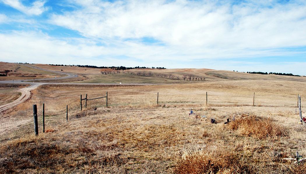
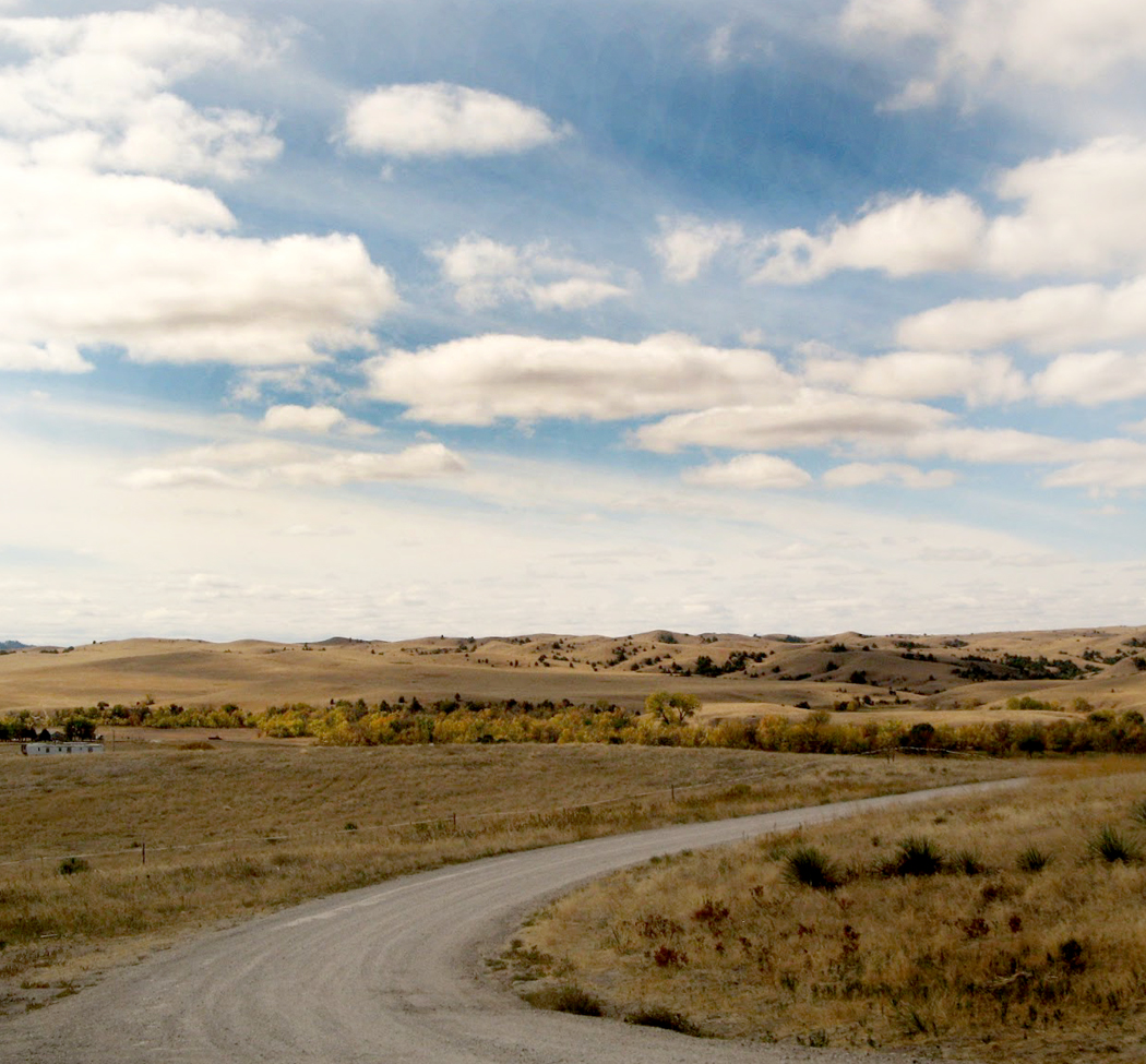
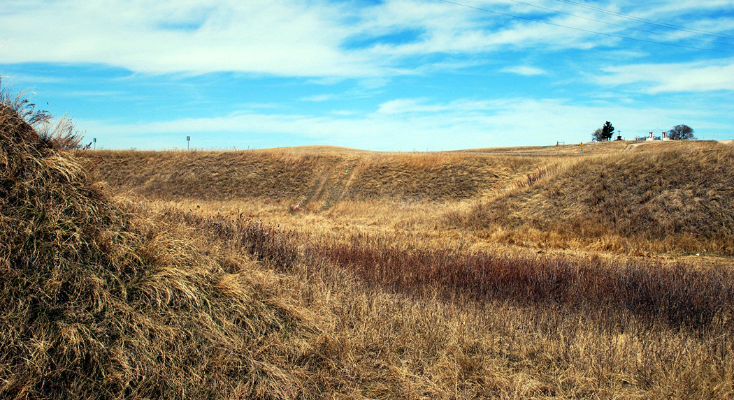
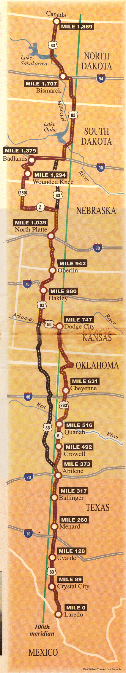
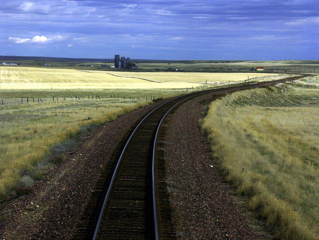
One trip I haven’t blogged about yet I took in 1997 for the newspaper where I worked — up the Hundredth Meridian from the Rio Grande to the Canadian border. That line is the mythic backbone of the nation, a dotted fold-line that divides the country in two. It’s just a line of longitude, and therefore imaginary, but this particular line has traditionally marked the beginning of the West. To the east of it, more than 20 inches of rain falls annually; to the west, less than 20 inches. hundredth meridian map

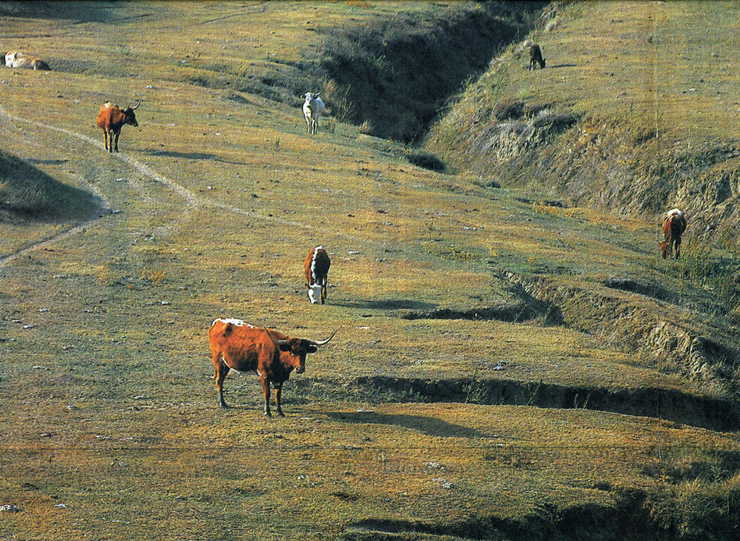
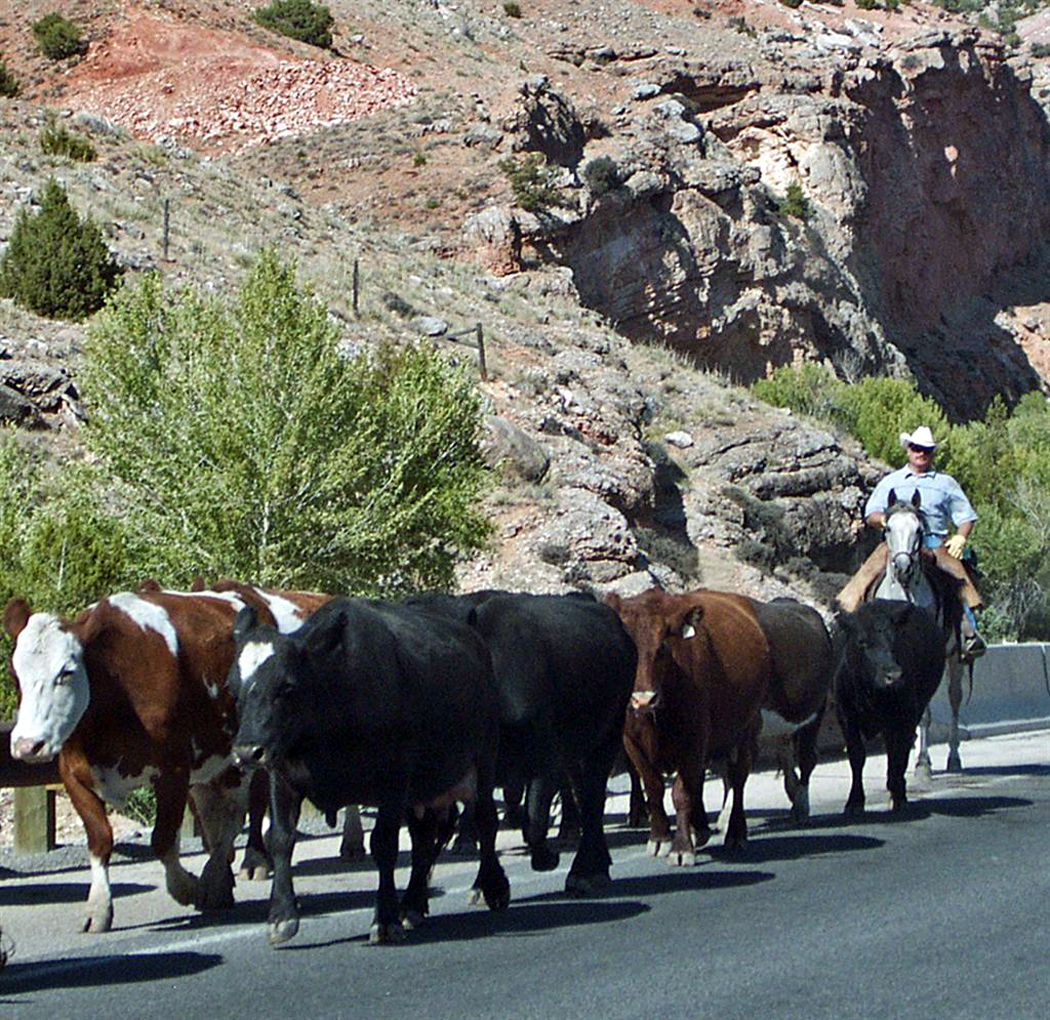
That means that to the east there were once tall-grass prairies that are now farmland; to the west, the High Plains where cattle now graze.
kine

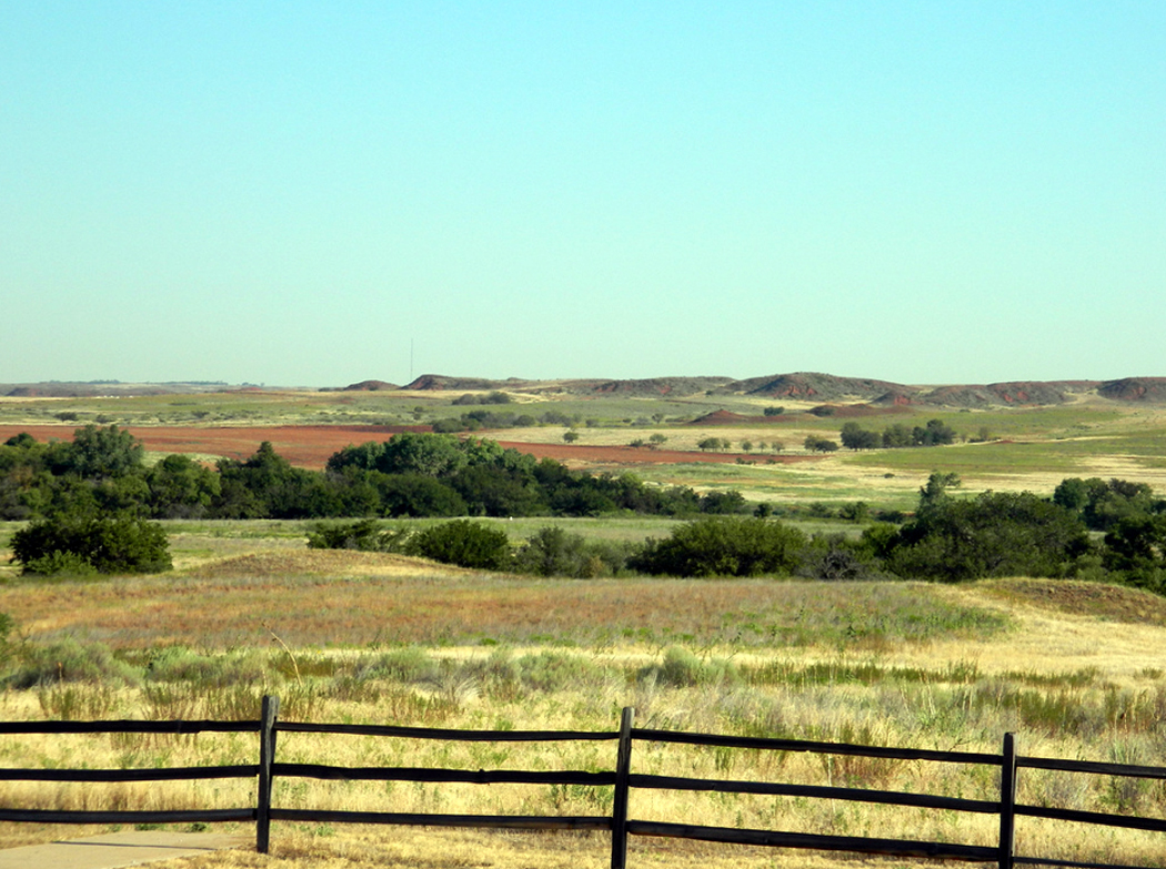
Of course, the change doesn’t exactly run due north and south; it meanders back and forth over the 100th Meridian, so the drive up its length passes from prairie to plains and back, moving from cotton field to feedlot, from pasture to spinach.

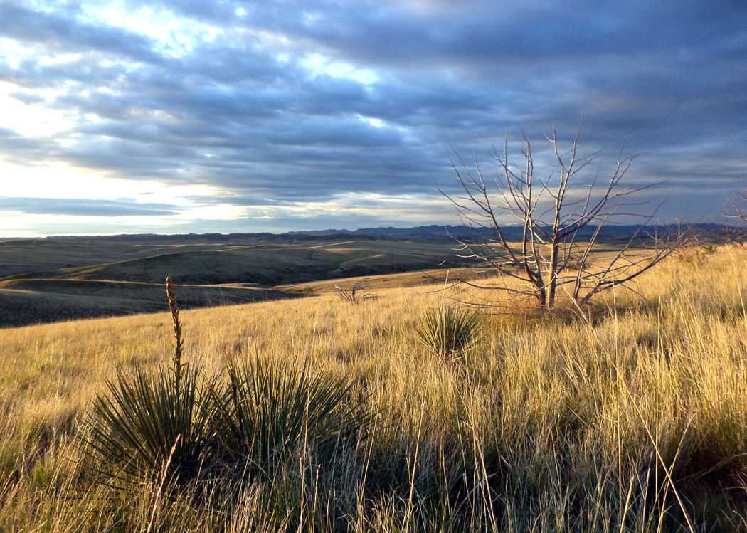
It’s the perfect drive to see the middle of America that is so often forgotten by the majority of us whose attention is too often turned solely to the twin coasts.

If you take a trip up this spine of America, you will see more than a few kine, some goats, some sheep and a couple of ostriches.

To say nothing of some interesting people.

Ah, green grass, blue sky and a yellow line down the center of the road.

Some things have changed since I wrote these stories: Harlow’s World Famous Bar-B-Q is closed; a flashy new visitor center has opened at the Washita Battlefield National Historical Site; and several of the elders I talked to have now passed on. But I thought the trip as a whole was interesting enough to revisit in this blog. 

It will take three entries; the first never gets out of Texas. 

THE TRIP
laredo texas 2

Mile 0, Laredo, Texas

The planet we live on is divided into 360 degrees of longitude, beginning with the one that runs north and south through Greenwich, England.
meridian mapNot many of the meridians carry much significance: The Greenwich Meridian has been the one that keeps the world’s time; the 180th Meridian, for the most part, is the International Date Line, separating Mondays from Tuesdays. And the 100th Meridian has traditionally marked the eastern edge of the American West.
It is purely a geographical accident, but the 100th Meridian is where the rain gives out. To the east, crops grow with little help; to the west, there is either dry farming, irrigation, or, mostly, cattle grazing.

I took a week in October to drive up the six states that form the central axis of the country, keeping as close to the meridian as I could, but occasionally detouring east or west for interesting sights.

The trip begins in Laredo, Texas.

The 100th Meridian enters Texas just to the west of the border town of Laredo.

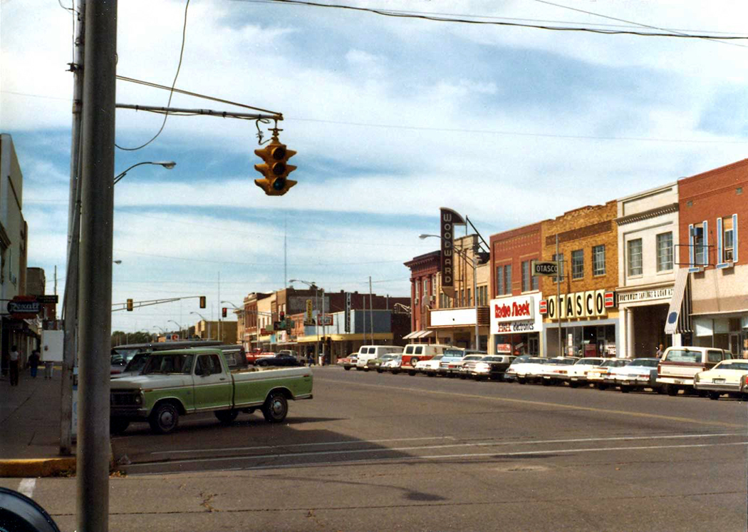
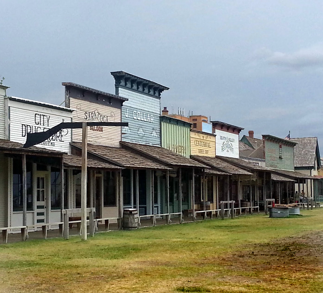
The city’s downtown looks more like Tijuana than any other American city I’ve seen. There are the narrow, uneven sidewalks; the old storefronts with overhanging eaves, whose windows are filled with carefully lined up watches, wedding dresses or toys. The streets are narrow through the old part of town.

Laredo was first settled in 1755 and the Woolworth’s looks at least that old.

There are a bunch of border crossings in town, and the lines of people move constantly through the archways; maquilladores flourish across the border and the employees move from one country to the other.

North of the old part of town, Laredo looks more like any other Western American city. Along the interstate that pushes north are hordes of strip malls, Wal-Marts, Popeye’s chicken franchises and home-repair discount supermarkets. Every 1.6 miles, there is a McDonald’s.

U.S. 83 heads northwest out of town and soon crosses the 100th Meridian, then paralleling it in its march to North Dakota.

As soon as you leave the city, you begin to see evidence of the uncertainness of the geography, as you move from farms to ranches.

The prairie doesn’t turn instantly to plains: There is a wide, undulating transition zone.

First, surrounding the city are “winter gardens,” where tomatoes and other vegetables are grown for places that can’t. But as soon as we leave the garden area, we hit the chaparral, where there are hundreds of ranches in the scrubland filled with mesquite, juniper and, most of all, purple sage, which turns patches of the chaparral into an inky lavender.

But as soon as you hit the tiny town of Asherton, the ranches give way once again to agriculture.

spinach, crystal city texas

Mile 89, Crystal City, Texas

During World War I, the small community of Crystal City tried an experiment: to grow a winter crop of spinach. In only a year, spinach became the area’s principal crop. There was a “spinach boom.” People talked of “green gold.”

By 1933, the Crystal City Cannery was producing 10,000 cans of spinach a day. In 1945, Del Monte took over as primary processor; it now produces an average of 2 1/2  million cases of spinach a year.

In 1936 the Chamber of Commerce held its first Spinach Festival and crowned its first queen and Texas Governor James Allred proclaimed March 16-21 as “Spinach  Week” and Crystal City as “the world’s largest spinach shipping center.”

popeye statue
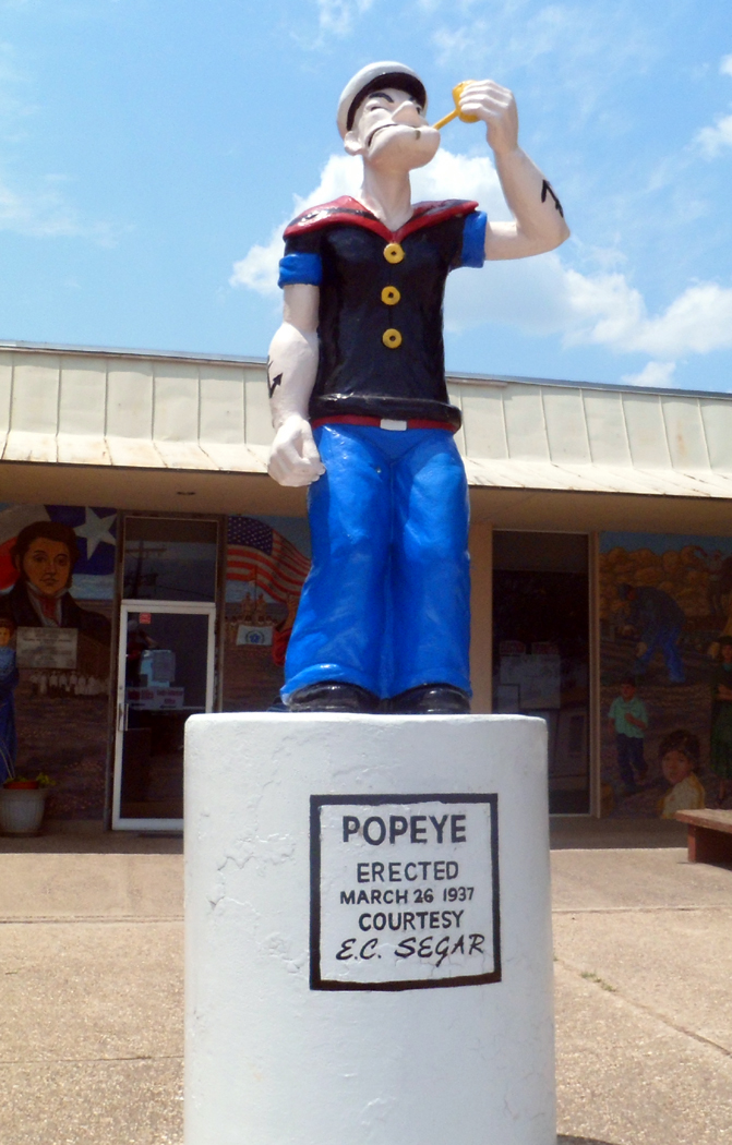
But the chamber of commerce wanted a symbol and found one in Popeye the Sailor Man. They arranged with Elzie Segar, the comic strip’s creator, to use Popeye to sell spinach and a “life-size” statue — if you can say that about a cartoon  character — was erected, which now sits on a pedestal in front of City Hall.

“Let us give three rousing whoops for Crystal City,” wrote Segar.

Crystal City has its Spinach Festival every year on the second weekend in November in honor of its “Patron Saint” Popeye. The city of 8,000 grows to 50,000 for the three day event.

Spinach, though, is no longer even the main crop. “We grow onions in the summer and cabbage in the winter,” explains the woman at City Hall.

There are also murals all over the building, including a giant cowboy, Mexican vaquero and a large crocodile. I don’t know what the croc is doing there, but there are some peccaries behind it, and an Indian on a horse with a spear and his head hanging low. Also a Jesus and an American flag, some campesinos and a woman in a graduation gown. It’s quite an iconographical salad.

But not all of history is rosy for the town. During World War II, a Japanese internment camp was built here, which at its peak, held 3,374 people, mostly Japanese American, with a few German and Italian families added, held temporarily as potential immigrants.

US 83 Uvalde Co. Texas

Mile 128, Uvalde, Texas

Uvalde, Texas, is best known as the home of John E. “Cactus Jack”  Nance, vice president of the United States under the first two terms of Franklin Roosevelt.

The irascible Nance, who had been a powerful member of the Senate and House, termed the job “the first demotion of my life,”  and said that the vice presidency “ain’t worth a bucket of warm piss.”

During a long career in the House and Senate, Nance had built a great reputation as a parliamentarian, and over the years, he was given scores of “honorary” gavels to replace one he broke in use.garner museum

These gavels, along with his canoe, hunting rifle, official papers, tons of PR photographs and some very nice oil paintings made by his wife, are on view at the Garner Museum on one of the shady back streets of Uvalde.

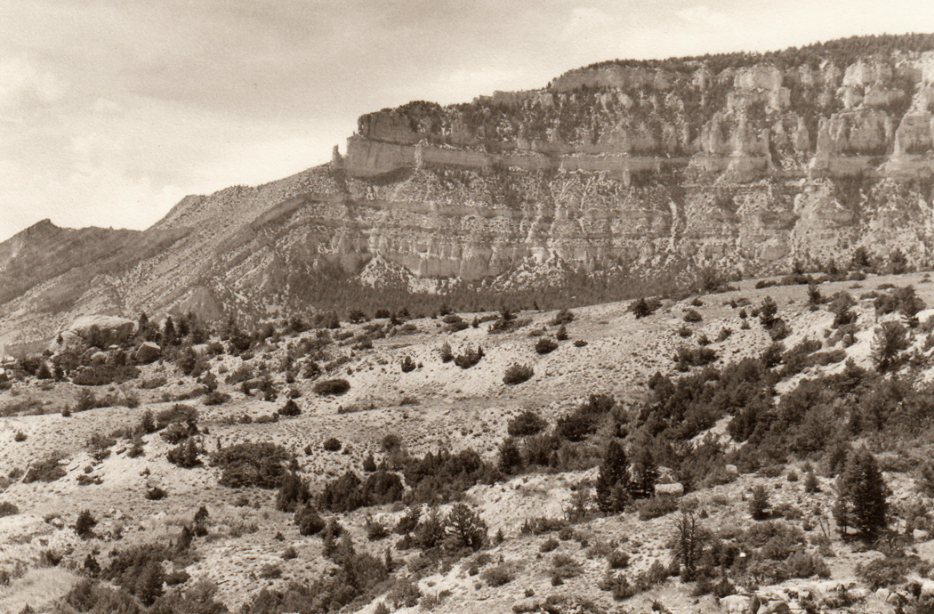
About 30 miles north of town, a state park has been named for Garner, in the spotted green canyons of the Texas Hill Country. The park, along the Rio Frio, is bumper to bumper with visitors in the summer, but on an October morning, it is nearly deserted, save for one family swimming in the icy clear water of the river, which is lined with bone-white cobbles eroded from the limestone hills.

Farming has given way once again to grazing land, although most of what chews the tough dry grass are sheep and goats. Central Texas is the Angora wool and mohair center of the nation.

“But we don’t eat mutton,” explains the volunteer at the park information desk. “You know, there’s a historical antagonism between the cattlemen and the sheepherders. That hasn’t completely disappeared.”

“Oh, but it’s changing a little,”  says her colleague in the office. “You can buy sheep meat in the H.E.B.”

The H.E.B. is the local chain of supermarkets. It is short for its owner’s name: Howard E. Butt, a major figure in the area, whose name you keep running across for his charitable donations.

If my name were Butt, I’d name my store with my initials, too.

menard texas

Mile 260, Menard, Texas

The land flattens out by the time you reach Menard, Texas. The town was founded in 1858 and was once — this is a litany in the Plains states — prosperous. Now most of the old stores on the town’s main street are empty.

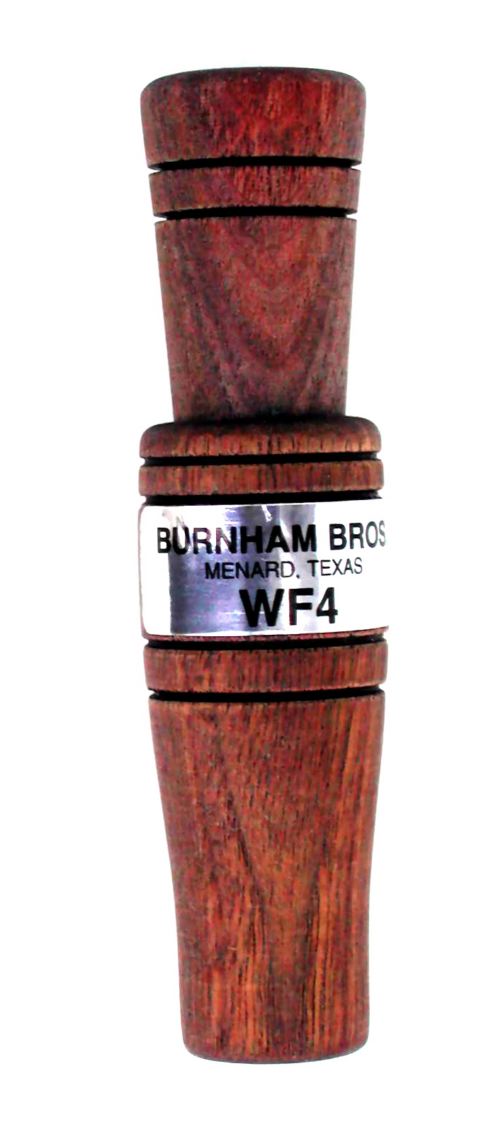
One exception is the old Luckinbach hardware store, which now houses one of the world’s most successful manufactury of hunter’s game calls.WF4 Deluxe Predator Call

Burnham Brothers specializes in predator calls, but they carry all kinds, from turkey to mouse calls. You squeeze them, hammer them, blow into them and rub them together, to make the variety of squawks, wheezes, yelps and chatters that will bring your desired prey into the sights of your 12-gauge.

Outside of Burnham Brothers, the towns main income comes from sheep manure, according to Coby Phillips,  who works behind the counter.

“My father used to work in the hardware store, and now I work in the same building,” he says. “It was his first job and this is mine.”

J. Morton Burnham is “recognized as the father of predator calling,” says the catalog. In 1952, his sons started up the business using their father’s know-how. They sold it in 1991 to its present owner, who supplies predator calls to the world. They have mechanical calls, cassette tapes of animal calls, and most recently, they have added 60 digital animal calls.

The catalog lists a Coyote Howler, which looks something like a child’s toy trumpet, a Buck Grunt Deer Call, a Coon Squaller, a Mini-Squeal and, Phillip’s recommendation, a Mini-Blaster, which has variable pitch and is “the best for calling coyote and bobcat.”

I am taken with a slate and wood turkey call and ante up the purchase price of $13.95.

“This is one of the top three turkey hunting areas in the world,” Phillips says.

Phillips was born in Menard and can’t imagine leaving. “Many young people do leave, but a lot come back when they are older,” he says.

He has a long list of reasons to stay, despite the generally depressed economy.

“The town is small, so everyone knows everyone else. There’s no crime to speak of and a good school system with small classes. My high school graduating class was 22.”

He was a Menard Yellowjacket.

And in the winter, “There’s only a week and a half out of the year that’s freezing.”

ballinger texas cotton

Mile 317, Ballinger, Texas

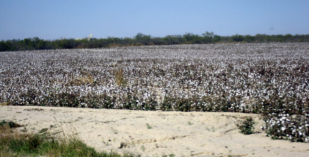
Near Ballinger, Texas, I start seeing fields of cotton. The fields are completely white with it, looking almost like snow.

Like many of the small towns — this one has a population of 4,170 — there is not much of note.

ballinger cross
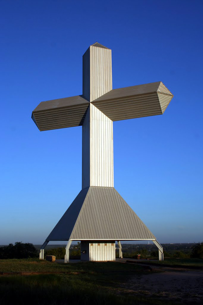
However, there is a giant high-tech steel cross on the rise overlooking town and a bronze statue of a cowboy in front of city hall. Like many such city halls, the building is the most impressive architecture in the county and and built of sandstone.

When I tune in the local radio station, the newscaster tells me there is some controversy in the city over the community center, which is sometimes used on weekends to hold dances.

Several neighbors have complained about the noise.

“Curtis Jennings appeared before the city council and said he felt past city fathers did not build the community center to be turned into a beer hall and dance hall.

“He told city councilmen that the music went on till almost 1 in the morning.

“Councilman Jerry Willingham said he felt 10 p.m. should be set as the time to shut down activity at the community center. Mayor Rudy Hoffman instructed them to set guidelines and make recommendations for the next council meeting.”

Big, white, puffy cumulus clouds are moving across the sky like a marching band.

abilene train

Mile 373, Abilene, Texas

Nothing says Texas like a good, thick steak in a sleazy tin-sheathed dive.

Harlow’s World Famous Bar-B-Q and Steaks in Abilene is just off the interstate and just the ticket. Ribeye is sold by the measure: from three-quarter inch (for sissies) up to 2 solid, meaty inches.

The ceiling is patterned tin sheathing, punctuated by six slow-moving fans. The walls are in need of a good scrubbing and are covered in a variety of neon beer signs. A piece of a Texas flag is framed at one end of the room and the 17 tables in the front room are lined up under plastic tablecloths. The chairs are  a grab bag of ’30s oak office furniture and ’50s kitchen dinette moderne.harlow's

Racks of potato chip bags hang on the counter next to the cash register and the menu is hand-printed on posterboard above the bar.

One old sign says “Beer 5¢” and just under it, “Dancing girls,” but the beer is the normal price and the closest thing to dancing girls are the jeans-and-T-shirt waitresses who hustle from one end of the painted concrete floor to the other.

The owner of this establishment is Timmy Harlow, who looks to be somewhere between 69 and death.  His white hair and gaunt body look like that of an old, worn-out cowboy. His beach-ball gut is largely covered by his red apron, but from behind, he has no shape at all: a thin, tubular body with neither shoulder nor hip nor waist. His jeans hang low on his frame and stay up only the way crew socks stay up on skinny shanks.timmy harlow

In actuality, Harlow is 49 years old and a worn-out former beer distributor. His Lone Star franchise fell through in the oil bust of the early ’80s and Harlow, always a hard-liver, had to drop out. There were divorces, some hard times and an inspiration.

So, he opened this restaurant in the former beer warehouse. The building still looks like a warehouse — or at least the back of it does: a  utilitarian cinderblock box with “Harlow’s” painted its length.

But in front of that, he has built a kind of garden, with trellises made out of unfinished wood and lots of climbing vines. You have to walk through this little paradise before you get to the fried onions and potatoes with sour cream.

There is a back room, also. It is fitted out with aviation memorabilia in honor of nearby Dyess AFB. There is also a shrine to Chuck Yeager, who has been known to eat here.

Yeager, in fact, so enjoyed the homemade honey ice cream that he asked Harlow for the recipe. Harlow said he wouldn’t give it away, but would trade it for one of Yeager’s flight suits. The suit now hangs near the front of the room.

There is also a wall full of dinner plates signed by celebrity customers. Among the 40 plates, I spotted George Strait, Clint Black and Lori Morgan. Many of the names are less luminous — at least, I didn’t recognize them; probably local radio personalities.

The clientele was a mix with on one hand,  well-to-do slummers in their “stone” colored chinos and Oxford-cloth shirts and on the other hand a few broad-bellied men with scraggy goatees and glassy eyes who looked like they just got off the construction site, or more accurately, had stopped on the way for a six-pack or two.

It’s a very Texas mix.

The mesquite broiled ribeye, by the way, was juicy and delicious.

crowell thunderstorm

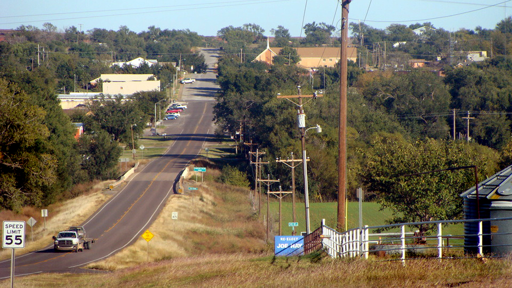
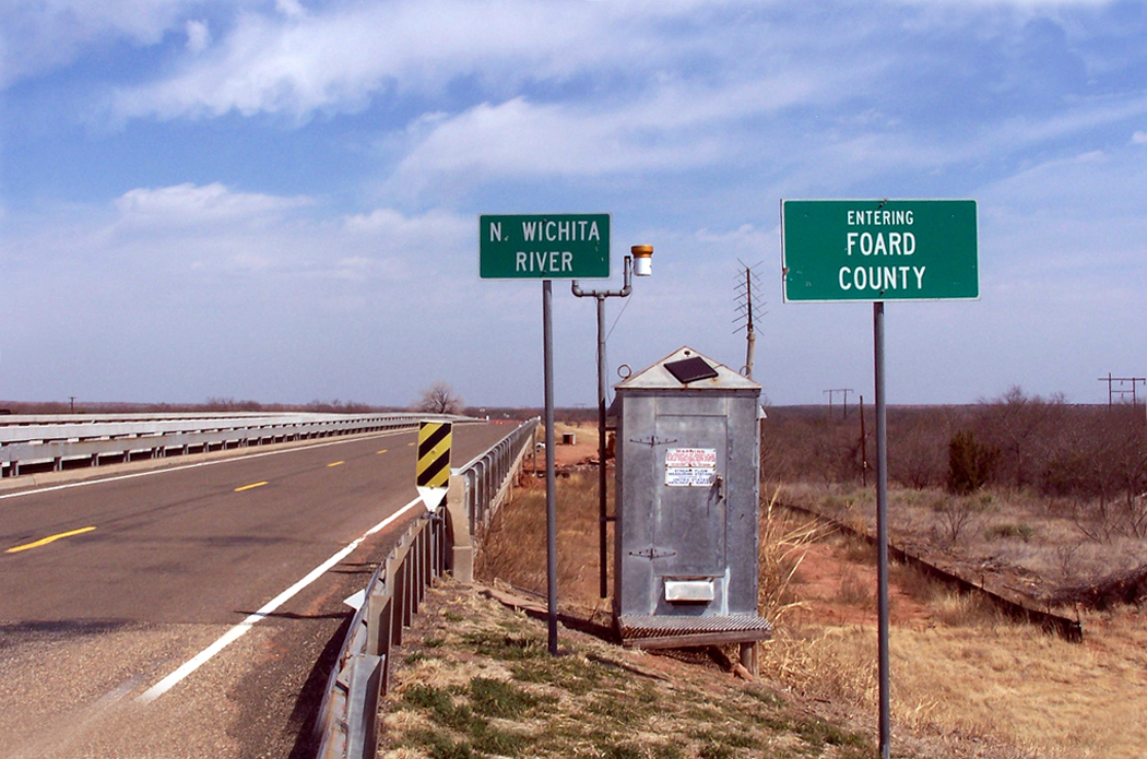
Mile 492, Crowell, Texas

Crowell is one more dried up little town in the flat plains of northern Texas.

Most of the buildings along the downtown highway are closed up. There is little traffic through the town as I step into the M and M Family Restaurant across from the courthouse and order my breakfast.

“Two scrambled eggs, bacon, biscuits and gravy and your largest orange juice.”

“I’m sorry, but I just ran out. I mixed up a whole gallon this morning and it’s gone.”

“That’s OK, I’ll have water then.”

I find out from three retired farmers who are lollygagging in the M and M that the whole land is thirsty for water.

“All there is in the wells is briny, so we can’t use that to irrigate,” says Abe, who is about 65 and has gone through two heart surgeries and is on the waiting list for a third. He wears a straw cowboy hat and a white shirt.

“The government has a brine reduction project with a pipeline that runs from Guthrie and tries to impound the briny runoff from wells, to reduce the saltiness of the Wichita River so cattle can drink out of it,” Abe says.crowell elevators

“But don’t give this gentleman the idea that we don’t like it here,”  says Joseph, who is in his late 50s and seems a little more cosmopolitan than Abe. He turns out to have once run the local newspaper.

“What do you like about it?” I ask.

“Everything,” Abe answers.

But the conversation seems to center on the disasters.

“The problem here is it’s always too hot, too cold, to dry and too wet,” cracks  Abe. “The weather is too irregular to make a regular living.”

And the weather is the constant topic of conversation — that and government policy.

The biggest weather they ever had was a tornado in April, 1942. It killed 11 people and tore straight through town.

“That tornado was the biggest thing that ever hit this town,” says Joe.

“I wasn’t here for it,” says Wendell, “But I got here the next day.”

Wendell is 92 and talks slowly. He is also wearing a white shirt, although it is now a couple of sizes too large for him, and a ball cap.

“It took the dome off the courthouse and took off three of the clock faces. One dial was left, but the works was blown out.”

“No, you can’t count on the weather,” Joe says. “We normally get 24 inches of rain a year, but in 1941, we had 40 inches and there were lakes all over.”

But the usual problem is not enough, or at least, not at the right time.

“It’ll rain all around us and Foard County won’t get any,” says Abe.

“Story is, when Noah had his flood, Foard County got a half-inch.”crowell wichita river

In the flat country around town, they tell me, the main product is cattle and wheat. A bit further south there is also cotton, but they don’t grow it anymore in Crowell.

“It’s the boll weevil,” says Joe.

“Deliver us from weevil,” says Abe.

“They got a weevil eradication program and it’s the best thing the government spends money on,” he continues. “Maybe one day, they will eliminate the problem — now I’m not saying they’ll ever completely get rid of it — but maybe they’ll reduce it enough that you can make a living with cotton again.”

He doesn’t sound convinced, more hopeful than anything.

As for government, Wendell says the only real non-agricultural industry in town is a company that makes “gimme” caps, but they are feeling the pinch from Mexico.

“I don’t like talking politics,” he says, “But you can hear that giant sucking sound that Ross Perot spoke of.”

North of town I spot a box tortoise slowly trying to cross the road, with his head tentatively dangling in front of his dome.
quanah parker

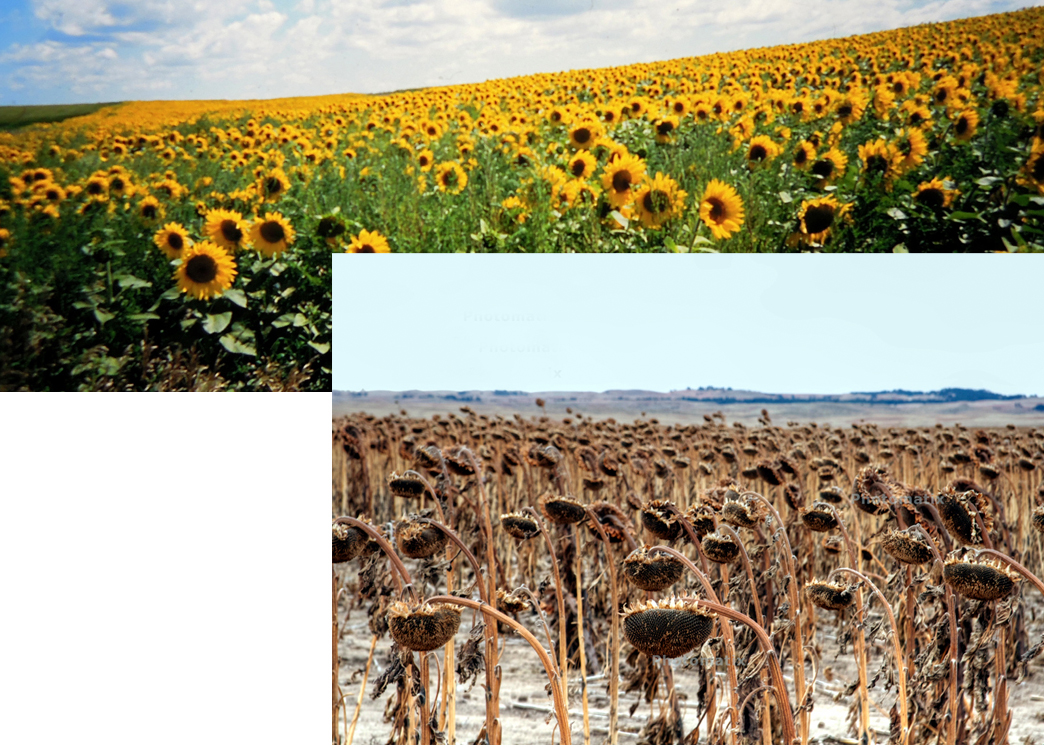
The roadside weeds are drying in the October sun. The sunflowers have passed the flower stage and a spattering of black seedheads dot the tan grass. Clouds blow quickly across the sky, leaving racing dapples of sun over the fields.

With the car window down, you can smell the damp straw in the fields, the wet earth and the smell of the cattle as they go by in a truck. Once in a while, the rhythm is broken by the smell of a roadkill skunk.

Just north of Crowell is the Pease River, where Cynthia Ann Parker was stolen back from the Comanche Indians in 1836 after 24 years of living among the Indians. Her Indian son was Quanah Parker, the greatest of the Comanche leaders. His name meant “fragrant.”

And the next town on the route is named after him.

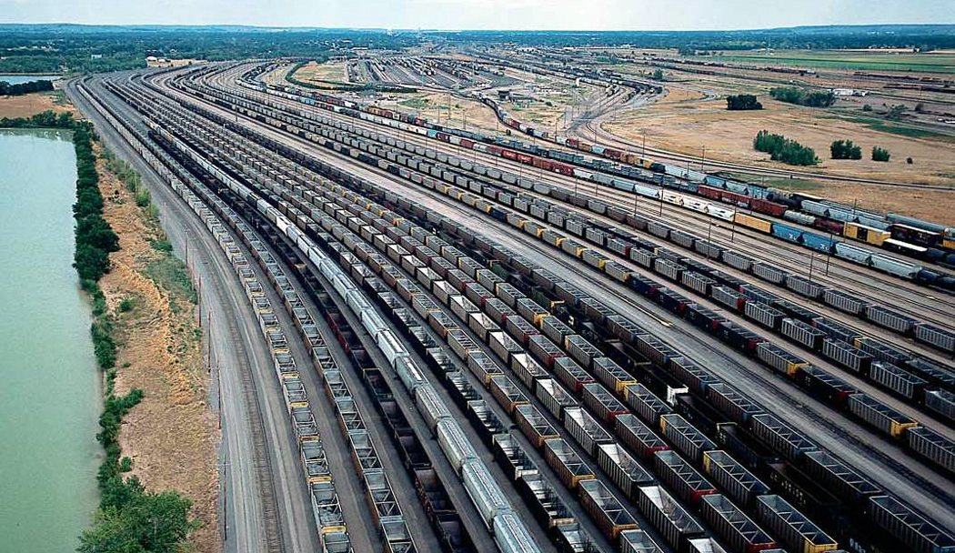
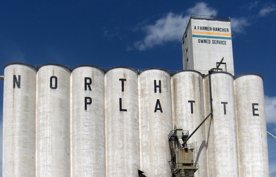
Next: The Central Plains

factory 2
Italy has its Colosseum. Cambodia has its Angkor Wat. And South America has its Machu Picchu.

They are all the ruined monuments of empire. Vines grow through the masonry joints and small birds build their twiggy nests where windows used to be.catherwood 1

As Stephens and Catherwood found in the Yucatan, nature takes back what we borrow. Our cities crumble and trees clothe everything once again in general greenness.

You can see the process in action from your railroad coach window, as the train passes through Toledo, Ohio, at three in the morning.

All across the southern rim of Lake Erie, factories made of brick under the harsh midnight illumination of security lights begin to metamorphose back into clay soil.

The train moves slowly through the back lots of rust-belt cities, where the tracks themselves groan and rattle under the weight of the bogeys, and the whole urban backstage is like the rough inside of a carnival mask. From the streets along the refurbished waterfront, the city looks shiny and prosperous. It is the face the town fathers want to show. nightfactories

But from the rails, the potemkin city is revealed in its rich, resonant decay. It is the same in all municipalities, from Trenton to L.A. The tracks take us to our ruined monuments and we can see the picturesque disintegration of our urban ambitions.

I have always found these scenes seductive.

It is why I have always loved to ride the trains. It is the same thrill the theatergoer gets when allowed to wander backstage through the flies and backdrops. A bit of the mystery is explained but a greater mystery fills its place.

I have been awake all night, the passing lights flashing briefly through the window. In each Toledo or Syracuse, N.Y., we pass, the train rolls through the back yards of the inner city and shows us the unhinged screen doors, jacked-up Fords and abandoned barbecue grills. Once in a great while a kitchen light is on and you can see a man rummaging for a midnight snack in his refrigerator.

It is 3 a.m., and the Southern Crescent is pulling into Greensboro; the Twentieth Century Limited into Erie; the Empire Builder into Minneapolis; or the Sunset Limited into New Orleans.

The train crawls into the station past the lowered crossing gate with its flashing lights and clanging bells. Behind it wait the one or two trucks working at this hour. A squeal of airbrakes and the shush of escaping air and the train comes to a halt. The passengers step off the stairway at the end of the coach, hanging on the thin metal rod that counts as a handrail, looking for the relatives who have awakened in the middle of the night to meet them.

While we wait, the brakemen walk back and forth under the passenger windows checking the journal boxes with their flashlights.factory 1

Then the car jerks forward with a rattle and the train picks up speed. Out my window, I see a junk yard surrounded with a tornado fence topped with coils of barbed wire. It is followed by an empty five-story brick factory. A thousand windows face the tracks and not one has an unbroken pane of glass; what is left is a tracery of empty mullions. The roof has partially collapsed and what was once a loading dock is now a tangle of wire, iron and tatters of tarpaper.

It is a world of oily soot collected as a film on steel I-beams, a world of concrete rubble and red bricks turning back to powder.

What is garish in the electric light disappears in the inky black and the clack of the rails rises by a tone and opens wide as the train begins to cross a bridge. On the other side, the train leaves the city, entering the suburbs that are unlit and fast asleep.

Up front, the airhorn sounds its warning and the slow burn of sunrise is faint behind us.

At one point, we pass our companion train, headed in the other direction toward the sunrise from which we came. The two trains slow as they pass each other in a kind of railroad pasodoble, and I can see dimly into the passing coaches.
birdswarm 1Most passengers are sleeping, their heads drooped back and their mouths hanging wide. But every so often you see another face looking back at you.

A rising cloud of blackbirds rotates into the air, roused by the train. As we pass, they settle again into the bare winter trees.

Who can sleep in such poetry.

streetlamps snowI’m in Chicago and it’s close to midnight late in November in 1978. The air is raw. There is a sleety mist falling and I haven’t eaten anything since leaving Syracuse early that morning.

I am fleeing across the country, jobless, broke, and emptied inside. I want to put a continent between me and my broken heart, but somehow, it is following me. “Stay!” “Stay!” I say, as if I were talking to an uncomprehending dog, but it just drools, looks at me with brown glazed eyes and won’t leave my side.

There is little that so perfectly captures this experience than a train rattling through the wintery night, with its distant points of light and the Doppler whirr of clanging bells as we pass a grade crossing.20th century limited

The Twentieth Century Limited had once been a great route on the New York Central line, driving north along the Hudson from Manhattan and turning west at Albany, passing Utica, Syracuse, Buffalo, Erie, Cleveland and Toledo on its way to frozen Chicago. It had been the train of movie stars and tycoons. The route no longer exists, replaced by Amtrak’s luxeless Lake Shore Limited.

But as I ride the train, in its last days and paying the minimum fair for a seedy coach seat, it is more like a linked chain of crowded, smoky Greyhound busses, rattling along from one decaying rust-belt depot to the next.

There is a lot of talk of the romance of rail travel, but we should remember that romance is not born of ease and indoor plumbing, but of struggle: The most memorable times in our lives are those we survive, not those we glide through.

So, it is one of the travails of train travel that you are at the mercy of inconvenient schedules that are never met, coaches that are always either too hot or too cold and bad tracks that jerk you awake as you try to grab a few winks leaning awkwardly across two seats.

I am in Chicago between trains, with a ticket for the Empire Builder, which will take me the rest of the way to Seattle, crossing the Great Plains and the Rocky Mountains along the way.streetlamp sleet

In the meantime, I’’m walking the block around Union Station looking for a bite.

What I find is a lonely kiosk, spewing steam, where a man is selling sausages and sauerkraut. He is getting ready to close up and I’m his last customer.

The sleet darts like needles through the cone of light under a streetlamp and I’m shivering by the time my boarding call echoes through the station like plainchant in a cathedral.kwakiutl design

The Empire Builder I enter still is decorated with the orange and green of the long-gone and multiply-merged Great Northern Railway and each coach is painted with oval-and-bar animal paintings of the Kwakiutl Indians. Here a beaver, there a raven and there a killer whale. It is a train with character.

It is dawn by the time the train reaches St. Paul and I step out on the platform to stretch my legs. It is cold but dry and I’m surprised by the comfort. “Don’t stand there too long in your shirtsleeves,” the conductor warns. “The temperature will fool you: It is 14 below zero.”empire builder station night winter

For the next two and a half days, I sit, squirm, fidget and fitfully doze as I ride the Empire Builder across the broad portions of the continent. I talk to my coachmates, but most of them only stay on board for a few stops as the depots tally up: Red Wing, St. Cloud, Fargo, Devils Lake, Minot, Williston, Wolf Point, Glasgow, Malta, Havre, Cut Bank.empire builder route map 2

But there are rewards paid for the suffering.

You can never see the expanse of the nation better than through a train window. From the air, you see what looks mostly like a huge map, with rivers and interstates. From the car, you see the consumer culture of Burger Kings and drug stores. But from the train, snaking its way through the unprogrammed portion of the country, you see the farms, the factories, the land and its people.montana prairie empire builder

Across North Dakota and eastern Montana, the land rolls like a seaswell and we see no roads, only wheat. Houses blip by only once every few miles. Only the moon is less populated than the American West.

It is night as we pass the Glacier National Park.

But when the train pulls out of Cle Elum in Washington and begins climbing the draw up the Yakima River, an elk stands on the side of the canyon, no more than 15 feet from the train window. Steam blows from his nostrils in the cold air and he watches the steel pass, with faces in its windows, each with a heart, swelling or drained.

Driving 1It was the weekend I drove across America: I left Phoenix after work on Friday and pulled into North Carolina before breakfast on Monday. I was hauling macadam.

But to paraphrase Mr. Bernstein from Citizen Kane, “There’s no secret to piling up miles, if all you want to do is pile up miles.”

At any rate, I logged 1,886 miles between work on Friday and sleep on Sunday.

People sometimes ask me if driving doesn’t wear me down, but it doesn’t. There is nothing I find as relaxing as spending a week on the highway, watching the scenery scroll by and the sun roll around heaven all day.

I get up at 5 each morning and count a hundred miles on the odometer before stopping for breakfast. You notice the difference from one edge of a time zone to another: On the same day, 5 a.m. can be black night in Williston, N.D., and broad daylight in Pensacola, Fla., both in the Central Time Zone.driving 2 - night

It gives you a cosmic feel: You know you are moving across the arc of the planet’s edge. In Saskatchewan you can watch the grain elevator behind you sink below the horizon in your rear view mirror, like the sails of a ship dropping under the curve of the earth, just as the next elevator breaks the surface in front of you. You are always on the top of a mound that falls off to every side.

The point of this particular dash across the continent was to collect my wife, who had been visiting her mother in North Carolina, and continue on our vacation, making a great loop across the Northeast and back through central Canada.

I left the office at about 4 p.m. on Friday and drove the 289 miles to Gallup, N.M., where I stayed in a chain motel and ate supper at a tiny, empty  dive, where a Navajo woman made a great turkey sandwich.

Saturday took me from Gallup to Oklahoma City, some 725 miles. I could have gone further, but I did some sightseeing in Endee, N.M., and in Amarillo, Texas.

Sunday, I stopped for a couple of hours in Arkansas, but still managed to make 872 miles, stopping in Kingston, Tenn., just short of Knoxville.

I usually avoid the interstates, but to waste as little time as possible before joining my wife, I took I-40 most of the way, playing dodge-cars with semis, terrorizing slow-moving RVs and watching my odometer spin like a slot machine.interstate mt airy

The next day, I drove across the Smokies, up along the Blue Ridge and down into the Piedmont, managing to cruise through Andy Griffith’s Mount Airy.

There are some disadvantages to this kind of travel. Meals, for instance, are either awful or non-existent. Mostly, I keep a box of Fig Newtons in the back seat and gnosh occasionally. The entree is beef jerky bought at a truck stop; I’ve become quite a connoisseur of jerky. A liter of bottled water sits on the back floor.

When I do stop and eat dinner, it is uniformly greasy, oversalted and overcooked. And don’t even mention the salad bar.

Then, it’s into the motel room for a night’s sleep before getting up again at 5, to see the dull light in the east spread out along the fuzzy line that separates the sky and its brightening clouds from the ground below and the road that stretches toward the rising sun.

litle bighorn bluff with roadWhat you see in eastern Montana is grass, oceans of it, from horizon to horizon.

It was on this sea of grass that many of the plains tribes of Native Americans navigated in their search for herds of buffalo, and it was on this sea that the most famous battle of the Indian Wars was fought.

You can walk through the history and try to reconstruct the events at Little Bighorn Battlefield National Monument on the Crow Reservation south of Billings. On these grassy hills on June 25, 1876, George Custer died with more than 260 of his soldiers.

Over the years, “Custer’s Last Stand” has been the source of a great deal of mythologizing, on both sides of the battle. You have only to look at such Hollywood histories as They Died With Their Boots On to see a heroic Errol Flynn, fighting to the last with his brave men as they are inundated by hordes of screaming Sioux and Cheyenne. custer's last fight anheuser buschA famous chromolithograph, from a painting by St. Louis artist Cassilly Adams, hung in almost every saloon from 1896 to up till the Korean War. It was called Custer’s Last Fight, but almost everyone remembers it as “Custer’s Last Stand.” LIttle Big Man

In the heroic versions, Custer and his men are unundated by a sea of Indans and go down fighting to the last man.

An alternate version has taken hold since then, in which Custer is an egomaniacal buffoon who sees genocide as his ticket to the White House, and was personified by Richard Mulligan in Little Big Man.

Despite the hundreds of books and movies about Custer, none has ever resolved the contradictions of his character. Certainly, in the years just after his death, he was canonized — partly due to the propagandizing of his wife — and served as a rallying cry for those who wanted to end the “Indian problem” once and for all.

But Custer himself isn’t the only myth of the battle.

How often have you heard that there were no white survivors of the Battle of the Little Bighorn? As you drive through the battlefield, you learn the complexity of the fight and that fewer than half of Custer’s men were killed. Granted, that’s still a bloody battle, but it’s not quite the same thing as the legend.little bighorn evening

On finding the Indian encampment, Custer divided his troops into three groups and intended to attack the bivouacked Indians from both the North and the South. He took field command of one third of the forces and marched them north, along the hills above the Indian encampment.

The other two thirds of his forces, at the south end of the battle, took heavy casualties and eventually retreated to relative safety at the top of one of the bluffs on the eastern side of the river. Custer’s third of the force — about 225 men — was wiped out.little bighorn headstones

Yet, 328 men survived to tell the story, which they did to official inquiries.

Another myth is that it is the only battle the Indians ever won. That is wrong on both ends of the deal, since there were many battles won by Indians, but the Little Bighorn cannot really be counted as one of them.

The purpose of Custer’s foray into Montana was to oust the Sioux and Cheyenne from the Crow Reservation, where they were not particularly welcome, and nudge them back to their own reservations.

The battle ended when word of the approach of General Terry’s troops from the north came and the Indians decamped. Most of them wandered back to their own reservations. In other words, while the battle is remembered as a defeat for Custer, its military objectives were largely met, though such a victory is truly Pyrrhic.

You can read about the battle in any number of books, but you can’t really get the feel of it without visiting the site.little bighorn distant rain

It is a quiet place, with the hiss of wind in the grass and the buzzing of grasshoppers. The road through the park continues for about five miles, past the congested visitor’s center and along the high ridge of bluffs and coulees over the river bottom to the location where Custer’s subordinates, Reno and Benteen, held off the Indian siege for two days.

Most people hang around the monument on Battle Ridge, where small white crosses mark the places where Custer and his men fell. But if you drive to the end of the pavement, you can walk out in the grass, which curls in the breeze like white horses on the sea swell, and hear the phoebe’s song among the seedheads, and watch the approach of an afternoon thunderstorm with its dark clouds and flickering glow of lightning.

And you can get a much deeper sense of what this part of Montana was like 119 years ago, before the roads and visitor’s center, before the white crosses and shallow graves.

Shell Falls Gorge, Bighorn Mountains, Wyo
Wyoming is a flat grassy state interrupted by some of the most beautiful mountains in the country.

That includes the Tetons on its western edge, looking like mountains ordered out of central casting, with the perfect features of a Hollywood star. But there are also the Wind River range that seem to extent forever and the thorny Absorokas, high to the east of Yellowstone.

In Wyoming’s east, you find the Laramie and Medicine Bow ranges.

All of them high, stony, craggy, pine-sided cordilleras rising over the high plains like the abodes of gods.bighorn mountains 9

And in north central Wyoming, the Bighorn Mountains divide the state in half. Approached from the west, they are a dry range, not rain-forested like the Olympics; you see a sedimentary ridge, not a wall of frozen lava like the Sierras. They are not green or gray or blue, but are a rich orange and yellow, stratified and striped with darker reds and browns. What you see are the Cambrian, Ordovician and Carboniferous sandstones and limestones. They surround a central core of granite that you only see as you climb to the high plateau and cross Granite pass at 8950 feet.

Along the way, traveling from Greybull, you drive up the Shell River Canyon and its waterfall. And when you reach the top, you don’t find a peak to descend from, but a 30-mile wide plateau of trees and lakes, unimagined from the grasslands below.

As we followed the plateau top across the range, we passed a cattle drive. Slow, lurching cows wandered distractedly across the narrow road. The look in their eyes gave me a new etymology for “vacant,” from the Spanish “vaca” for cow.bighorn cattle

The kine stumbled off the road on both sides, some climbing the rocky hill to our left and some dangerously nearing the edge of a cliff that dropped into the wide canyon to our right.

Cowhands on horses herded the cattle back onto the road — all an extremely slow process. Traffic was snarled and it was almost like being on the Santa Monica Freeway at rush hour. Well, not quite. There were only two or three cars, bumper to bumper, but the thick cattle traffic was nose to tail.

The road was a bakery display case of cow pies.

We wondered about the men on horses, how they had their bedrolls tied to the back of their saddles, and whether they really did have to spend the night under starry skies boiling coffee in tin pots and sleeping to the sounds of lowing cattle.

Among them were several small children riding horses and watching their daddies at work.

One blond, tow-headed youngster in front of our car was hardly bigger than the saddle horn on his saddle.

There was a relaxed, even lazy festive air about the job at hand, as though it were a community project forced to work at the cows’ pace.

The men were dry-faced workers with oily hats and tattered shirts, the extreme opposite of the drugstore cowboy. There were no shiny 10-gallon stetsons, no arrow-ribbed shirt pockets, no fringe, no buckskin, and no shooting irons on their hips.

What there was was flies, horse sweat, the squeak of leather saddles and the muffled clop-clop of hooves on pavement.bighorn mountains 2

When we asked, we learned that the cows were being herded up the mountains to their summer pastures on the plateau.

The mountains that were so rocky and rugged seen from the west, in fact did become a plateau and we drove for nearly an hour across the summit of the Big Horns, past those forests and lakes.

So, when we reached the eastern escarpment, it was a shock to see the land stretch out under us as flat rangeland, semi-desert again for as far as the eye could see.