Archive

Tag Archives: travel

LIttle Tunk Pond, Maine

LIttle Tunk Pond, Maine

I’m big on climbing small mountains. From coast to coast, I’ve managed to hike my way up mountains large enough to have names, but not so imposing that special equipment is involved. It’s become something of a specialty.

Those that are big, I drive up: Colorado’s Pike’s Peak; New Hampshire’s Mt. Washington; North Carolina’s Mt. Mitchell; Washington’s Hurricane Ridge. The views are sprawling, the air is thin and you can sometimes find snow even in June.

But the greatest pleasure comes from what you can climb on foot. I’ve “conquered” Roden Crater in northern Arizona, Humpback Rocks in Virginia — give me a mountain climb under 1,200 feet and I’m Edmund Hillary.

Others may dream of K2 or Aconcagua; I fancy the mighty Watchungs of New Jersey.

But just because my ambition is small, don’t think there is no challenge. Some small mountains are quite rugged, and when climbed in the proper nasty weather, you can work up quite an appreciation for their wildness and tenacity.

I’m thinking in particular of Schoodic Mountain in Maine. At 1,069 feet, it qualifies as my kind of mountain, but it is no pushover. Even to get to its bottom requires either a 4-wheel drive or long hike on shank’’s mare from the spot where you finally decide the road has gotten too primitive for your car. On a cool, humid day in July, the mosquitoes are thick near its foot and the foliage is dense and close over the path. Higher up, it’s all rock.

Summit, Schoodic Mountain

Summit, Schoodic Mountain

Of course, there is great breeding in its name. “Schoodic” is a name you will see elsewhere in these climes, most notably in Schoodic Point, which is a detached portion of Acadia National Park. Most of the park is on Mt. Desert Isle, with smaller sections on Isle au Haut some miles out to sea off Stonington, and at Schoodic Point, a rocky peninsula across Frenchman’s Bay from the main part of the park.

For many, Acadia National Park has become synonymous with the tourist development in Bar Harbor, with its T-shirt emporia, cappucino bars and Cap’n’s Table restaurants. Like many national parks, Acadia in the summer has become crowded and intolerable. But Schoodic is different. Fewer people make it out to the peninsula; although it is only something like eight miles across the bay from Bar Harbor, Schoodic Point is closer to 40 miles by road and with no shopping, it doesn’t attract the vacationers.

The main section of Schoodic Point is a pile of cracked and weathered granite jutting into the sea waves at the end of the peninsula. On a good, mizzly day, the gray of rock, sea and air all mesh in a uniform mood that is the essence of the Maine Coast. You can stand on the precipice and watch the churning ocean rise over and drain from the kelp and barnacles on the rocks below, wrenching the green seaweed this way and that.

Schoodic Point, Acadia National Park, Maine

Schoodic Point, Acadia National Park, Maine

What must be millions of gallons of salt water, beaten into a white seafoam, collide into the granite with each swell. In some crevices, the surf traps air which explodes like a rocket, sending spume high into the air and leaving the whole rock perpetually wet with the descending mist.

The same craggy spirit built Schoodic Mountain, about 15 miles north of the point. Locals pronounce the name with its double-“O” matching that in the word “good.” It is an Indian word said to mean “Place near water,” but in Maine, it is hard to find a spot that isn’t. Schoodic Bog at the bottom of the mountain, for instance, is soggy underfoot and thick with birch and alder.

The trail up the south face of the mountain crosses the col between the summit and Schoodic Nubble, a secondary peak to the west, and then continues east till it reaches the top. The broad mountaintop is smooth with weathered granite and decorated with scattered erratics, boulders that are the leftovers of the glaciers that ground the mountain down to its present size during the last ice age.

A tower is anchored in the rock with guy wires that hum in the wind.

It is a fine time to sit down and enjoy the view. To the north, there are other similar drumlins, with their gradual north slopes and abrupt southern precipices — Caribou and Tunk mountains and further, on the horizon, Lead Mountain.

To the south of Schoodic, just below the peak are several small lakes and the unused railroad trunk line, which looks like it is sinking in the bog. Further out, you can see Frenchman’s Bay and Mt. Desert Isle, topped with the imposing dome of Cadillac Mountain, said to be the spot where the sun first hits the United States each morning.

In the winter, my friend Alexander, who lives nearby, likes to ski up Cadillac Mountain. That’s right, up the mountain. Cross-country skiers are a strange lot.

As for me, I’ve driven up the summit road.
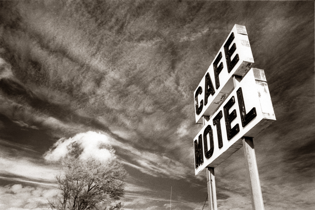
Glen Rio, on Texas, New Mexico boundary

Glen Rio, on Texas, New Mexico boundary

The world is divided into drivers and riders. I’m a driver.

Riders are easygoing; they can relax in their seats, even nap. They feel comfortable being chauffeured.

But drivers have to have the wheel in their hands, their feet on the pedals and their eyes bouncing from road to rear-view.

For those with driving in their genes, there is nothing so relaxing as a 500-mile drive on a nearly forgotten U.S. highway route, dashing over endless prairies and collecting state lines like baseball cards.

But driving as a pleasure is something that can be done properly only on the remaining two-lane blacktops and three-lane concrete highways that used to be the mainstay of the American road system. There is no pleasure to be had from the endless drone of radials on the endless concrete of interstate highways.

The interstate system is really only a poor substitute for flying. If you need to get somewhere fast, a jet is much more efficient.

But driving — tooling along with the window down, one hand on the wheel, watching the countryside change — is a job to be done on the smaller roads.

Before the interstates were built, roads connected cities with their surrounding towns and towns with their surrounding villages. It was a time when home and community meant something more than they do now. Roads went from Chicago to Joliet or Rockford. From Paramus, N.J., to Hackensack. When roads connected the places where people actually lived, long-distance travel meant seeing hundreds of towns.

Now interstates run directly from Chicago to Denver, or Seattle to San Diego. The towns have become invisible; the scale is different. So is the importance we give to Joliet or Hackensack, and we are the poorer for it.

The interstate is mile after mile of mown grass, interspersed with patches of crown vetch. It has the personality of a bureaucrat. Along dustier roadsides, wildflowers grow thick and mark the calendar. If it is March, the Coulter’s globe mallow oranges Arizona highways. If it is October, joe-pye weed lines New Jersey road shoulders and vacant lots between the discount houses.

February brings red maple flowers to North Carolina; June brings them chicory. Ironweed and asters make fall in New York state. When I get out on the road in some rural area — Iowa, Indiana, North Carolina or Wyoming — I can smell the tobacco, the corn, the hogs, the coming rain. It smells like this place, this now. Sharp, beautiful, fresh, clean.

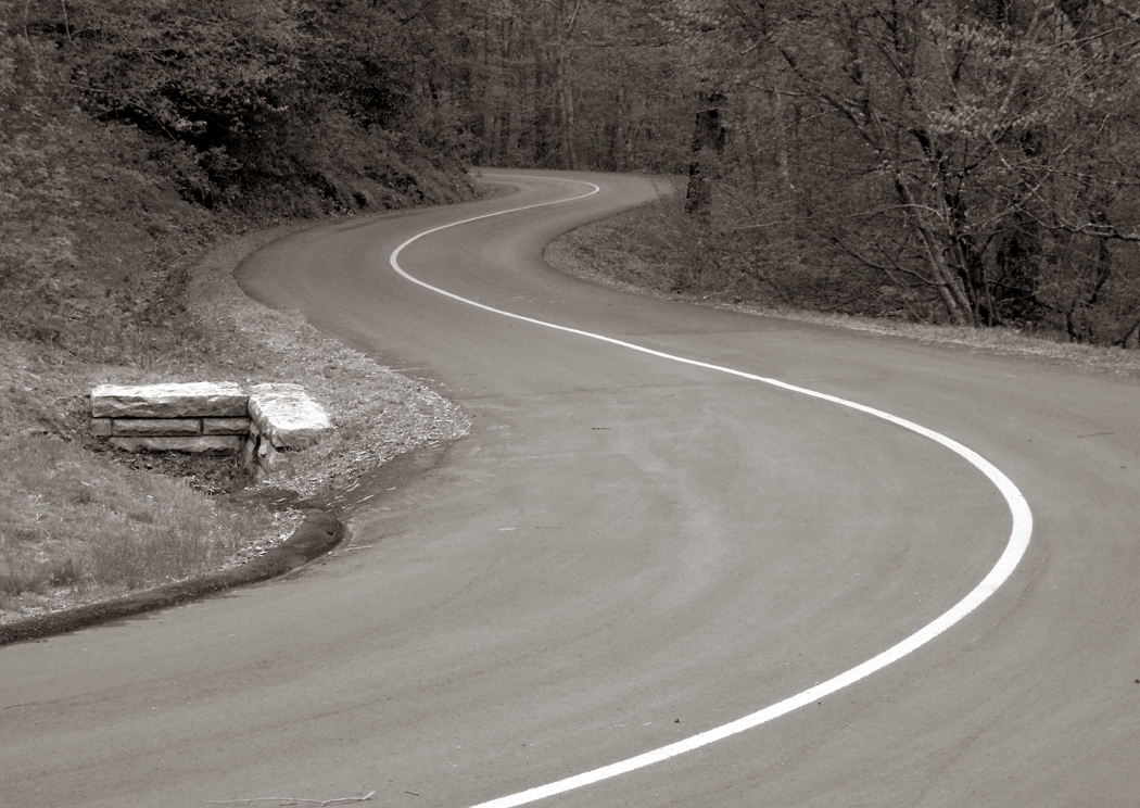
Near Asheville, N.C.

Near Asheville, N.C.

There is a romance to the long miles: the song of the open road. The nighttime driving on empty highways. Venus rides the top of a slim wedge of brightness that lines the western horizon, and no other cars break the darkness for miles of Ohio miles.

We drive from Canton to Toledo, from Toledo to Chicago. The hum of the tires on pavement. Nighttime radio. Detroit. Denver. Missoula. Summer in New Orleans.

Fall moves in on the continent, and we travel south toward the Rio Grande. Rain in Albuquerque, snow in Flagstaff. Palm trees in Phoenix.

As winter covers Wyoming, the windshield is icy to the touch.

Along the back roads of the high plains there are no cars, and only a few trucks, lonesome beads on a string of asphalt.

Near Pendleton, Ore.

Near Pendleton, Ore.

It’s spring along the smokestacks of Charleston, W.Va. The Kanawha River is glassy in the morning. Pittsburgh. Memphis. Ours is a generation of wheels as much as of television. We read about how TV has shaped our imagery, our cultural myth. Yet since World War II, the car has had an equally powerful effect on our world view. Our modern Odyssey is Route 66, Jack Kerouac’s On the Road, any song by Bruce Springsteen. We were told to “see the USA in your Chevrolet.” American optimism in the ’50s and ’60s demanded bigger and better Mercuries and Edsels, 405 horsepower under the hood. But the power of the automobile is measured in more than horses.

In one day of driving, say from Jackson, Miss., to Abilene, Texas — about 800 miles — one drives a substantial arc across the circumference of the Earth. It would take only a month — one good summer vacation — of such travel to circumnavigate the globe. Driving, through time zones and climate changes, is a planetary experience.

There is one destination we all will arrive at. But few people, when they get there, say, “Thank god, the journey is over. The trip was long and arduous, and if there had been a shorter, faster way to get here, I would have taken it.”

No. The travel itself is the point, the excuse, the breath, the joy.

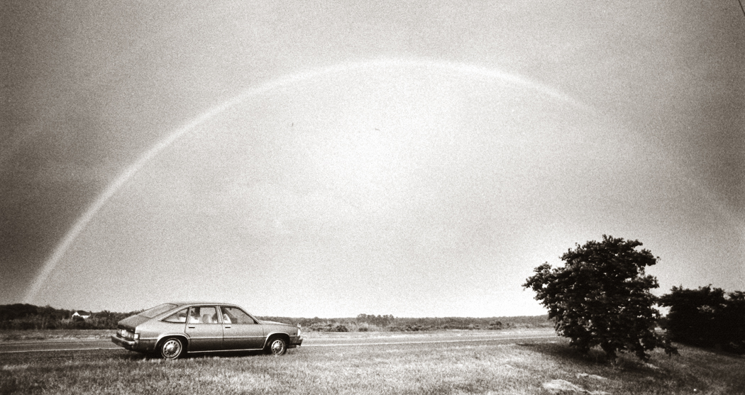
Rainbow, Delmarva

The DOZEN BEST ROADS 

* Blue Ridge Parkway — Begun during the Depression and only recently finished, the Blue Ridge Parkway wends through the mountains of Virginia and North Carolina. Best driven in early spring, just as the red maple flowers, or slightly later, when the chill gives way to trillium, redbud, spiderwort and dogwood, it is just about the most beautiful road to drive anywhere.

* Kancamagus Highway — This 30-mile mountain road runs from Crawford Notch to Franconia Notch in New Hampshire, following for part of its route the Pemigewasset River. Along its way are bright white paper birches and waterfalls rasping through gnarled gneiss. Covered bridges lead to some of the off-the-road campgrounds.

* California 1 — Hugging the Pacific shore for 700 miles, the road can be touristy along parts of its southern limbs, from L.A. to San Francisco, but north of the Bay City it winds its way tortuously through headlands and canyons whiskered with pine and redwood. It is the only serious rival to the Blue Ridge Parkway.

* U.S. 22 and U.S. 46 in New Jersey — Seriously. Along them were the Flagship, a furniture store shaped like a ship; giant pin in front of bowling lanes; giant paint cans atop a paint store; and the Leaning Tower of Pizza. Piscataway and Watchung, Lodi and Moonachie, these crusted, cracked and crowded highways are the soul of New Jersey. It is because of these museums of ’30s road building that the New Jersey state flower is the cloverleaf.

* U.S. 9W in New York — Squeezing up the West Shore of the Hudson River, past Bear Mountain, West Point and Storm King, 9W was the primordial three-lane highway, daring the impatient to risk passing a Sunday driver in the middle lane as both round a crag and plunge down the mountain. Blind thrills.

* Going-to-the-Sun Highway — Across the alpine spine of the Rockies, Going-to-the-Sun Highway in Glacier National Park breasts Logan Pass at 6,646 feet, an icy height so far north as Montana. In midsummer, the air is still nippy, breath congealed.

* Virginia 58 — 58 underlines Virginia for emphasis, running from the Atlantic to Cumberland Gap, where Virginia meets Kentucky and Tennessee. It is 450 miles of bad concrete and twisting macadam. It also runs the gamut of the best Virginia has to offer.

* N.C. 12 — What’s it like to drive a car 30 miles out to sea? North Carolina 12 runs down the length of the Outer Banks like the vein down the back of a shrimp. The Banks are a line of barrier islands that bends at Cape Hatteras, and in places is so narrow that the highway must exhale to squeeze through. Salt air, squawking gulls and a constant 30-knot wind.

* Texas 170 from Terlingua to Presidio — Really, the great driving extends from Marathon, Texas, down through Big Bend National Park and through to Presidio. It is a grand, empty Chihuahuan desert road along which you can see for leagues. From Terlingua it parallels the Rio Grande, and Mexico is on the far shore.

* Nebraska 2 — Sand hills, rolling grasslands and the Nebraska National Forest, the only national forest entirely planted by humans. From Alliance to Broken Bow, Nebraska 2 gives one a feeling for the loneliness of pioneer families and the wide-open spaces. This is not the West of John Wayne movies, this is real.

* Utah 12 from Bryce to Torrey — Dirt roads are some of the best in the country to drive on, and Utah 12 is a dotted line of dirt alternating with pavement. At one point it rides a road-narrow ridge between two precipitous red-rock canyons. Don’t look down, passenger or driver side. Aspens and Anasazis fill out the appeal.

* U.S. 14 through Cody from Yellowstone to Gillette — City driving causes ulcers and hyperventilation. Cruising the plains east of Yellowstone in Wyoming is relaxing. You really don’t even need to watch the road. Put the car on auto pilot and kick back: Driving never was this relaxing.

River

The RIVER

Probably everyone has a river in his life.

I suppose it needn’t be a river; for some it is a mountain. For others it is the ocean, that great river that circles the known world.

But it is an image of the larger picture of life: the flowing from one point to another; the sense that nature was here before us and will be here after we’re gone.

For Mark Twain, it was the Mississippi, for Henry Thoreau it was the Concord. You have yours: the Colorado through the Grand Canyon or the Columbia past the wheat fields of eastern Washington. For me, it is the Hudson.

From Battery Park north to Albany and beyond, the 315-mile-long Hudson is broad, gray and dignified, three miles wide at its broadest point, the Tappan Zee.

It was for me, as I was growing up, the single very definition of what a river should be. When I later lived in North Carolina and would cross the Deep River or the Yadkin, I had to laugh. They were little more than creeks.

Even more preposterous are the rivers of the Southwest, flowing with dust and gravel. There is the story of the old Arizonan who visited Manhattan. When he got back, his friend asked him if he had seen the Hudson River. “Yep.” “What did it look like?” “Couldn’t tell, it was covered in water.”

Adding to the river’s stateliness is its history.

The Hudson passes underneath the steep basalt cliffs of the Palisades, where George Washington beat a hasty retreat from the British troops when leaving Manhattan in 1776. It runs past the tiny town of Tappan where the spy John Andre was hanged. The river circles Bear Mountain just south of West Point, where Benedict Arnold tried to sell out the rebel nation.

All of these places are still there for the traveler to see.

And so are the earlier historic spots, leftover from the Dutch colonization of the area. There are old stone houses with Mansard roofs along the river and places with names made famous by Washington Irving in his stories, The Legend of Sleepy Hollow and Rip Van Winkle.

That Dutch presence is still felt in many place names: High Tor, the Spuyten Duyvil, Yonkers, Sparkill.

What isn’t still there are many of the landmarks I knew as a boy. The “Mothball Fleet” of hundreds of World War II liberty ships are no longer lined up north of Haverstraw in a crook in the river. The white-knuckle stretch of U.S. 9W around Storm King has been straightened and tamed. The Yonkers ferry long ago ceased running from the base of the Palisades to what was then a quiet, middle-class suburb of New York City.

But that is part of the mythology of the river: You can’t step into the same moment of history twice, either. It is all one great flowing.

At least 9W is still there, and it still the best way to see the river and its countryside. From the George Washington Bridge, it travels up the West Shore of the river until it rejoins its eastern branch, U.S. 9, at Albany.

Along the way, you pass Harriman State Park, with its scenic Seven Lakes Drive; you pass Bear Mountain, with its winter ski jumping; you pass West Point, Newburgh, Kingston. You pass tiny West Park, where the famous 19th Century nature writer John Burroughs had his rustic cabin in the woods.

Further north, you skirt the Catskills, where America’s first great assembly of painters called themselves the “Hudson River School.” Asher Durand’s painting, Kindred Spirits, shows the school’s founder, Thomas Cole, meeting with the poet William Cullen Bryant in the “Cathedral of Nature.”

The Catskills were later the home to many plush resort hotels, such as Grossingers, where Jewish comedians honed their acts in a circuit known as the “Borscht Belt.”

The river flows down from the north through the mountains, which rise on both sides. The Catskills on the west, the Taconics on the east.

It is through them that I left the Hudson Valley many years ago on the Twentieth Century Limited which rode the tracks on the east of the river past Sing Sing Prison and Peekskill on the way to Chicago, where I caught the Empire Builder to Seattle.

I felt a little removed, seeing the familiar landscape on the Western Shore from the unfamiliar perspective of the opposite river bank. But I couldn’t help respond to the gentle green curves of the mountains and the hundreds of ducks that shivered the water that November morning as the train spooked them.

In some way, the Hudson River is who I am. That’s what rivers are for.

GWB cables

The BRIDGE

The best way to enter any great city is across a great bridge, and there is neither city nor bridge greater than the George Washington Bridge and Manhattan.

And the best way to cross the bridge is neither by bus nor car, but by foot. Park by a meter on Kelby Street in Fort Lee, N.J. — you don’t really want to drive in New York City anyway — and begin walking toward the noise. You can’t miss it.

On the way, notice the broad expanse of green where the Port Authority, which operates the bridge, decided to beautify the cement by painting it the color of grass.

The GWB is a monument to pre-war design and engineering. With its lower deck, added in 1962, it handles a total of 14 lanes of traffic, all spewing fumes and rumbling geologically: The noise shakes the ground underneath your feet.

The bridge approach cuts through a rise of raw basalt, leaping out past the cliff-face of the Palisades and flying high over the Hudson River, 200 feet below.

You walk under the graffiti-sprayed rock of the approach, and pass Brobdingagian air vents that clear exhaust from the lower road level tunneling under you. And then you see the cable anchors, with the main steel cables like twin pipes, each three feet in diameter, angling up from the ground toward the top of the first of the Erector Set towers.

Looking almost as delicate as spider web from the distance, twined iron cables descend from these main tubes and support the weight of the roadway. If you touch these vertical cables, you can feel them vibrate and hum sympathetically with the noise of trucks and buses.

As you step out onto the bridge proper, the view opens up. If you are lucky and the air is clear — a rare but glorious occurrence — you can see all the way from 178th Street, where the bridge connects with the island, down to the lower harbor to the south and Rockland County in the north. Most of Manhattan spreads before you, from the Spuyten Duyvil to about 30th Street, where the river bends around the south part of the island. Boat traffic moves below you in poetic slow motion.

More often, the city disappears in a whitish haze by about 145th Street. The smog can be choking, to say nothing of the diesel fumes from the Red and Tan buses passing a few feet from you on the roadway.

There is wind, there is traffic roar and their is the smell of exhaust. It is all exhilarating.

The bridge was opened in 1931 and its criss-cross of iron girders has been painted so many times the silver-gray has built up like cake frosting over the rivets and joints. Each upper surface is further highlighted in a dusting of grimy soot.

The concrete sidewalk makes a detour around the outer edge of the tower, which rises to the height of a 60-story building. From there, you can look back and see the apartment buildings at the top of the cliff where Palisades Amusement Park and its roller coaster used to be. At the bottom of the cliff, Henry Hudson Drive meanders through Palisades Interstate Park. You can see families on outings alongside the drive below you, looking like ants at their own picnic.

The first half of the mile-long walk across the bridge is slightly uphill. At the peak, where the giant cables loop down close to the roadway, there is a sign marking the boundary between the two states. And from there, it is all downhill into the city.

But as you approach the second steel-lattice tower, you should look down over the handrail. On the rocks at the base of the tower is the little red lighthouse of the children’s book. It is still there, but looking rusty and scribbled on with spray paint.

little red lighthouse

You’ll pass a few hardy joggers and a bicycle or two, but for most of the walk, you’ll have the bridge to yourself.

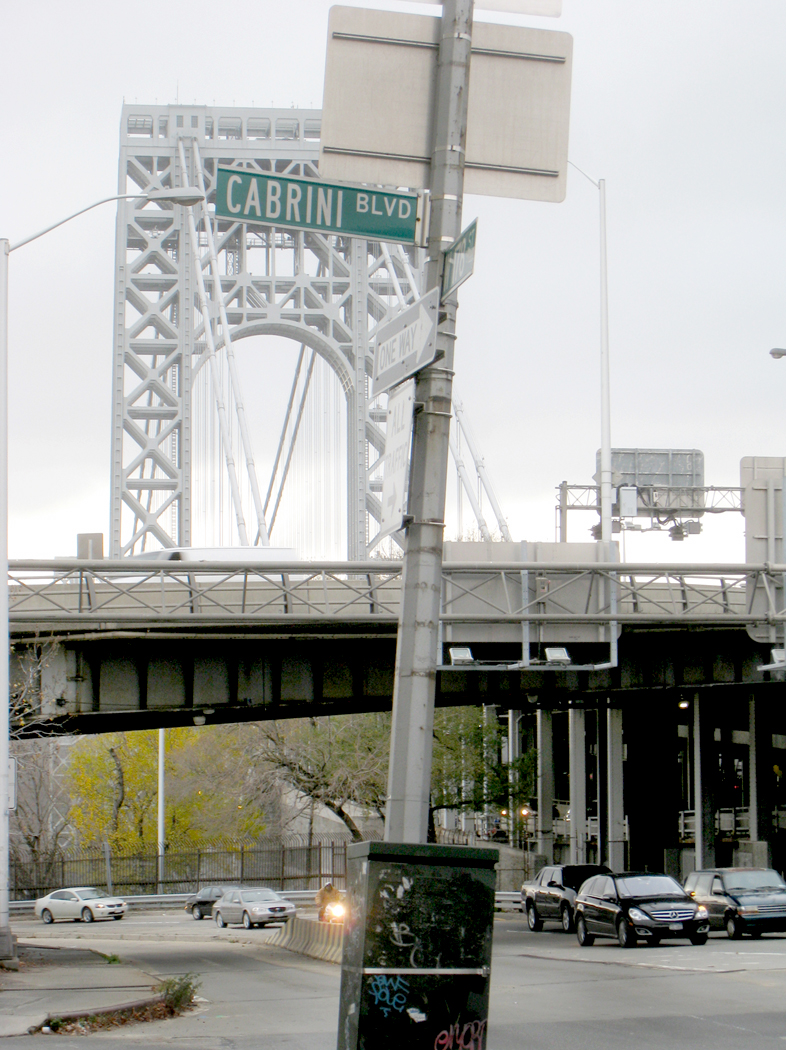
Once in Manhattan, you take a descending spiral walkway down to Cabrini Boulevard and walk up 178th Street toward the bus terminal, which was designed by Pier Luigi Nervi and opened in 1962.

cabrini blvd

From their, you catch the A-Train.

I take this walk each time I visit New York. I do this in part because it is such an invigorating hike, but it is also a pilgrimage.

My grandfather worked as an engineer during the construction of the bridge, from 1927 until his death of tuberculosis in 1930; my mother was six years old.

So although I never knew him, I feel through him a kind of inheritance, an ownership of the regal old bridge.

And like some English lord whose castle is now part of the public trust, I like sharing the experience of my bridge with others.

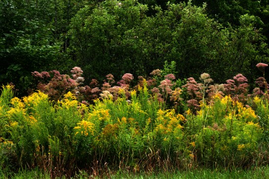
wildflowers copy

Sometimes, it’s not just where you take a trip, but when.

You can be too young to appreciate something or too old to partake.

When I was young, I loved the spring flowers, from the first jonquils that burst through the last snow on the lawn, to the wake robin in the woods. Nothing could compare with the speckled salmon color of the pinxter flower hanging over the stream, dripping dew in the early morning from the long, bowed tongues of its stamens.

All up and down the East Coast, the bright red stars of fire pinks grew along paths and blue spiderwort grew under the shade of trees. When they came out, the Eastern Seaboard seemed to be waking from its frozen sleep and taking its first deep stretches of the year.

After that, the seasons seemed anticlimactic. Summer was when leaves were turned to dry Swiss cheese by hungry insects. Fall was when those leaves dried out completely and fell off. Back then, I didn’t trust anyone over 30, either.

But a single road trip through northwestern New Jersey changed that for me. As I drove up the Delaware River in October from Philadelphia, north past the Water Gap and into the Kittatinny Mountains, every field was a paint box.

There had been a death in my family, and I had just gone through a divorce. After the formalities, I drove along the river, looking for some quiet.

In its northern parts, the Delaware is not much of a river; it is just a broad, shallow, stony-bottomed stream with a sandy bluff on one shore or the other, depending which way the riverbed turns.

The Kittatinnies are not much in the way of mountains, either.

But along the roadsides, the bobbing orange heads of black-eyed Susans mixed with the midnight blue of ironweed.

There is something different about the fall wildflowers, something weedier, something more insistent. Their vegetable smells and sticky white sap are less immediately pretty, but they have more character: They are grown-up.

Perhaps, too, it is the drier air of autumn, the mixed stands of plants, blending goldenrod with Queen Anne’s lace, bull thistle and hawkweed in a Pointillist stew of color.

Anyway, that’s how it seemed as I drove by the railroad yard in Port Jervis, at the point New Jersey, New York and Pennsylvania all meet. The old yard was grown over in asters.

There were millions of them in the open acres of the yard, each with its yellow disk surrounded by blue ray flowers. Intermixed were all the other fall flowers: the yarrow, boneset, coneflowers and chicory left over from midsummer.

And in the weedy field, even the spring flowers were represented, not by their blossoms, but by their fruits: the burrs; seed pods; milkweed down and nightshade berries.

There was yet no frost in the air, but you could see it coming in the overgrown fields that grind in the breeze with the peculiar sound of weeds.

I am now 64 and this is not a story about flowers.

We live on a planetary canvas; colors and shapes are spread across the stretched linen of the Earth’s surface, although we have to step back to see it with any clarity.

The best way to do that is to climb up into the air. Up a tree and the neighborhood looks different; up a mountain and the valleys change; up in a jet plane and whole quarters of the continent are transformed.

That is the gift of the window seat. The view out and down paints a completely different picture of the world: clouds below us; shadows stretch out for dozens of miles late in the day, or as the sun rises; seas catch the sunlight in a scatter of sparks; the sky overhead is so dark a blue as to mimic midnight at midday.

I love flying. There is nothing quite so exciting as seeing a whole state underneath you opened up like a life-size map.

From 30,000 feet, you get a sense of the world as a tiny globe and can see whole ranges of many mountains as single features, like wrinkles on a face.

Few of us will ever see the Earth from the moon, or even from orbit, but anyone with a boarding pass can have his sensibility slapped silly with the incredible beauty of the planet.

So I always book a window seat for the show. And no matter how long the flight, I’m glued, stiff-necked, to the view.

You can spot the Rio Grande and its terrace, the Mississippi and its wiggle. You can tell Chicago from Detroit, Oklahoma from Arkansas.

Several times on cross-country flights, sitting on the north side of the plane, away from the glare of the direct sun, I looked out the window and down below the jet would be a floating pool of light, moving with the plane at some 500 mph. It is called a “glory” and it is certainly well-named. It is a visual effect much like a rainbow, and no two people see it in just the same place.

It can be seen at a point 180 degrees opposite the sun, speeding across the map-landscape below, crossing interstates and rivers, past the pegged dots of new housing developments, looking like mitochondria in an electron microscope, or the great circles of irrigated crops — great green coins spaced across Texas.

But it isn’t just the landforms that excite me. Even bad weather keeps my attention. Think of all the thousands of generations of humans who were never able to see the tops of clouds, which form their own fantastic landscapes, with mountains and valleys of crenellated whiteness.

The pilot curves the jet route in wide circles around a towering thunderhead, bleach-white at top and sooty at bottom, with its cauliflower protuberances catching new light. The distance is crowded with them, sprouting like mushrooms to the horizon. Dozens of fresh, new thunderstorms rising sunward like children reaching up for their mothers.

Over California once, after a rainstorm, with a low mist of water evaporating up into the atmosphere, the millions of puddles aggregated their mirror effect into a single flash, moving at the speed of the plane and making Fourth of July lightning bolts that flashed just beneath the surface of the mist, the way you can sometimes see the blood pulsing under the skin of a newborn. It gave me a feeling of intimacy with the planet.

Or a night flight, with the ground black underneath you as you fly over the empty expanses of the Southwest, with the small embers of tiny desert communities coming periodically into view, glowing like the last bit of a dying campfire. As you approach Phoenix, those embers gather into a vast pattern of incandescence, like some great lava field, with the glowing magma breaking through the cracks of the cooling stone above it. Almost nothing is as radiant as a city at night seen from the air. You want to hold your palms out toward it, to warm your hands in its heat.

Earthbound, we have a very bland, utilitarian sense of the celestial body we ride around on. It is all streets and signage, houses and mini malls. It is the place we go to work every day, the place where we watch television in the evening.

It is true, to those who have the eyes to see it, the planetary nature of our home is there to be seen: Daybreak shows us the sun breeching the horizon and moving across the heavens; the stars are there to see at night; there are rainy days and lightning storms to remind us of the larger forces. But they have all become ordinary through habit and usage. How many of us take the time to look up and admire a mackerel sky or a fair-weather cumulus cloud floating puffy on the slightly denser air beneath it?

But take an elevator to 30,000 feet and you get the god’s-eye view, moving across the curved surface of the world, where the people aren’t even ants and where the Earth is one small aggie in a great colliding pile of cosmic marbles.

(Buy “Window Seat” here.)